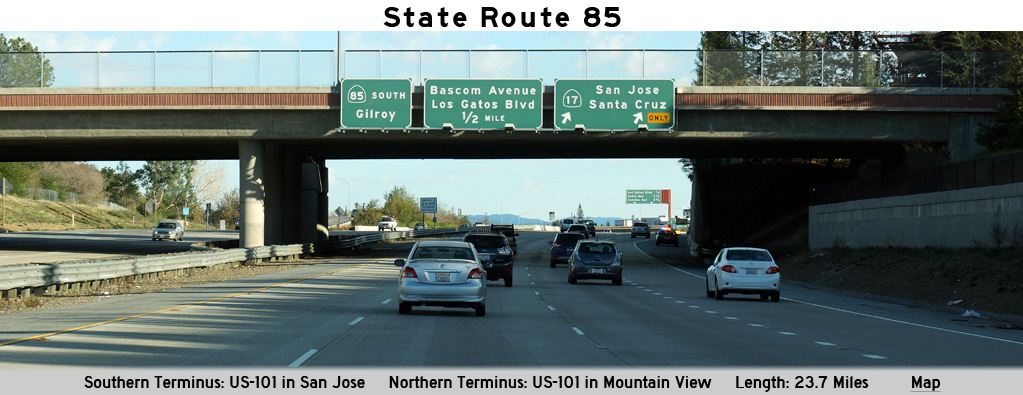
AsphaltPlanet.ca > California > SR-85
Pictures on this
page are arranged in order from south to north. CA-85 North photos are
left-aligned in the last column, while CA-85 South photos are right-aligned.
Center-line pictures are centered within the last column.
|
Location |
Description |
Photo |
||
|
North- |
South- |
|||
|
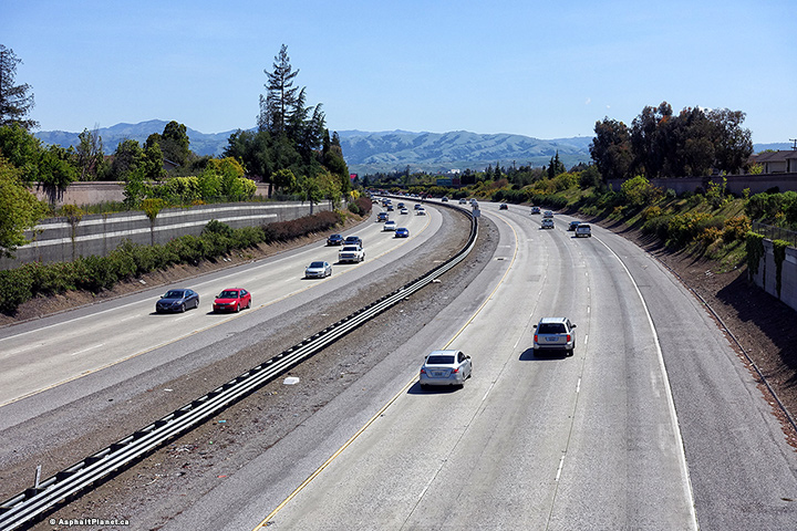
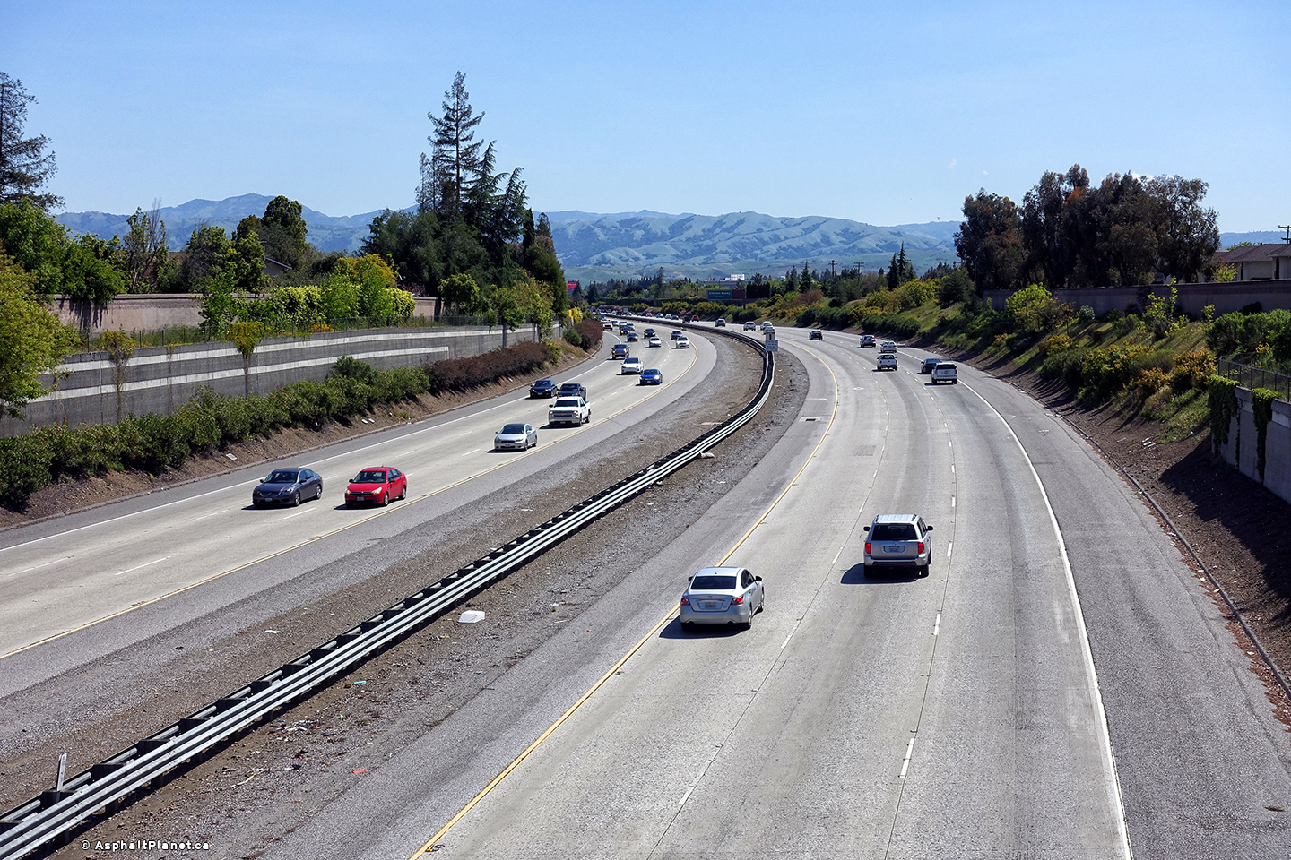
Santa Clara County |
Southerly view from the Meridian Avenue overpass. |
 |
||
|
Date: 4/14/2017 |
High-res: (1440x960) (2400x1600) | |||
|
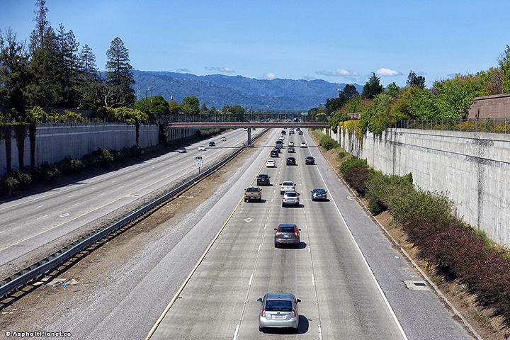
Santa Clara County |
View looking northerly from the Meridian Avenue overpass. |
 |
||
|
Date: 4/14/2017 |
High-res: (1440x960) (2400x1600) | |||
|
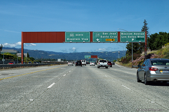
Santa Clara County |
Northbound signage for the Bascom Avenue interchange. |
 |
||
|
Date: 4/14/2017 |
High-res: (1440x960) (2400x1600) | |||
|
Santa Clara County |
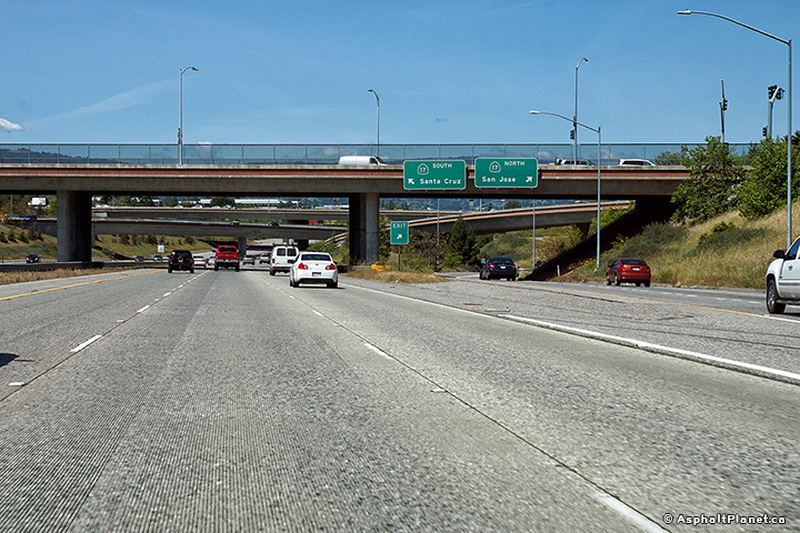
Northbound advanced signage for the SR-17 interchange. |
 |
||
|
Date: 4/14/2017 |
High-res: (1440x960) (2400x1600) | |||
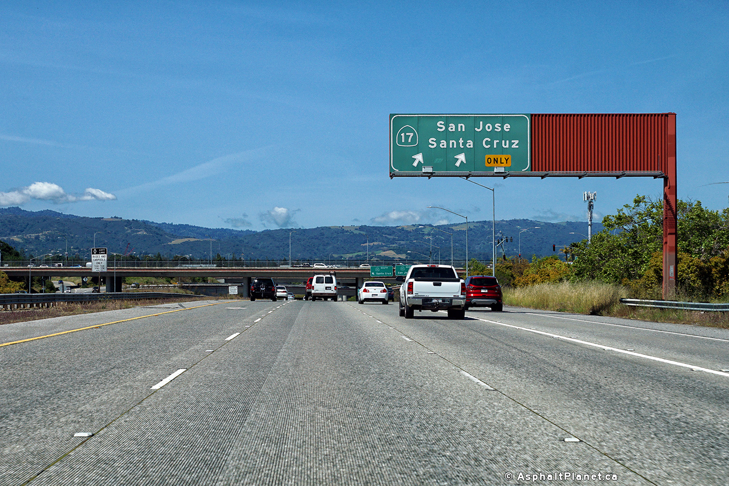
|
Santa Clara County |
Signage at the northbound off-ramp to SR-17. |
 |
||
|
Date: 4/14/2017 |
High-res: (1440x960) (2400x1600) | |||
|
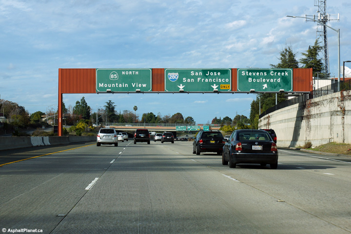
Santa Clara County |
Overhead signage at the northbound off-ramp to Stevens Creek Boulevard. |
 |
||
|
Date: 12/14/2014 |
High-res: (1440x960) (2400x1600) | |||
|
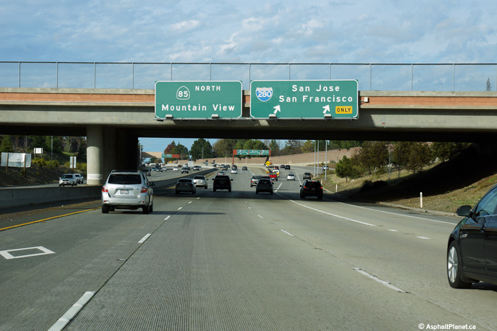
Santa Clara County |
The northbound off-ramp to I-280 departs the freeway beneath the Stevens Creek Boulevard overcrossing. There is a short collector lane segment between the Stevens Creek Boulevard and I-280 interchanges for the next half mile. |
 |
||
|
Date: 12/14/2014 |
High-res: (1440x960) (2400x1600) | |||
|
Santa Clara County |
Overhead signage overtop of the collector lane segment in advance of the I-280 interchange. |
 |
||
|
Date: 12/14/2014 |
High-res: (1440x960) (2400x1600) | |||
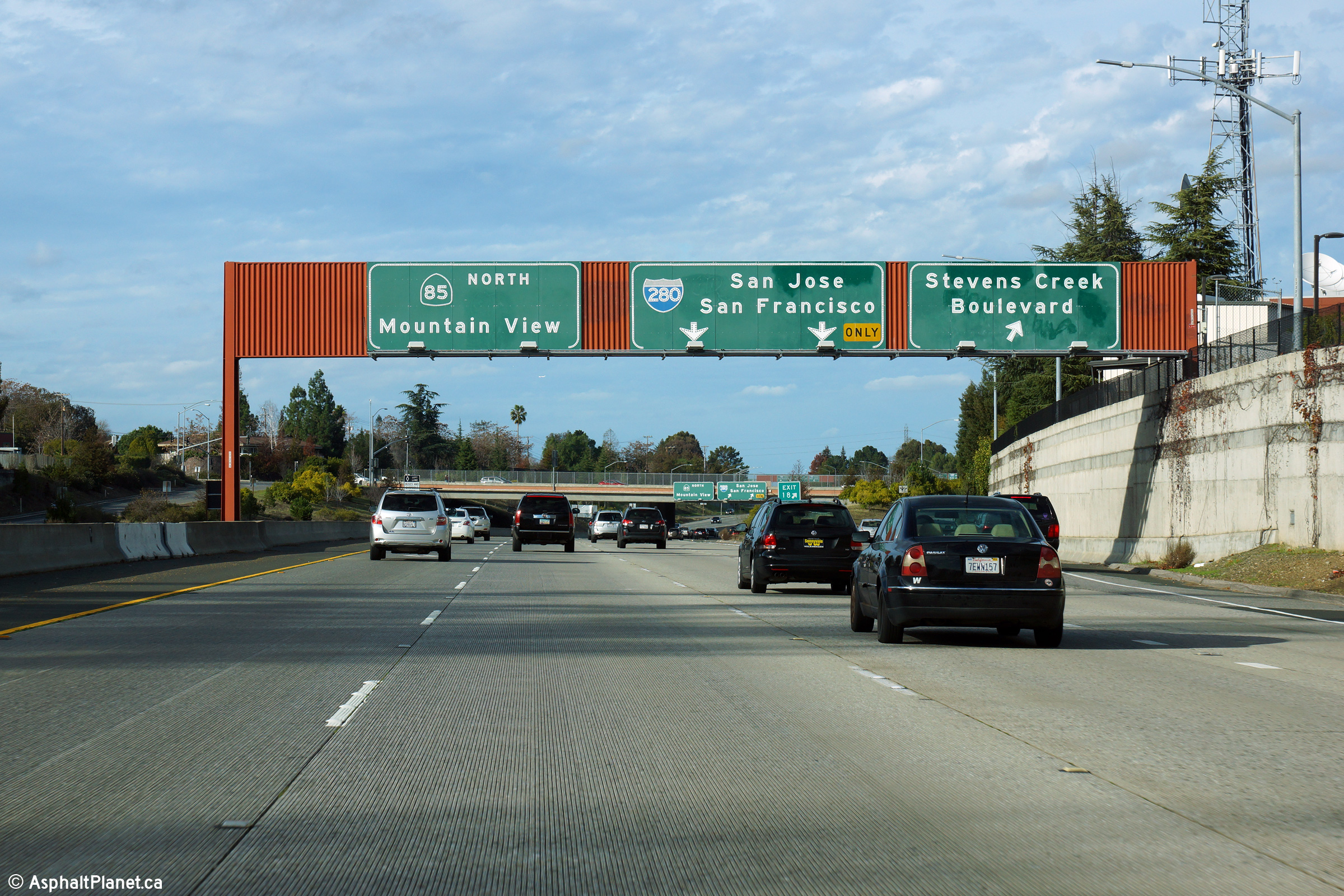
|
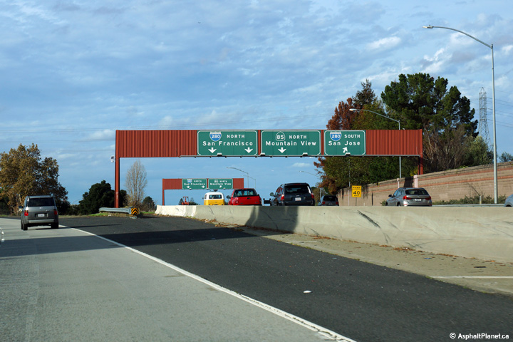
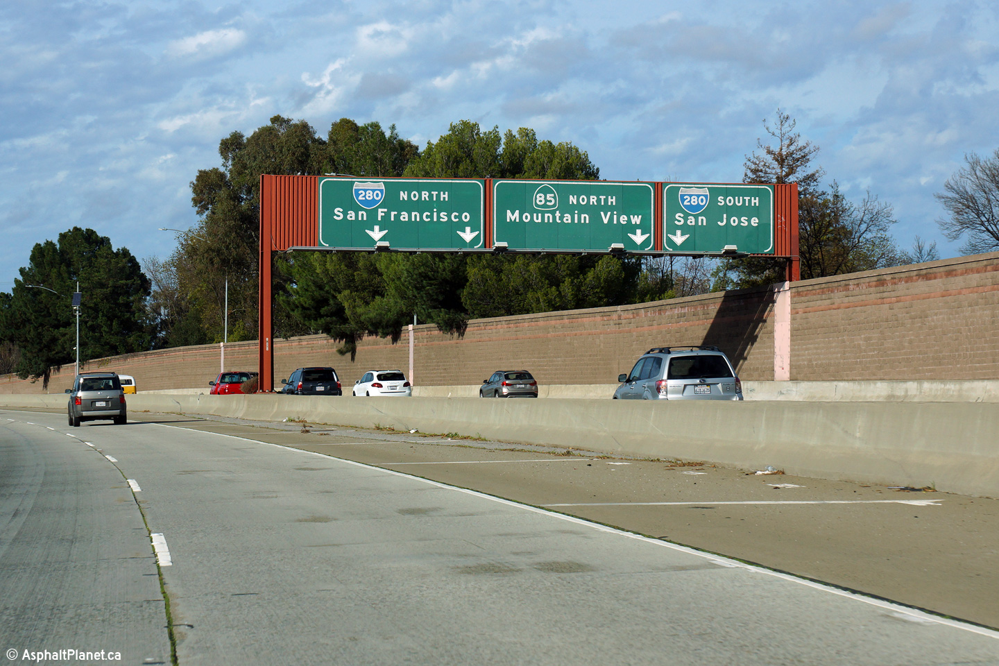
Santa Clara County |
Signage at I-280 interchange. Traffic that entered the freeway from the Stevens Creek Boulevard interchange may rejoin the SR-85 beyond the I-280 interchange. |
 |
||
|
Date: 12/14/2014 |
High-res: (1440x960) (2400x1600) | |||
|
Santa Clara County |
Beyond the I-280 interchange sits this advanced signage for the Fremont Avenue interchange. The sign is affixed to the Homestead Road overcrossing. |
 |
||
|
Date: 12/14/2014 |
High-res: (1440x960) (2400x1600) | |||
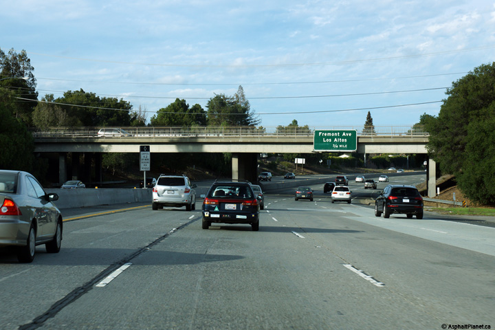
|
Santa Clara County |
Interchange sequence signage in advance of the off-ramp to Fremont Avenue. |
 |
||
|
Date: 12/14/2014 |
High-res: (1440x960) (2400x1600) | |||
|
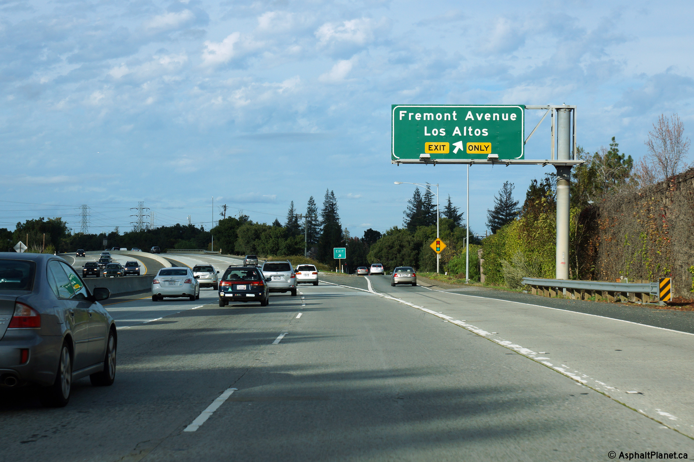
Santa Clara County |
Signage at the off-ramp to Fremont Avenue. |
 |
||
|
Date: 12/14/2014 |
High-res: (1440x960) (2400x1600) | |||
|
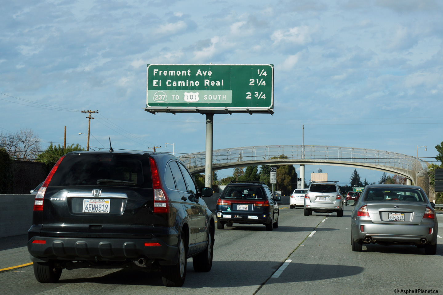
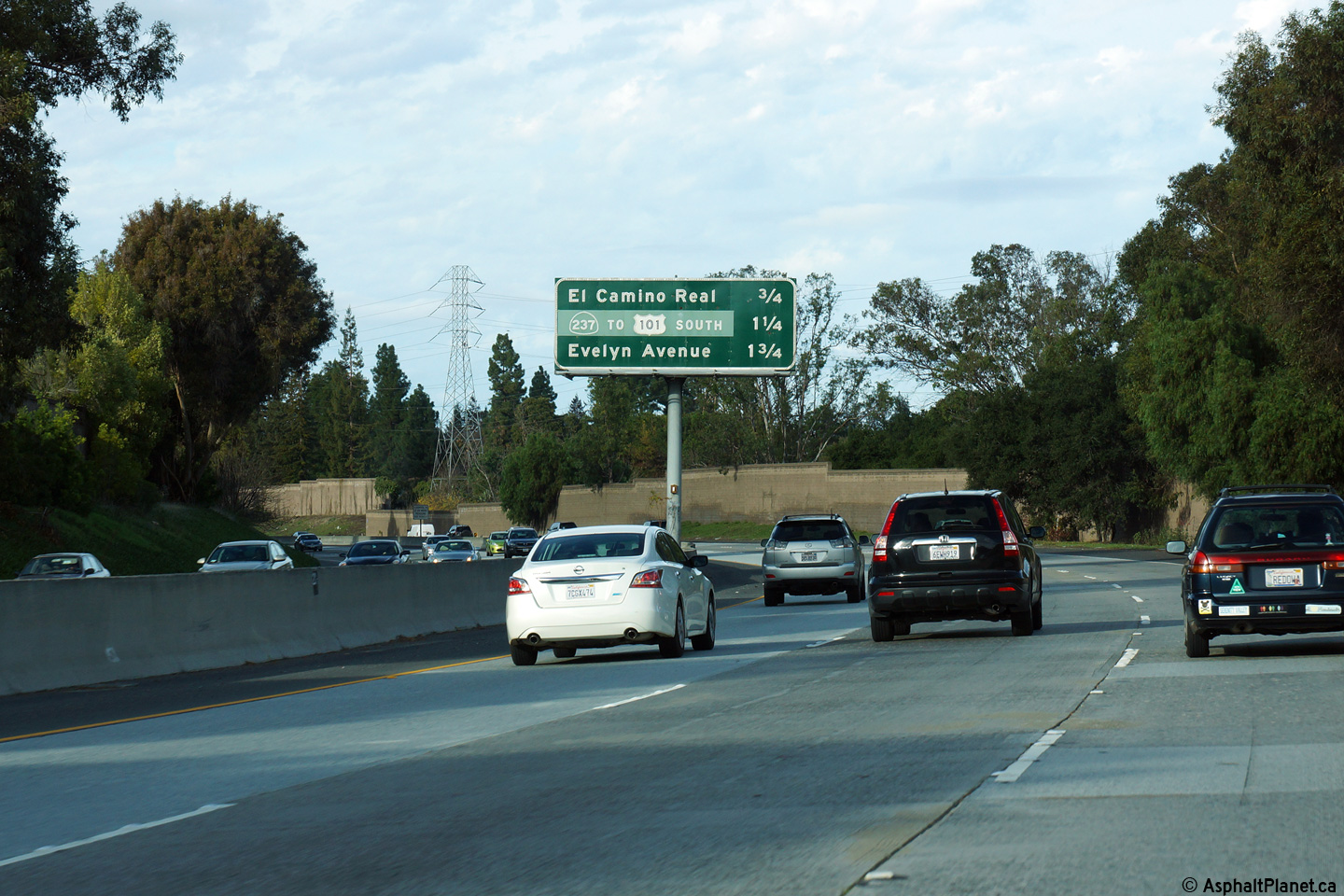
Santa Clara County |
Interchange sequence signage in advance of the off-ramp to El Camino Real. |
 |
||
|
Date: 12/14/2014 |
High-res: (1440x960) (2400x1600) | |||
|
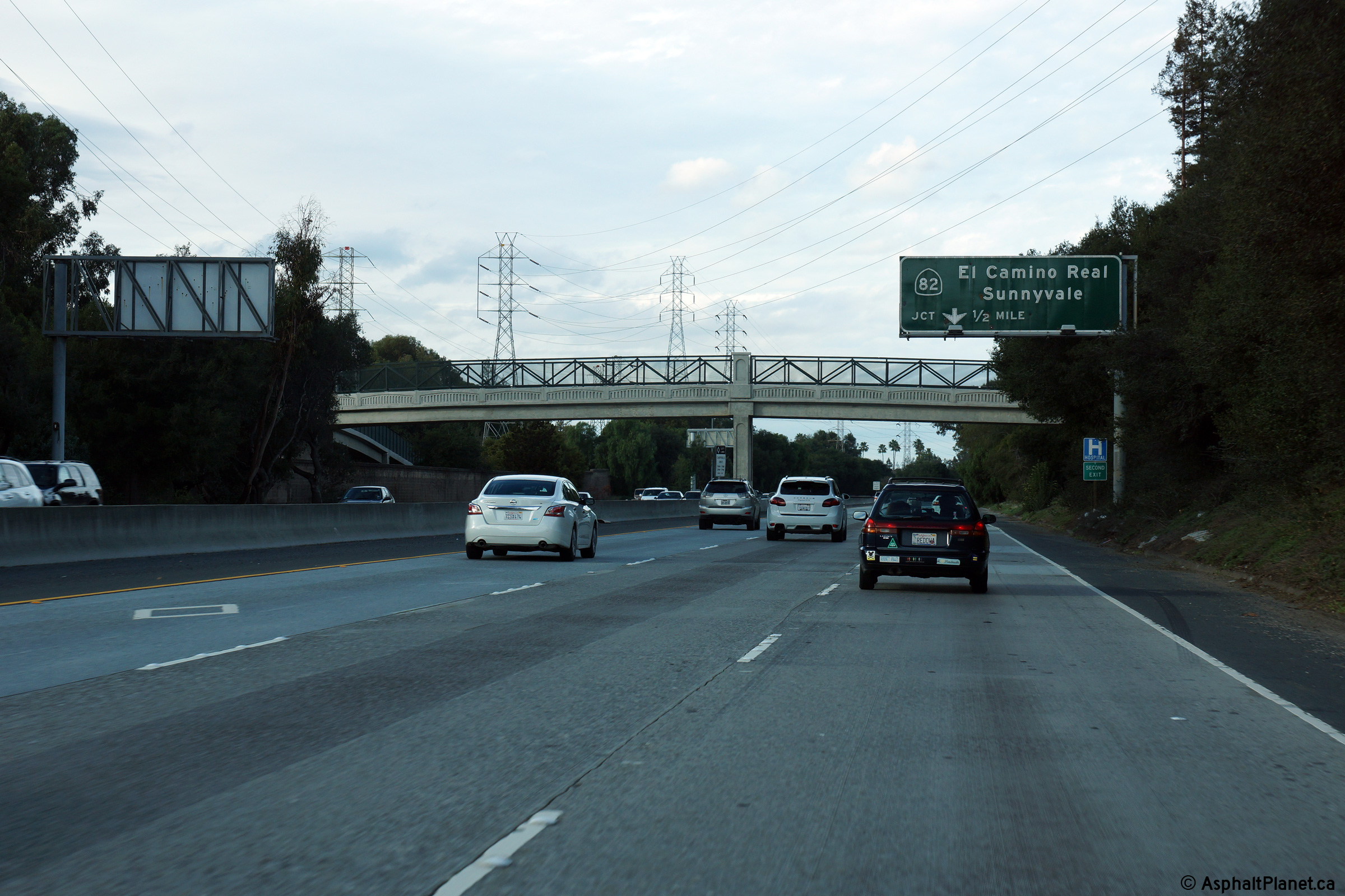
Santa Clara County |
Northbound advanced signage approaching the El Camino Real interchange. |
 |
||
|
Date: 12/14/2014 |
High-res: (1440x960) (2400x1600) | |||
|
Santa Clara County |
Signage at the ramp to El Camino Real (SR-82) South. |
 |
||
|
Date: 12/14/2014 |
High-res: (1440x960) (2400x1600) | |||
|
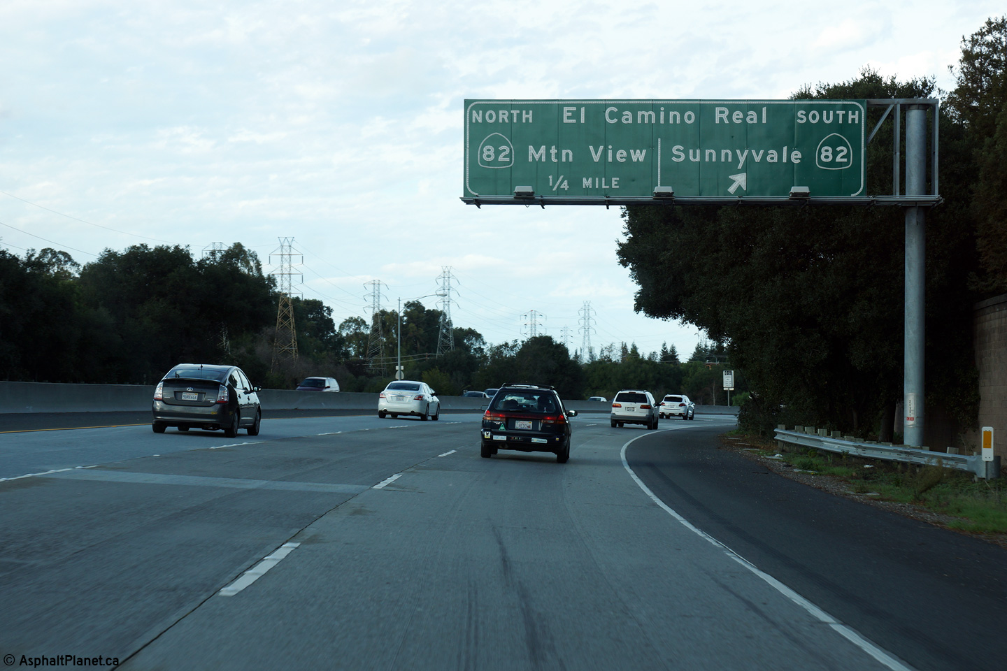
Santa Clara County |
Overhead signage for the ramp to El Camino Real North. |
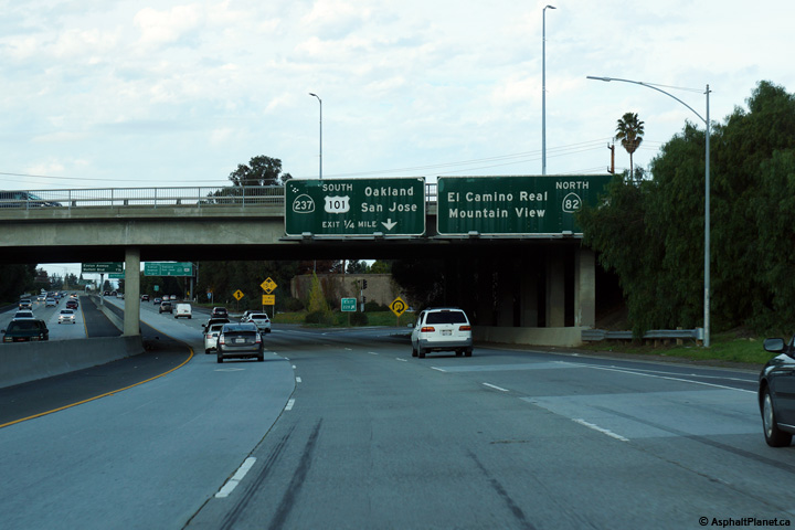 |
||
|
Date: 12/14/2014 |
High-res: (1440x960) (2400x1600) | |||
|
Santa Clara County |
Signage at the northbound off-ramp to SR-237. At the northern terminus of SR-85 there is not a direct ramp to US-101 South. Southbound traffic is instead directed to use SR-237. |
 |
||
|
Date: 12/14/2014 |
High-res: (1440x960) (2400x1600) | |||
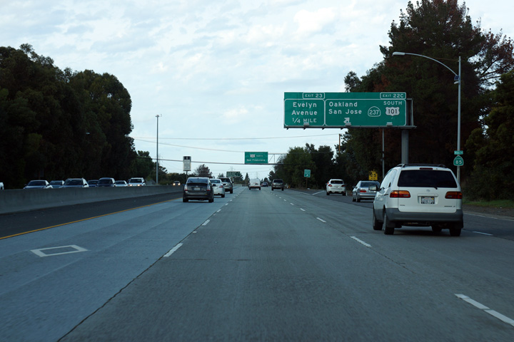
|
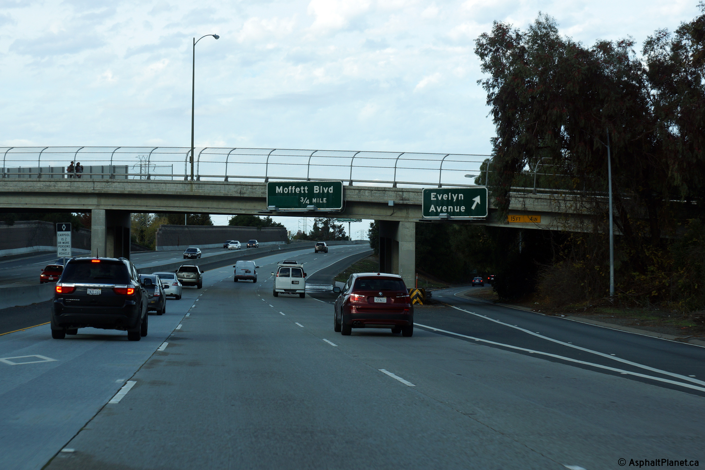
Santa Clara County |
Overhead signage at the off-ramp to Evelyn Avenue. |
 |
||
|
Date: 12/14/2014 |
High-res: (1440x960) (2400x1600) | |||
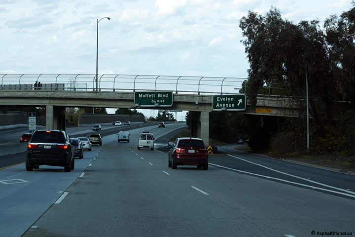
|
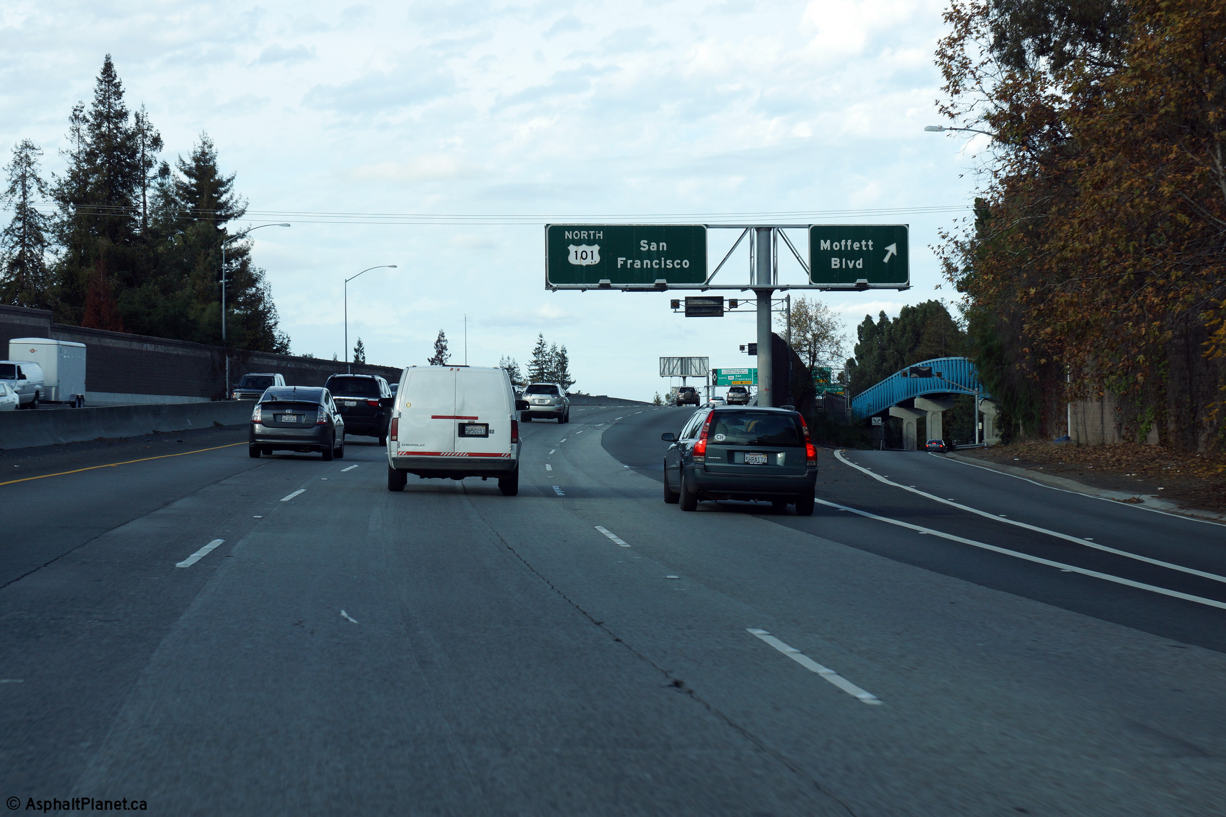
Santa Clara County |
Northbound signage at the off-ramp to Moffett Boulevard. Moffett Boulevard is the final northbound interchange prior to SR-85's northern terminus at US-101 and Shoreline Drive. |
 |
||
|
Date: 12/14/2014 |
High-res: (1440x960) (2400x1600) | |||
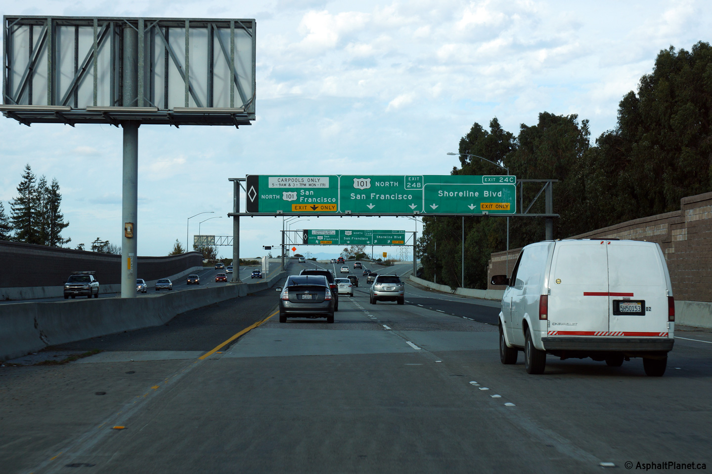
|
Santa Clara County |
Advanced signage at the northern terminus of SR-85. |
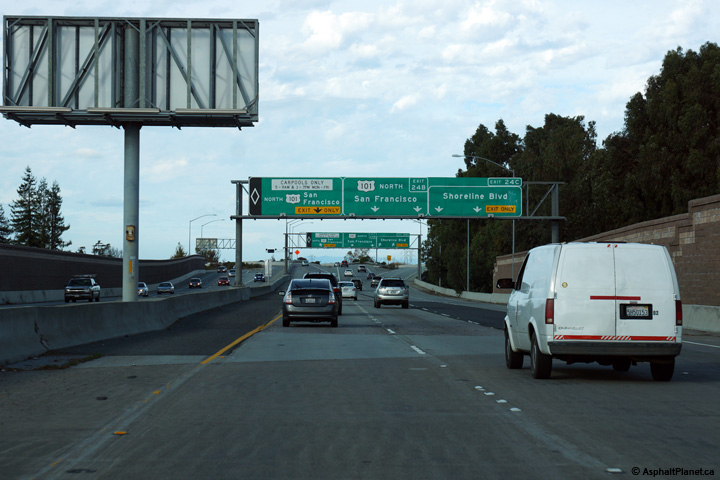 |
||
|
Date: 12/14/2014 |
High-res: (1440x960) (2400x1600) | |||
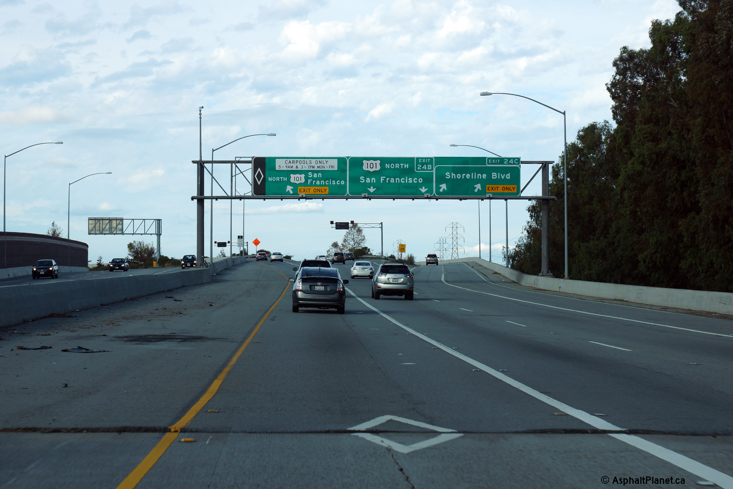
|
Santa Clara County |
Final northbound guide signage along SR-85 north. |
 |
||
|
Date: 12/14/2014 |
High-res: (1440x960) (2400x1600) | |||
| US-101 is the principal route between San Francisco and Los Angeles. Click here for US-101 Images. | ||||
<- CA-84 CA Highways
CA-86 ->
AsphaltPlanet.ca
© 2010-15 AsphaltPlanet.ca.
Scott@asphaltplanet.ca
Page Created: December 22, 2014.
Last Updated: December 22, 2014.