AsphaltPlanet.ca > California > SR-242
Pictures on this page are arranged in order from south to north. CA-242
North photos are left-aligned in the last column, while CA-242 South photos are right-aligned.
Center-line pictures are centered within the last column.
|
Location |
Description |
Photo |
||
|
North- |
South- |
|||
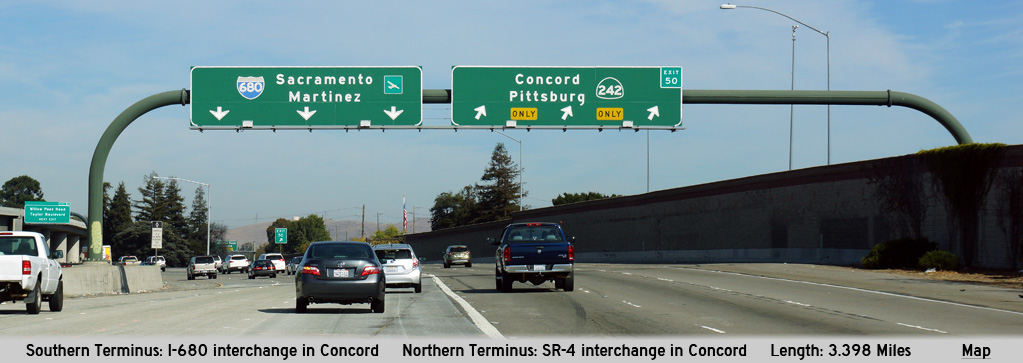
| Interstate 680 runs north-south along and through the cities that make up the eastern bay area of Northern California. Click here for I-680 Images. | ||||
|
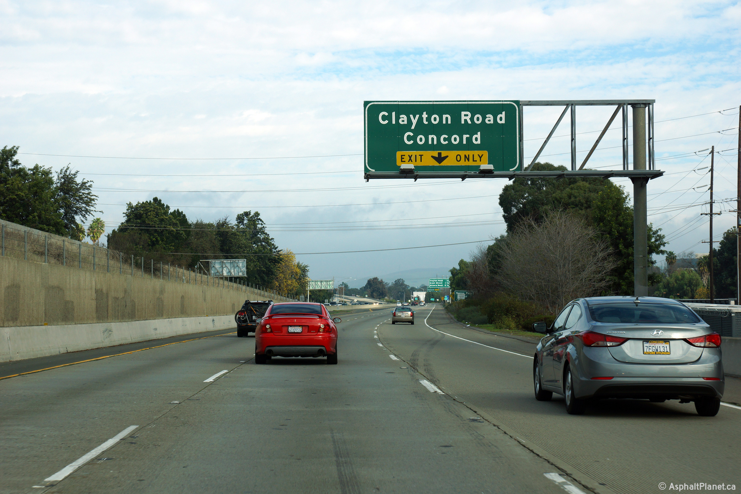
Contra Costa County |
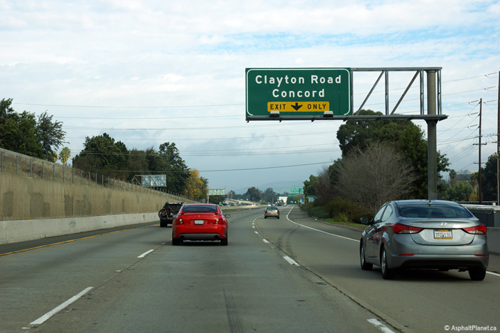
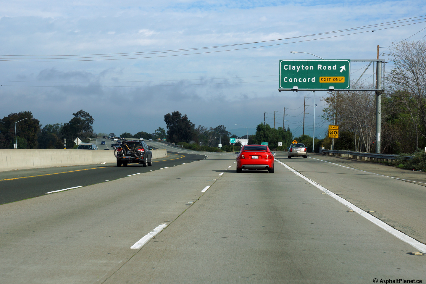
Overhead advanced signage for the Clayton Road interchange. At this interchange, the right-most freeway lane departs the freeway mainline. A new left lane commences however, just before the right lane exits the freeway. |
 |
||
|
Date: 12/14/2014 |
High-res: (1440x960) (2400x1600) | |||
|
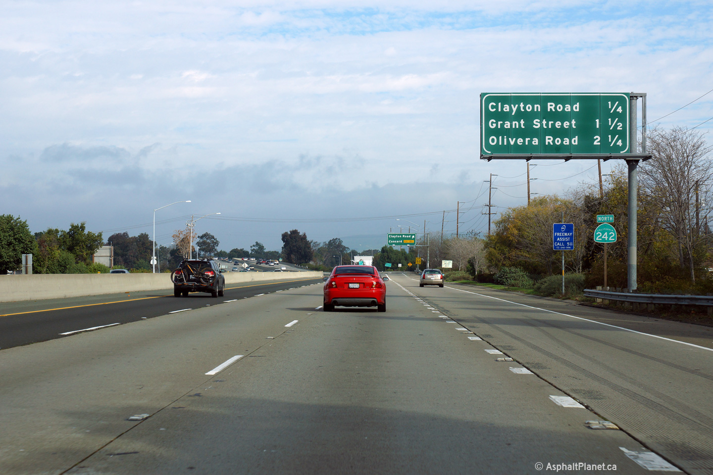
Contra Costa County |
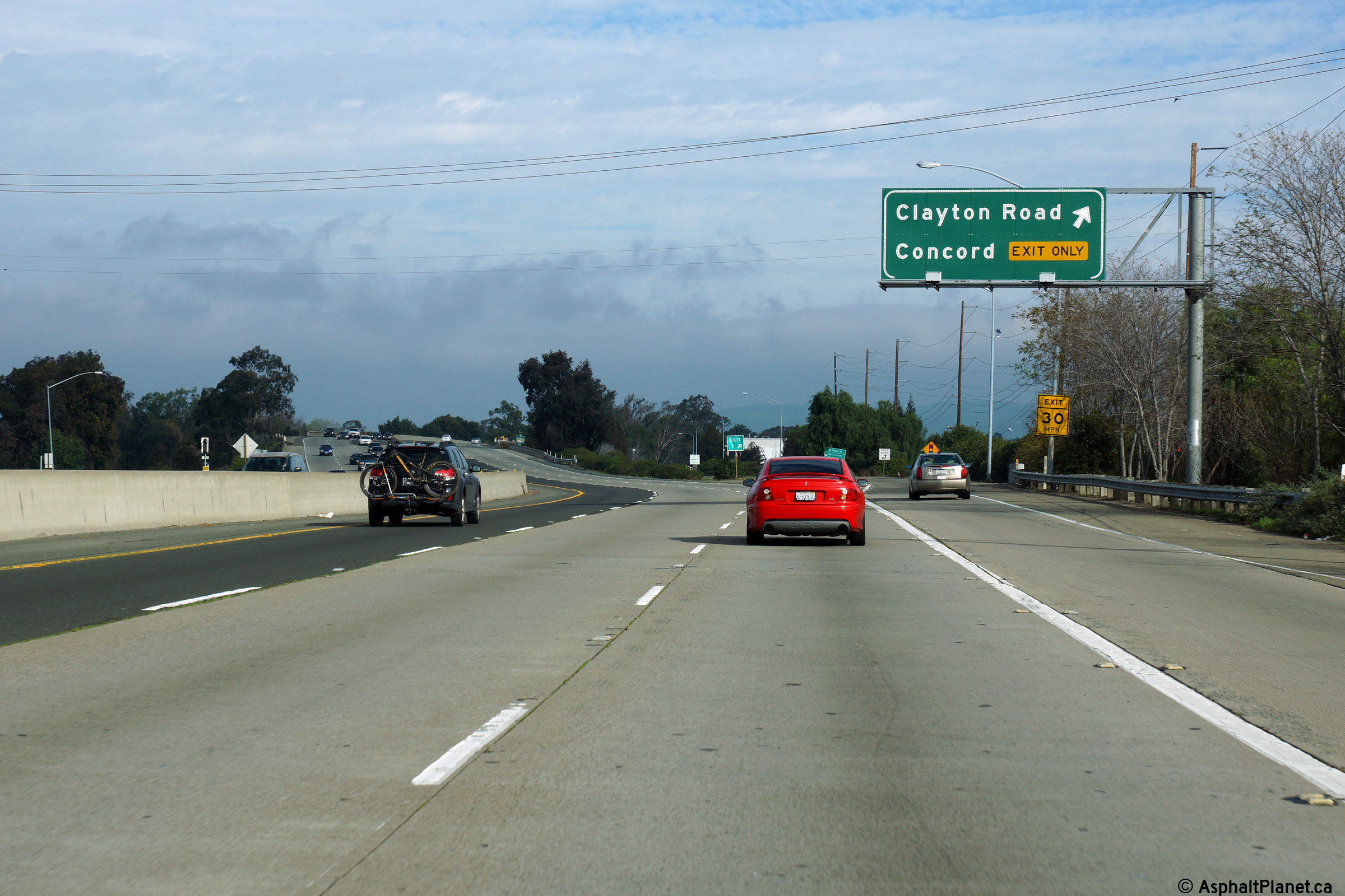
Interchange sequence signage in advance of the Clayton Road interchange. |
 |
||
|
Date: 12/14/2014 |
High-res: (1440x960) (2400x1600) | |||
|
Contra Costa County |
Signage at the northbound off-ramp to Clayton Road. |
 |
||
|
Date: 12/14/2014 |
High-res: (1440x960) (2400x1600) | |||
|
Contra Costa County |
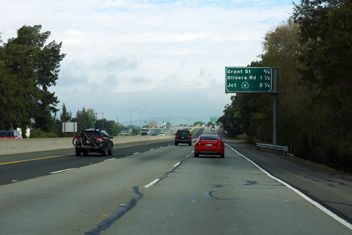
Interchange sequence signage approaching the Grant Street interchange. |
 |
||
|
Date: 12/14/2014 |
High-res: (1440x960) (2400x1600) | |||
|
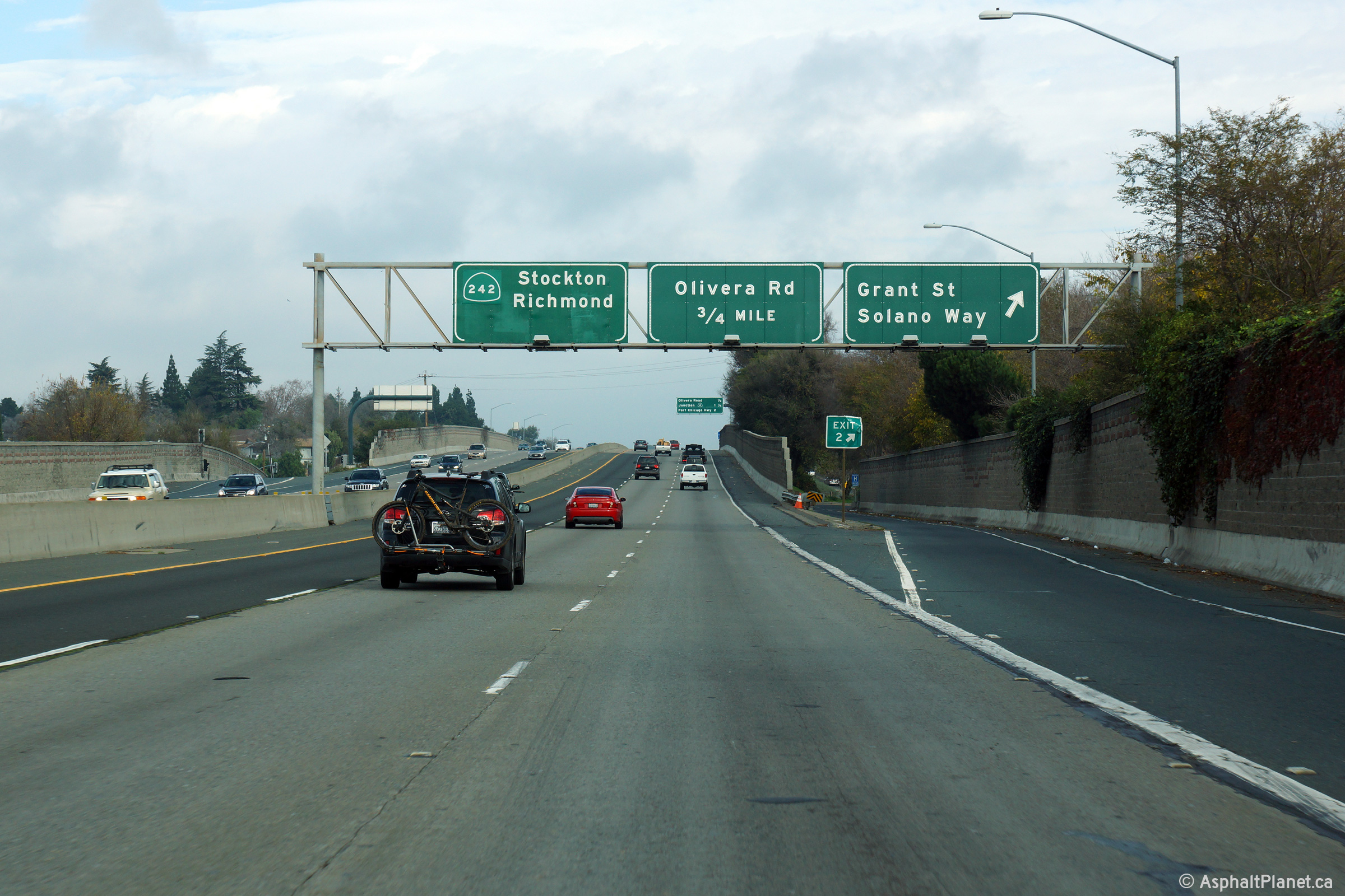
Contra Costa County |
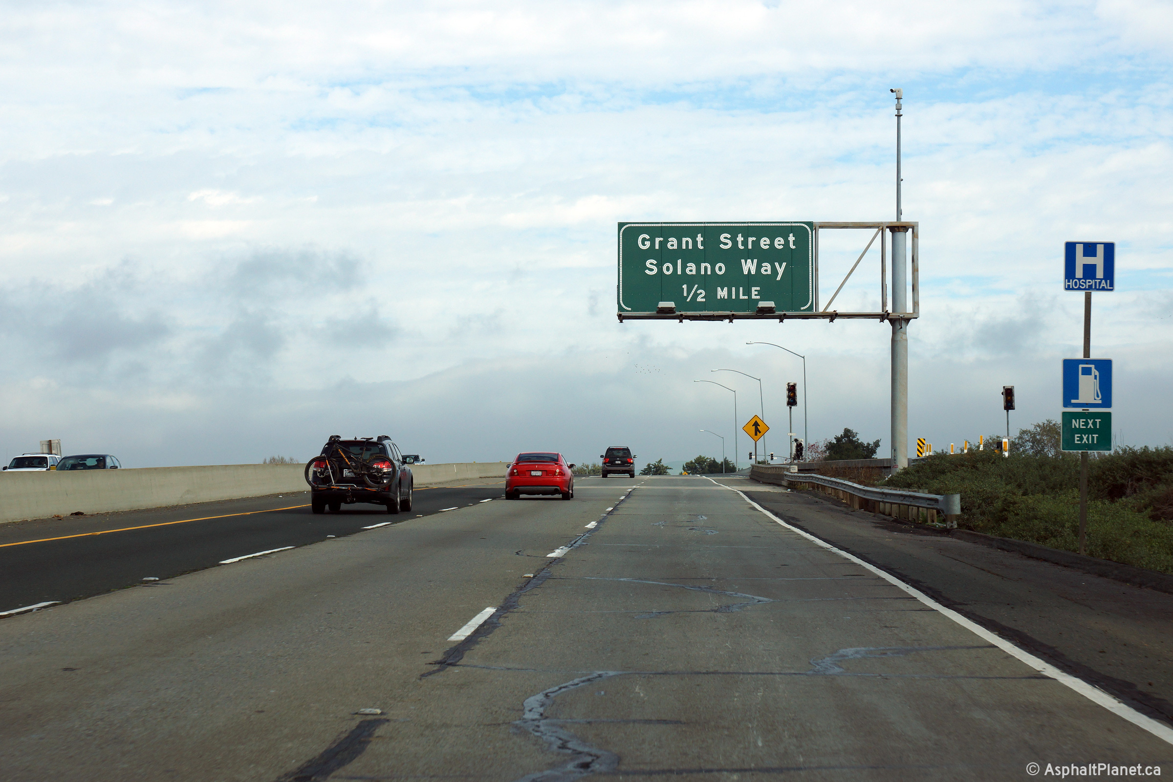
Advanced signage for the off-ramp to both Grant Street and Solano Way. |
 |
||
|
Date: 12/14/2014 |
High-res: (1440x960) (2400x1600) | |||
|
Contra Costa County |
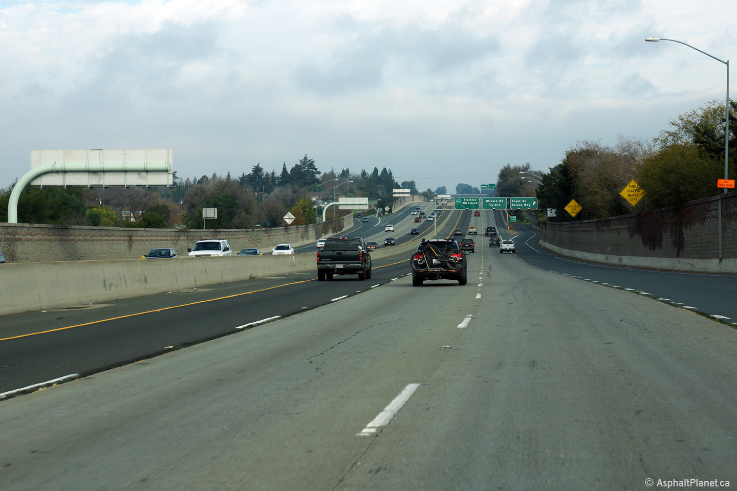
View in advance of the Grant Street off-ramp. State Route 242 was widened from four to six lanes in the year 2000. |
 |
||
|
Date: 12/14/2014 |
High-res: (1440x960) (2400x1600) | |||
|
Contra Costa County |
Overhead signage at the northbound off-ramp to Grand Street and Solano Way. Notice that the State Route 242 sign on the overhead reassurance signage is an overlay. Until 1987, State Route 242 was part of Route 24. What became SR-242 was redesignated in order to eliminate the Route 24/680 codesignation through Walnut Creek and Pleasant Hill. |
 |
||
|
Date: 12/14/2014 |
High-res: (1440x960) (2400x1600) | |||
|
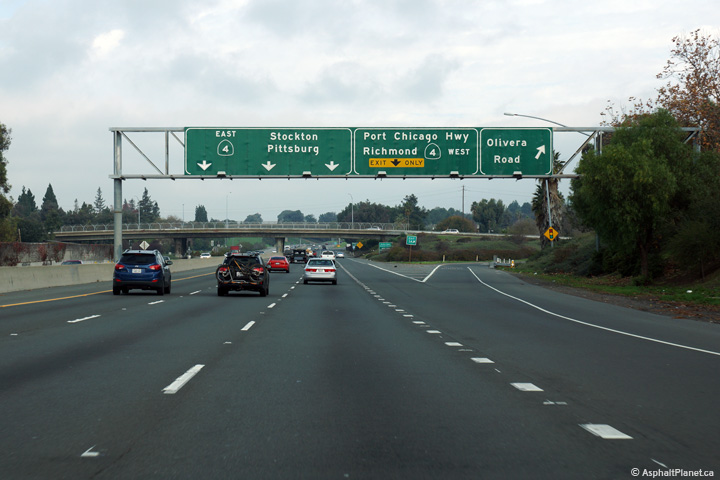
Contra Costa County |
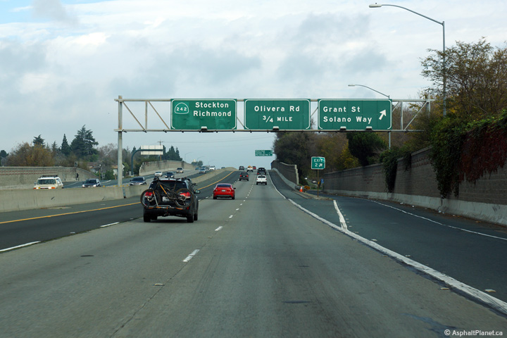
Beyond the Grant Street interchange, stands this interchange sequence signage. State Route 242 terminates at State Route 4. |
 |
||
|
Date: 12/14/2014 |
High-res: (1440x960) (2400x1600) | |||
|
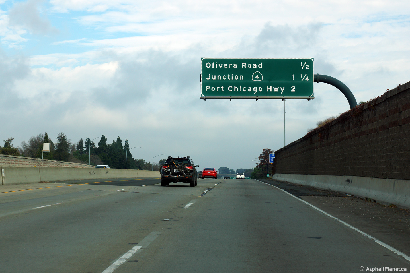
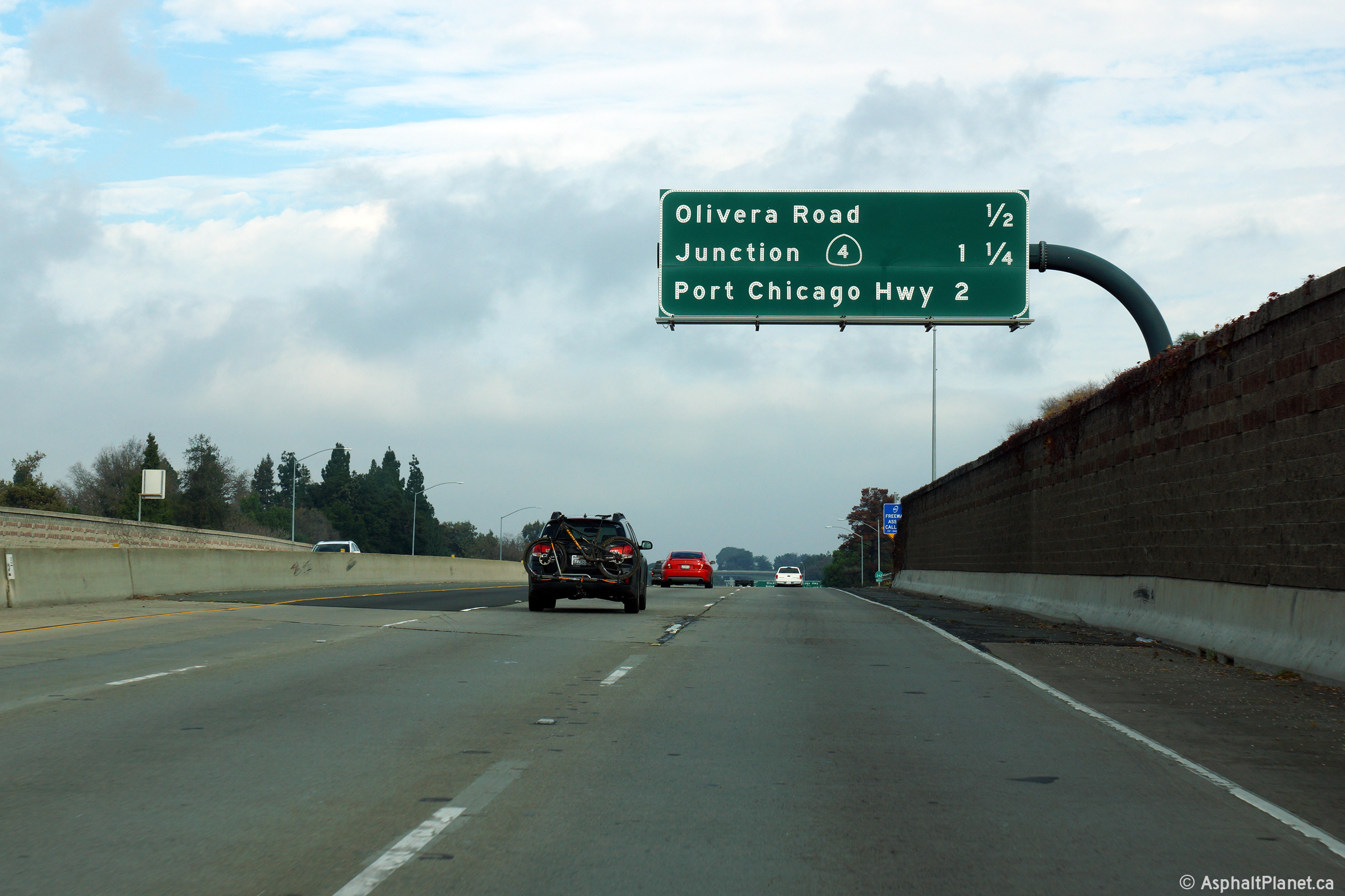
Contra Costa County |
Northbound signage at the off-ramp to Olivera Road. |
 |
||
|
Date: 12/14/2014 |
High-res: (1440x960) (2400x1600) | |||
|
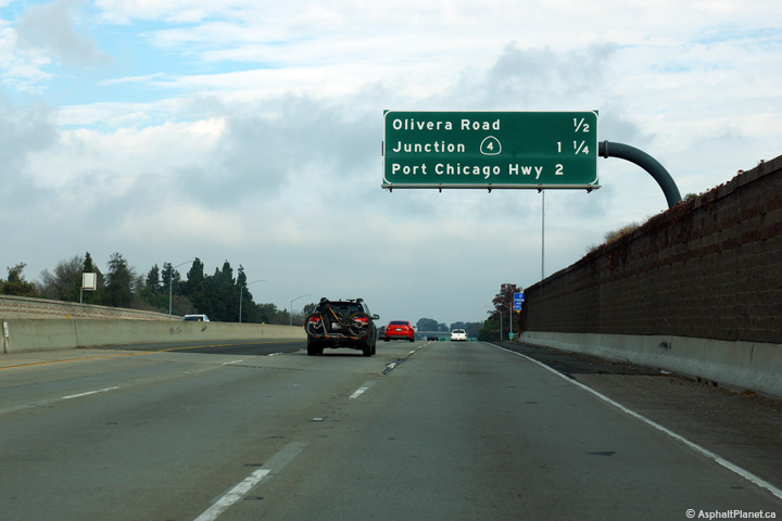
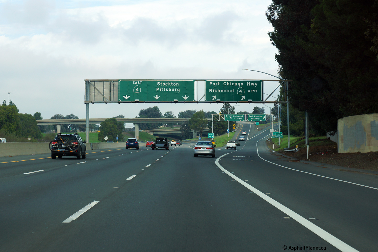
Contra Costa County |
Signage at the SR-4 interchange. This is the final northbound interchange along SR-242. |
 |
||
|
Date: 12/14/2014 |
High-res: (1440x960) (2400x1600) | |||
| State Route 4 is a long highway that runs easterly from I-80 through Stockton all the way through to US-395 in the Owens Valley. Click here for SR-4 Images. | ||||
<- CA-214
CA Highways
CA-243 ->
AsphaltPlanet.ca
© 2010-17 Scott Steeves. Scott@asphaltplanet.ca
Page Created: January 1, 2015.
Last Updated: January 1, 2015.