AsphaltPlanet.ca > Québec > Autoroute 30 > Page 1
|
Autoroute 30 |
|
|
Page 2 -> |
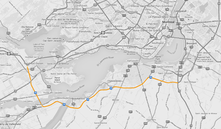
Pictures on this page are arranged in order from west to east. A-30 East photos are left-aligned in the last column, while A-30 west photos are right-aligned. Center-line pictures are centered within the last column.
|
Location |
Description |
Photo |
||
|
East- |
West- |
|||
|
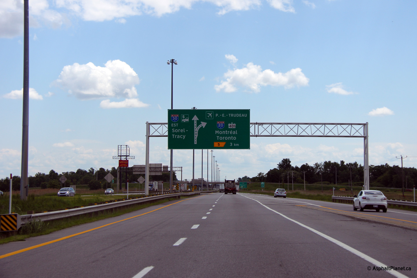
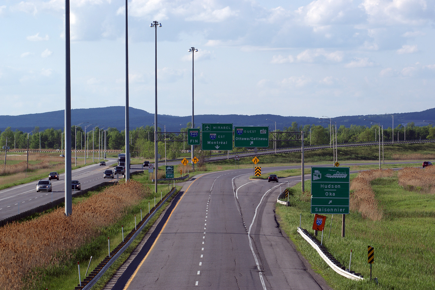
A-30 begins at Autoroute 40, the Trans-Canada Highway. Click here for A-40 images. |
||||
|
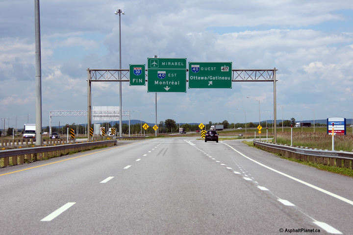
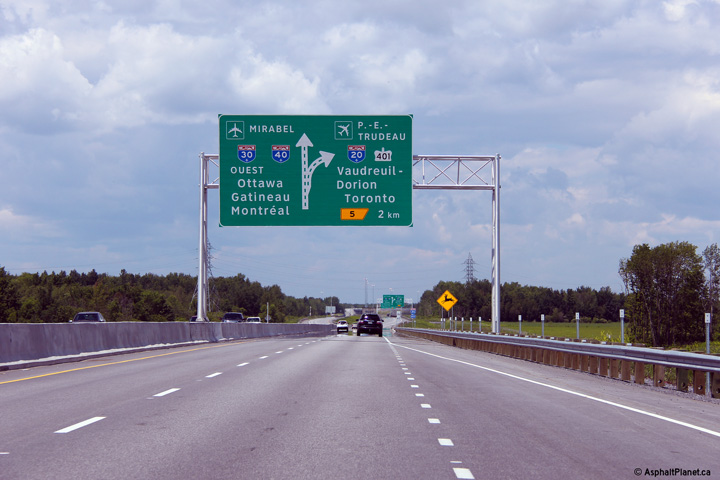
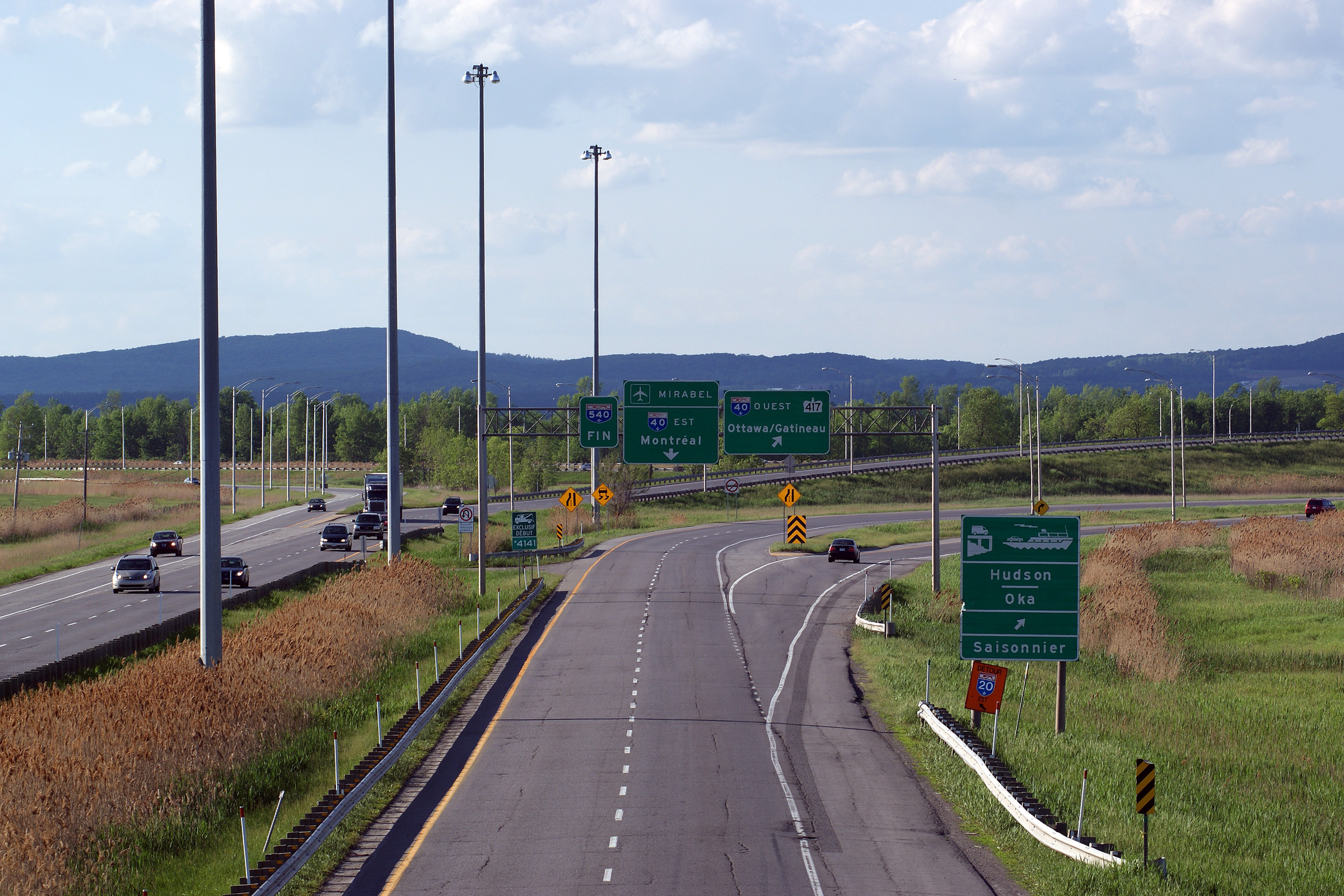
M.R.C. de Vaudreuil-Soulanges Vaudreuil-Dorion |
Overhead signage at the western terminus of Autoroute 30 at the Autoroute 40 interchange. |
 |
||
|
Date: 18/06/2013 |
High-res: (1440x960) (2400x1600) | |||
|
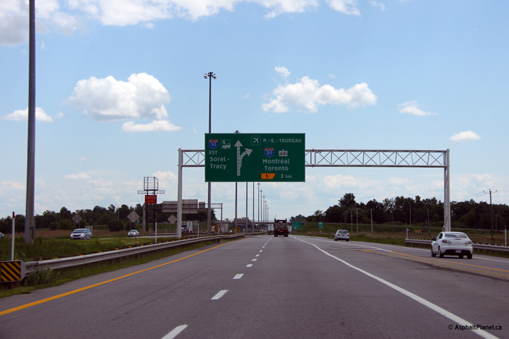
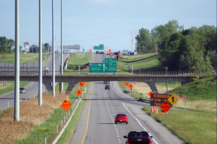
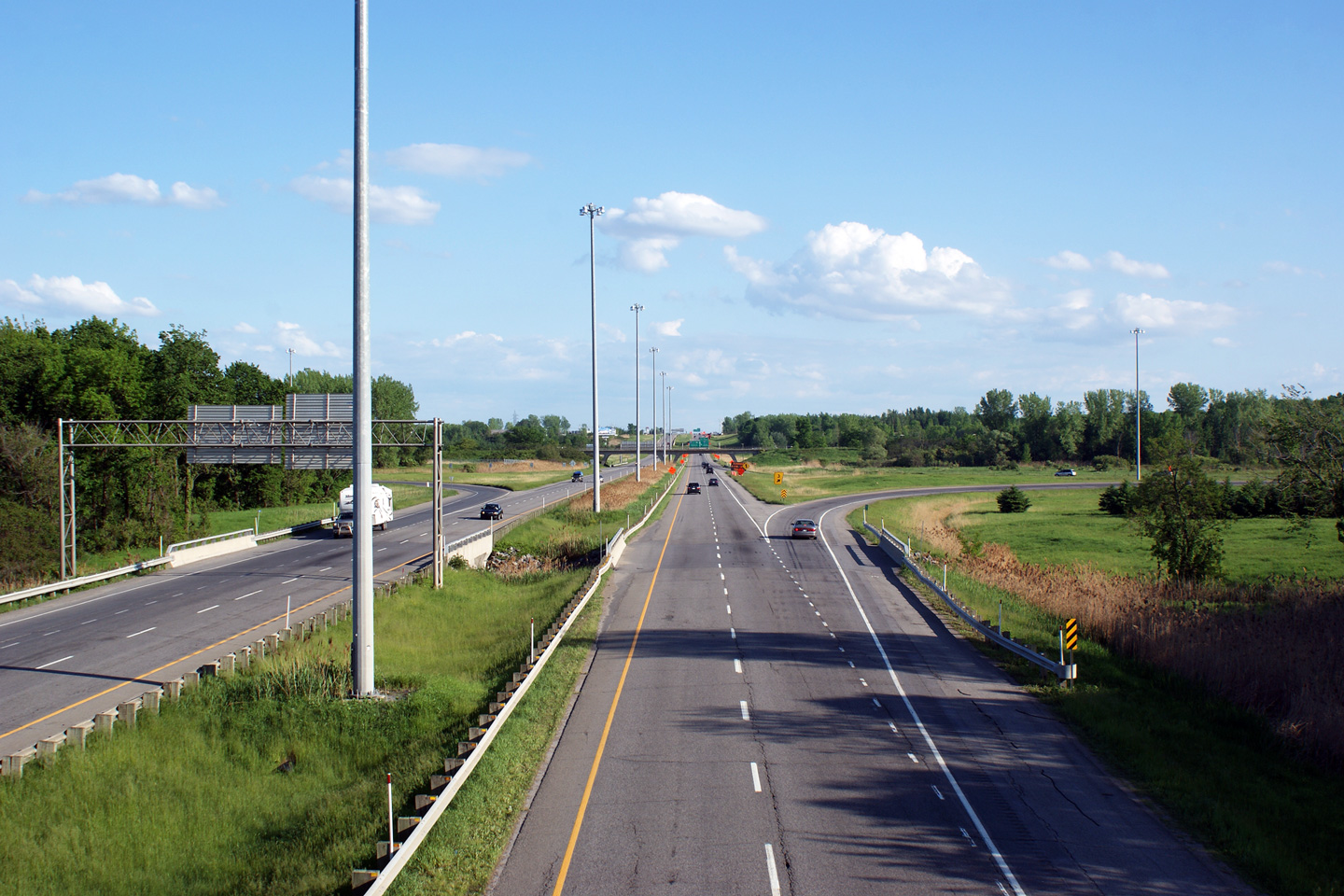
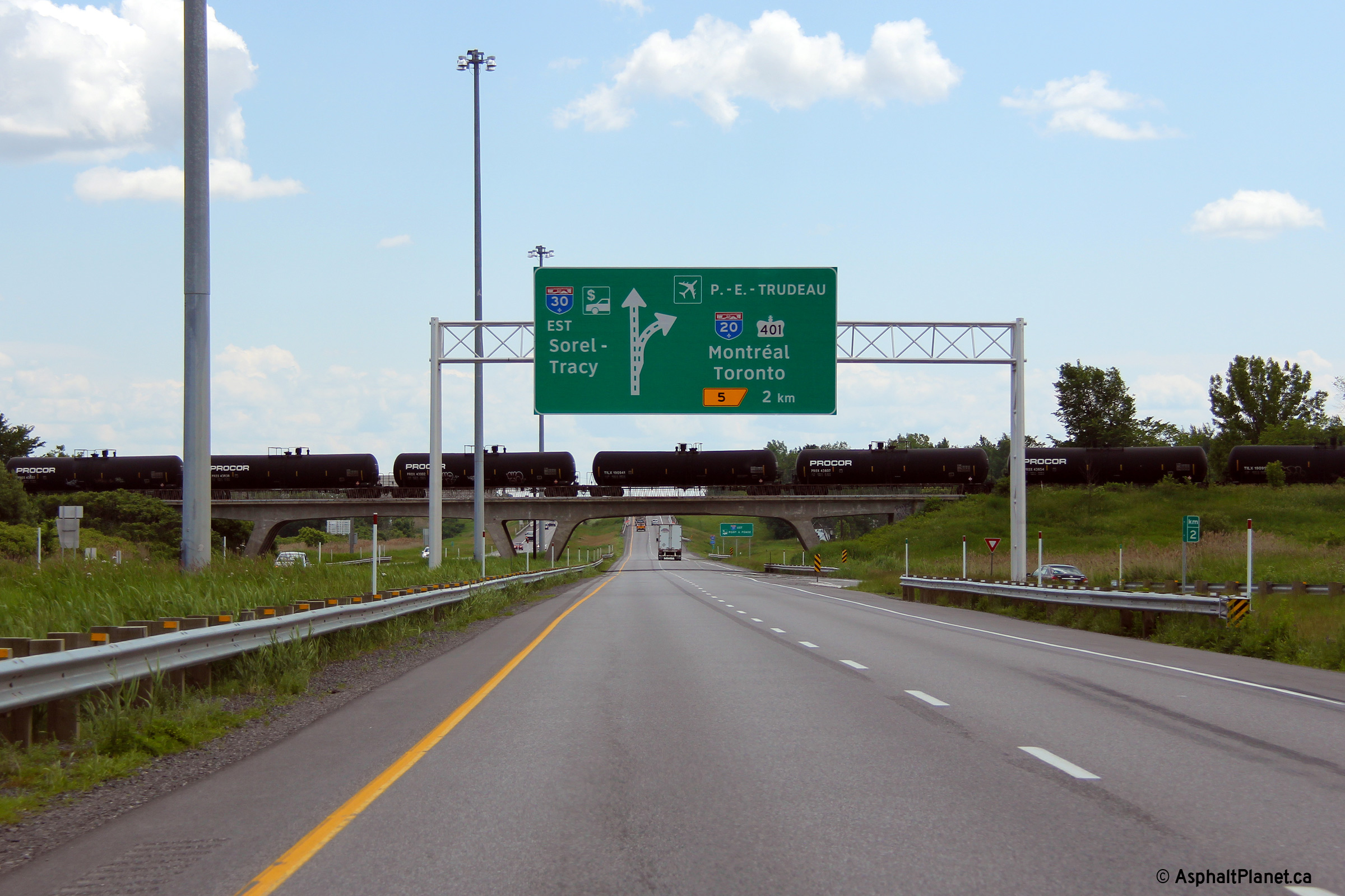
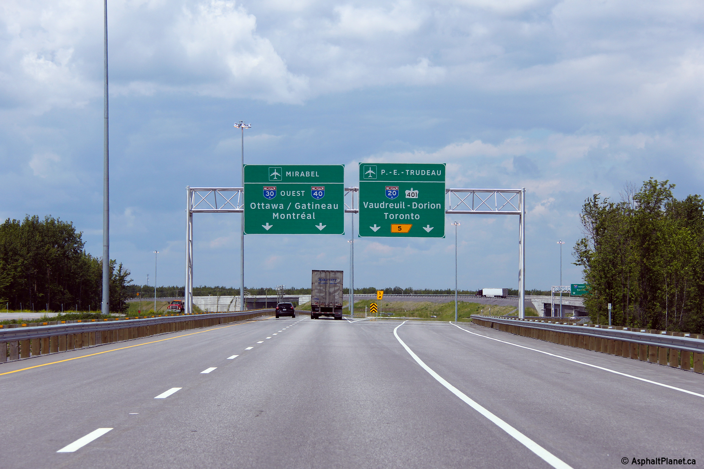
M.R.C. de Vaudreuil-Soulanges Vaudreuil-Dorion |
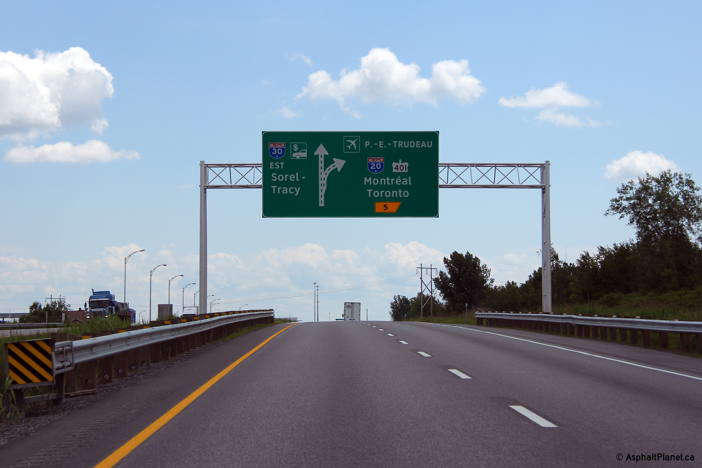
First of three eastbound diagram signs for the upcoming Autoroute 20 interchange. |
 |
||
|
Date: 18/06/2013 |
High-res: (1440x960) (2400x1600) | |||
|
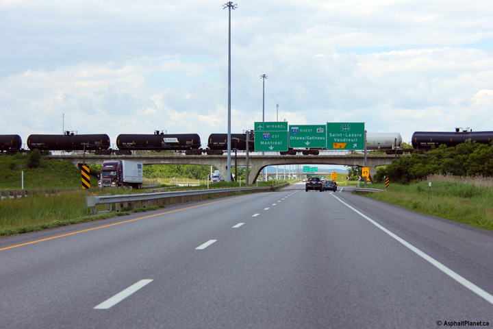
M.R.C. de Vaudreuil-Soulanges Vaudreuil-Dorion |
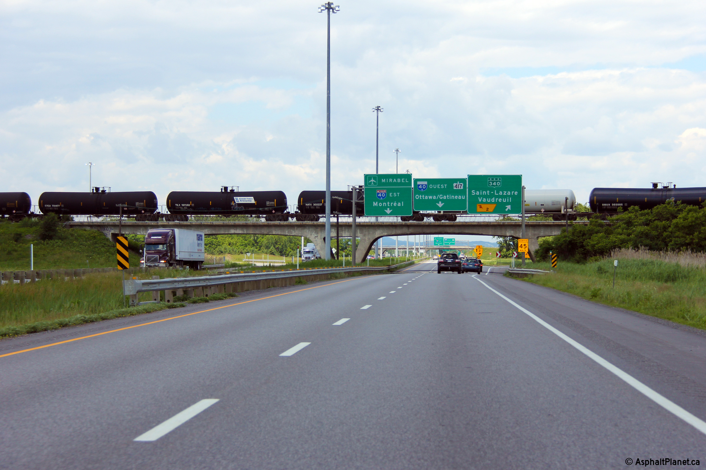
Westerly view from the Route 340 overpass at the overhead sign that denotes the western terminus of Autoroute 30 at Autoroute 40. When this photo was taken, this portion of A-30 was still designated as A-540. |
|
||
|
Date: 5/23/2010 |
High-res: (1440x960) (2400x1600) | |||
|
M.R.C. de Vaudreuil-Soulanges Vaudreuil-Dorion |
Two views looking easterly from the Route 340 overpass. These photos were taken when this portion of A-30 was still part of A-540. |
|
||
| High-res: (1440x960) (2400x1600) | ||||
|
|
||||
|
Date: 5/23/2010 |
High-res: (1440x960) (2400x1600) | |||
|
M.R.C. de Vaudreuil-Soulanges Vaudreuil-Dorion |
Lane assignment signage in advance of the A-40 interchange at the Route 340 overpass. |
 |
||
|
Date: 18/06/2013 |
High-res: (1440x 960) (2400x1600) | |||
|
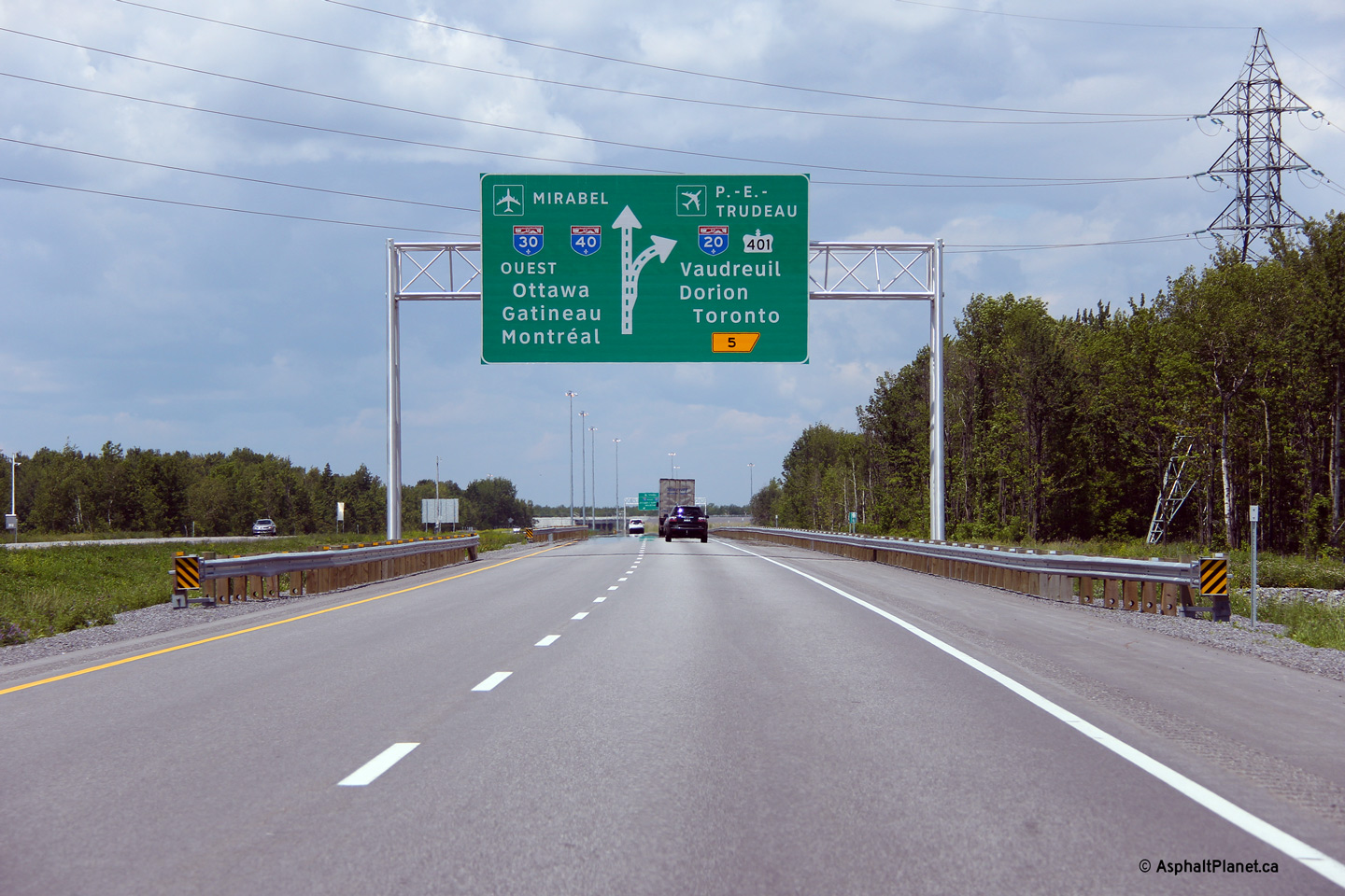
M.R.C. de Vaudreuil-Soulanges Vaudreuil-Dorion |
Second of three diagram signs for the A-20 interchange. |
 |
||
|
Date: 18/06/2013 |
High-res: (1440x960) (2400x1600) | |||
|
M.R.C. de Vaudreuil-Soulanges Vaudreuil-Dorion |
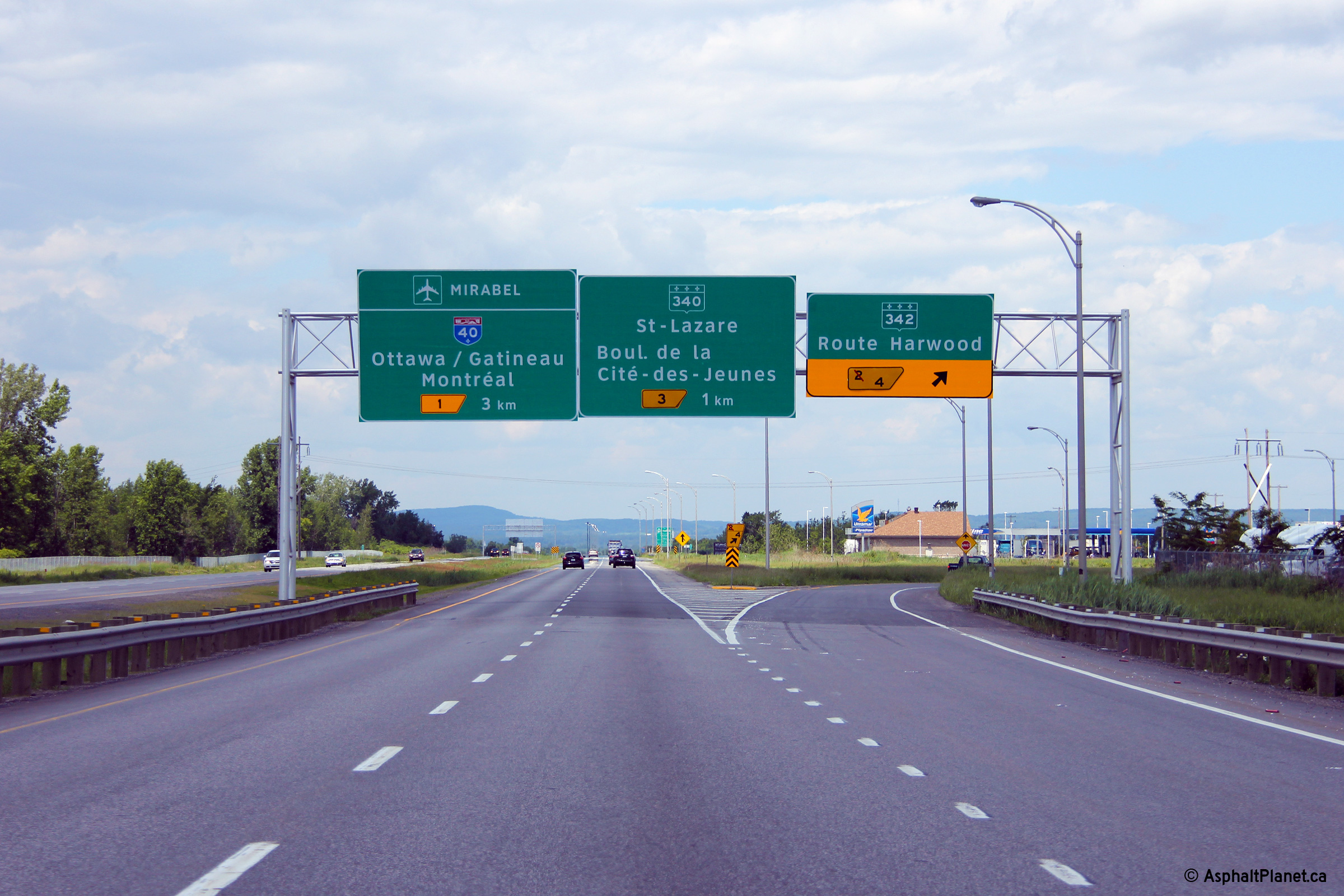
Overhead signage for the Route 340 interchange. |
 |
||
|
Date: 18/06/2013 |
High-res: (1440x960) (2400x1600) | |||
|
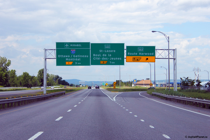
M.R.C. de Vaudreuil-Soulanges Vaudreuil-Dorion |
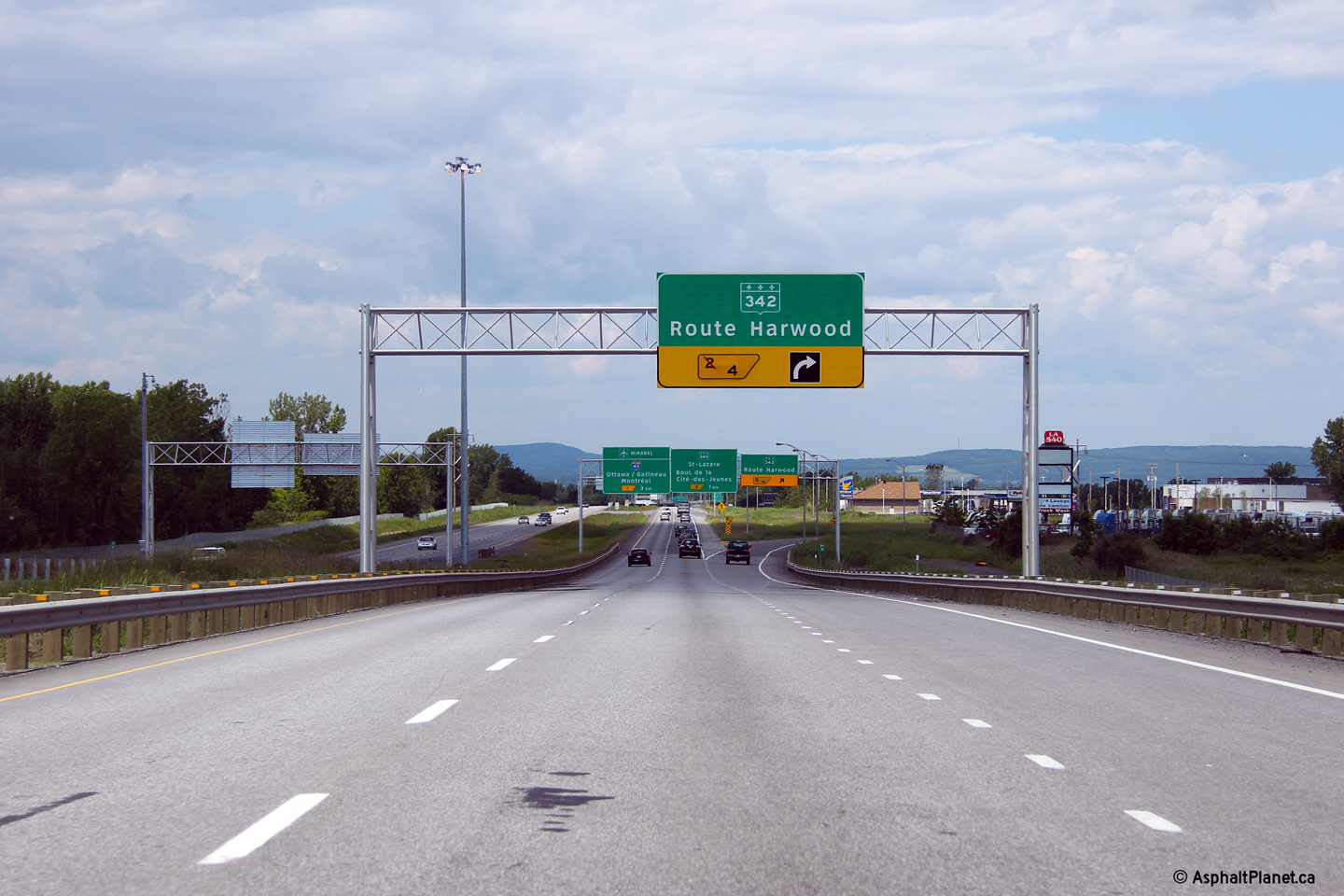
Overhead signage at the off-ramp Route 342. The interchange at Route 342 is a westbound partial interchange. There is no connection between A-30 East and Route 342. |
 |
||
|
Date: 18/06/2013 |
High-res: (1440x960) (2400x1600) | |||
|
M.R.C. de Vaudreuil-Soulanges Vaudreuil-Dorion |
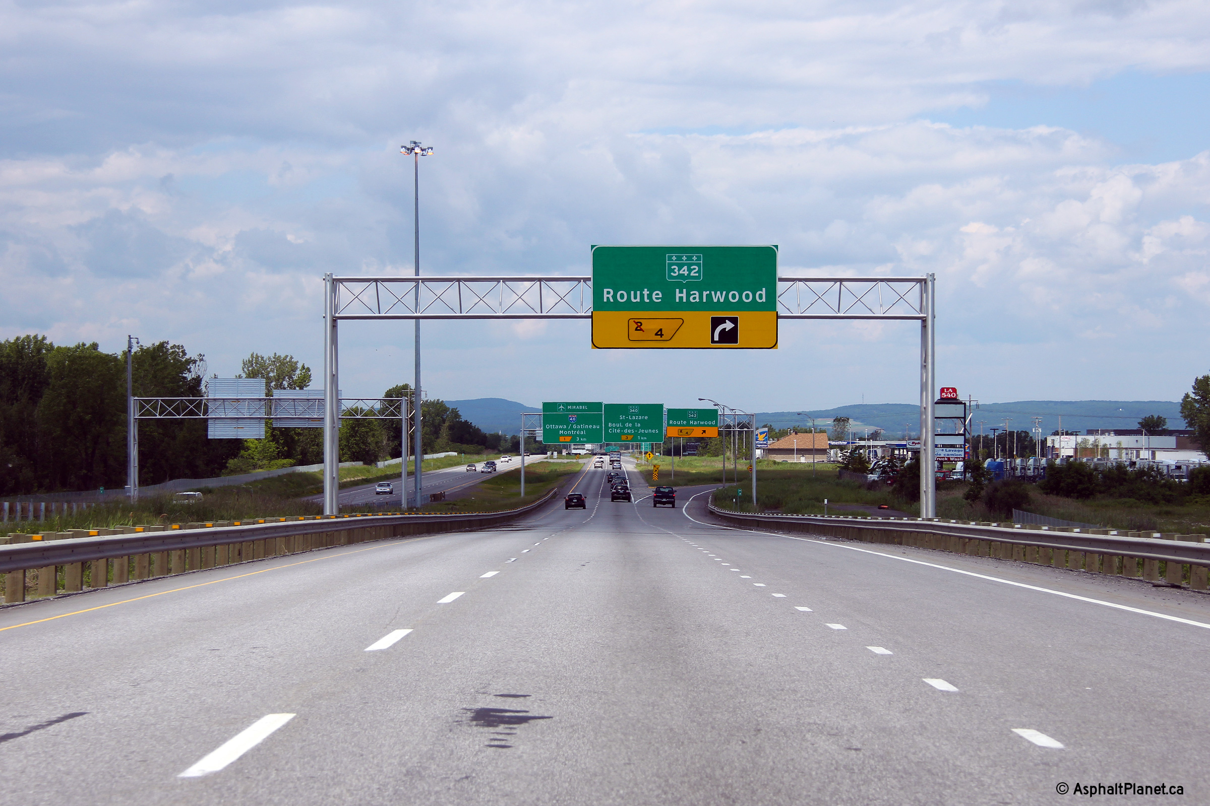
The westbound auxiliary lane from the A-20 interchange departs the eastbound carriageway at the Route 342 off-ramp. |
 |
||
|
Date: 18/06/2013 |
High-res: (1440x960) (2400x1600) | |||
|
M.R.C. de Vaudreuil-Soulanges Vaudreuil-Dorion |
Third of three eastbound diagram signs for the Autoroute 20 interchange. |
 |
||
|
Date: 18/06/2013 |
High-res: (1440x960) (2400x1600) | |||
|
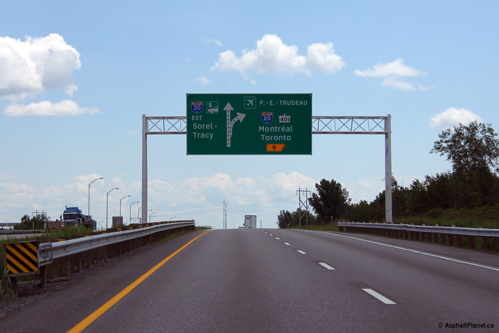
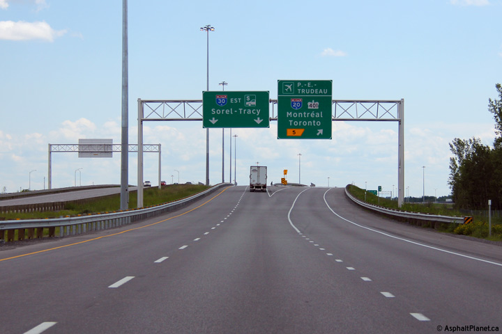
M.R.C. de Vaudreuil-Soulanges Vaudreuil-Dorion |
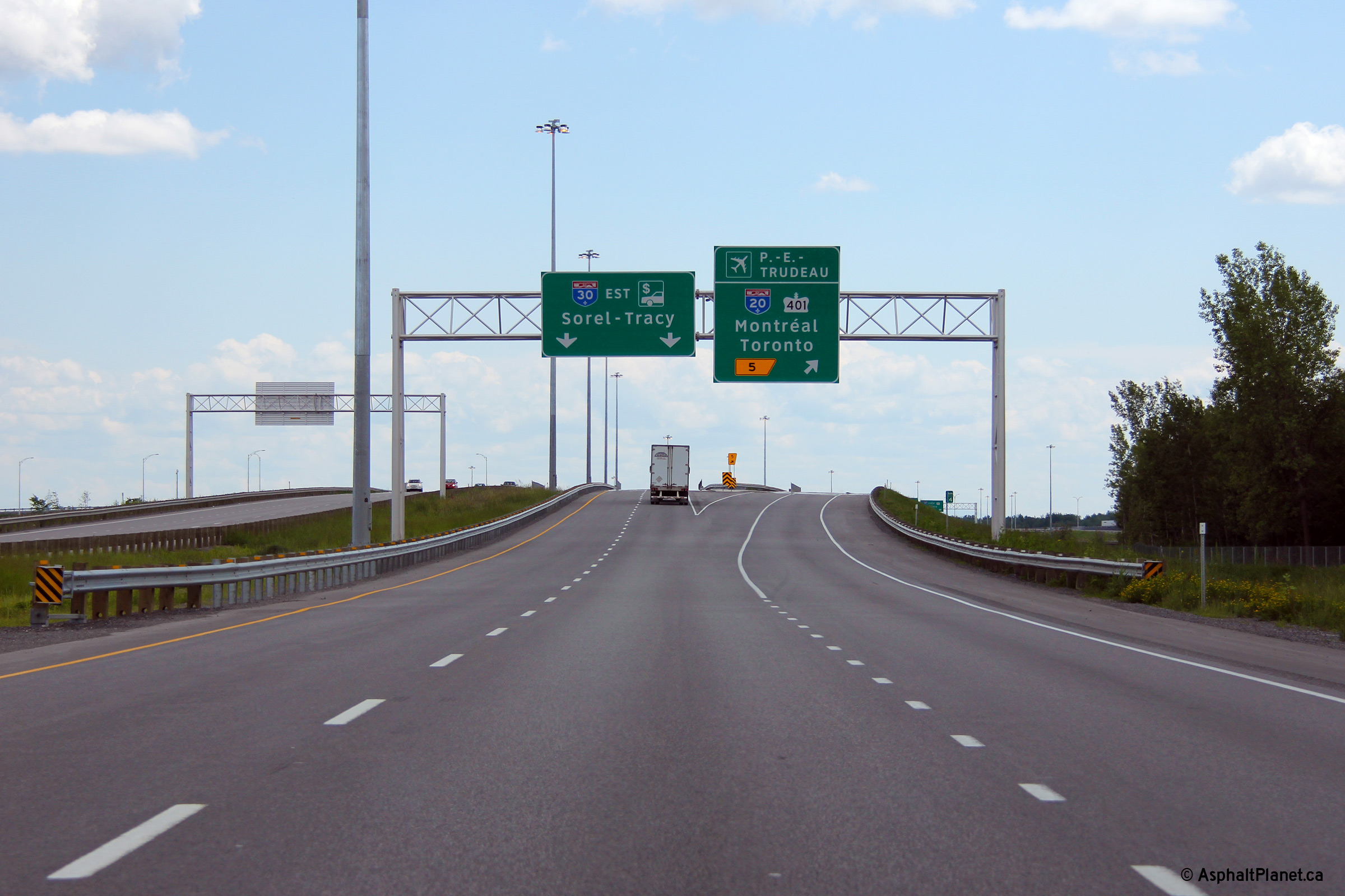
Overhead signage for at the off-ramp to Autoroute 20. |
 |
||
|
Date: 18/06/2013 |
High-res: (1440x960) (2400x1600) | |||
|
M.R.C. de Vaudreuil-Soulanges Vaudreuil-Dorion |
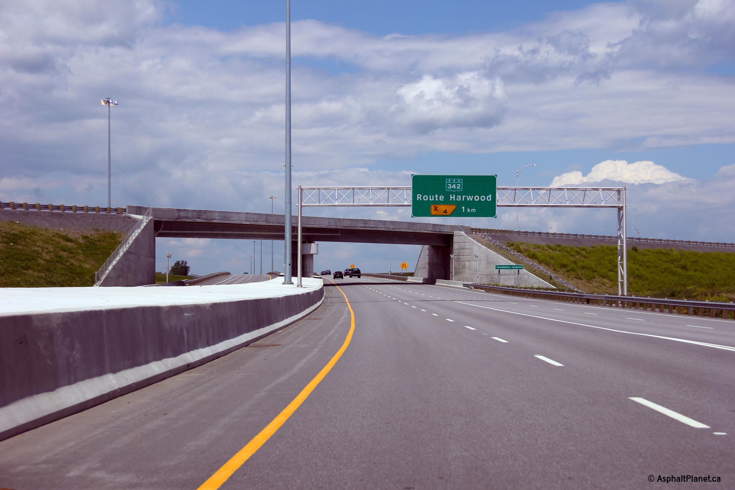
The westbound advanced signage for the ramp to Route Harwood is located just before the fly-over ramp that carries traffic from westbound Autoroute 20 to Eastbound Autoroute 30. |
 |
||
|
Date: 18/06/2013 |
High-res: (1440x960) (2400x1600) | |||
|
A-30 crosses A-20 just west of Dorion. Click here for A-20 West Images and here for A-20 East Images. |
||||
|
M.R.C. de Vaudreuil-Soulanges Les Cèdres |
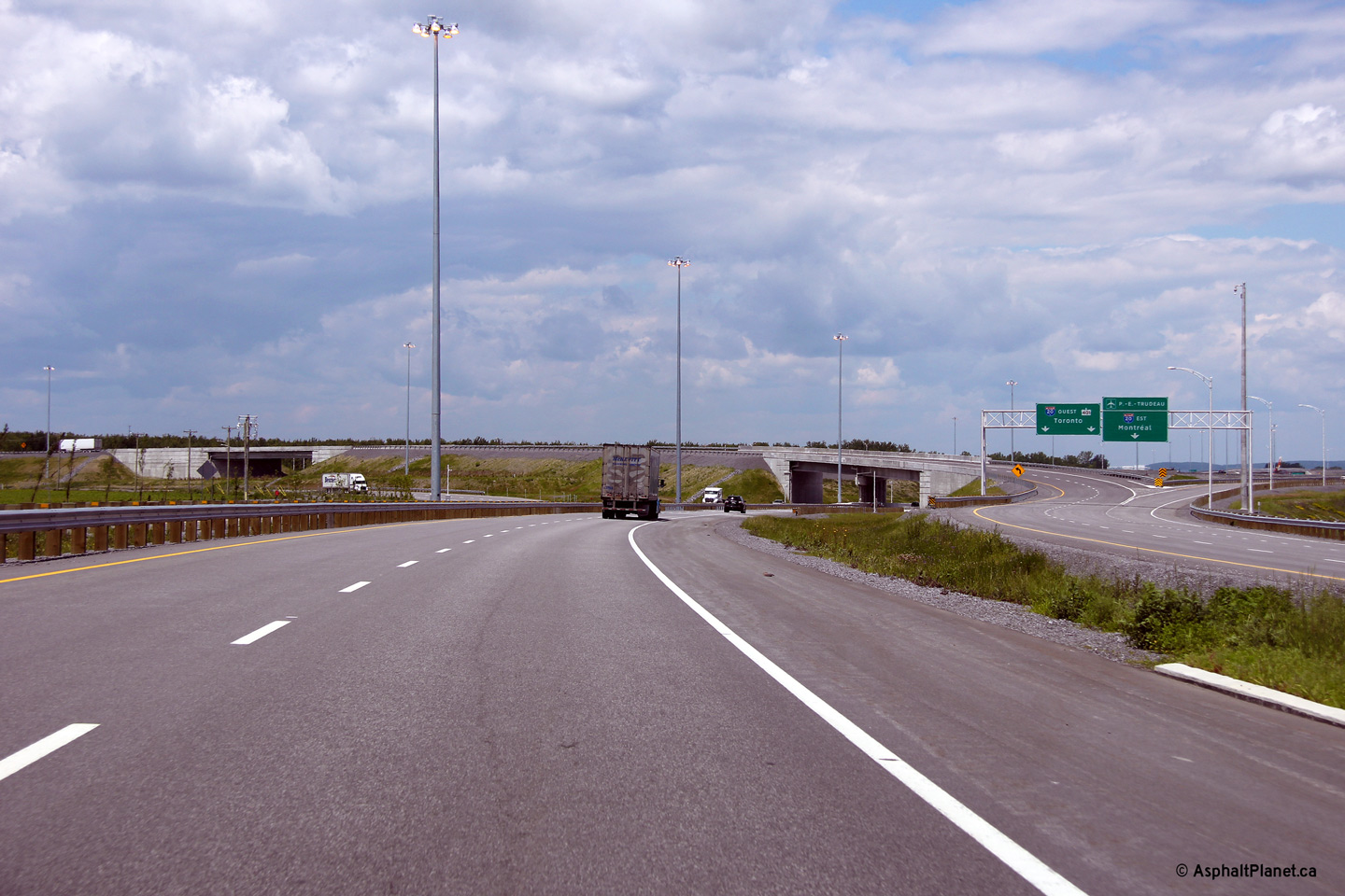
View looking westerly through the A-20 interchange. |
 |
||
|
Date: 18/06/2013 |
High-res: (1440x960) (2400x1600) | |||
|
M.R.C. de Vaudreuil-Soulanges Les Cèdres |
Westbound signage for at the ramp to A-20. |
 |
||
|
Date: 18/06/2013 |
High-res: (1440x960) (2400x1600) | |||
|
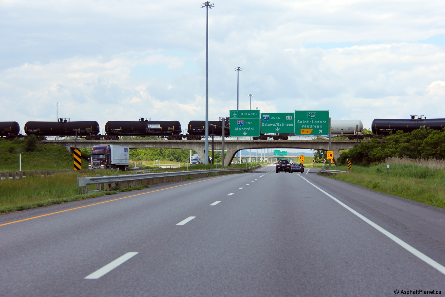
M.R.C. de Vaudreuil-Soulanges Les Cèdres |
Third of three westbound diagram signs in advance of the Autoroute 20 interchange. |
 |
||
|
Date: 18/06/2013 |
High-res: (1440x960) (2400x1600) | |||
|
M.R.C. de Vaudreuil-Soulanges Les Cèdres |
Second of three diagram signs for the A-20 interchange. |
 |
||
|
Date: 18/06/2013 |
High-res: (1440x960) (2400x1600) | |||
|
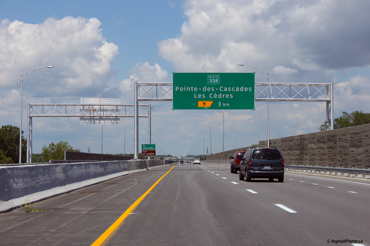
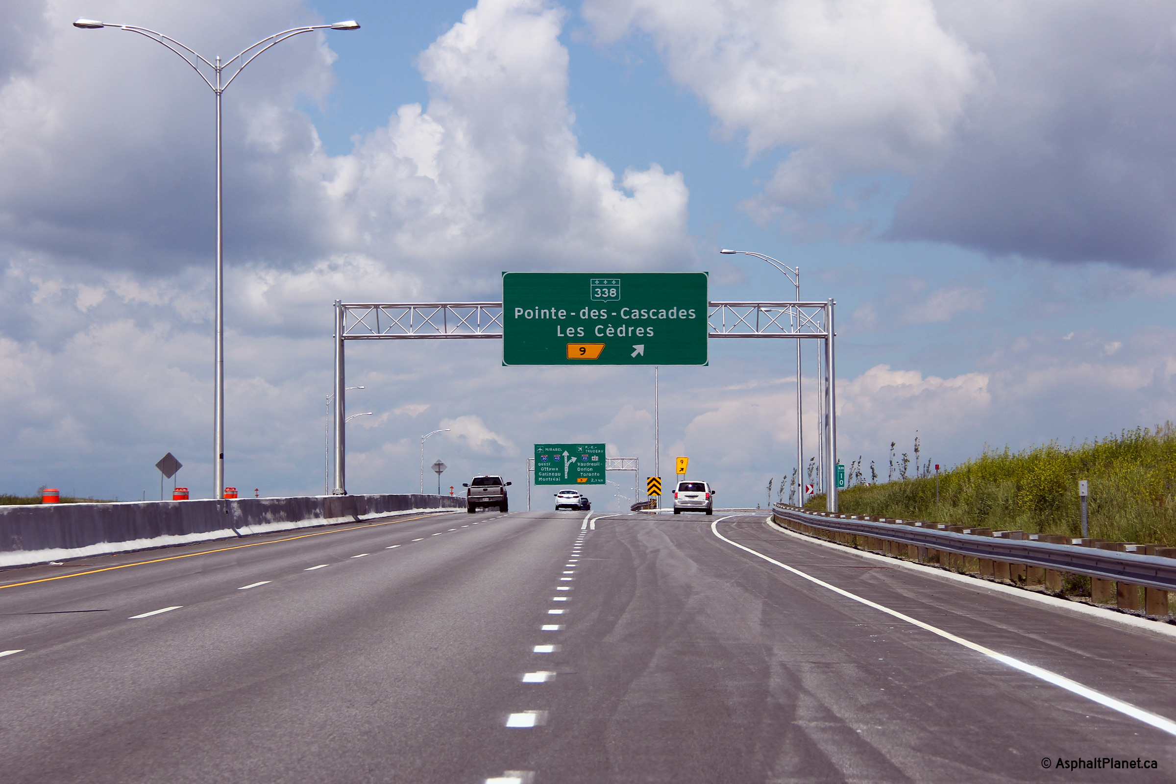
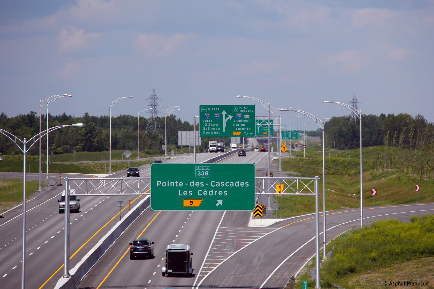
Agglomeration de Longueuil Saint-Bruno-de-Montarville |
Overhead signage for the ramp to Route 338. |
 |
||
|
Date: 18/06/2013 |
High-res: (1440x960) (2400x1600) | |||
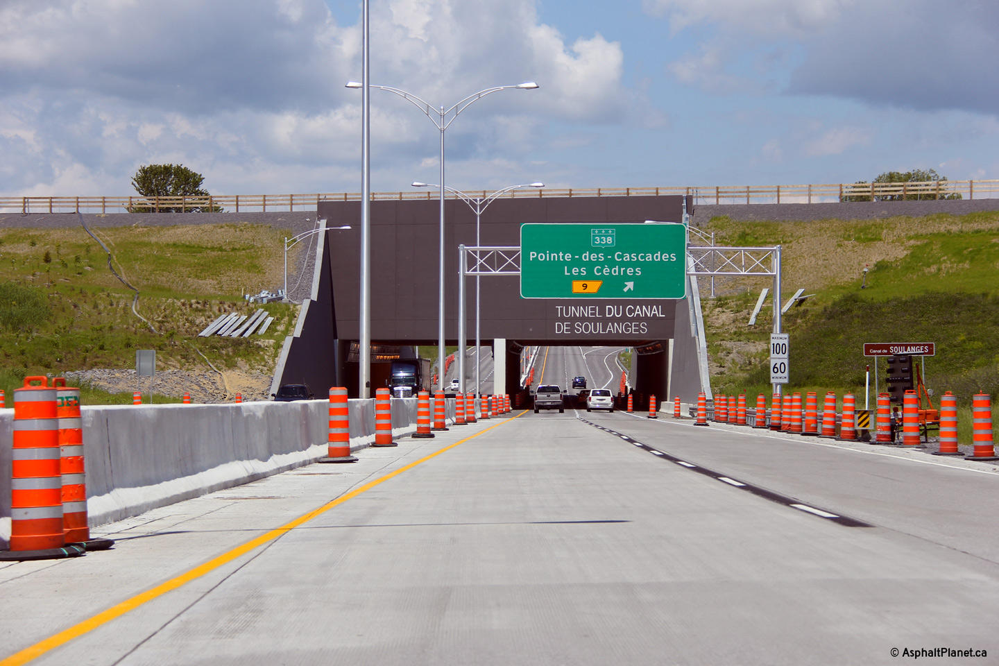
|
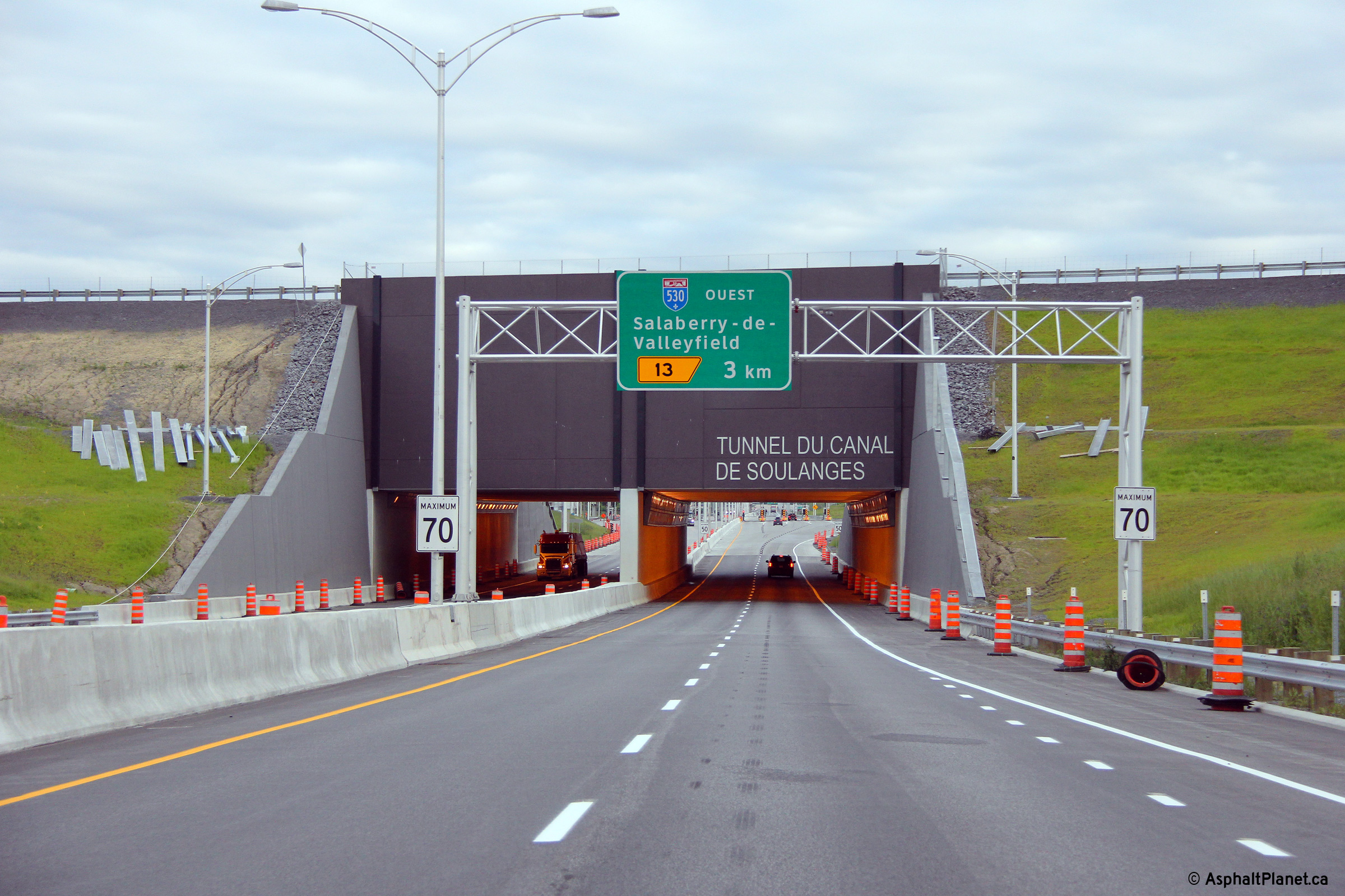
M.R.C. de Vaudreuil-Soulanges Les Cèdres |
View looking easterly through the Canal de Soulanges Tunnel. |
 |
||
|
Date: 18/05/2013 |
High-res: (1440x960) (2400x1600) | |||
|
M.R.C. de Vaudreuil-Soulanges Les Cèdres |
Two views looking westerly along Autoroute 30 from the side of the Soulanges Canal. The Soulanges Canal was the principle canal to by-pass a series of rapids along the Saint Lawrence River before it was by-passed in 1958 by the current alignment of the Beauharnois Canal during the Saint Lawrence Seaway project of the 1950s. Today, the locks are derelict, there has been some consideration to reopen the canal to pleasure crafts.
|
 |
||
| High-res: (1440x960) (2400x1600) | ||||
 |
||||
|
Date: 18/06/2013 |
High-res: (1440x960) (2400x1600) | |||
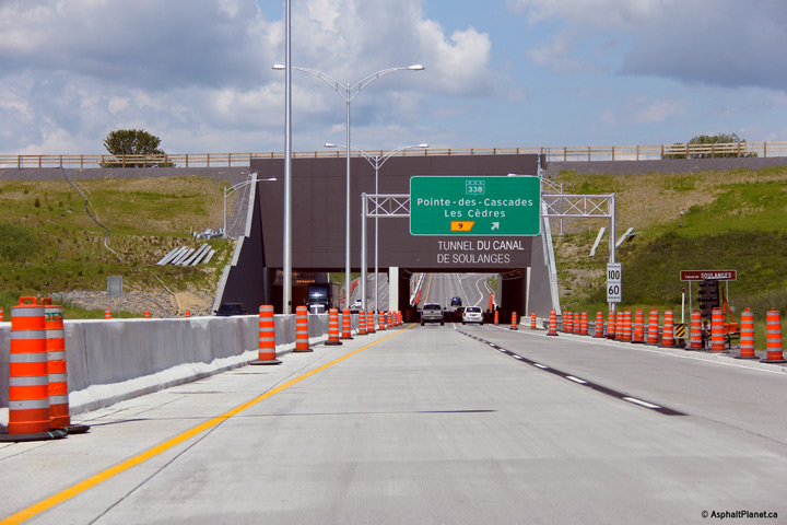
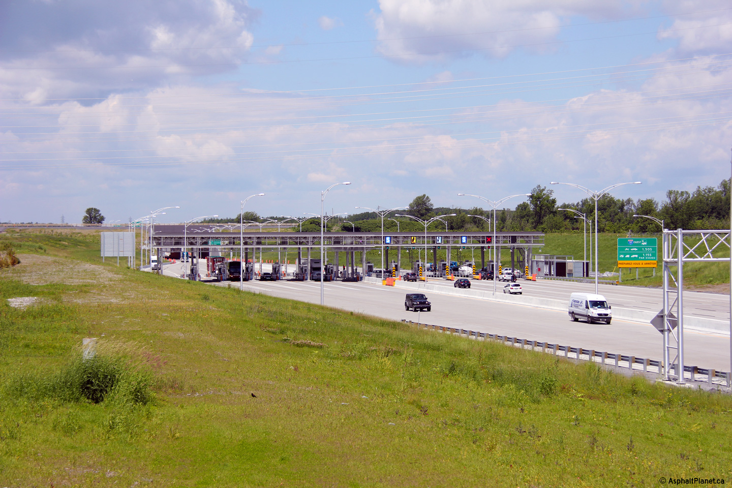
|
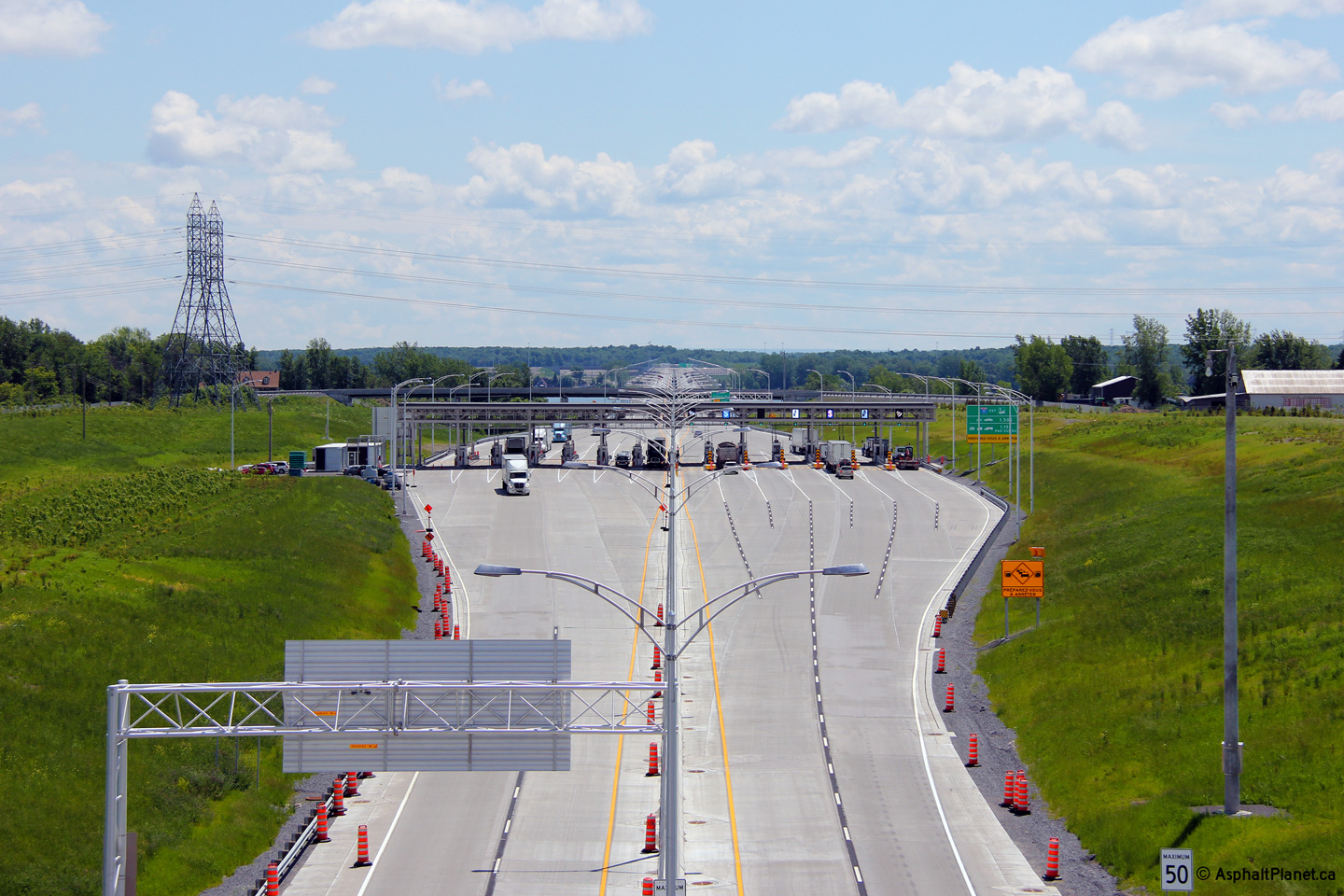
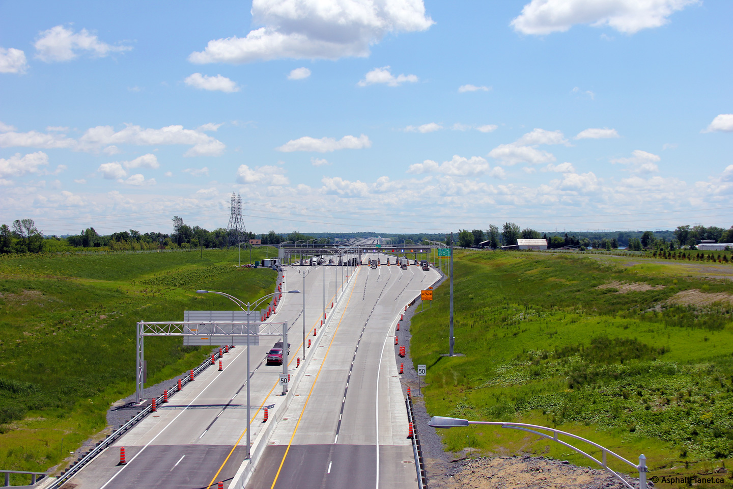
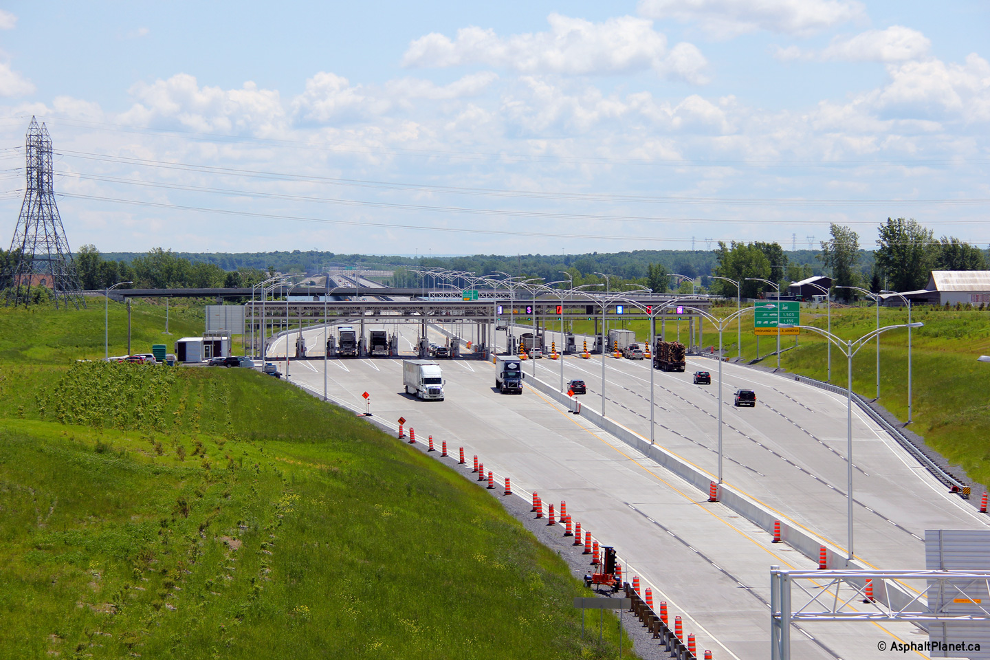
M.R.C. de Vaudreuil-Soulanges Les Cèdres |
Looking easterly towards the toll plaza from overtop of the Canal de Soulanges Tunnel. |
 |
||
| High-res: (1440x960) (2400x1600) | ||||
 |
||||
| High-res: (1440x960) (2400x1600) | ||||
 |
||||
|
Date: 18/06/2013 |
High-res: (1440x960) (2400x1600) | |||
|
M.R.C. de Vaudreuil-Soulanges Les Cèdres |
Westerly view through the Canal de Soulanges Tunnel. |
 |
||
|
Date: 18/06/2013 |
High-res: (1440x960) (2400x1600) | |||
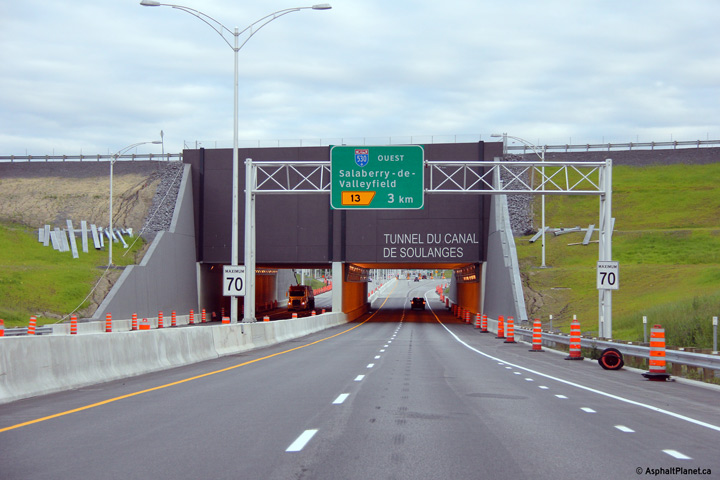
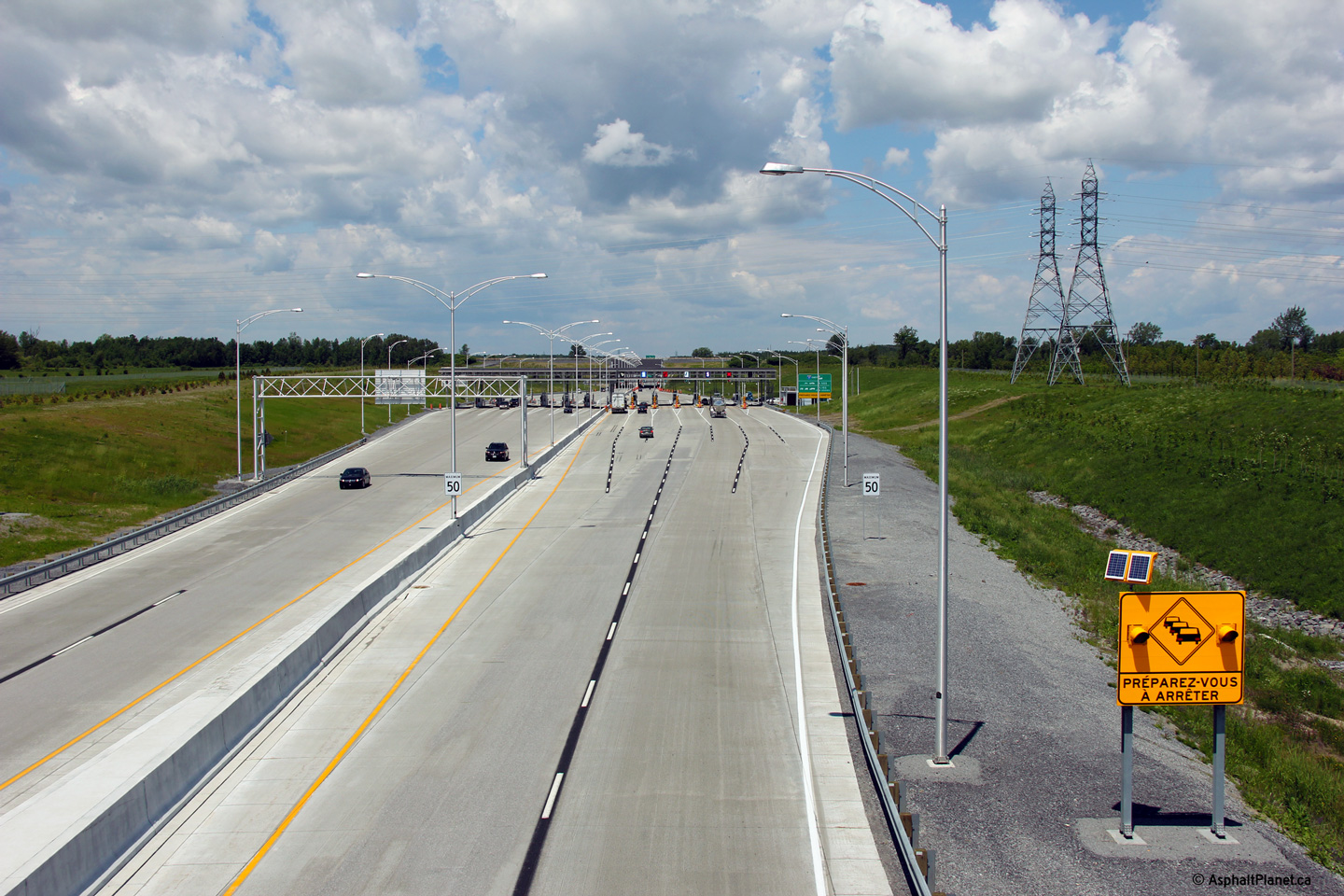
|
M.R.C. de Vaudreuil-Soulanges Les Cèdres |
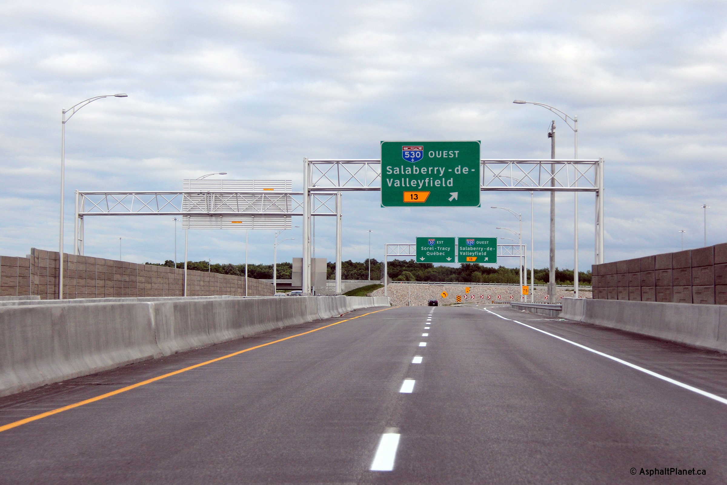
This advanced sign for the upcoming A-530 interchange is situated just beyond the toll plaza. |
 |
||
|
Date: 17/06/2013 |
High-res: (1440x960) (2400x1600) | |||
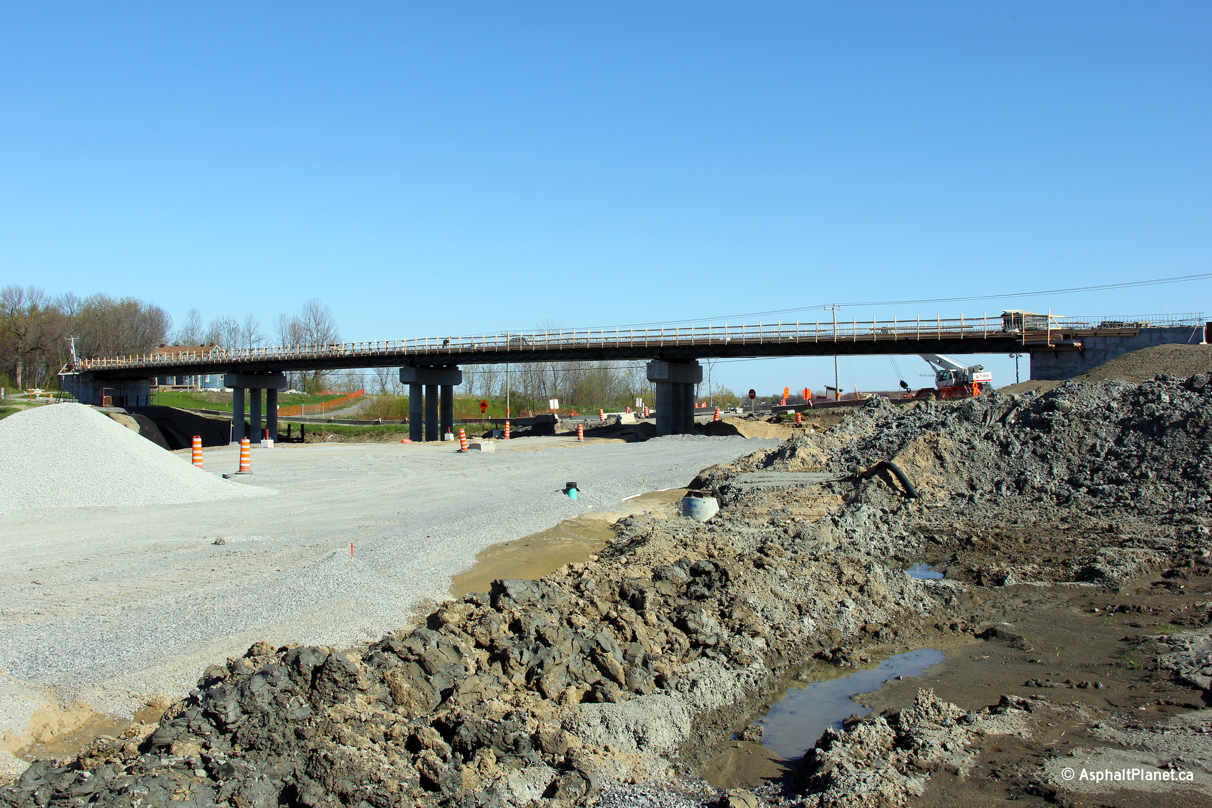
|
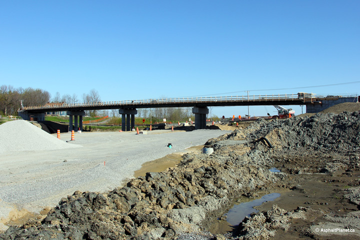
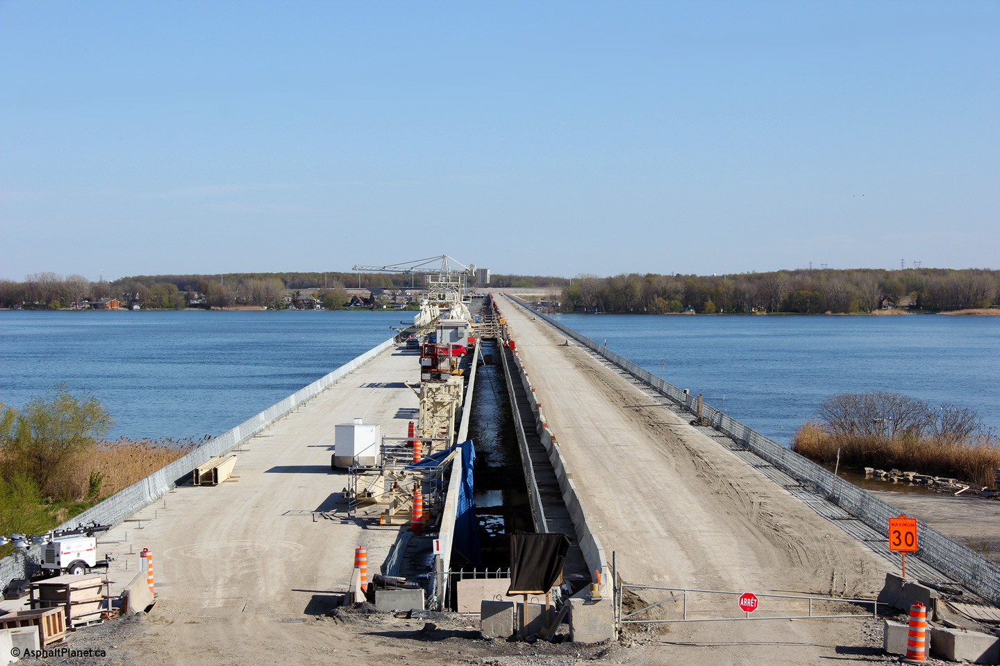
M.R.C. de Vaudreuil-Soulanges Les Cèdres |
View looking easterly through the under construction Chemin du Fleuve overpass. The four span Chemin du Fleuve overpass is considerably wider than the four lane expressway it spans. |
 |
||
|
Date: 5/5/2012 |
High-res: (1440x960) (2400x1600) | |||
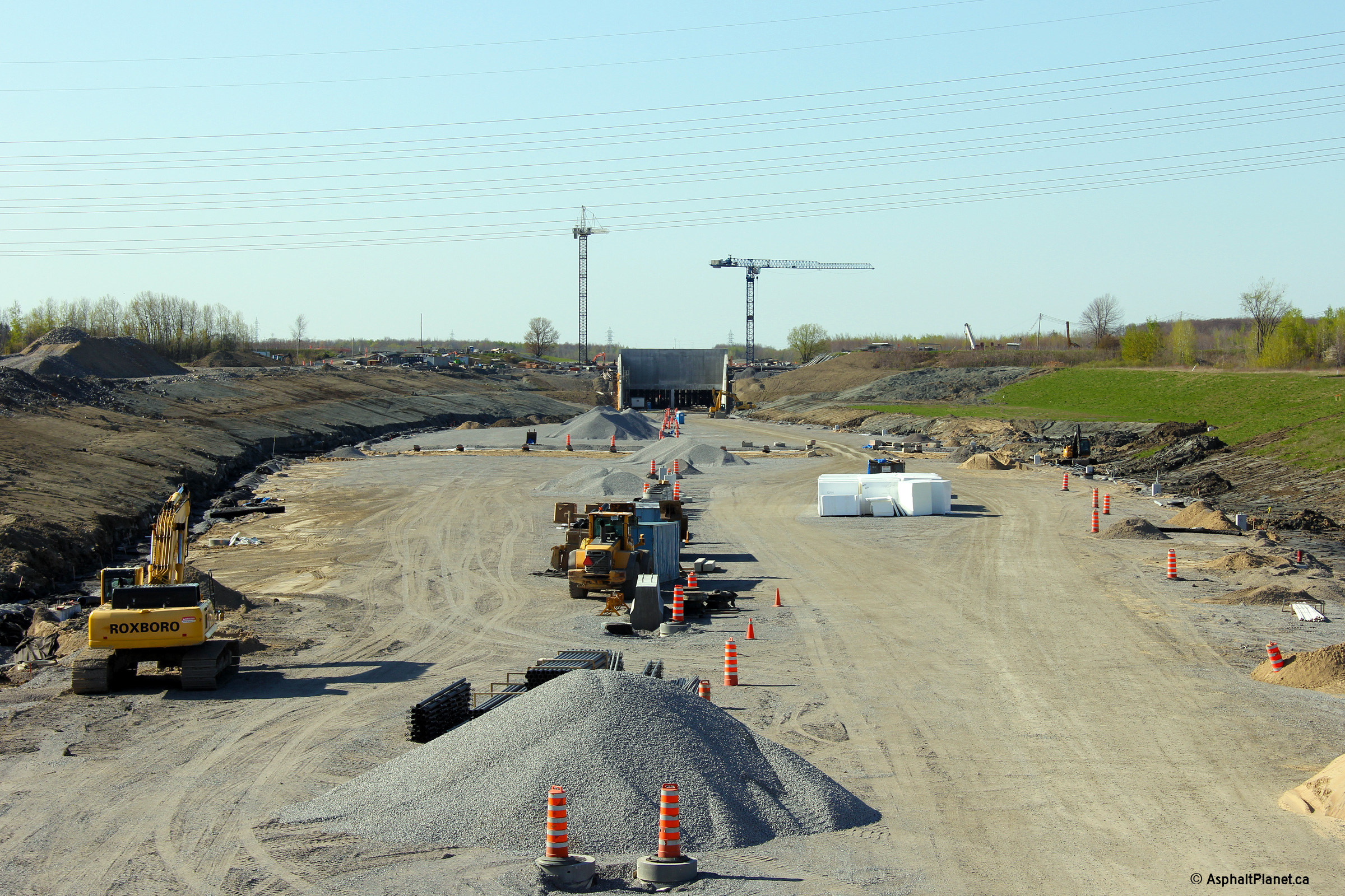
|
M.R.C. de Vaudreuil-Soulanges Les Cèdres |
View looking westerly from the Chemin du Fleuve overpass towards the under construction toll plaza and tunnel. |
 |
||
|
Date: 5/5/2012 |
High-res: (1440x960) (2400x1600) | |||
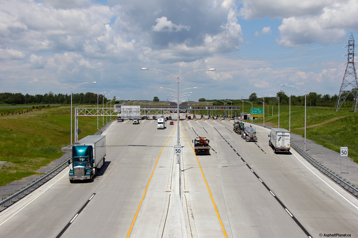
|
M.R.C. de Vaudreuil-Soulanges Les Cèdres |
A series of the three views looking west from the Chemin du. Fleuve overpass towards the Saint Lawrence River bridge toll plaza. As of 2013, it costs $1.50 to cross the Saint Lawrence River along A-30. |
 |
||
| High-res: (1440x960) (2400x1600) | ||||
 |
||||
| High-res: (1440x960) (2400x1600) | ||||
 |
||||
|
Date: 18/06/2013 |
High-res: (1440x960) (2400x1600) | |||
|
M.R.C. de Vaudreuil-Soulanges Les Cèdres |
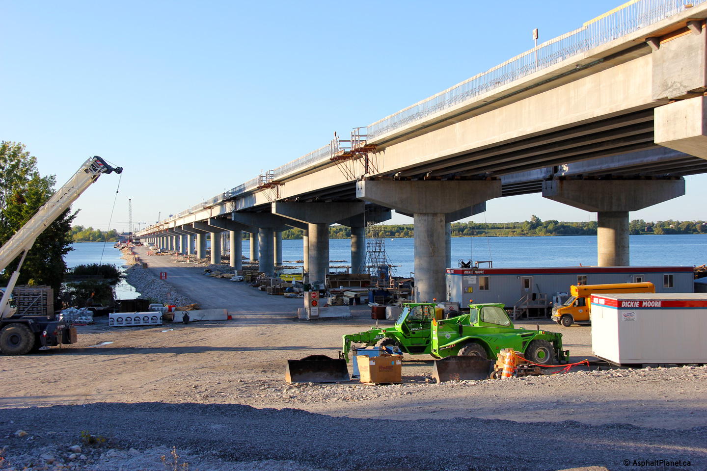
This view looks easterly across the twin Saint Lawrence River bridges taken during construction from the Chemin du Fleuve overpass. |
 |
||
|
Date: 5/5/2012 |
High-res: (1440x960) (2400x1600) | |||
|
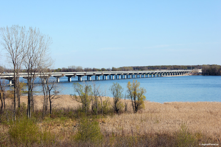
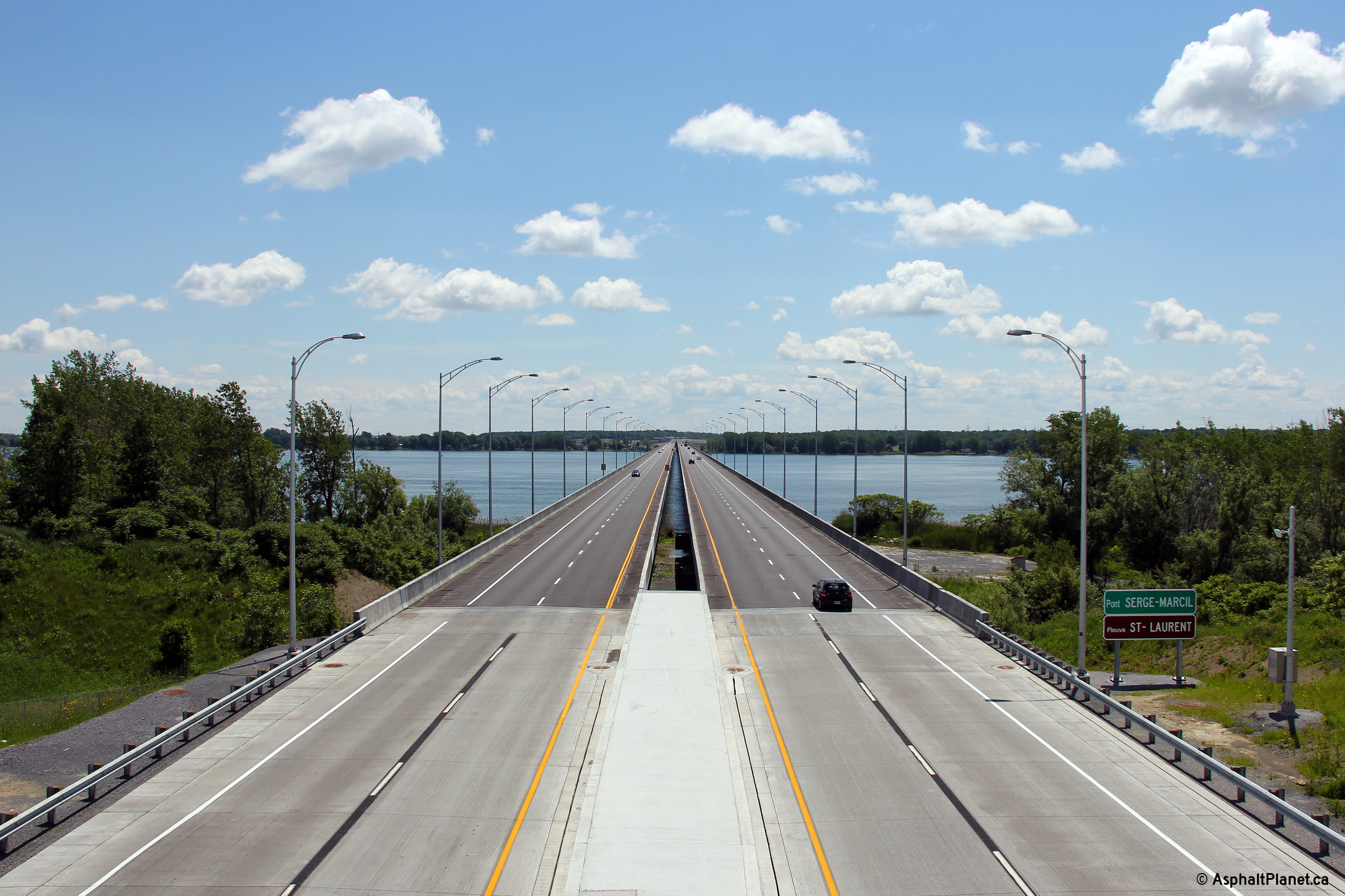
M.R.C. de Vaudreuil-Soulanges Les Cèdres |
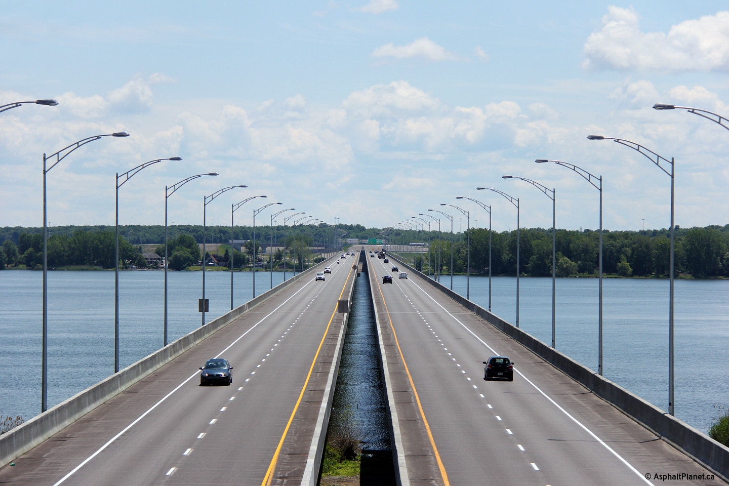
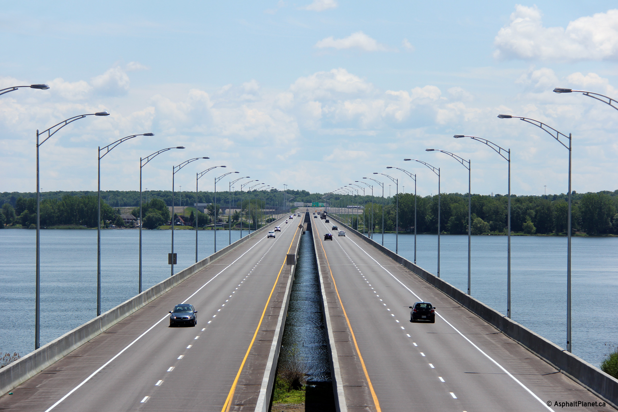
Three views of the twin completed Saint Lawrence River bridges from the Chemin du Fleuve overpass. The Saint Lawrence River Bridge was named for Serge Marcil, who served as both an MPP in the Quebec Legislature and as an MP in Canadian Parliament in both cases within the Salaberry area. |
 |
||
| High-res: (1440x960) (2400x1600) | ||||
 |
||||
| High-res: (1440x960) (2400x1600) | ||||
 |
||||
|
Date: 18/06/2013 |
High-res: (1440x960) (2400x1600) | |||
|
M.R.C. de Vaudreuil-Soulanges Les Cèdres |
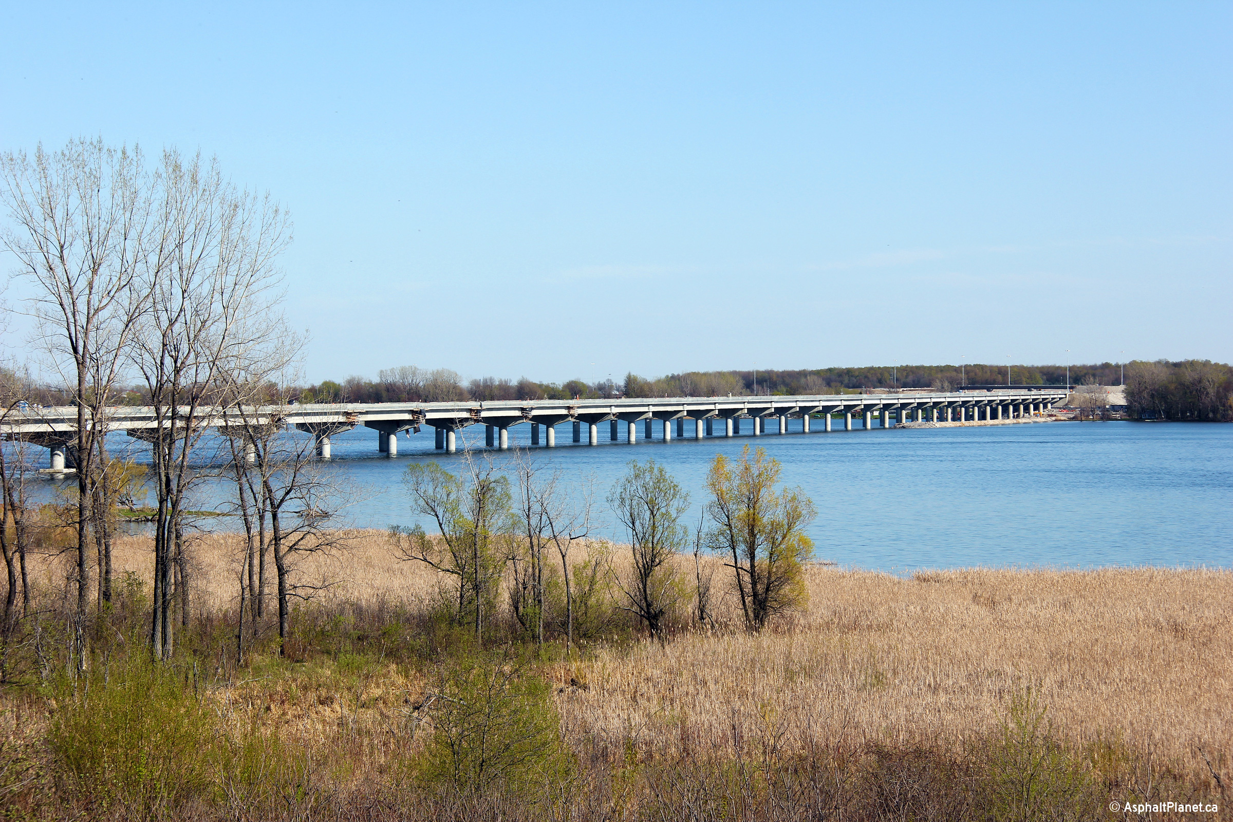
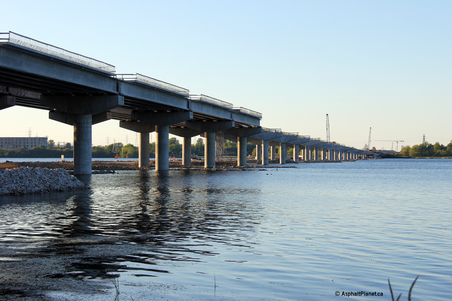
Easterly view from the north shore of the still under construction Saint Lawrence River Bridge. The structure was nearly completed when this photo was taken. |
 |
||
|
Date: 12/7/2008 |
High-res: (1440x960) (2400x1600) | |||
|
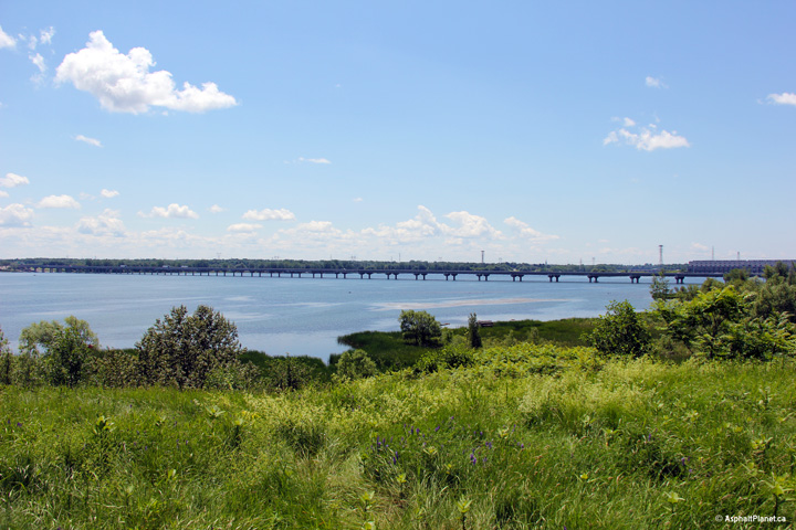
M.R.C. de Vaudreuil-Soulanges Les Cèdres |
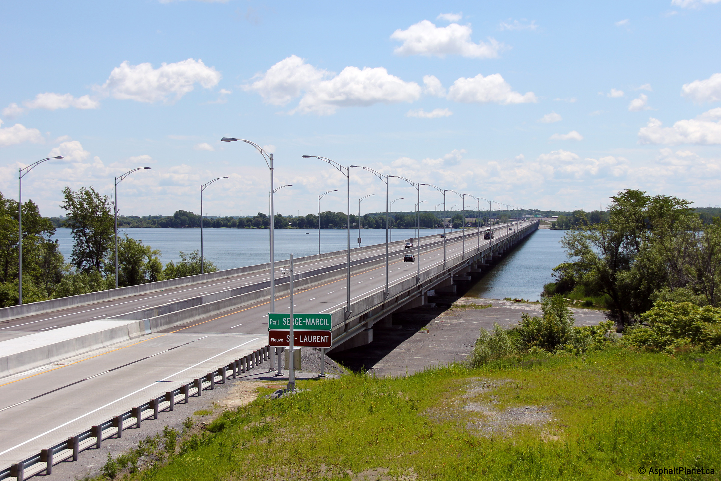
Looking southwesterly towards the completed Saint Lawrence River bridge. This is the only photo in this collection that shows a side view of the completed structure. |
 |
||
|
Date: 18/06/2013 |
High-res: (1440x960) (2400x1600) | |||
|
MRC de Beauharnois-Salaberry Salaberry-de-Valleyfield |
Two views looking across the under construction Autoroute 30 bridges from Route 132 on the South Shore of the St. Lawrence River. |
 |
||
| High-res: (1440x960) (2400x1600) | ||||
 |
||||
|
Date: 9/18/2011 |
High-res: (1440x960) (2400x1600) | |||
|
MRC de Beauharnois-Salaberry Salaberry-de-Valleyfield |
Advanced signage for the Route 338 interchange on the south side of the Saint Lawrence River. |
|
||
|
Date: 18/06/2013 |
High-res: (1440x960) (2400x1600) | |||
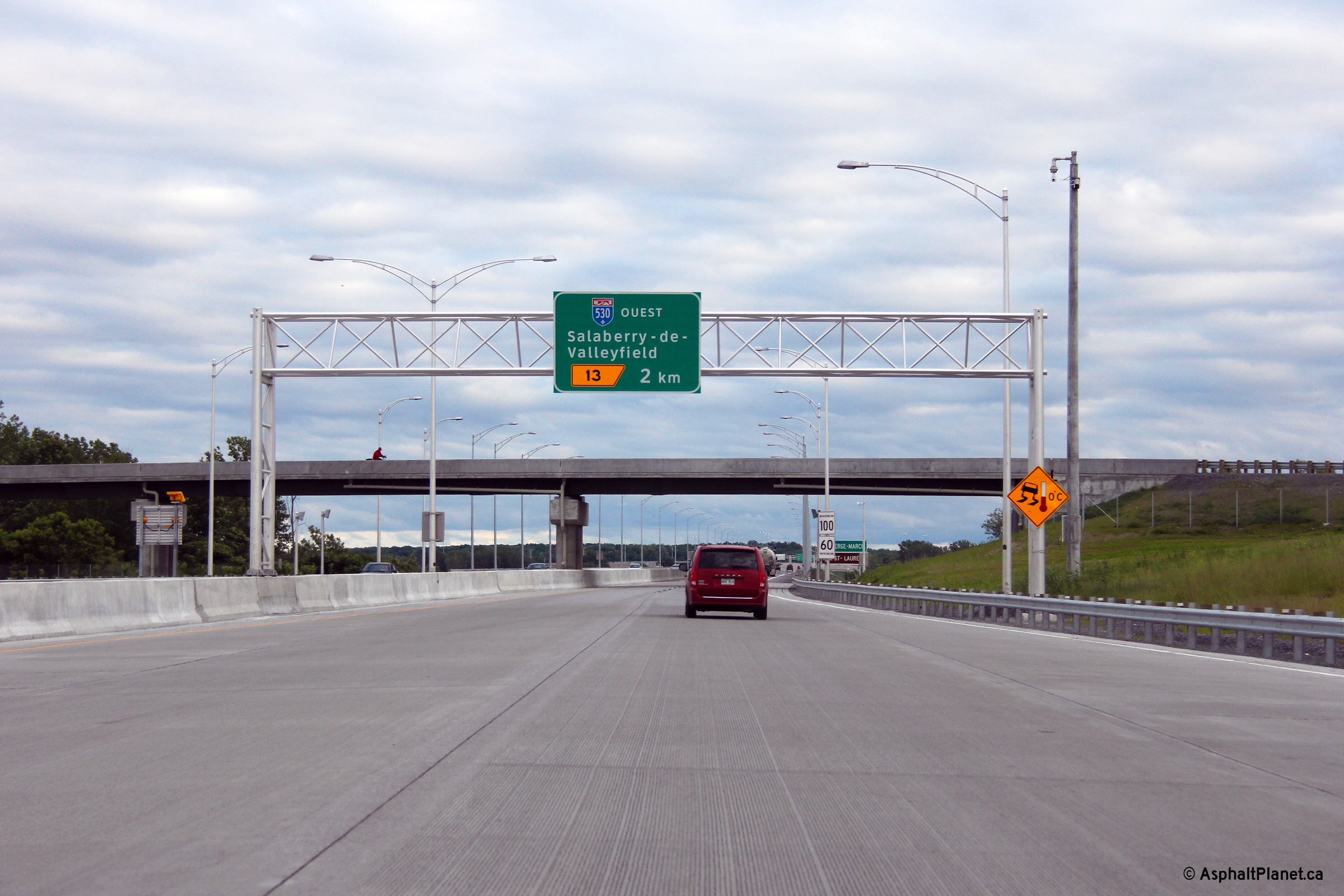
|
MRC de Beauharnois-Salaberry Salaberry-de-Valleyfield |
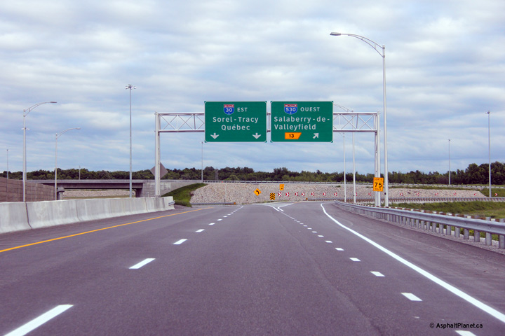
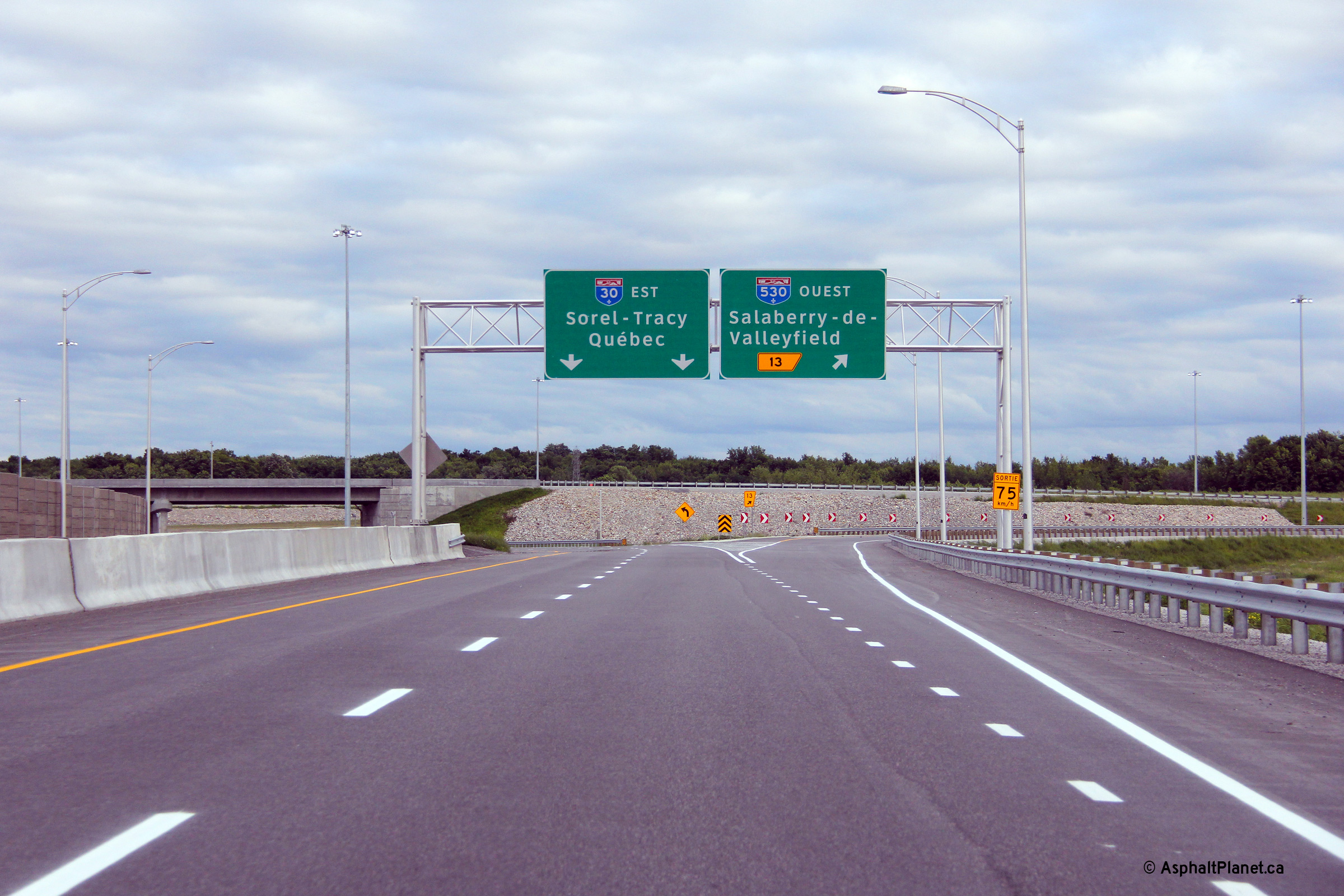
Advanced signage for the ramp to Autoroute 530. |
 |
||
|
Date: 17/06/2013 |
High-res: (1440x960) (2400x1600) | |||
|
MRC de Beauharnois-Salaberry Salaberry-de-Valleyfield |
Turn-off signage for the ramp to Autoroute 530. |
 |
||
|
Date: 17/06/2013 |
High-res: (1440x960) (2400x1600) | |||
|
A-530 is the former mainline of Autoroute 30 that runs westerly along the south shore, paralleling R-132. Click here for Autoroute 530 images. |
||||
|
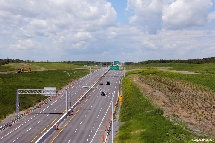
MRC de Beauharnois-Salaberry Salaberry-de-Valleyfield |
Westerly view towards the Autoroute 530 interchange from the Montée Pilon overpass. |
 |
||
|
Date: 18/06/2013 |
High-res: (1440x960) (2400x1600) | |||
|
MRC de Beauharnois-Salaberry Salaberry-de-Valleyfield |
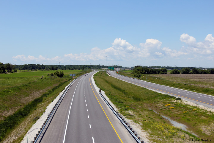
Easterly view along A-30 from the Montée Pilon overpass. |
|
||
|
Date: 18/06/2013 |
High-res: (1440x960) (2400x1600) | |||
|
MRC de Beauharnois-Salaberry Beauharnois |
Westerly view from the Chemin Canal overpass. |
 |
||
|
Date: 18/06/2013 |
High-res: (1440x960) (2400x1600) | |||
|
MRC de Beauharnois-Salaberry Beauharnois |
Easterly view towards the Beauharnois Canal Skyway from the Chemin Canal overpass. |
|
||
|
Date: 18/06/2013 |
High-res: (1440x960) (2400x1600) | |||
|
MRC de Beauharnois-Salaberry Beauharnois |
View looking easterly approaching the high-level bridge that carries Autoroute 30 over the Beauharnois Canal. |
 |
||
|
Date: 17/06/2013 |
High-res: (1440x960) (2400x1600) | |||
|
MRC de Beauharnois-Salaberry Beauharnois |
Westerly view from the Route 205 overpass. |
 |
||
|
Date: 18/06/2013 |
High-res: (1440x960) (2400x1600) | |||
|
MRC de Beauharnois-Salaberry Beauharnois |
Easterly view from the Route 205 overpass. The Montreal Skyline is faintly visible to the left of the highway from this overpass. |
|
||
|
Date: 18/06/2013 |
High-res: (1440x960) (2400x1600) | |||
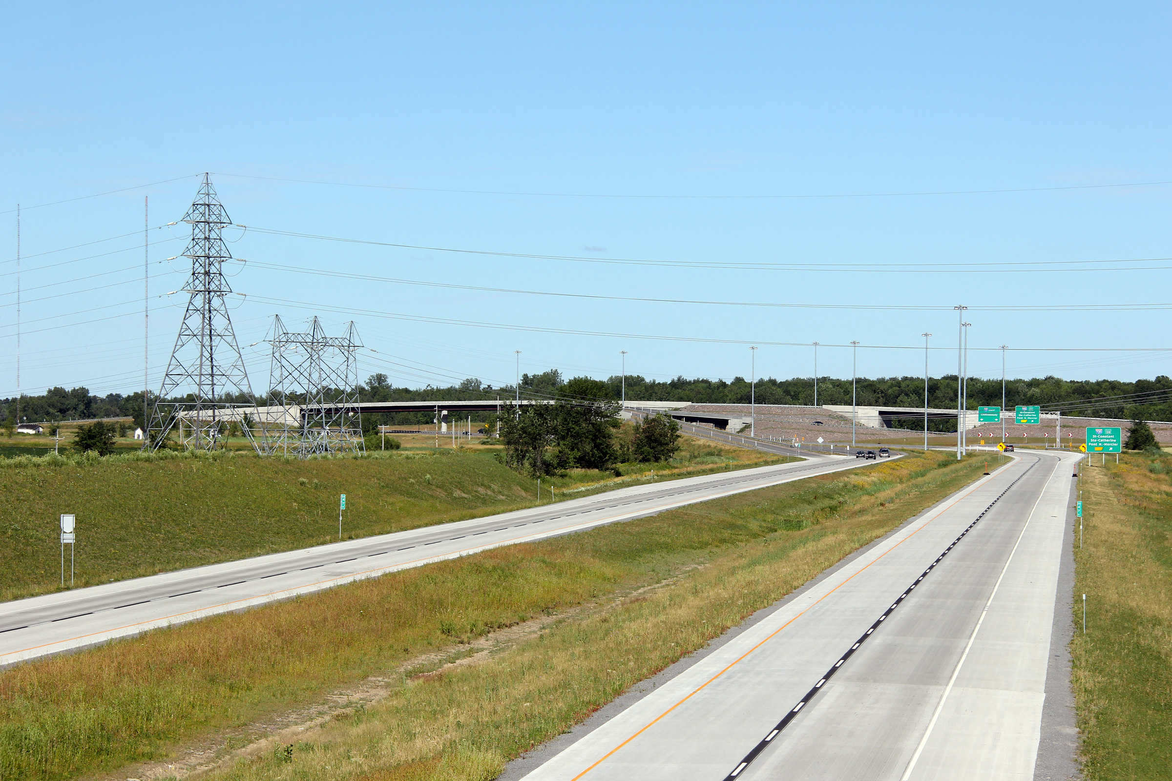
|
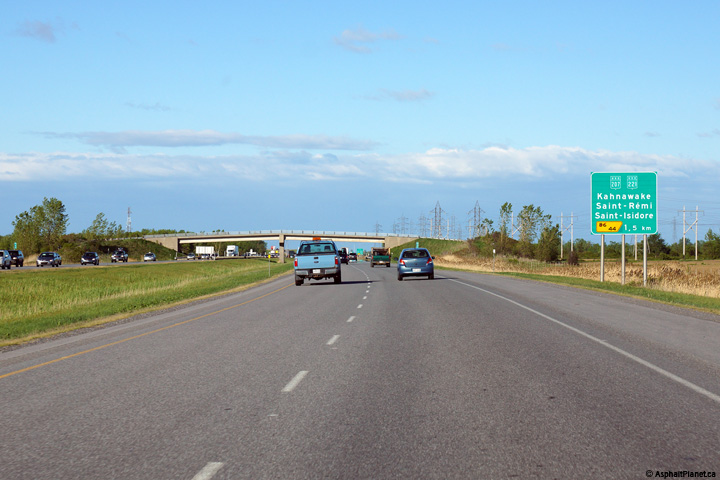
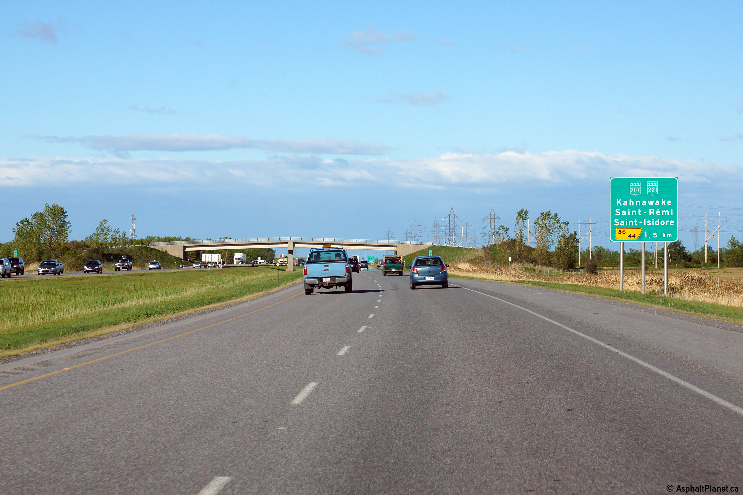
MRC de Roussillon Saint-Constant |
Eastbound advanced signage for the Route 207/221 interchange. |
 |
||
|
Date: 5/22/2015 |
High-res: (1440x960) (2400x1600) | |||
|
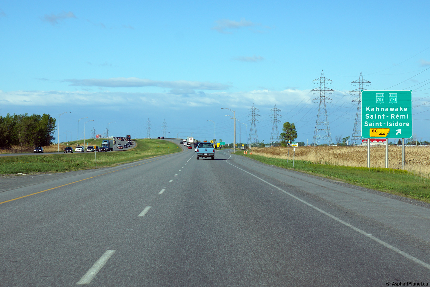
MRC de Roussillon Saint-Constant |
View looking easterly at the off-ramp to Route 207/221. |
 |
||
|
Date: 5/22/2015 |
High-res: (1440x960) (2400x1600) | |||
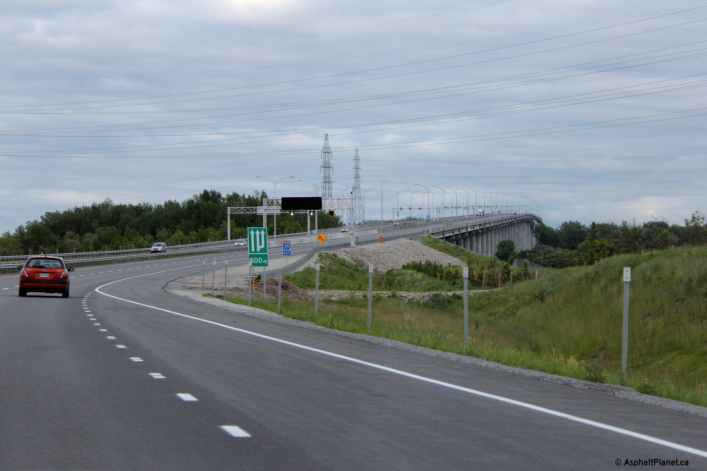
|
MRC de Roussillon Saint-Constant |
The first of three advanced signs for the Autoroute 730 interchange is located within the footprint of the preceding Route 207/221 interchange. |
 |
||
|
Date: 5/22/2015 |
High-res: (1440x960) (2400x1600) | |||
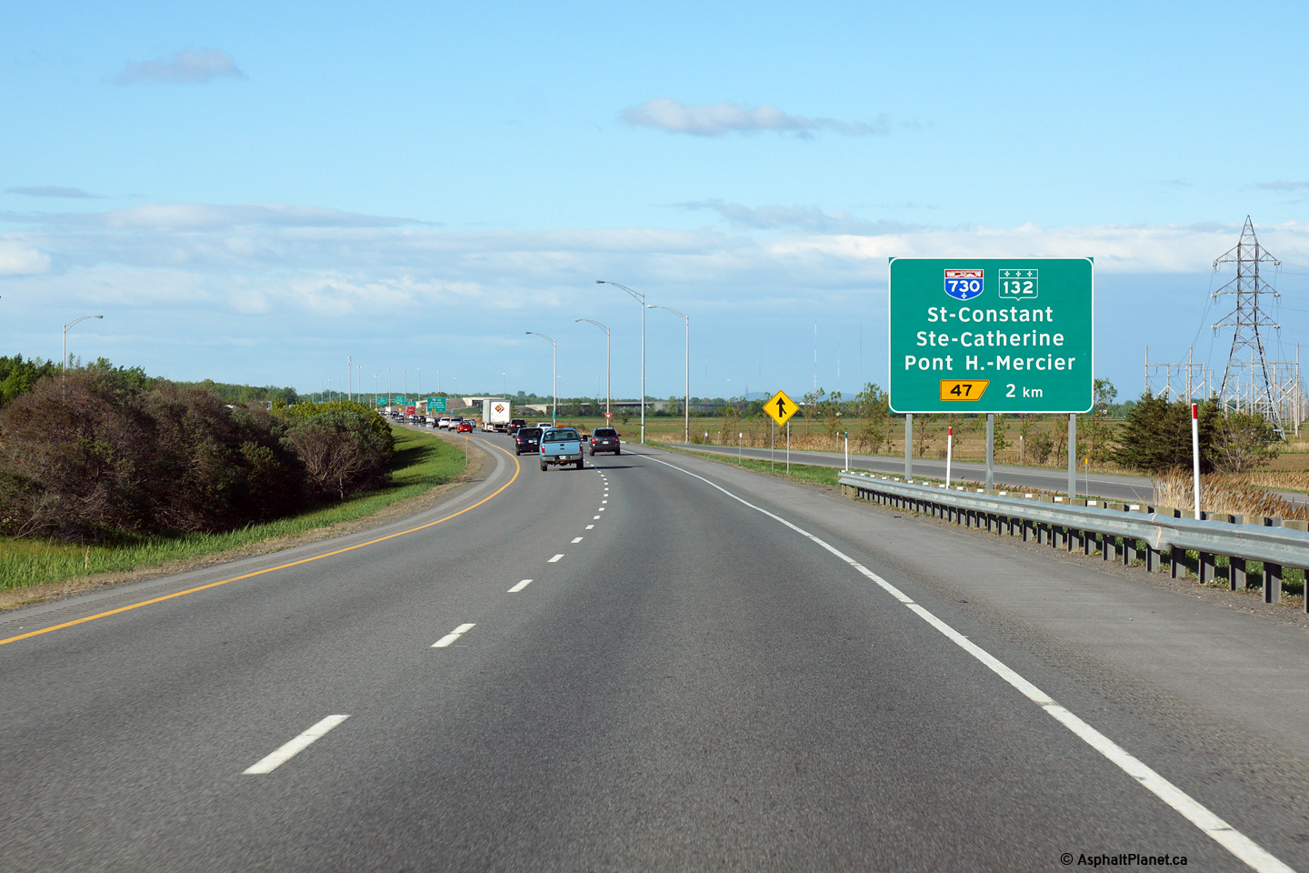
|
MRC de Roussillon Saint-Constant |
1km advanced signage for the Autoroute 730 interchange. |
 |
||
|
Date: 5/22/2015 |
High-res: (1440x960) (2400x1600) | |||
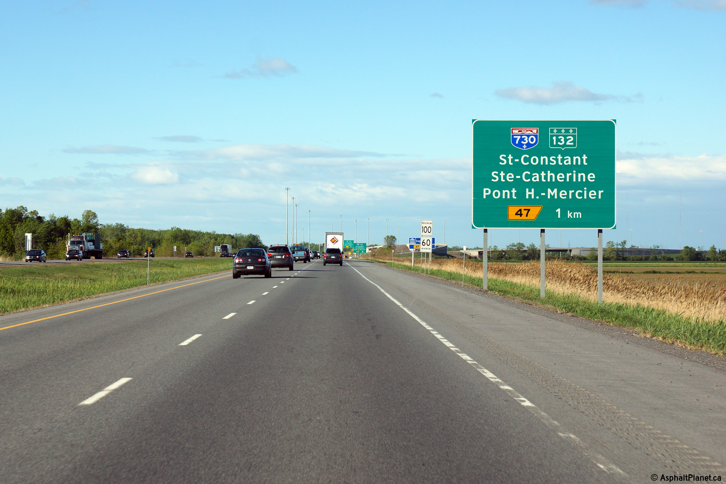
|
MRC de Roussillon Saint-Constant |
Third and final eastbound advanced signage for the Autoroute 730 interchange. |
 |
||
|
Date: 5/22/2015 |
High-res: (1440x960) (2400x1600) | |||
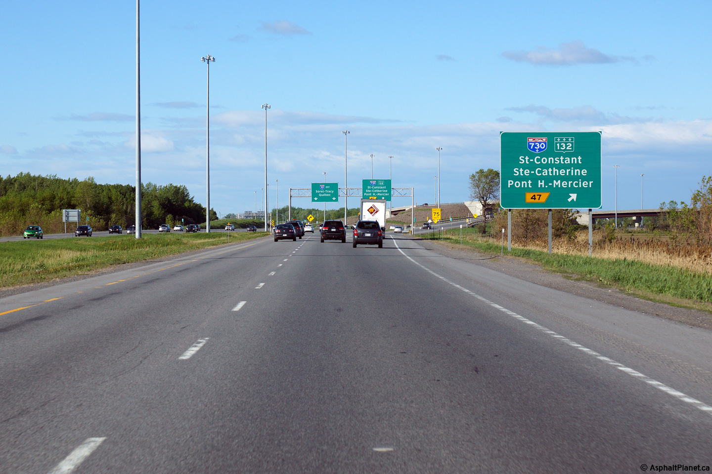
|
MRC de Roussillon Saint-Constant |
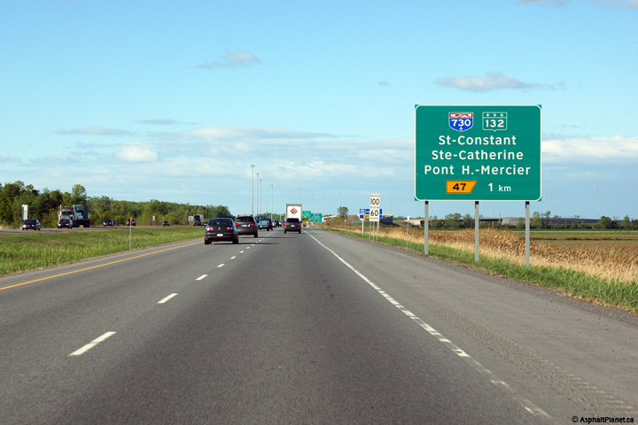
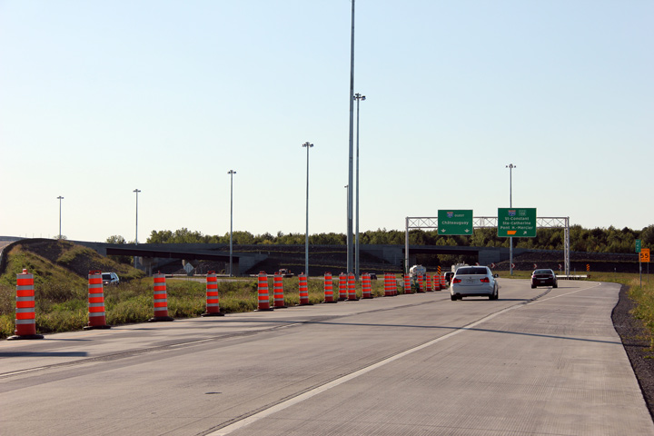
Eastbound overhead signage at the off-ramp to Autoroute 730. Autoroute 730 meets Autoroute 30 at a modern three-level interchange. |
 |
||
|
Date: 5/22/2015 |
High-res: (1440x960) (2400x1600) | |||
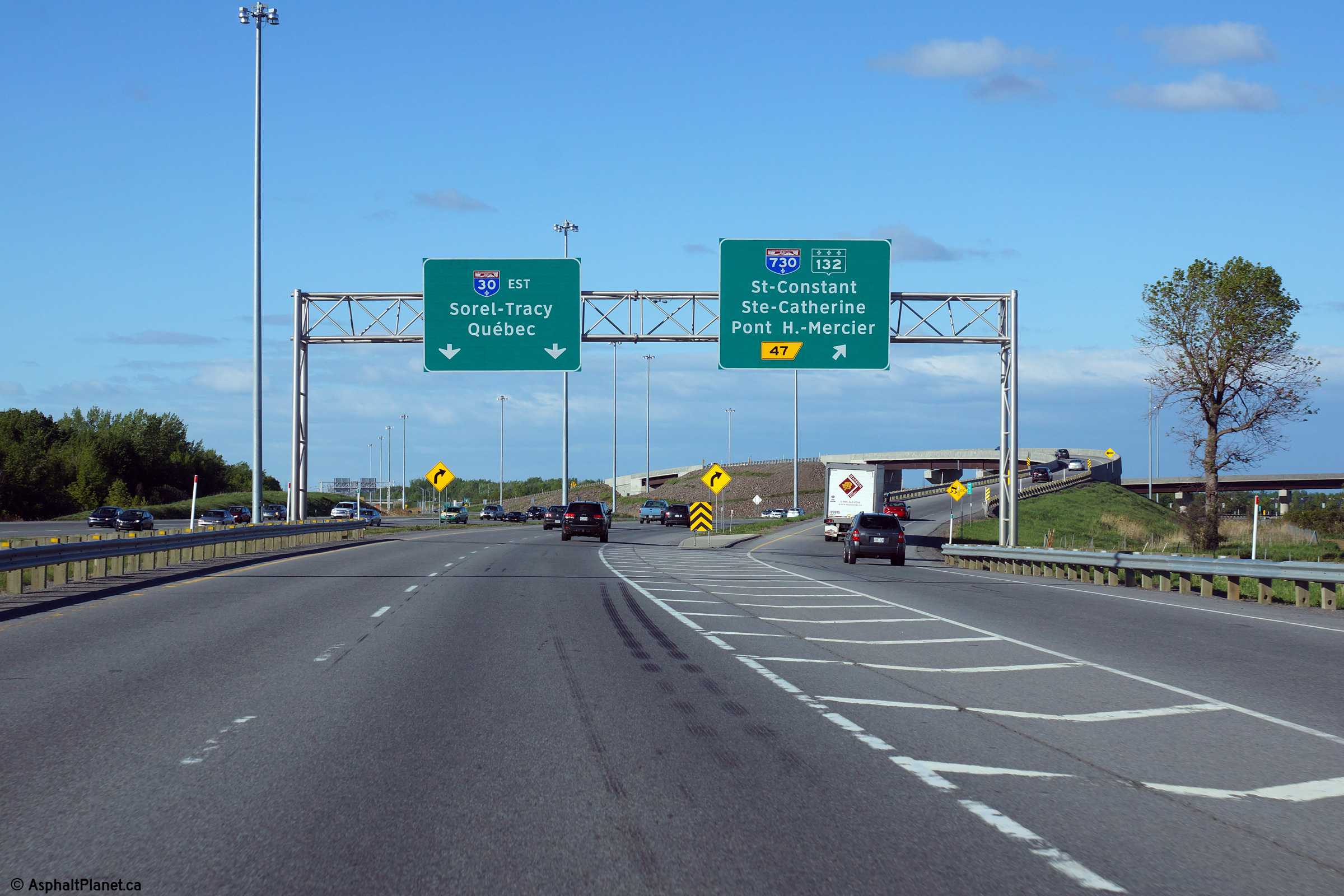
|
Autoroute 730 is a short spur highway that was formerly part of Autoroute 30's mainline. It leads north of A-30 to R-132. Click here for A-730 images. |
||||
|
MRC de Roussillon Saint-Constant |
Westerly view approaching the ramp to Autoroute 730. |
 |
||
|
Date: 7/24/2011 |
High-res: (1440x960) (2400x1600) | |||
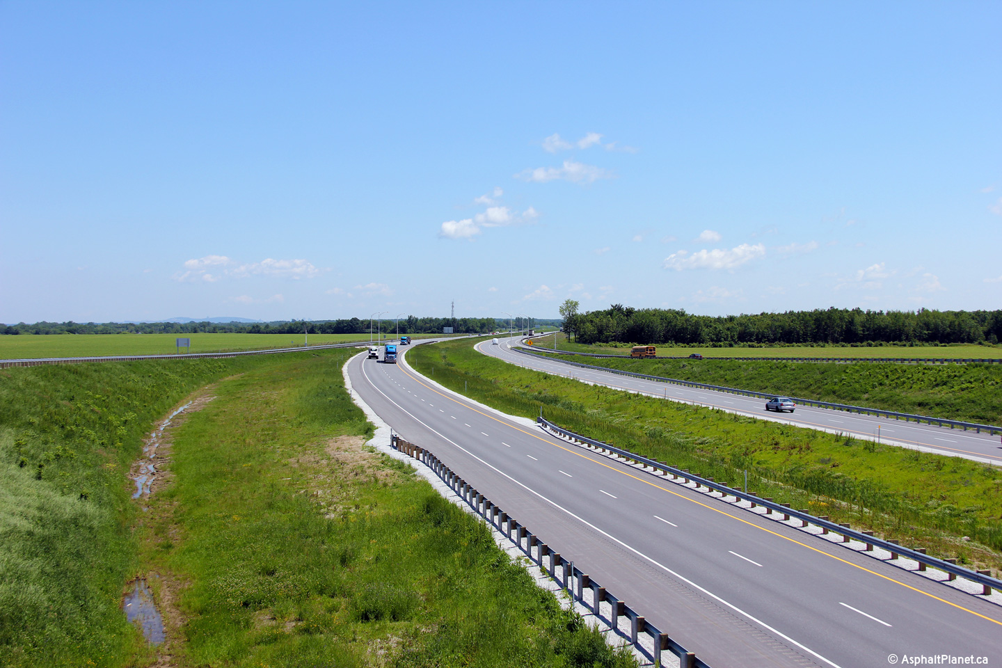
|
MRC de Roussillon Saint-Constant |
Westerly view towards the Autoroute 730 interchange from the Rang St-Régis North overpass. |
 |
||
|
Date: 7/24/2011 |
High-res: (1440x960) (2400x1600) | |||
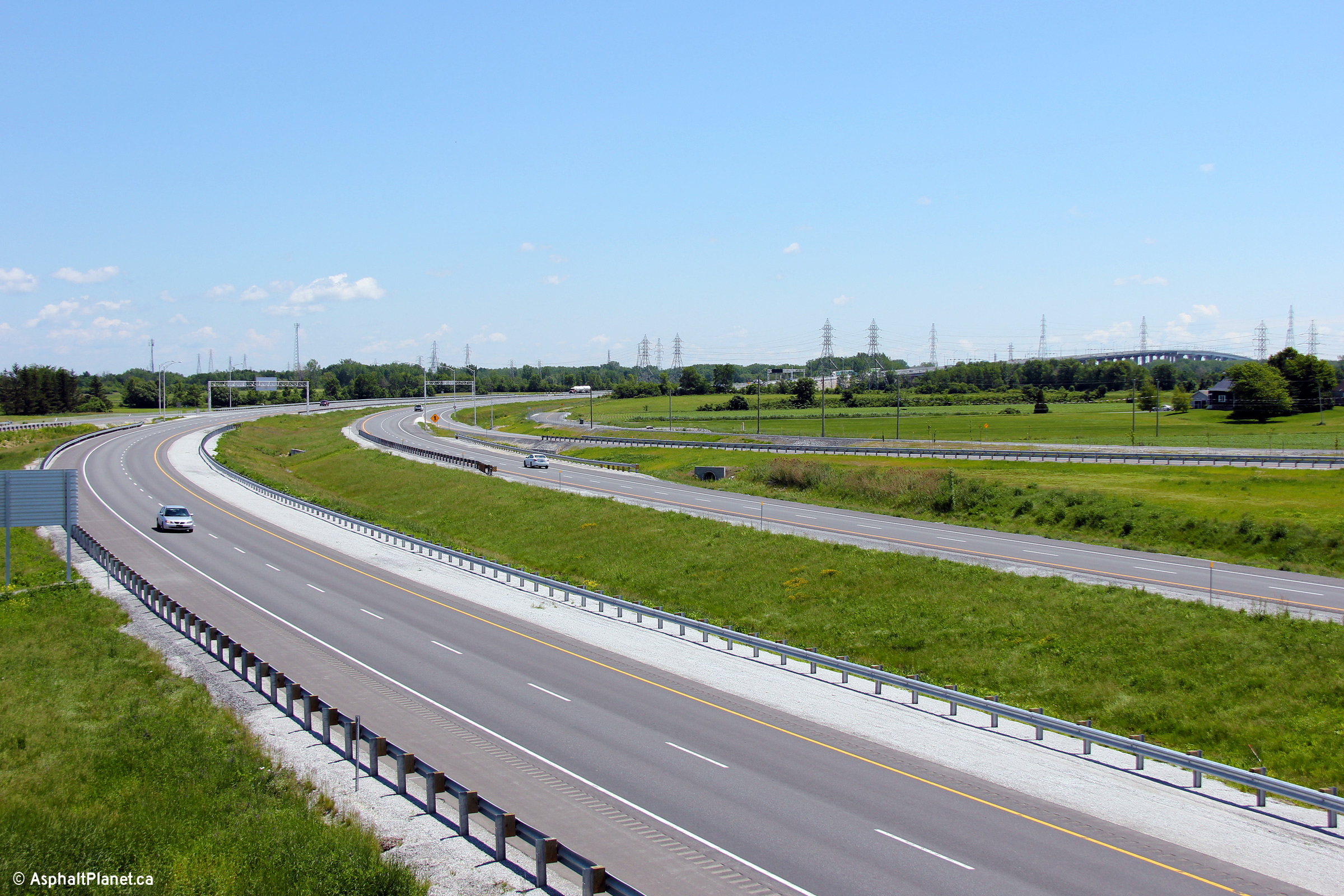
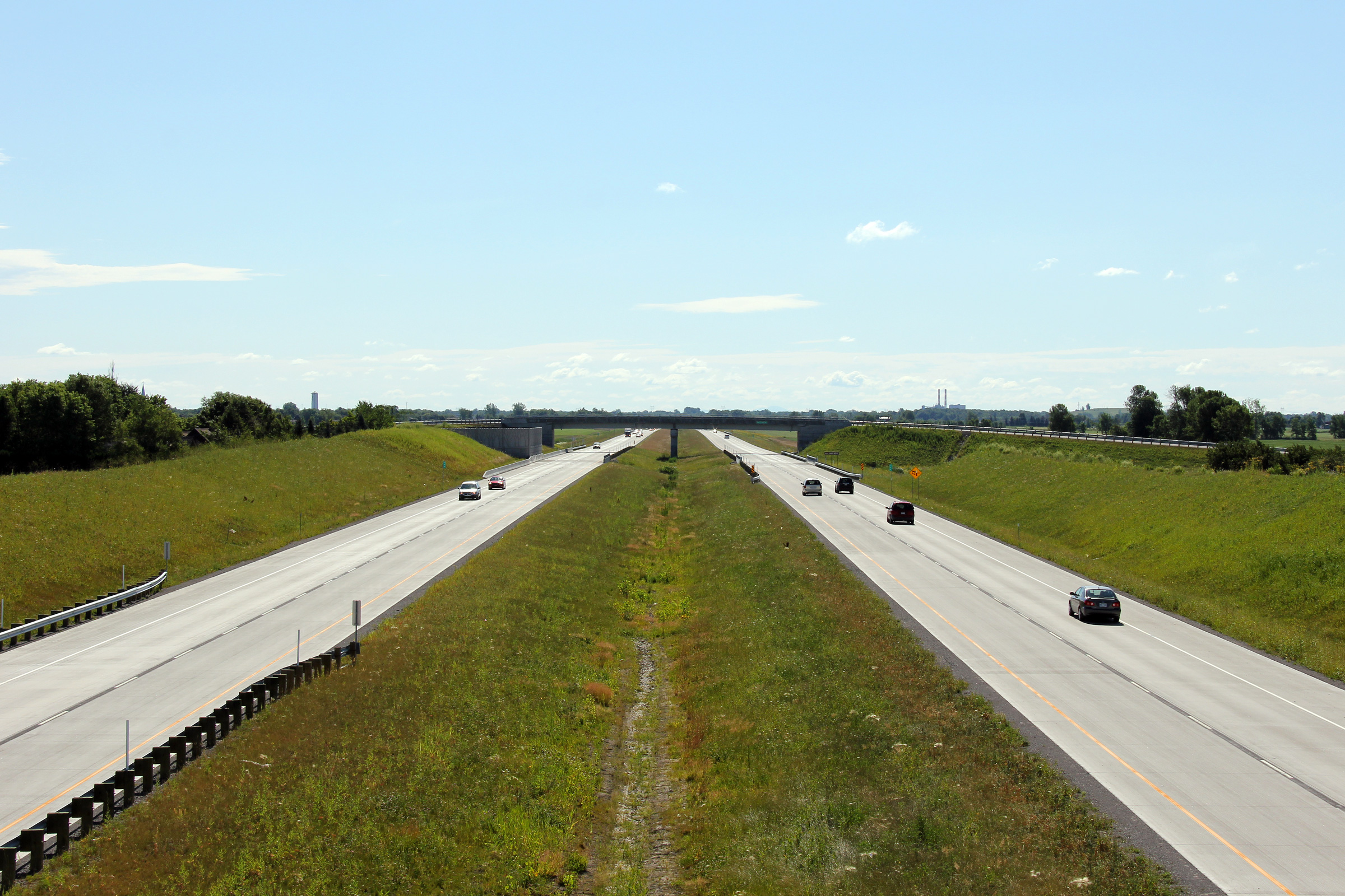
|
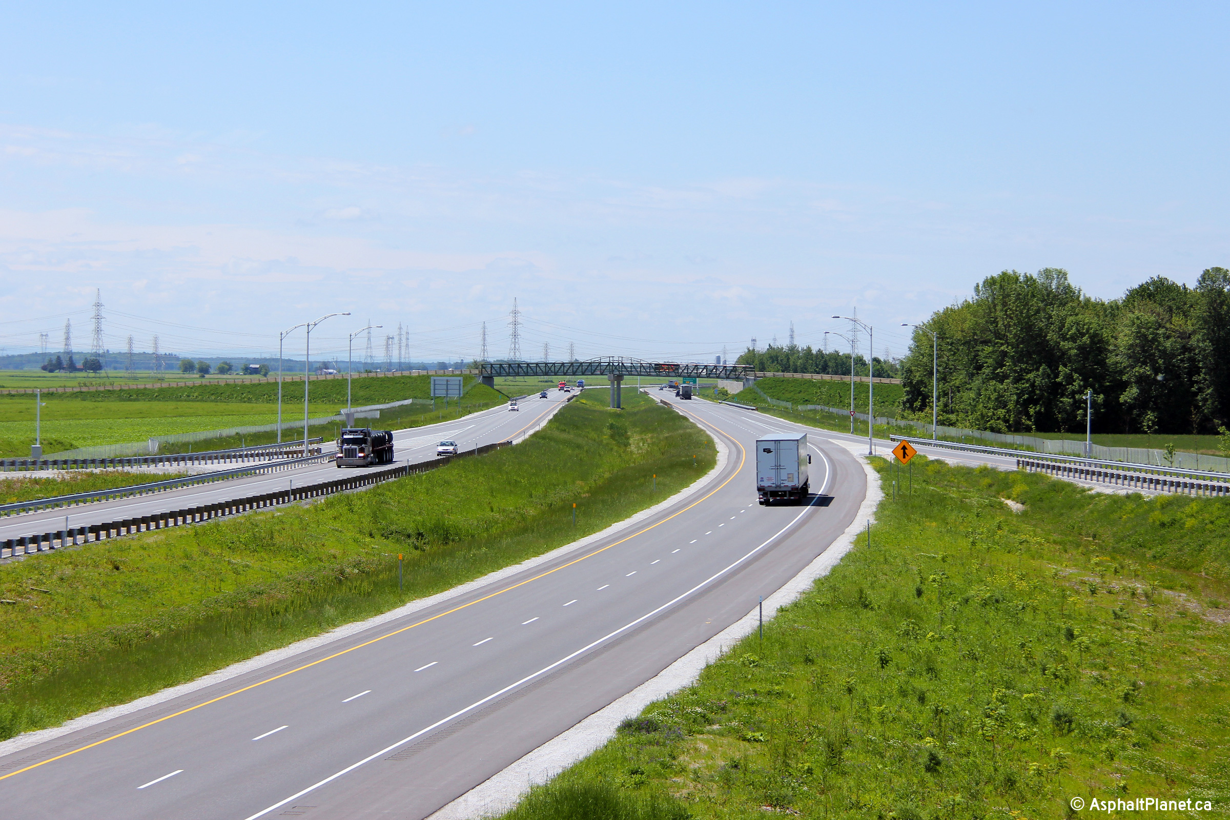
MRC de Roussillon Saint-Constant |
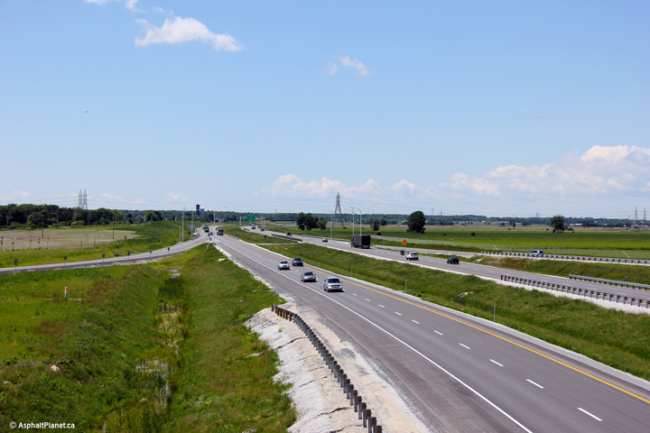
Easterly view along A-30 from the Rang St-Régis North overpass. |
 |
||
|
Date: 7/24/2011 |
High-res: (1440x960) (2400x1600) | |||
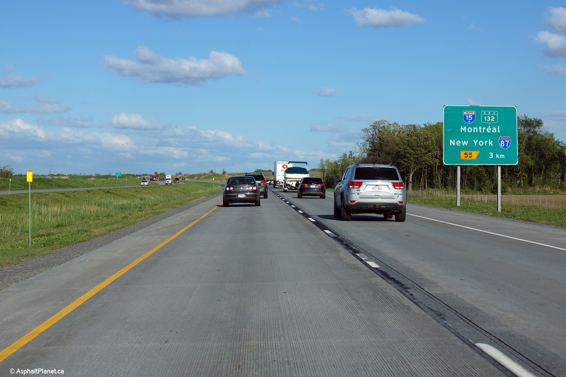
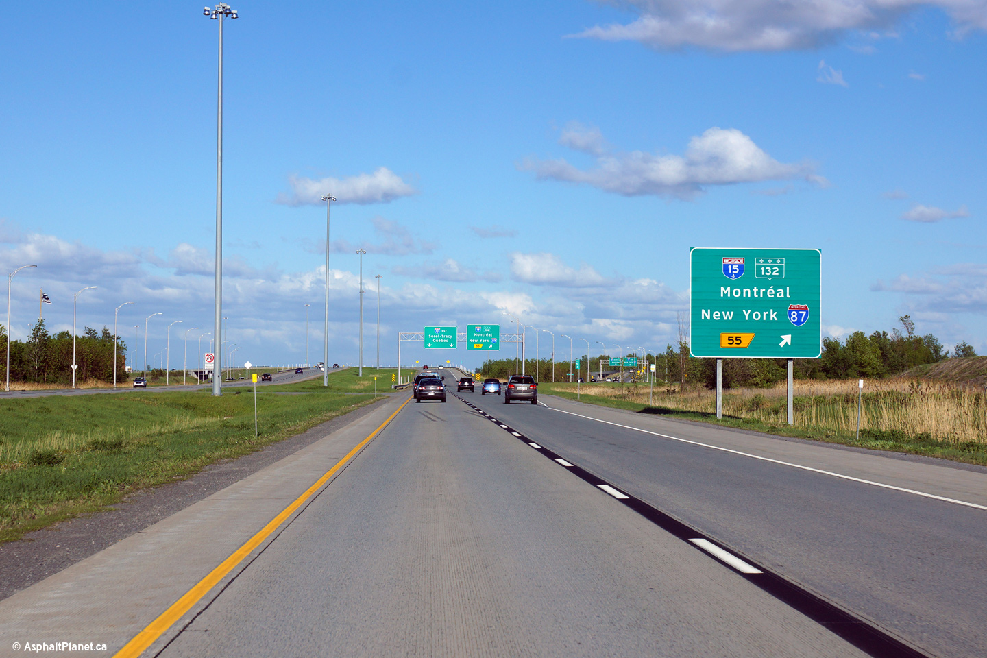
|
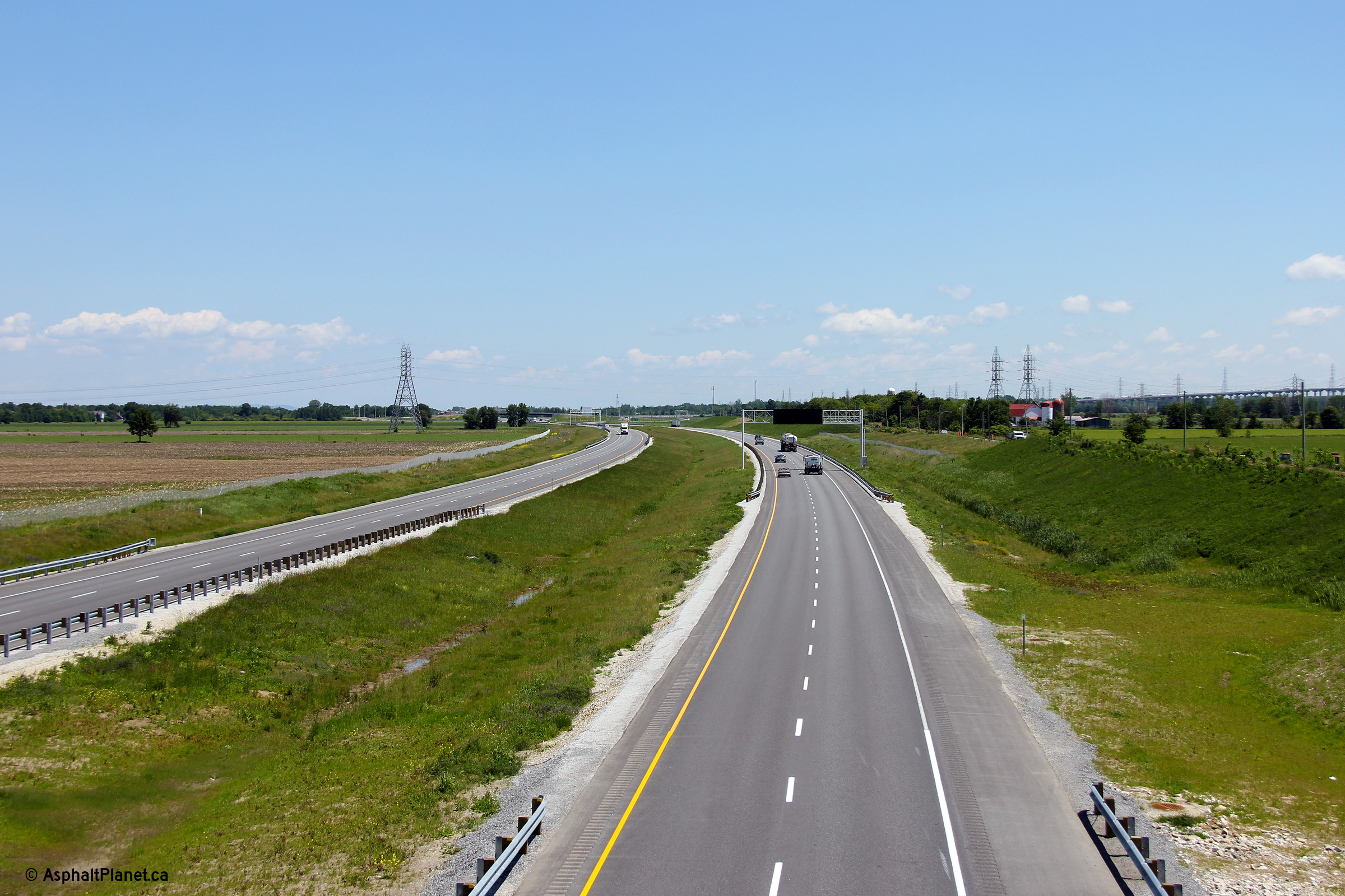
MRC de Roussillon Saint-Constant |
Eastbound advanced signage for the Autoroute 15 interchange. |
 |
||
|
Date: 5/22/2015 |
High-res: (1440x960) (2400x1600) | |||
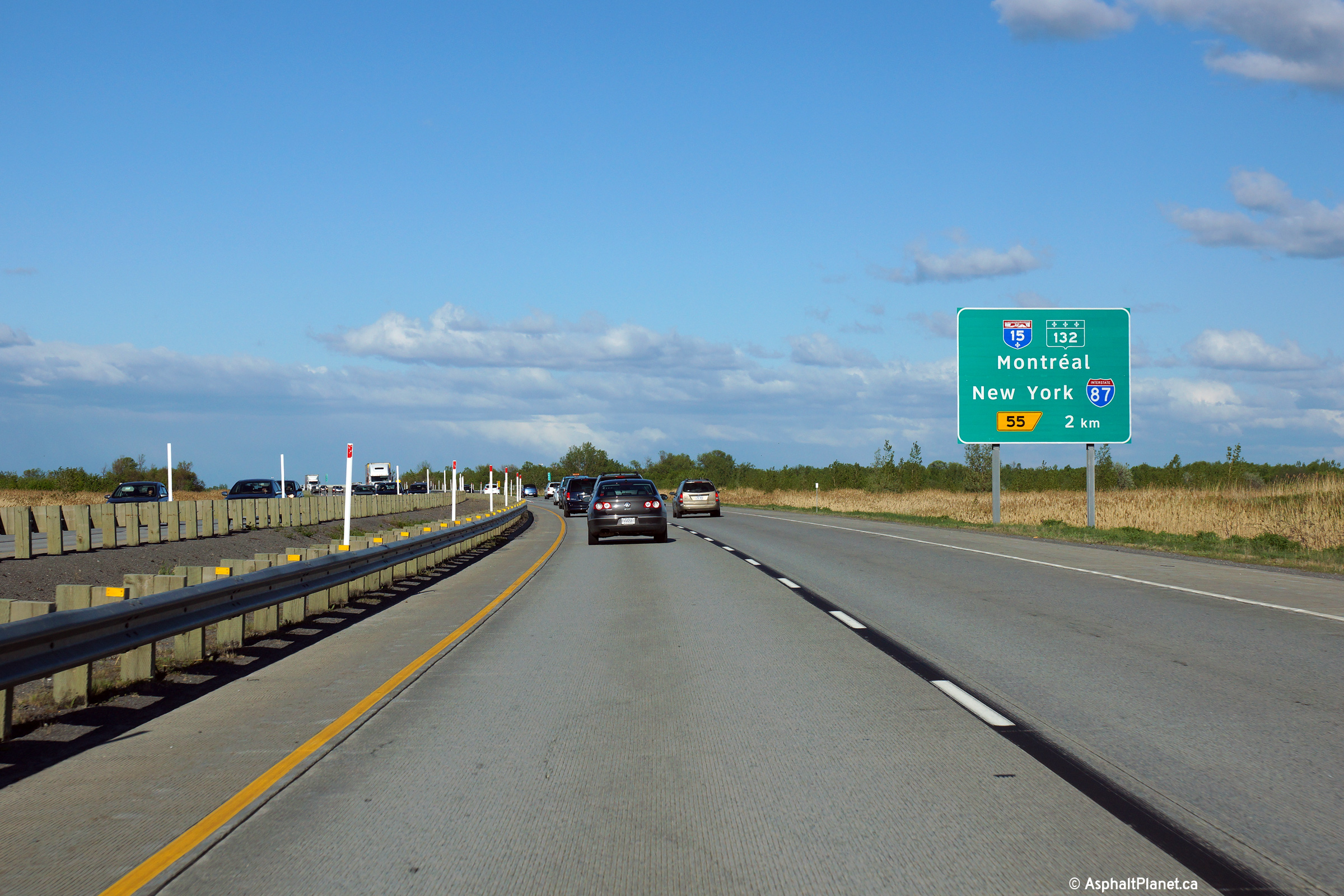
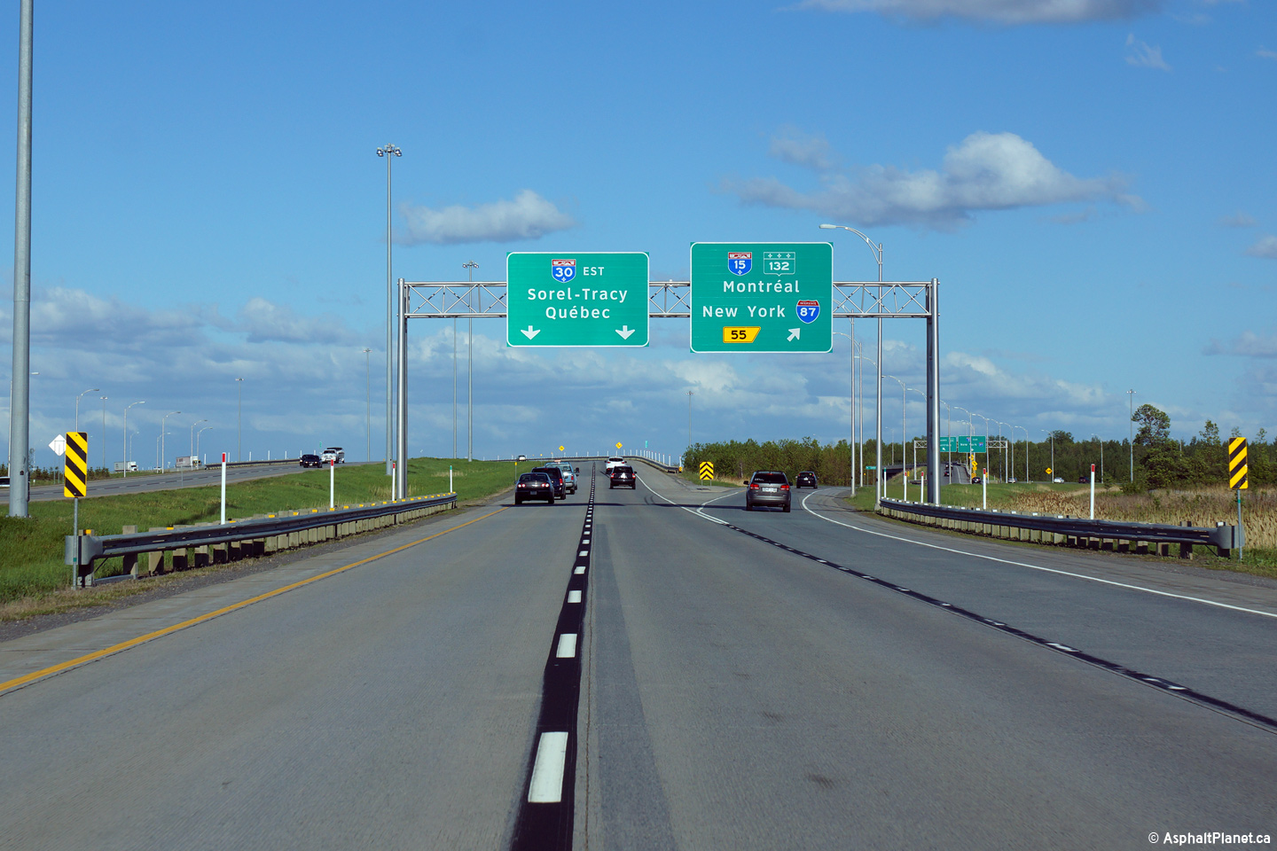
|
MRC de Roussillon Saint-Constant |
Second of three eastbound advanced signs for the Autoroute 15 interchange. |
 |
||
|
Date: 5/22/2015 |
High-res: (1440x960) (2400x1600) | |||
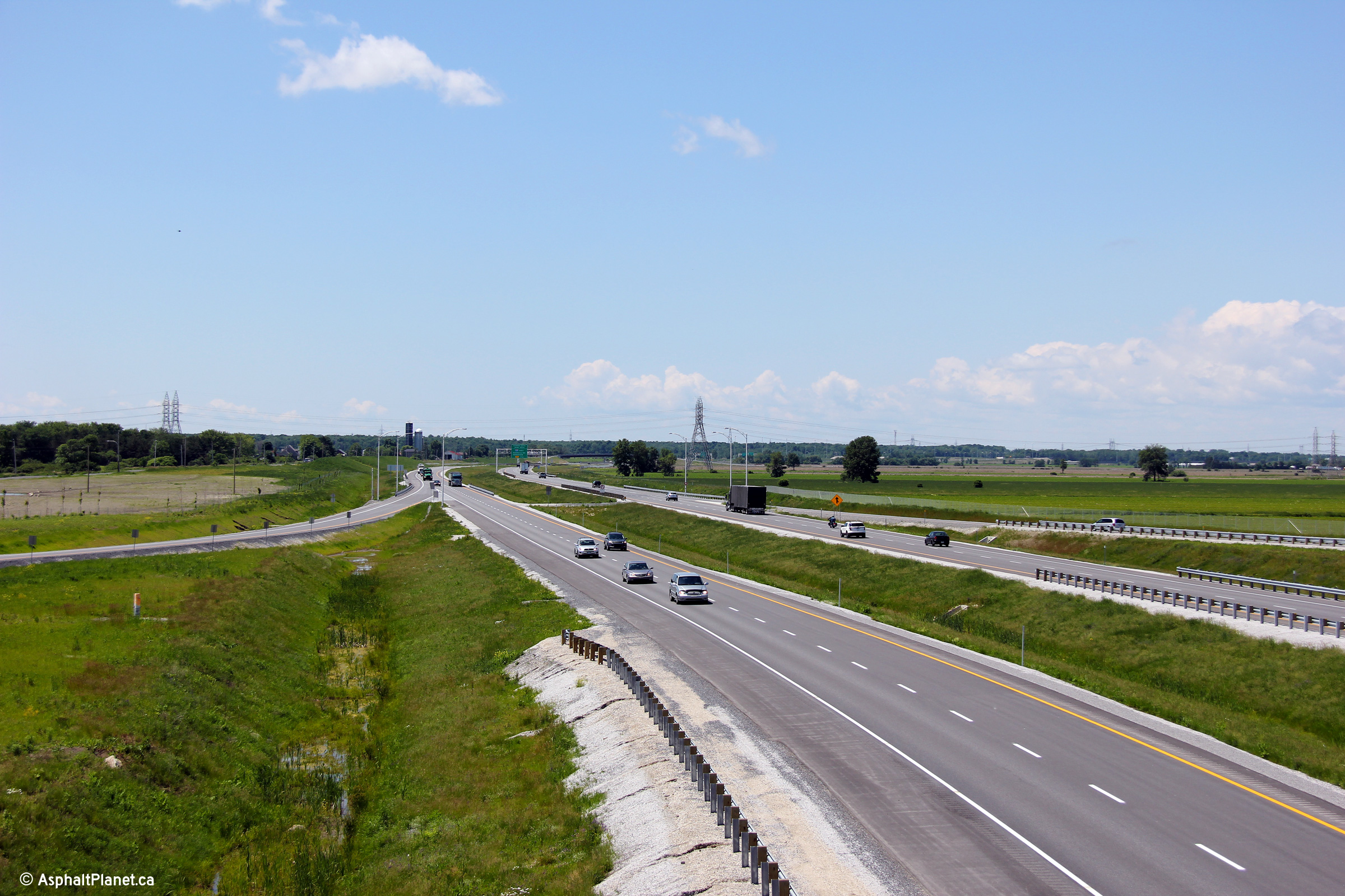
|
MRC de Roussillon Saint-Constant |
Final eastbound advanced signage for the Autoroute 15 interchange. |
 |
||
|
Date: 5/22/2015 |
High-res: (1440x960) (2400x1600) | |||
|
MRC de Roussillon Saint-Constant |
View as the ramp to Autoroute 15 departs from the eastbound lanes of Autoroute 30. |
 |
||
|
Date: 5/22/2015 |
High-res: (1440x960) (2400x1600) | |||
|
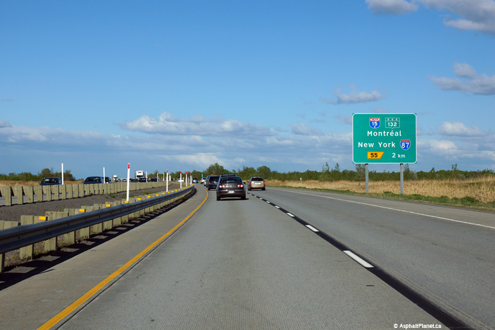
A-30 ends at Route 132 in Sainte-Catharine. The highway begins easterly again at A-15 in Candiac. Click here for A-15 images. |
||||
Back to Autoroute 30 Index Page 2 ->
© 2006-2016 AsphaltPlanet.ca.
AsphaltPlanet@asphaltplanet.ca
Page Created: August 6, 2009.
Last Updated: December 23, 2015.


