AsphaltPlanet.ca > OntHighways >
Highway 401 > Images
> Page 5
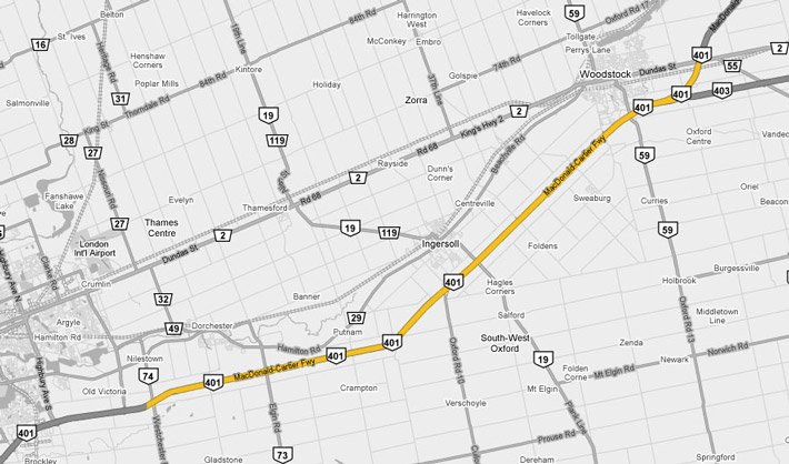
King's Highway 401 - Images
<- Page 4 Page 5 - London to Woodstock Page 6->
Photos shown in this table are arranged from West to East:
| Proper Municipality Name | Photo Description | Photo | ||
|
Photos taken from driver's perspective appear offset from centre-line Photos: |
East- bound |
West- bound |
||
| Continued from London Images | ||||
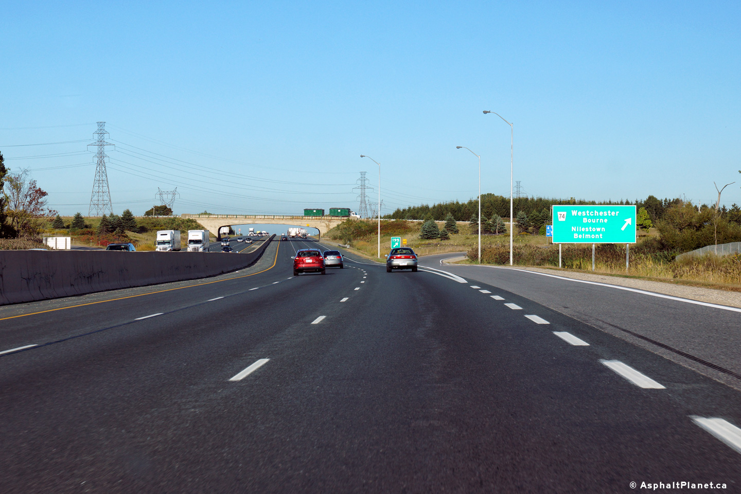
| Municipality of Thames Centre County of Middlesex |
Eastbound signage in advance of the Highway 74 interchange. Photo taken: September 25th, 2014. |
 (720x480) (720x480)(1440x960) (2400x1600) |
||
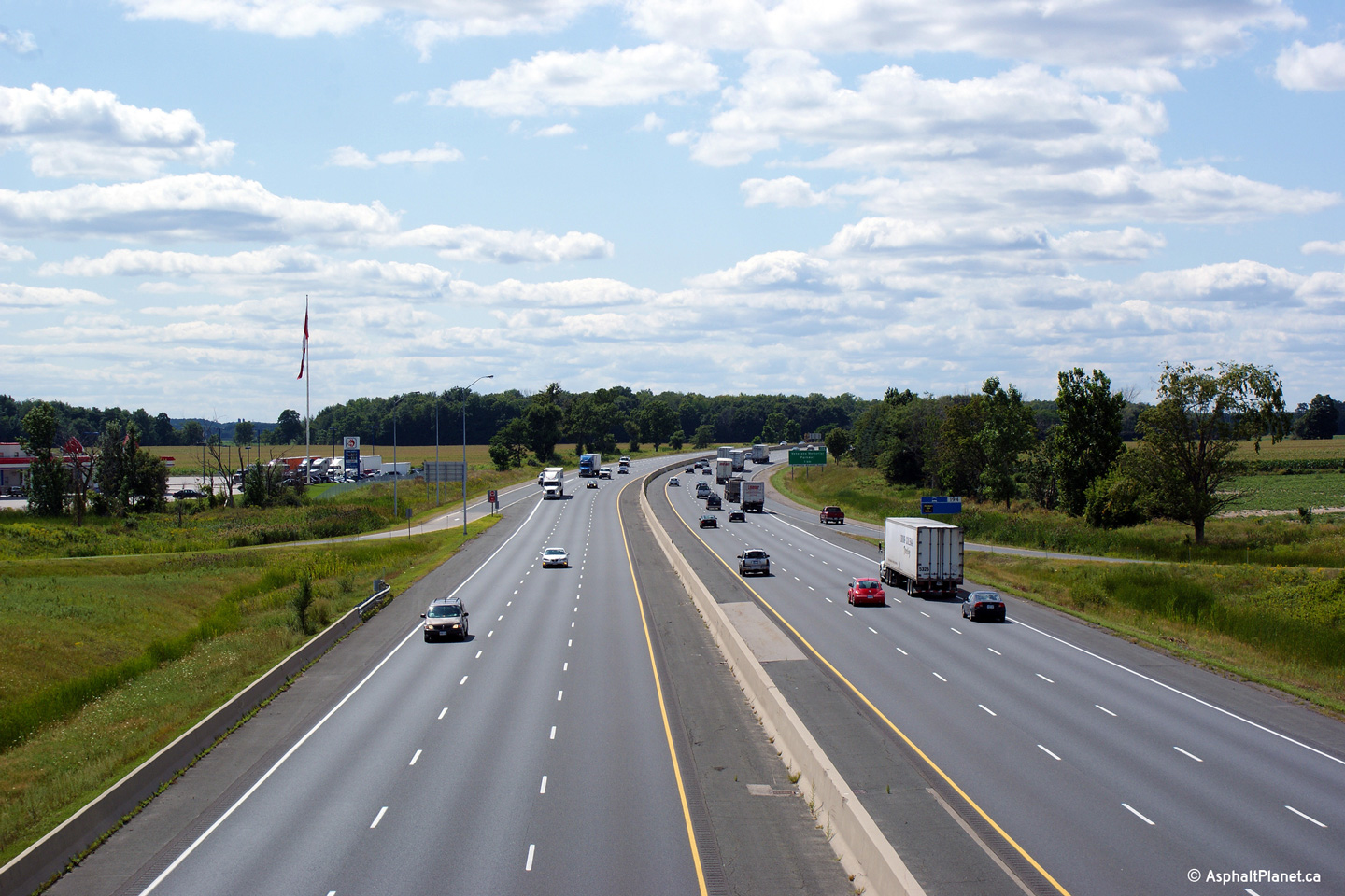
| Municipality of Thames Centre County of Middlesex |
Easterly view at the Highway 74 interchange. Photo taken: September 25th, 2014. |
 (720x480) (720x480)(1440x960) (2400x1600) |
||
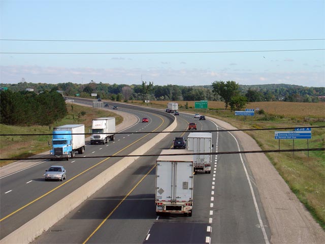
| Municipality of Thames Centre County of Middlesex |
View looking westerly from the Highway 74
overpass towards London along Highway 401. Photo taken: August 31st, 2009. |
 |
||
| Highway 74 led from Hamilton Road southerly to New Sarum at Highway 3. Click here for Highway 74 images. | ||||
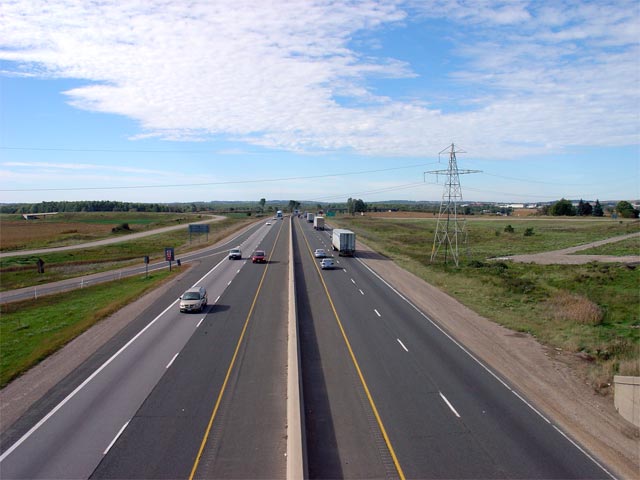
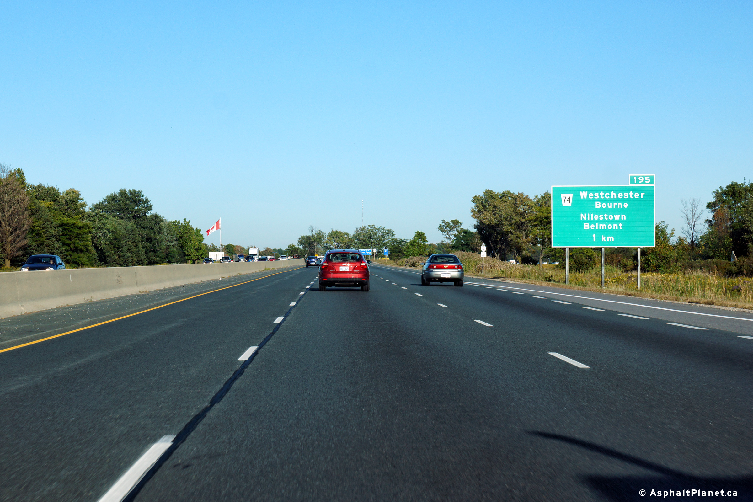
| Municipality of Thames Centre County of Middlesex |
View looking easterly towards Woodstock from the Highway 74 overpass.
Highway 74 is located roughly at kilometre marker 195. Photo taken: August 31st, 2009. |
 (720x480) (1440x960) (2400x1600) |
||
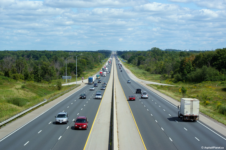
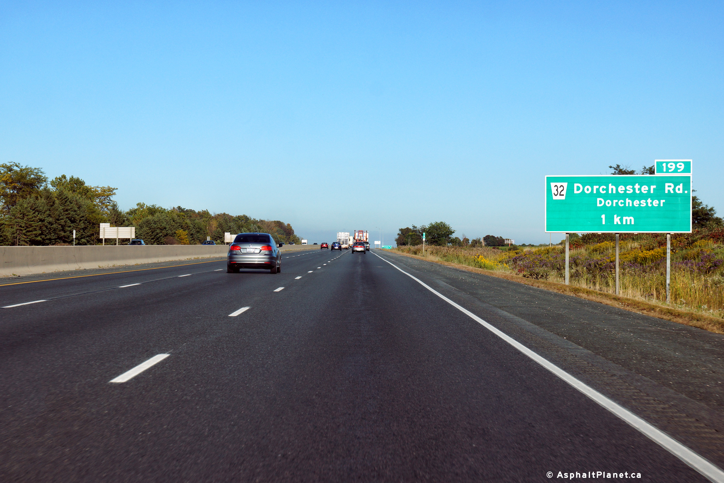
| Municipality of Thames Centre County of Middlesex |
Eastbound advanced signage for the ramp to Dorchester Road. Photo taken: September 25th, 2014. |
 (720x480) (720x480)(1440x960) (2400x1600) |
||
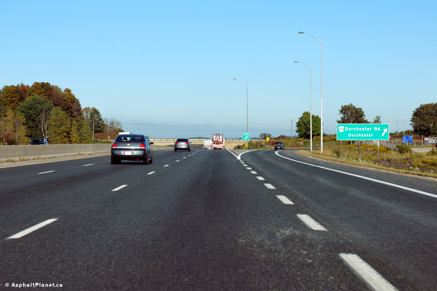
| Municipality of Thames Centre County of Middlesex |
Eastbound view at the off-ramp to Dorchester Road. Photo taken: September 25th, 2014. |
 (720x480) (720x480)(1440x960) (2400x1600) |
||
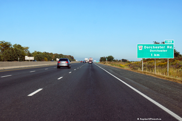
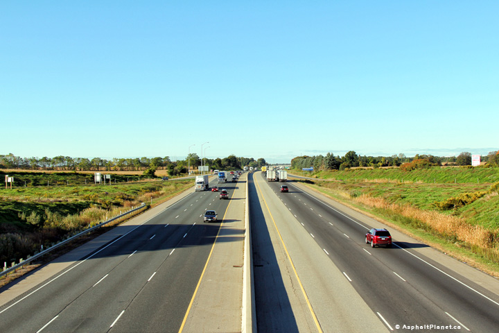
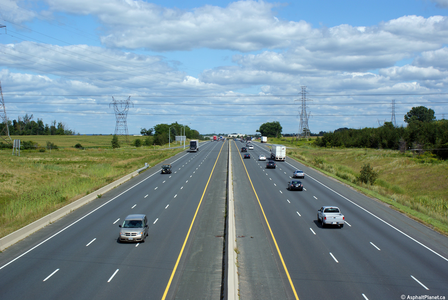
| Municipality of Thames Centre County of Middlesex |
Looking easterly along Highway 401 from the Dorchester Road overpass.
Dorchester Road meets Highway 401 at a diamond interchange. This
interchange is located at kilometre marker 199. Photo taken August 31st, 2009. |
 |
||
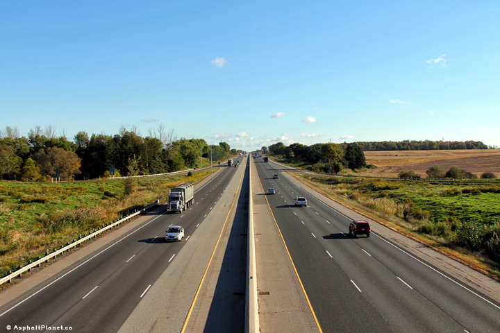
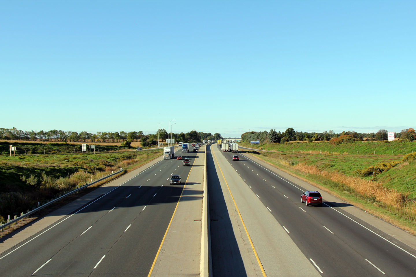
| Municipality of Thames Centre County of Middlesex |
Highway 401 looking east from the Dorchester Road overpass just east of London. It is probably a reasonable assumption, that if modern environmental protection laws were in effect when Highway 401 was built in this area (in the mid 1950s), the DHO (predecessor to the MTO) would have chosen to not route the 401 straight through the Dorchester swamp.
Photos taken: August 31st, 2009. |
 (720x480) (1440x960) (2400x1600)  (720x480) (1440x960) (2400x1600) |
||
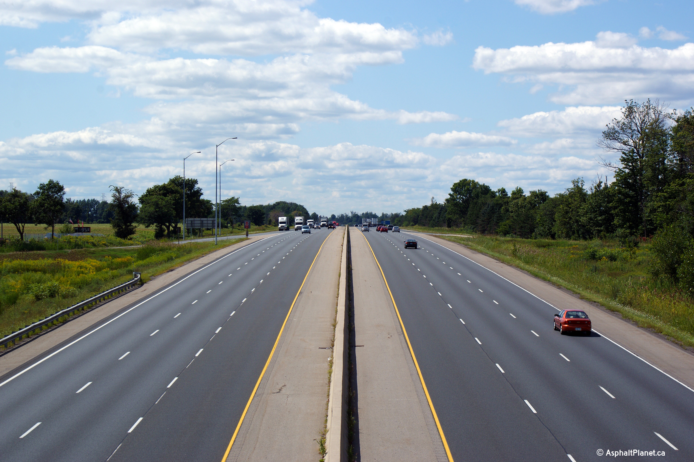
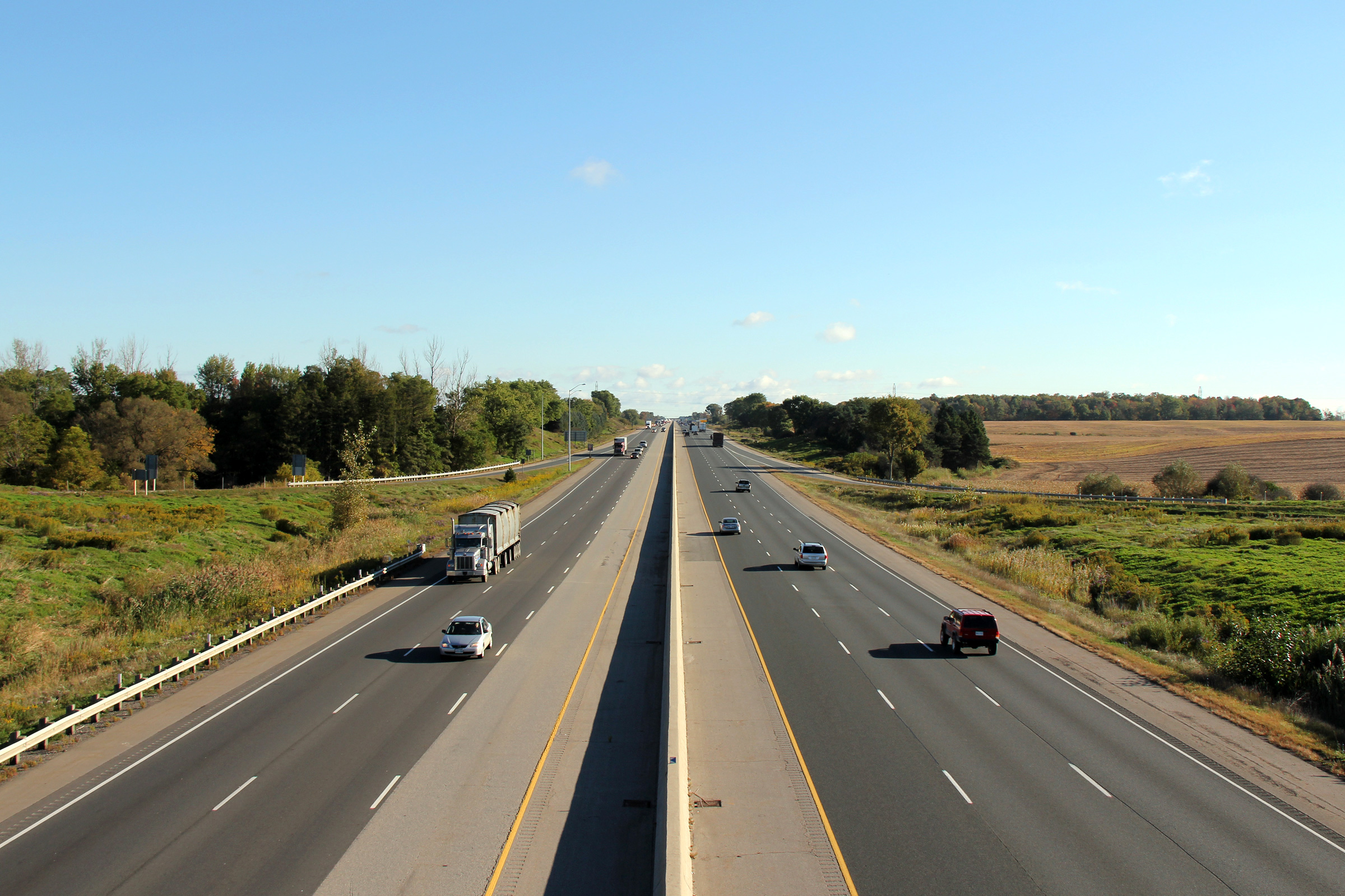
| Municipality of Thames Centre County of Middlesex |
View looking westerly along Highway 401 approaching the Dorchester Road
interchange. What I find interesting about this photo, and really this
section of highway in general, are the single span concrete rigid frame
structures. Highway structures are no longer designed like this, and
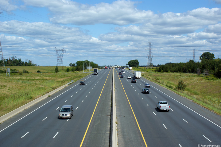
seldom do new structures embody the same simple elegance as these. Photo taken: May 17th, 2009. |
 (720x480) (720x480)(1440x960) |
||
| Municipality of Thames Centre County of Middlesex |
Eastbound signage in advance of the Highway 73 interchang. Photo taken: September 25th, 2014. |
 (720x480) (720x480)(1440x960) (2400x1600) |
||
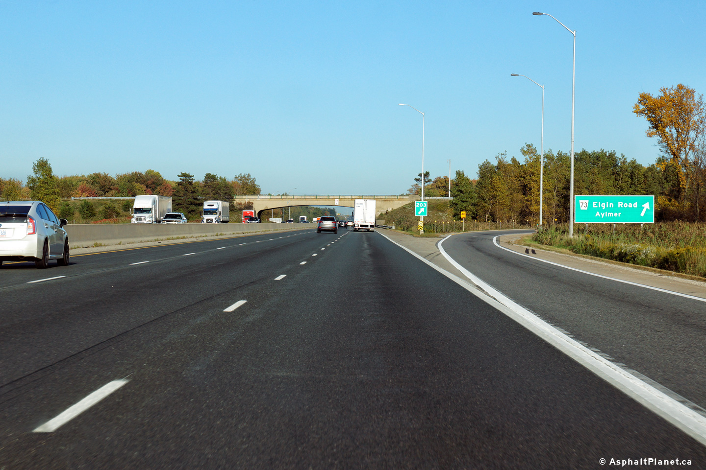
| Municipality of Thames Centre County of Middlesex |
View looking easterly at the off-ramp to Highway 73. Photo taken: September 25th, 2014. |
 (720x480) (720x480)(1440x960) (2400x1600) |
||
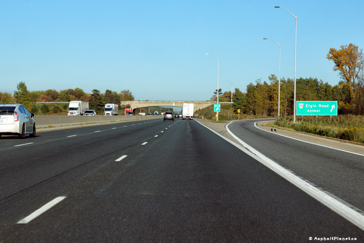
| Municipality of Thames Centre County of Middlesex |
View looking westerly towards London from the Highway
73/401 interchange.
This interchange is located almost directly in the centre of Dorchester
Swamp. Highway 401 was resurfaced throughout the Dorchester Swamp area
during two separate contracts during the 2004 and 2005 construction seasons. Photo taken: August 31st, 2009. |
 |
||
| Highway 73 was a short highway that linked Port Bruce and Aylmer to Highway 401 east of London. Click here for Highway 73 images. | ||||
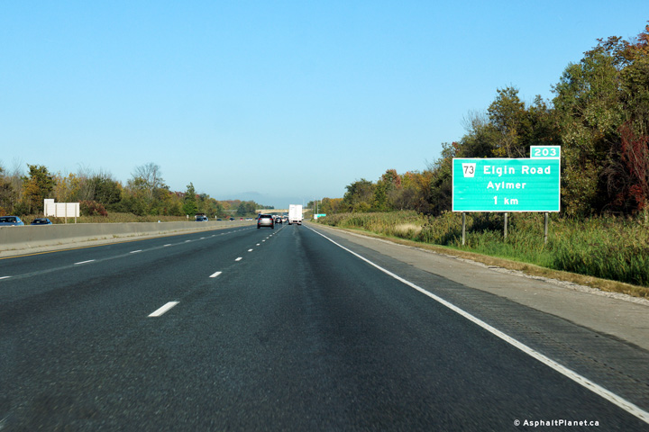
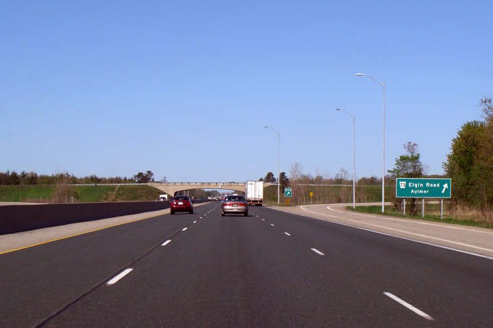
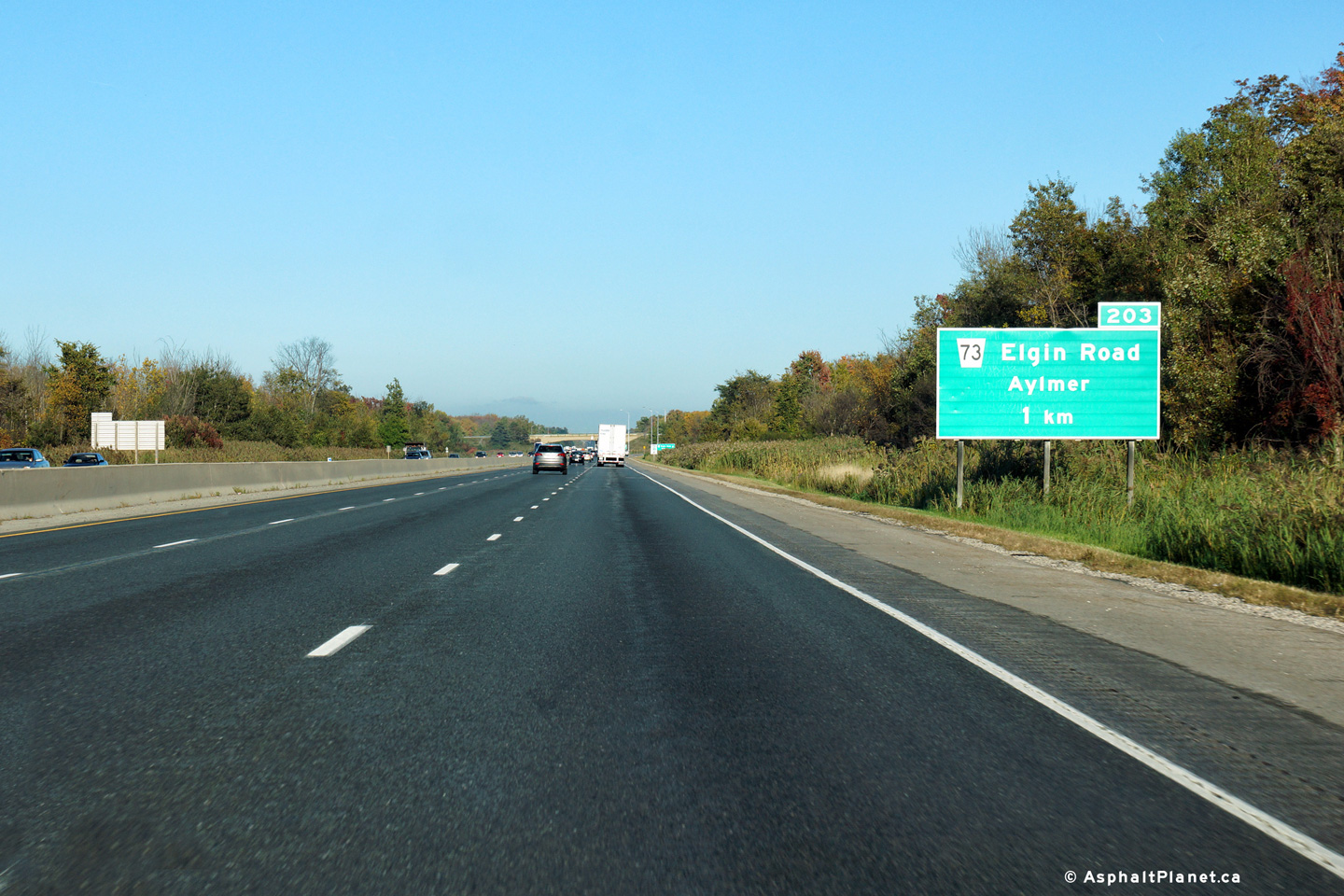
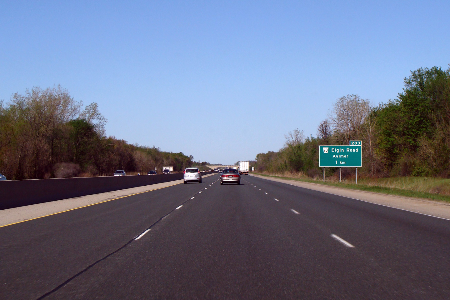
| Municipality of Thames Centre County of Middlesex |
Facing east from the Highway 73 overpass
towards Woodstock. Highway 73 is
located at roughly kilometre marker 203. Photo taken: August 31st, 2009. |
 |
||
| Municipality of Thames Centre County of Middlesex. |
Westerly view of the signage approaching the Highway 73 intersection along
Highway 401. Photo taken: May 17th, 2009. |
 (720x480) (720x480)(1440x960) |
||
| Municipality of Thames Centre County of Middlesex. |
Westbound approach signage delineating the Highway 73 interchange. Photo taken: May 17th, 2009. |
 (720x480) (720x480)(1440x960) |
||
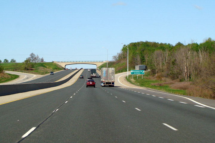
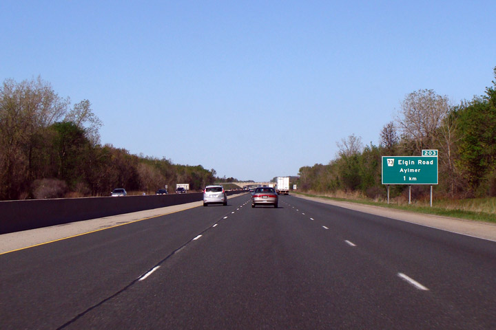
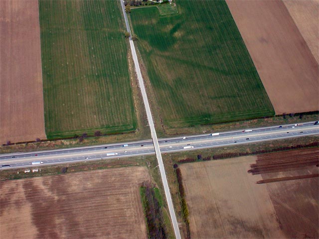
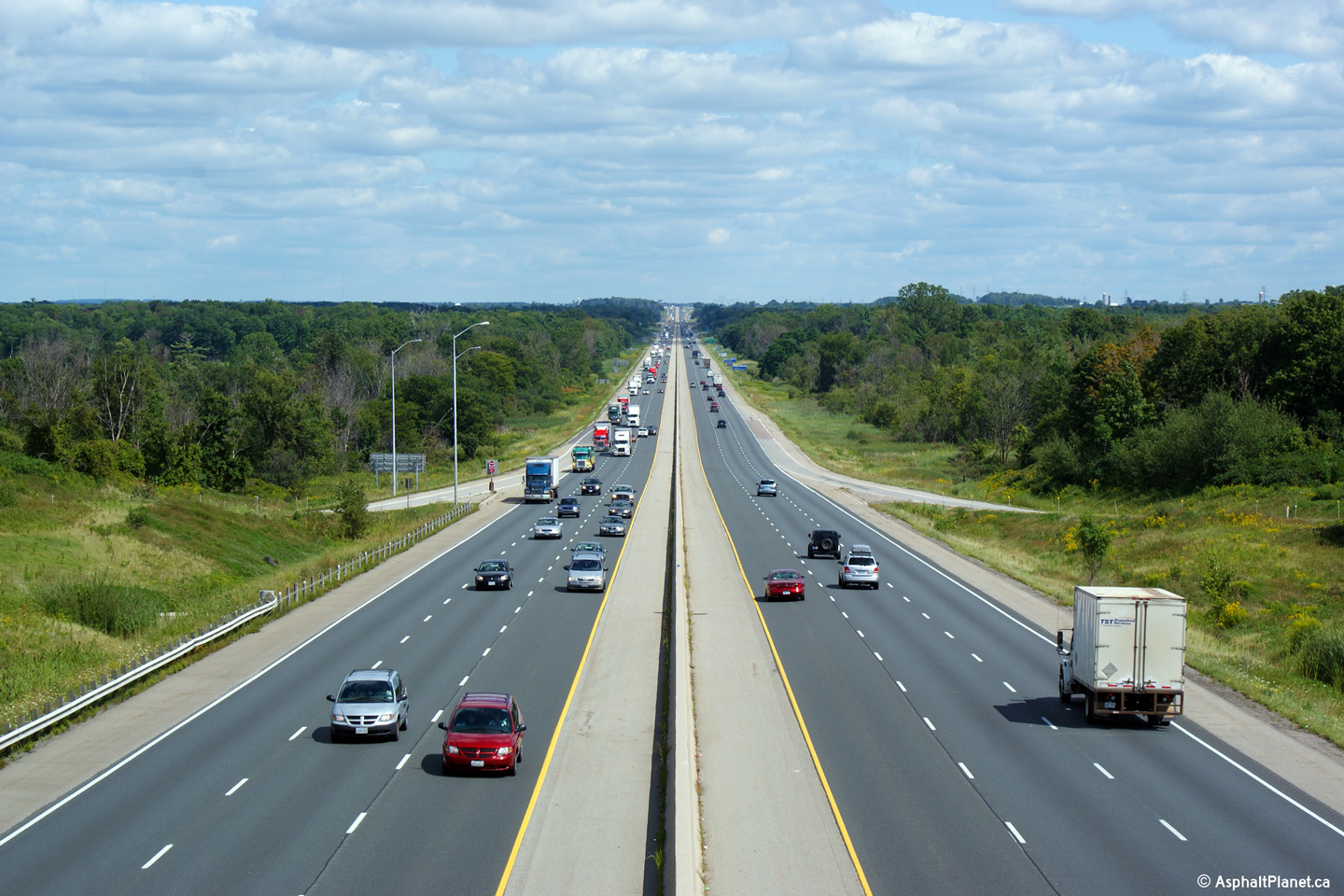
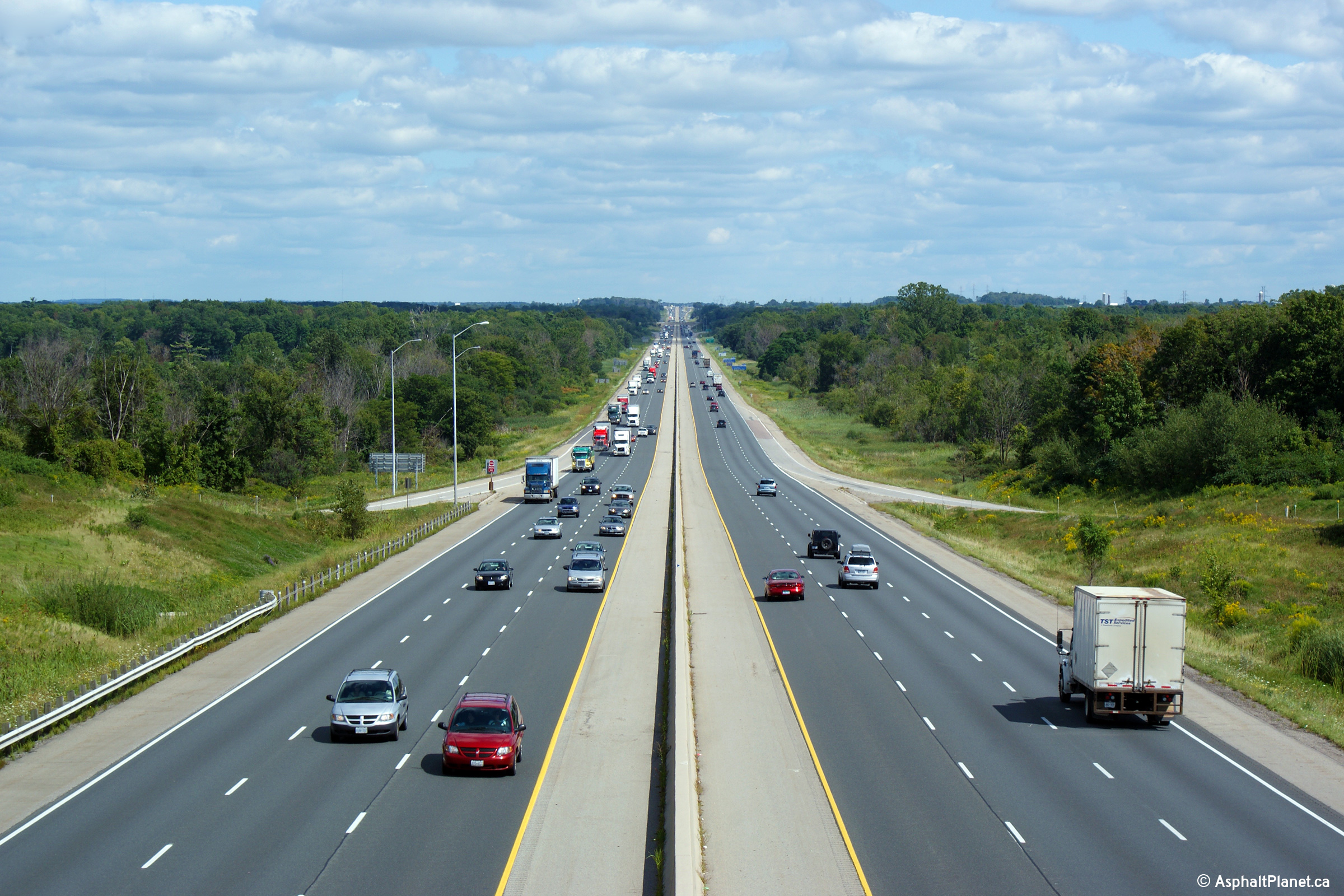
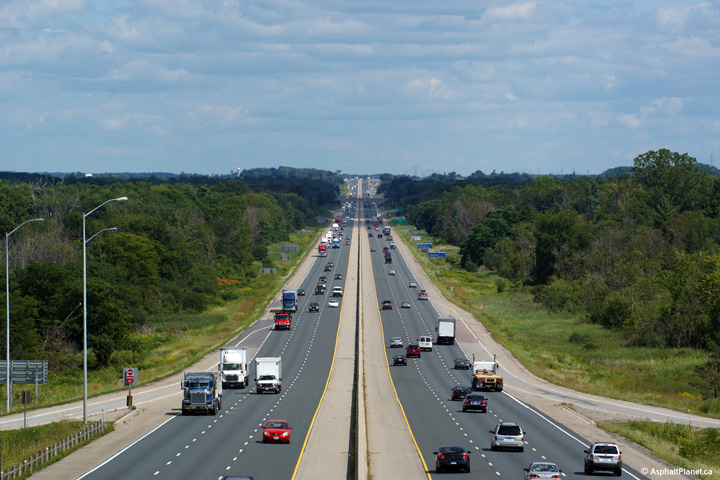
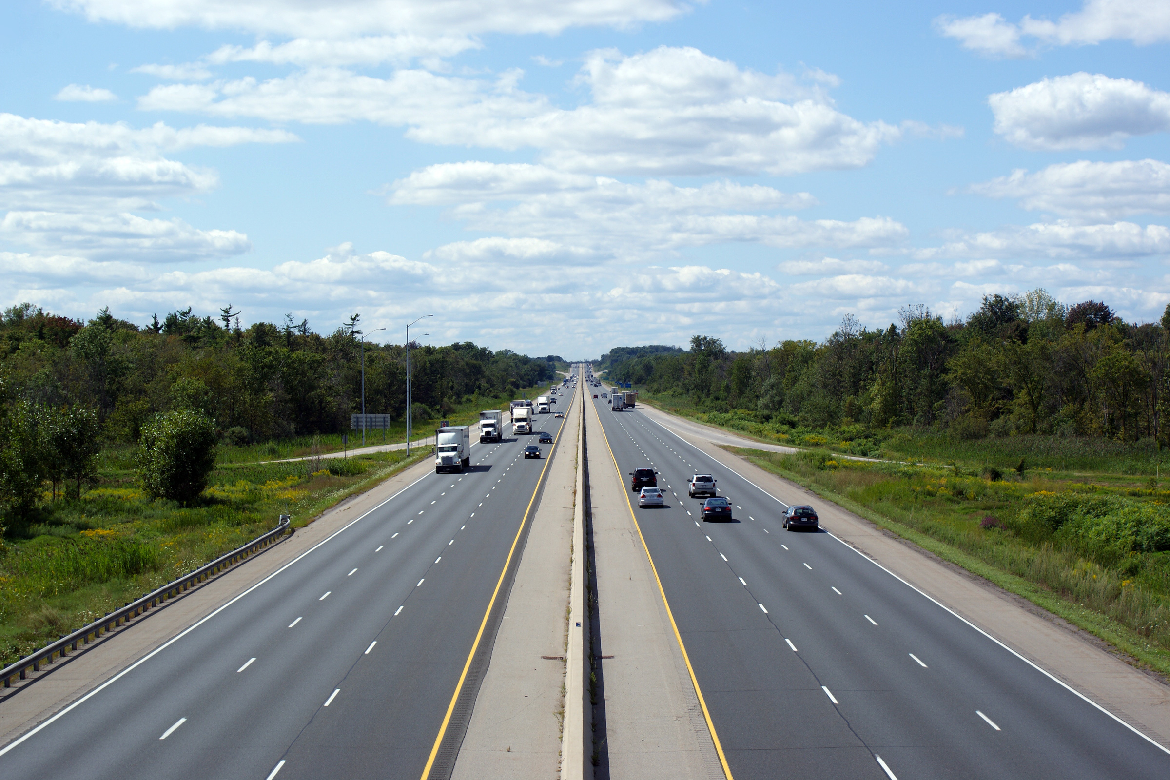
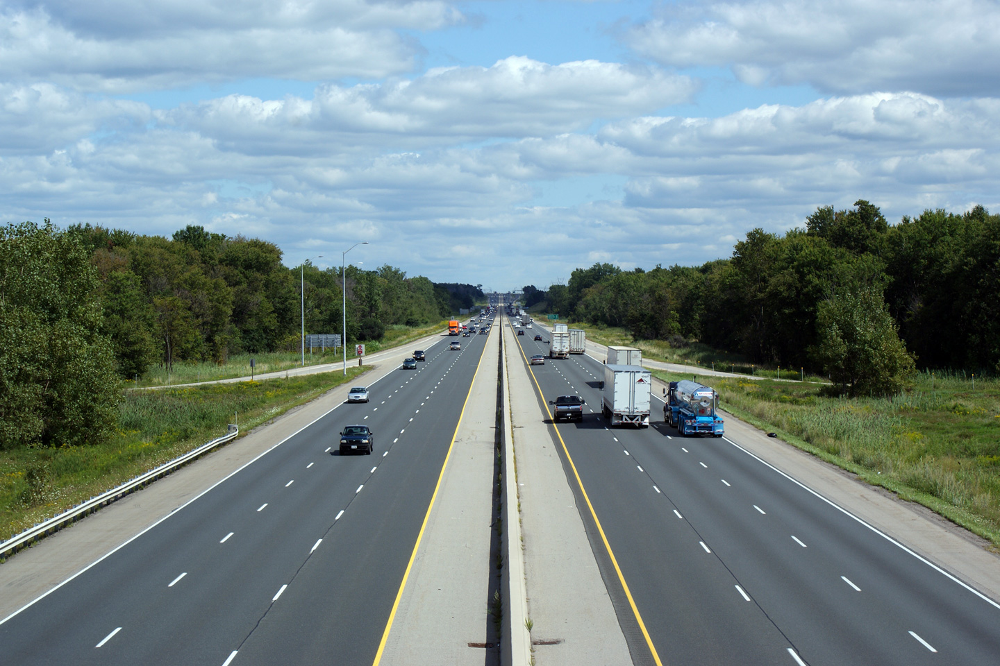
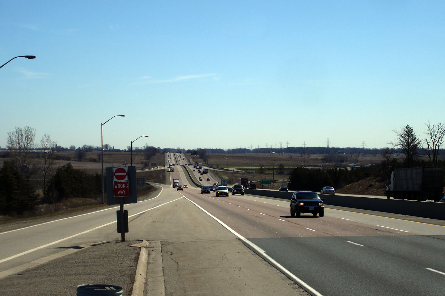
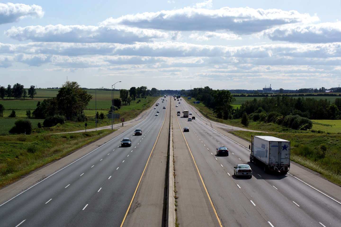
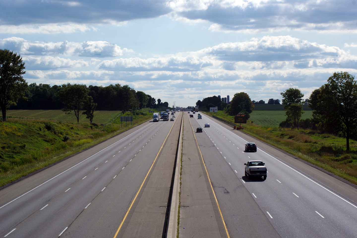
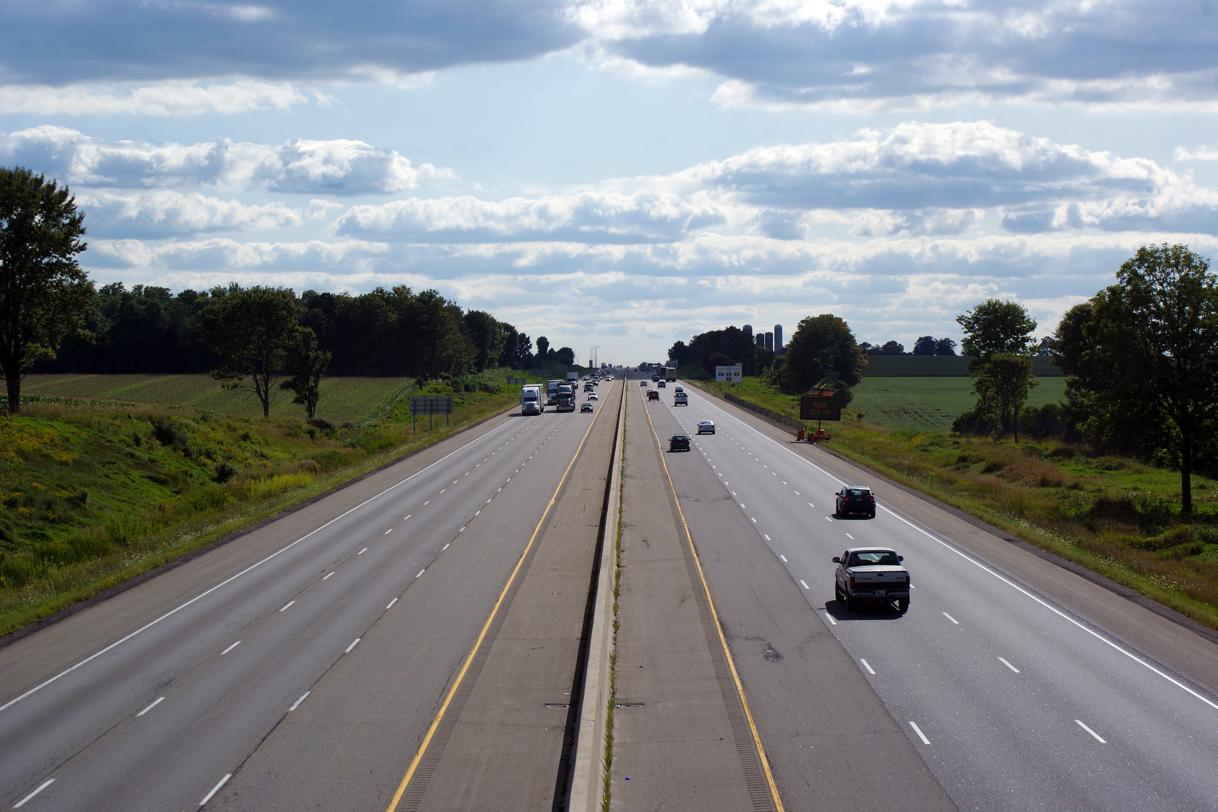
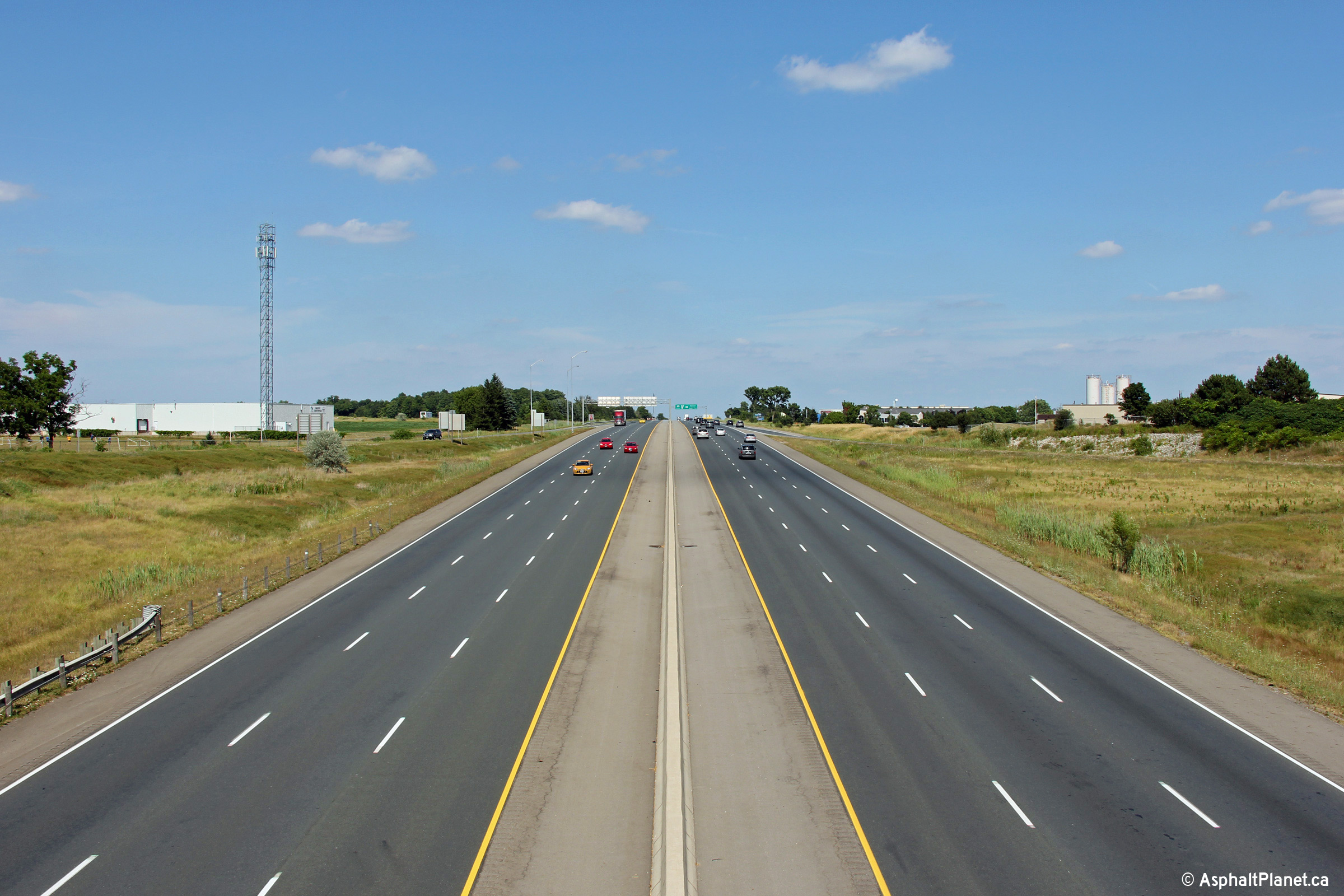
| Municipality of Thames Centre County of Middlesex. |
Easterly view from the Putnam Road scales to the Putnam Road interchange.
The Putnam Road underpass gives the highway a unique look as it traverses
the shallow valley. I think this is one of the most photographed
sections of Highway 401 in Southwestern Ontario. Photo taken: April 20th, 2007. |
 |
||
| South-West Oxford - Ingersoll
Boundary County of Oxford |
Looking west towards London from the Culloden Road interchange near
Ingersoll. Click here for an
additional view from this vantage point, taken September, 2005. Photo taken: August 31st, 2009. |
 (720x480) (1440x960) (2400x1600) |
||
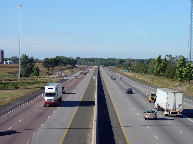
| South-West Oxford - Ingersoll
Boundary County of Oxford |
Looking east form the Culloden Road overpass in Ingersoll. Culloden
Road is located at roughly kilometre marker 216. Click
here for an additional view from this
vantage point, taken September, 2005. Photos taken: August 31st, 2009. |

(720x480)
(1440x960)
(2400x1600) |
||
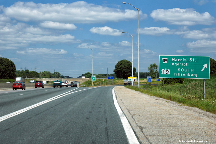
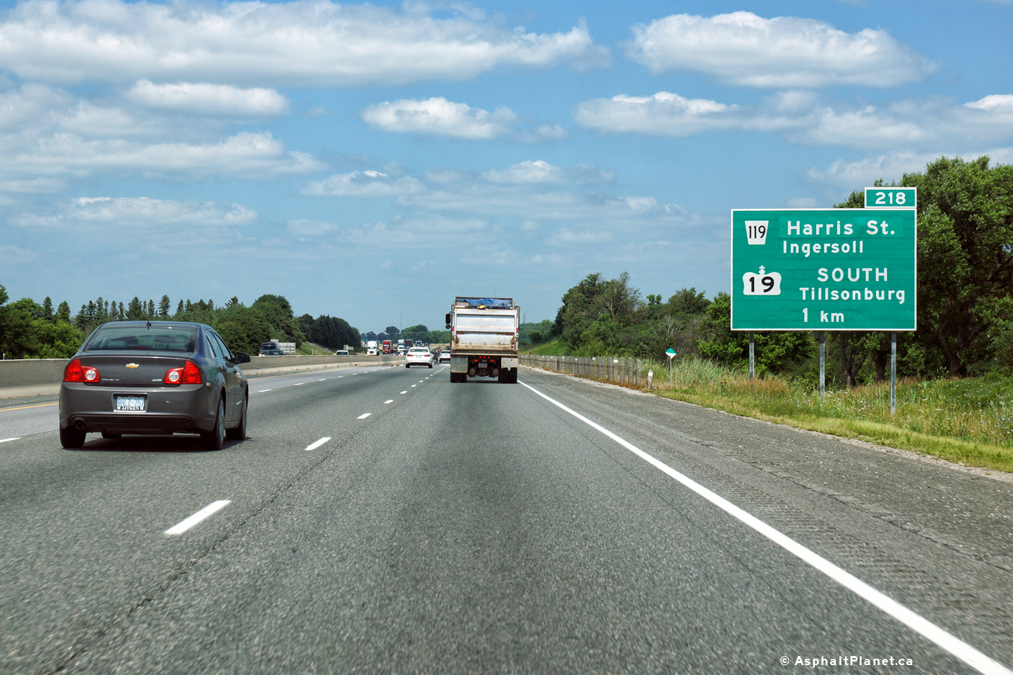
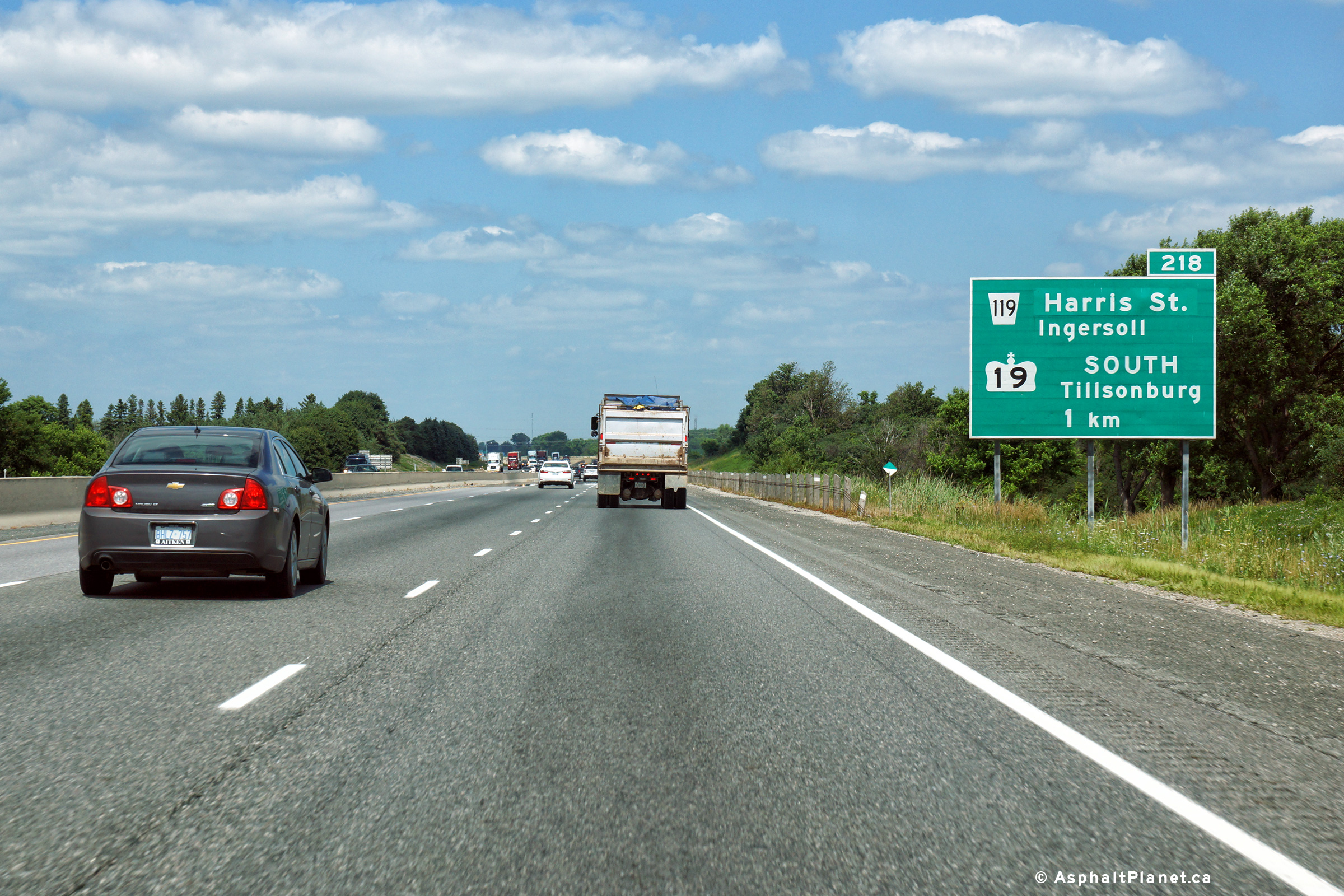
| South-West Oxford - Ingersoll
Boundary County of Oxford |
Eastbound advanced signage for the Highway 19 interchange. Photo taken: July 14th, 2014. |
 (720x480) (720x480)(1440x960) (2400x1600) |
||
| South-West Oxford - Ingersoll
Boundary County of Oxford |
View looking easterly at the off-ramp to Highway 19. Photo taken: July 14th, 2014. |
 (720x480) (720x480)(1440x960) (2400x1600) |
||
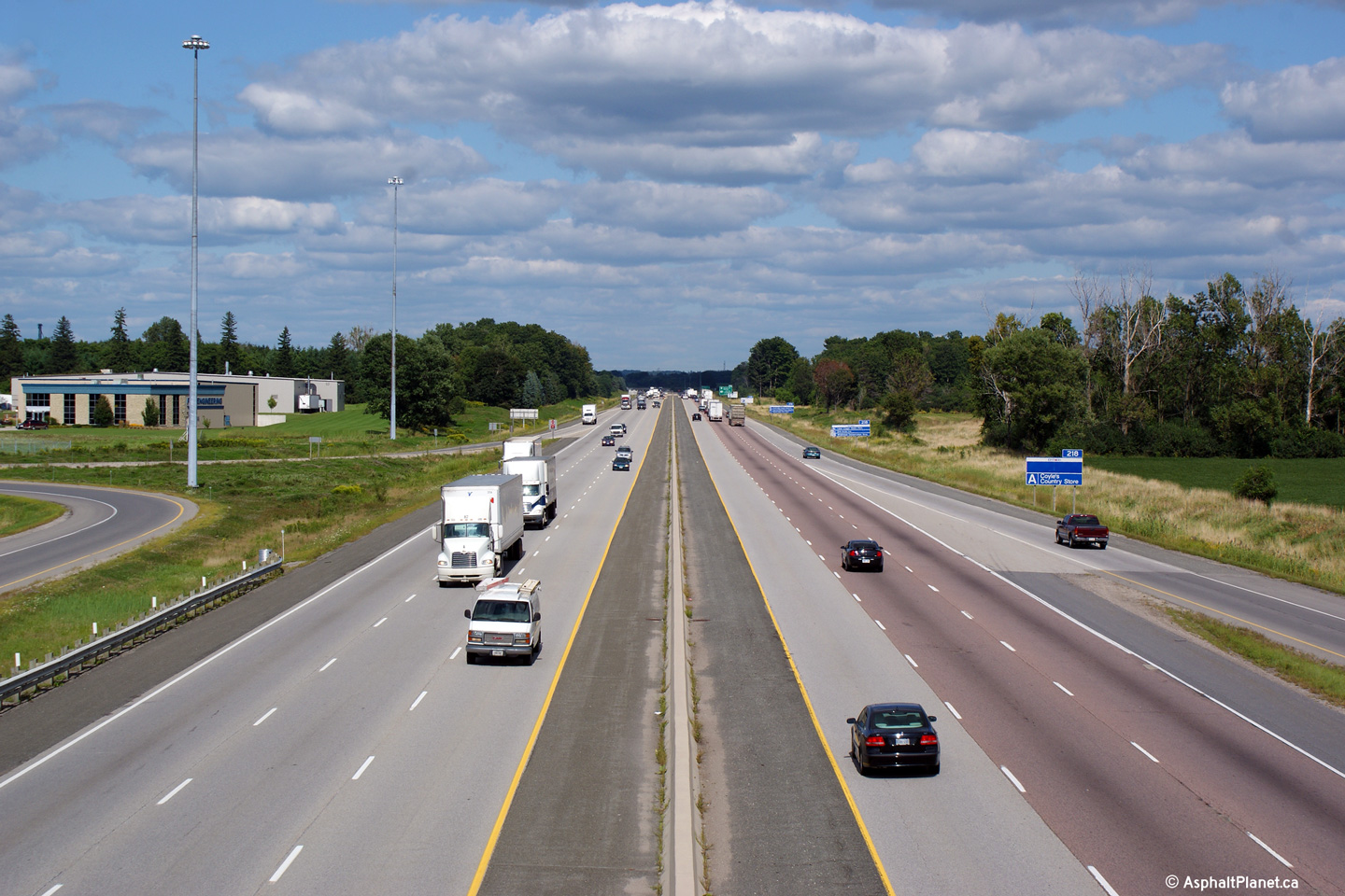
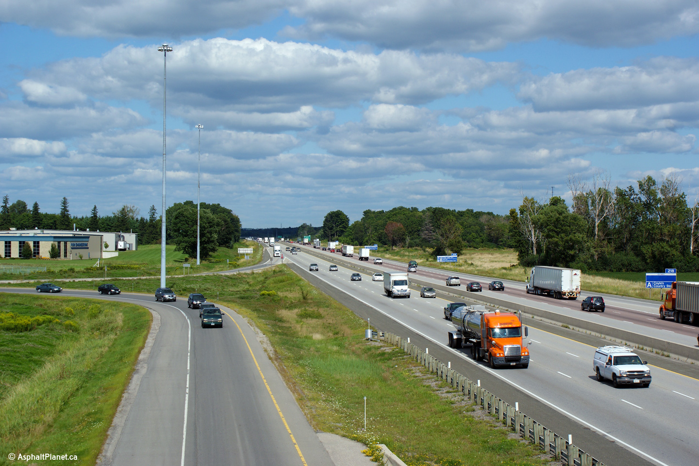
| South-West Oxford - Ingersoll
Boundary County of Oxford |
View looking west from the Highway 19
overpass. Highway 19 is located at kilometre marker 218. Photo taken: October 1st, 2010. |
|||
| Highway 19 traverses the distance from Port Burwell northerly to Tralee at Highway 86. Click here for Highway 19 images. | ||||
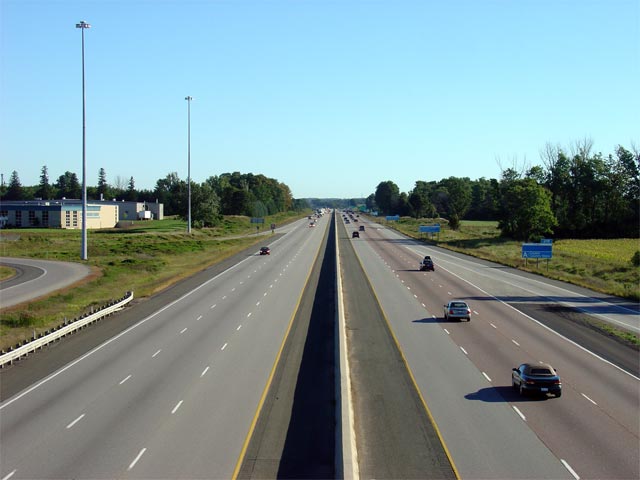
| South-West Oxford - Ingersoll
Boundary County of Oxford |
Facing east towards Woodstock from the Highway 19
overpass. The eastbound lanes of the 401 were resurfaced in the
vicinity of Highway 19 during two separate
contracts during 2004/2005. Photo taken: October 1st, 2010. |
|||
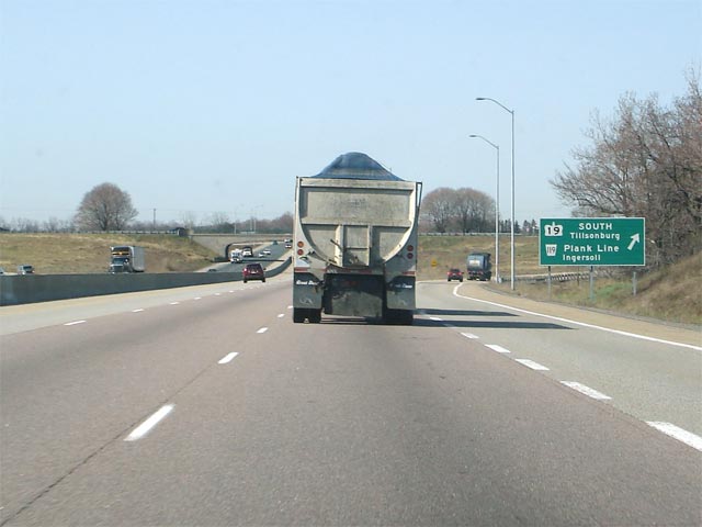
| South-West Oxford - Ingersoll
Boundary County of Oxford |
Signage denoting the westbound exit to Highway 19. Photo taken: April 18th, 2006. |
 |
||
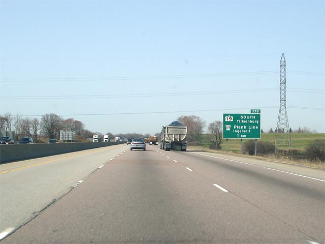
| Township of South-West Oxford County of Oxford |
Westbound advanced signage for the Highway 19 interchange.
Highway 19
leads travelers south of Highway 401 to Tillsonburg and
Highway 3. Before 1998,
Highway 19 also
continued north of Highway 401 to Ingersoll and eventually Highway 86. Photo taken: April 18th, 2006. |
 |
||
| Township of South-West Oxford County of Oxford |
Looking westerly from the Foldens Line overpass. Foldens Line is
located approximately at kilometre marker 222. Photo taken: August 31st, 2009. |
 |
||
| Township of South-West Oxford County of Oxford |
This view looks easterly from the Foldens Line overpass along Highway 401.
An interchange was constructed at Foldens Line as part of a project
completed by both the MTO and the County of Oxford to construct a western
truck by-pass of the City of Woodstock. Photo taken: August 31st, 2009. |
 |
||
| Township of South-West Oxford County of Oxford |
View looking westerly towards London from the Dodge Line overpass.
Dodge Line is located at roughly kilometre marker 228. Photo taken: August 31st, 2009. |
 (720x480) (1440x960) (2400x1600) |
||
| Township of South-West Oxford County of Oxford |
Looking east from the Dodge Line overpass. The Sweaburg Road
interchange is located just overtop the crest of the Photod hill. Photo taken: August 31st, 2009. |
 |
||
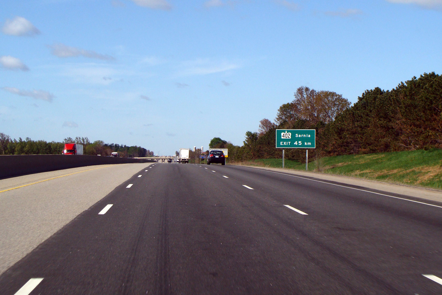
| Township of South-West Oxford County of Oxford |
Just west of the City of Woodstock, an advance exit stands advising that
Highway 402 departs the 401 in 45km. This is a unique sign in Ontario,
no other freeway junction is signed with so much advanced warning. Photo taken: May 17th, 2009. |
 (720x480) (720x480)(1440x960) |
||
| City of Woodstock County of Oxford |
Eastbound signage for the off-ramp to Highway 59 in Woodstock. Photo taken: July 21st, 2012 |
 (720x480) (720x480)(1440x960) (2400x1600) |
||
| City of Woodstock County of Oxford |
Looking at the 401 from the western side of the Highway 59 overpass in Woodstock. Click here for this same view taken in September, 2005.
Photo taken: July 21st, 2012. |
 (720x480) (1440x960) (2400x1600) |
||
| Highway 59 was a highway that stretched from Long Point on Lake Erie to Shakespeare at Highway 7/8. Click here for Highway 59 images. | ||||
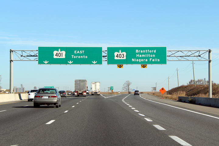
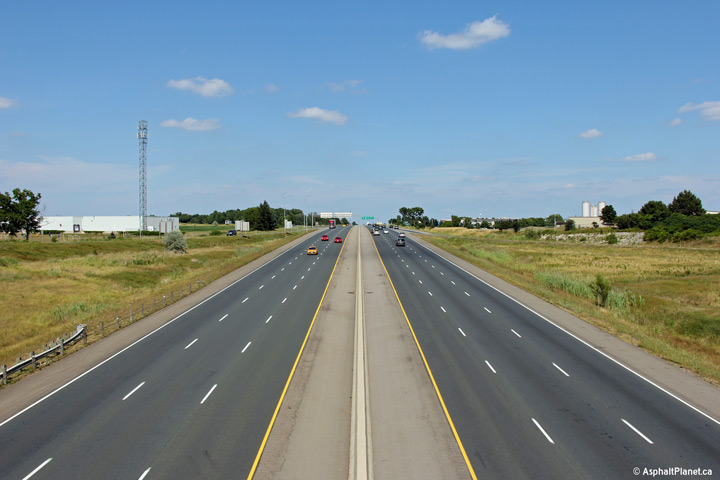
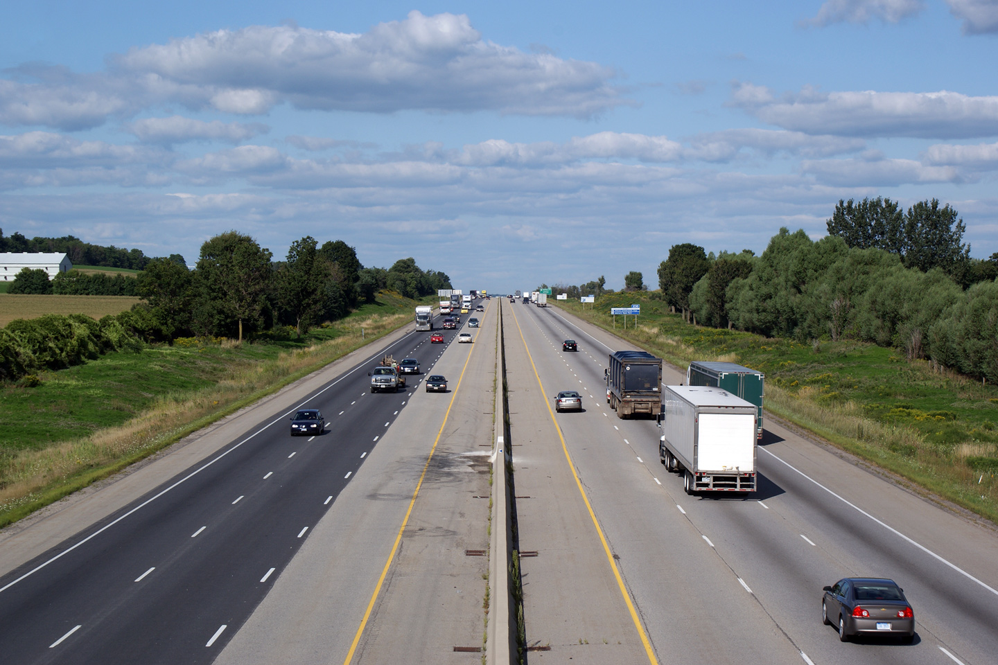
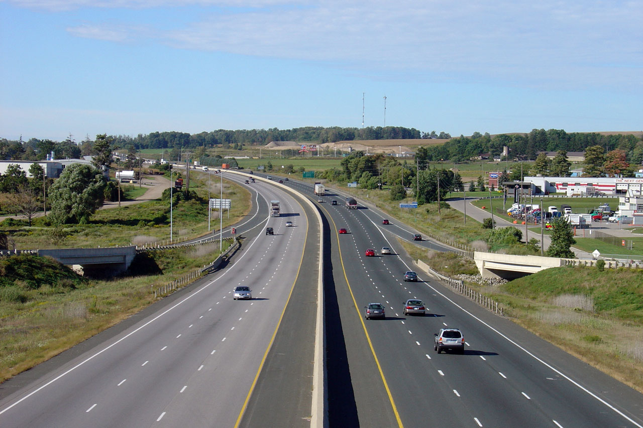
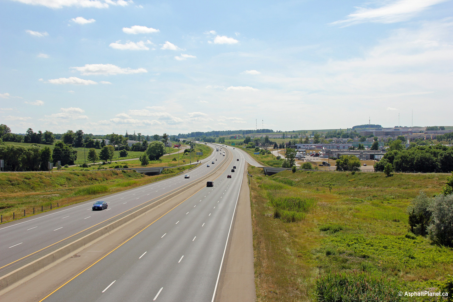
| City of Woodstock County of Oxford |
Looking east along Highway 401
from the Highway 59 overpass in Woodstock. Highway 59 is located
approximately at kilometre marker 232. The
Highway 403 interchange is located
approximately 2km east of the Highway 59 overpass. Photo taken: July 21st, 2012. |
|||
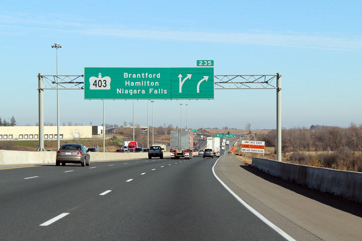
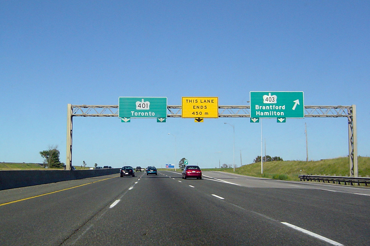
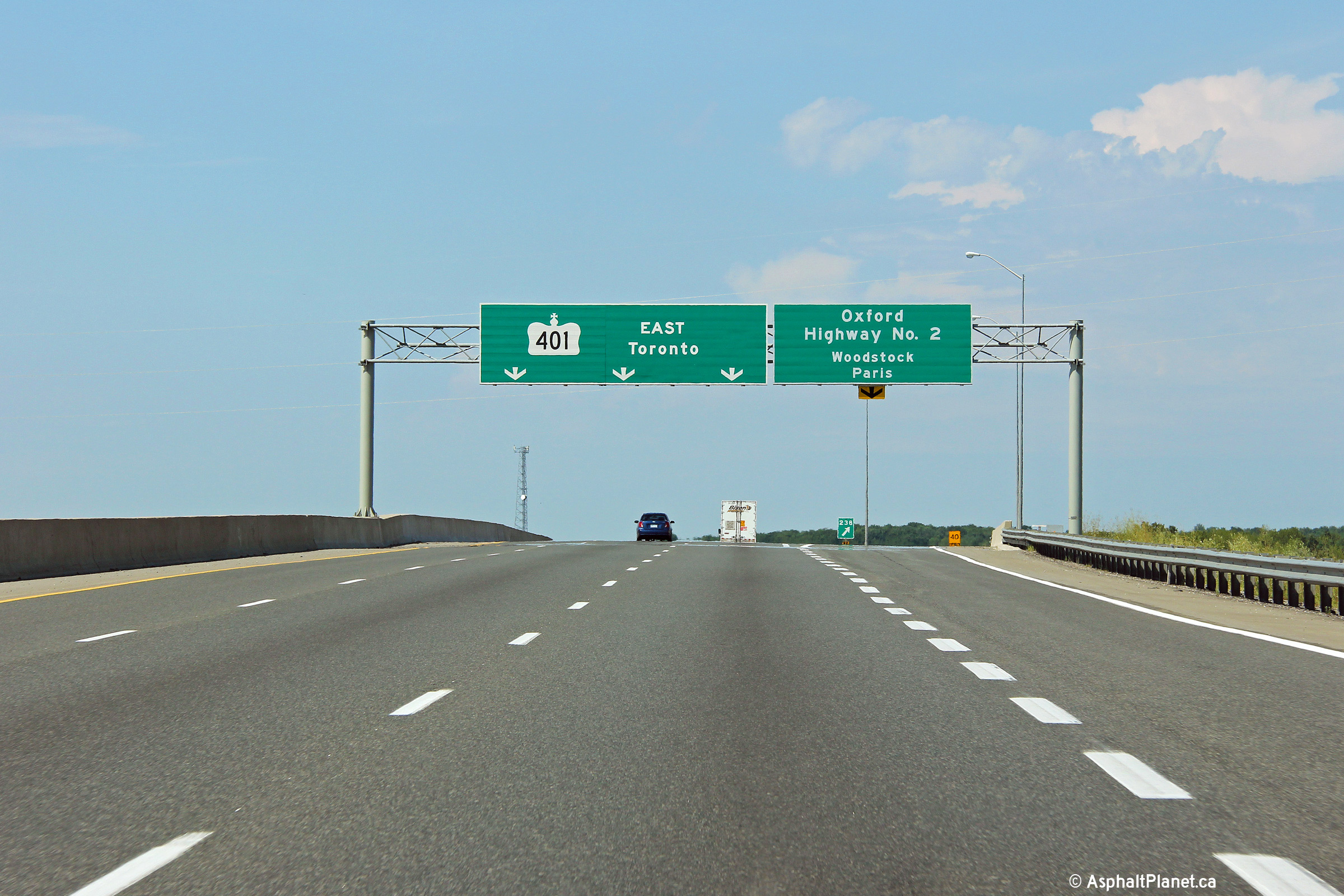
| City of Woodstock County of Oxford |
Diagram signage was erected for the Highway 403
interchange as part of the widening through Woodstock. Southwest Region has
erected several new diagram signs on its freeways during the past few years. Photo taken: November 10th, 2010. |
 (720x480) (720x480)(1440x960) (2400x1600) |
||
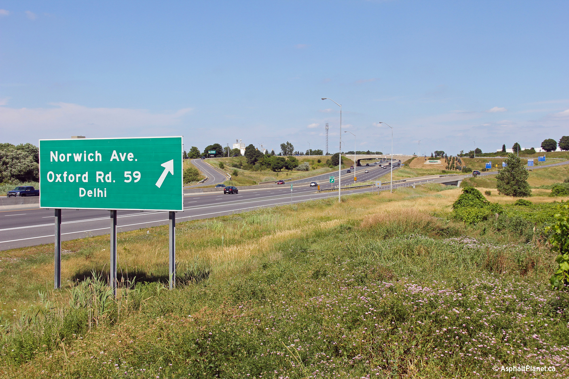
| Township of Norwich County of Oxford |
This Photo shows the advanced signage for the
Highway 403 interchange in Woodstock. Photo taken: November 10th, 2010. |
 (720x480) (720x480)(1440x960) (2400x1600) |
||
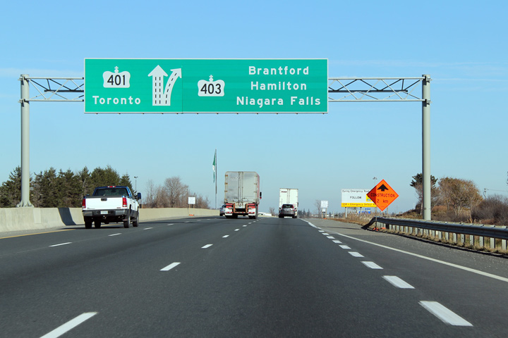
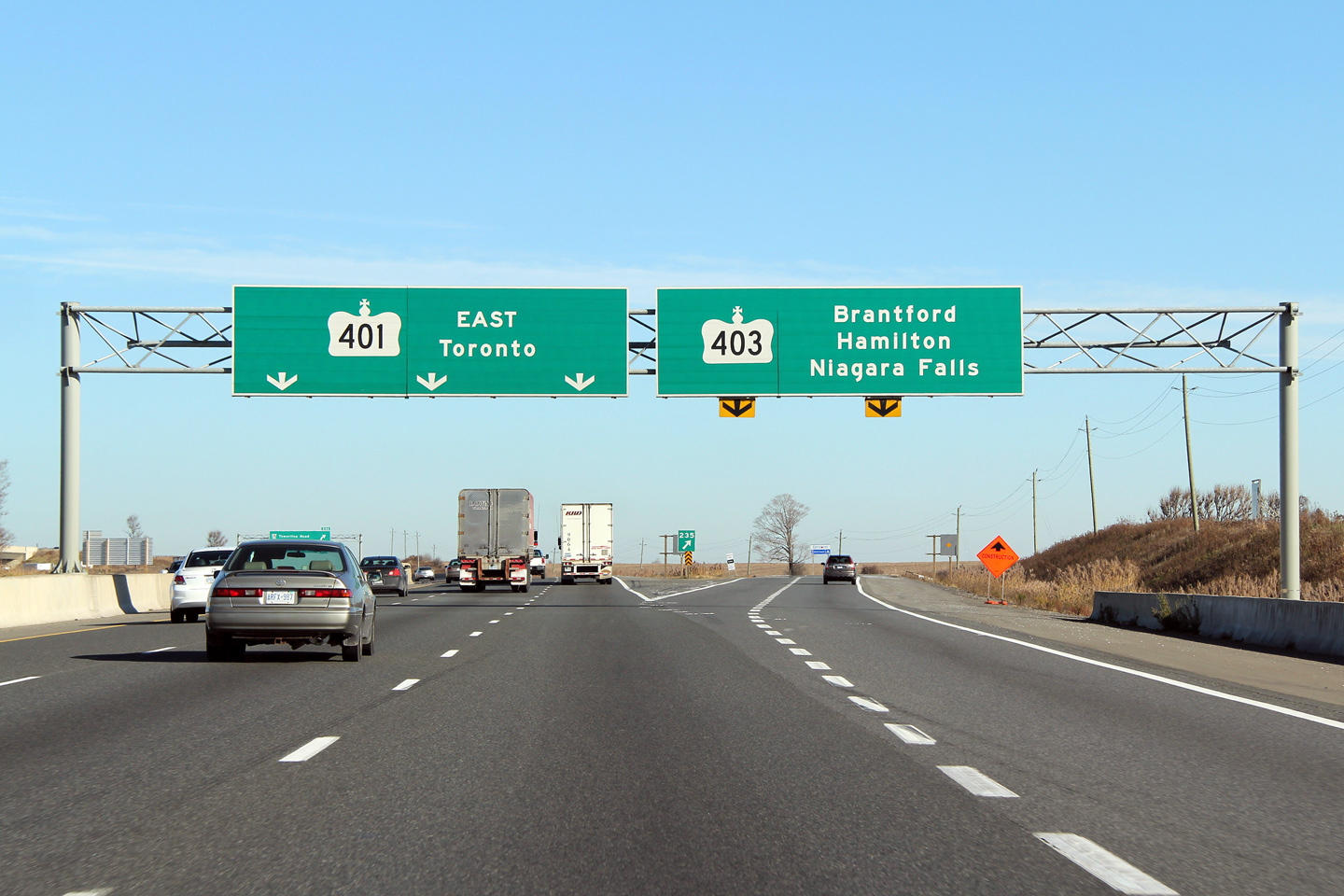
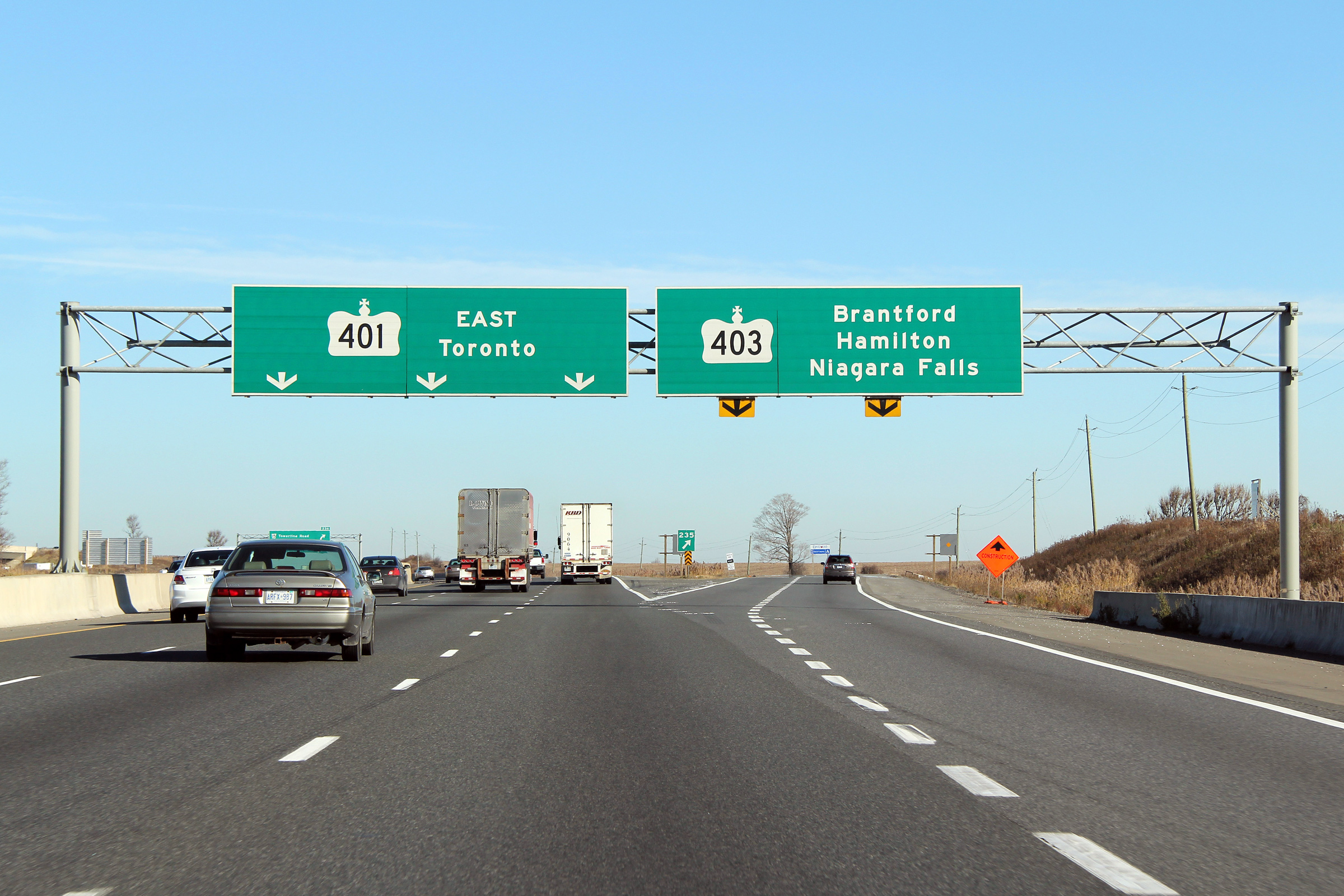
| Township of Norwich County of Oxford |
This Photo shows the overhead signage located
at the split for
Highway 403 in Woodstock. Highway 403 leads travelers to Brantford,
Hamilton, and eventually Mississauga. Click
here for an earlier version of
this signage taken in June, 2004. Photo taken: November 10th, 2010. |
 (720x480) (720x480)(1440x960) (2400x1600) |
||
| Highway 403 leads east from Highway 401 towards Brantford and Hamilton. Click here for Highway 403 images. | ||||
| Township of Norwich County of Oxford |
Westbound signage denoting the Highway 403
flyover. This signage is quite unique; no other freeway flyovers are
signed this way in Ontario. Photo taken: March 17th, 2007. |
 |
||
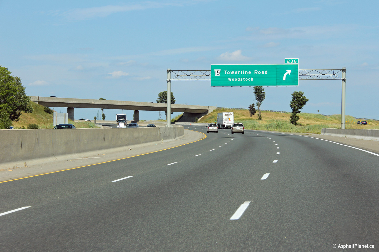
| Township of Norwich County of Oxford |
Advanced overhead signage for the Towerline Road interchange. The Highway
403 flyover stands just beyond this overhead signage. Photo taken: July 21st, 2012. |
 (720x480) (720x480)(1440x960) (2400x1600) |
||
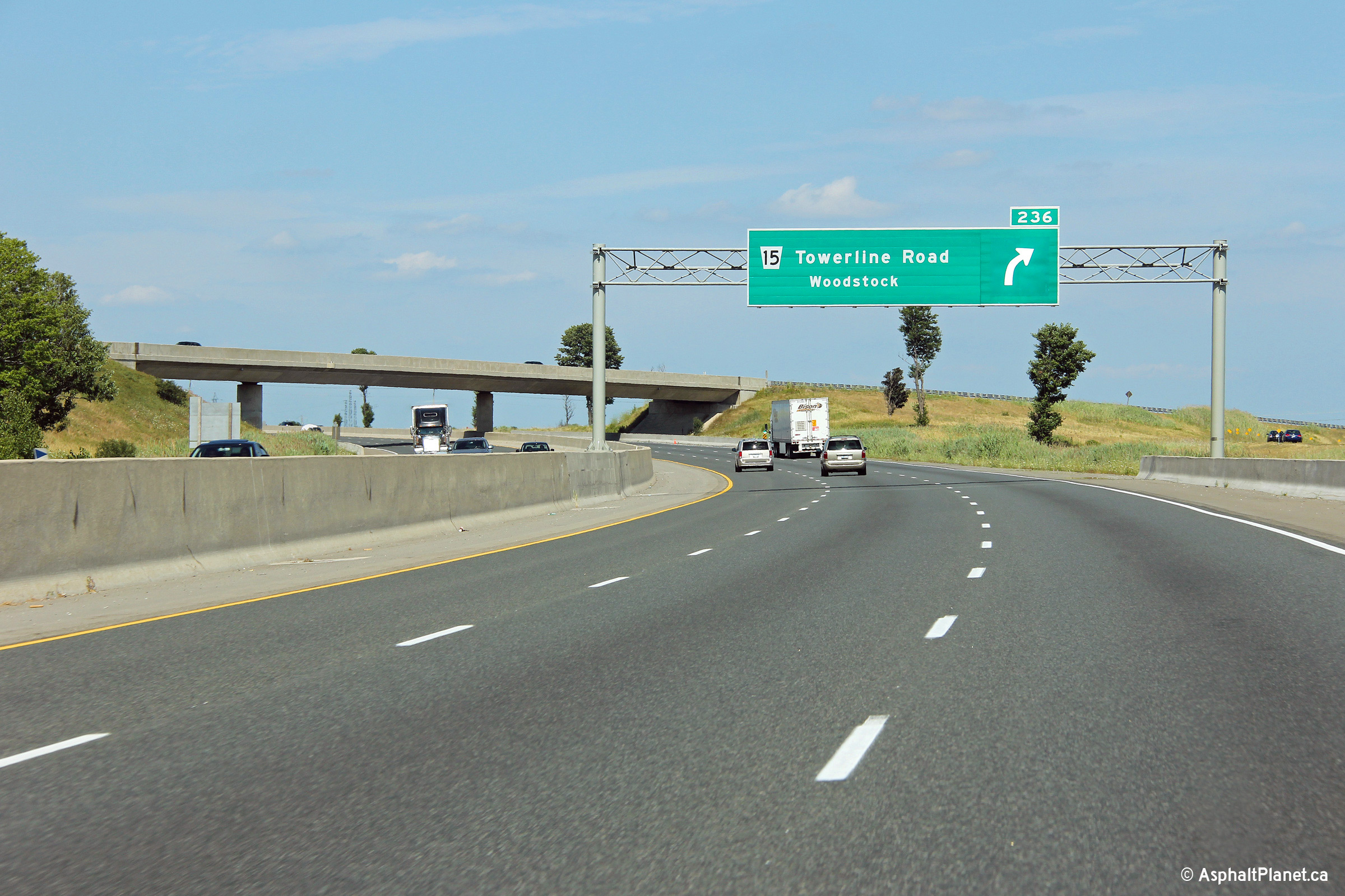
| Township of Norwich County of Oxford |
Partial advanced signage denoting the exit to Towerline Road. This was one
of the first modern partial overhead gantry to be erected over an Ontario
highway. Photo taken: July 21st, 2012. |
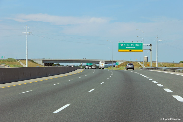 (720x480) (720x480)(1440x960) (2400x1600) |
||
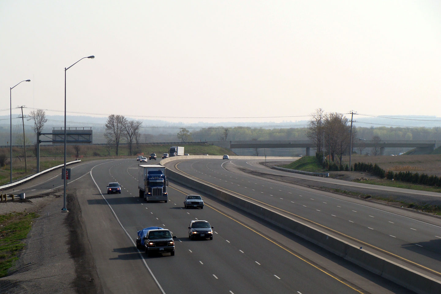
| Township of Norwich County of Oxford |
Highway 401 looking west from the Towerline Road overpass. For several years in the 1980s, Towerline bridged the gap for the uncompleted Highway 403 until the large freeway to freeway interchange was completed in 1987. Click here for an additional view of the widened highway, taken April, 2008.
Upper photo taken: April 16th, 2004.
Lower photo taken: July 21st, 2012. |
 (720x480) (1440x960) (2400x1600) |
||
| Highway 401 is being widened in the vicinity of the Towerline Road interchange. Click here for more information and photos (Coming Soon!). | ||||
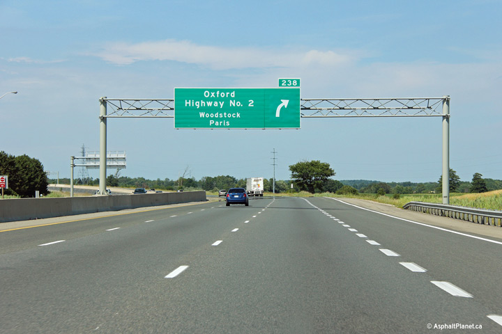
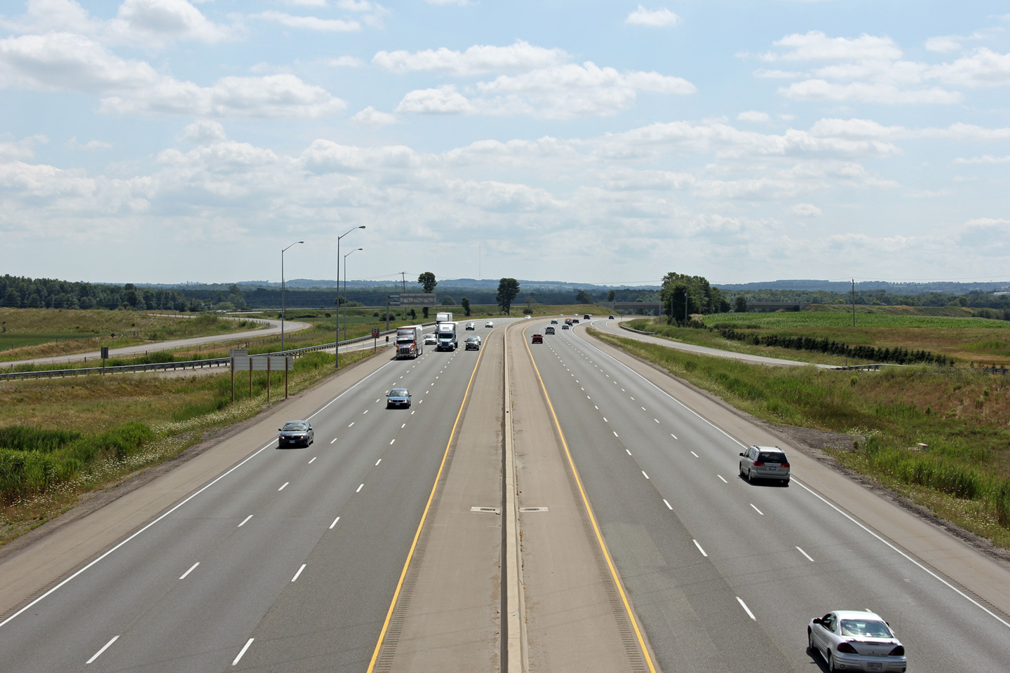
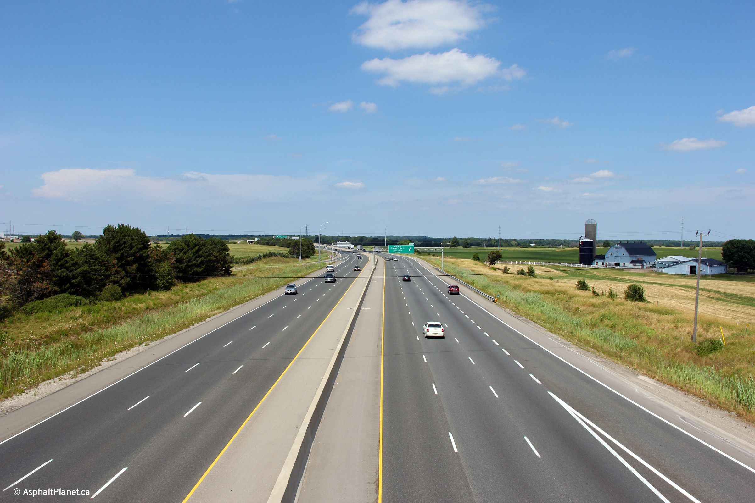
| Township of Norwich County of Oxford |
Two views looking easterly from the Towerline Road
overpass towards the Highway 2 interchange.
Click here
for an additional view of the widened highway, taken April, 2008. Upper photo taken: September 9th, 2005. Lower photo taken: July 21st, 2012. |
 |
||
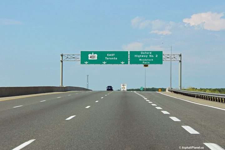
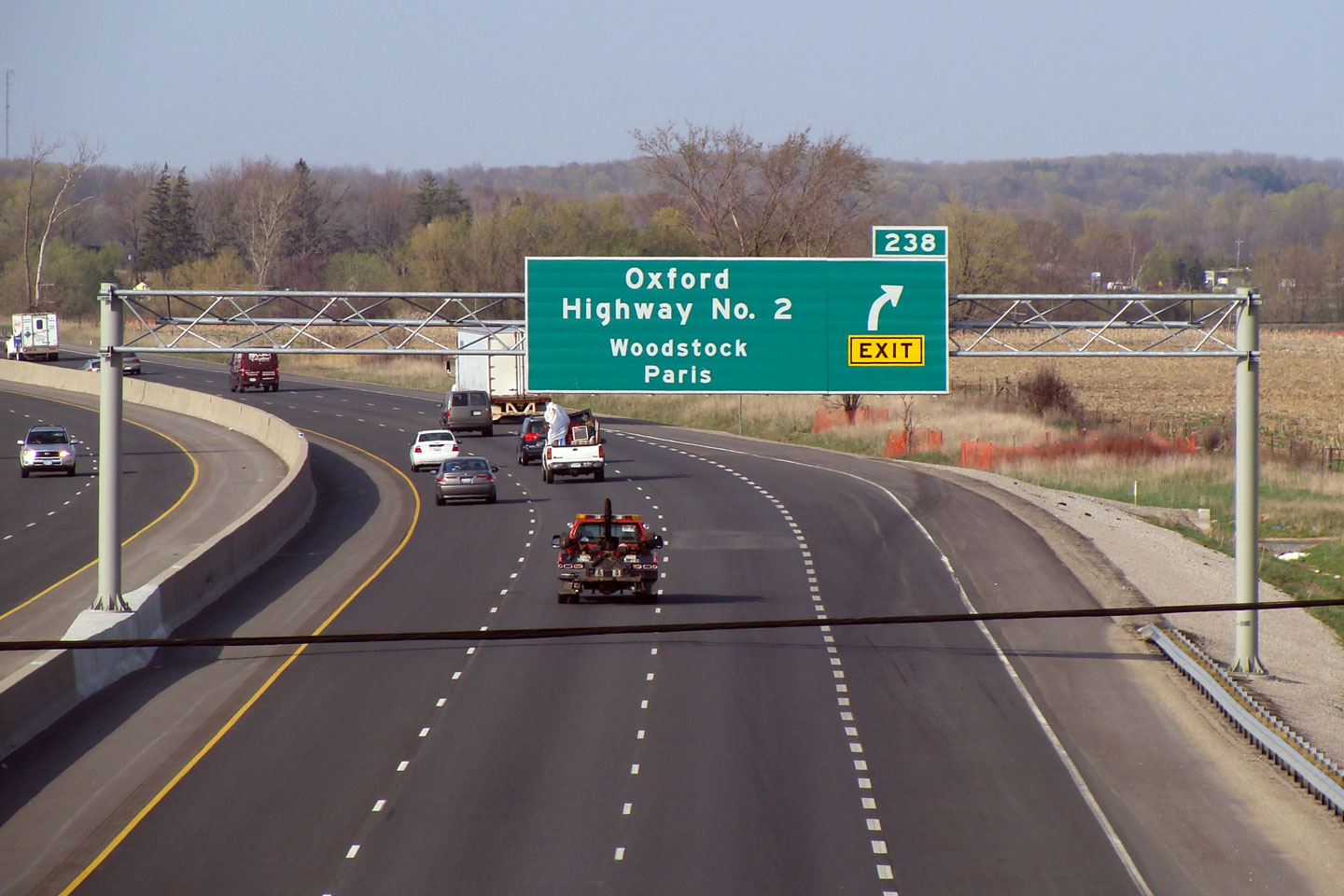
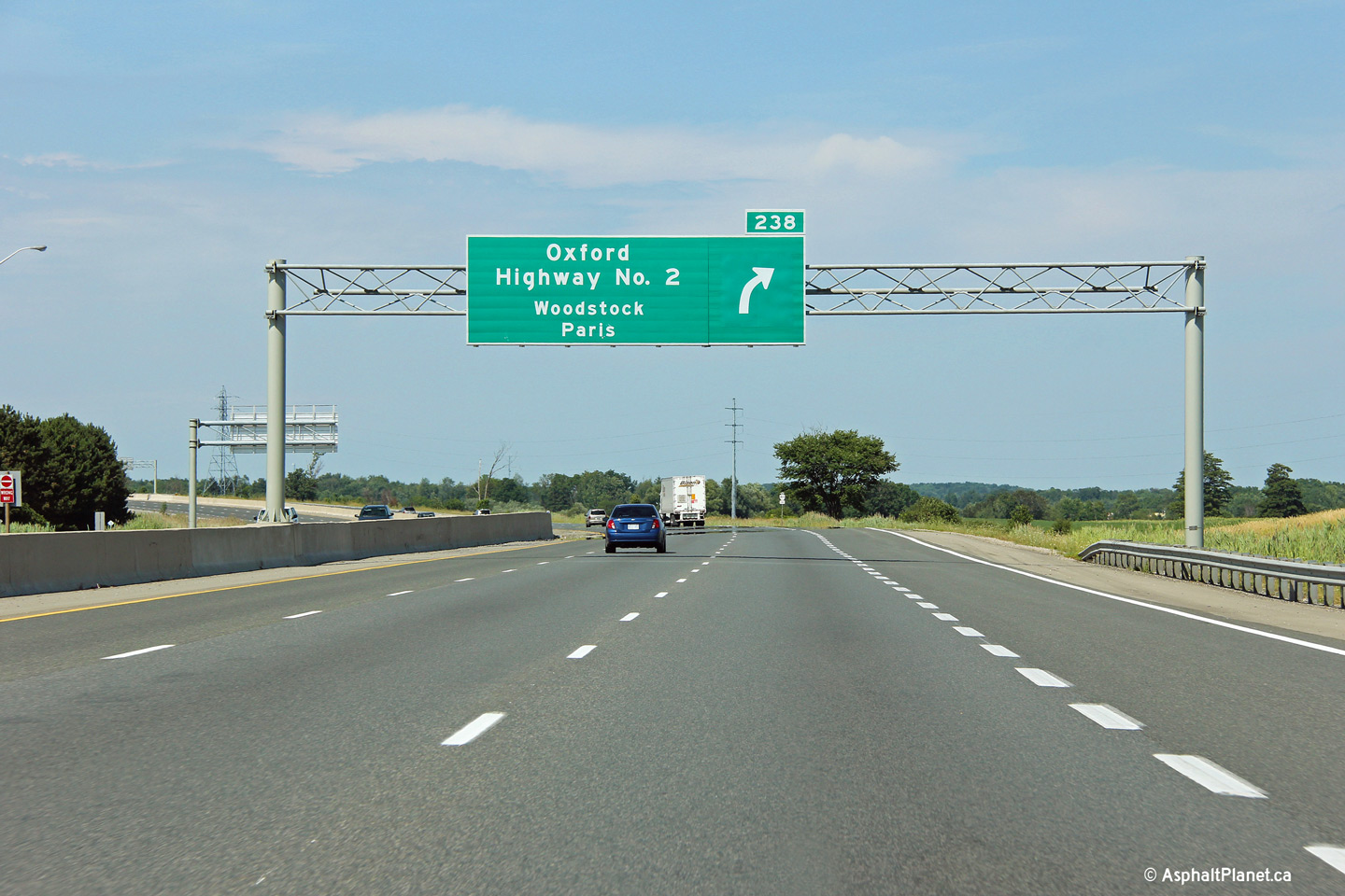
| Township of Norwich County of Oxford |
Eastbound signage approaching the Highway 2
interchange. When this sign was first erected, it featured an
erroneous 'exit' block underneath of the arrow. Click
here for this same view taken in April,
2008. Photo taken: July 21st, 2012. |
 (720x480) (720x480)(1440x960) (2400x1600) |
||
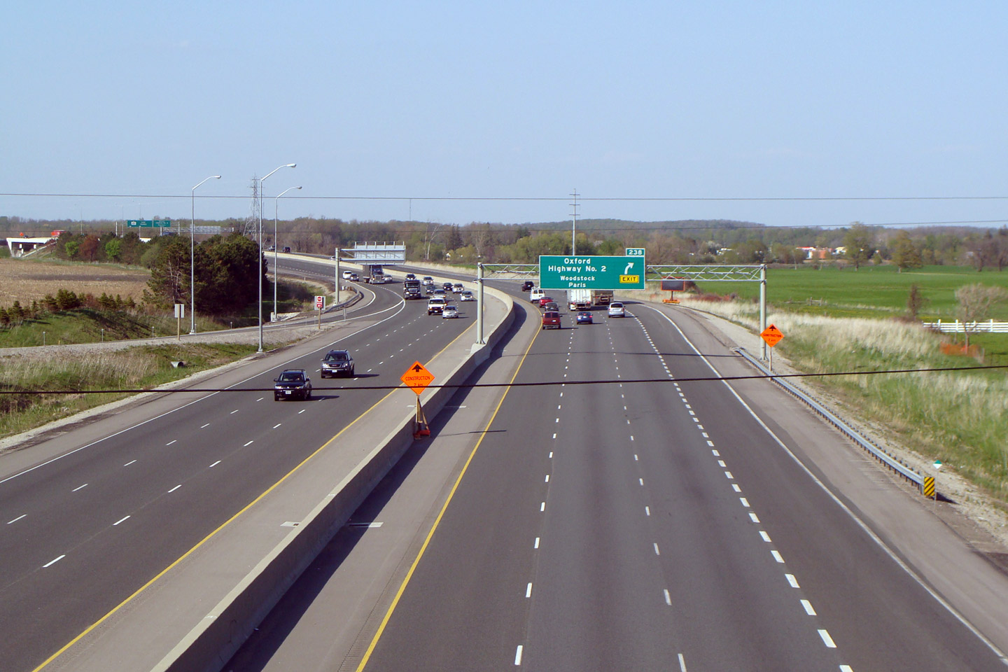
| Township of Norwich County of Oxford |
Easterly view at the off-ramp to Highway 2. The
Highway 2 interchange was converted to a five ramp partial cloverleaf from a
full cloverleaf when Highway 401 was widened to six lanes through eastern
Woodstock in 2007-2008. Photo taken: July 21st, 2012. |
 (720x480) (720x480)(1440x960) (2400x1600) |
||
| Highway 2 once served the same purpose as Highway 401 before the freeway era. It is now a series of County Roads. Click here for Highway 2 images. | ||||
| Click here for Woodstock to Cambridge Images | ||||
Page 5 - Aerials
Photos shown in this table are arranged from West to East:
| Proper Municipality Name | Photo Description | Photo |
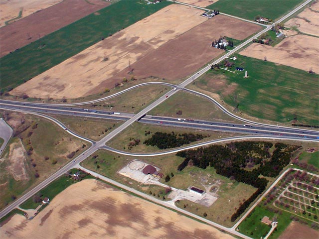
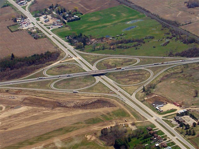
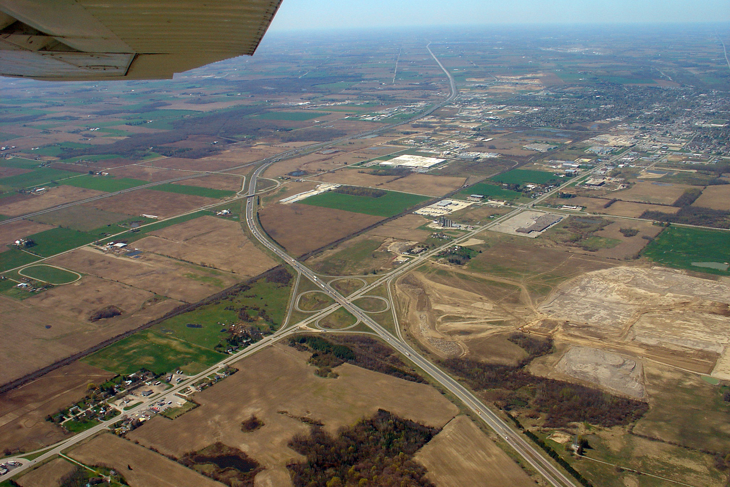
| Municipality of Thames Centre County of Middlesex |
View looking northeasterly at the Highway 74/401
interchange. This interchange is located just east of London's eastern
City Limits at approximately kilometre 195. Photo taken: April 28th, 2006. Size: 65kb. |
 |
| Municipality of Thames Centre County of Middlesex |
Another view of the Highway 74/401
partial-cloverleaf interchange. Before Highway 401 was widened to
six-lanes in this area in the mid 1990s, Highway 74 met the 401 at a parclo
A4 interchange. When constructed in the 1950s, this was the only
interchange on this stretch of Highway 401 between two provincial highways
not to be constructed as a full cloverleaf. Photo taken: April 28th, 2006. Size: 70kb. |
 |
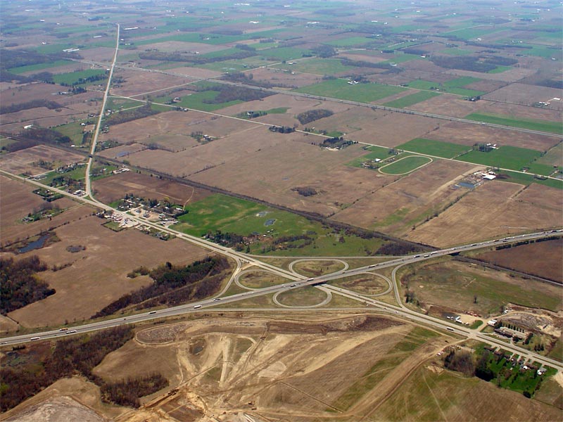
| Municipality of Thames Centre County of Middlesex |
Looking northwesterly at the Dorchester Road interchange along Highway 401.
Dorchester Road is located at kilometre marker 199. Photo taken: April 28th, 2006. Size: 65kb. |
 |
| Municipality of Thames Centre County of Middlesex |
View looking northeasterly towards the Highway
73/401 interchange. This interchange is located at kilometre
marker 203. Photo taken: April 28th, 2006. Size: 80kb. |
 |
| Municipality of Thames Centre County of Middlesex |
A more centralized view of the Highway
73/401 interchange. Notice the grading for the former loop ramps
at this interchange. Like most other interchanges between two highways
between London and Woodstock, this was originally a cloverleaf interchange. Photo taken: April 28th, 2006. Size: 80kb. |
 |
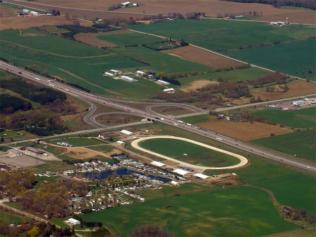
| Municipality of Thames Centre County of Middlesex |
View looking northwesterly at Highway 401 at the Putnam Road interchange.
The Putnam Road interchange was the only originally Highway 401 interchange
not to be drastically changed when the 401 was widened to six lanes between
London and Woodstock. The interchange wasn't reconfigured because of
the railway line that follows the east side of Putnam Road. Photo taken: April 28th, 2006. Size: 65kb. |
 |
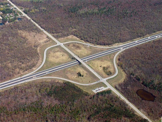
| South-West Oxford - Ingersoll
Boundary County of Oxford |
Looking northwesterly at the Culloden Road interchange along Highway 401.
Culloden Road is located at roughly kilometre marker 216. Interchange
improvements were made at the Culloden Road interchange during the 2006
construction season, after this photo was taken.| Photo taken: April 28th, 2006. Size: 65kb. |
 |
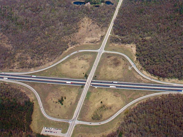
| South-West Oxford - Ingersoll
Boundary County of Oxford |
Looking northwesterly at the Highway
19/401
diamond interchange. The former graded ramps from the original
cloverleaf interchange have become quite obscured in the years since the
interchange was reconfigured to a diamond. Photo taken: April 28th, 2006. Size: 65kb. |
 |
| South-West Oxford - Ingersoll
Boundary County of Oxford |
View looking northwesterly at the Highway
19/401
interchange near Ingersoll. This interchange is located in the vicinity
of kilometre marker 218. Photo taken: April 28th, 2006. Size: 65kb. |
 |
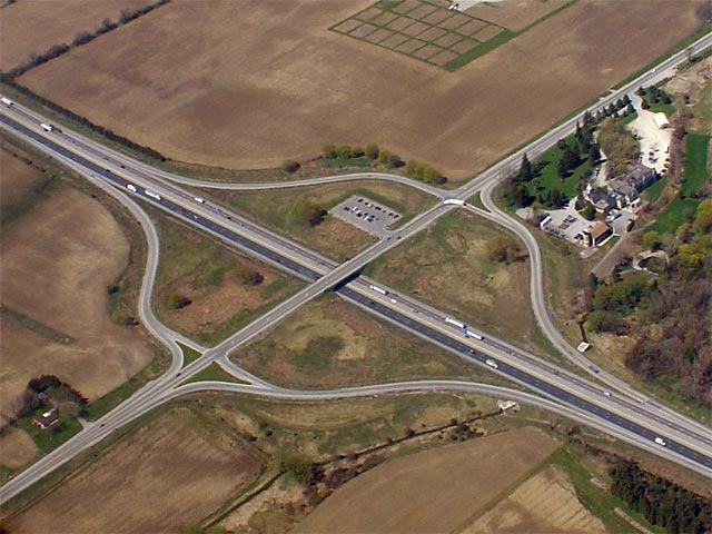
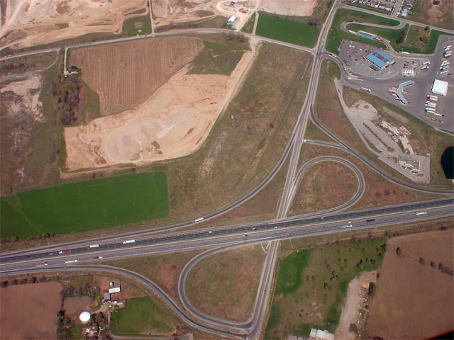
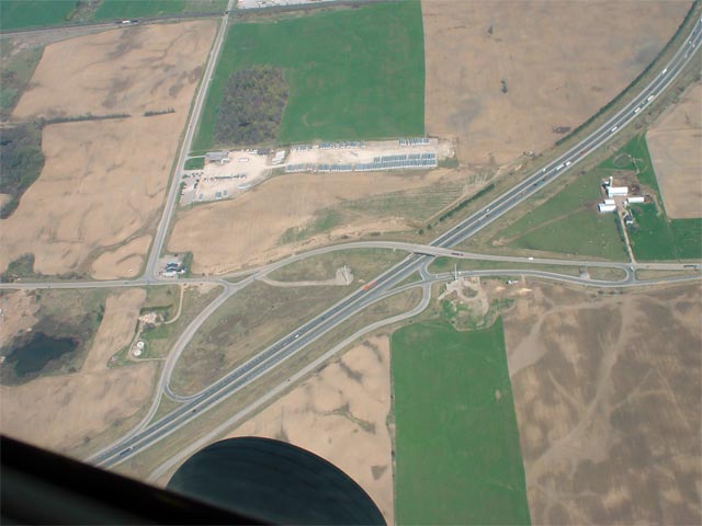
| Township of South-West Oxford County of Oxford |
View looking south towards the Foldens Line interchange along Highway 401.
Foldens Line is located at kilometre marker 222. Photo taken: April 28th, 2006. Size: 50kb. |
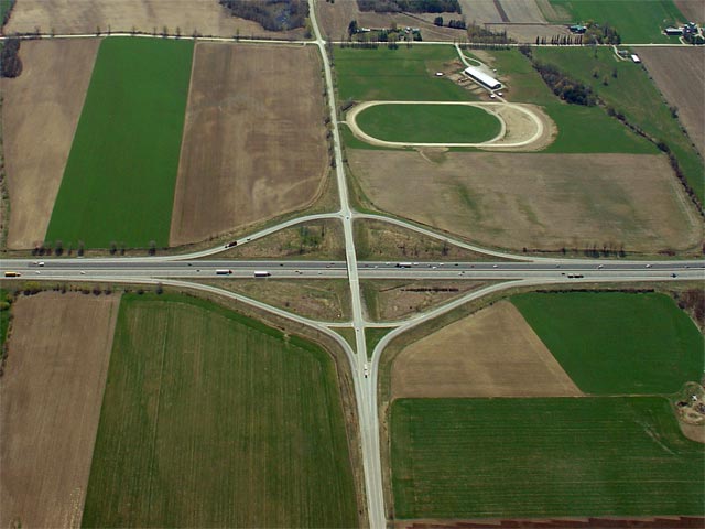 |
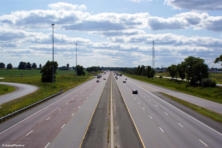
| Township of South-West Oxford County of Oxford |
A view of the westbound service centre at Beachville and the Foldens Line
interchange. Notice the very close proximity of the interchange and
the service station. Because the vintage 1950s overpass was not
replaced when the Foldens Line interchange was constructed in the early
1980s, a diamond interchange had to be constructed, necessitating the close
proximity to the service centre. Photo taken: April 28th, 2006. Size: 55kb. |
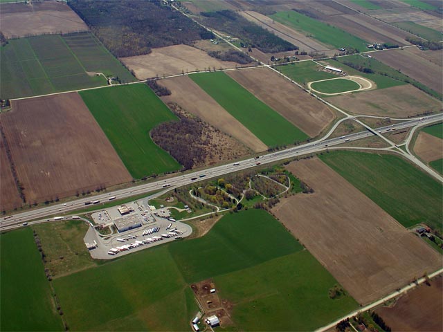 |
| Township of South-West Oxford County of Oxford |
Looking southerly towards the eastbound Service Centre at Beachville.
Both the westbound and eastbound service centre's offer travelers a Wendy's
Tim Horton's, and an Esso gas station. The westbound centre also
features a Mr. Sub and a Nicolby's Express. Photo taken: April 28th, 2006. Size: 50kb. |
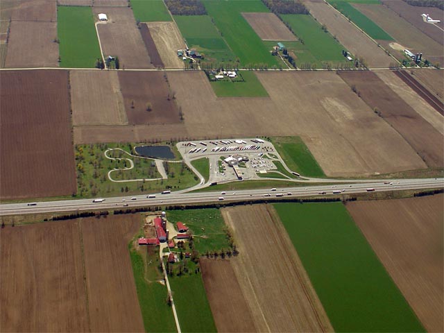 |
| Township of South-West Oxford County of Oxford |
A close up perspective of the eastbound service centre at Beachville. Photo taken: April 28th, 2006. Size: 60kb. |
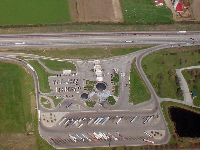 |
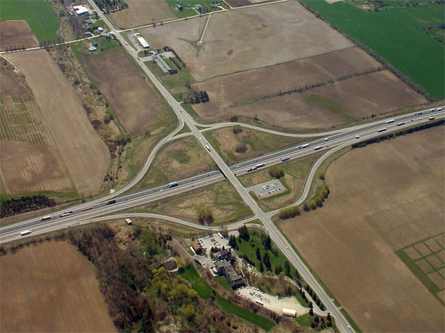
| Township of South-West Oxford County of Oxford |
Looking down upon the overpass where Dodge Line crosses Highway 401 just
west of Woodstock. Photo taken: April 28th, 2006. Size: 55kb. |
 |
| South-West Oxford - Woodstock
Boundary County of Oxford |
Looking down upon the Sweaburg Road interchange in Western Woodstock.
Sweaburg Road is located at kilometre marker 230. Photo taken: April 28th, 2006. Size: 60kb. |
 |
| South-West Oxford - Woodstock
Boundary County of Oxford |
Looking southeast at the 401/Sweaburg Road interchange. Before the
Sweaburg Road interchange was reconstructed in the early 1990s, the exit
ramps followed much of the pre-401 Sweaburg Road alignment (visible on the
near side of the current road in the photo) and met the 401 with very tight
corners (much like the sharp ramps at the nearby Towerline Road
interchange). Photo taken: April 28th, 2006. Size: 70kb. |
 |
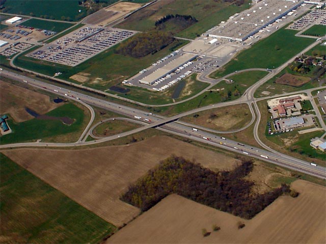
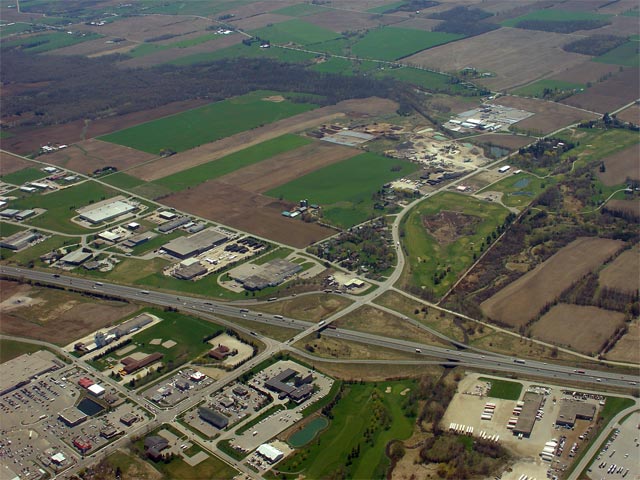
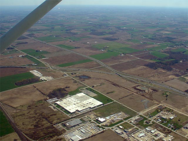
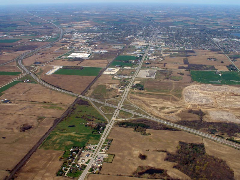
| City of Woodstock |
Looking west towards the Highway 59 and Highway
403 interchanges. Highway 401 skirts around the south side of
Woodstock. Photo taken: April 28th, 2006. Size: 75kb. |
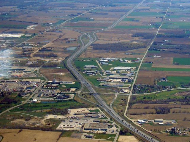 |
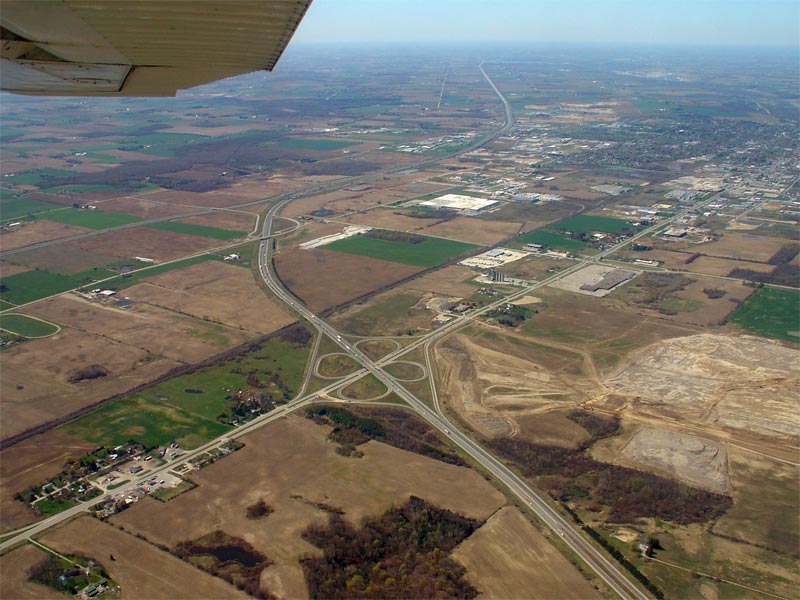
| City of Woodstock |
Looking south towards the Highway 59/401 interchange. Before Highway
401 was six-laned in the early 1990s, Highway 59 met the 401 at a very tight
cloverleaf interchange. Unlike most other cloverleaf's that were
converted to diamonds, the remaining ramps at this interchange were fairly
heavily realigned. Photo taken: April 28th, 2006. Size: 75kb. |
 |
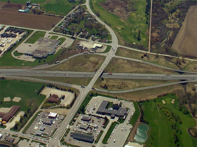
| City of Woodstock |
Another view of the Highway 59/401 interchange. Highway 401 was
widened to six lanes through Woodstock in 1992. Photo taken: April 28th, 2006. Size: 75kb. |
 |
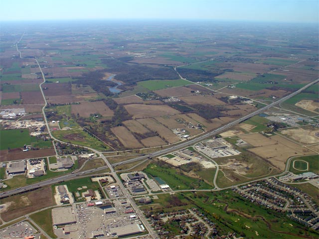
| City of Woodstock |
Looking southerly overtop Woodstock at Highway 401 and both the Highway 59
and Sweaburg Road interchanges. Photo taken: April 28th, 2006. Size: 65kb. |
 |
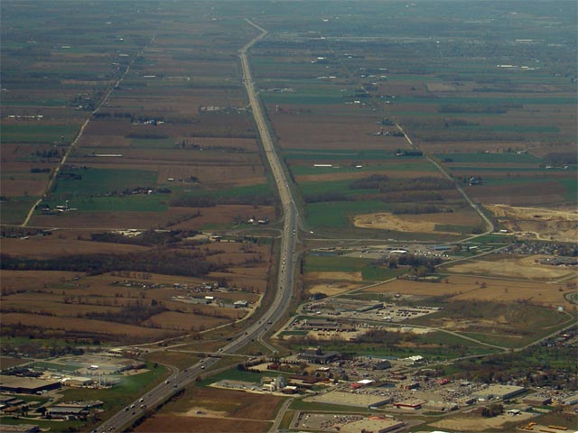
| City of Woodstock | Looking westerly along Highway 401 from overtop
of the Highway 59 interchange. Highway 401 disappears from view at
roughly the Middlesex County Line. Photo taken: April 28th, 2006. Size: 55kb. |
 |
| City of Woodstock |
Looking southerly overtop Woodstock at Highway 401 and both the Highway 59
and Sweaburg Road interchanges. Photo taken: April 28th, 2006. Size: 65kb. |
|
| City of Woodstock | Looking westerly along Highway 401 from overtop
of the Highway 59 interchange. Highway 401 disappears from view at
roughly the Middlesex County Line. Photo taken: April 28th, 2006. Size: 55kb. |
|
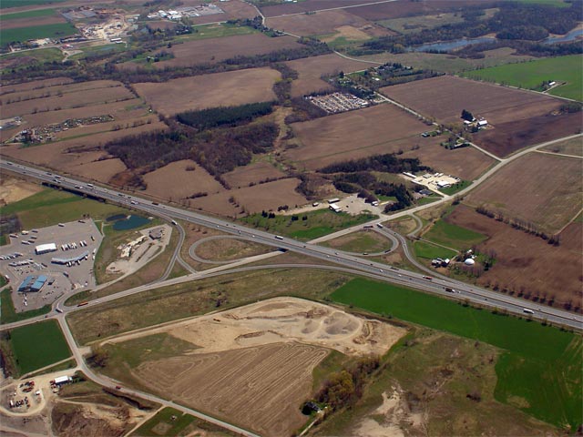
| Woodstock - Norwich -
Blandford-Blenhiem Boundary County of Oxford |
Looking southeasterly towards both the Highway
403 interchange (right) and Towerline Road interchange (left). Photo taken: April 28th, 2006. Size: 60kb. |
 |
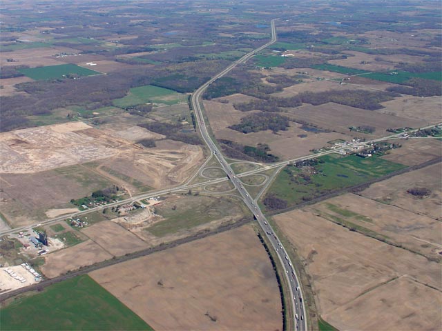
| Norwich - Blandford-Blenhiem
Boundary County of Oxford |
Looking down upon the Highway 401/Towerline Road interchange. This
interchange will be reconfigured to a more standard and modern interchange
starting this year. This work is part of the project to widen Highway
401 to 6-lanes from Highway 403 easterly to
just east of Highway 2. Photo taken: April 28th, 2006. Size: 45kb. |
 |
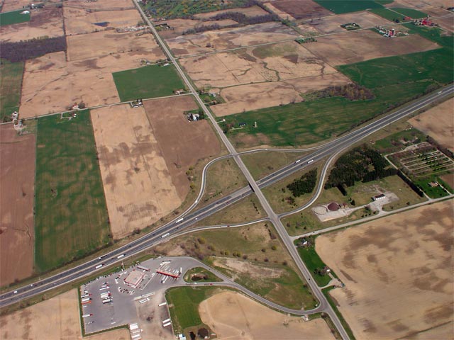
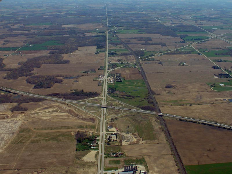
| Norwich - Blandford-Blenhiem
Boundary County of Oxford |
Looking northeasterly towards the Highway 2/401
cloverleaf. Highway 401 will be widened to 6-lanes from
Highway 403 to roughly the start of the
grassed median beyond the Highway 2
interchange. Photo taken: April 28th, 2006. Size: 60kb. |
 |
| Norwich - Blandford-Blenhiem
Boundary County of Oxford |
Looking east through the Highway 2/401
cloverleaf. This is the last example of two divided highways meeting
at a cloverleaf interchange in Ontario. Construction is currently
underway to reconstruct this interchange into a standard 5-ramp parclo. Photo taken: April 28th, 2006. Size: 85kb. |
 |
| Norwich - Blandford-Blenhiem
Boundary County of Oxford |
A zoomed in perspective of the Highway 2/401
cloverleaf interchange looking southeast. Photo taken: April 28th, 2006. Size: 75kb. |
 |
| Norwich - Blandford-Blenhiem
Boundary County of Oxford |
Looking southeasterly through the Highway 2/401.
This photo shows the western extent of the 1930s divided
Highway 2, as well as the Highway 53/403
interchange in the distance. Photo taken: April 28th, 2006. Size: 110kb. |
 |
| Norwich - Blandford-Blenhiem
Boundary County of Oxford |
Looking westerly through the Highway 2/401
cloverleaf. Notice the large cleared area in the upper right of this
photo. This is the future site of a Toyota manufacturing facility. Photo taken: April 28th, 2006. Size: 105kb. |
 |
| Norwich - Blandford-Blenhiem
Boundary County of Oxford |
Looking southwesterly towards the Highway 2/401
cloverleaf. Notice the construction in the nearest quadrant of the
interchange. Temporary ramps are being constructed while the
Highway 2 and CNR overpasses are being
replaced and rehabilitated during the 6-laning project. Photo taken: April 28th, 2006. Size: 95kb. |
 |
<- Page 4 Images Highway 401 Images Index Page 6 Images ->
<- Highway 400 Images Back to Highway 401 Highway 402 Images ->
Copyright (c) 2004-2017, AsphaltPlanet.ca AsphaltPlanet@asphaltplanet.ca
