AsphaltPlanet.ca > OntHighways > Highway 11 > Images
< Hwy 10    Hwy 11A >

King's Highway 11 - www.OntHighways.com

Highway 11 is a long highway that runs from Toronto to Rainy River via Cochrane and Thunder Bay.  Highway 11 passes through densely populated southern Ontario, and through some very remote regions of northern Ontario, and Northwestern Ontario.  The route through Northern Ontario (Nipigon to North Bay) is for the most part lightly traveled, however, because of its overall flat terrain, it is the preferred truck route across northern Ontario.  In northwestern Ontario (Shabaqua Corners to Fort Francis) Highway 11 sees very little traffic, in fact, it is one of the least traveled primary highways in Ontario.

Most of this long highway was untouched by provincial downloading.  Only the southern 99 km of Highway 11 from Toronto to Crown Hill reverted to local control.  Despite the historical significance of this section of 11 (particularly where it was know as Yonge Street), this download was fairly logical.  Much of Highway 11south of Crown Hill had become congested urban streets.


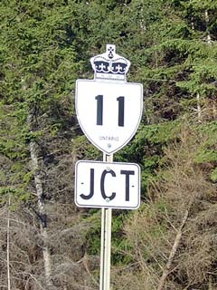
JCT King's Highway 11.


Southern Terminus: Pre-1997:  At Lakeshore Boulevard / Gardiner Expressway (Highway 2) in downtown Toronto.
                                         Currently:  At the Highway 400 extension split near Crown Hill, just north of Barrie.

Western Terminus:  At the Ontario - Minnesota border in Rainy River Ontario.

Length:  Pre-1997: 1883.5 km.  Current: 1784.2 km.

Multiplexes:  In Central Ontario Highway 11 is multiplexed with Highway 12 for 2.4 km, and with Highway 17 for 4.7 km.  In Northeastern Ontario there is a 2.7 km multiplex with Highway 65 near New Liskeard, a 6.4 km cosign with Highway 101 and a 1.3 km with co-designation with Highway 583.  Before 1998 there was also a 2.6 km multiplex with Highway 67 and a 300m multiplex with Highway 577.  In Northwestern Ontario there is a 187 km cosign with Highway 17 in the Thunder Bay area, a 2.8 km multiplex with Tertiary Road 802, and a 41 km multiplexed with Highway 71 near Fort Francis.  There is also a triple cosign with Highways 11/71 and Highway 611 for 2.0 km near Fort Francis.

Freeway:  Mixed expressway / freeway from Crown Hill to North Bay.  Highway 11 is an urban (undivided) expressway concurrent with Highway 17 in Thunder Bay.

Trans-Canada Highway:  11 is part of the Trans-Canada Highway network between Shabaqua Corners and North Bay.  From Nipigon to North Bay, it makes up the Northern Ontario Route.  Concurrent with Highway 17 in Thunder Bay it is part of the Lake Superior Route, it is part of the Ottawa Valley Route in North Bay.  Before the designation was discontinued, Highway 11 was also part of the Voyageur Route, that ran from Shabaqua Corners to Kenora via Emo, and Highway 71.

AADT  (2002):  Highest: 34,100 from Highway 93 (Simcoe Road 93) to Oro-Medonte Road 4;

                              Lowest: 710 from the Kashabowie River bridge to Secondary Highway 633.


Highway 11 information:


OntHighways.com  

Detailed Route information:

Page 1 (Toronto - Highway 93, Crown Hill)
Page 2 (Crown Hill - Highway 17, North Bay)

Page 3 (North Bay - Highway 579/652, Cochrane)
Page 4 (Cochrane to Highway 17, Nipigon)

Page 5 (Nipigon to Highway 17, Rainy River)

Virtual Tour and other photos index
- Images Page 1 - Toronto to Bradford


TheKingsHighway.ca   History of Highway 11
Photographic History of Highway 11

<- Highway 10         www.OntHighways.com - Home         Highway 11A ->


Copyright (c) 2004-2010, AsphaltPlanet.ca  AsphaltPlanet@asphaltplanet.ca

Page last updated:  January 10th, 2007

Page created:  February 10th, 2004