AsphaltPlanet.ca > California > SR-58
Pictures on this page are arranged in order from west to east. CA-58 East photos are left-aligned in the last column, while CA-58 West photos are right-aligned. Center-line pictures are centered within the last column.
|
Location |
Description |
Photo |
||
|
East- |
West- |
|||
| CA-58 ends at US-101 just north of San Louis Obispo. Click here for US-101 Images. | ||||
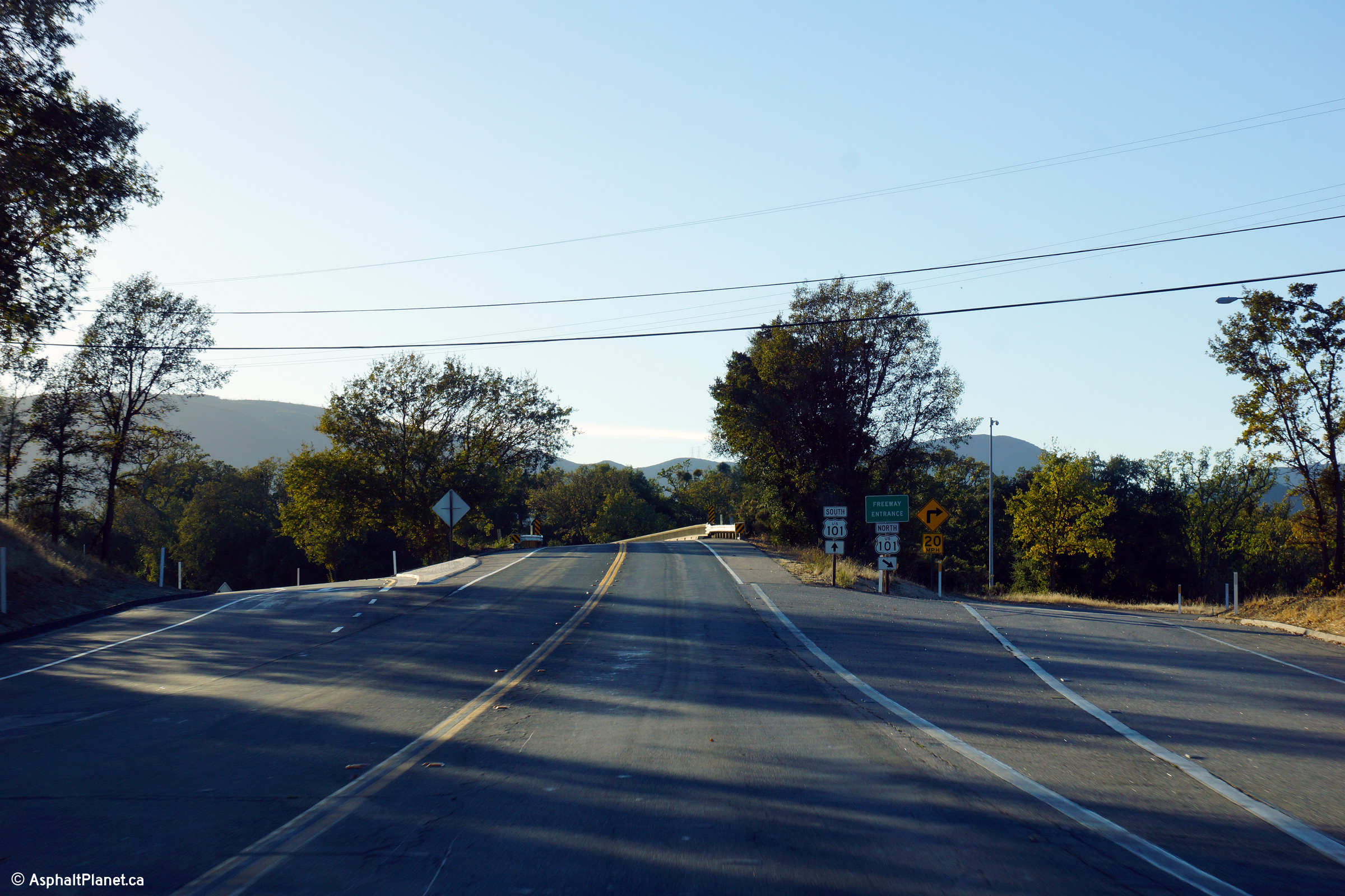
|
San Louis Obispo County |
Westerly view at the western terminus of State Route 58 at the US-101 interchange. |
|
||
|
Date: 4/06/2010 |
High-res: (1440x960) (2400x1600) |
|||
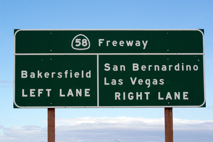
|
Kern County |
Westbound signage along CA-58/99 West at the western split between State Routes 58 and 99. |
|
||
|
Date: 4/06/2010 |
High-res: (1440x960) (2400x1600) |
|||
|
San Bernardino County |
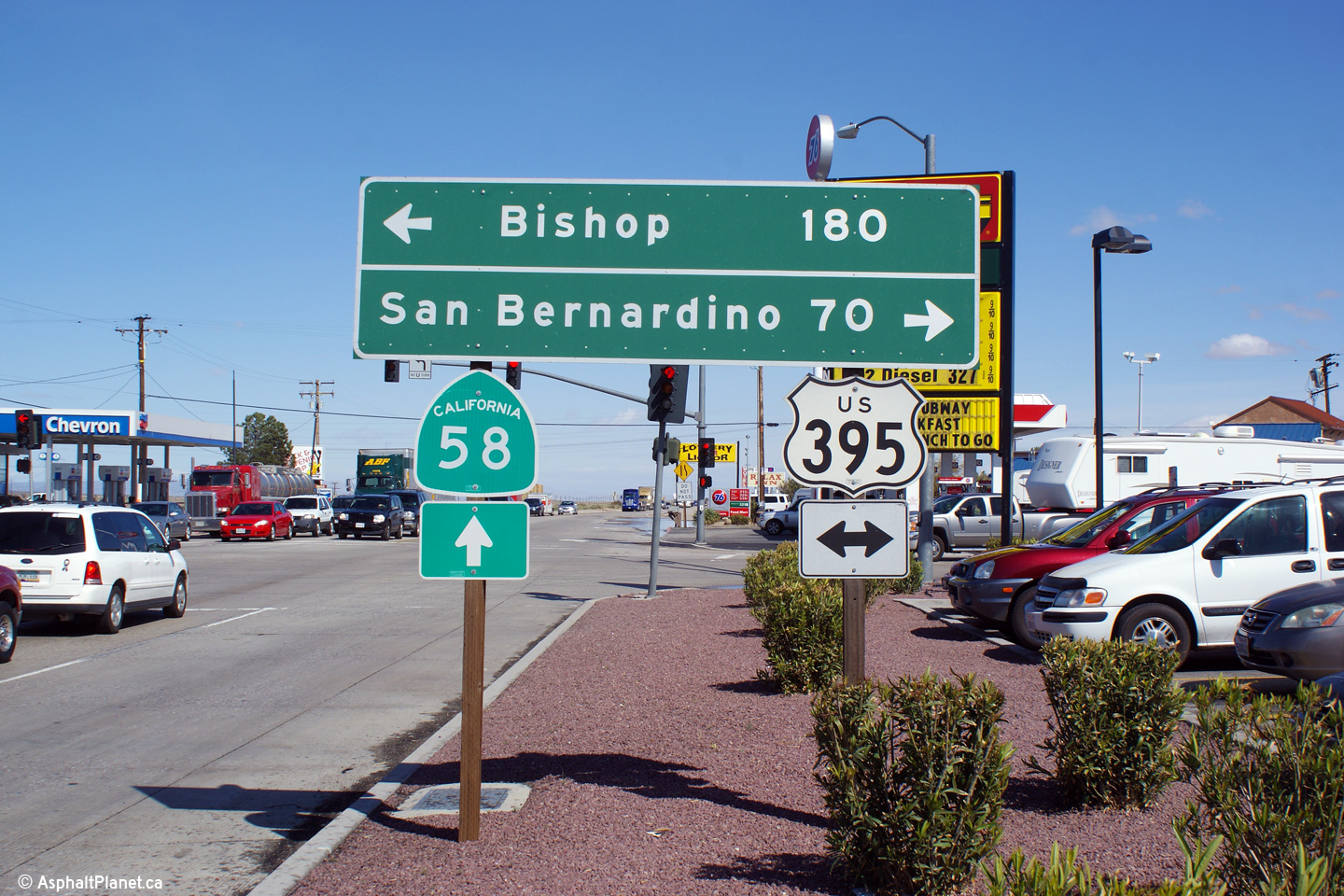
Easterly view as State Route 58 meets US-395 in Kramer Junction. |
 |
||
|
Date: 4/05/2010 |
High-res: (1440x960) (2400x1600) |
|||
|
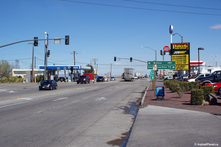
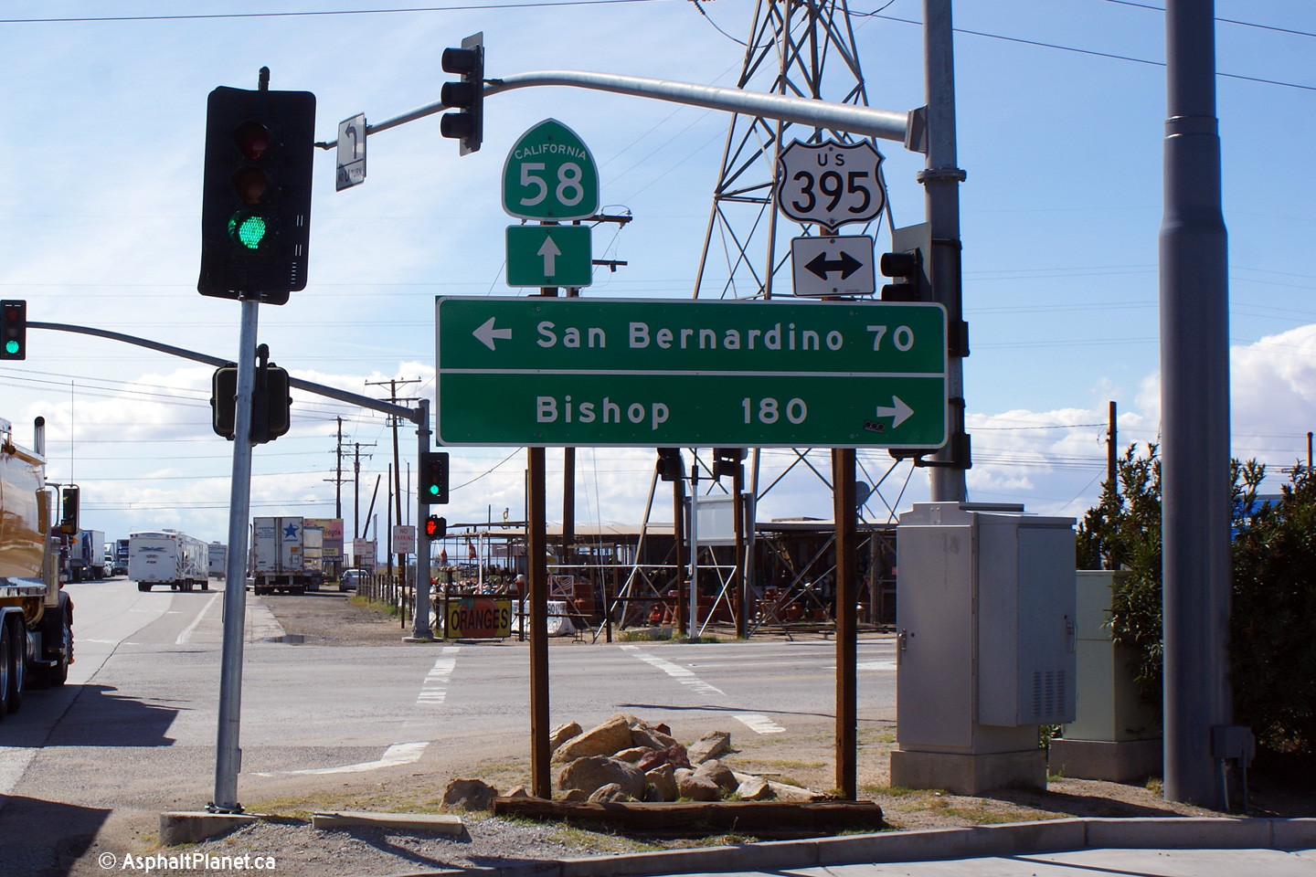
San Bernardino County |
Eastbound signage at US-395 in Kramer Junction. |
 |
||
|
Date: 4/05/2010 |
High-res: (1440x960) |
|||
|
San Bernardino County |
Westbound signage at the US-395 junction. |
|
||
|
Date: 4/05/2010 |
High-res: (1440x960) |
|||
|
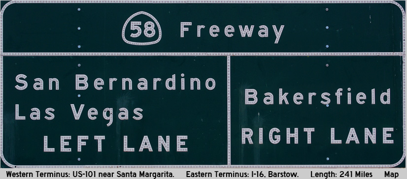
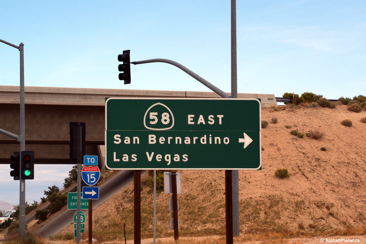
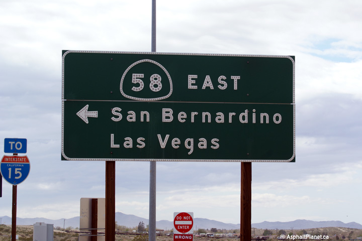
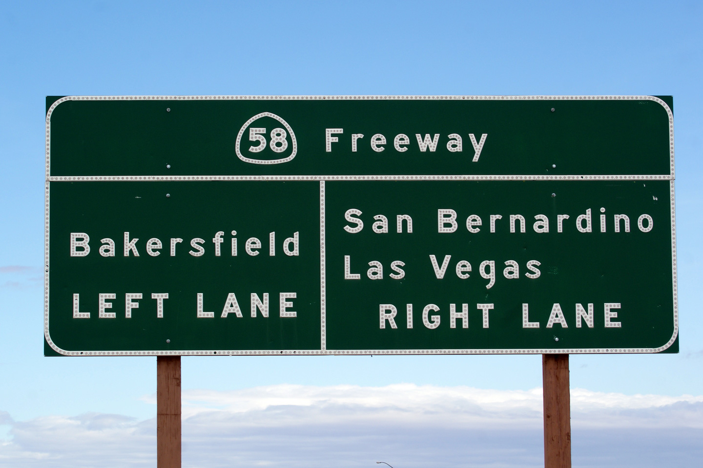
San Bernardino County City of Barstow |
Three signs for the State Route 58 Freeway from Main Street in Barstow. Main Street is the former alignment of US-66 through Barstow. |
|
||
|
High-res: (1440x960) |
||||
 |
||||
|
High-res: (1440x960) |
||||
 |
||||
|
Date: 4/05/2010 |
High-res: (1440x960) |
|||
|
San Bernardino County City of Barstow |
Advanced signage for the I-15 interchange. State Route 58 ends at the I-15 interchange. |
 |
||
|
Date: 4/05/2010 |
High-res: (1440x960) (2400x1600) |
|||
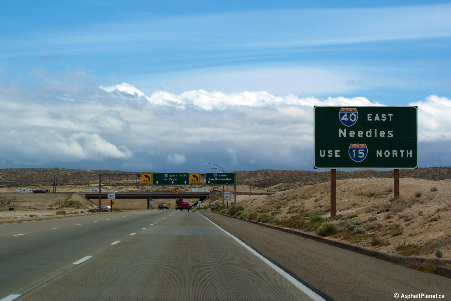
|
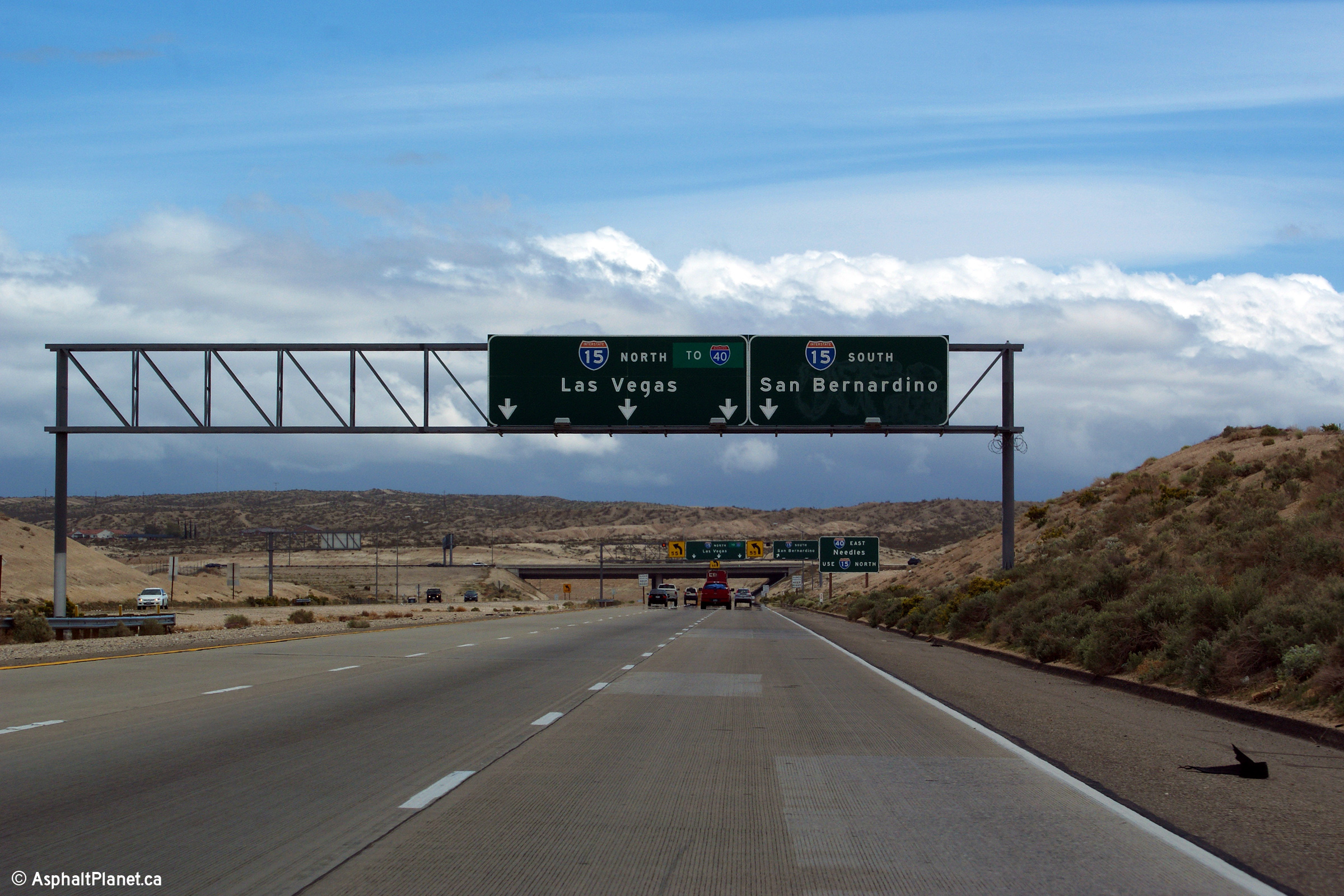
San Bernardino County City of Barstow |
State Route 58 ends at I-15 several miles south of the I-40 interchange in Barstow. This sign directs eastbound traffic bound for I-40 to use I-15 North. |
 |
||
|
Date: 4/05/2010 |
High-res: (1440x960) (2400x1600) |
|||
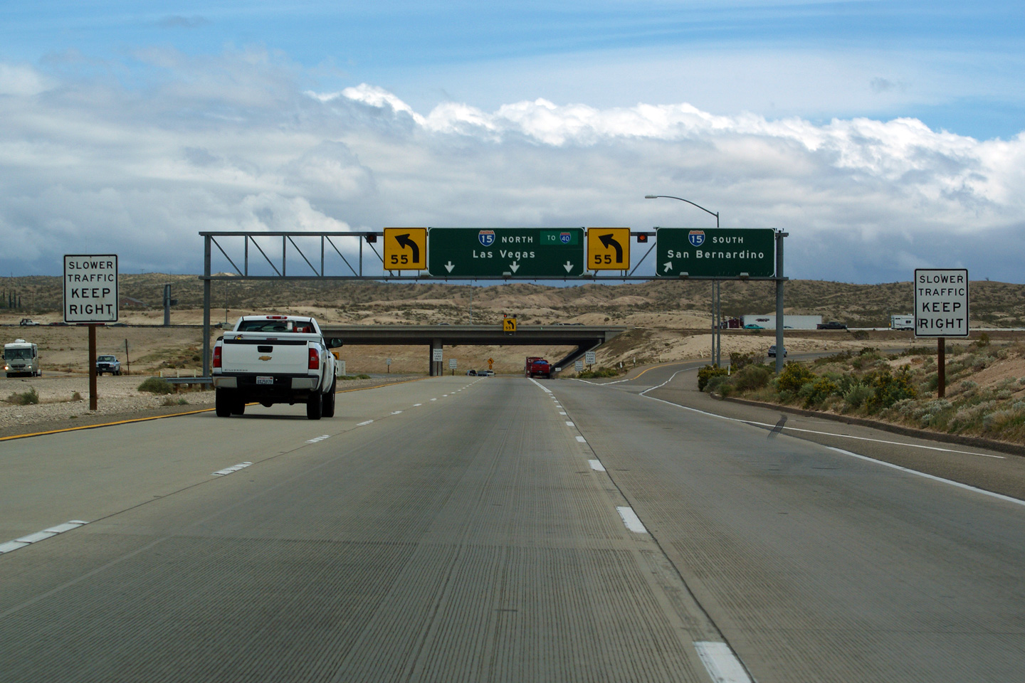
|
San Bernardino County City of Barstow |
Easterly view at the the ramp to I-15 South. Inexplicably, the ramp to I-15 north has three lanes. State Route 58 meets I-15 at a trumpet interchange. |
|
||
|
Date: 4/05/2010 |
High-res: (1440x960) (2400x1600) |
|||
| I-15 leads north-south through the southeastern part of the state of California. Click here for Interstate 15 Images. | ||||
<- CA-57
CA Highways
CA-59 ->
AsphaltPlanet.ca
© 2010 AsphaltPlanet.ca.
Scott@asphaltplanet.ca
Page Created: April 22, 2010.
Last Updated: March 25, 2012.


