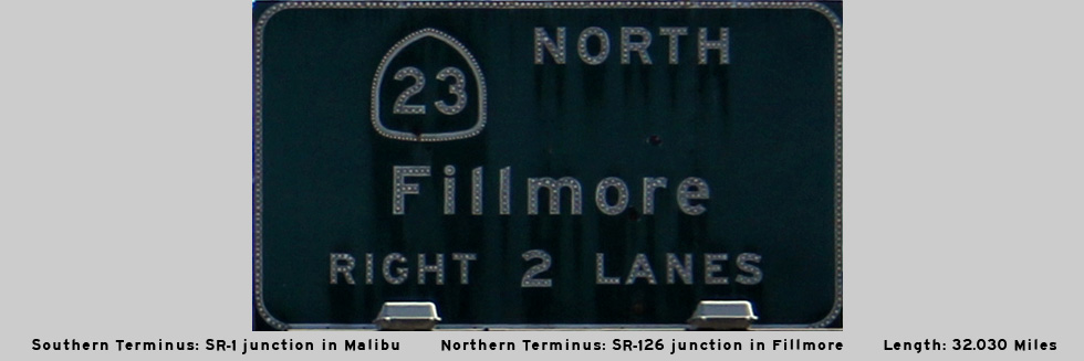
AsphaltPlanet.ca > California > SR-23
Pictures on this
page are arranged in order from south to north. CA-23 North photos are
left-aligned in the last column, while CA-23 South photos are right-aligned.
Center-line pictures are centered within the last column.
|
Location |
Description |
Photo |
||
|
North- |
South- |
|||
| While SR-23 continues south from US-101 through Decker Canyon, the Moorpark Freeway ends at the US-101 interchange. Click here for US-101 Images. | ||||
|
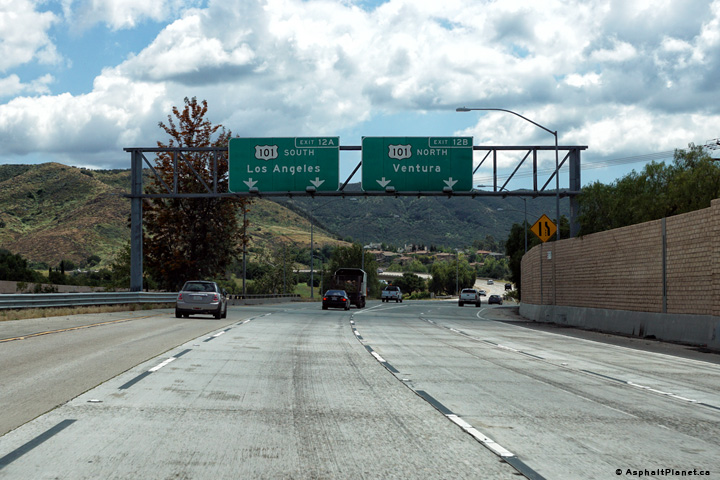
Ventura County |
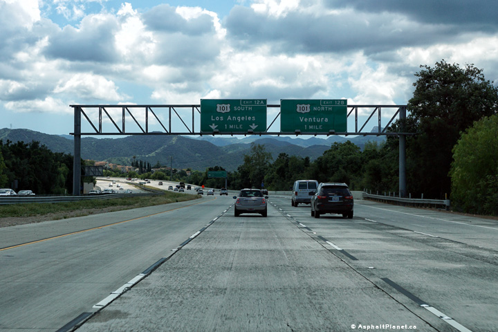
Southerly view along SR-23 at the US-101 interchange. Though it is not indicated on the pictured signage, SR-23 continues southerly along US-101 for a short distance before departing on its own southerly alignment to SR-1 along the Pacific Coast. |
 |
||
|
Date: 04/11/2016 |
High-res: (1440x960) (2400x1600) | |||
|
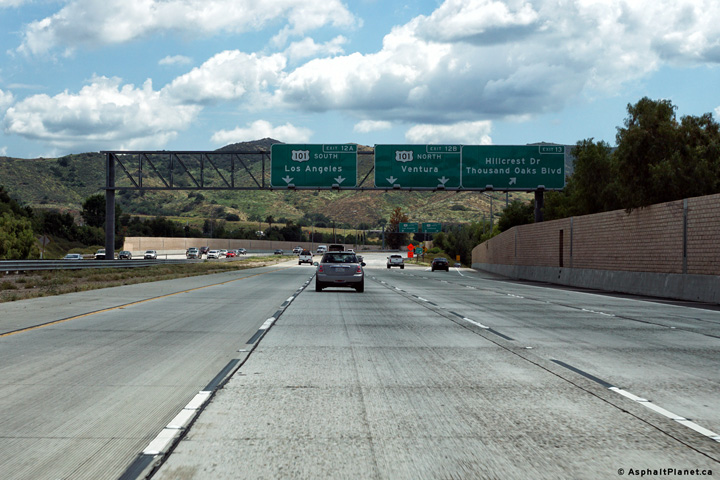
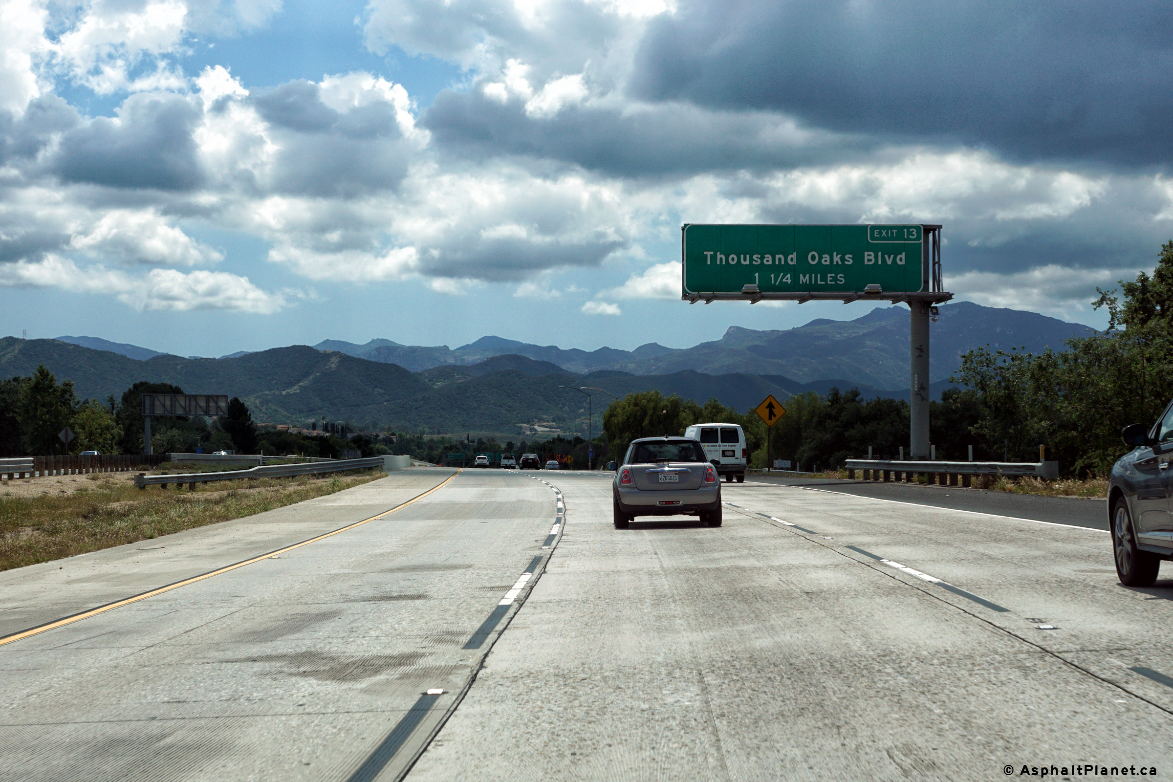
Ventura County |
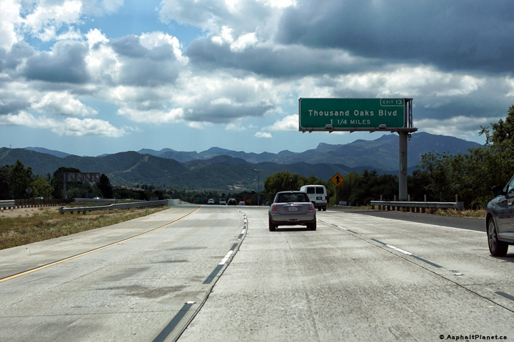
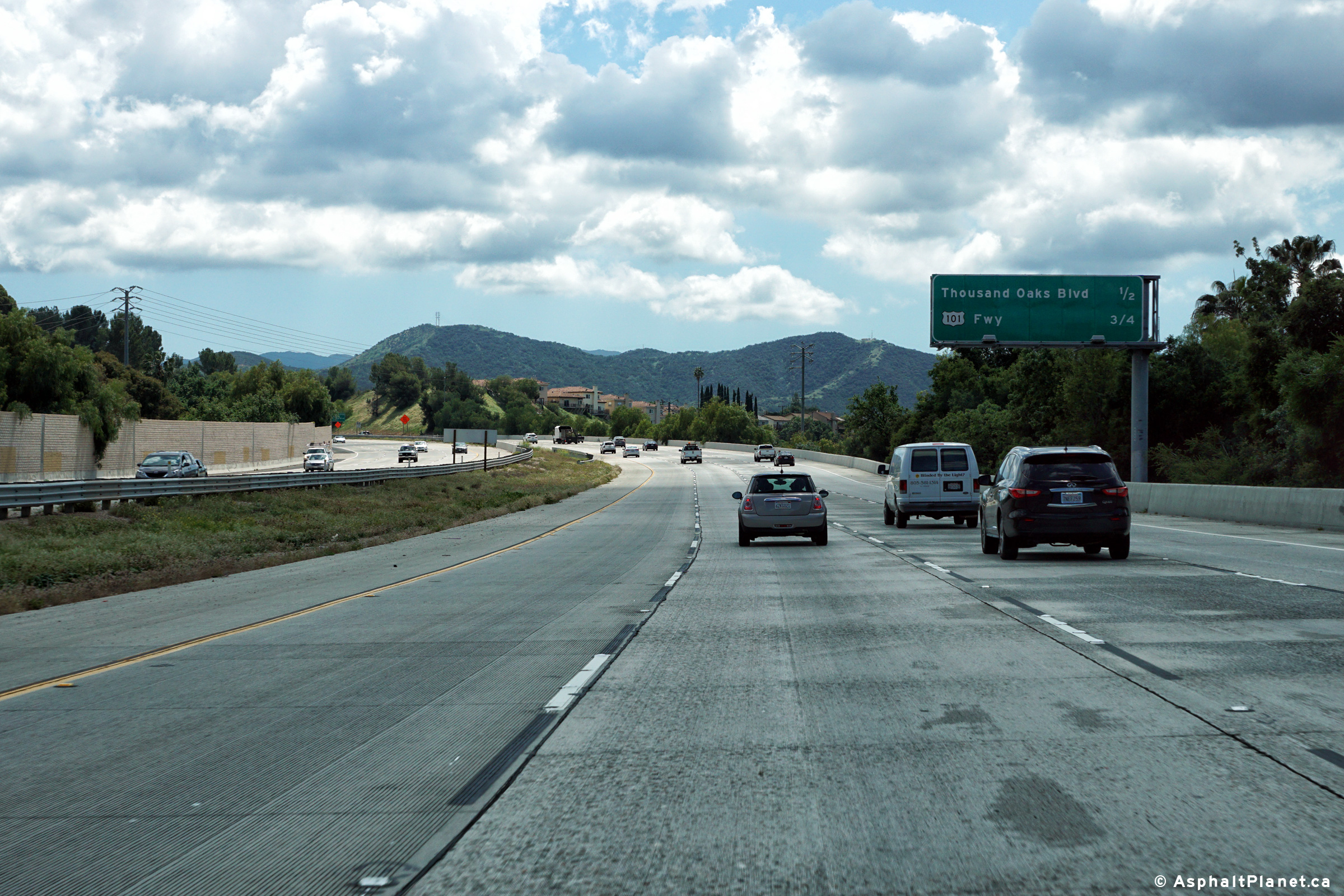
Southerly view along SR-23 at the off-ramp to Hillcrest Drive and Thousand Oaks Boulevard. |
 |
||
|
Date: 04/11/2016 |
High-res: (1440x960) (2400x1600) | |||
|
Ventura County |
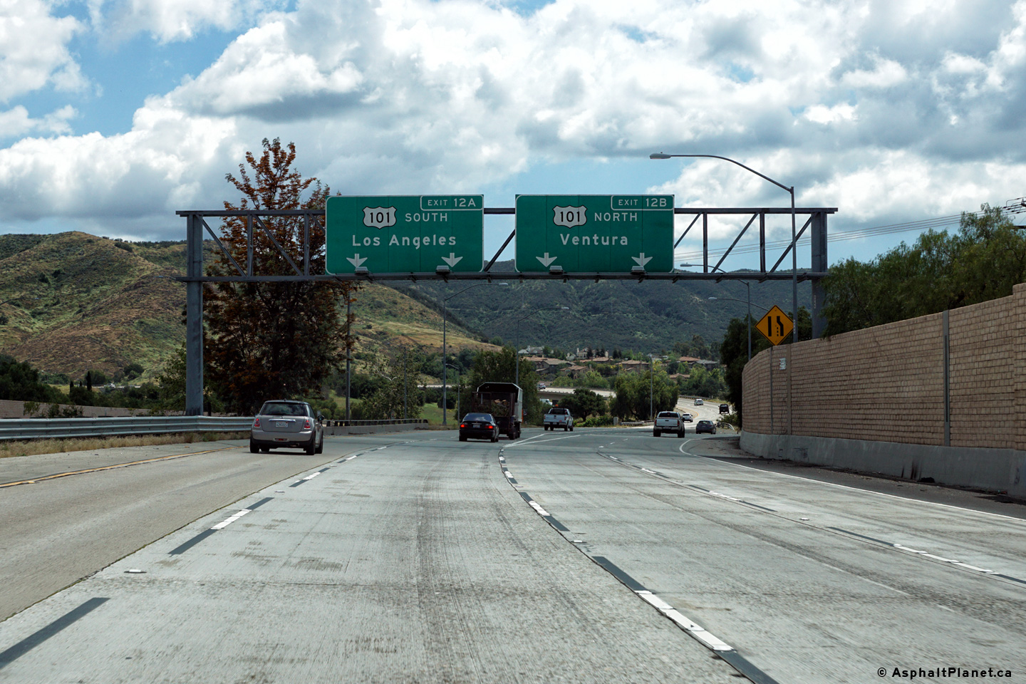
Southbound interchange sequence signage in advance of the Thousand Oaks Boulevard interchange. |
 |
||
|
Date: 04/11/2016 |
High-res: (1440x960) (2400x1600) | |||
|
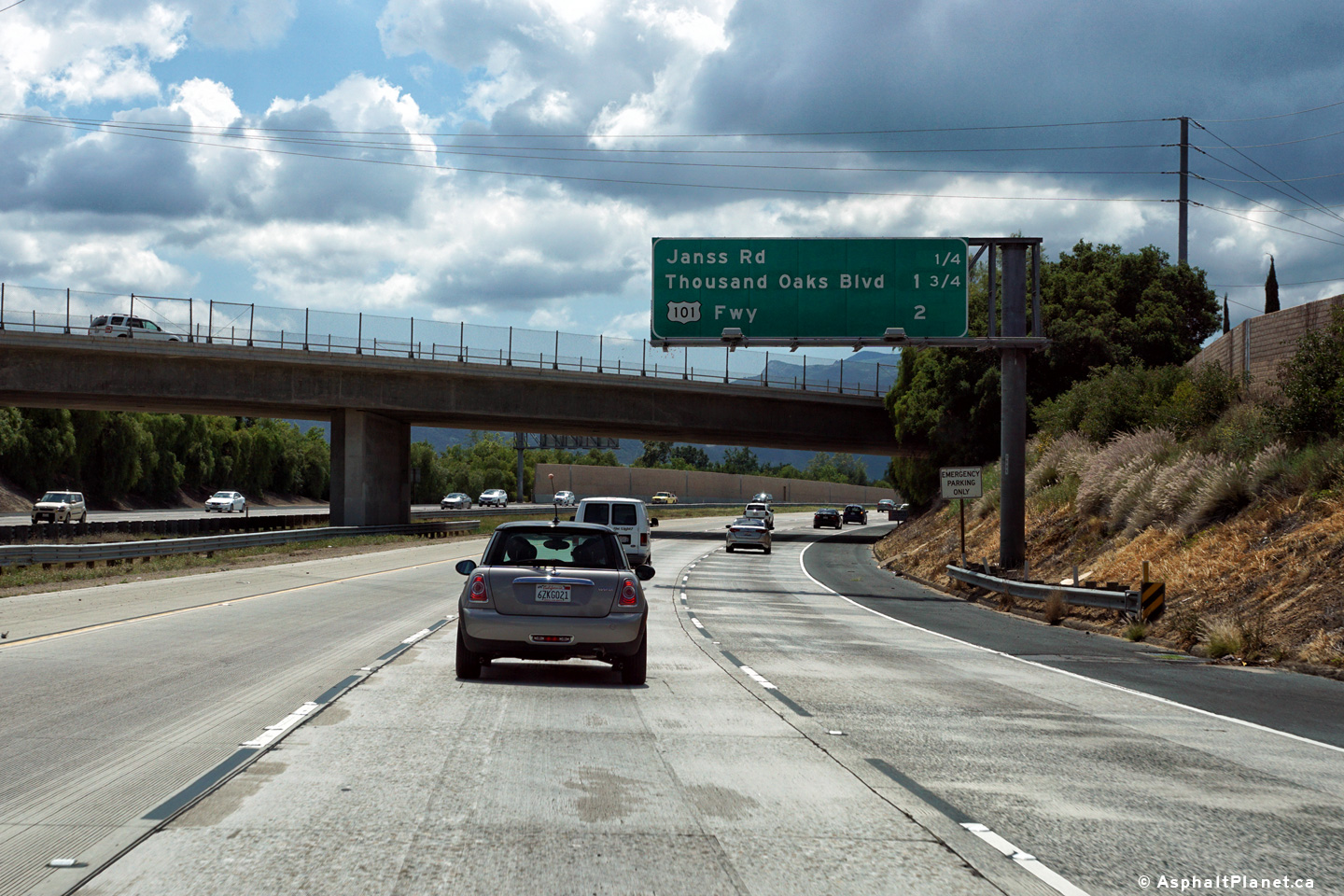
Ventura County |
Advanced lane assignment signage along SR-23 approximately 1 mile north of the US-101 interchange. The southbound approach to US-101 was widened to four southbound lanes during a widening contract that was completed in 2008, which saw an additional northbound and southbound lane constructed along the length of the SR-23 (Moorpark) Freeway. |
 |
||
|
Date: 04/11/2016 |
High-res: (1440x960) (2400x1600) | |||
|
Ventura County |
Northbound interchange sequence signage along California Highway 23 from north of the US-101 and Thousand Oaks Boulevard interchanges. |
 |
||
|
Date: 04/11/2016 |
High-res: (1440x960) (2400x1600) | |||
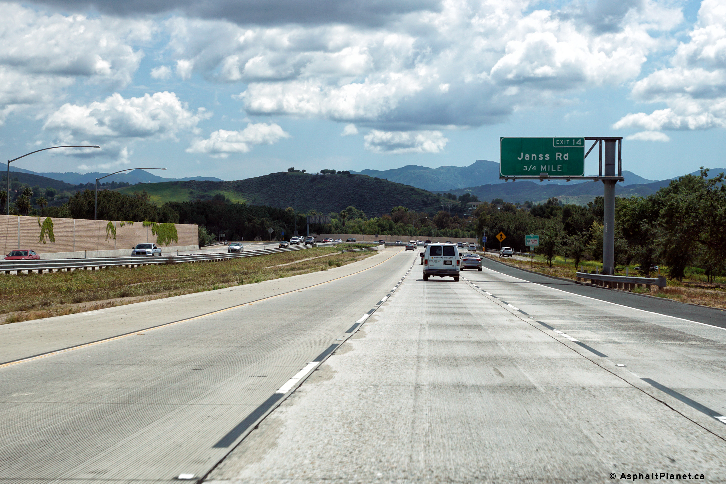
|
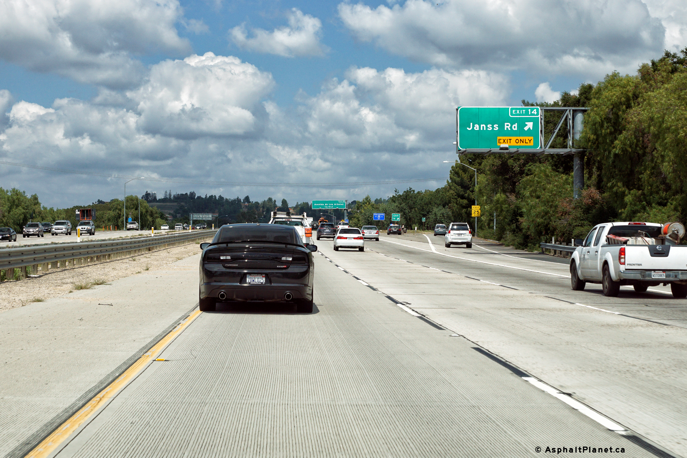
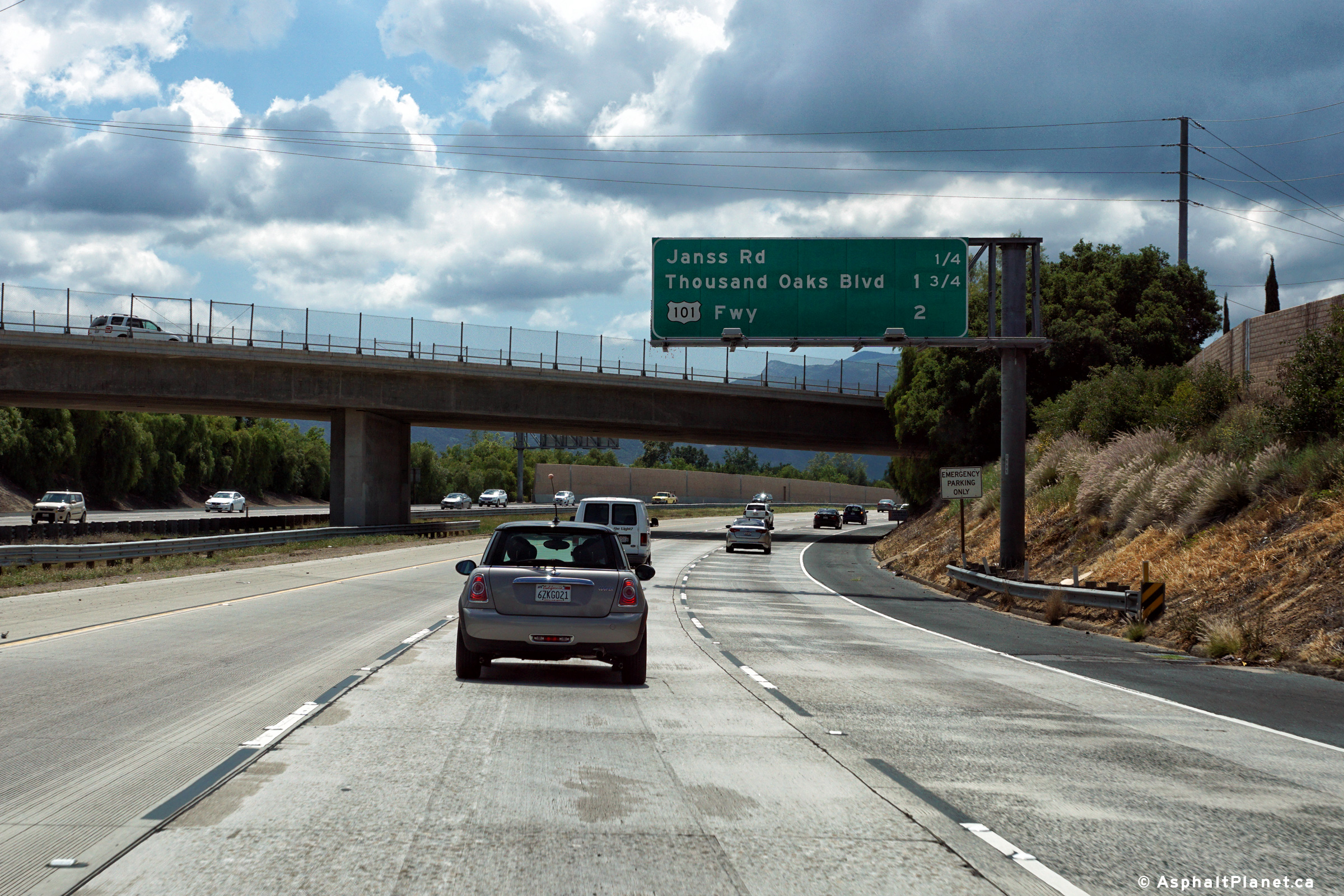
Ventura County |
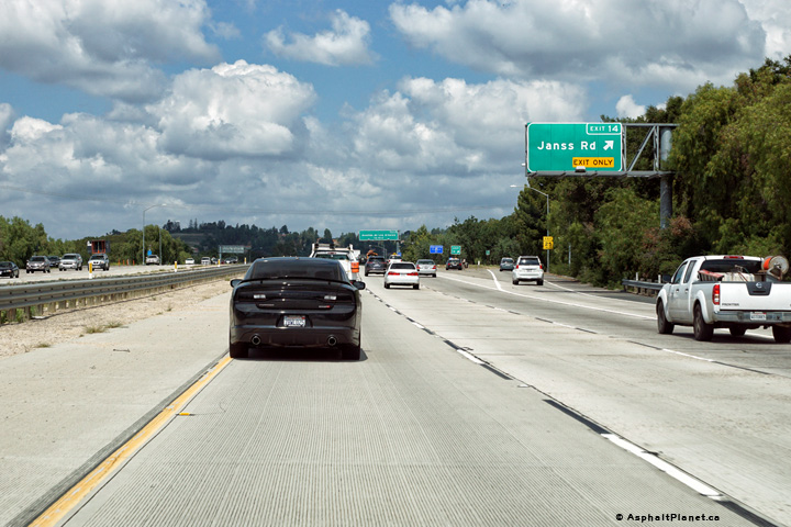
Northerly view at the off-ramp to Janss Road. The fourth northbound lane along the 23 Freeway exits at the Janss Road interchange. Beyond Janss Road, SR-23 has a six lane cross-section northerly to the interchange with SR-118, the Simi Valley Freeway. |
 |
||
|
Date: 04/11/2016 |
High-res: (1440x960) (2400x1600) | |||
|
Ventura County |
Southbound advanced signage for the Thousand Oaks Boulevard interchange. |
 |
||
|
Date: 04/11/2016 |
High-res: (1440x960) (2400x1600) | |||
|
Ventura County |
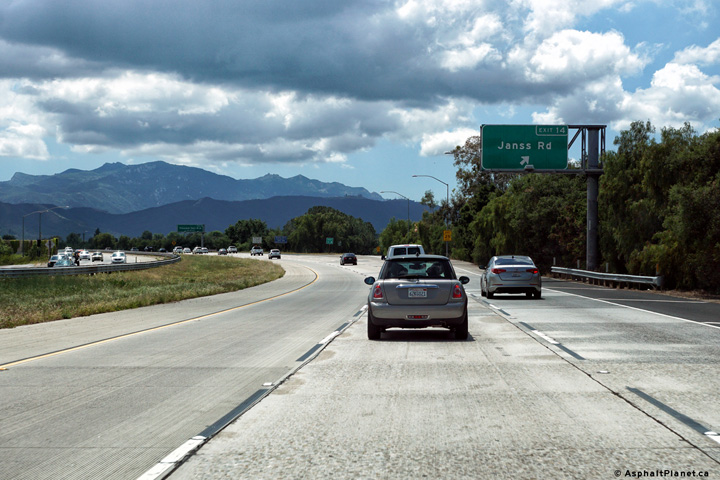
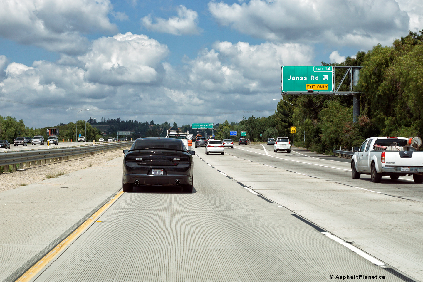
Southbound view at the off-ramp to Janss Road. |
 |
||
|
Date: 04/11/2016 |
High-res: (1440x960) (2400x1600) | |||
|
Ventura County |
Southbound interchange sequence signage in advance of the Janss Road interchange. |
 |
||
|
Date: 04/11/2016 |
High-res: (1440x960) (2400x1600) | |||
|
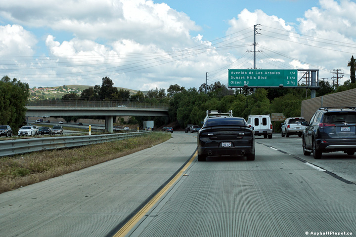
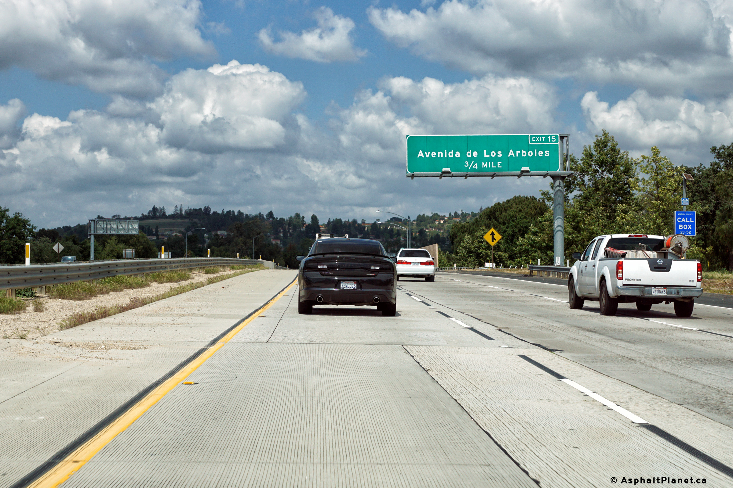
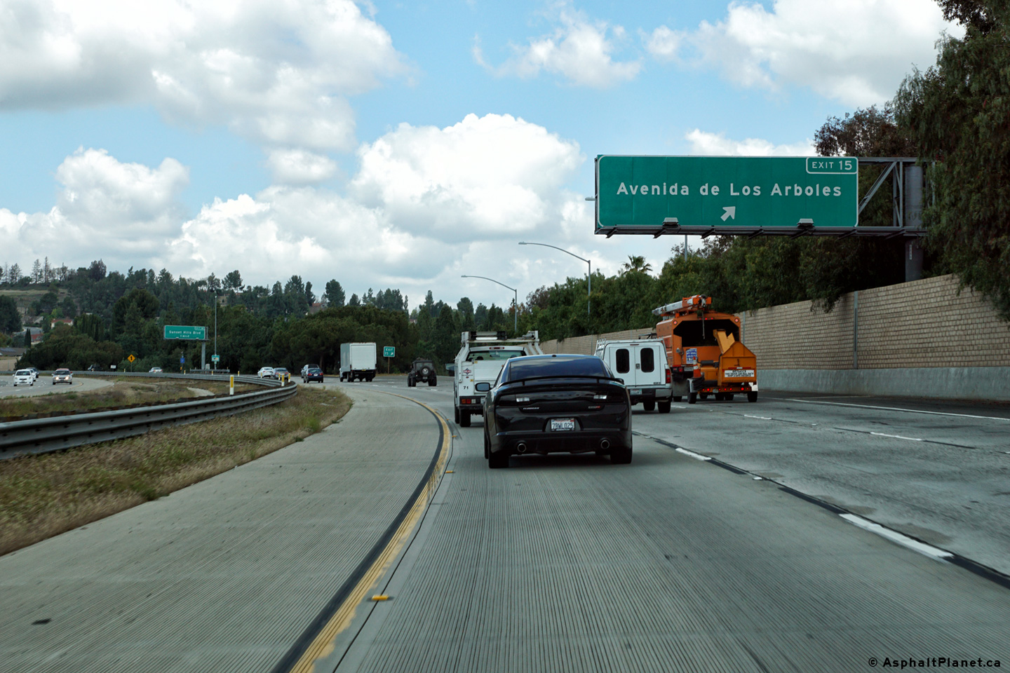
Ventura County |
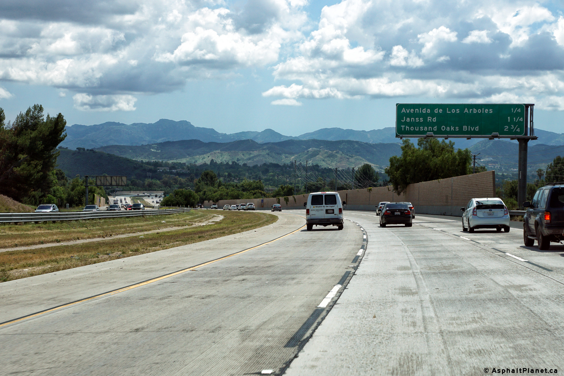
Northbound interchange sequence signage approaching the Avenida de Los Arboles interchange. |
 |
||
|
Date: 04/11/2016 |
High-res: (1440x960) (2400x1600) | |||
|
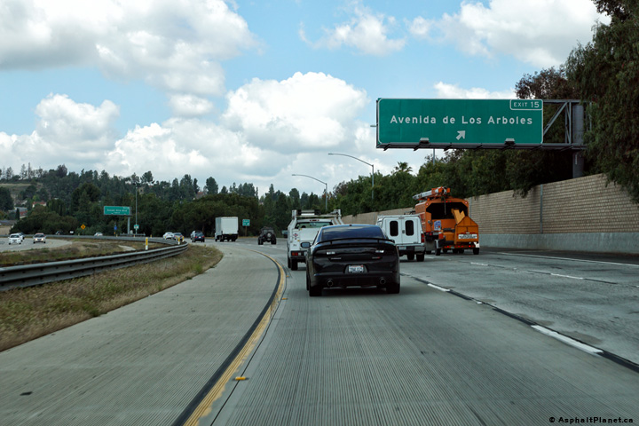
Ventura County |
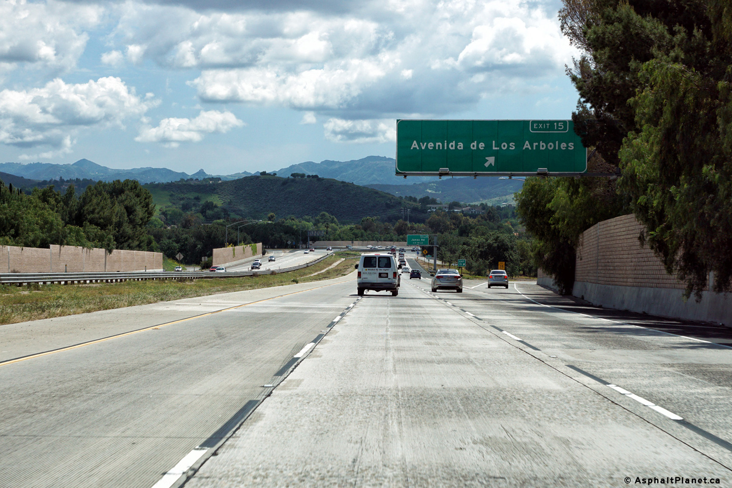
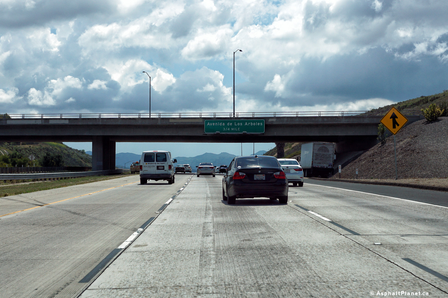
Northerly view at the off-ramp to Avenida de Los Arboles. |
 |
||
|
Date: 04/11/2016 |
High-res: (1440x960) (2400x1600) | |||
|
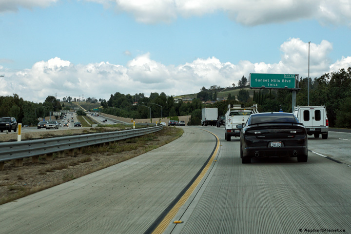
Ventura County |
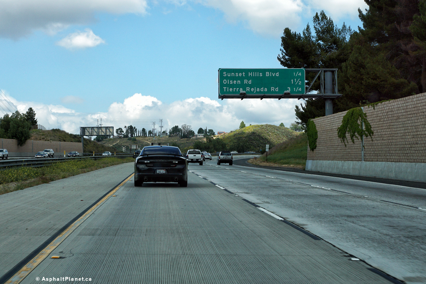
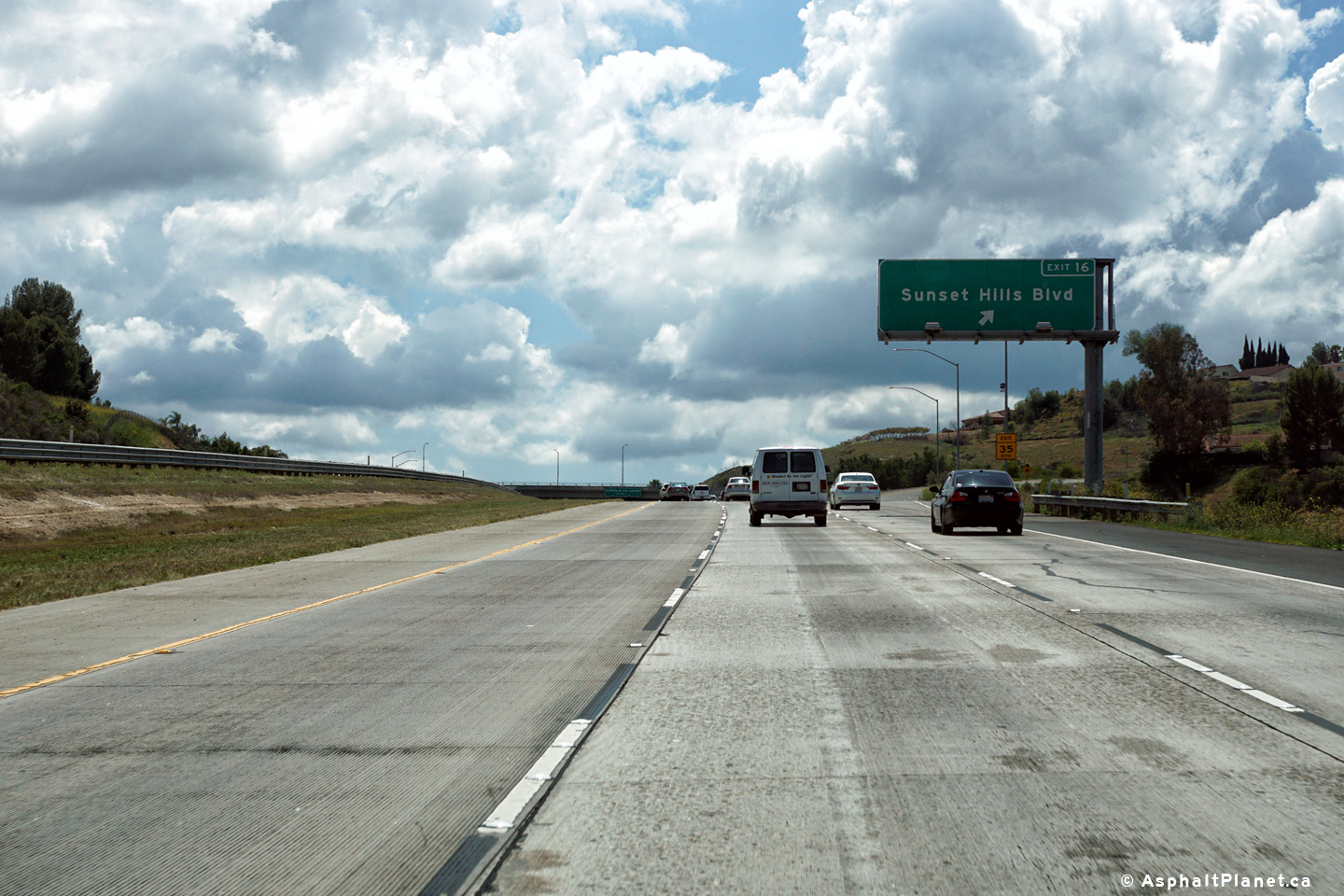
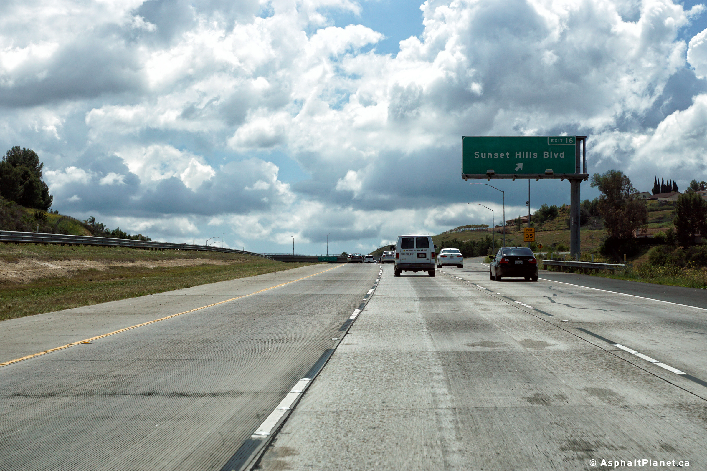
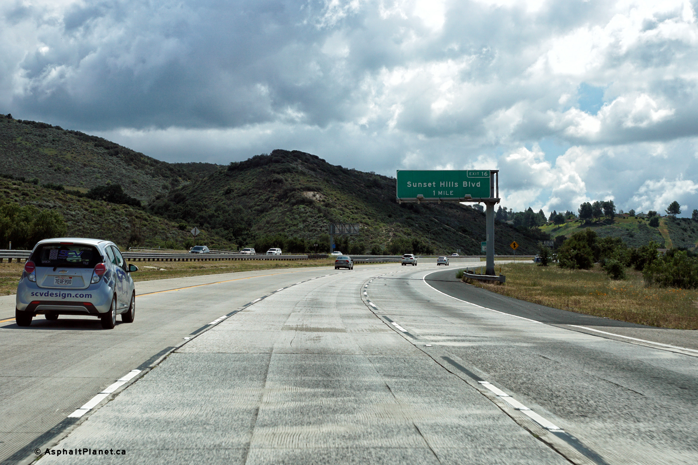
Advanced signage for the Sunset Hills Boulevard interchange. |
 |
||
|
Date: 04/11/2016 |
High-res: (1440x960) (2400x1600) | |||
|
Ventura County |
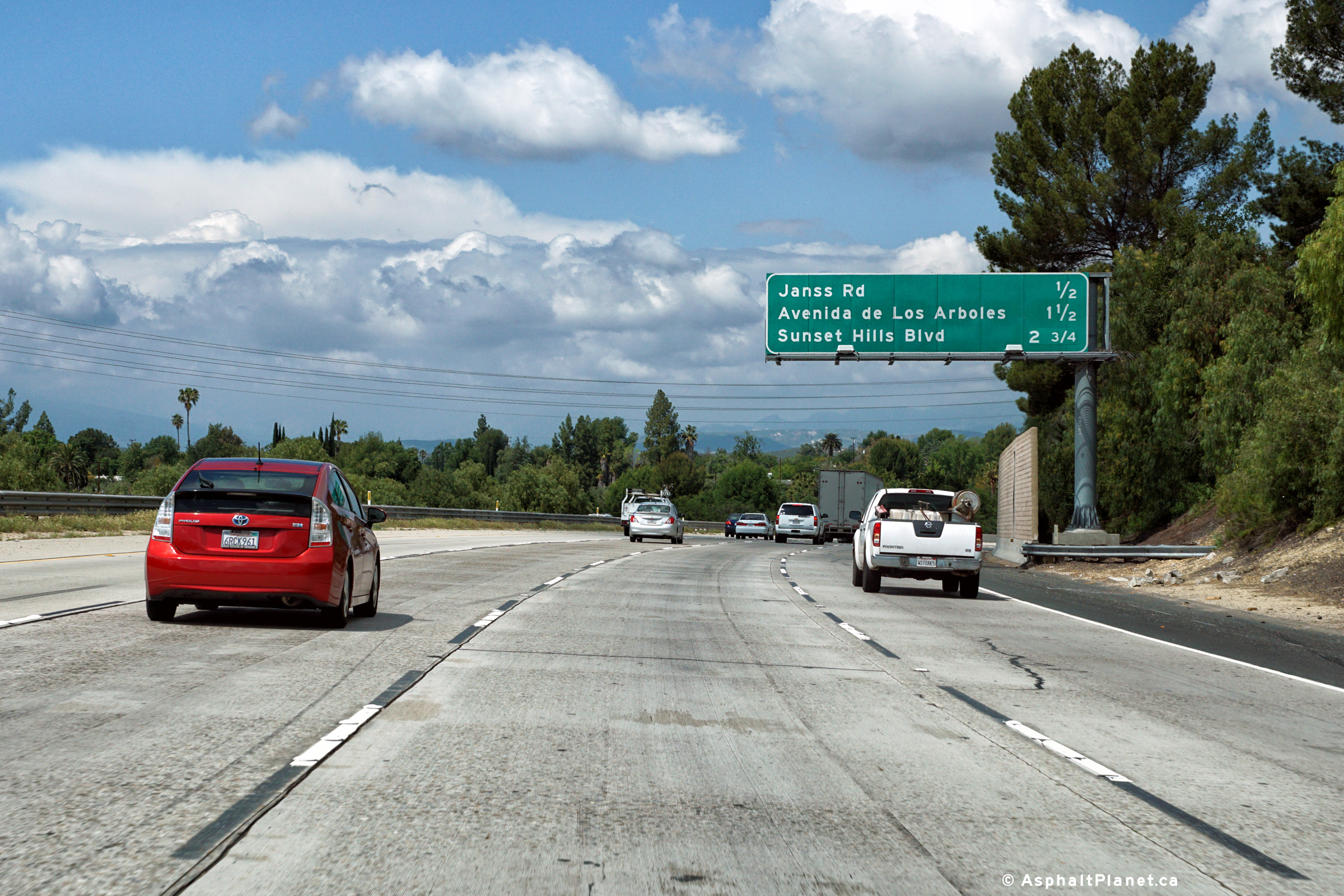
Southbound advanced signage for the Janss Road interchange located just south of the Avenida de Los Arboles interchange. |
 |
||
|
Date: 04/11/2016 |
High-res: (1440x960) (2400x1600) | |||
|
Ventura County |
Southbound signage for the ramp to Avenida de Los Arboles. |
 |
||
|
Date: 04/11/2016 |
High-res: (1440x960) (2400x1600) | |||
|
Ventura County |
Interchange sequence signage in advance of the Avenida de Los Arboles interchange. |
 |
||
|
Date: 04/11/2016 |
High-res: (1440x960) (2400x1600) | |||
|
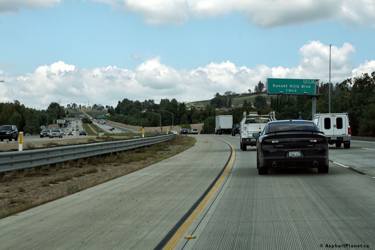
Ventura County |
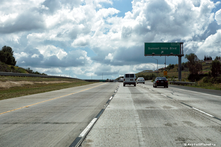
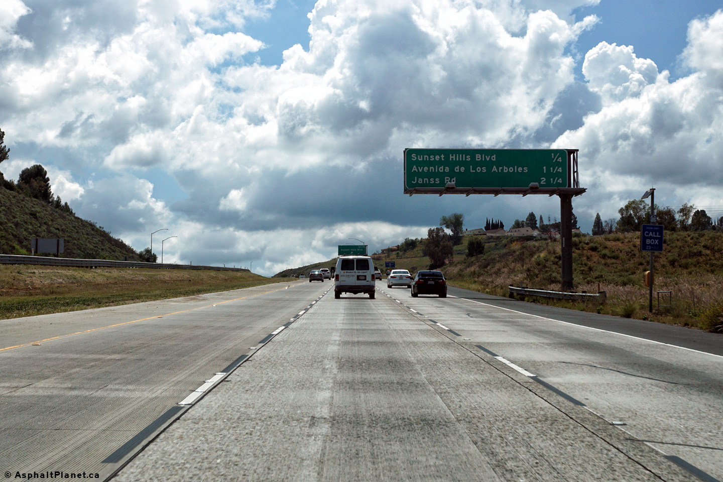
Northbound next exit signage approaching the Sunset Hills Boulevard interchange. |
 |
||
|
Date: 04/11/2016 |
High-res: (1440x960) (2400x1600) | |||
|
Ventura County |
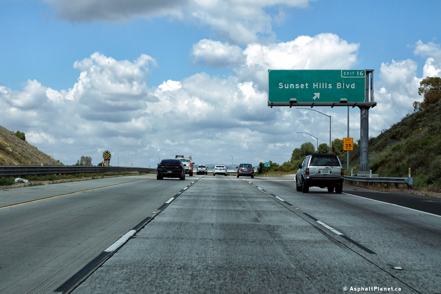
View looking northerly at the Sunset Hills Boulevard interchange. |
 |
||
|
Date: 04/11/2016 |
High-res: (1440x960) (2400x1600) | |||
|
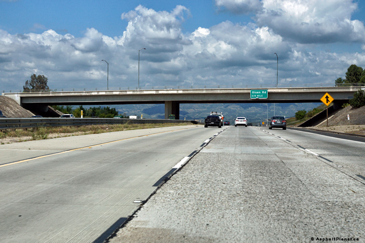
Ventura County |
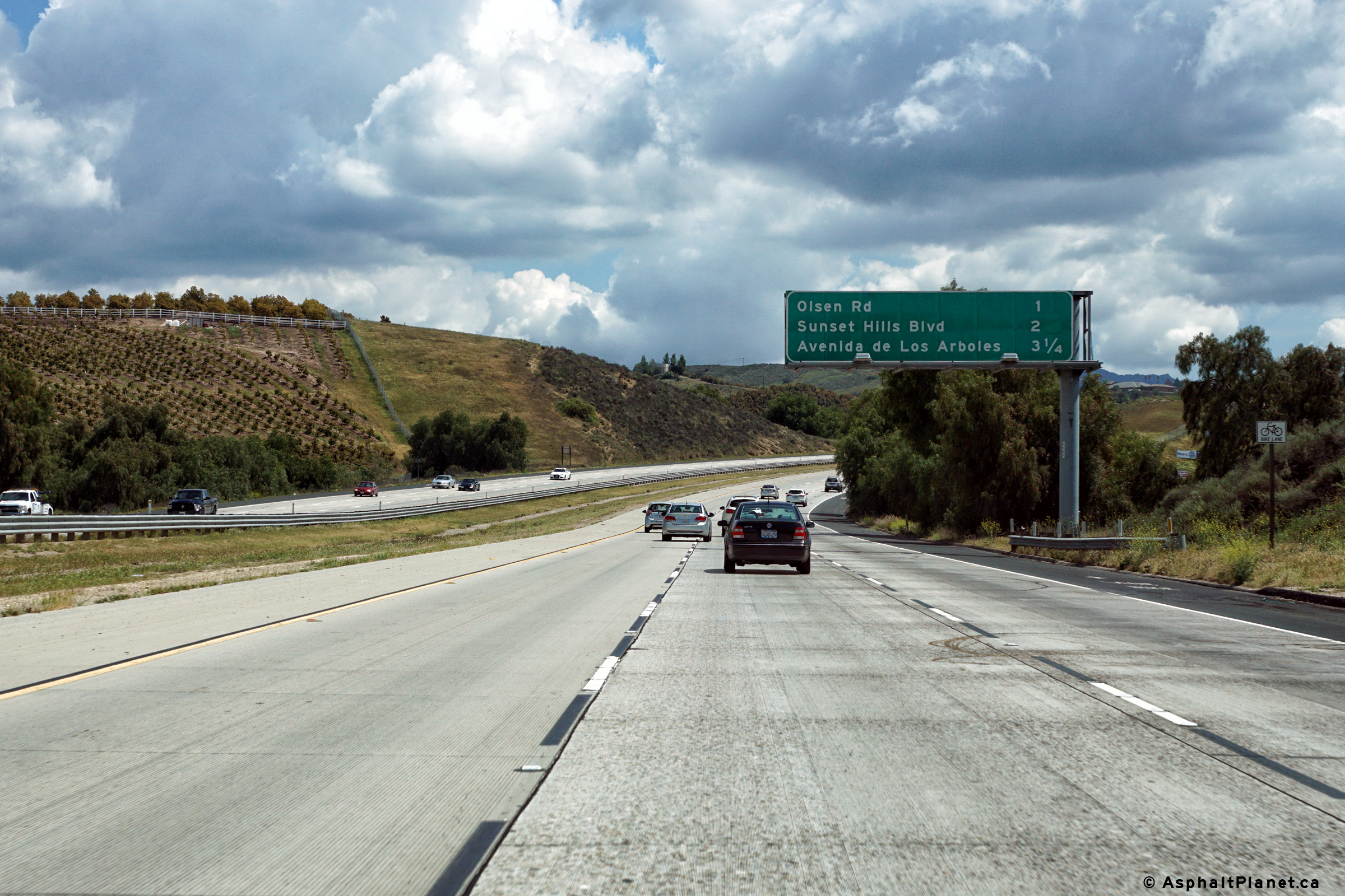
The advanced signage for the Olsen Road interchange is affixed to the Sunset Hills Boulevard overpass. |
 |
||
|
Date: 04/11/2016 |
High-res: (1440x960) (2400x1600) | |||
|
Ventura County |
Southerly view as Highway 23 passes beneath the Sunset Hills Boulevard interchange. |
 |
||
|
Date: 04/11/2016 |
High-res: (1440x960) (2400x1600) | |||
|
Ventura County |
Southbound view at the off-ramp to Sunset Hills Boulevard. |
 |
||
|
Date: 04/11/2016 |
High-res: (1440x960) (2400x1600) | |||
|
Ventura County |
Southbound signage in advance of the Sunset Hills Boulevard interchange. |
 |
||
|
Date: 04/11/2016 |
High-res: (1440x960) (2400x1600) | |||
|
Ventura County |
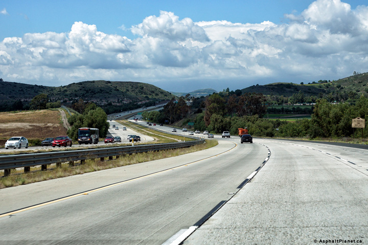
Picturesque northerly view along Highway 23 north of the Sunset Hills Boulevard interchange. |
 |
||
|
Date: 04/11/2016 |
High-res: (1440x960) (2400x1600) | |||
|
Ventura County |
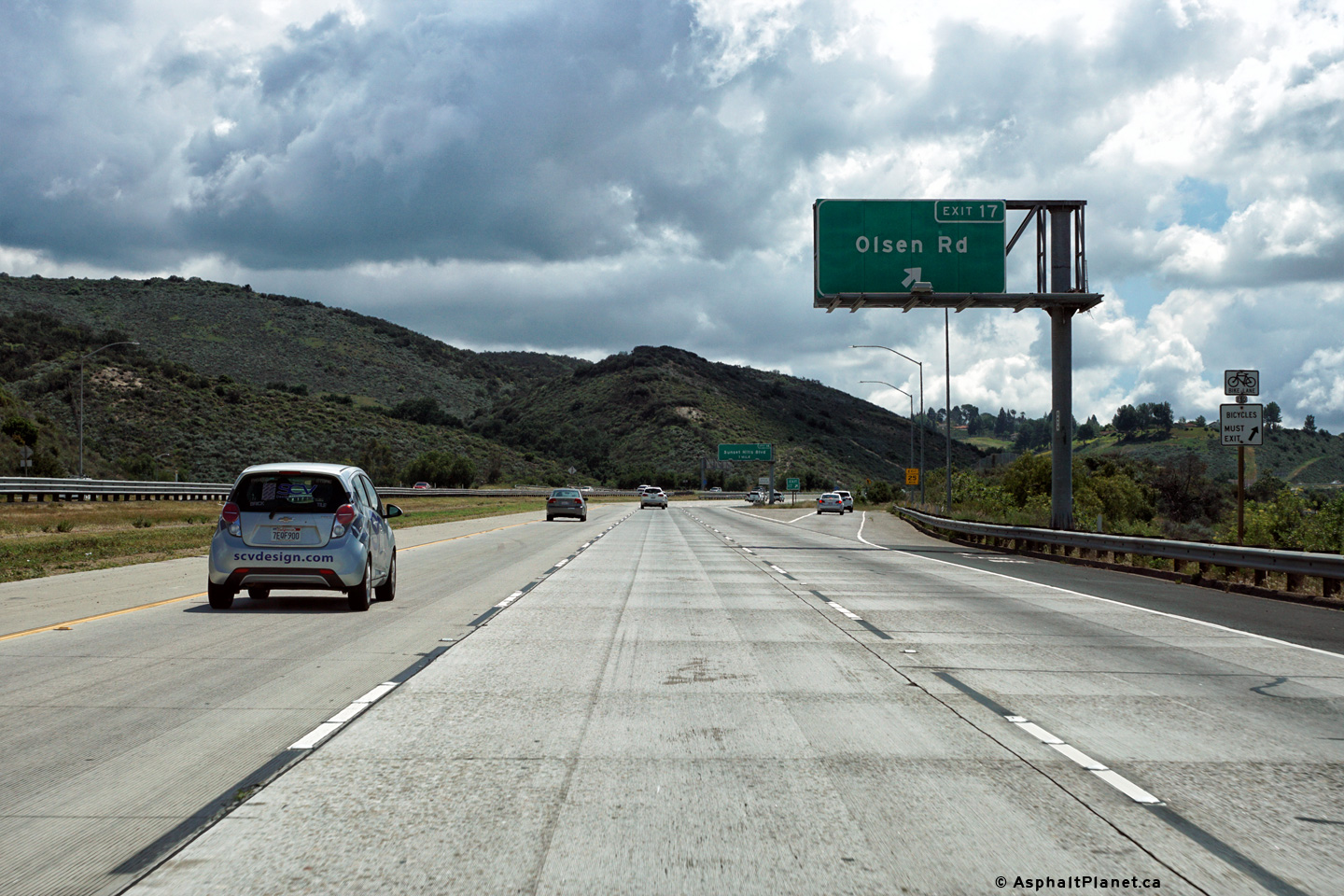
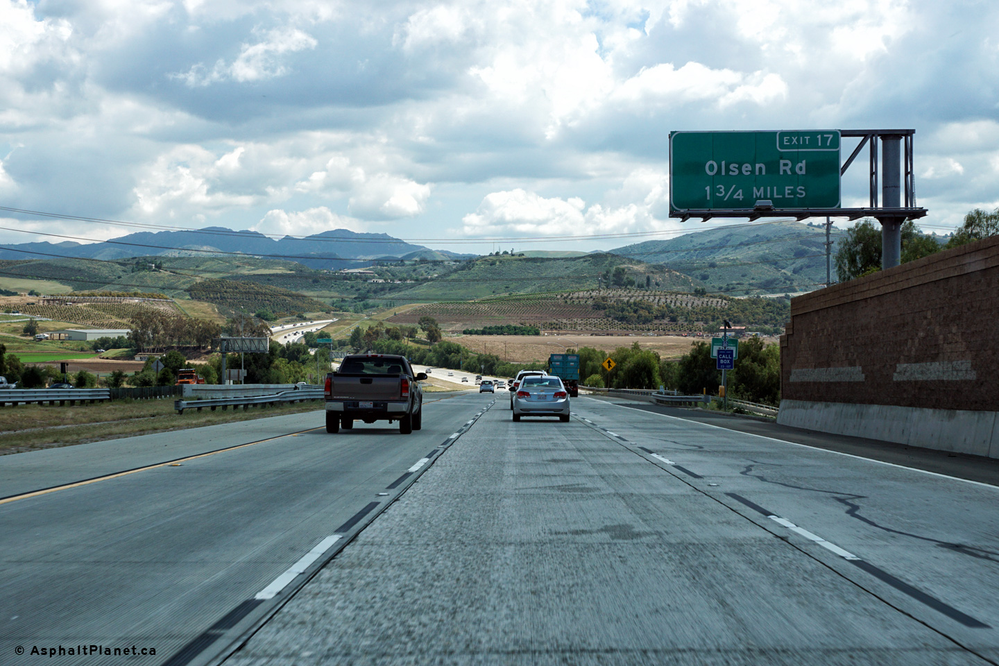
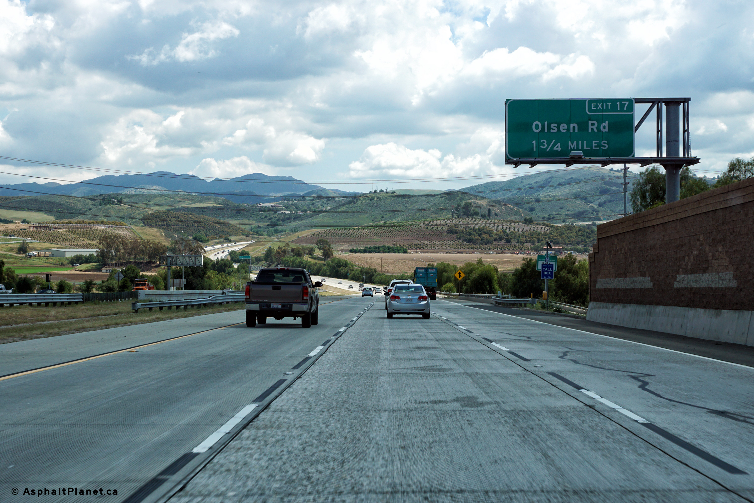
View looking northerly at the off-ramp to Olsen Road. |
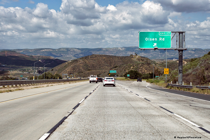 |
||
|
Date: 04/11/2016 |
High-res: (1440x960) (2400x1600) | |||
|
Ventura County |
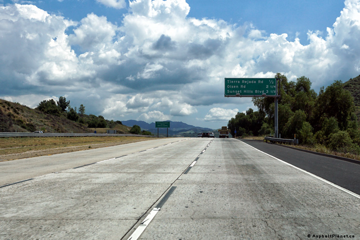
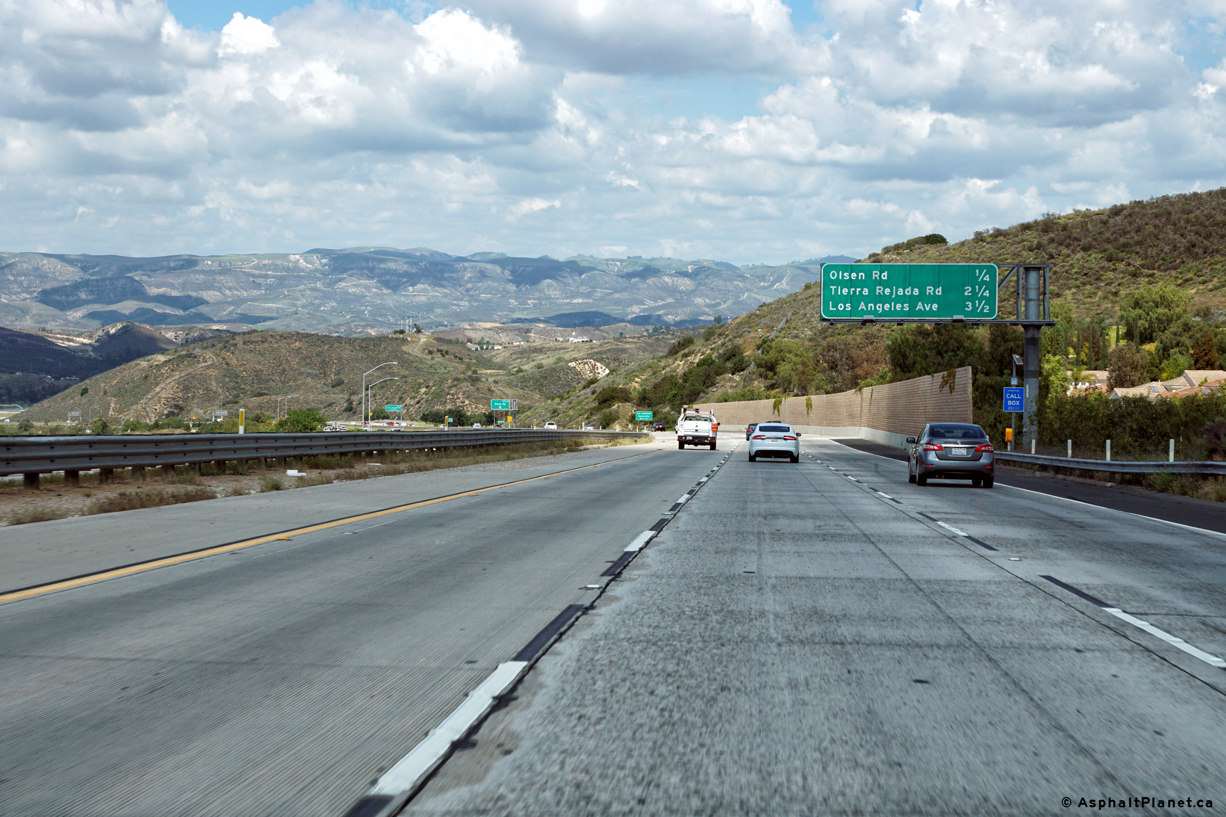
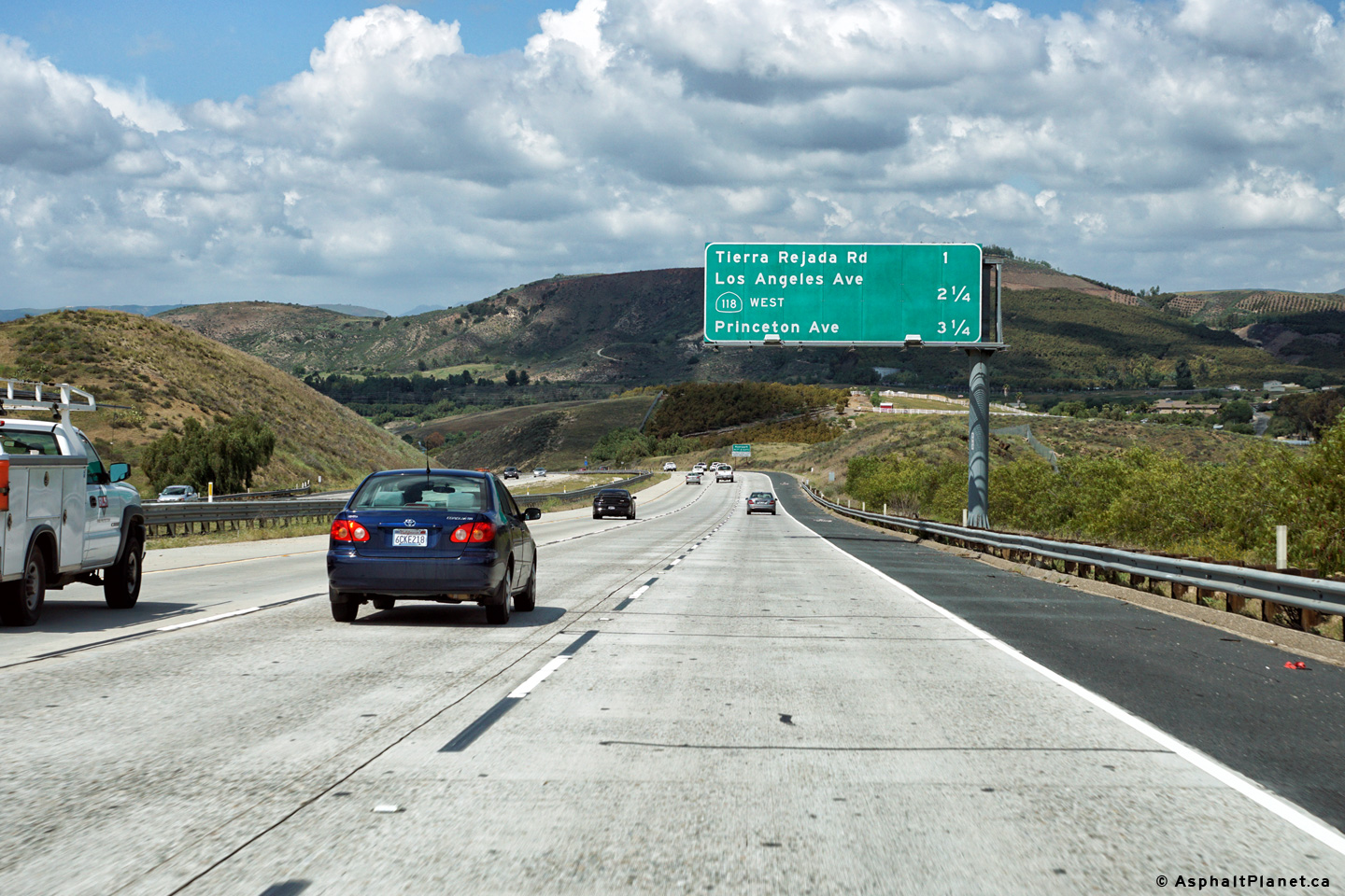
Advanced signage for the ramp to Tierra Rejada Road at the Olsen Road interchange. |
 |
||
|
Date: 04/11/2016 |
High-res: (1440x960) (2400x1600) | |||
|
Ventura County |
Southbound advanced signage for the Sunset Hills Boulevard interchange. |
 |
||
|
Date: 04/11/2016 |
High-res: (1440x960) (2400x1600) | |||
|
Ventura County |
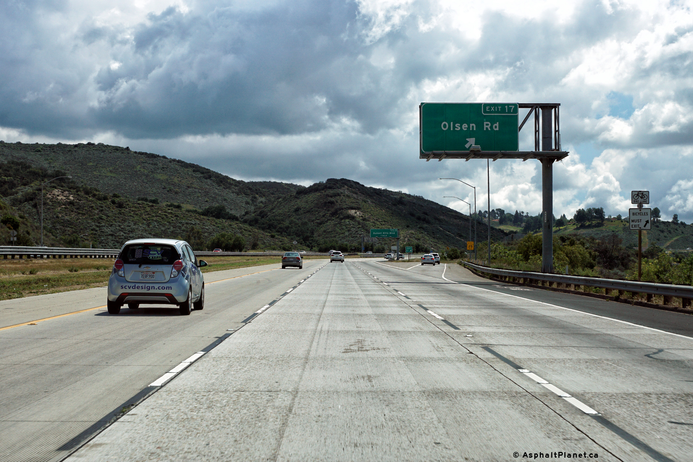
Southerly signage at the off-ramp to Olsen Road. |
 |
||
|
Date: 04/11/2016 |
High-res: (1440x960) (2400x1600) | |||
|
Ventura County |
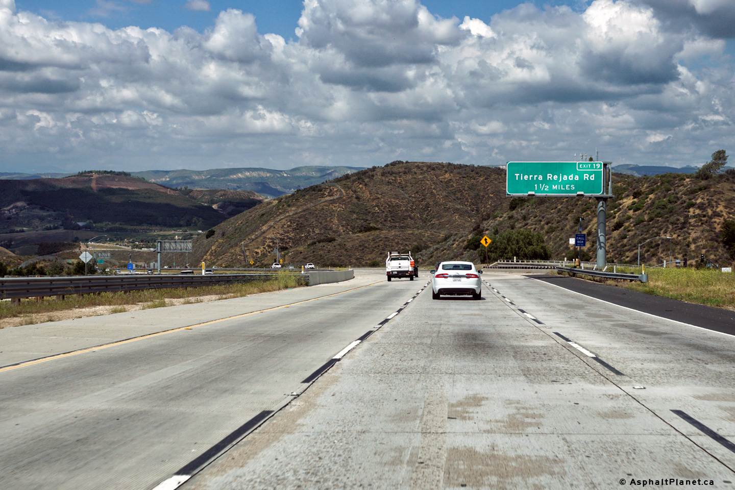
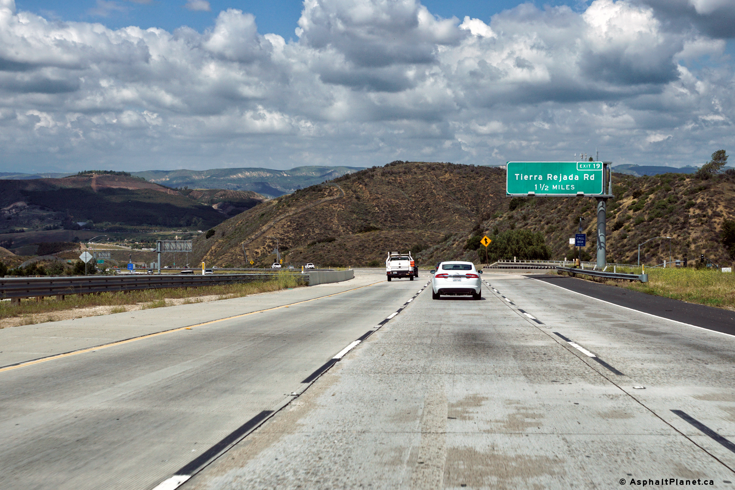
Advanced signage for the Tierra Rejada Road interchange situated north of the Olsen Road interchange. |
 |
||
|
Date: 04/11/2016 |
High-res: (1440x960) (2400x1600) | |||
|
Ventura County |
Picturesque reversing curve looking northerly south of Tierra Rejada Road. |
 |
||
|
Date: 04/11/2016 |
High-res: (1440x960) (2400x1600) | |||
|
Ventura County |
Southbound advanced signage in advance of the Olsen Road interchange. |
 |
||
|
Date: 04/11/2016 |
High-res: (1440x960) (2400x1600) | |||
|
Ventura County |
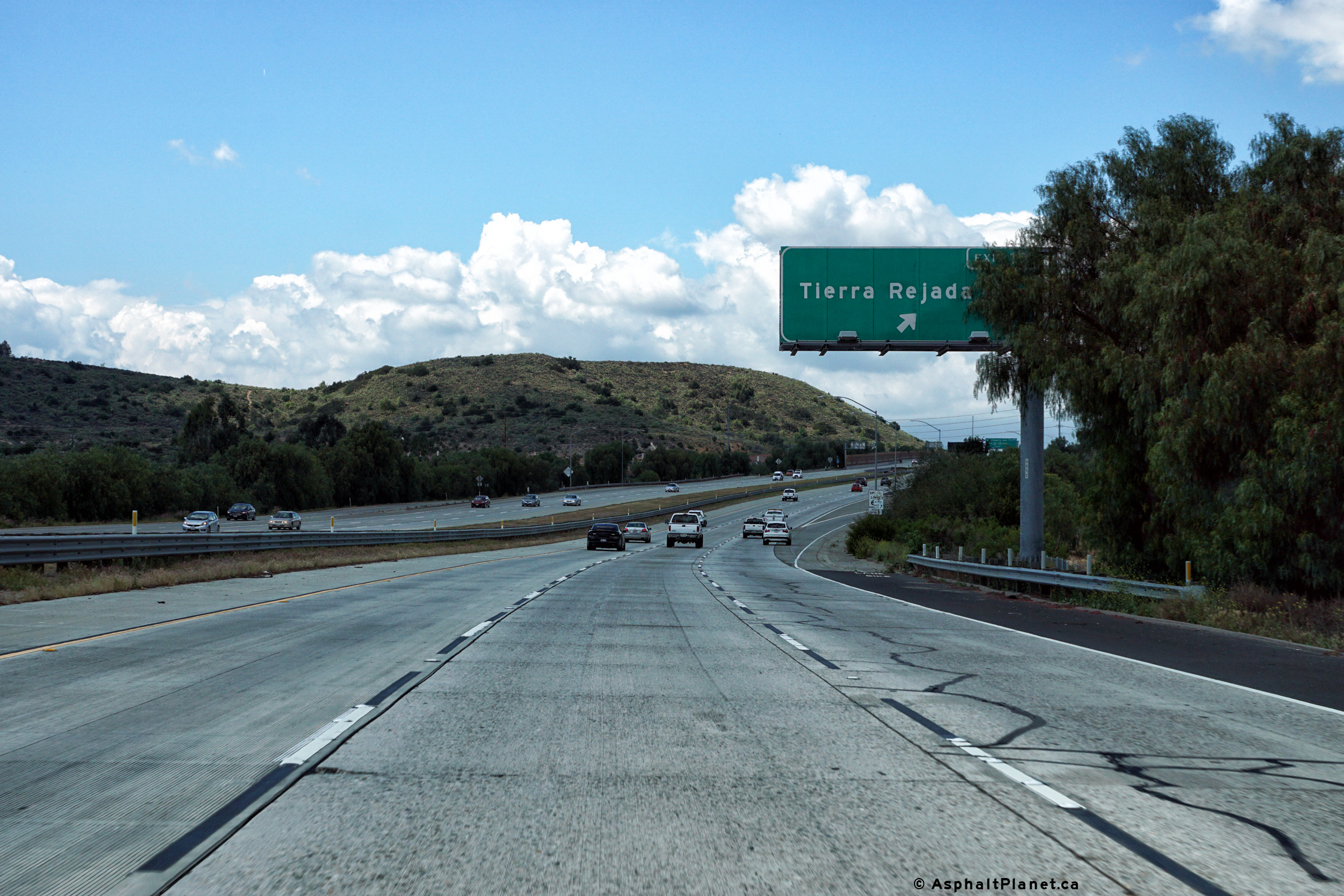
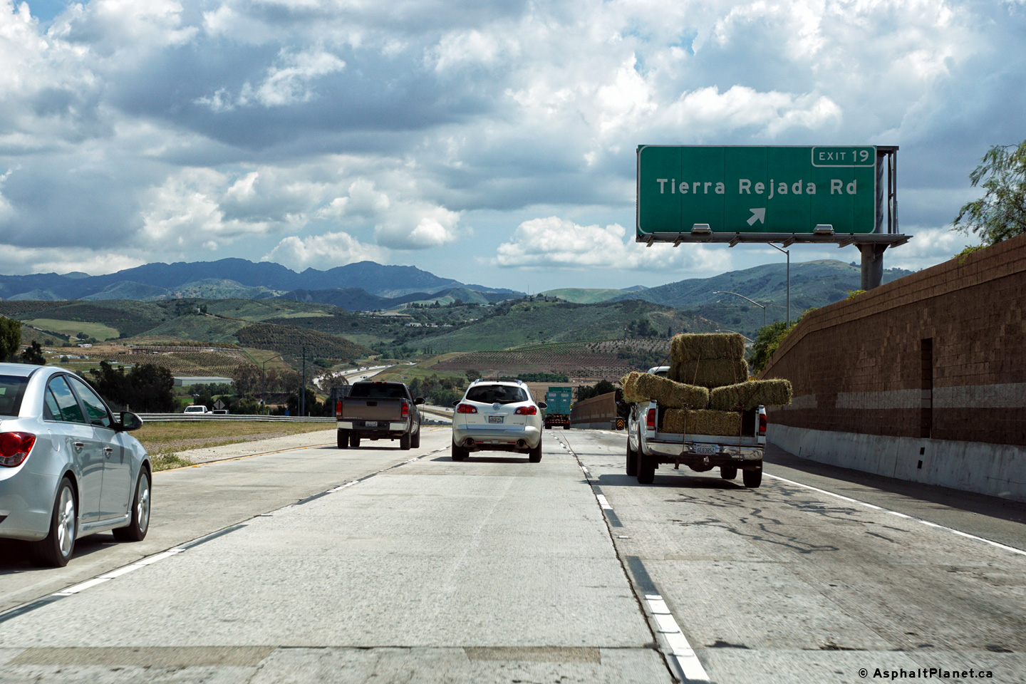
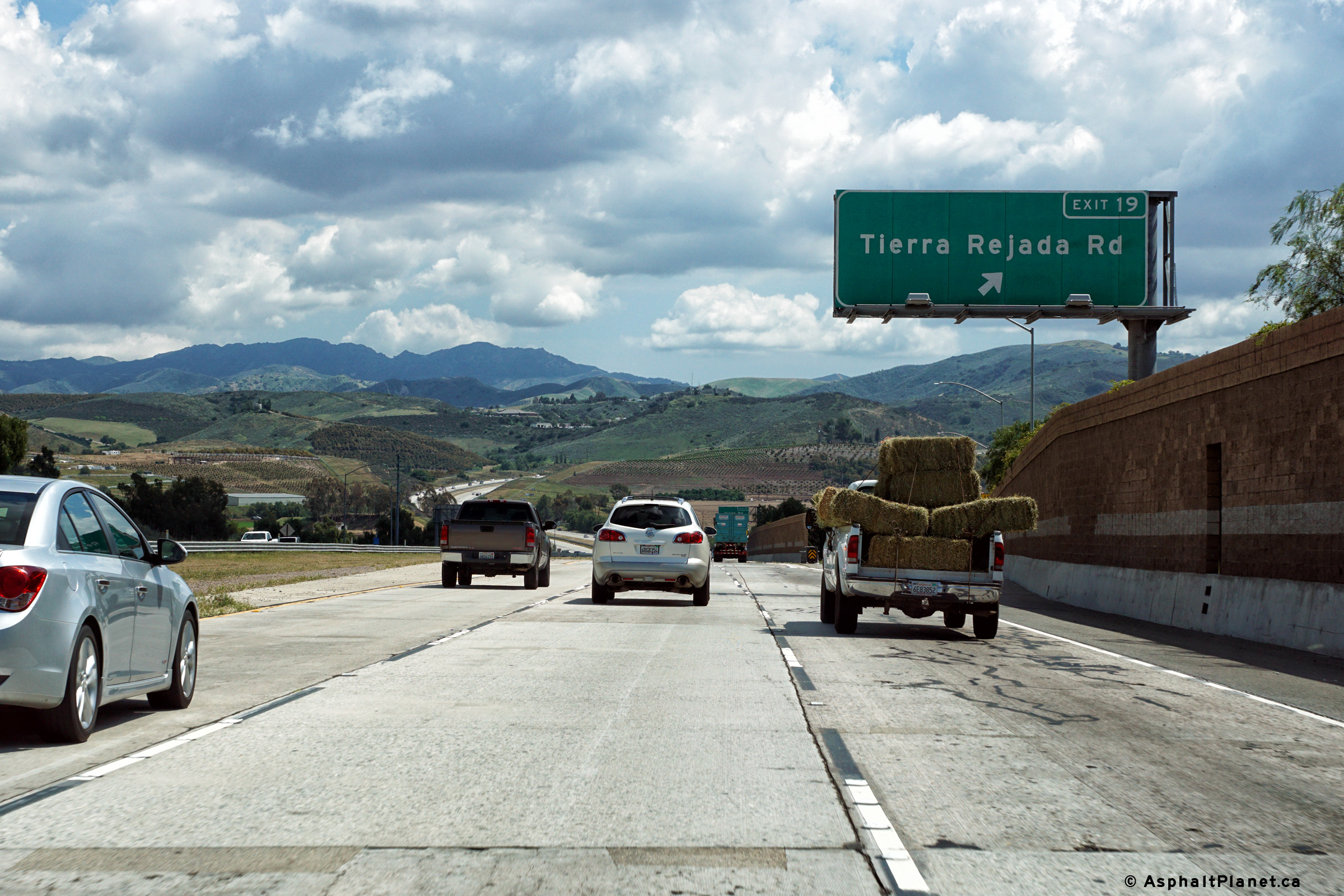
The signage at the exit to Tierra Rejada Road is partially obstructed by roadside vegetation. |
 |
||
|
Date: 04/11/2016 |
High-res: (1440x960) (2400x1600) | |||
|
Ventura County |
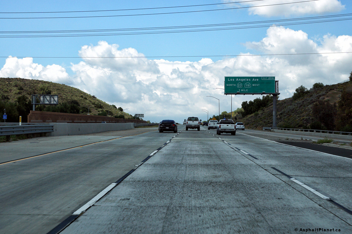
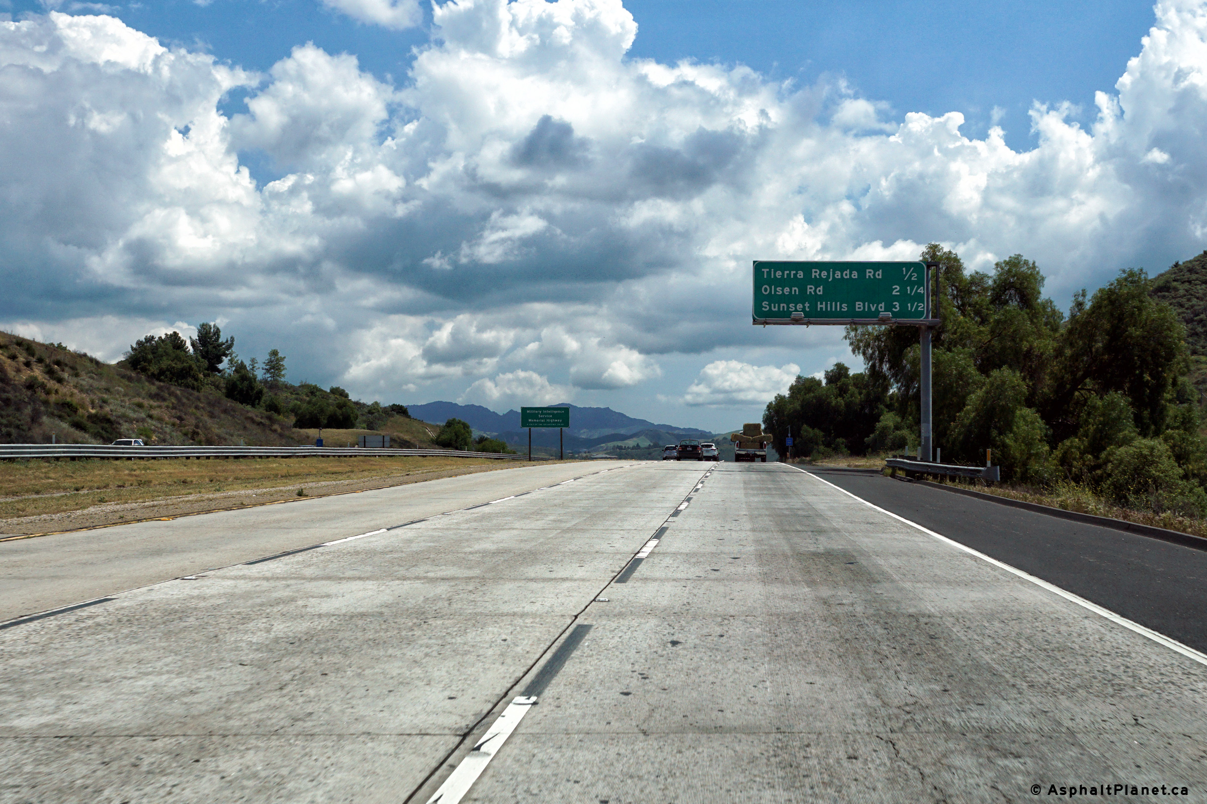
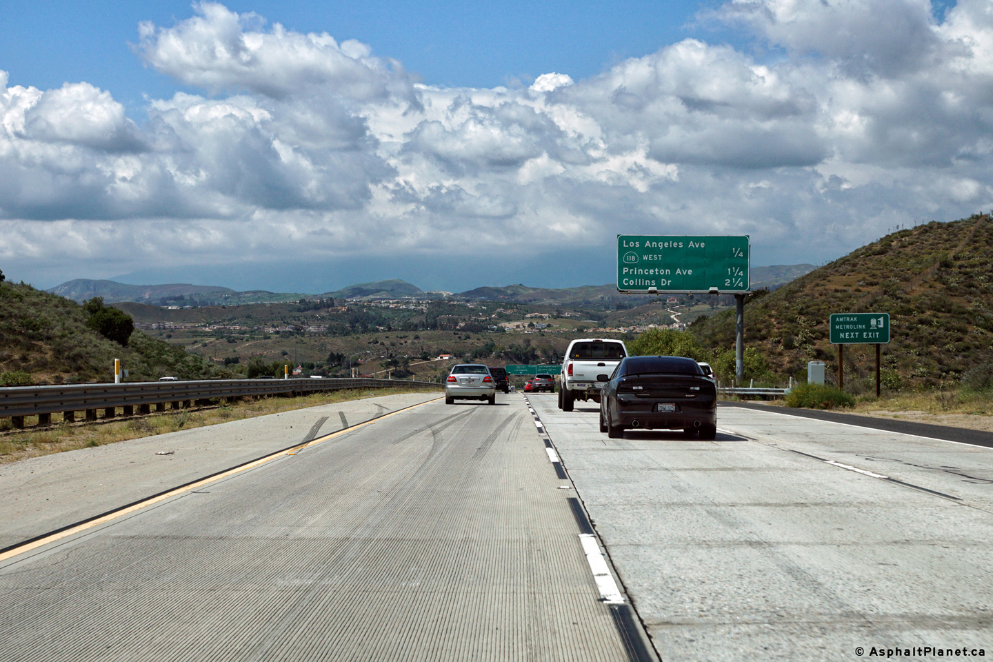
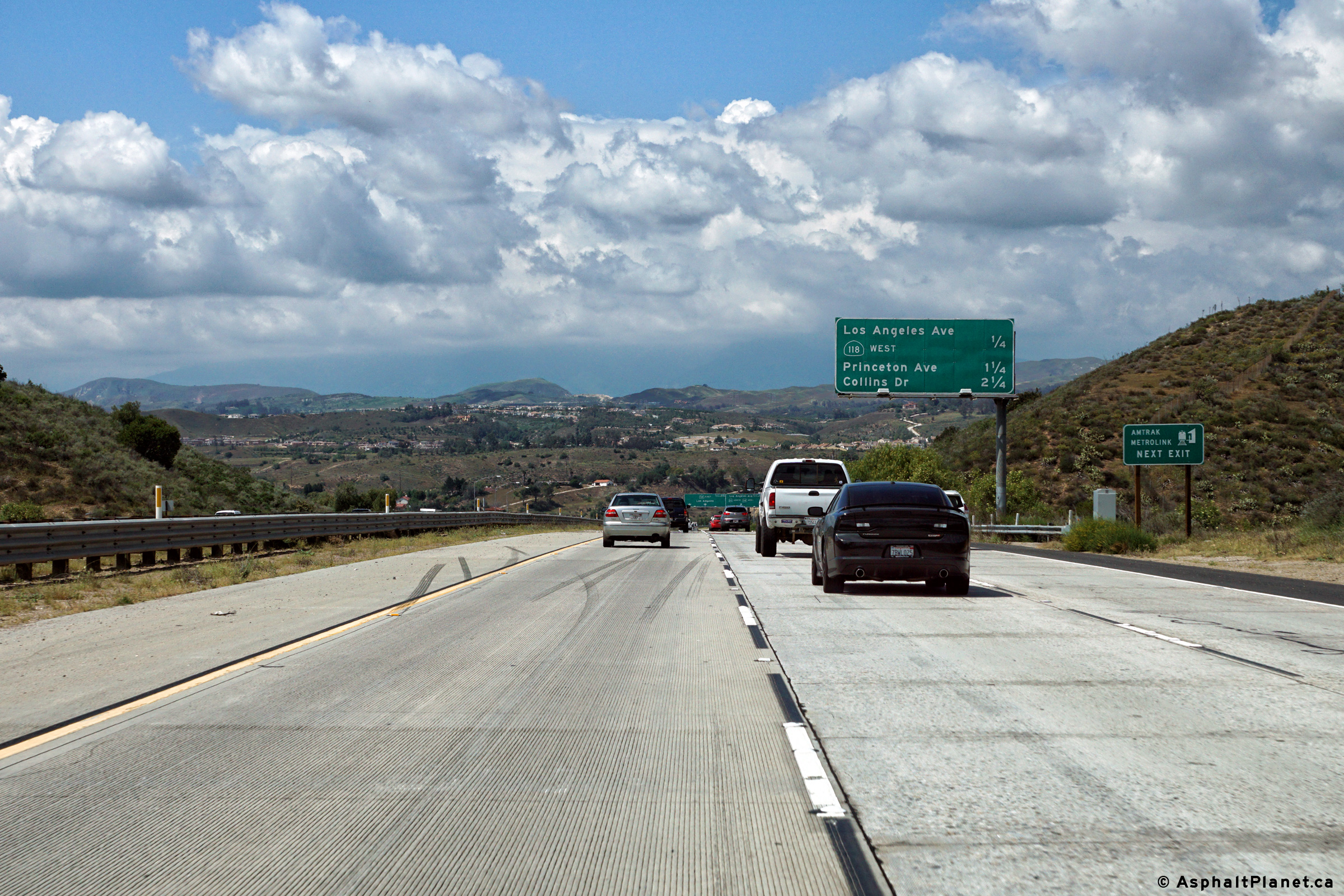
This advanced signage for the Los Angeles Avenue interchange is situated just beyond the underpass that carries the Moorpark Freeway overtop of Tierra Rejada Road. |
 |
||
|
Date: 04/11/2016 |
High-res: (1440x960) (2400x1600) | |||
|
Ventura County |
Southbound advanced signage for the Olsen Road interchange located within the footprint of the Tierra Rejada Road interchange. |
 |
||
|
Date: 04/11/2016 |
High-res: (1440x960) (2400x1600) | |||
|
Ventura County |
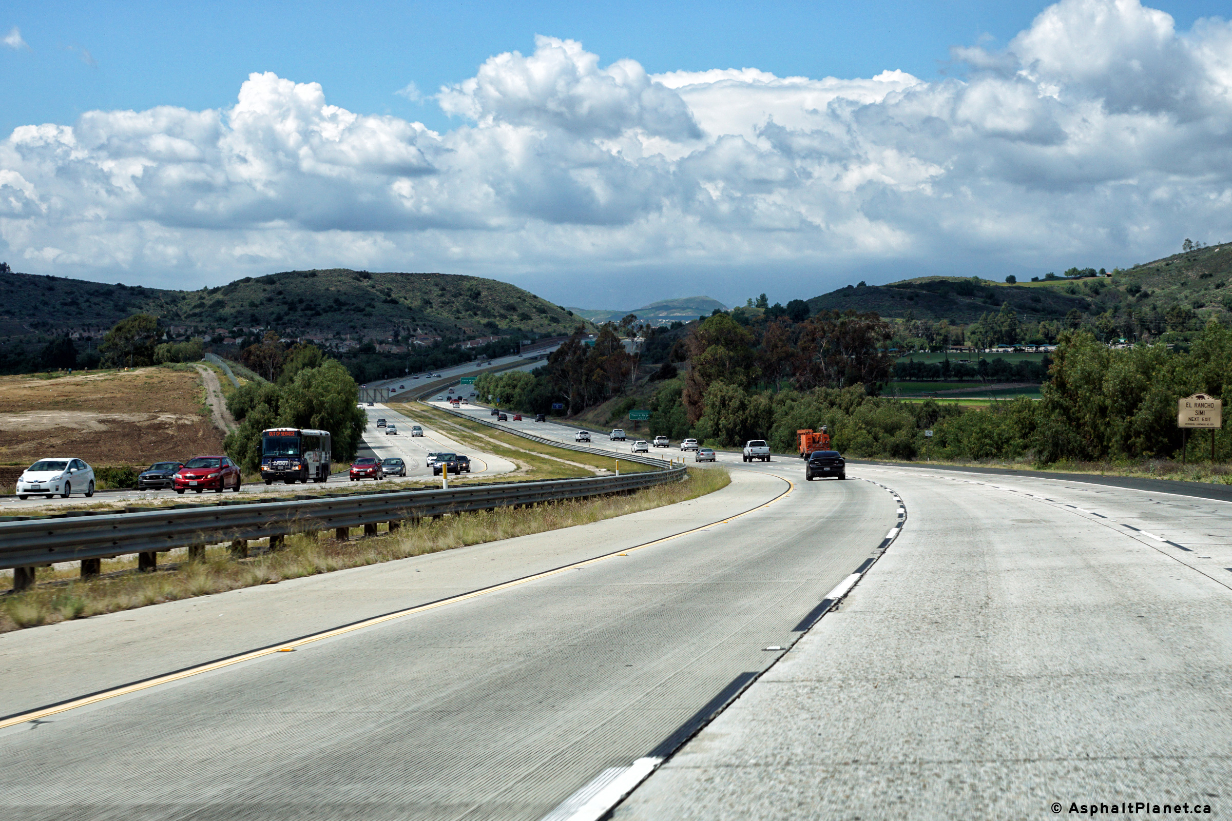
Southerly view at the off-ramp to Tierra Rejada Road interchange. |
 |
||
|
Date: 04/11/2016 |
High-res: (1440x960) (2400x1600) | |||
|
Ventura County |
Southbound interchange sequence signage south of the Los Angeles Avenue interchange. |
 |
||
|
Date: 04/11/2016 |
High-res: (1440x960) (2400x1600) | |||
|
Ventura County |
Northbound interchange sequence signage in advance of the Los Angeles Avenue interchange. Although the Moorpark Freeway ends at the Los Angeles Avenue interchange, this interchange sequence signage lists the exits that follow Los Angeles Avenue along SR-118 and the Simi Valley Freeway. |
 |
||
|
Date: 04/11/2016 |
High-res: (1440x960) (2400x1600) | |||
|
Ventura County |
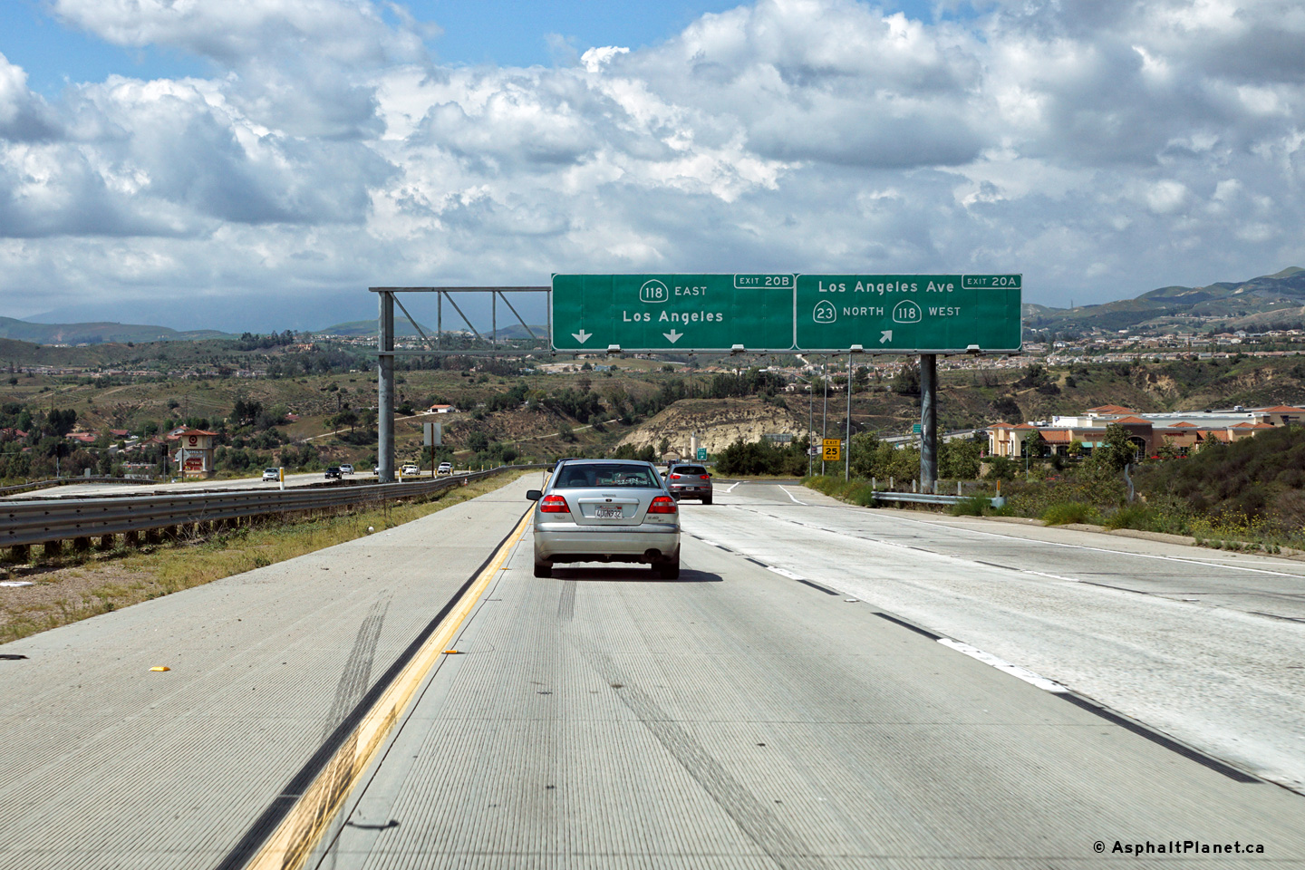
View looking northerly at the off-ramp to Los Angeles Avenue. SR-23 exits the freeway at this interchange, and continues its trek northerly towards SR-126 and Fillmore as a conventional two lane highway. The Moorpark Freeway also ends at this interchange. Beyond this point, northbound travelers abruptly turn to the east, and follow SR-118 along the Simi Valley Freeway. |
 |
||
|
Date: 04/11/2016 |
High-res: (1440x960) (2400x1600) | |||
| SR-118 follows the Simi Valley Freeway easterly from Moorpark from Ventura County to Los Angeles County. Click here for State Route 118 Images. | ||||
<- CA-22
CA Highways
CA-24 ->
AsphaltPlanet.ca
© 2010-17 AsphaltPlanet.ca.
Scott@asphaltplanet.ca
Page Created: December 4, 2016.
Last Updated: December 4, 2016.