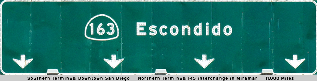
AsphaltPlanet.ca > California > SR-163
Pictures on this
page are arranged in order from south to north. CA-163 North photos are
left-aligned in the last column, while CA-163 South photos are right-aligned.
Center-line pictures are centered within the last column.
|
Location |
Description |
Photo |
||
|
North- |
South- |
|||
|
San Diego County |
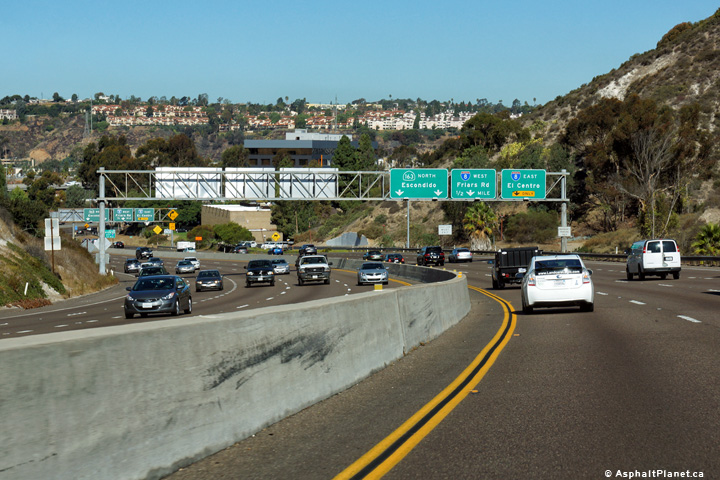
View looking northerly along SR-163 as the highway approaches the Interstate 8 interchange. |
 |
||
|
Date: 10/31/2013 |
High-res: (1440x960) (2400x1600) |
|||
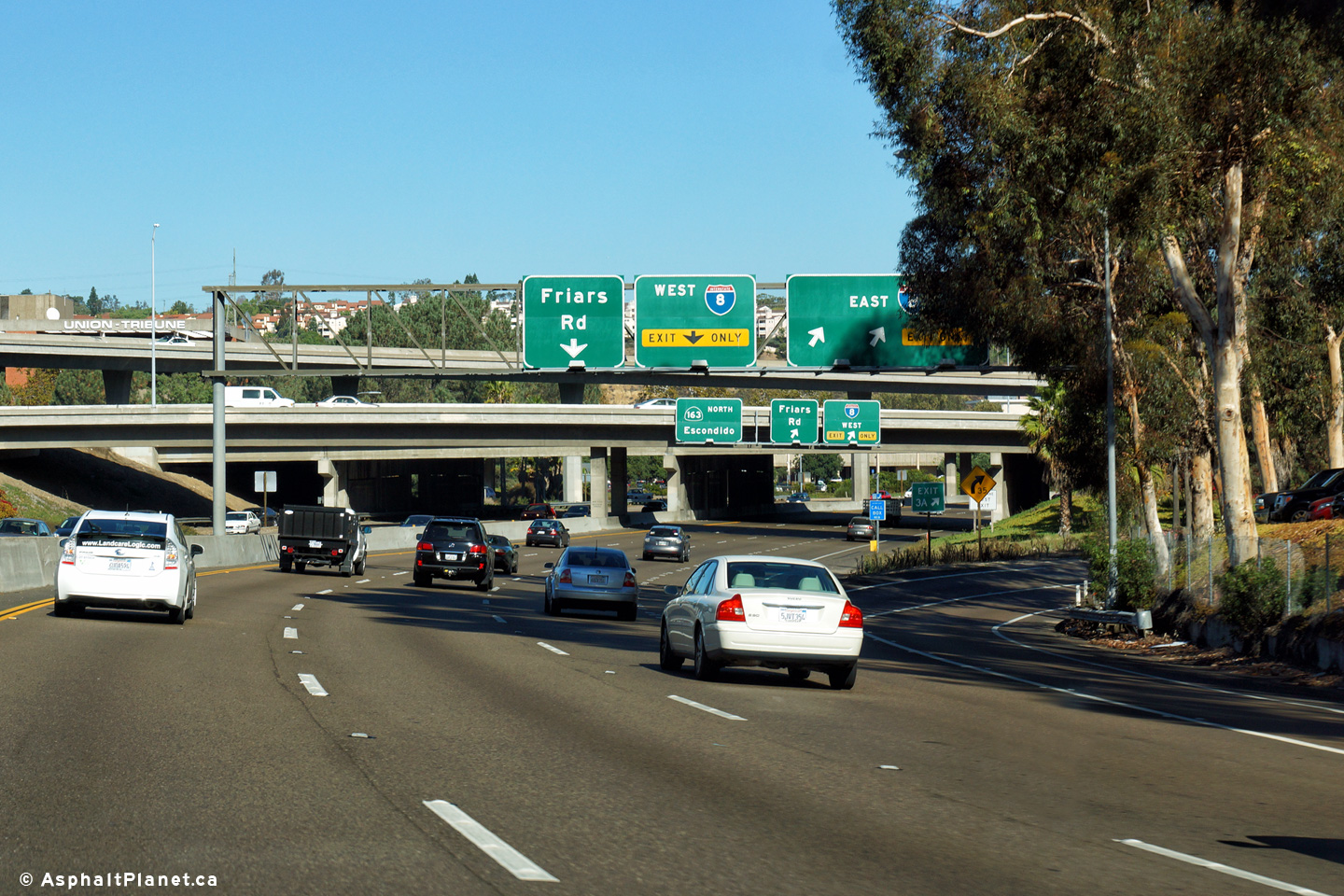
|
San Diego County |
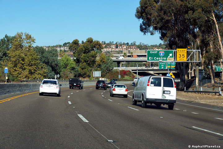
Advanced signage for the ramp to Interstate 8 East. |
 |
||
|
Date: 10/31/2013 |
High-res: (1440x960) (2400x1600) |
|||
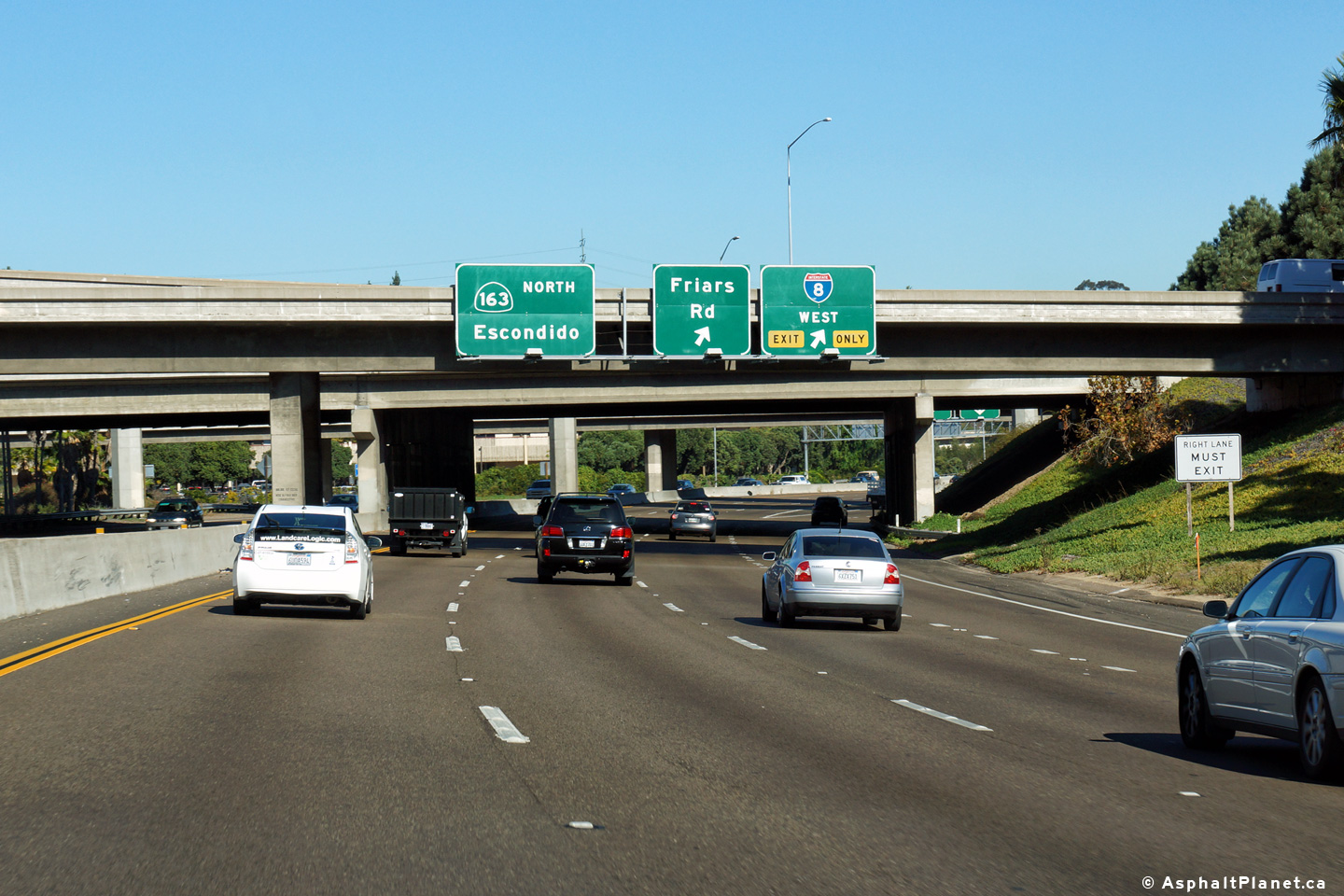
|
San Diego County |
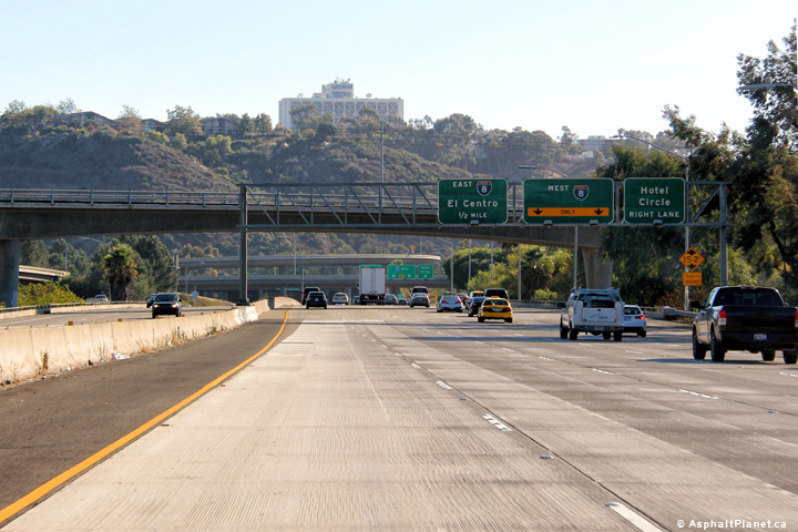
Signage for the ramp to Interstate 8 East. The signage to the ramp to Interstate 8 East is obscured from view by roadside trees. |
 |
||
|
Date: 10/31/2013 |
High-res: (1440x960) (2400x1600) |
|||
|
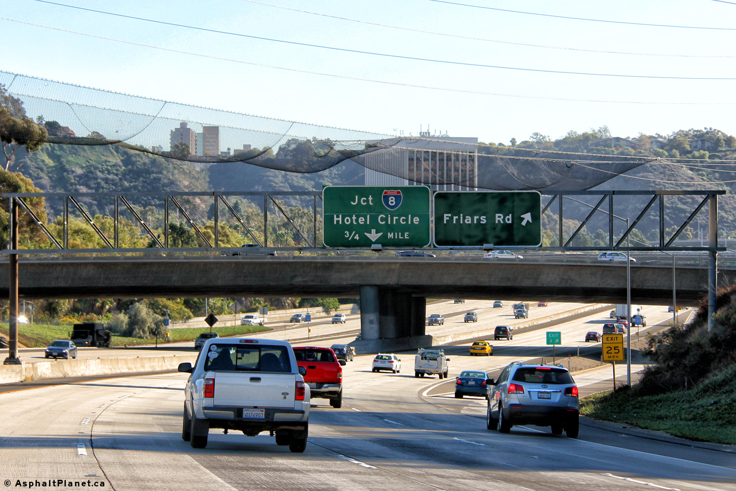
San Diego County |
Signage for the ramp to Interstate 5 West and Friars Road. The actual ramp is situated just beyond the overpasses, and is somewhat obscured from a motorists view. |
 |
||
|
Date: 10/31/2013 |
High-res: (1440x960) (2400x1600) |
|||
| I-8 leads easterly from I-5 in San Diego through the San Diego suburbs towards Brawly and continues easterly into Arizona. Click here for Interstate 8 Images. | ||||
|
San Diego County |
Southbound advanced signage approaching the Interstate 8 interchange. |
 |
||
|
Date: 10/30/2013 |
High-res: (1440x960) (2400x1600) | |||
|
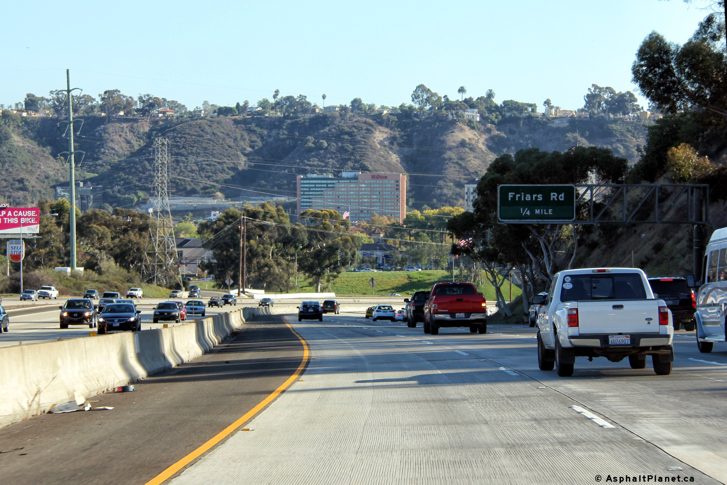
San Diego County |
Signage at the southbound off-ramp to Friars Road. |
 |
||
|
Date: 10/30/2013 |
High-res: (1440x960) (2400x1600) | |||
|
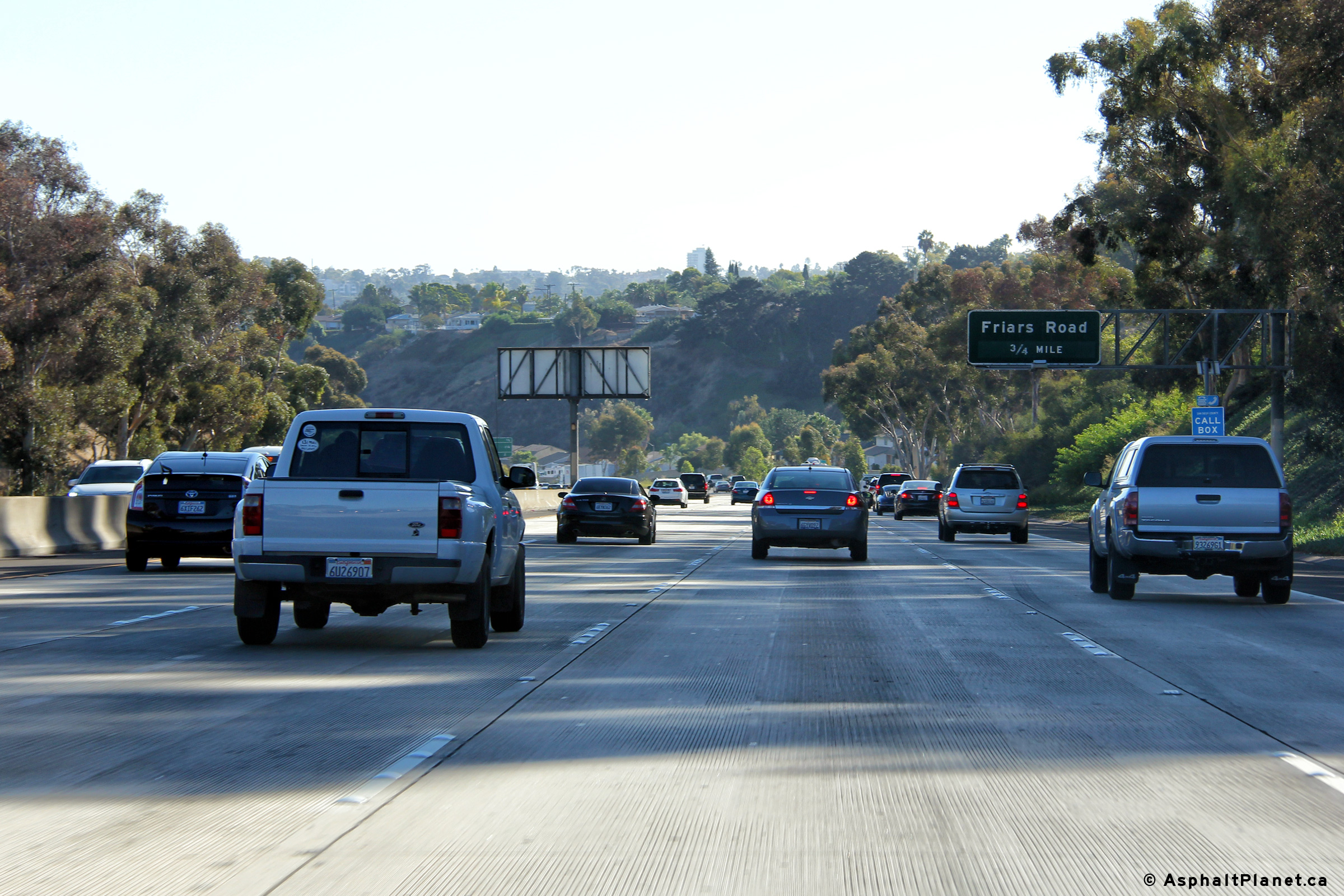
San Diego County |
Southbound advanced signage approaching the Friars Road interchange. |
 |
||
|
Date: 10/30/2013 |
High-res: (1440x960) (2400x1600) | |||
|
San Diego County |
View looking southerly approaching the Friars Road interchange. |
 |
||
|
Date: 10/30/2013 |
High-res: (1440x960) (2400x1600) | |||
|
San Diego County |
Northbound interchange sequence signage approaching the Genesee Avenue interchange. |
 |
||
|
Date: 10/31/2013 |
High-res: (1440x960) (2400x1600) |
|||
|
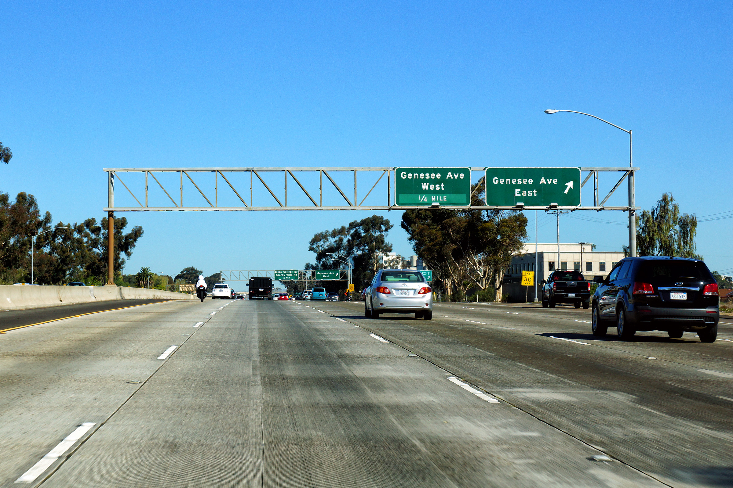
San Diego County |
Signage at the northbound off-ramp to Genesee Avenue East. |
 |
||
|
Date: 10/31/2013 |
High-res: (1440x960) (2400x1600) |
|||
|
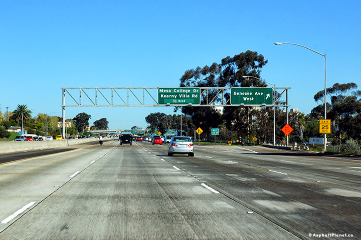
San Diego County |
View looking northerly at the off-ramp to Genesee Avenue West. |
 |
||
|
Date: 10/31/2013 |
High-res: (1440x960) (2400x1600) |
|||
|
San Diego County |
Northbound signage at the off-ramp to Mesa College Drive. |
 |
||
|
Date: 10/31/2013 |
High-res: (1440x960) (2400x1600) |
|||
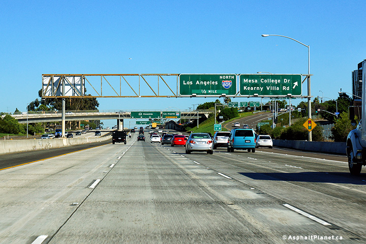
|
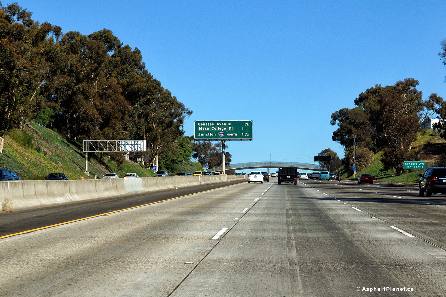
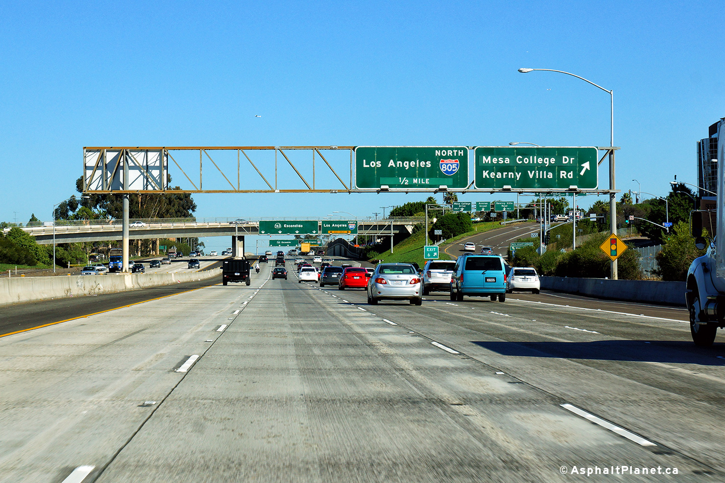
San Diego County |
Advanced signage for the upcoming Interstate 805 interchange has been affixed to the Mesa College Drive overpass. |
 |
||
|
Date: 10/31/2013 |
High-res: (1440x960) (2400x1600) |
|||
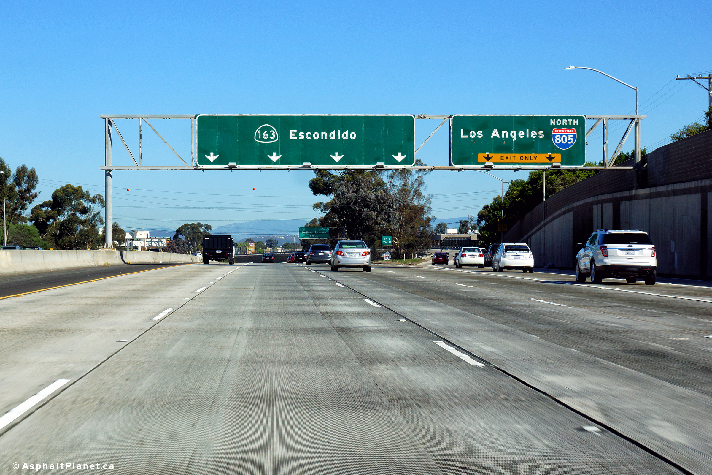
|
San Diego County |
Northbound signage at the off-ramp to Interstate 805 North. There is not a direct connection between SR-163 North and I-805 South as the freeways run nearly in the same direction. |
 |
||
|
Date: 10/31/2013 |
High-res: (1440x960) (2400x1600) |
|||
| I-805 bypasses Interstate 5 and Downtown San Diego to the East. Click here for Interstate 805 Images. | ||||
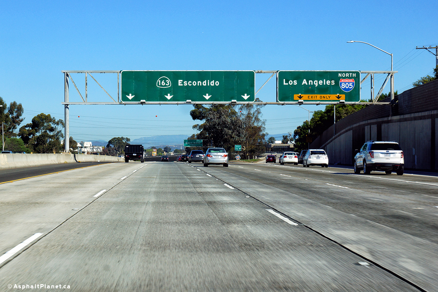
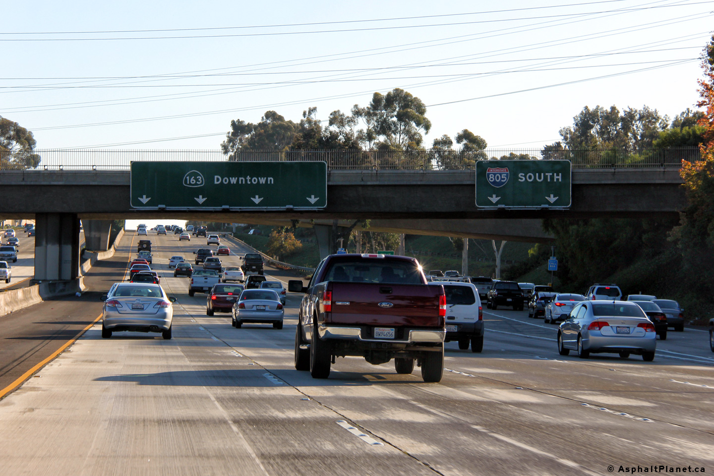
|
San Diego County |
Signage for the southbound off-ramp to I-805 South. |
 |
||
|
Date: 10/30/2013 |
High-res: (1440x960) (2400x1600) | |||
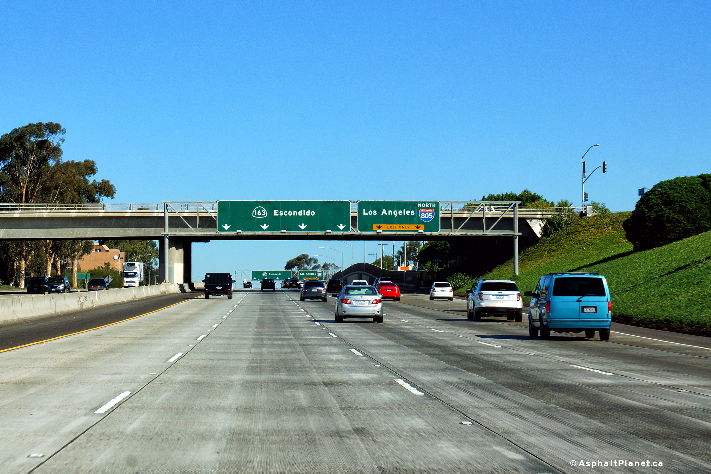
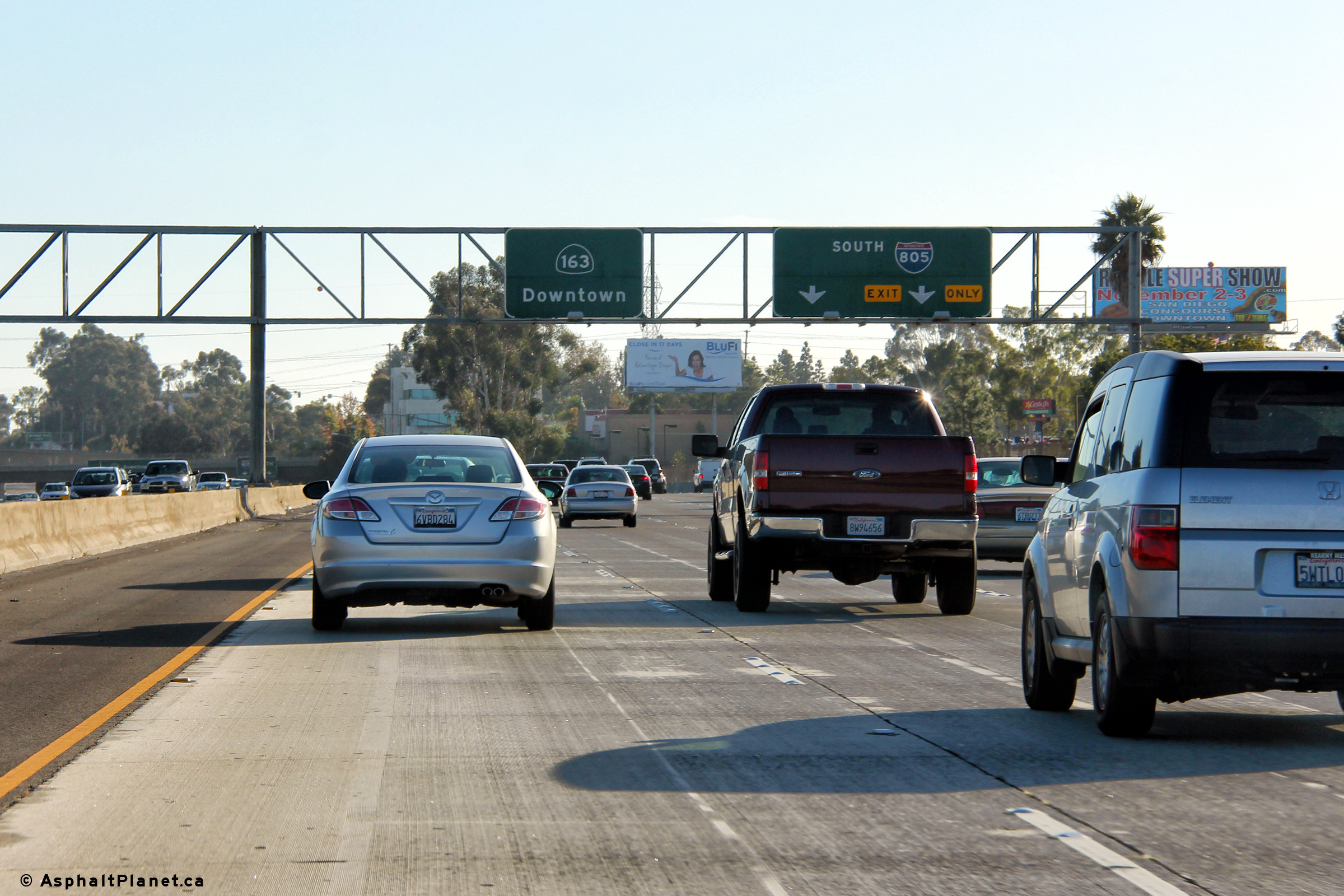
|
San Diego County |
Southbound advanced signage for the ramp to Interstate 805 South. |
 |
||
|
Date: 10/30/2013 |
High-res: (1440x960) (2400x1600) | |||
|
San Diego County |
Northbound signage at the off-ramp to Clairemont Mesa Road. |
 |
||
|
Date: 04/10/2016 |
High-res: (1440x960) (2400x1600) |
|||
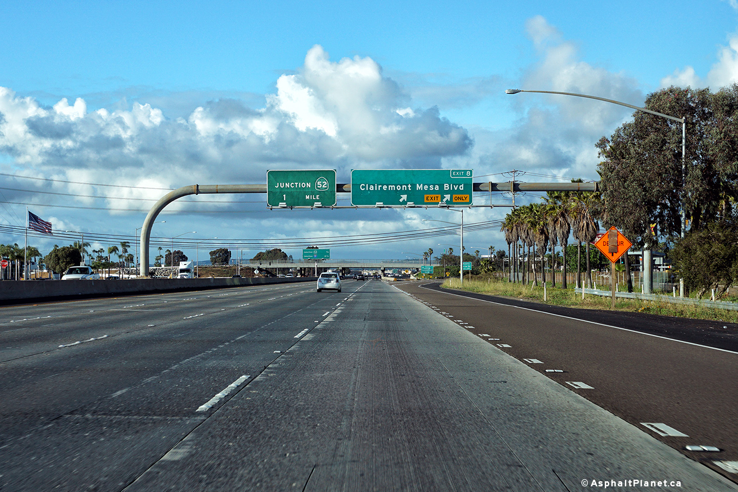
|
San Diego County |
Advanced signage for the ramp to SR-52 East. The northbound on-ramp from Clairemont Mesa Road quickly departs the freeway for SR-52 East. |
 |
||
|
Date: 04/10/2016 |
High-res: (1440x960) (2400x1600) |
|||
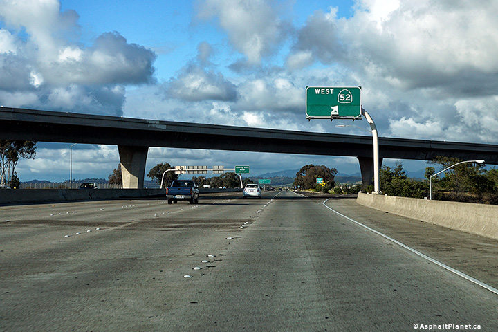
|
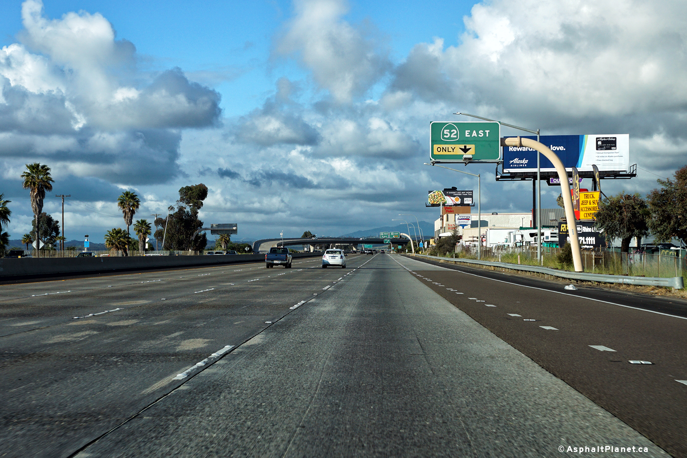
San Diego County |
Signage at the off-ramp to SR-52 East. |
 |
||
|
Date: 04/10/2016 |
High-res: (1440x960) (2400x1600) |
|||
|
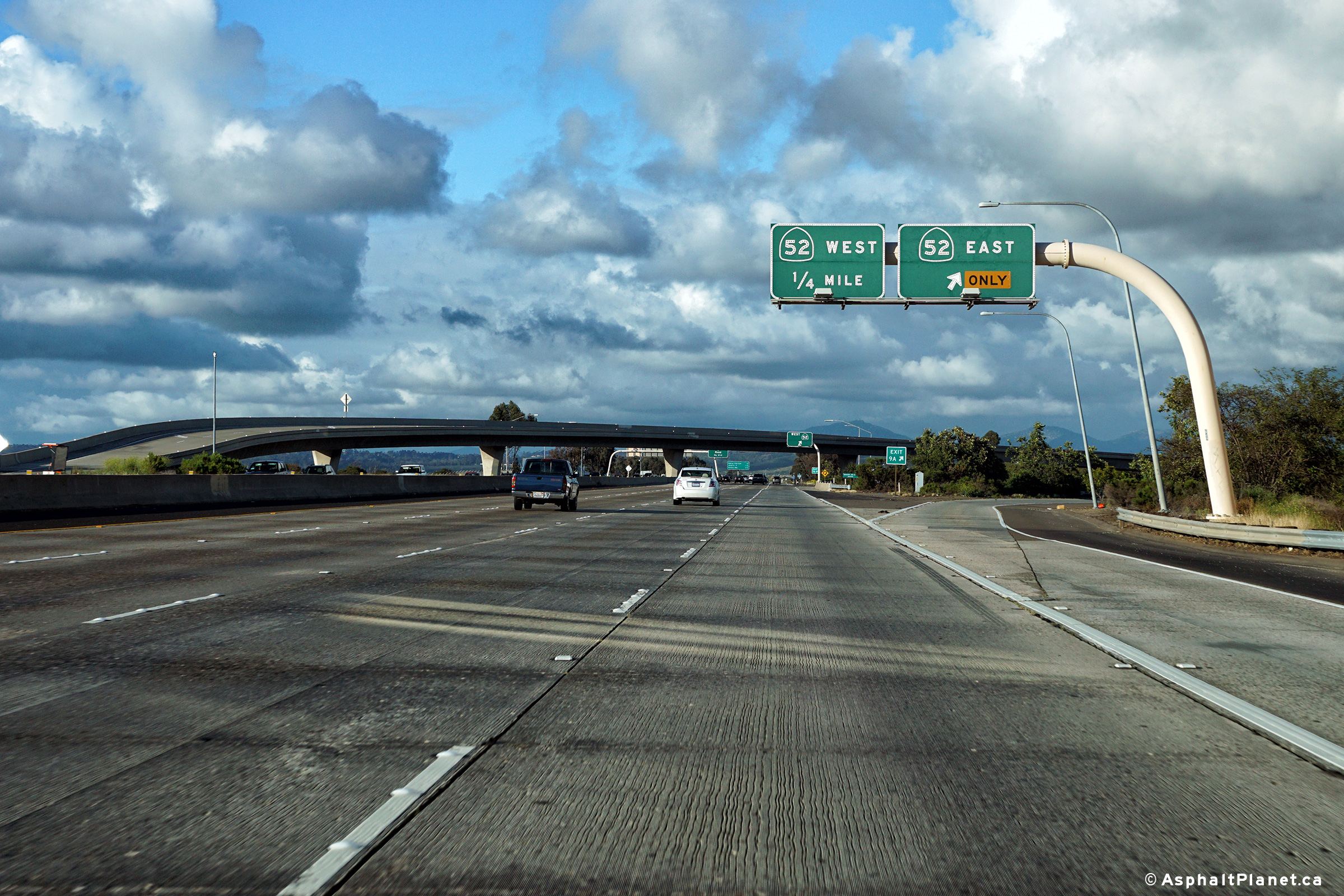
San Diego County |
Signage at the off-ramp to SR-52 West. |
 |
||
|
Date: 04/10/2016 |
High-res: (1440x960) (2400x1600) |
|||
| California 52 runs easterly from Interstate 5 easterly to State Route 67. Click here for SR-52 Images. | ||||
|
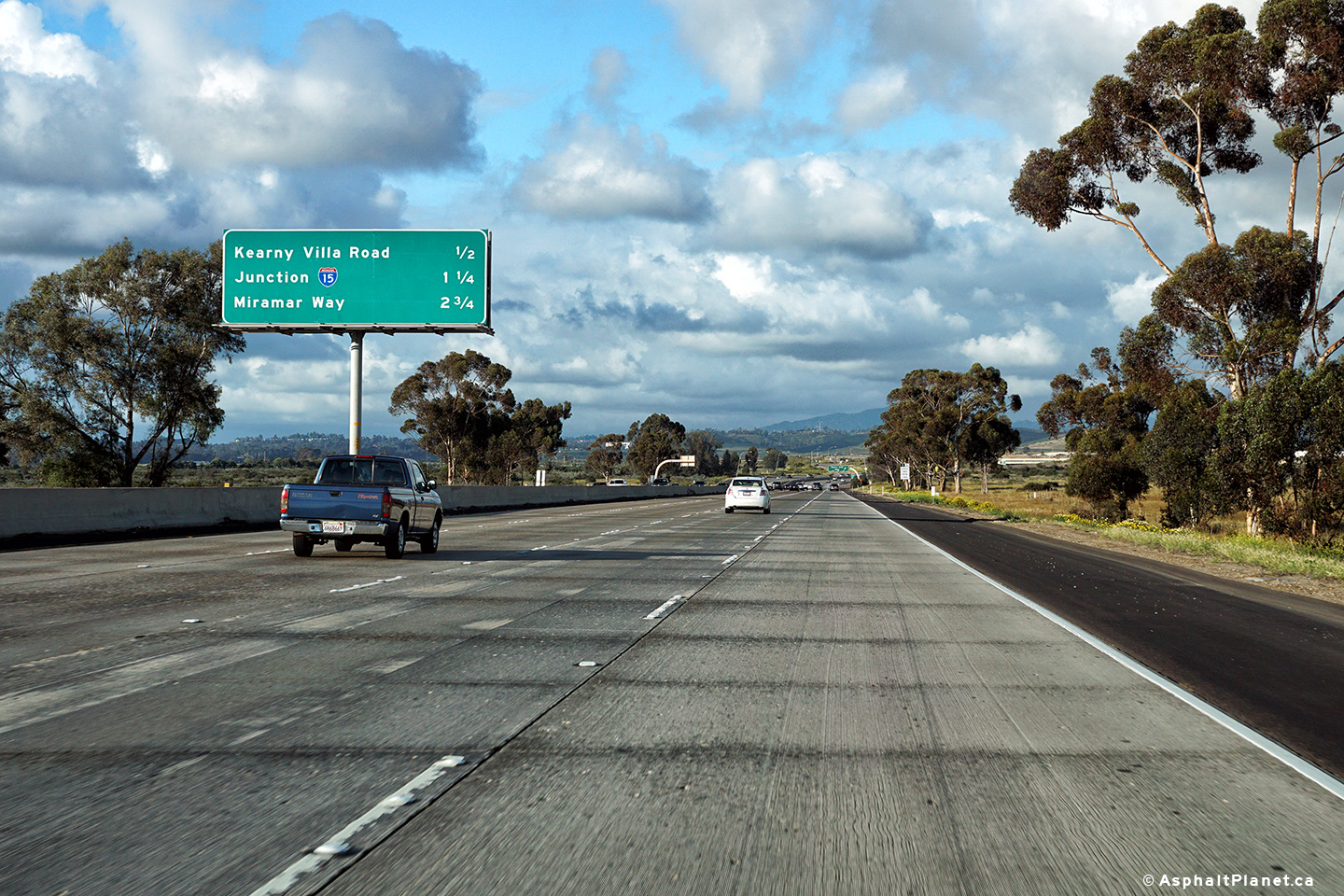
San Diego County |
Interchange sequence signage approaching the Kearney Villa Road interchange. |
 |
||
|
Date: 04/10/2016 |
High-res: (1440x960) (2400x1600) |
|||
|
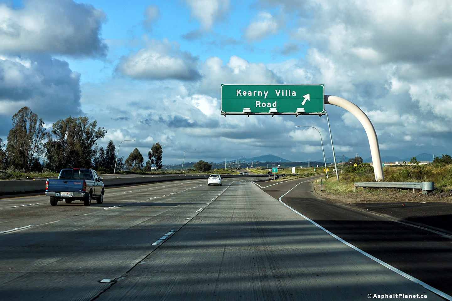
San Diego County |
Northbound view at the off-ramp to Kearney Villa Road. |
 |
||
|
Date: 04/10/2016 |
High-res: (1440x960) (2400x1600) |
|||
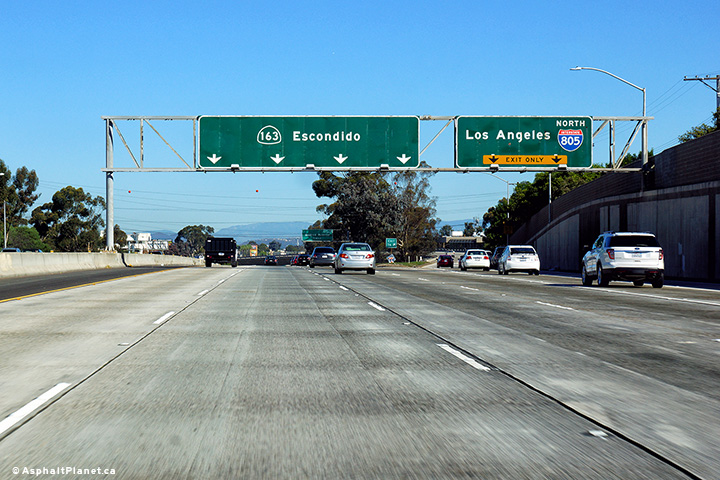
|
San Diego County |
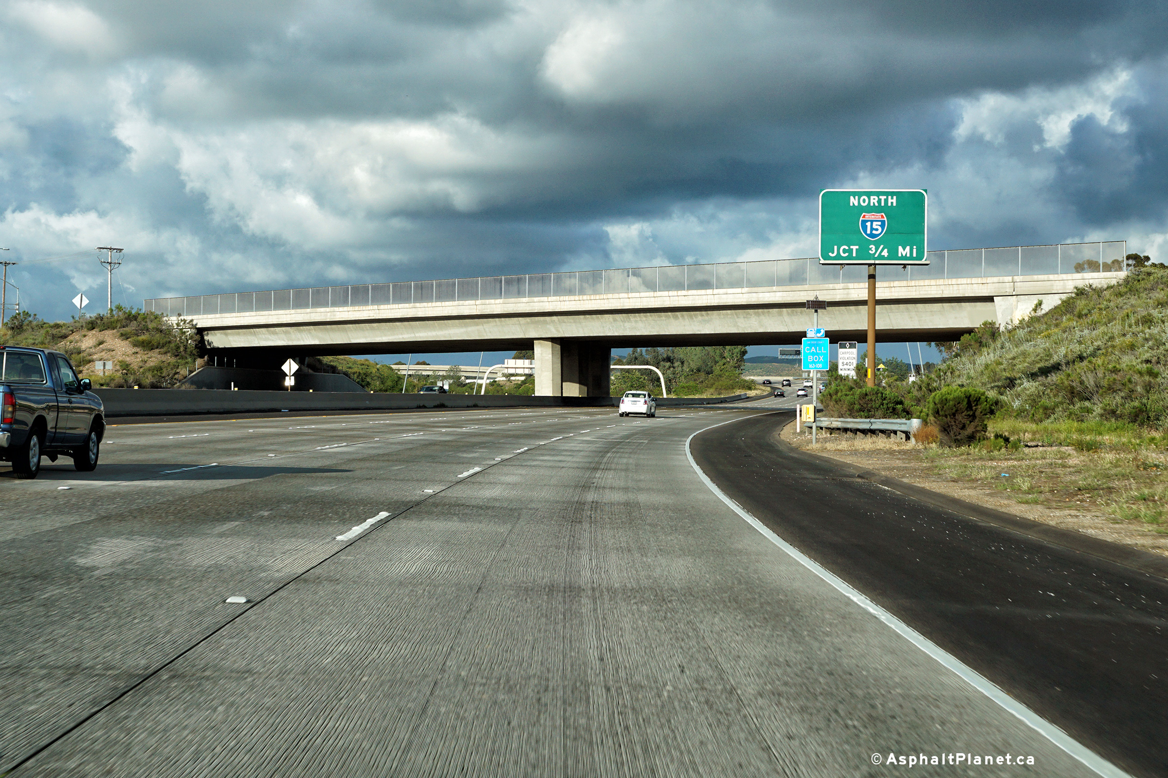
Advanced signage for the Interstate 15 interchange situated just upstream of the Kearney Villa Road overpass. |
 |
||
|
Date: 04/10/2016 |
High-res: (1440x960) (2400x1600) | |||
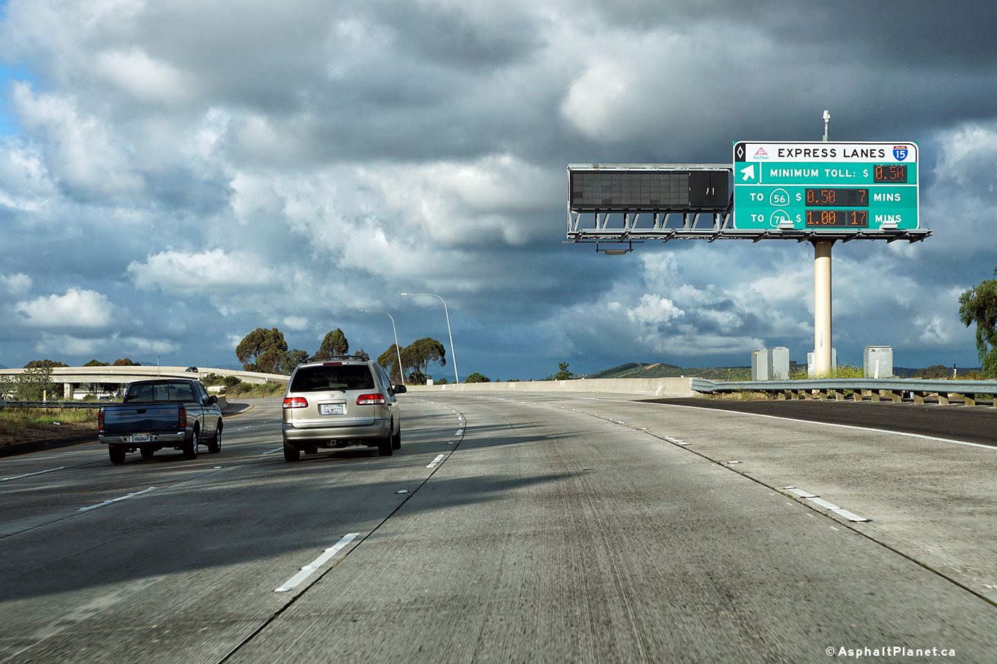
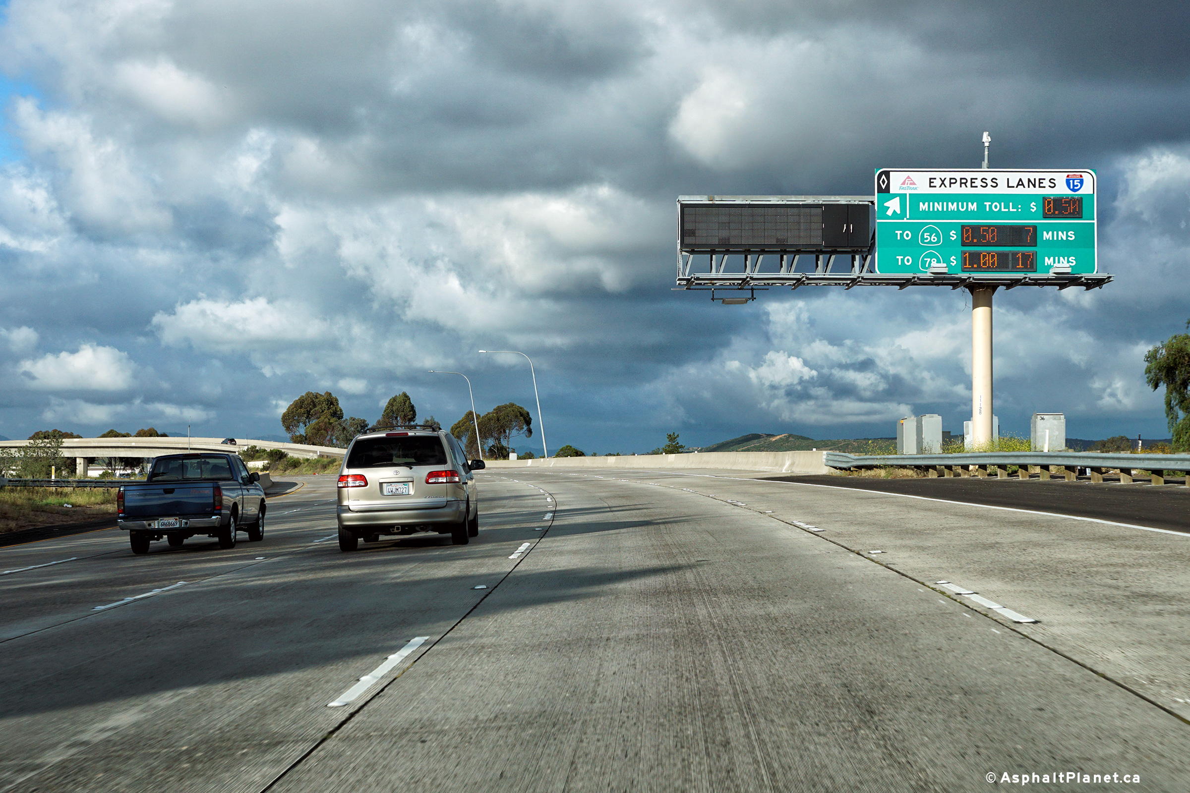
|
San Diego County |
Signage at the ramp to the Interstate 15 Tolled Express Lanes along SR-163 North. Traffic was light when this photograph was taken, so the tolling rates were fairly inexpensive to travel the tolled express lanes. |
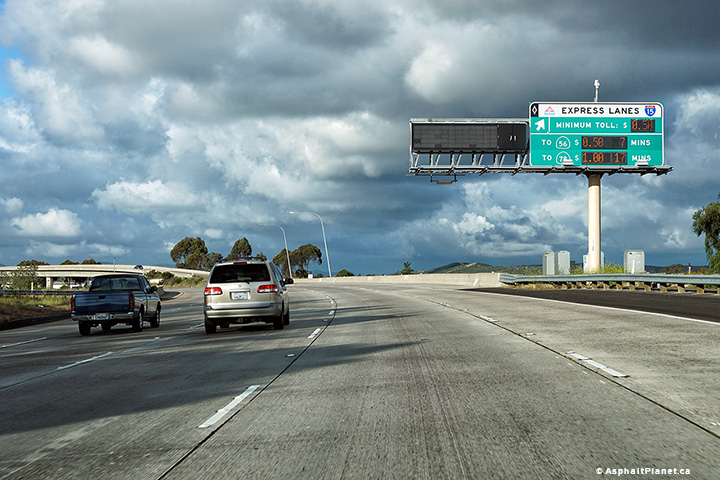 |
||
|
Date: 04/10/2016 |
High-res: (1440x960) (2400x1600) |
|||
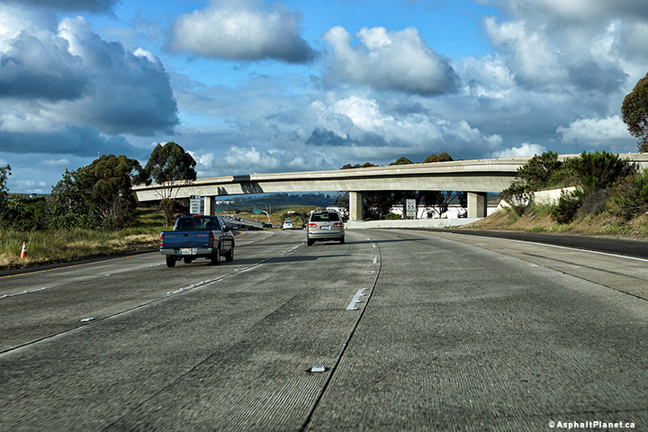
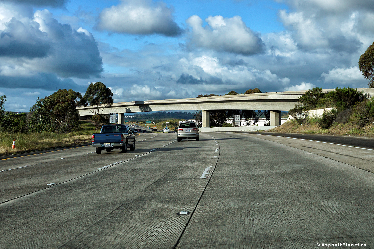
|
San Diego County |
View looking northerly along SR-163 in California as the northbound lanes pass beneath the ramp from SR-163 north to the I-15 Tolled Express Lanes. |
 |
||
|
Date: 04/10/2016 |
High-res: (1440x960) (2400x1600) |
|||
| SR-163 ends at Interstate 15. I-15 continues northerly towards Escondido and eventually northerly to the Canadian Border at Sweetgrass, MT. Click here for Interstate 15 Images. | ||||
<- CA-162
CA Highways
CA-165 ->
AsphaltPlanet.ca
© 2010-17 AsphaltPlanet.ca.
Scott@asphaltplanet.ca
Page Created: January 9, 2017.
Last Updated: January 9, 2017.