AsphaltPlanet.ca > California > State Route 14
Pictures on this
page are arranged in order from south to north. CA-14 North photos are
left-aligned in the last column, while CA-14 South photos are right-aligned.
Center-line pictures are centered within the last column.
|
Location |
Description |
Photo |
||
|
North- |
South- |
|||
| The 5 Freeway is the principal north-south freeway through California. Click here for Interstate 5 Images. | ||||
|
Los Angeles County |
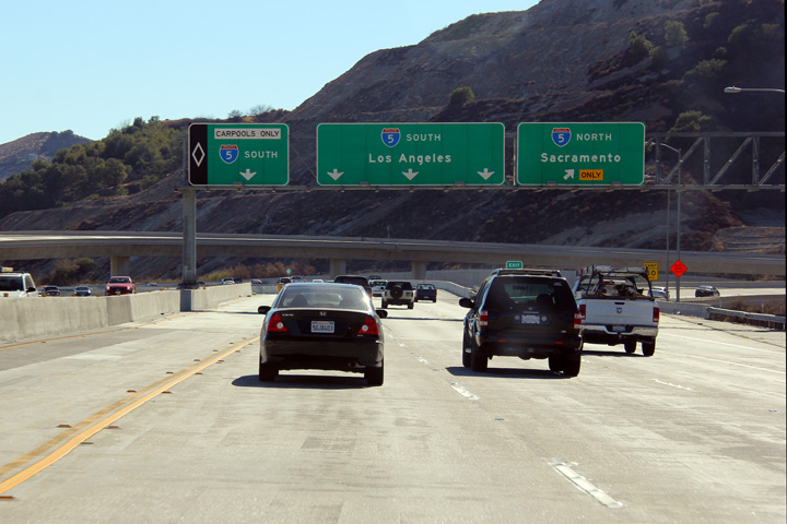
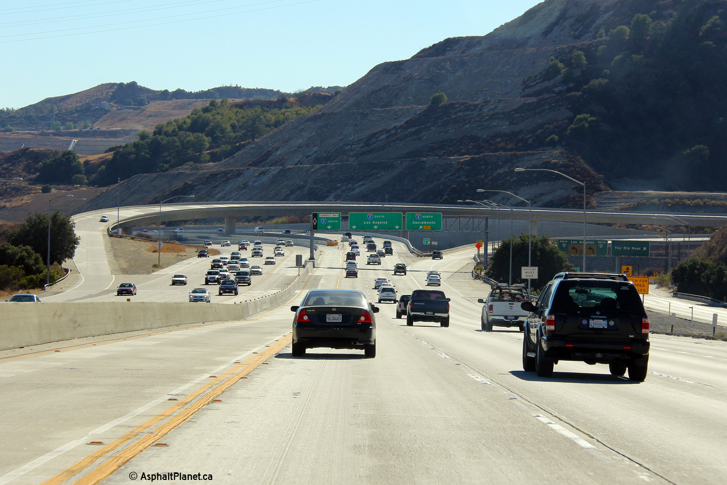
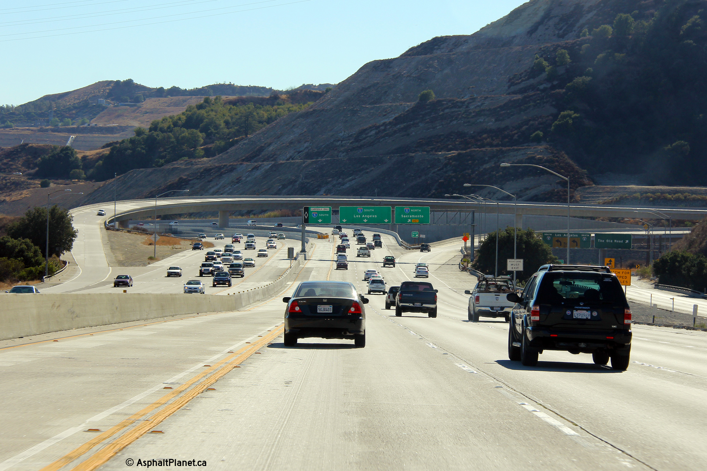
Two views southbound at the I-5 interchange. |
 |
||
|
High-res: (1440x960) (2400x1600) |
||||
 |
||||
|
Date: 10/31/2013 |
High-res: (1440x960) (2400x1600) |
|||
|
Los Angeles County |
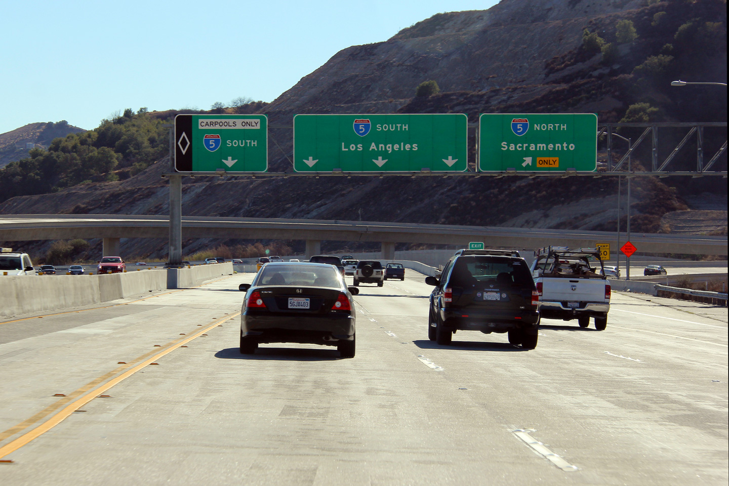
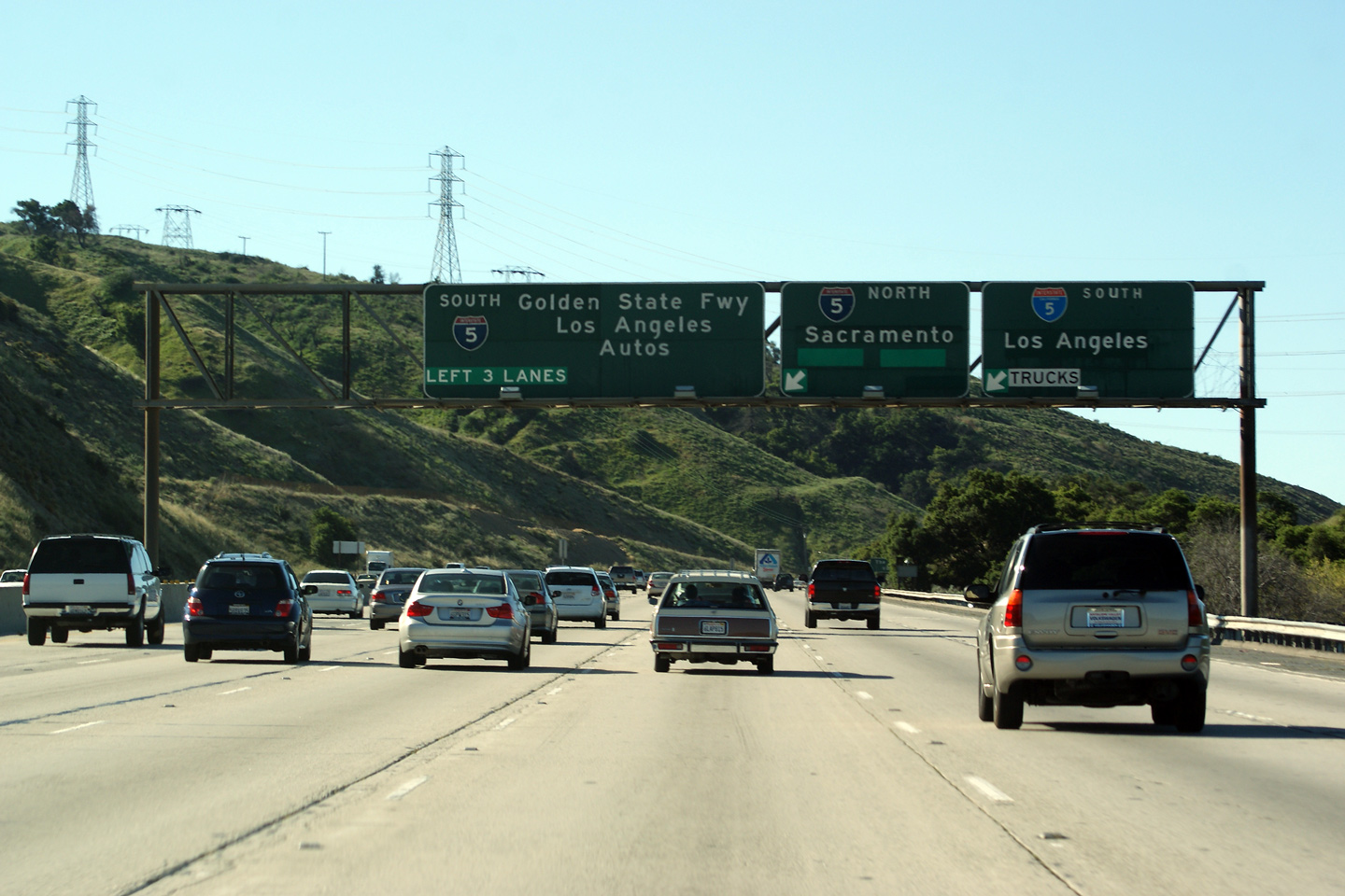
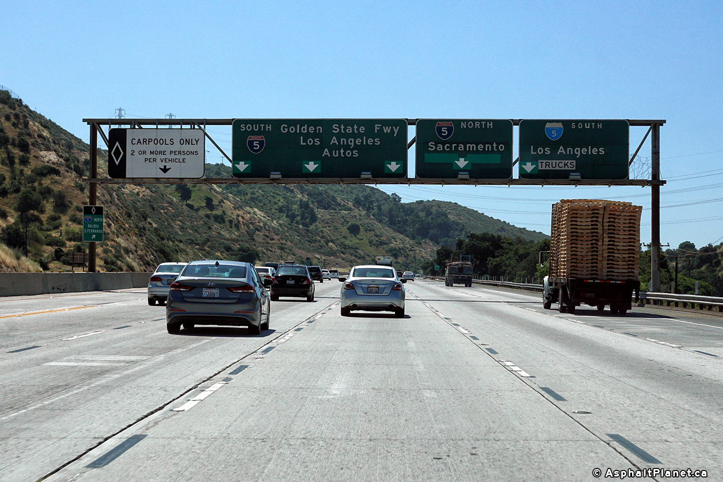
Advanced lane assignment signage approaching the I-5 interchange. |
 |
||
|
Date: 10/31/2013 |
High-res: (1440x960) (2400x1600) |
|||
|
Los Angeles County |
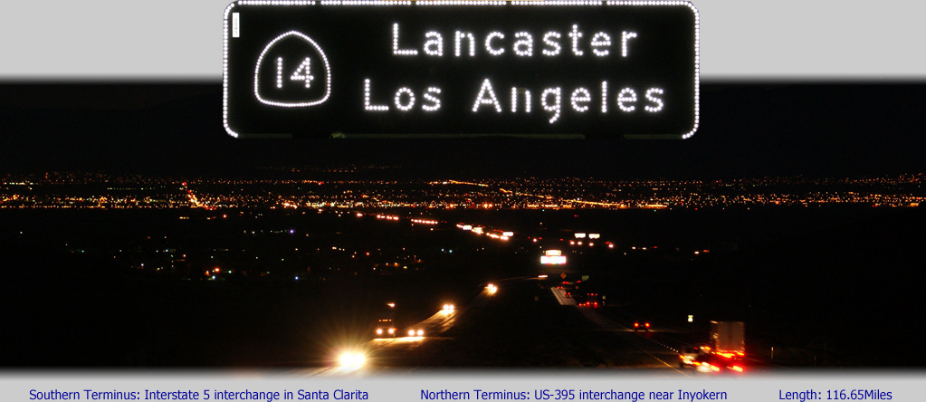
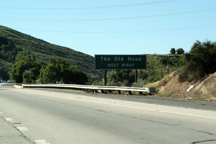
Ground mounted next exit signage for the Old Road. As the name entails, the old road is the historic alignment of US-99. US-99 was the precursor to Interstate 5 through Northern Los Angeles County. |
 |
||
|
Date: 4/06/2010 |
||||
|
Los Angeles County |
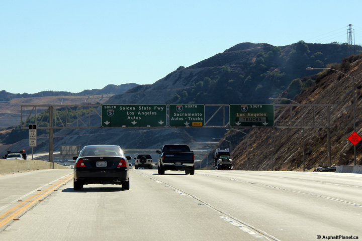
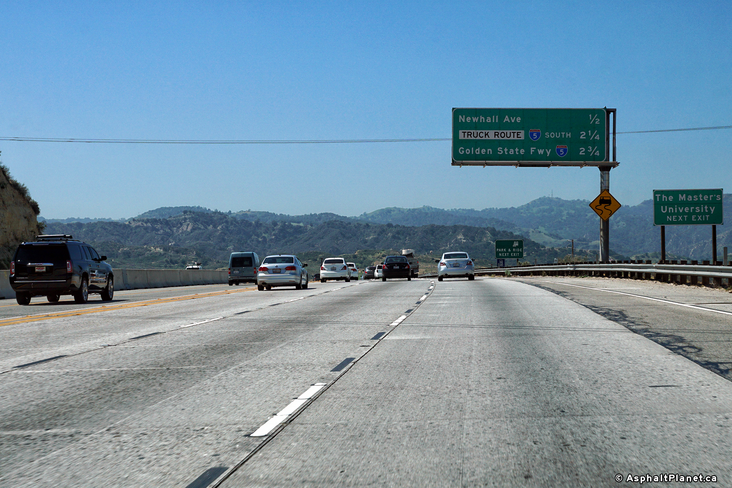
Advanced signage for the upcoming Interstate 5 interchange. It looks as if this signage was modified rather hastily when the HOV lane was added to the median of Highway 14. Construction is underway to build a direct flyover ramp between the Highway 14 HOV lanes, and the HOV lanes on Interstate 5. Hopefully once that construction is completed, this outdated and convoluted signage will be replaced. Old version of this signage, taken in April, 2010, click here. |
 |
||
|
Date: 10/31/2013 |
High-res: (1440x960) (2400x1600) |
|||
|
Los Angeles County |
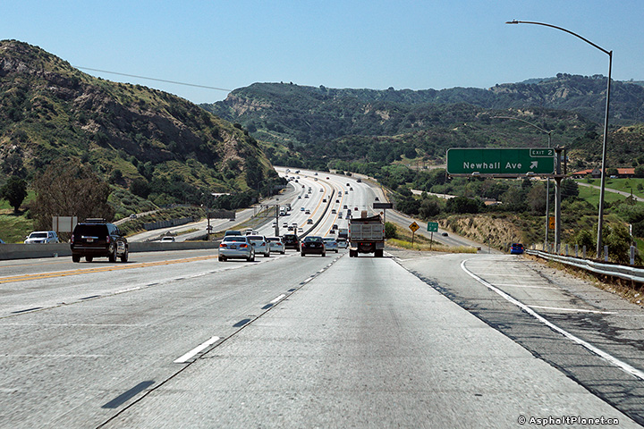
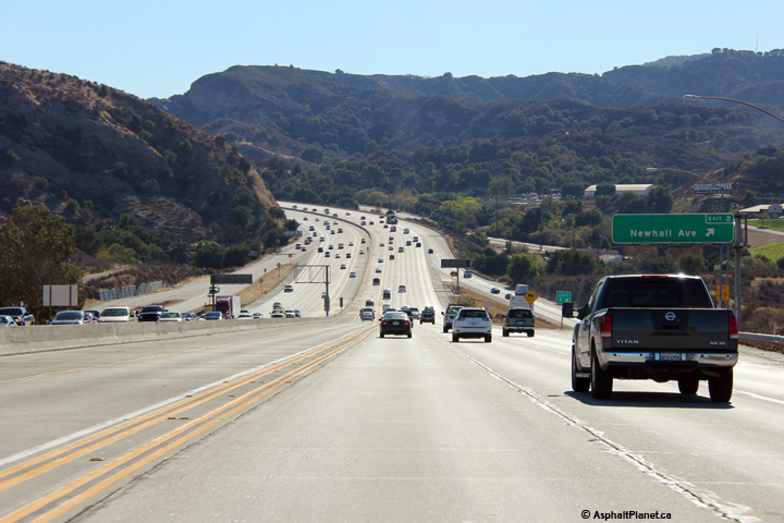
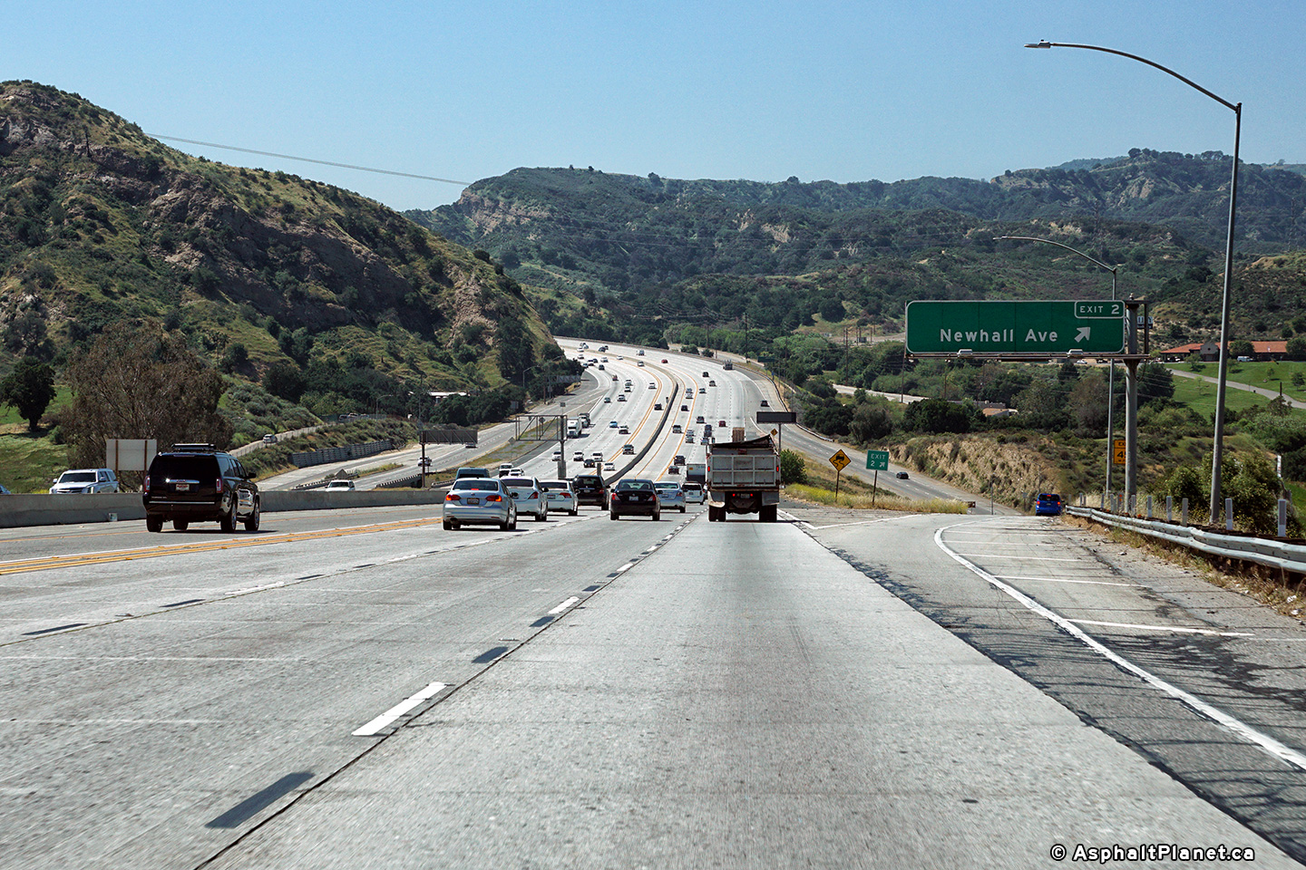
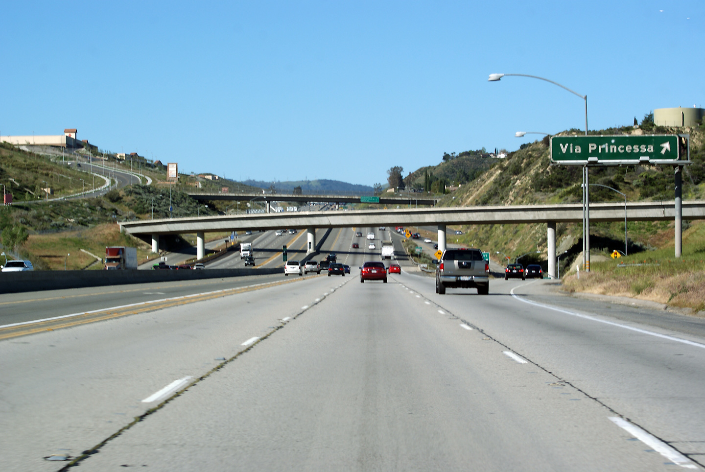
Signage at the southbound exit for Newhall Avenue. Highway 14 is unbelievably picturesque; the freeway twists and winds through the shallow valley's much like this all the way from Palmdale into Los Angeles. |
 |
||
|
Date: 10/31/2013 |
High-res: (1440x960) (2400x1600) |
|||
|
Los Angeles County |
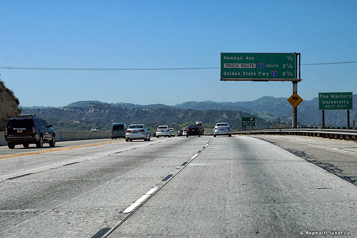
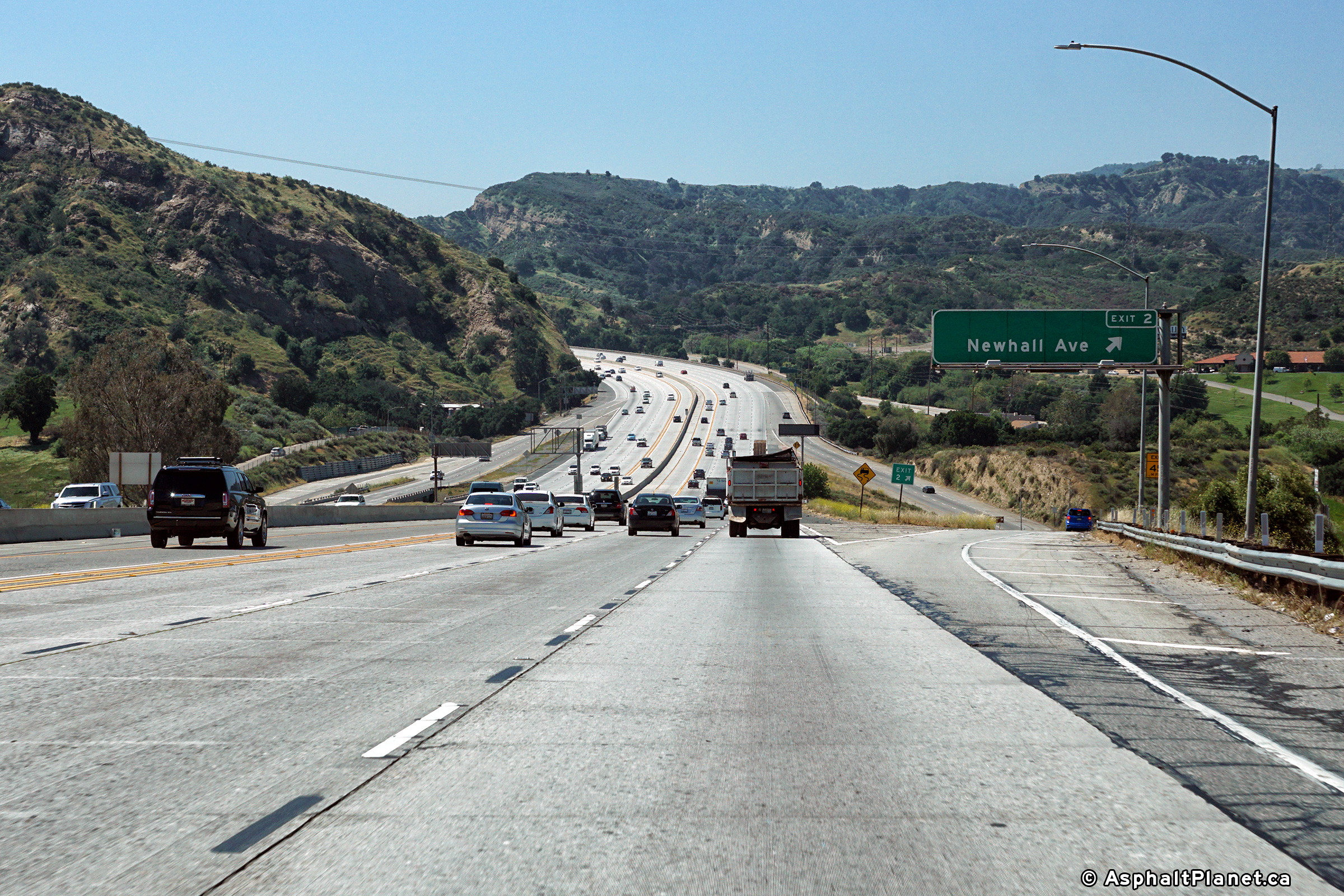
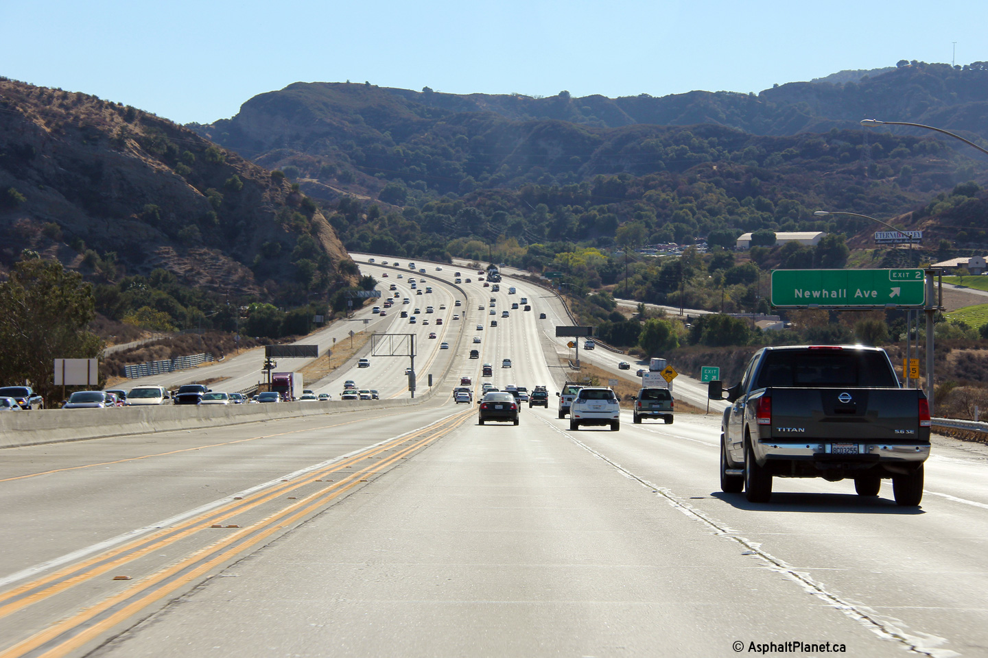
Overhead advanced guide signage for the southbound exit to Newhall Avenue in Santa Clarita. |
 |
||
|
Date: 4/06/2010 |
High-res: (1440x960) (2400x1600) |
|||
|
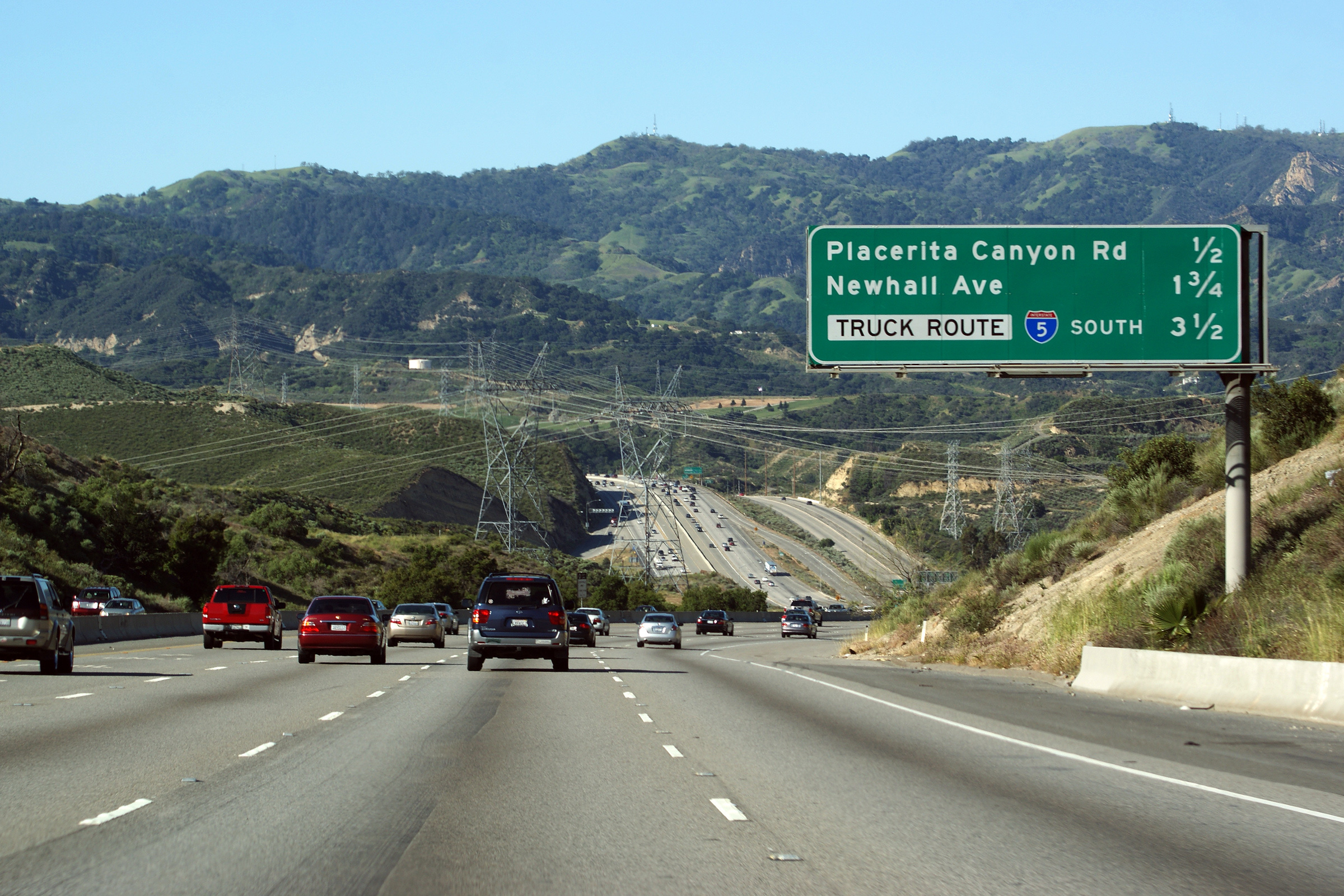
Los Angeles County |
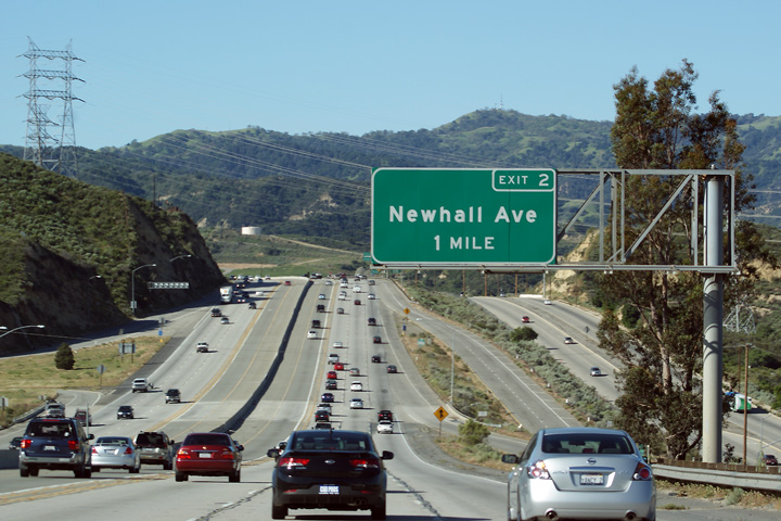
Overhead advanced guide signage for the southbound exit to Newhall Avenue in Santa Clarita. |
 |
||
|
Date: 10/31/2013 |
High-res: (1440x960) (2400x1600) |
|||
|
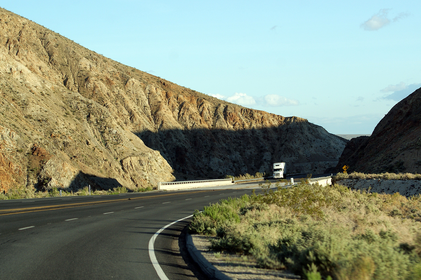
Los Angeles County |
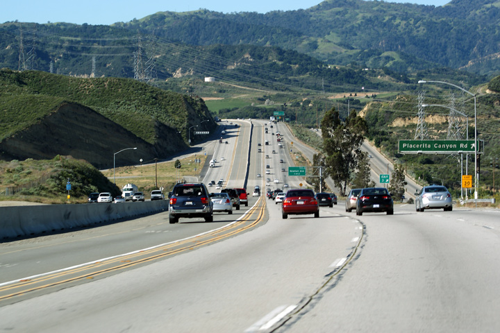
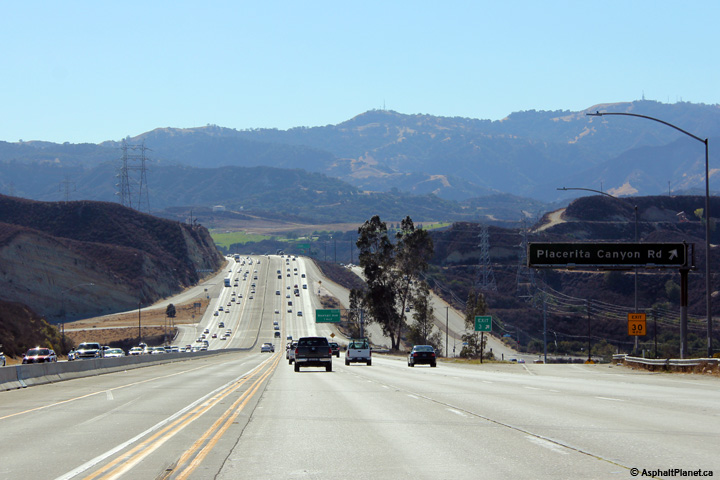
Southbound view approaching the Plancerita Canyon Road interchange. Note just how much material needed to be taken away to push the Antelope Valley Freeway through Southern Santa Clarita. The rock cut dwarfs the neighbouring transport truck that is heading northbound along the highway in the valley. |
  |
||
|
Date: 4/06/2010 |
High-res: (1440x960) (2400x1600) |
|||
|
Los Angeles County |
Next exit sign approaching the Placerita Canyon Road interchange. Often times next exit signage would be median mounted, yet the Antelope Valley Freeway lacks any median mounted signs. |
 |
||
|
Date: 4/06/2010 |
High-res: (1440x960) (2400x1600) |
|||
|
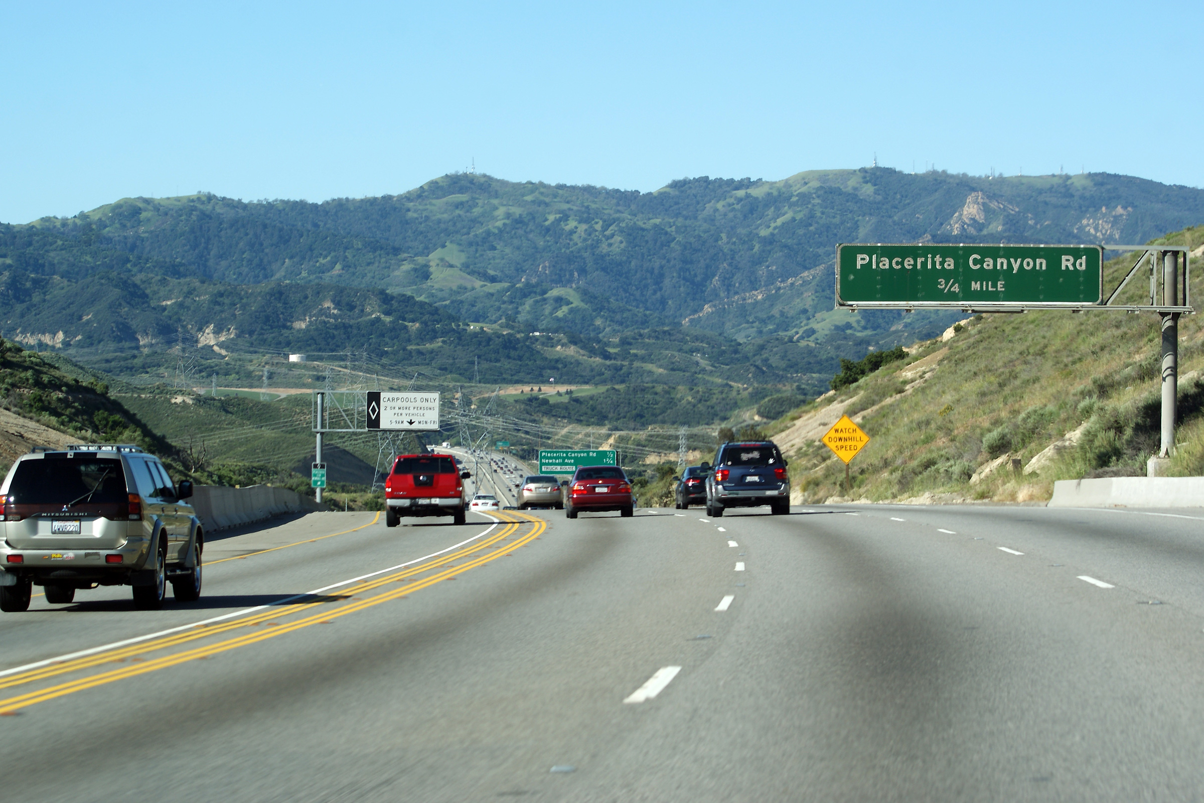
Los Angeles County |
Advanced sign for Placerita Canyon Road. |
 |
||
|
Date: 4/06/2010 |
High-res: (1440x960) (2400x1600) |
|||
|
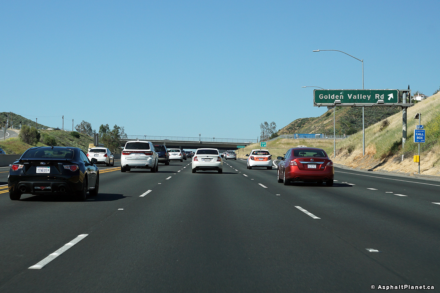
Los Angeles County |
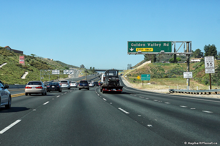
Southbound button copy signage at the ramp to Golden Valley Road. |
 |
||
|
Date: 4/06/2010 |
High-res: (1440x960) (2400x1600) |
|||
|
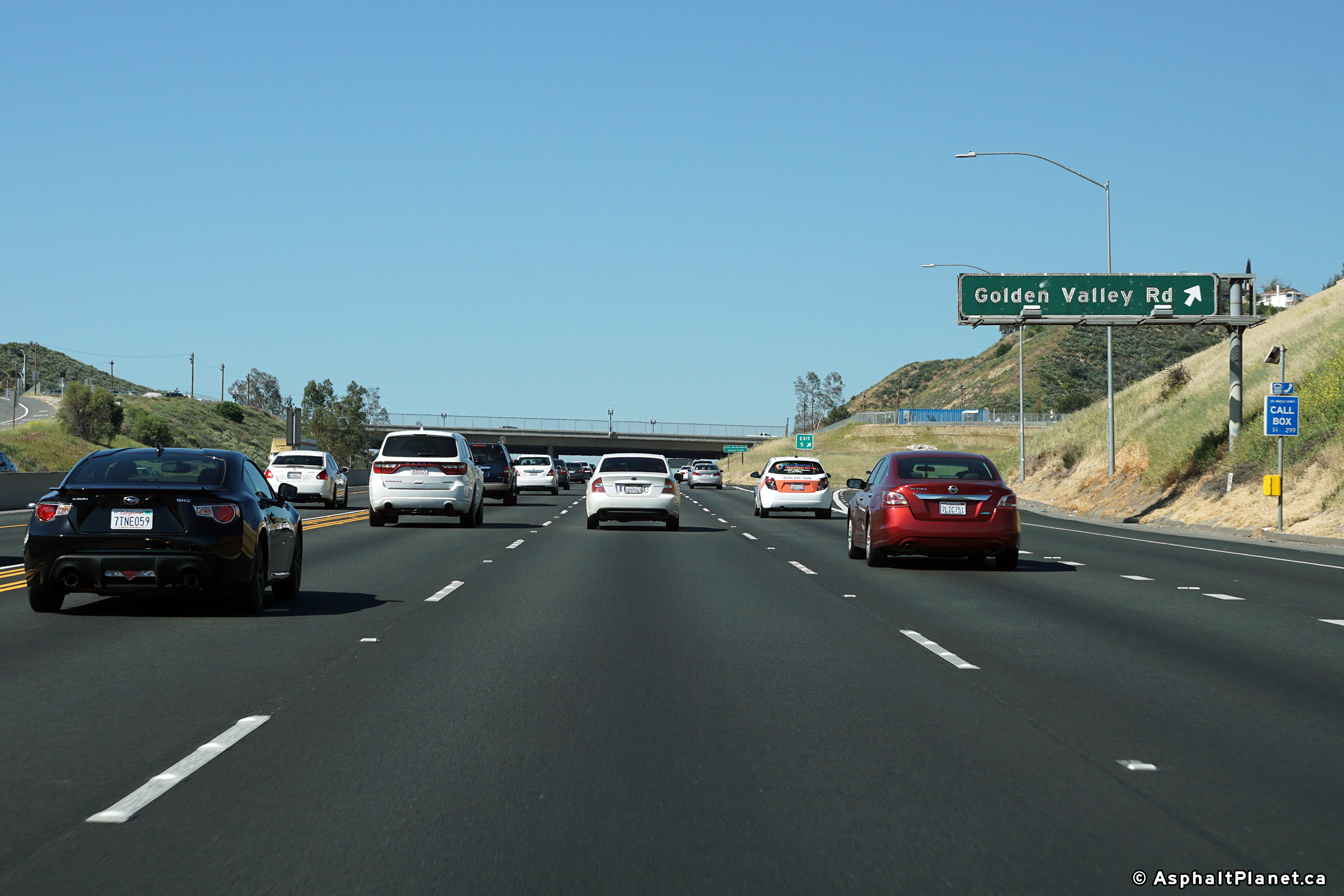
Los Angeles County |
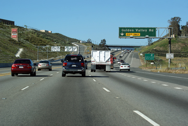
Southbound button copy signage at the ramp to Golden Valley Road. |
 |
||
|
Date: 4/06/2010 |
High-res: (1440x960) (2400x1600) |
|||
|
Los Angeles County |
Southbound button copy signage at the ramp to Golden Valley Road. |
 |
||
|
Date: 4/06/2010 |
||||
|
Los Angeles County |
First things first, admittedly, this photo is a little bit blurry. This might sound a tad anal retentive, however I try to only upload the best of the best in terms of highway photos. Generally this means discarding anything that didn't turn out properly. However, I always run into issues when a photo is just a tad blurry but highlights something fairly interesting. I found the scale of the northbound flyover ramp to the Sierra Highway to be of particular interest -- it almost seems to indicate that an additional freeway was planned to parallel the Santa Clara River past the north end of these ramps. Hence why I included a blurry photo. |
 |
||
|
Date: 4/06/2010 |
||||
|
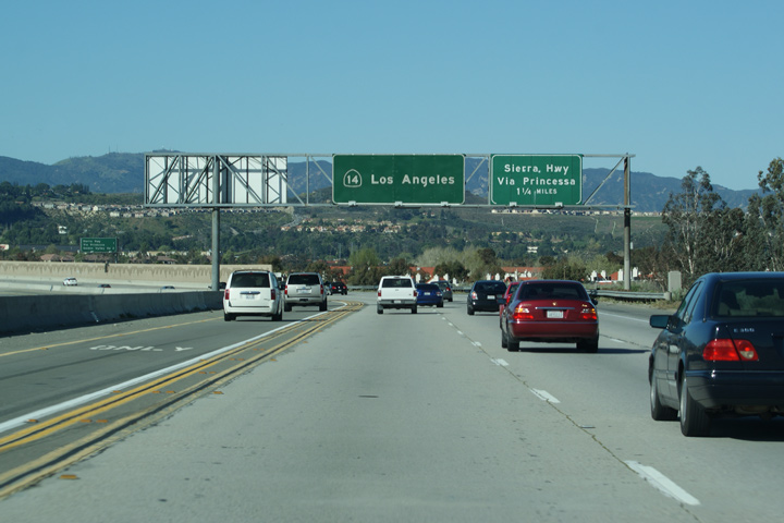
Los Angeles County |
Advanced signage for the Sierra Highway interchange that is upcoming. Sierra Highway is the former alignment of US-6 through the Antelope Valley prior to the construction of the current freeway. Doing research about California Highway 14 for this page, I discovered that a small section of the Sierra Highway is still maintained by CalTrans, and is designated and signed as Highway 14U (Unrelinquished). Thanks to aaroads.com for this interesting piece of information. |
 |
||
|
Date: 4/06/2010 |
||||
|
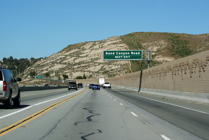
Los Angeles County |
Advanced signage for the Sand Canyon Road interchange along Highway 14 South. The block noise barriers that are typical of Californian Freeways give the Antelope Valley freeway a distinctive southern flavour. |
 |
||
|
Date: 4/06/2010 |
||||
|
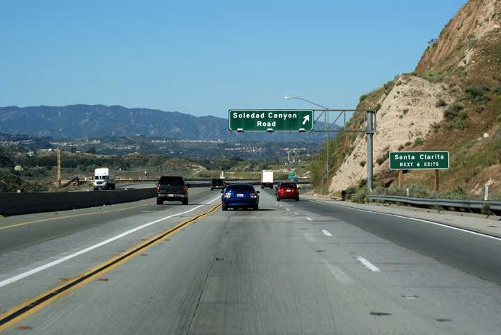
Los Angeles County |
Button copy signage for the ramp to Soledad Canyon Road. |
 |
||
|
Date: 4/06/2010 |
High-res | |||
|
Los Angeles County |
Southbound view from the Escondido Canyon Road overpass. Again, note the scale of the rock cut visible on the right hand side of the freeway in the photo. It would have cost California a fortune to build this freeway. |
 |
||
|
Date: 4/06/2010 |
High-res | |||
|
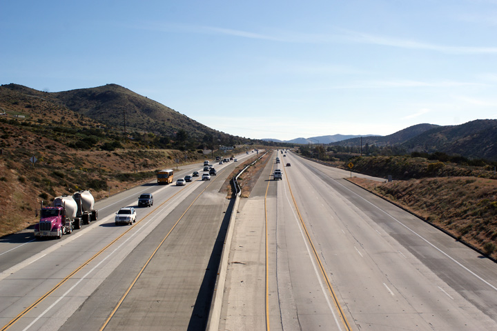
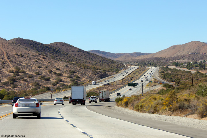
Los Angeles County |
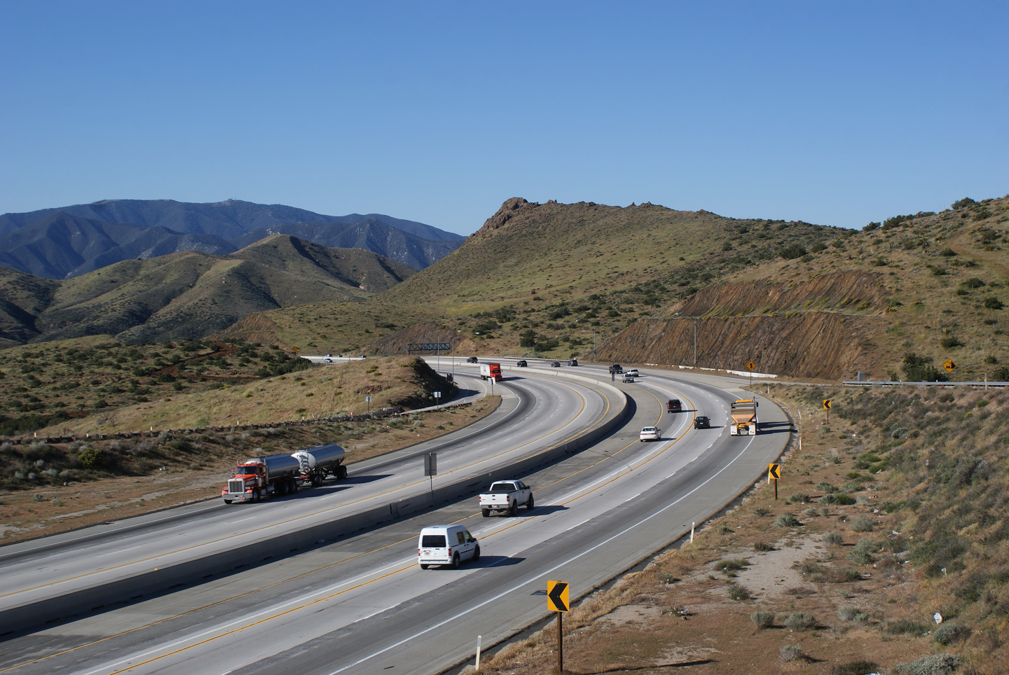
This view looks north along the Antelope Valley Freeway from the Escondido Canyon Road overpass. Take notice of the irregular cross-section of Highway 14; Highway 14 has several passing lanes serving both northbound and southbound traffic as it ascends and descends the San Gabriel Mountain Range. |
 |
||
|
Date: 4/06/2010 |
High-res: (1440x960) (2400x1600) |
|||
|
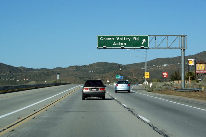
Los Angeles County |
Southbound signage to the ramp to Crown Valley Road. No matter where it is, it is worth the drive to Acton. |
 |
||
|
Date: 4/06/2010 |
||||
|
Los Angeles County |
Southerly view approaching the Santiago Road interchange. |
 |
||
|
Date: 10/31/2013 |
High-res: (1440x960) (2400x1600) |
|||
|
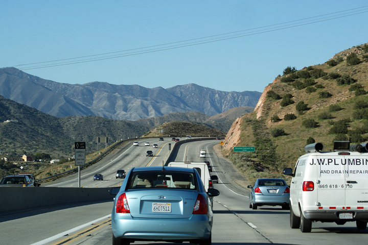
Los Angeles County |
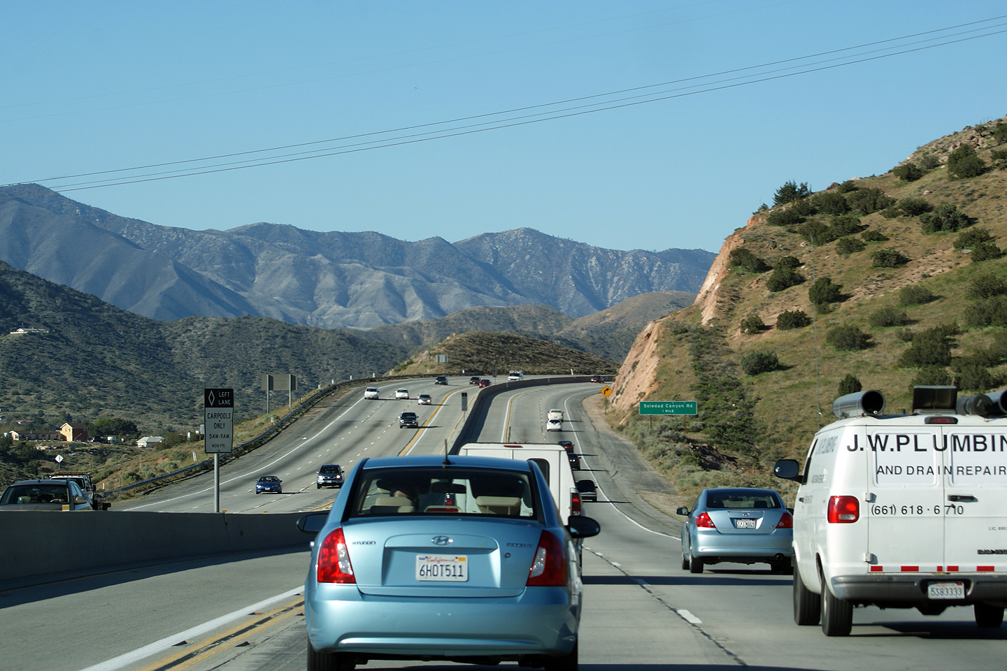
Scenic southbound view along Highway 14 about a mile north of Soledad Canyon Road. |
 |
||
|
Date: 4/06/2010 |
||||
|
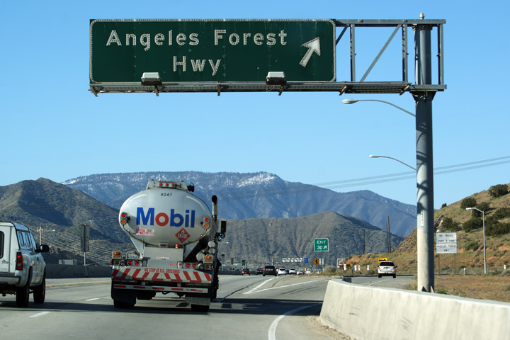
Los Angeles County |
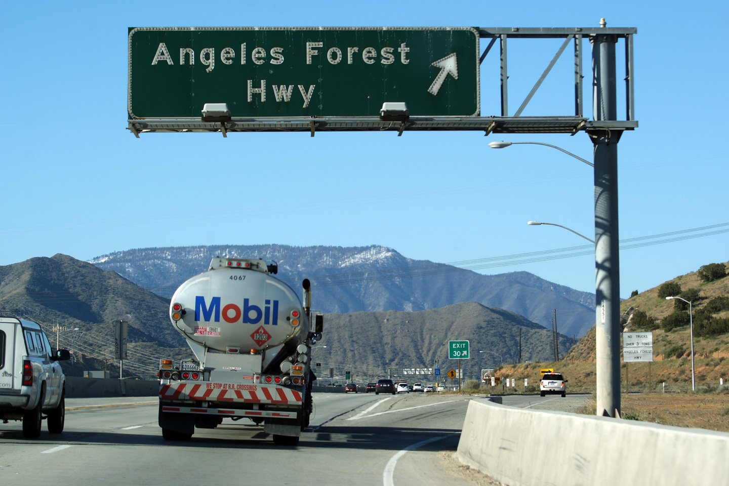
Exit signage for the ramp the Angeles Forest Highway. The Angeles Forest Highway is a county road that leads southerly from the Antelope Valley Freeway to the Angeles Crest Highway (Highway 2), high atop the San Gabriel Mountains. |
 |
||
|
Date: 4/06/2010 |
||||
|
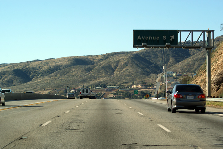
Los Angeles County |
Overhead signage for the ramp to Avenue S in Lancaster. |
 |
||
|
Date: 4/06/2010 |
||||
| Highway 138 is a long east-west highway that runs from Highway 18 on the San Bernardino Mountains westerly along the north side of the San Gabriel Mountain Range. Click here for Highway 138 Images. | ||||
|
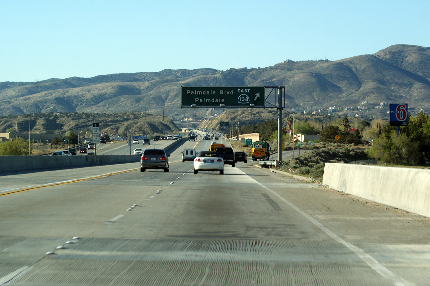
Los Angeles County |
Overhead signage for Highway 138 East in Palmdale. |
 |
||
|
Date: 4/06/2010 |
||||
|
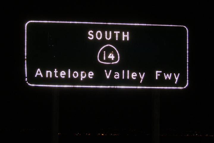
Los Angeles County |
Southbound signage for the Antelope Valley Freeway just south of the Highway 138-West interchange. |
 |
||
|
Date: 4/05/2010 |
||||
|
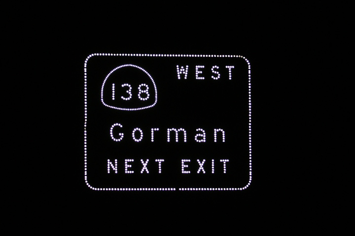
Los Angeles County |
Night view of the approach signage for Highway 138-West. |
 |
||
|
Date: 4/05/2010 |
||||
|
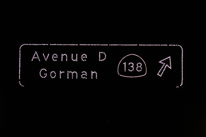
Los Angeles County |
Partial overhead sign for Highway 138-West. |
 |
||
|
Date: 4/05/2010 |
||||
|
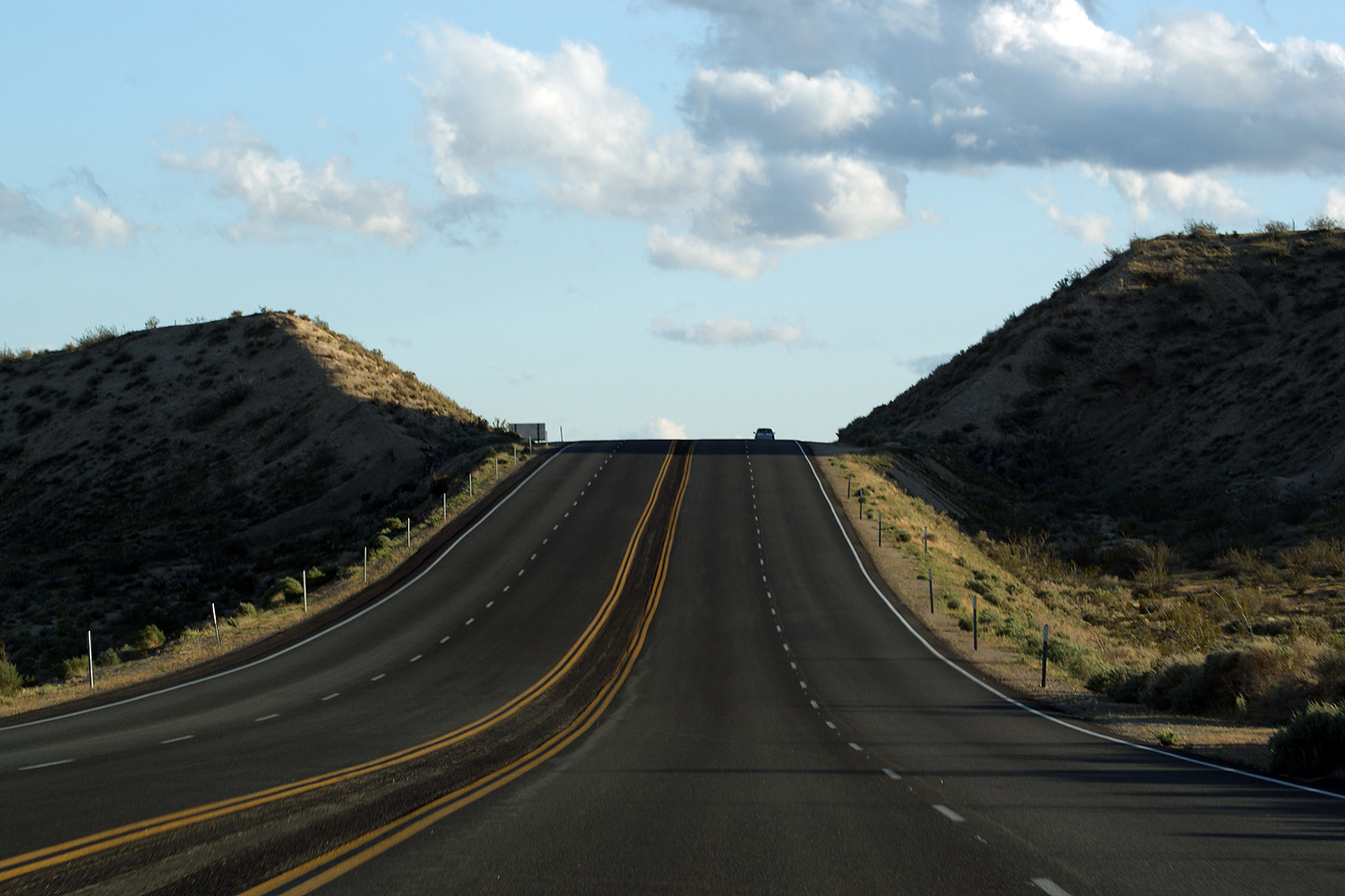
Kern County |
This view looks southerly as Highway 14 begins its decent from Red Rock Canyon into the Fremont Valley of the Mojave Desert. |
 |
||
|
Date: 4/05/2010 |
||||
|
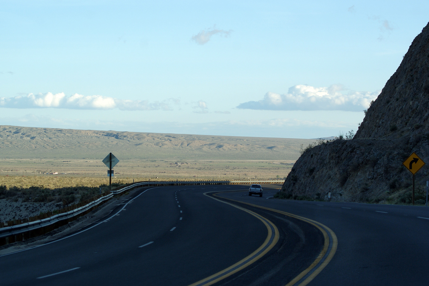
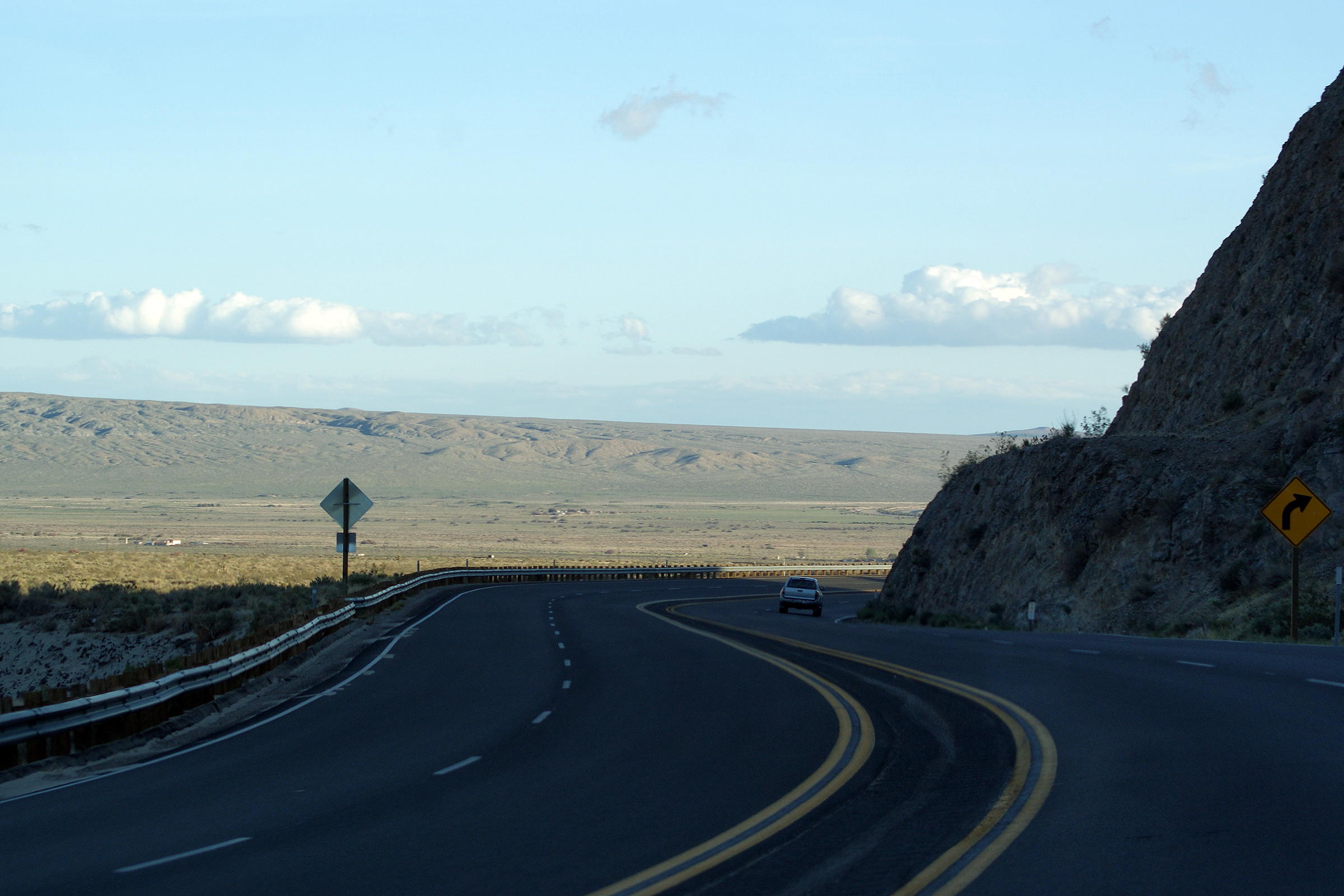
Kern County |
Highway 14 passes through a considerable cut in the mountain as it passes through the south end of Red Rock Canyon State Park bound for the Fremont Valley. |
 |
||
|
Date: 4/05/2010 |
||||
|
Kern County |
Southerly view as Highway 14 winds through the El Paso Mountain Range. |
 |
||
|
Date: 4/05/2010 |
High-res: (1440x960) (2400x1600) | |||
|
Kern County |
View as Highway 14 curves southerly crossing a dry gulch in Red Rock Canyon State Park. It is common in California to see fairly considerable structures over dry river beds. Though rain events are rare in the California Desert, it is not uncommon for sheet flow surface water to inundate a roadway that has not been designed to accommodate overland flow of water. |
 |
||
|
Date: 4/05/2010 |
||||
|
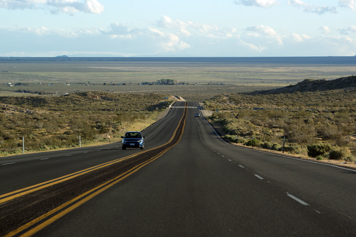
Kern County |
Southerly view approaching Red Rock Canyon from the north. The four-lane highway has narrowed from being divided to having a flush paved median -- Highway 14 maintains this cross-section throughout Red Rock Canyon. |
 |
||
|
Date: 4/05/2010 |
||||
|
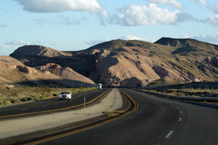
Kern County |
View looking southerly approaching Red Rock Canyon. Red Rock Canyon is found at the the southeast edge of the El Paso Mountain Range. |
 |
||
|
Date: 4/05/2010 |
||||
|
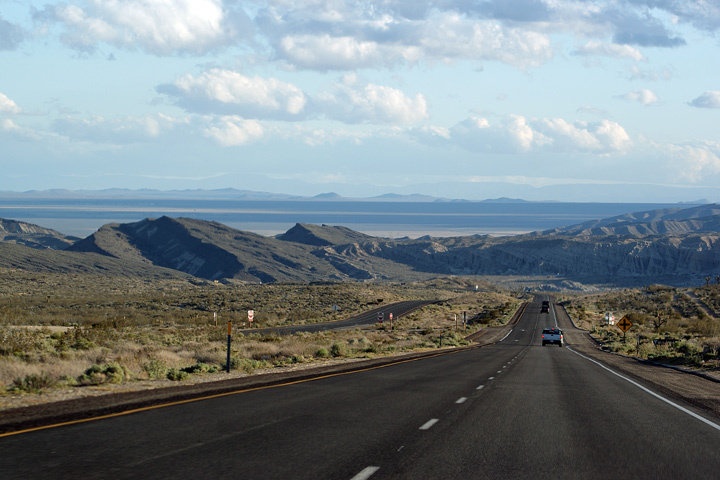
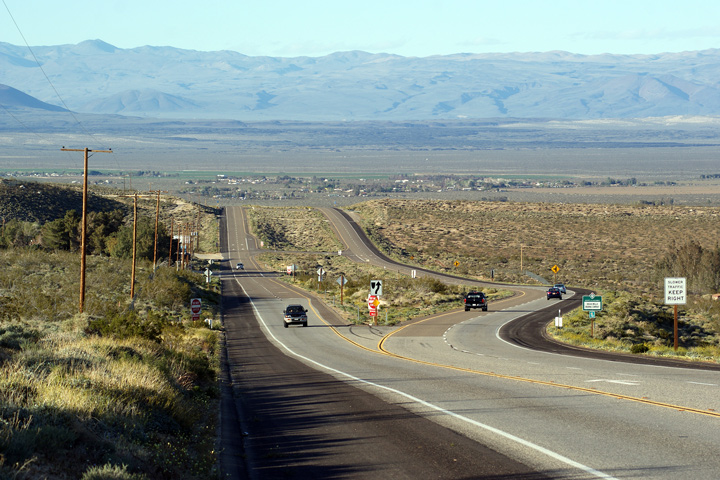
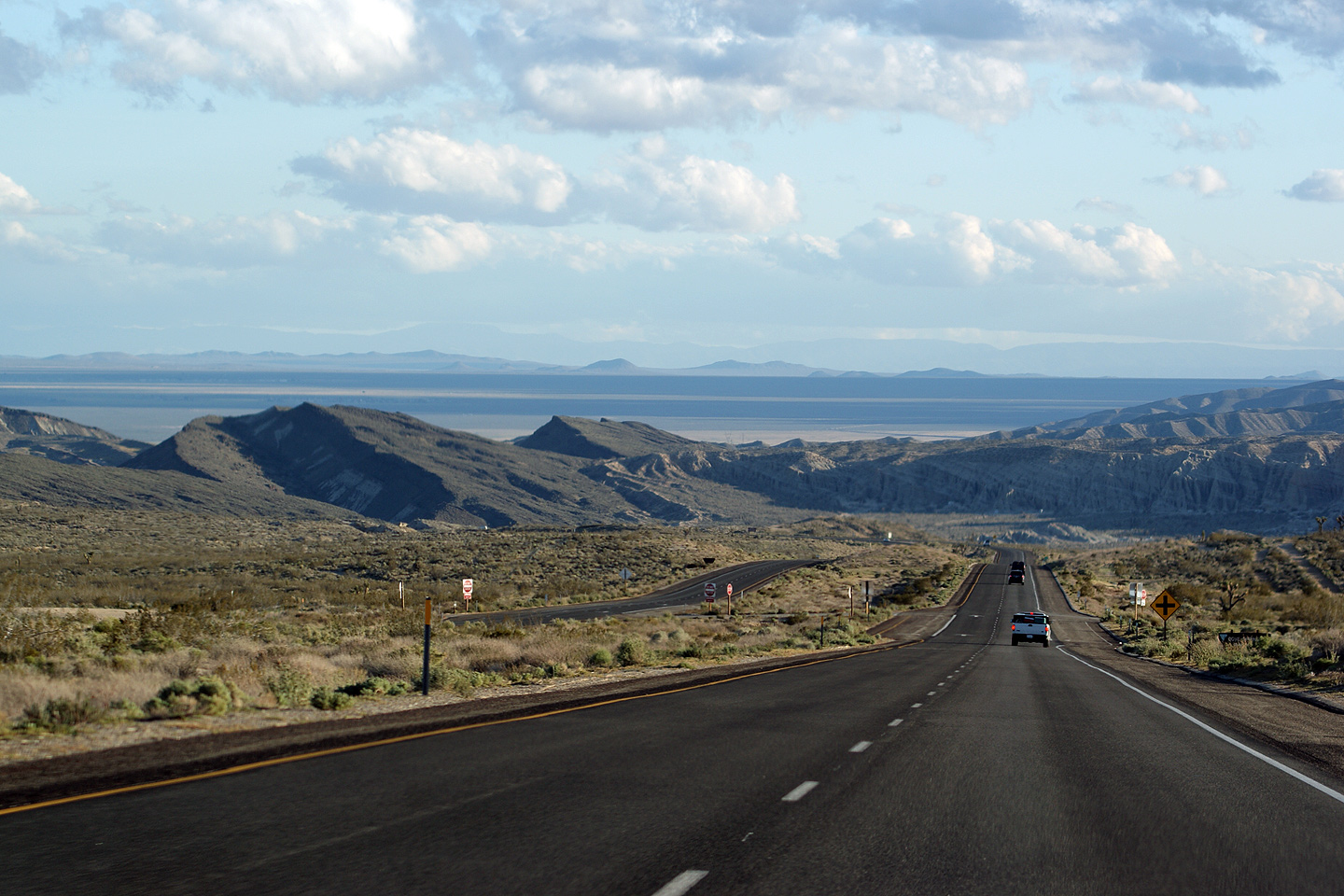
Kern County |
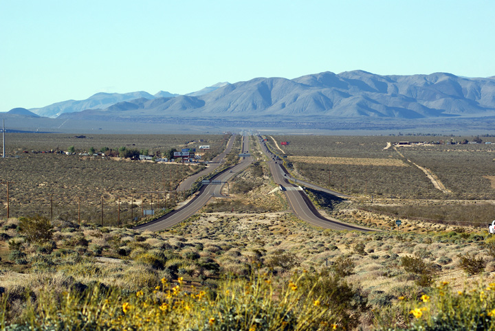
This view looks north towards the Indian Wells Valley from a high foothill along the El Paso Range. The Sierra Nevada Mountains are visible along the left hand side of the photo, while the Coso Mountain Range is visible encroaching the valley straight ahead in the distance. |
 |
||
|
Date: 4/05/2010 |
High-res: (1440x960) (2400x1600) | |||
|
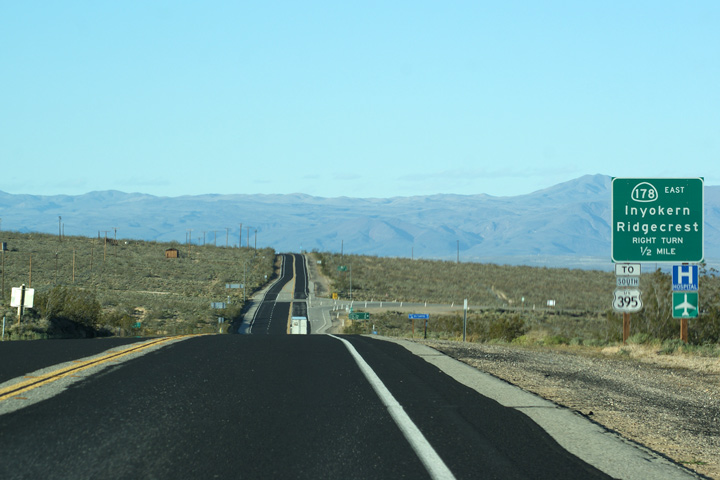
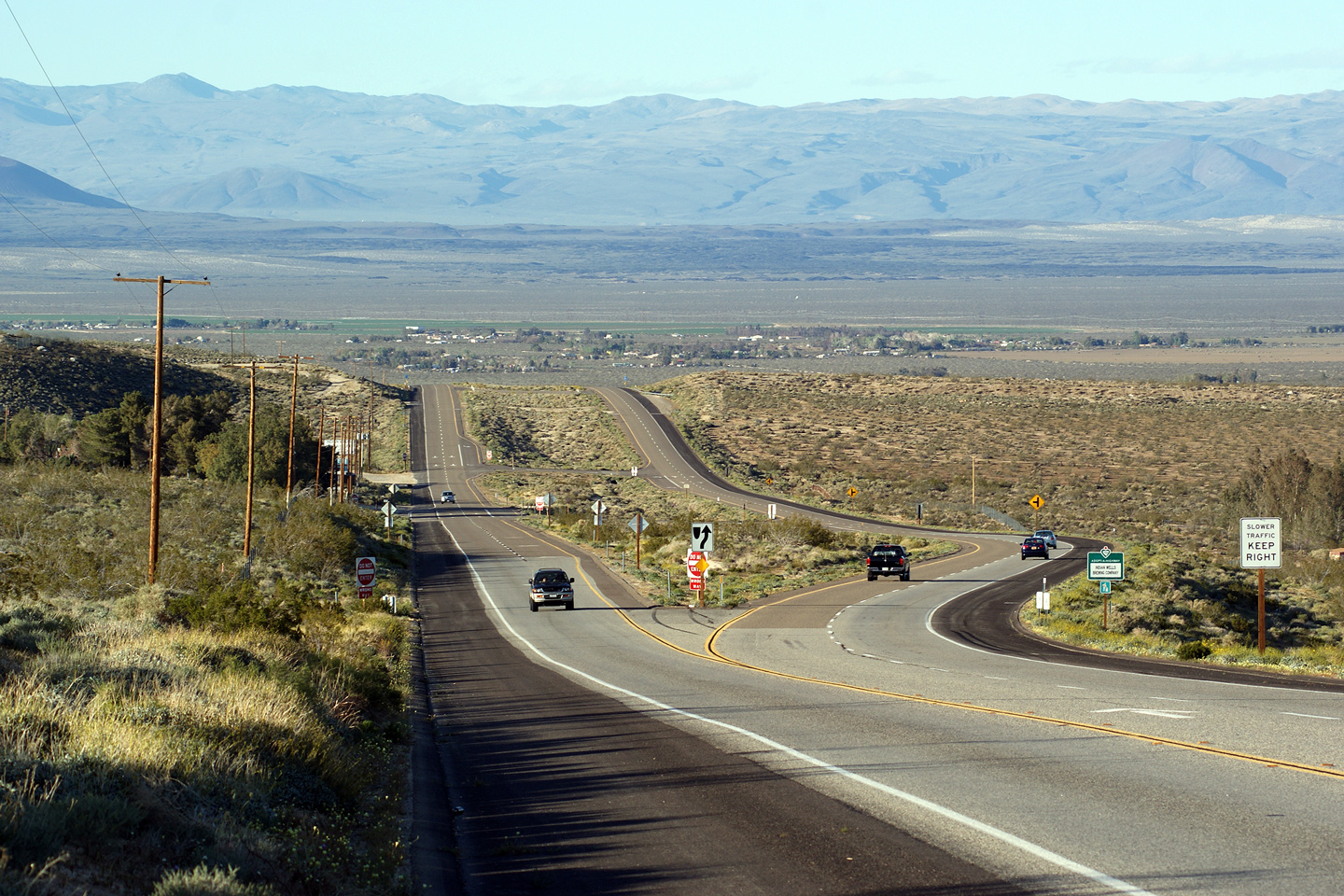
Kern County |
Northbound view from the drivers seat approaching the Highway 178-East junction. Highway 14 ends at a directional Y interchange with US-395 a few miles ahead. Wrong way movements are not permitted at this interchange, hence the sign at Highway 178 then directing traffic to US-395 South. |
 |
||
|
Date: 4/05/2010 |
High-res | |||
|
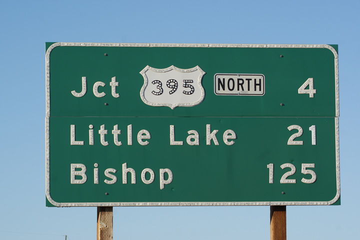
Kern County |
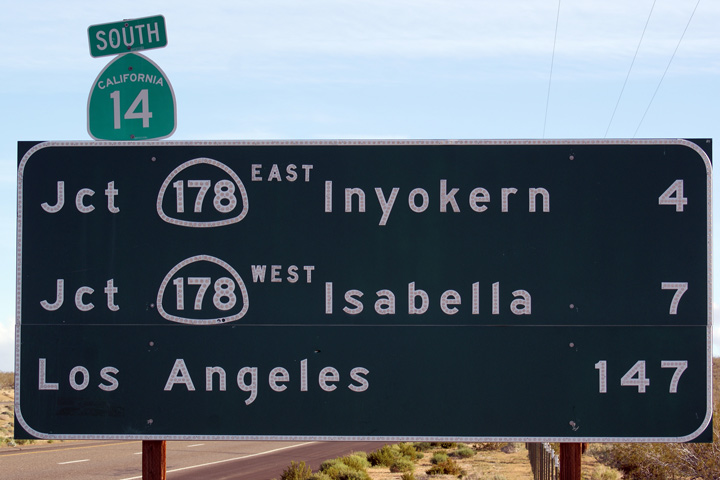
Distance sign heading north after the Highway 178-East junction. Bishop, at a distance of 125 miles, marks the current western terminus of US-6. Prior to 1964, when US-6 was truncated in Bishop, US-6 ran concurrently with US-395 for 121 miles south from Bishop. It is curious why the US-6 designation was truncated, seeing as it served the larger centre (Los Angeles), while the US-395 designation was retained given that leads only to San Bernardino. |
 |
||
|
Date: 4/05/2010 |
||||
|
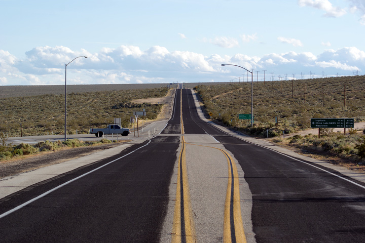
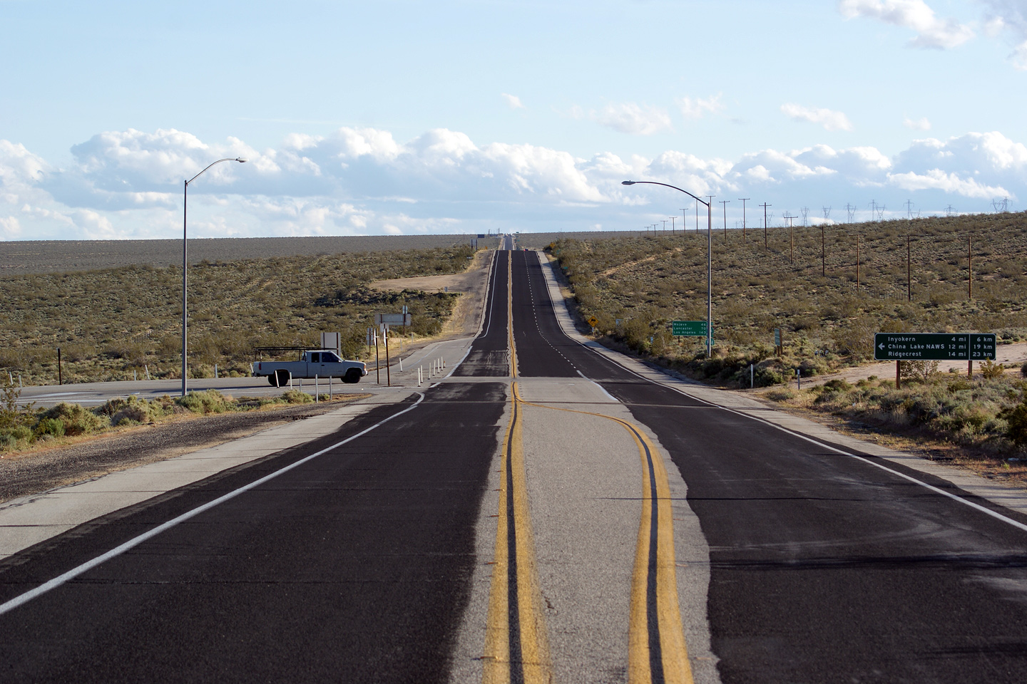
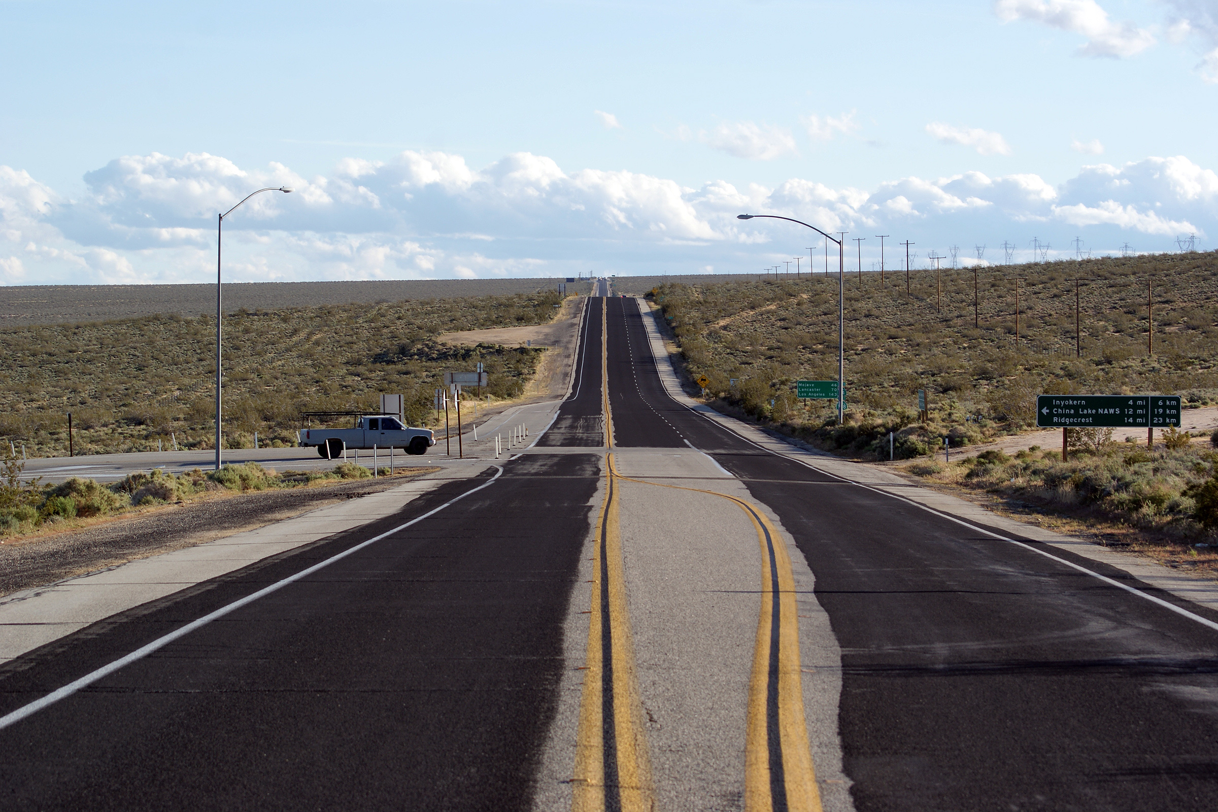
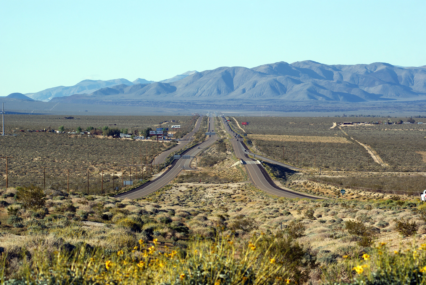
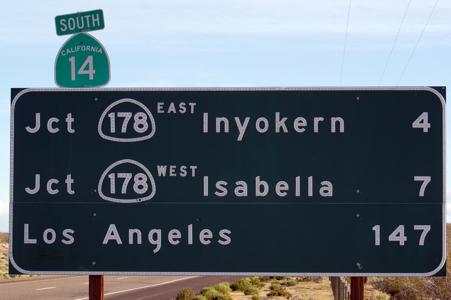
Kern County |
Southbound view approaching the Highway 178-West junction. Note that the destination sign visible to the right of the highway includes distance measures in both Imperial and metric. Given the simplicity of metric (SI) measures, it is simply astonishing that the US still uses Imperial measurement. |
 |
||
|
Date: 4/05/2010 |
High-res: (1440x960) (2400x1600) | |||
|
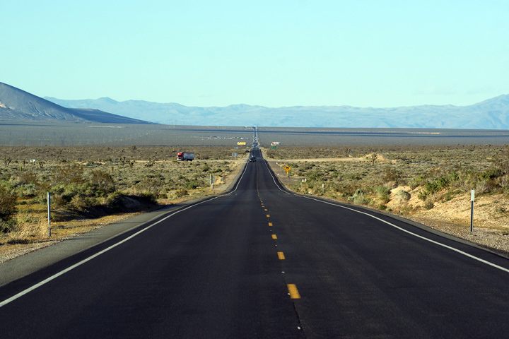
Kern County |
This view looks northerly as Highway 14 widens to four lanes at Indian Wells. Highway 14 is a divided four lane highway from this point, northerly for the next mile or so until Highway 14 terminates at the US-395 interchange. |
 |
||
|
Date: 4/05/2010 |
High-res: (1440x960) (2400x1600) | |||
|
Kern County |
Northbound view from Athel Avenue as Highway 14 meets US-395 at a directional-'Y' interchange. |
 |
||
|
Date: 4/05/2010 |
High-res: (1440x960) (2400x1600) | |||
|
Kern County |
First southbound distance sign along Highway 14 south of the US 395 interchange. |
 |
||
|
Date: 4/05/2010 |
||||
| US-395 is a long highway extending northerly from Interstate 15 into Reno, Nevada and beyond. Click here for US-395 Images. | ||||
<- CA-13
CA Highways
CA-15 ->
AsphaltPlanet.ca
© 2010 AsphaltPlanet.ca.
Scott@asphaltplanet.ca
Page Created: July 5, 2010.
Last Updated: July 5, 2010.