AsphaltPlanet.ca > California > SR-134
Pictures on this page are arranged in order from west to east. CA-134 East photos are left-aligned in the last column, while CA-134 West photos are right-aligned. Center-line pictures are centered within the last column.
|
Location |
Description |
Photo |
||
|
East- |
West- |
|||
| CA-58 ends at US-101 just north of San Louis Obispo. Click here for US-101 Images. | ||||
|
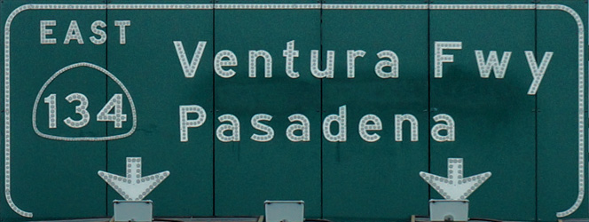
Los Angeles County |
Westbound signage at the end of State Route 134. The Ventura Freeway continues ahead as US-101. |
|
||
|
Date: 12/11/2014 |
High-res: (1440x960) (2400x1600) |
|||
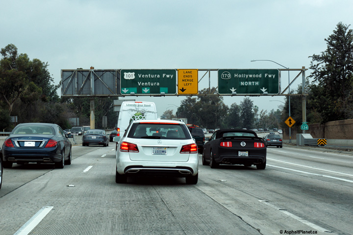
|
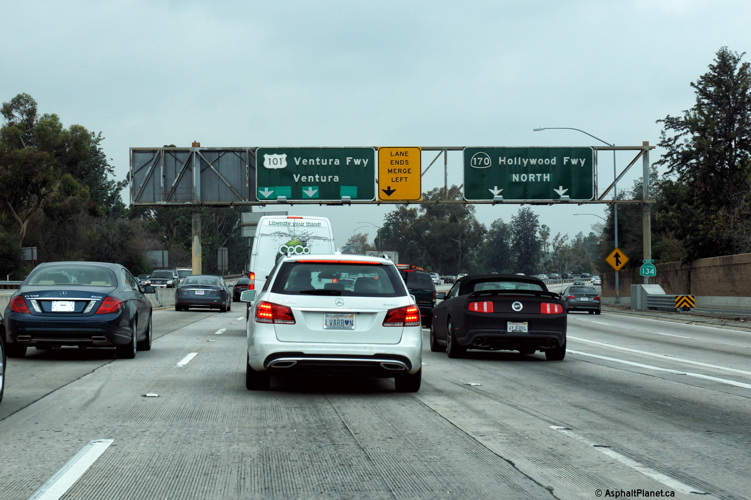
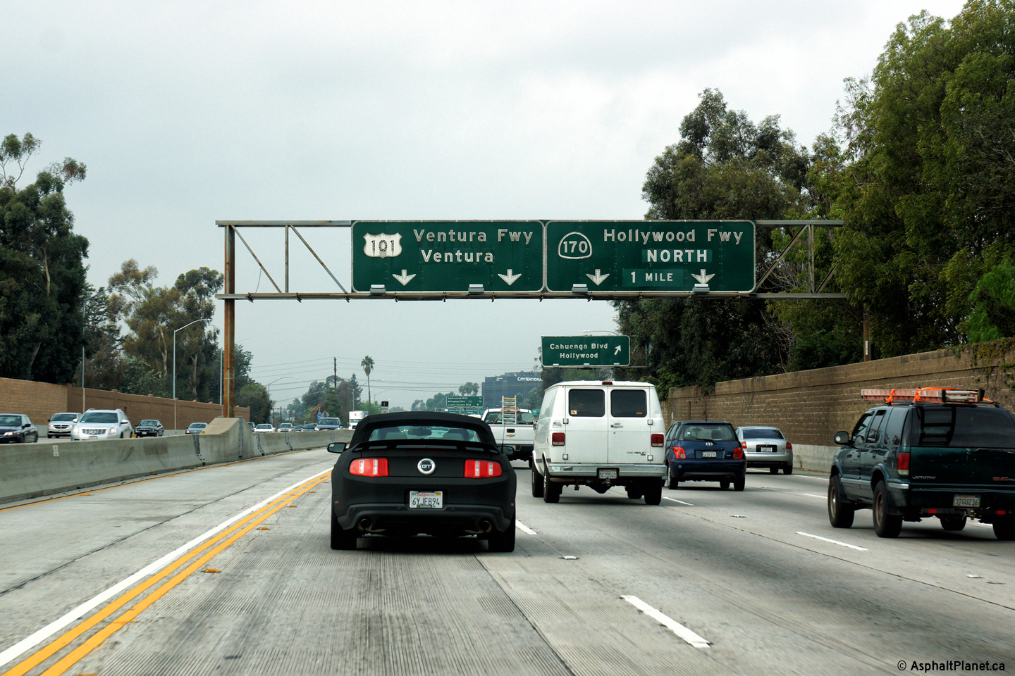
Los Angeles County |
Interchange sequence signage facing westbound motorists approaching the Hollywood Freeway interchange. Interchanges beyond the Hollywood Freeway (and the end of SR-34) are indicated on this signage due to the continuation of the Ventura Freeway as US-101. |
|
||
|
Date: 12/11/2014 |
High-res: (1440x960) (2400x1600) |
|||
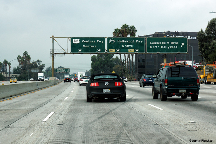
|
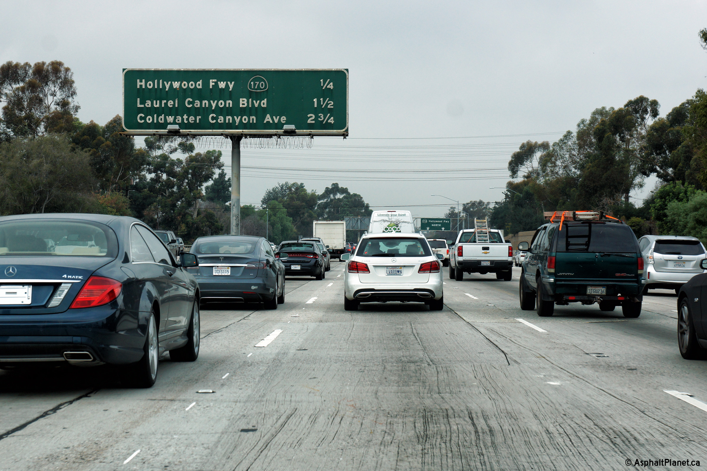
Los Angeles County |
Signage at the westbound off-ramp to Lankershim Boulevard. |
|
||
|
Date: 12/11/2014 |
High-res: (1440x960) (2400x1600) |
|||
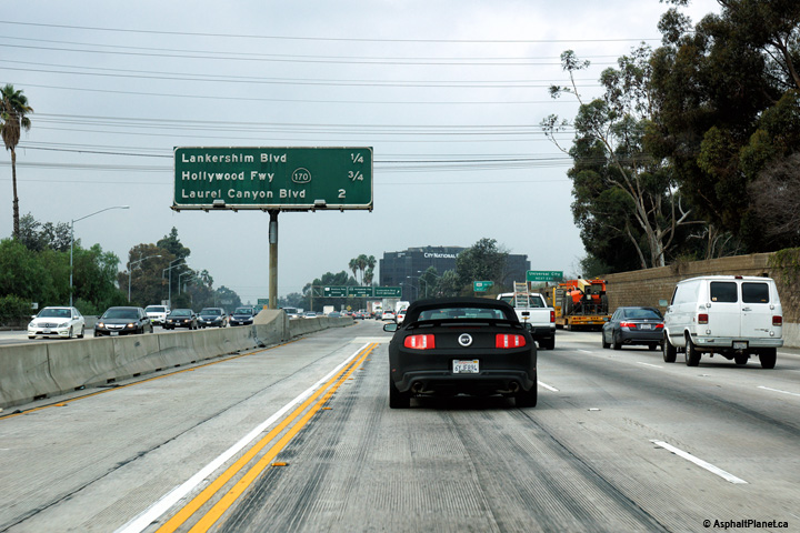
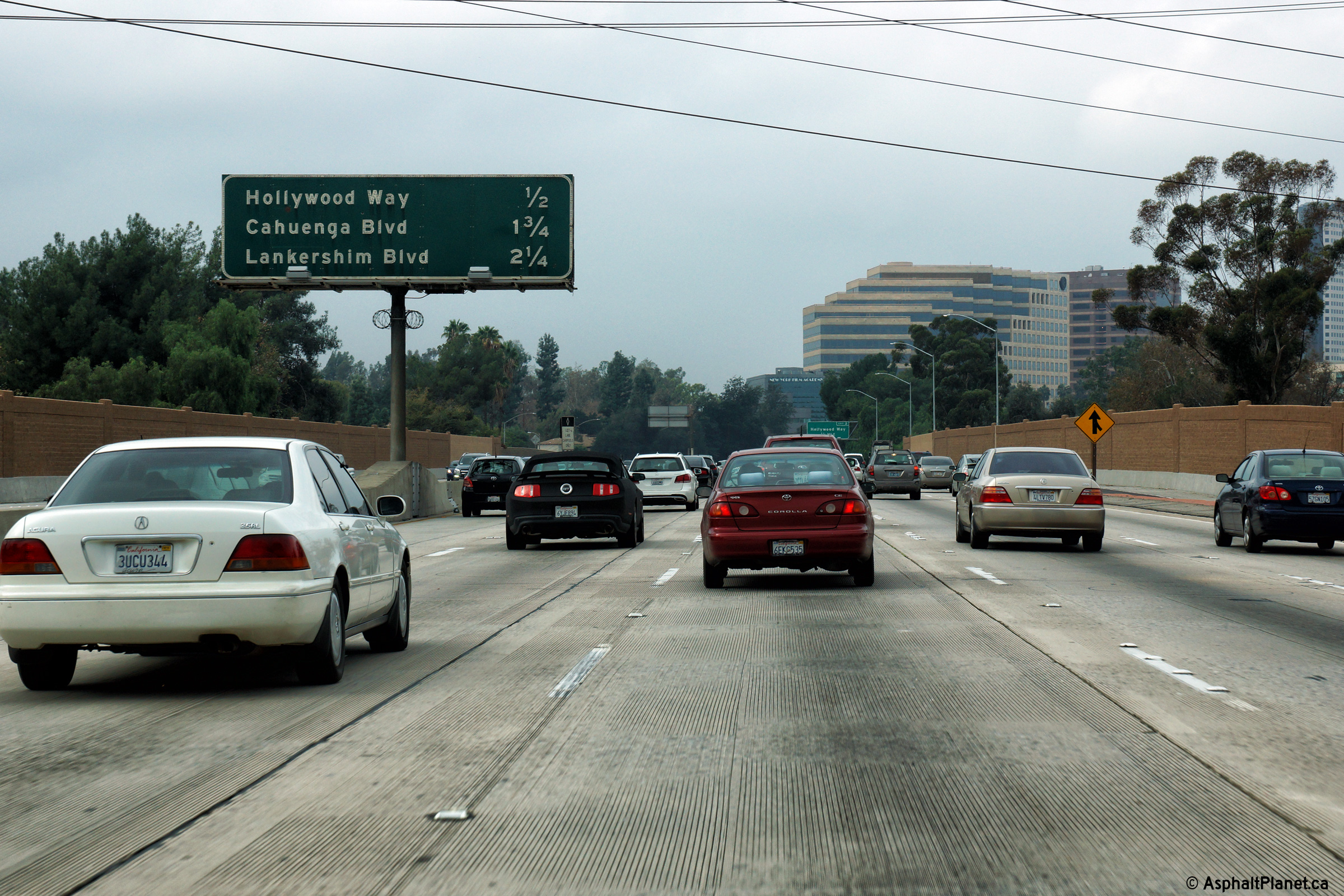
|
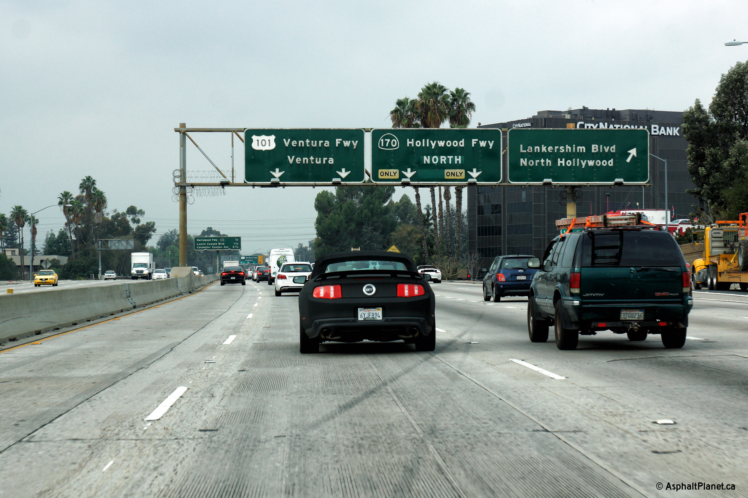
Los Angeles County |
Interchange sequence signage in advance of the Lankershim Boulevard interchange. |
|
||
|
Date: 12/11/2014 |
High-res: (1440x960) (2400x1600) |
|||
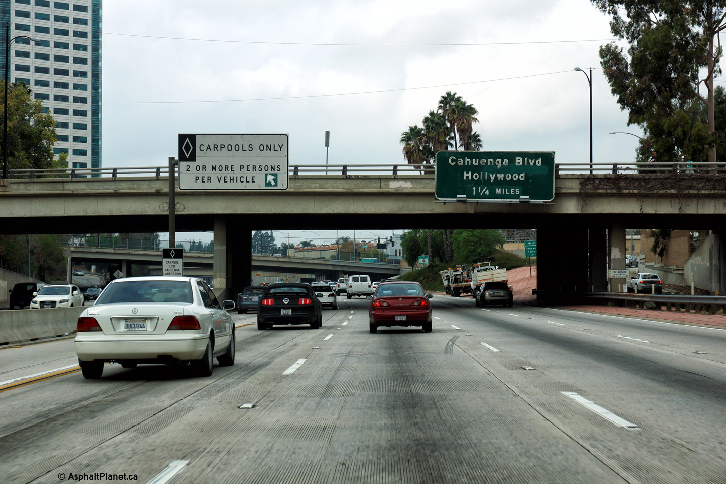
|
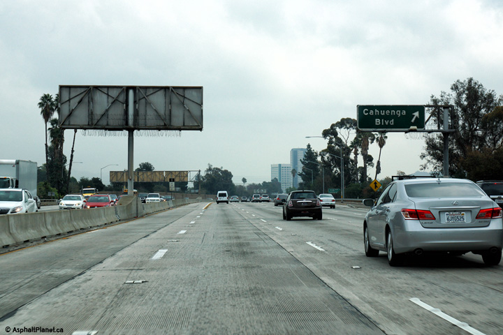
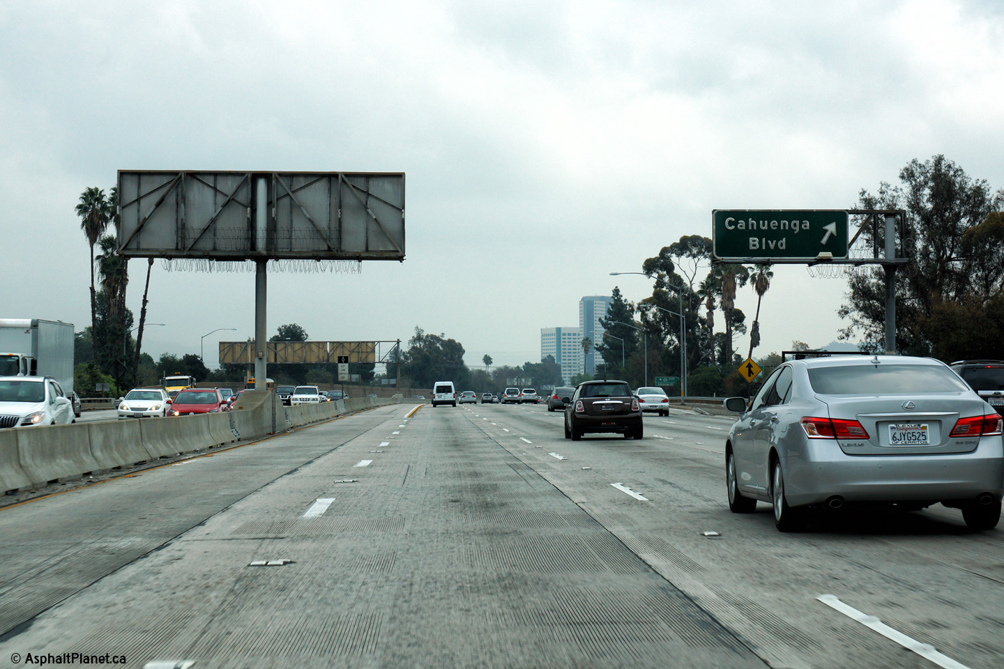
Los Angeles County |
Eastbound signage for the Cahuenga Boulevard interchange. |
 |
||
|
Date: 12/11/2014 |
High-res: (1440x960) (2400x1600) |
|||
|
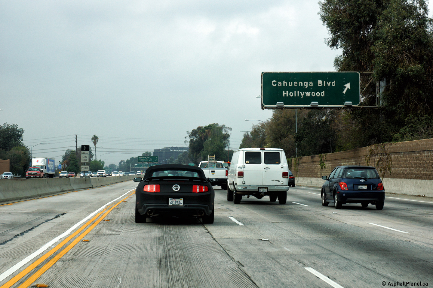
Los Angeles County |
Westbound signage for the off-ramp to Cahuenga Boulevard. |
|
||
|
Date: 12/11/2014 |
High-res: (1440x960) (2400x1600) |
|||
|
Los Angeles County |
Westbound signage in advance of the Hollywood Freeway interchange. State Route 134 ends at this interchange. |
|
||
|
Date: 12/11/2014 |
High-res: (1440x960) (2400x1600) |
|||
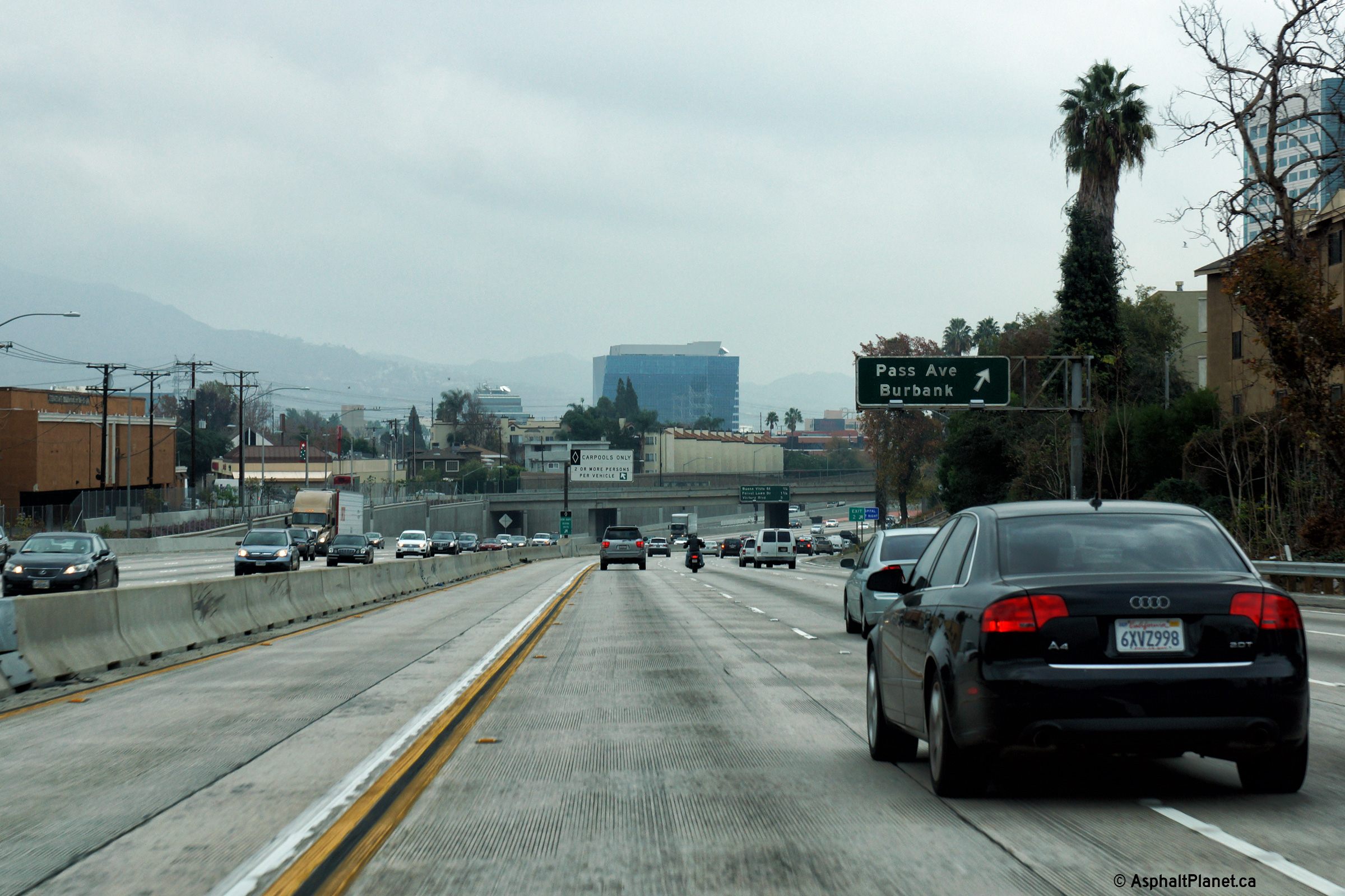
|
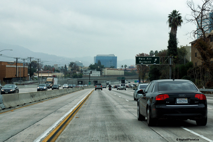
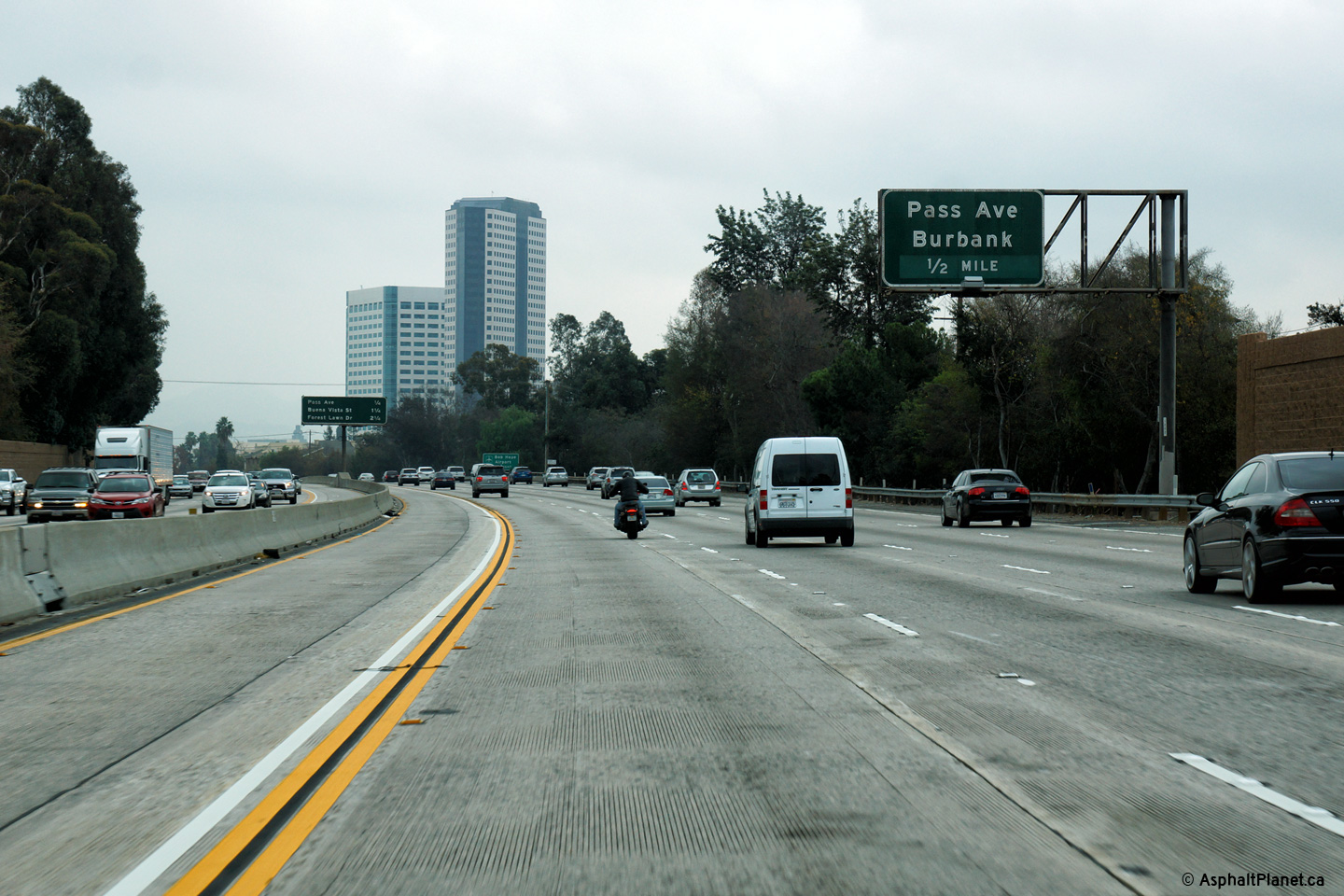
Los Angeles County |
Eastbound advanced signage for the ramp to Pass Avenue. |
 |
||
|
Date: 12/11/2014 |
High-res: (1440x960) (2400x1600) |
|||
|
Los Angeles County |
Eastbound interchange sequence signage for the Pass Avenue interchange. |
 |
||
|
Date: 12/11/2014 |
High-res: (1440x960) (2400x1600) |
|||
|
Los Angeles County |
State Route 58 ends at I-15 several miles south of the I-40 interchange in Barstow. This sign directs eastbound traffic bound for I-40 to use I-15 North. |
 |
||
|
Date: 12/11/2014 |
High-res: (1440x960) (2400x1600) |
|||
|
Los Angeles County |
Just beyond the Hollywood Way interchange stands this advanced signage for the Cahuenga Boulevard interchange. |
 |
||
|
Date: 12/11/2014 |
High-res: (1440x960) (2400x1600) |
|||
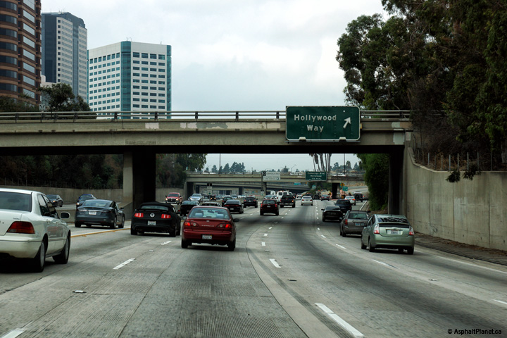
|
Los Angeles County |
Signage for the westbound off-ramp to Hollywood Way. |
|
||
|
Date: 12/11/2014 |
High-res: (1440x960) (2400x1600) |
|||
|
Los Angeles County |
Interchange sequence signage facing westbound motorists in advance of the Hollywood Way interchange. |
 |
||
|
Date: 12/11/2014 |
High-res: (1440x960) (2400x1600) |
|||
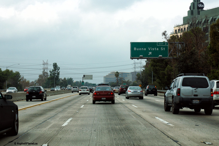
|
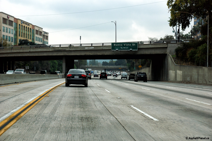
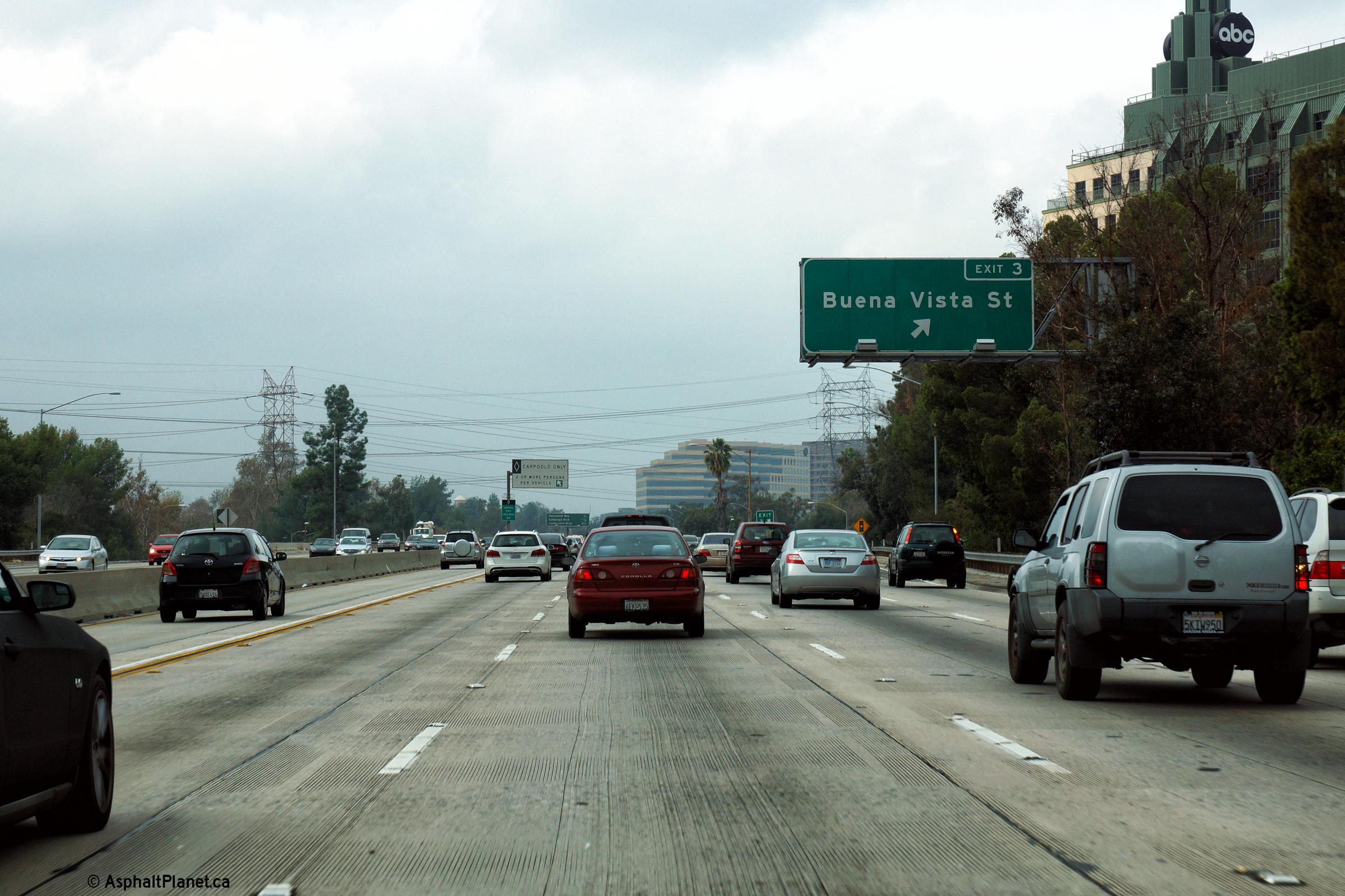
Los Angeles County |
Eastbound advanced signage for the Buena Vista Street interchange interchange. |
 |
||
|
Date: 12/11/2014 |
High-res: (1440x960) (2400x1600) |
|||
|
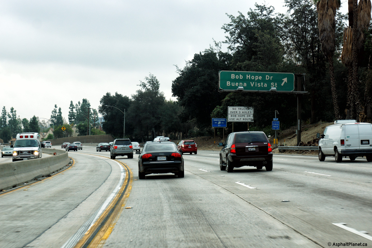
Los Angeles County |
Eastbound view at the off-ramp to Bob Hope Drive and Buena Vista Street. |
 |
||
|
Date: 12/11/2014 |
High-res: (1440x960) (2400x1600) |
|||
|
Los Angeles County |
Signage at the westbound off-ramp to Buena Vista Street. When I drove this road in 2014, this was one of only a handful of non-button copy signs installed on SR-134's portion of the Ventura Freeway. |
|
||
|
Date: 12/11/2014 |
High-res: (1440x960) (2400x1600) |
|||
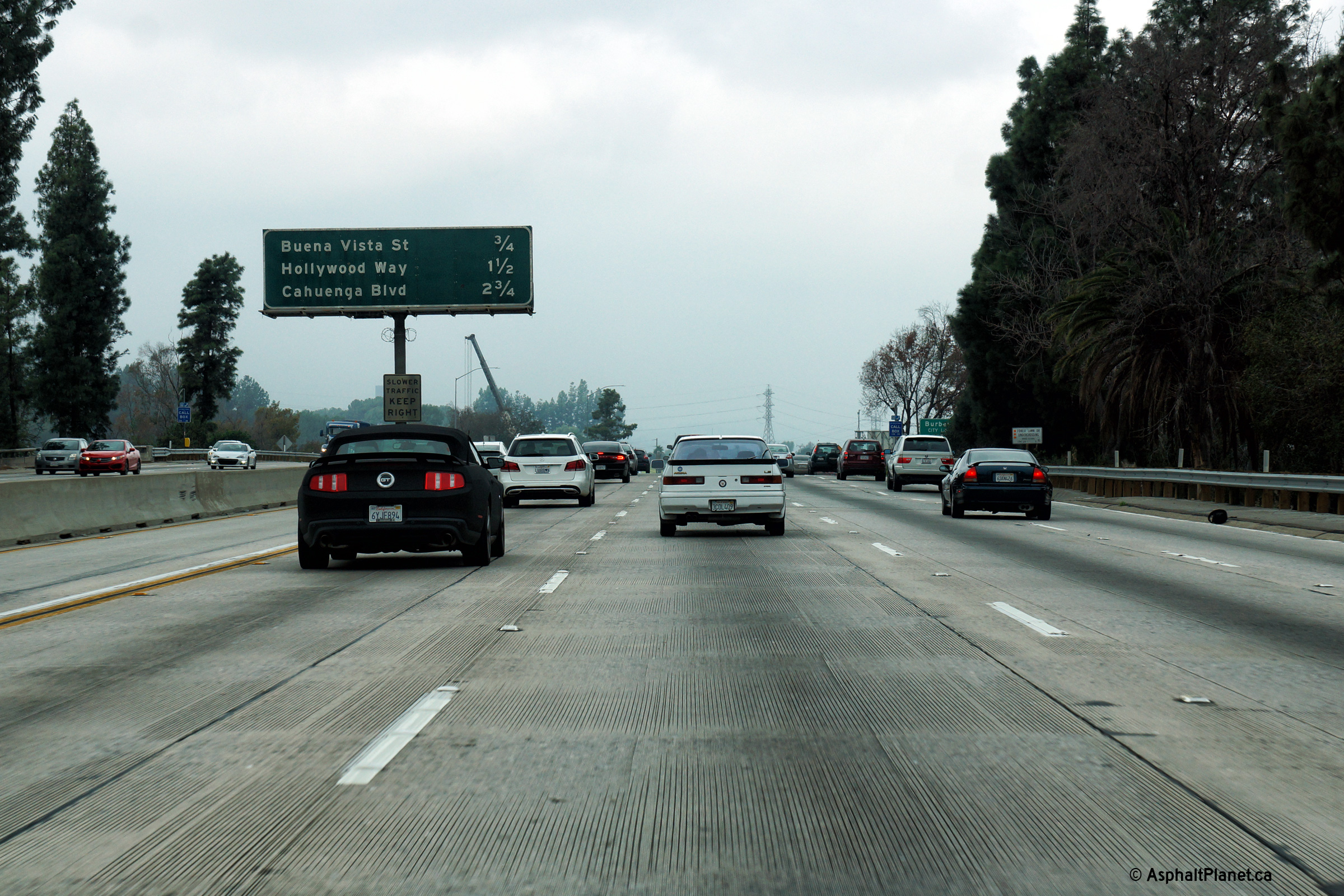
|
Los Angeles County |
Westbound interchange sequence signage on approach the Buena Vista Street interchange. |
 |
||
|
Date: 12/11/2014 |
High-res: (1440x960) (2400x1600) |
|||
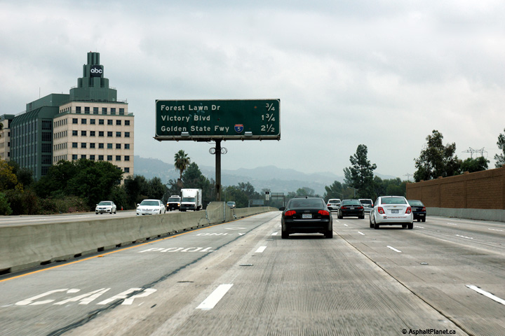
|
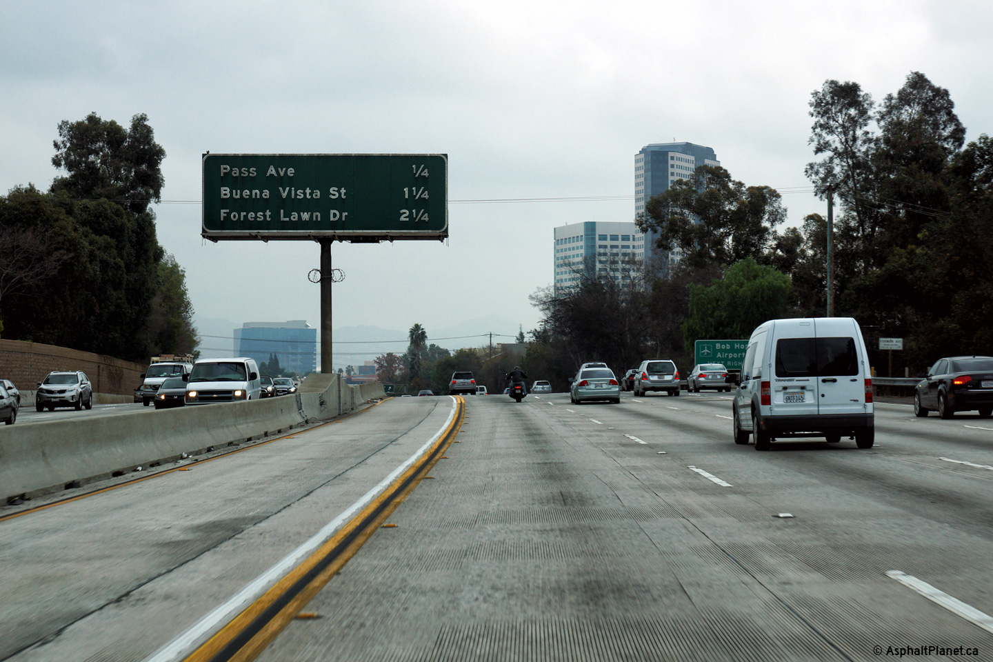
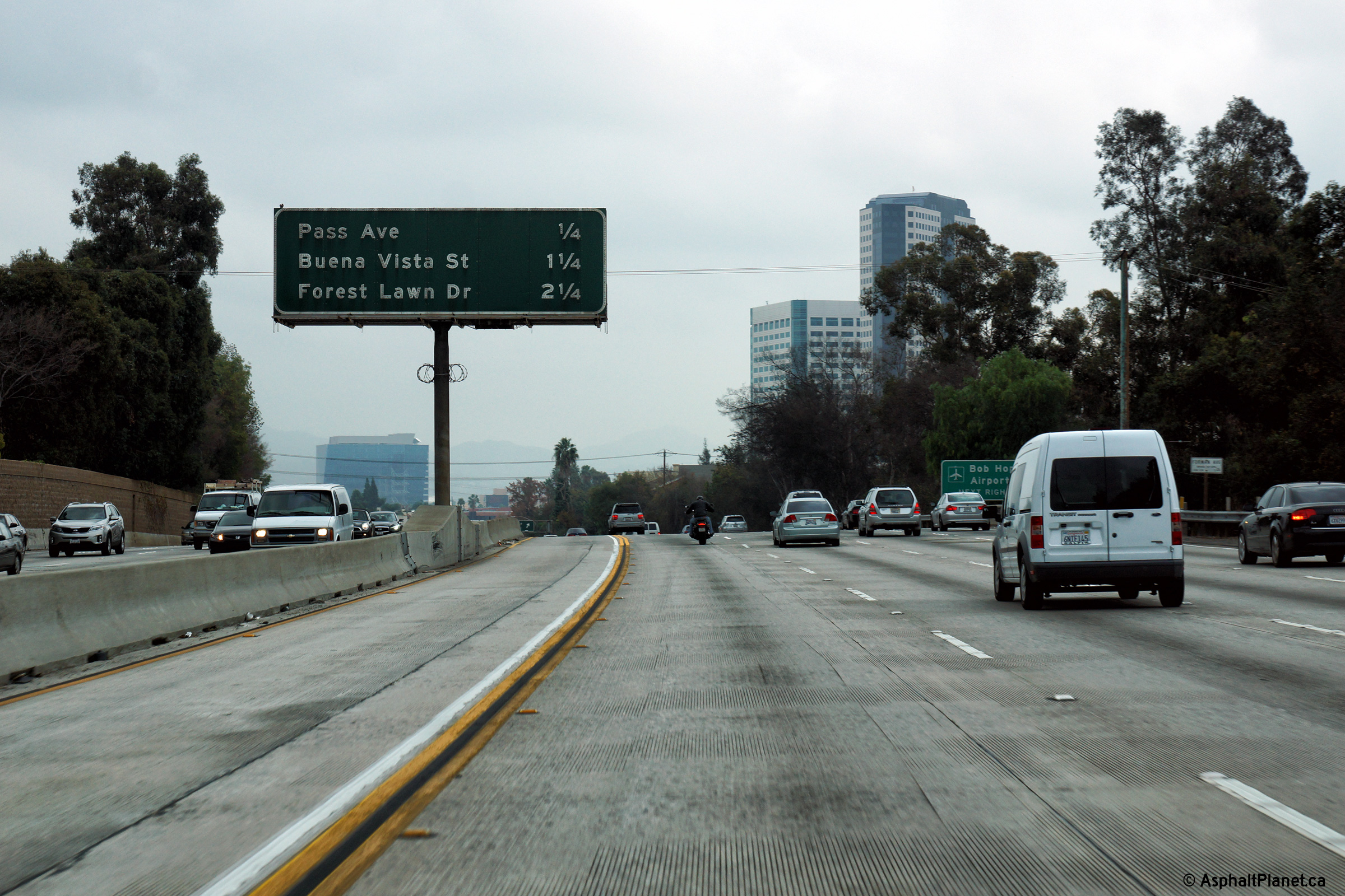
Los Angeles County |
Interchange sequence signage approaching the Forest Lawn Drive interchange. |
 |
||
|
Date: 12/11/2014 |
High-res: (1440x960) (2400x1600) |
|||
|
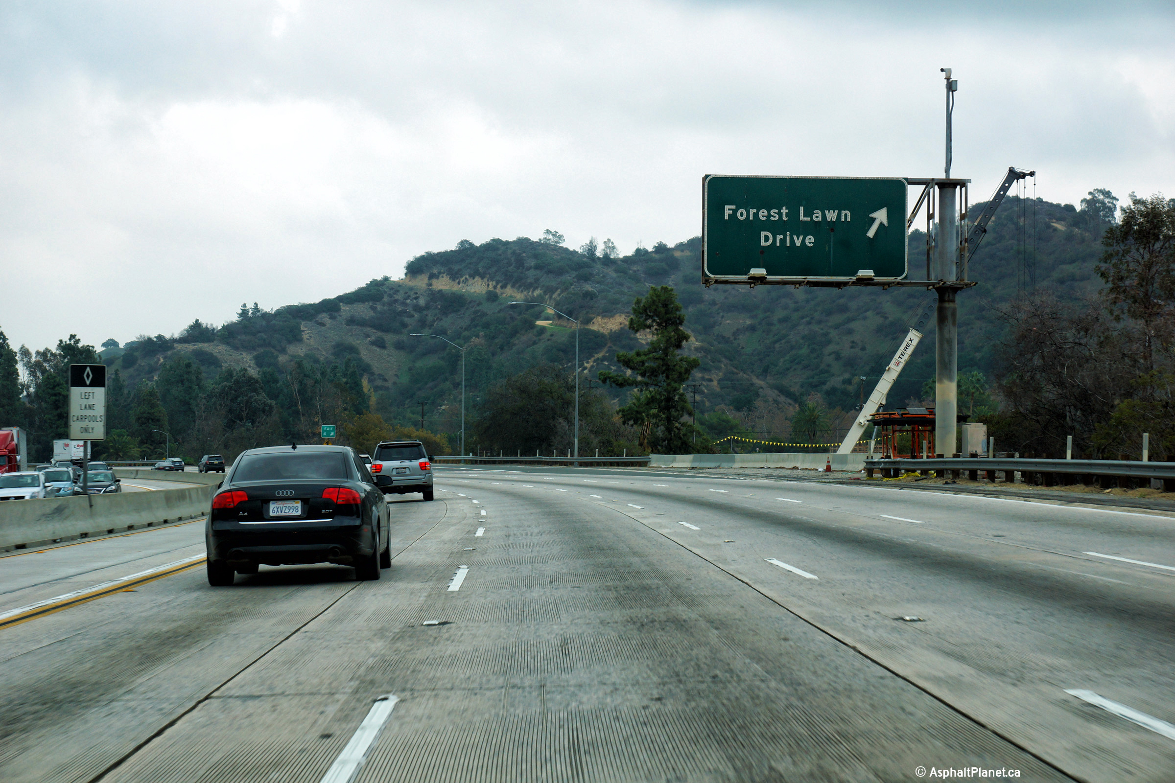
Los Angeles County |
Signage at the eastbound off-ramp to Forest Lawn Drive. |
 |
||
|
Date: 12/11/2014 |
High-res: (1440x960) (2400x1600) |
|||
|
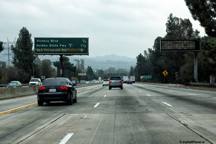
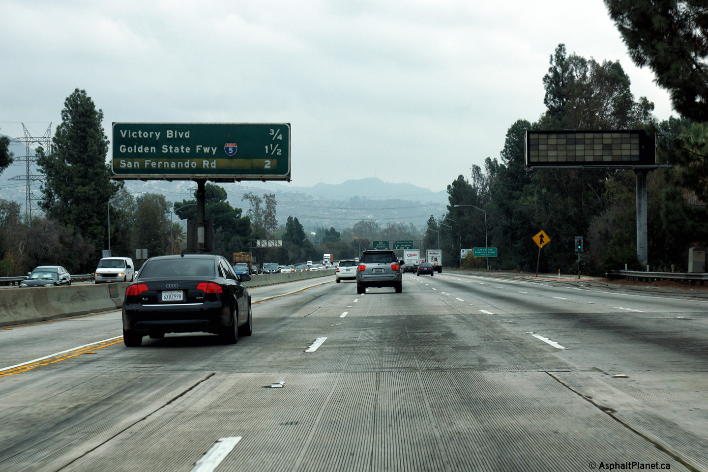
Los Angeles County |
Interchange sequence signage approaching the Victory Boulevard interchange. |
 |
||
|
Date: 12/11/2014 |
High-res: (1440x960) (2400x1600) |
|||
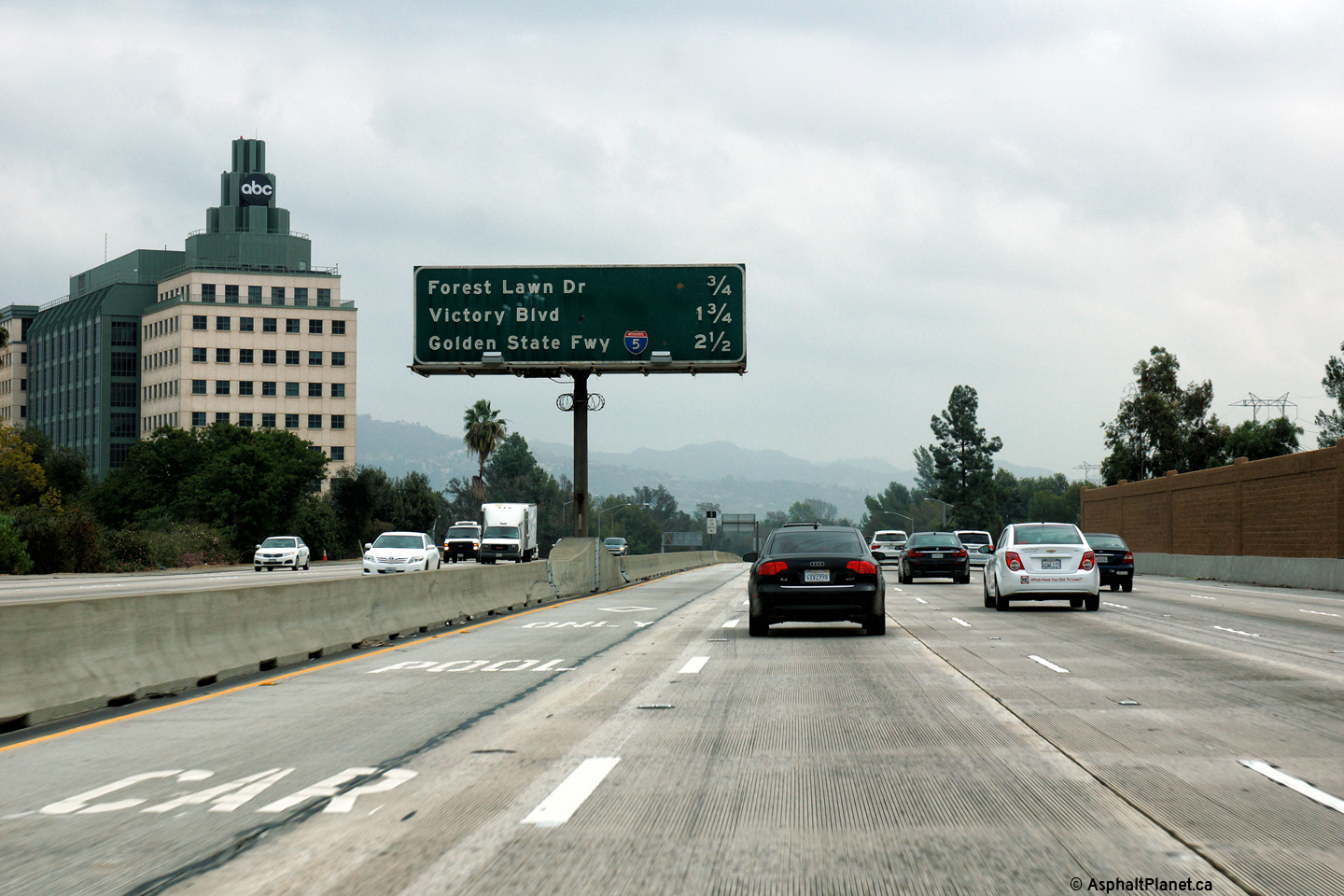
|
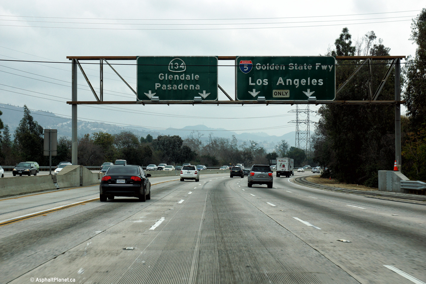
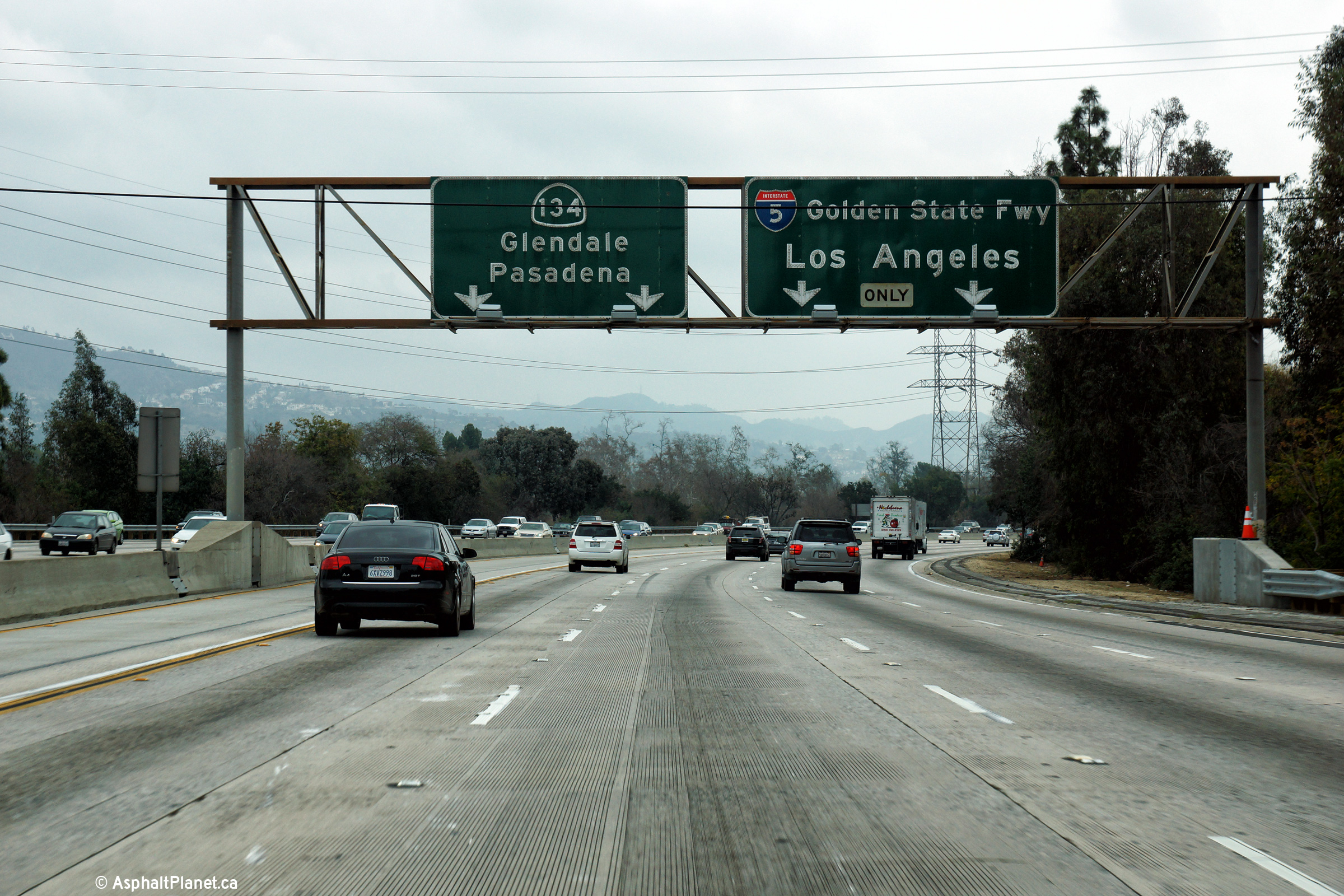
Los Angeles County |
Eastbound advanced signage for the upcoming Golden State Freeway (I-5) interchange. |
 |
||
|
Date: 12/11/2014 |
High-res: (1440x960) (2400x1600) |
|||
|
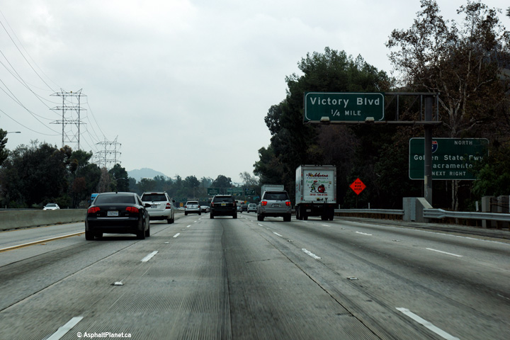
Los Angeles County |
Eastbound advanced signage for the off-ramp to Victory Boulevard. |
 |
||
|
Date: 12/11/2014 |
High-res: (1440x960) (2400x1600) |
|||
|
Los Angeles County |
Eastbound signage for the off-ramp to Victory Boulevard. There is no westbound off-ramp to Victory Boulevard. |
 |
||
|
Date: 12/11/2014 |
High-res: (1440x960) (2400x1600) |
|||
|
Los Angeles County |
Advanced signage for the I-5 interchange affixed to the Victory Boulevard off-ramp. |
 |
||
|
Date: 12/11/2014 |
High-res: (1440x960) (2400x1600) |
|||
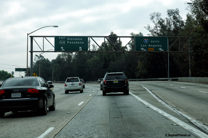
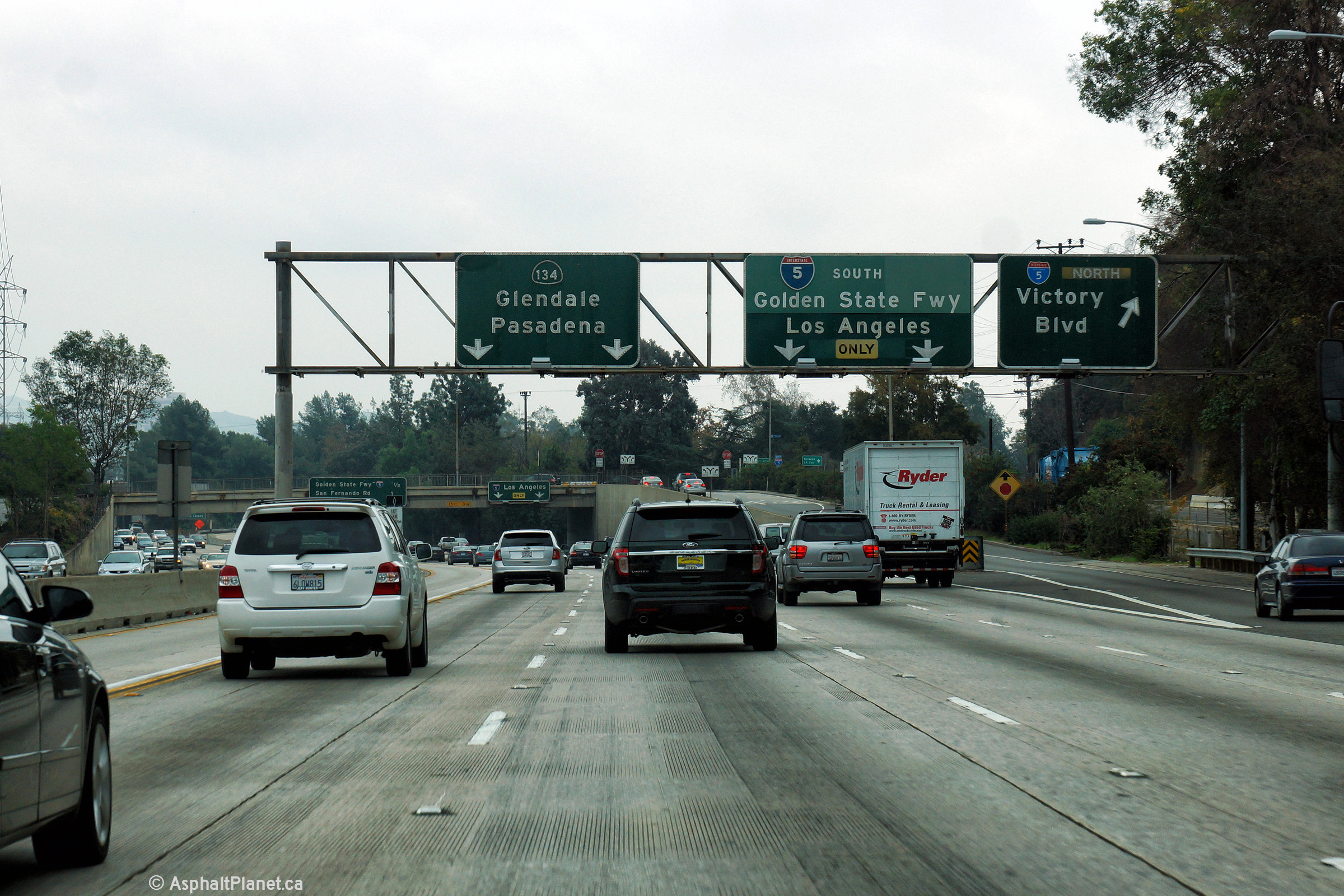
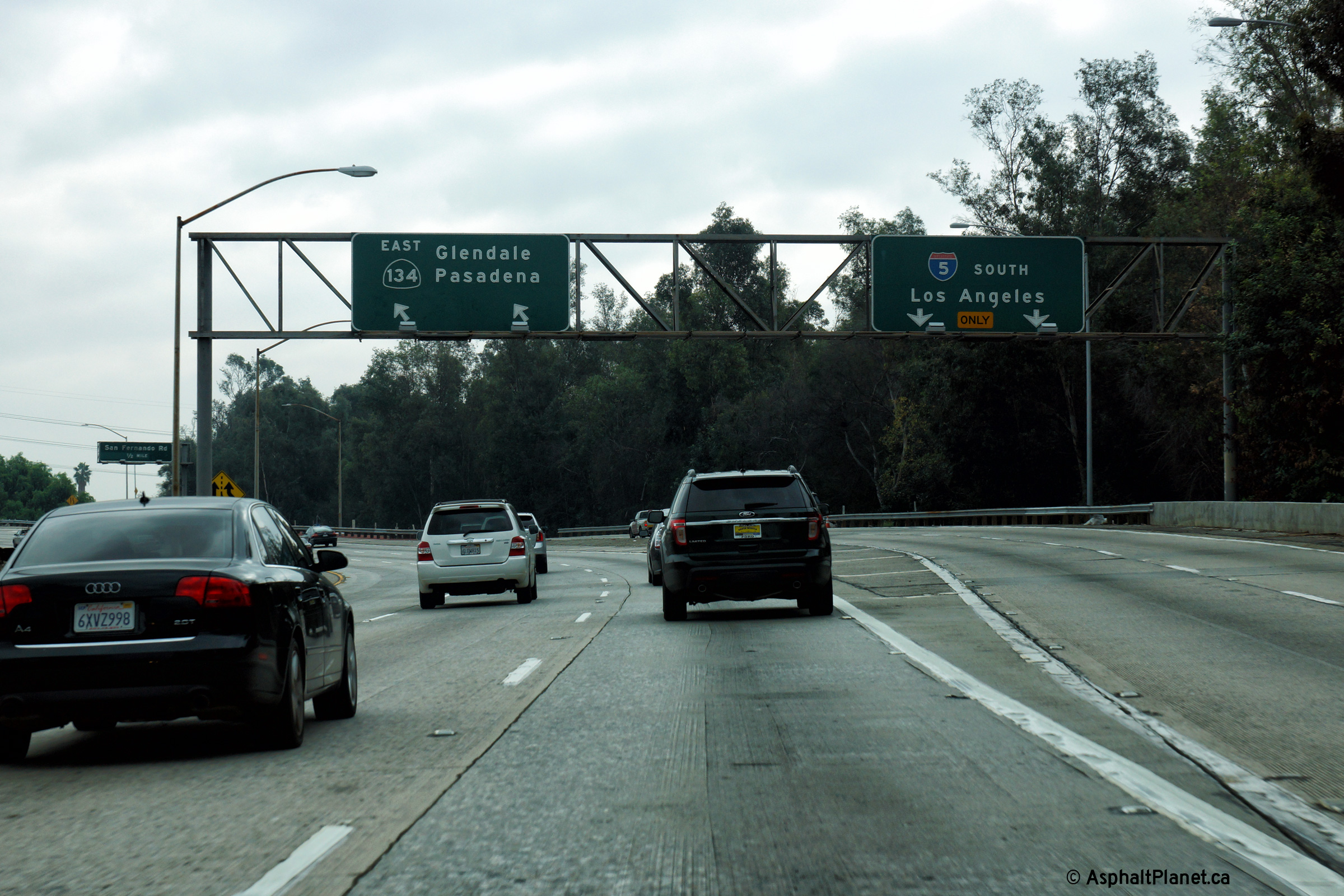
|
Los Angeles County |
View at the eastbound off-ramp to I-5 South. |
 |
||
|
Date: 12/11/2014 |
High-res: (1440x960) (2400x1600) |
|||
| Interstate 5 is the Golden State Freeway through northern Los Angeles. Click here for Interstate 5 Images. | ||||
|
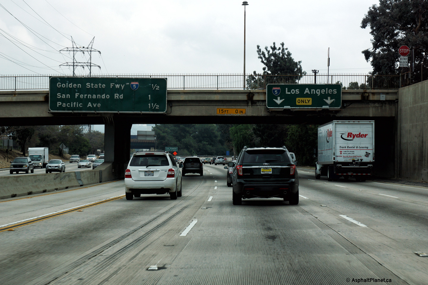
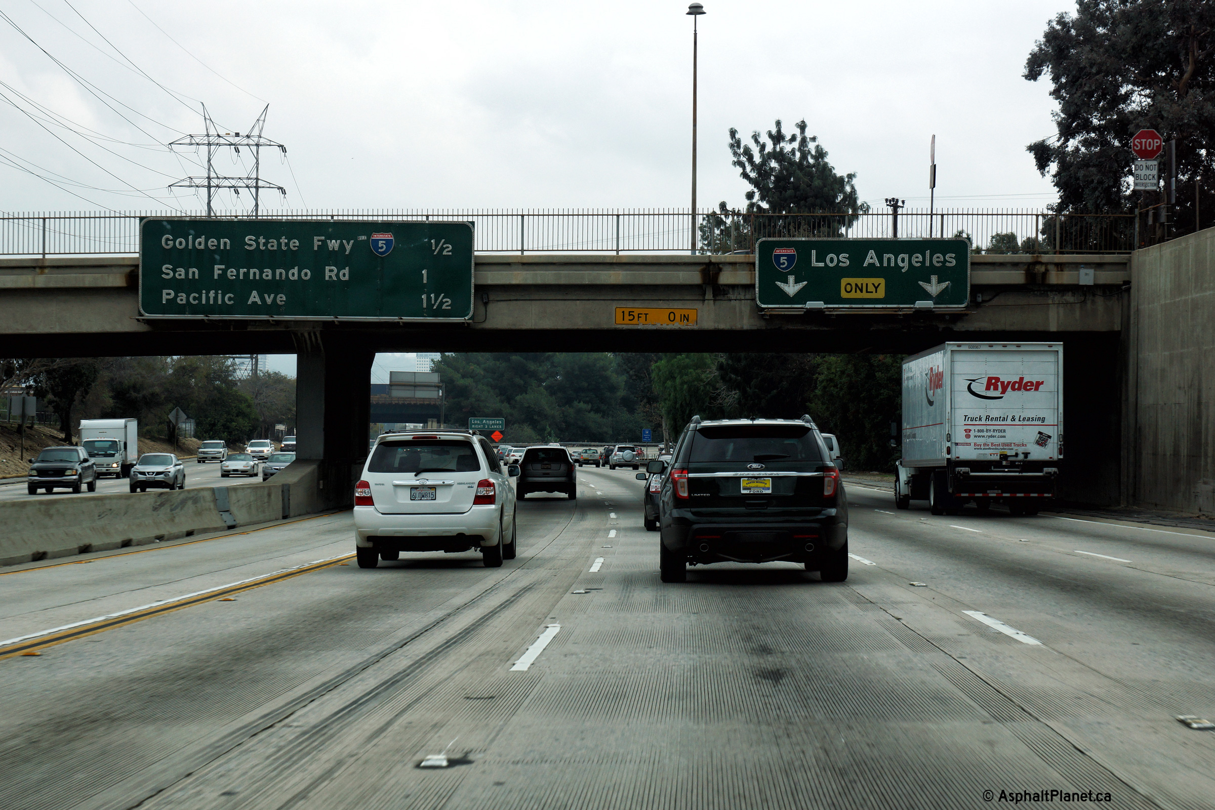
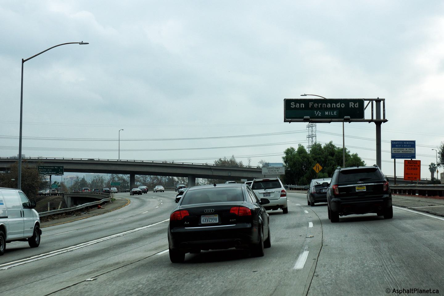
Los Angeles County |
This eastbound advanced signage for the San Fernando Road interchange stands within the footprint of the I-5 interchange. |
 |
||
|
Date: 12/11/2014 |
High-res: (1440x960) (2400x1600) |
|||
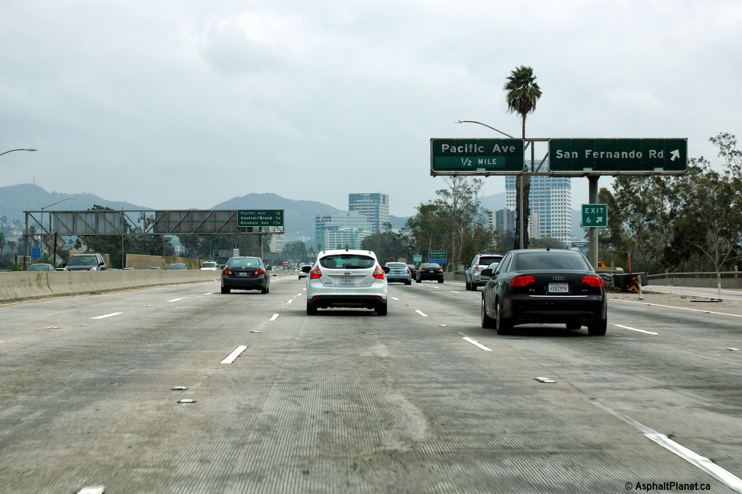
|
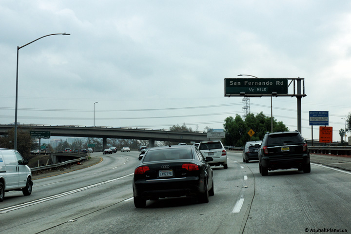
Los Angeles County |
Eastbound view of the signage at the off-ramp to San Fernando Road. San Fernando Road is the historic alignment of US Route 99, which was the precursor to I-5 on the west coast. |
 |
||
|
Date: 12/11/2014 |
High-res: (1440x960) (2400x1600) |
|||
|
Los Angeles County |
Eastbound view at the off-ramp to Pacific Avenue on this misty December morning. |
 |
||
|
Date: 12/11/2014 |
High-res: (1440x960) (2400x1600) |
|||
|
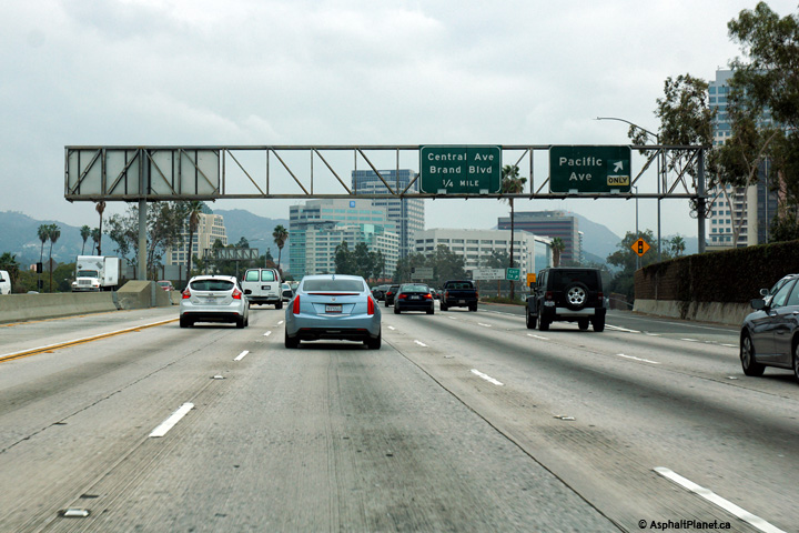
Los Angeles County |
Eastbound view at the off-ramp to Central Avenue in Downtown Glendale. |
 |
||
|
Date: 12/11/2014 |
High-res: (1440x960) (2400x1600) |
|||
|
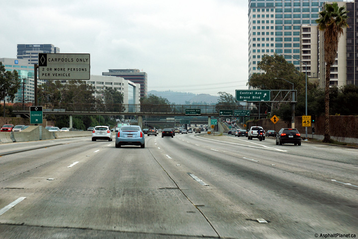
Los Angeles County |
Interchange sequence signage located within Downtown Glendale. |
|
||
|
Date: 12/11/2014 |
High-res: (1440x960) (2400x1600) |
|||
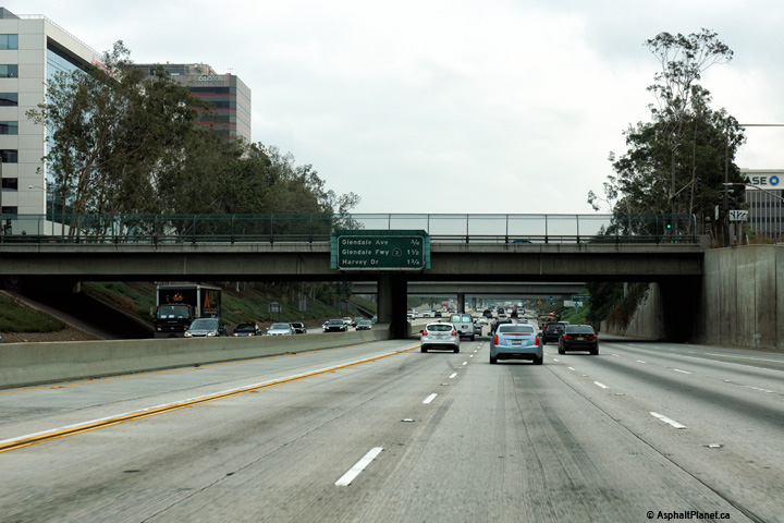
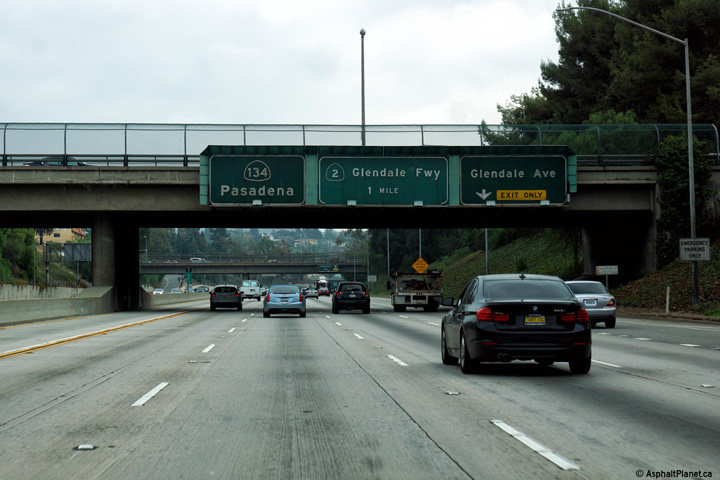
|
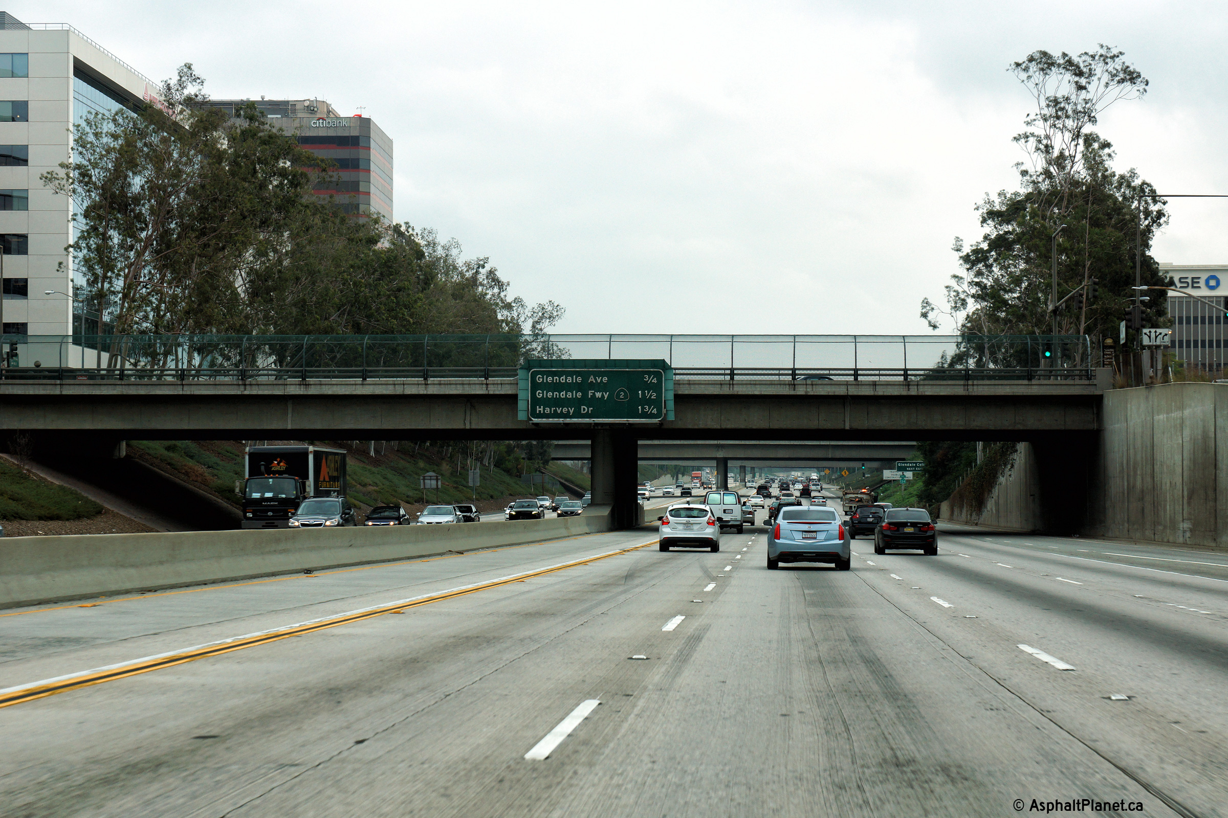
Los Angeles County |
Advanced signage for both the Glendale Avenue and Glendale Freeway interchanges. |
|
||
|
Date: 12/11/2014 |
High-res: (1440x960) (2400x1600) |
|||
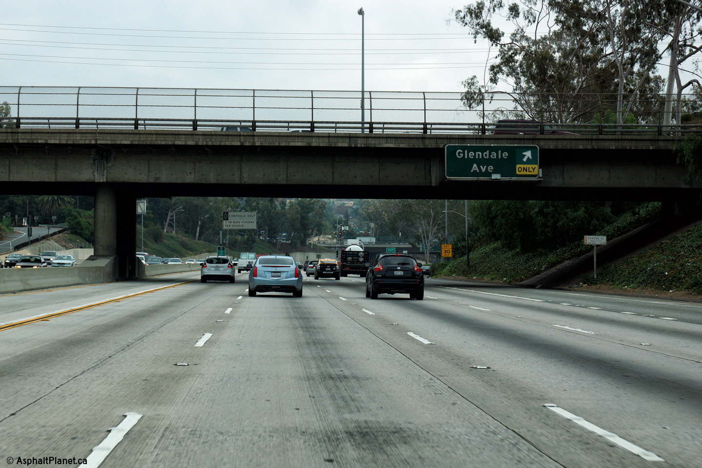
|
Los Angeles County |
Eastbound signage at the off-ramp to Glendale Avenue. |
 |
||
|
Date: 12/11/2014 |
High-res: (1440x960) (2400x1600) |
|||
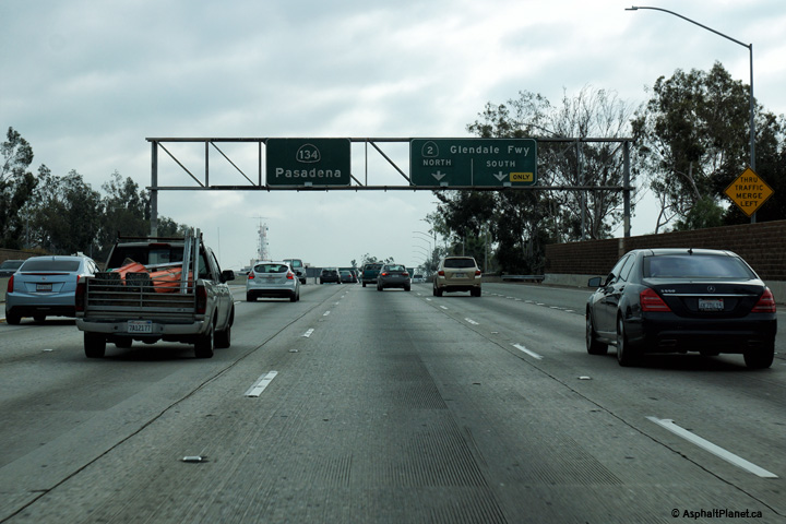
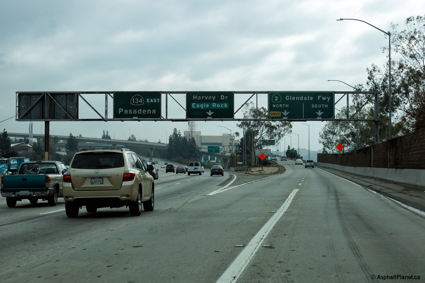
|
Los Angeles County |
Advanced signage notifying eastbound motorists of the upcoming Glendale Freeway interchange. |
|
||
|
Date: 12/11/2014 |
High-res: (1440x960) (2400x1600) |
|||
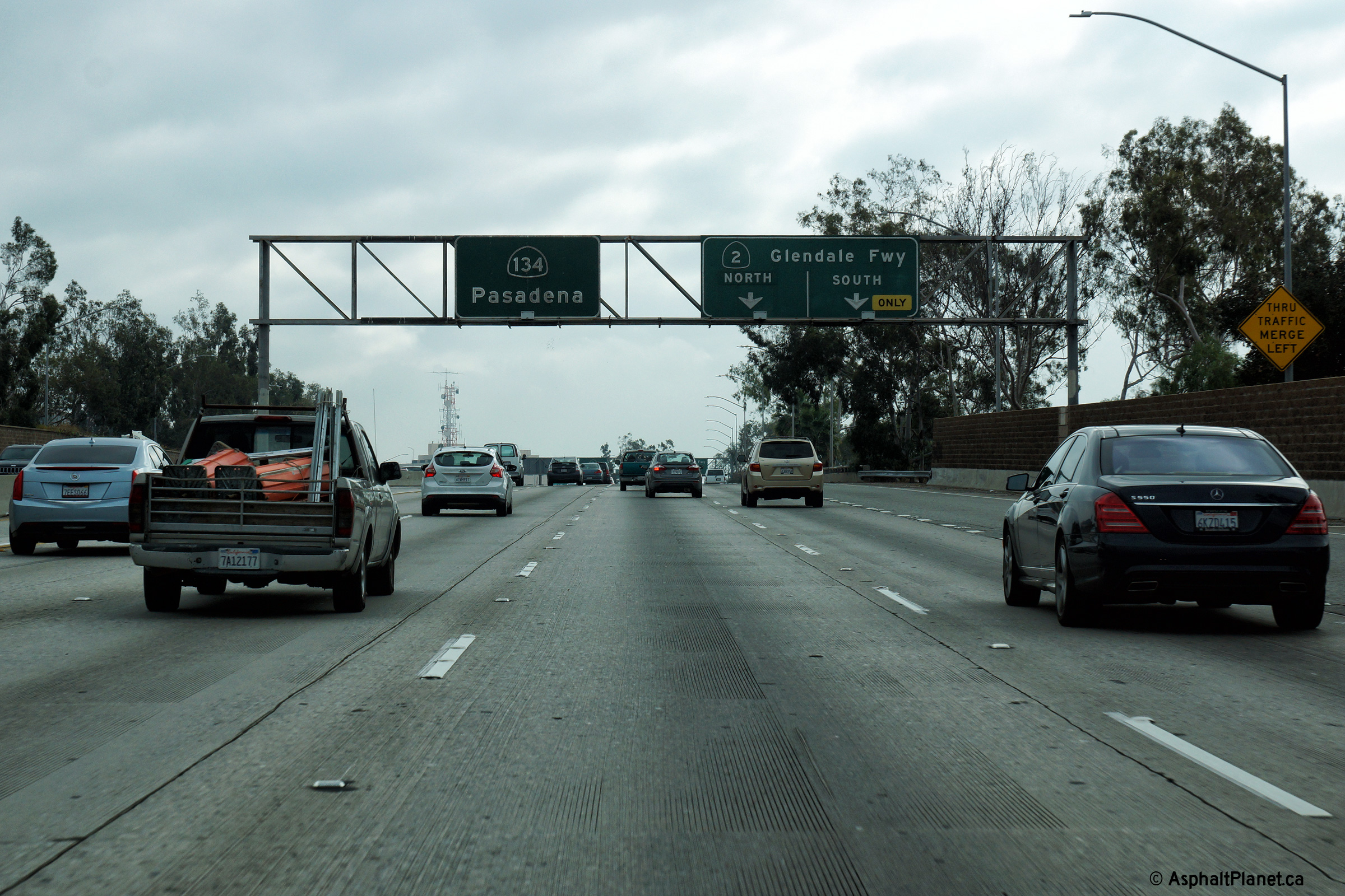
|
Los Angeles County |
Signage at the eastbound off-ramp to the Glendale Freeway from the Ventura Freeway. |
 |
||
|
Date: 12/11/2014 |
High-res: (1440x960) (2400x1600) |
|||
| SR-2 is the Glendale Freeway running northerly through the northern Metro area of Los Angeles. Click here for SR-2 Images. | ||||
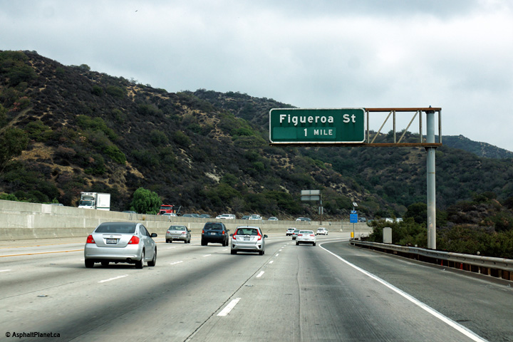
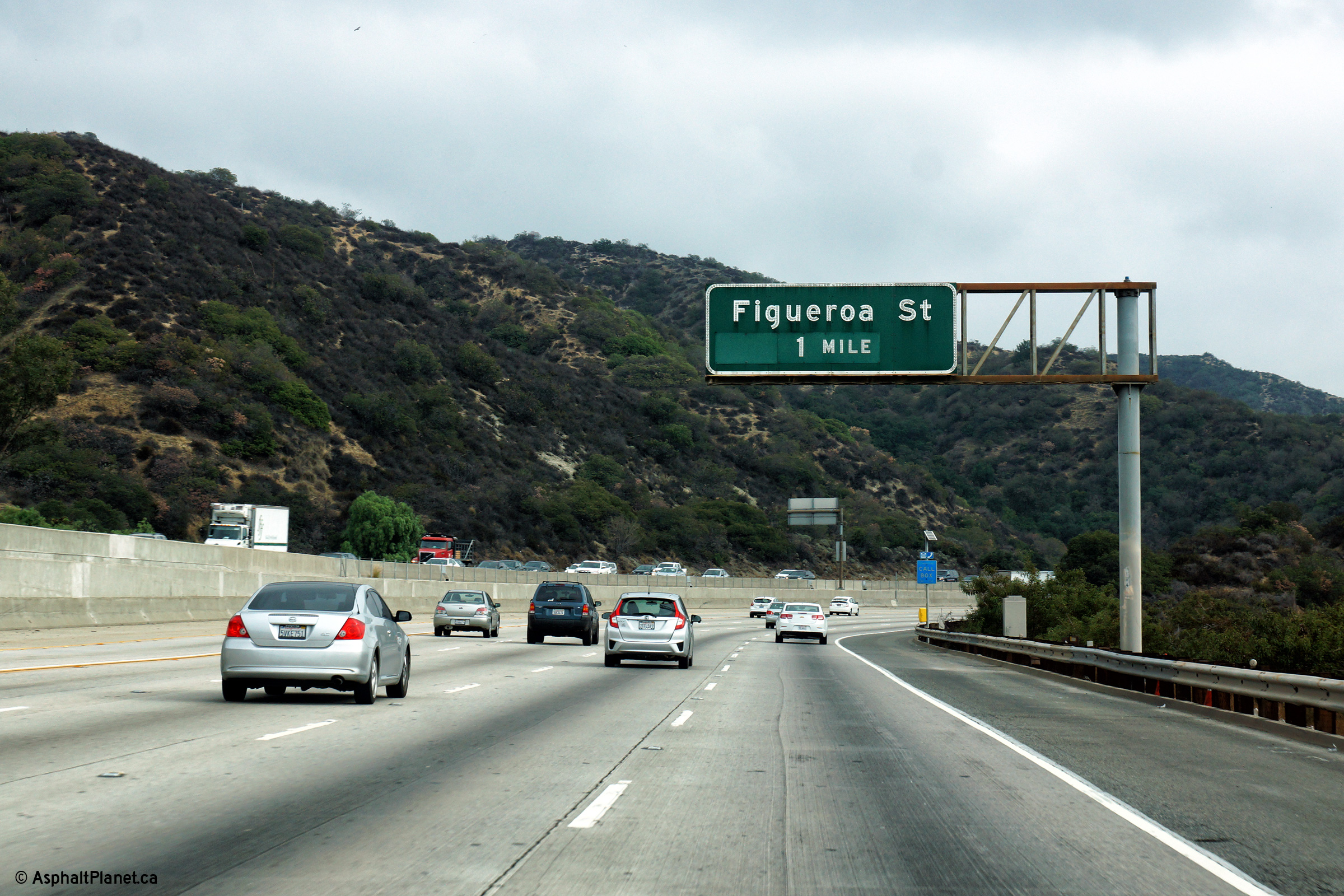
|
Los Angeles County |
Eastbound advanced signage for the Figueroa Street interchange. |
|
||
|
Date: 12/11/2014 |
High-res: (1440x960) (2400x1600) |
|||
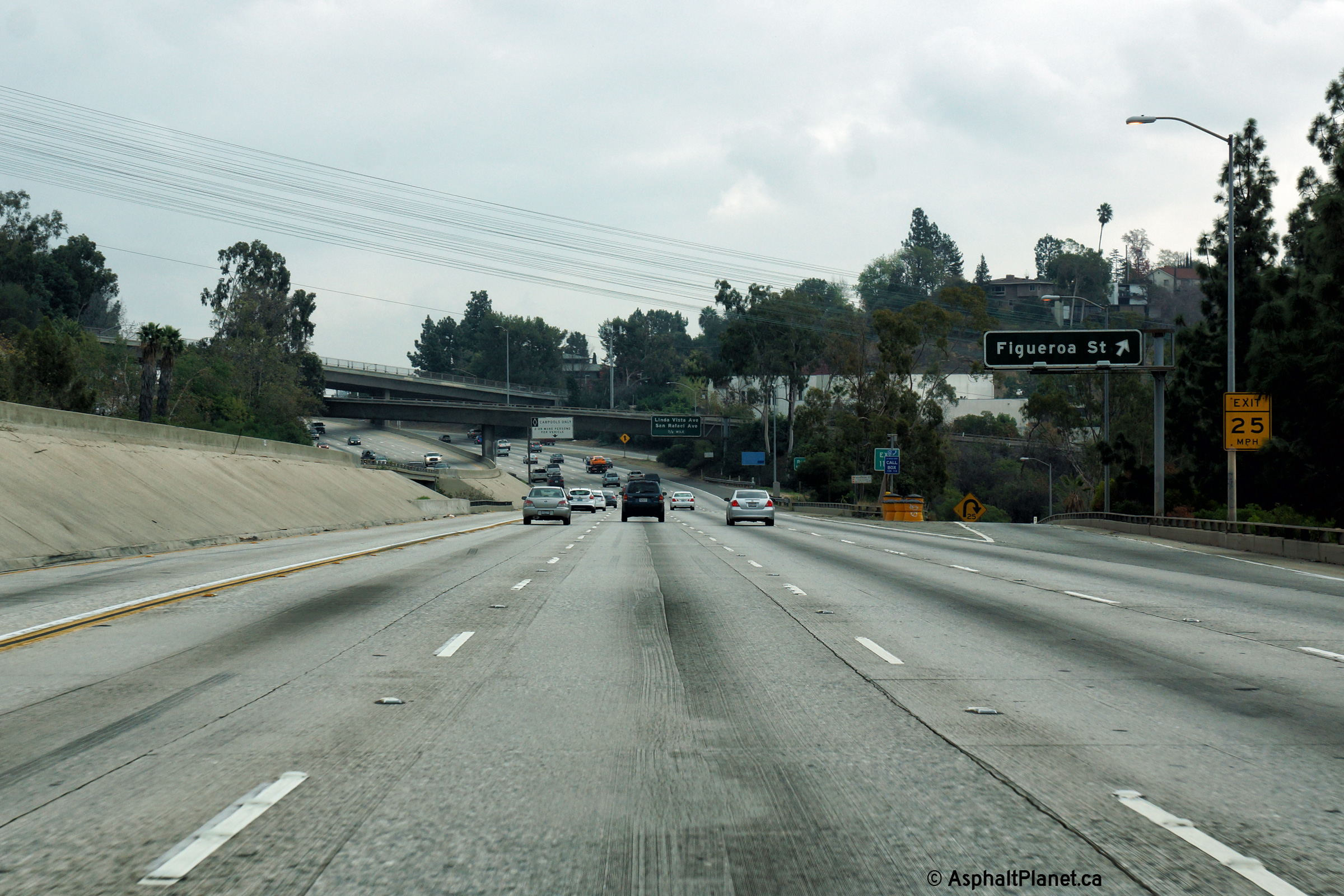
|
Los Angeles County |
View looking easterly at the off-ramp to Figueroa Street. Figueroa Street is one of LA's more noteworthy street names. Interestingly, the tunnels that now carry the northbound lanes of the 110 Freeway north of Downtown, were initially built to carry traffic for an extension of Figueroa Street. |
 |
||
|
Date: 12/11/2014 |
High-res: (1440x960) (2400x1600) |
|||
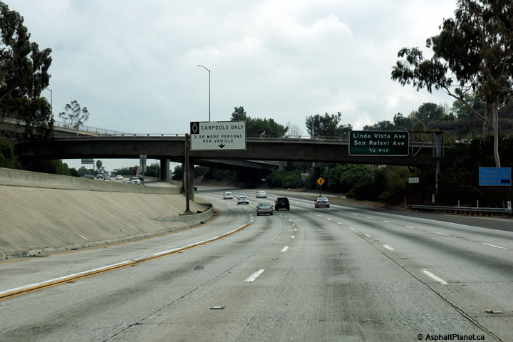
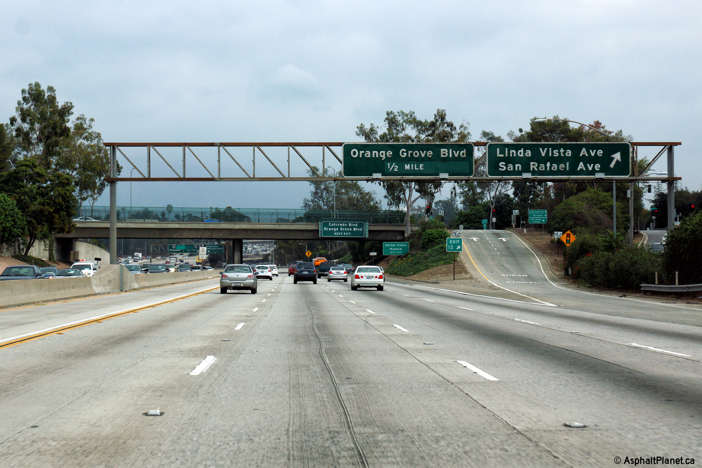
|
Los Angeles County |
Eastbound advanced signage for the ramp to Linda Vista Avenue. |
|
||
|
Date: 12/11/2014 |
High-res: (1440x960) (2400x1600) |
|||
|
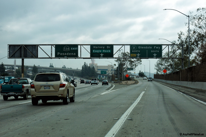
Los Angeles County |
Overhead signage in advance of the 210 Freeway (the Foothill Freeway) interchange. |
|
||
|
Date: 12/11/2014 |
High-res: (1440x960) (2400x1600) |
|||
|
Los Angeles County |
Easterly view at the off-ramp to Linda Vista Avenue. |
|
||
|
Date: 12/11/2014 |
High-res: (1440x960) (2400x1600) |
|||
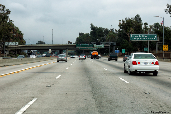
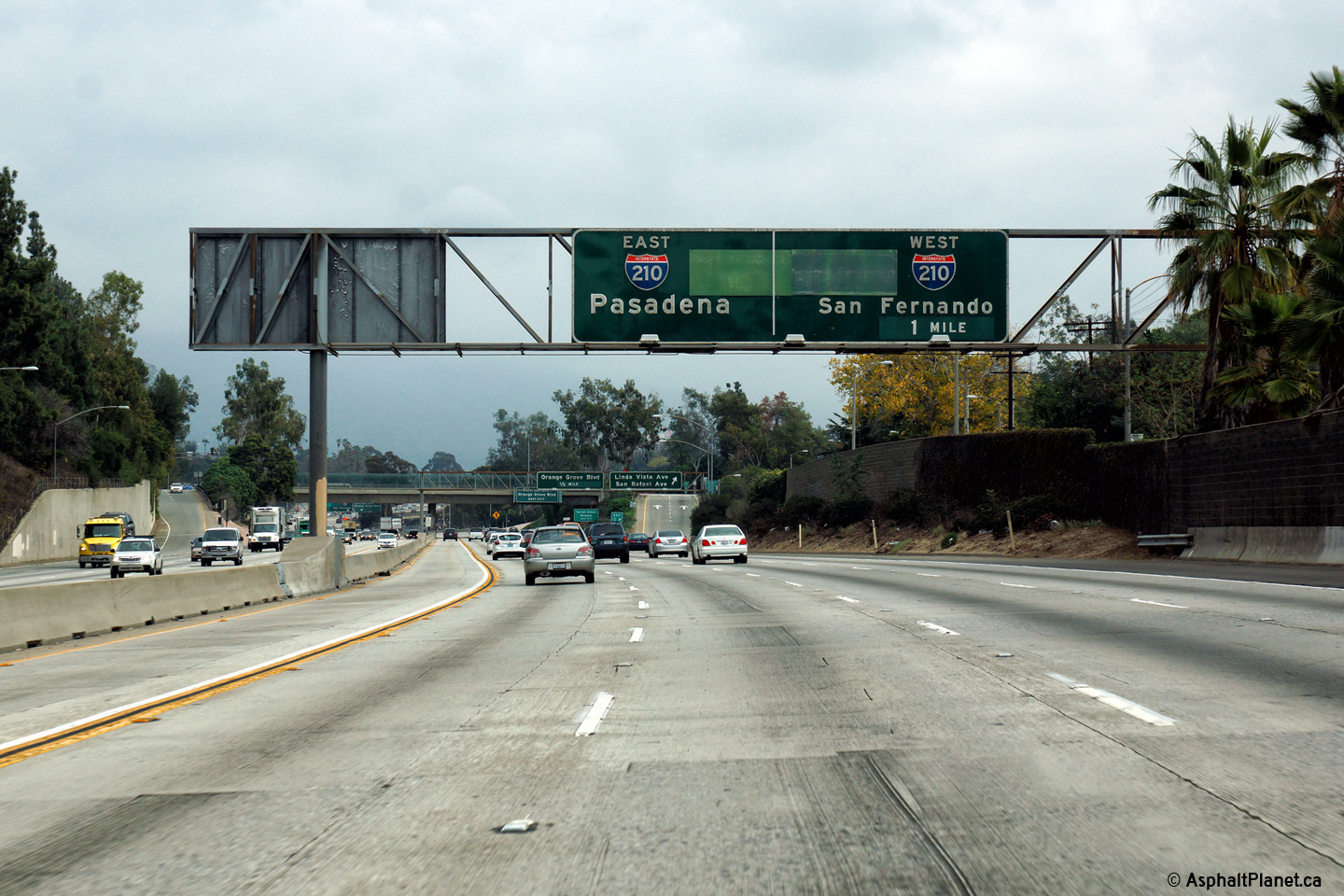
|
Los Angeles County |
Advanced signage for both the Colorado Boulevard and 210 Freeway interchanges. The long proposed extension of the 710 Freeway (the Long Beach Freeway) was to have met with the 210 Freeway at the upcoming interchange. As such, the signage approaching this interchange features a significant amount of "green-out". |
|
||
|
Date: 12/11/2014 |
High-res: (1440x960) (2400x1600) |
|||
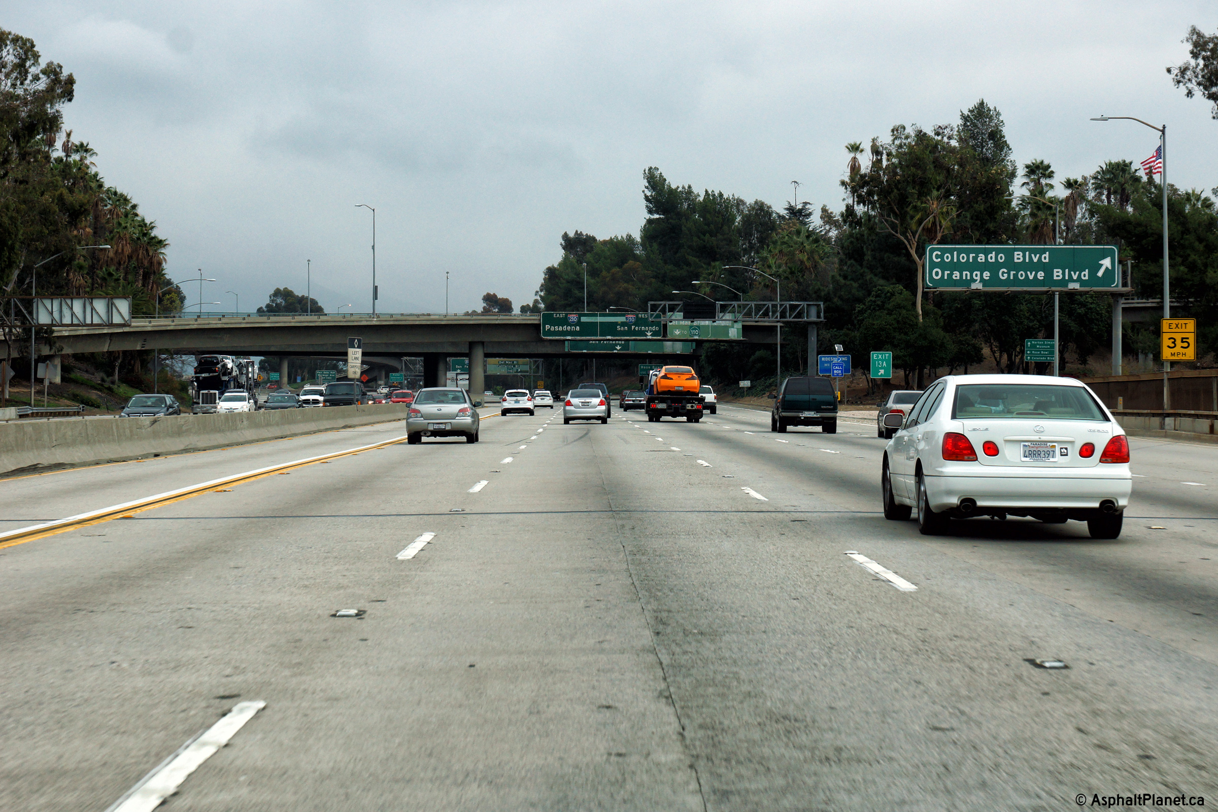
|
Los Angeles County |
Eastbound signage at the off-ramp Colorado Boulevard. Colorado Boulevard was once part of the route of the now defunct Route 66. |
 |
||
|
Date: 12/11/2014 |
High-res: (1440x960) (2400x1600) |
|||
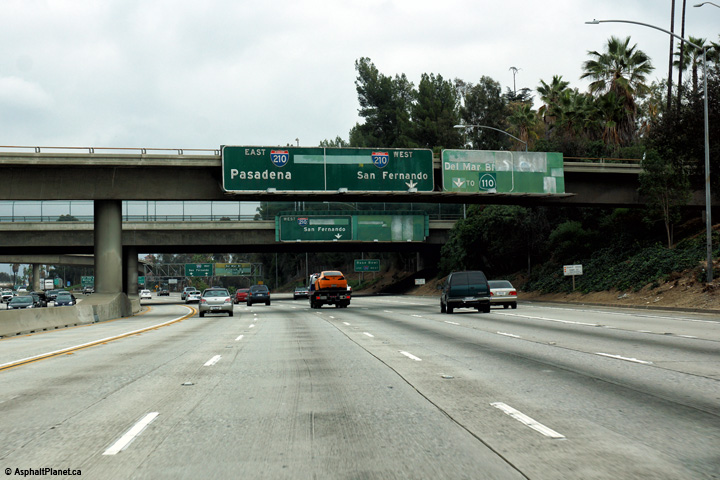
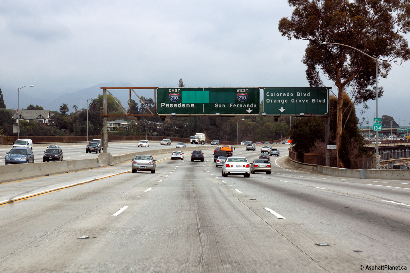
|
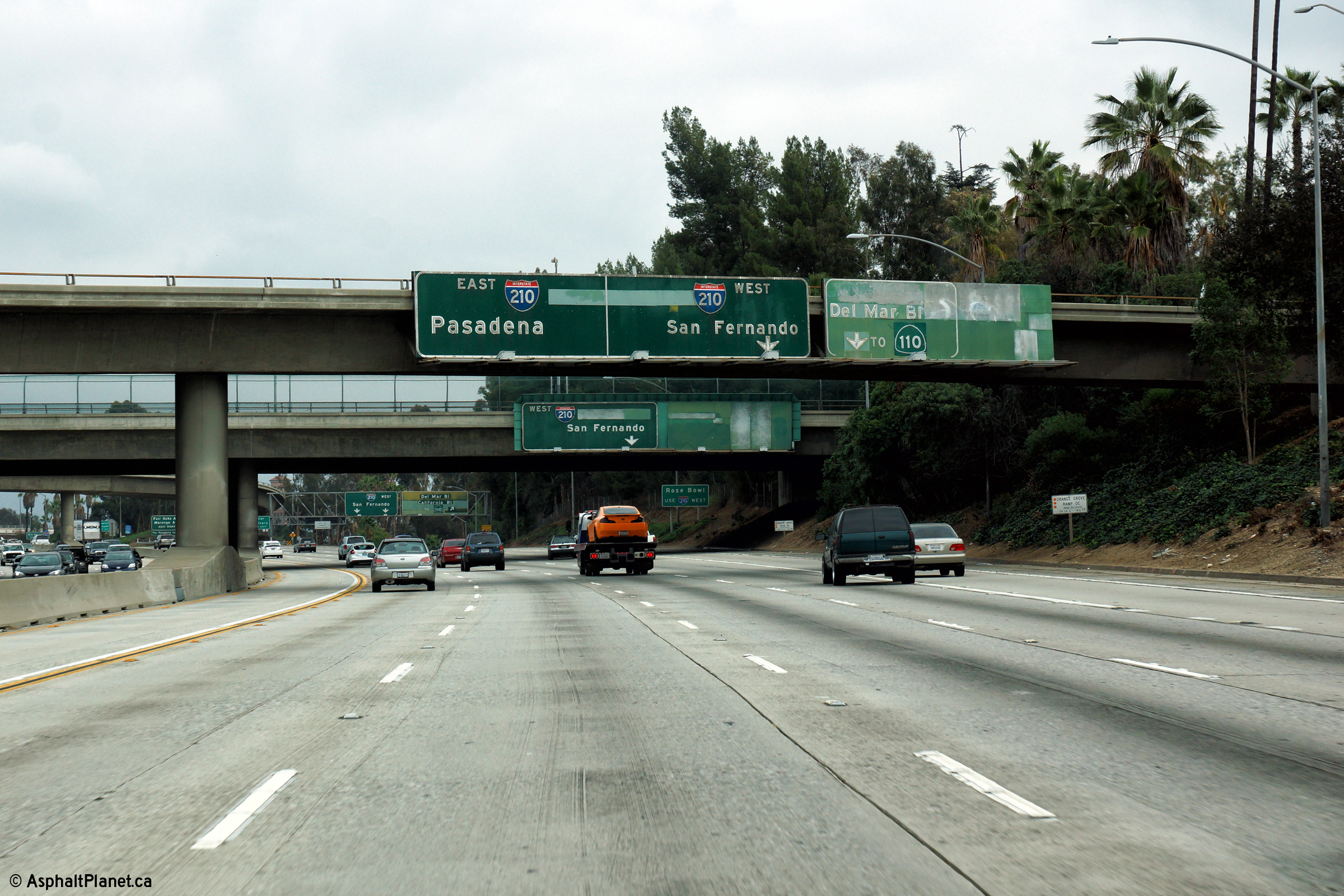
Los Angeles County |
Signage at the 210 Freeway interchange. Beyond this interchange the through lanes of the Ventura Freeway become the eastbound lanes of the Foothill Freeway (I-210). |
 |
||
|
Date: 12/11/2014 |
High-res: (1440x960) (2400x1600) |
|||
| I-210 is the Foothill Freeway and runs along the northern edge of the Los Angeles and San Bernardino Metro Areas. Click here for Interstate 210 Images. | ||||
<- CA-133
CA Highways
CA-135 ->
AsphaltPlanet.ca
© 2010-2016 AsphaltPlanet.ca.
AsphaltPlanet@asphaltplanet.ca
Page Created: April 22, 2010.
Last Updated: March 25, 2012.


