
AsphaltPlanet.ca > Utah > US-189
Pictures on this
page are arranged in order from south to north. US-189 North photos are
left-aligned in the last column, while US-189 South photos are right-aligned.
Center-line pictures are centered within the last column.
|
Location |
Description |
Photo |
||
|
North- |
South- |
|||
|
Utah County |
View looking northerly as the ramp to US-189 departs from the northbound lanes of I-15. US-189 begins at this interchange. |
 |
||
|
Photographed by: AsphaltPlanet.ca |
Date: 5/20/2014 |
High-res: (1440x960) (2400x1600) |
||
|
Utah County |
Southerly view along US-189 approaching the I-15 interchange. US-189 ends at I-15. University Avenue continues a short distance to south of the ramp to I-15 South ending at 1860 South. |
 |
||
|
Photographed by: AsphaltPlanet.ca |
Date: 5/20/2014 |
High-res: (1440x960) (2400x1600) |
||
|
Utah County |
Northerly view approaching the US-89 intersection just south of Downtown Provo. Surprisingly, US-89 doesn't follow Provo's main street. |
 |
||
|
Photographed by: AsphaltPlanet.ca |
Date: 5/20/2014 |
High-res: (1440x960) (2400x1600) |
||
|
Utah County |
Northerly view approaching Center Street in Downtown Provo. While I have admittedly little experience in Utah, aside from spending a couple of days in the state, many Utah communities seem to quite pleasant and lively central business districts. |
 |
||
|
Photographed by: AsphaltPlanet.ca |
Date: 5/20/2014 |
High-res: (1440x960) (2400x1600) |
||
|
Utah County |
View looking southerly through the 500 North intersection as US-189 nears Downtown Provo. |
 |
||
|
Photographed by: AsphaltPlanet.ca |
Date: 3/25/2013 |
High-res: (1440x960) (2400x1600) |
||
|
Utah County |
Northerly view approaching the UT-265 intersection in Provo. UT-265 is known as University Drive, due to its proximity to Brigham Yong University. |
 |
||
|
Photographed by: AsphaltPlanet.ca |
Date: 5/20/2014 |
High-res: (1440x960) (2400x1600) |
||
|
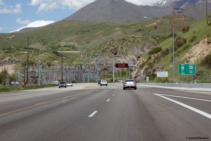
Utah County |
Northbound lane assignment signage approaching the signalized intersection with UT-52. |
 |
||
|
Photographed by: AsphaltPlanet.ca |
Date: 5/19/2014 |
High-res: (1440x960) (2400x1600) |
||
|
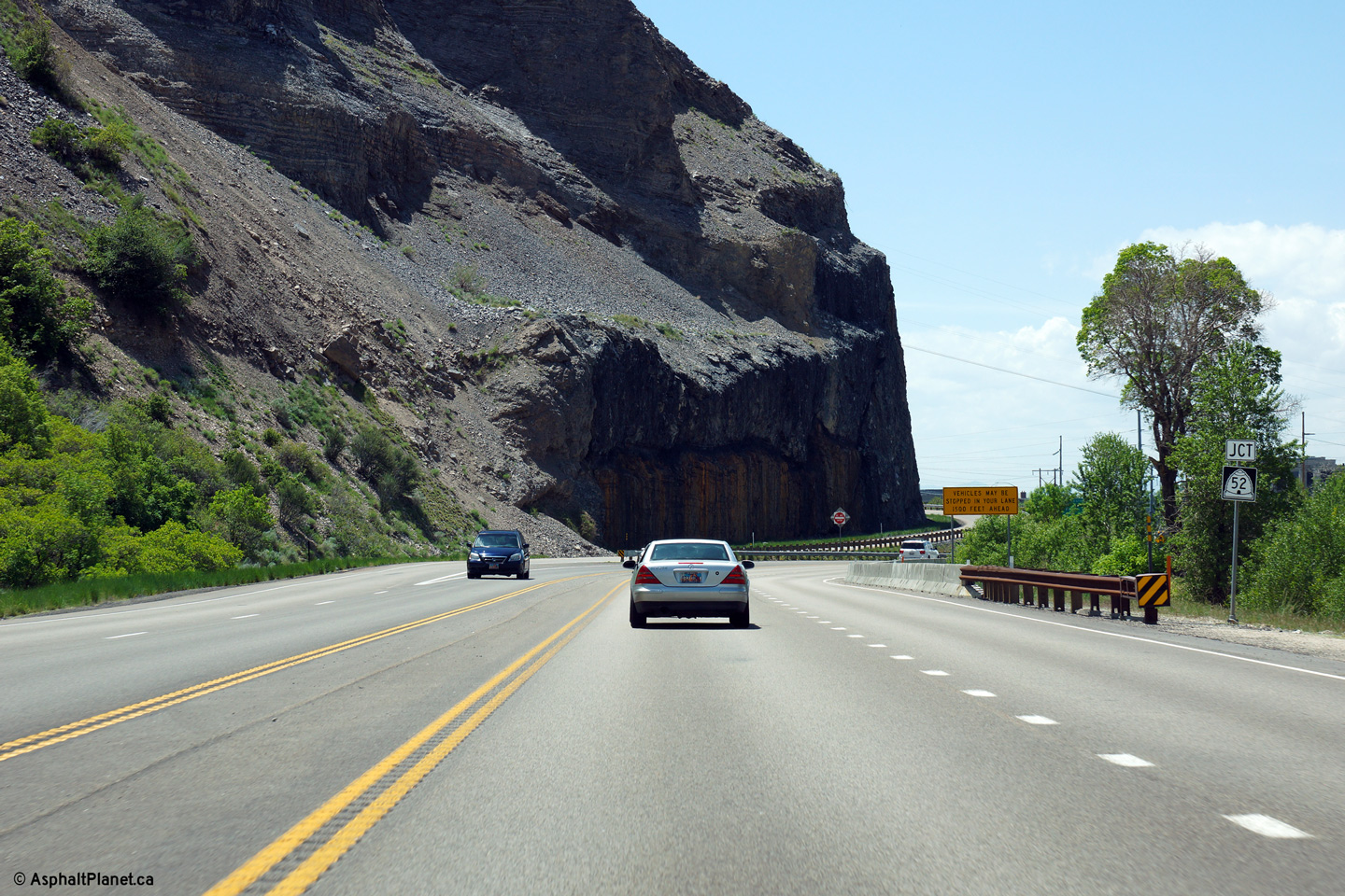
San Juan County |
View approaching the UT-52 junction. The two left lanes turn left at this intersection, while the right continues through the intersection unimpeded by the traffic signal that alternates flow between the left turn movement and southbound traffic. |
 |
||
|
Photographed by: AsphaltPlanet.ca |
Date: 3/24/2013 |
High-res: (1440x960) (2400x1600) |
||
|
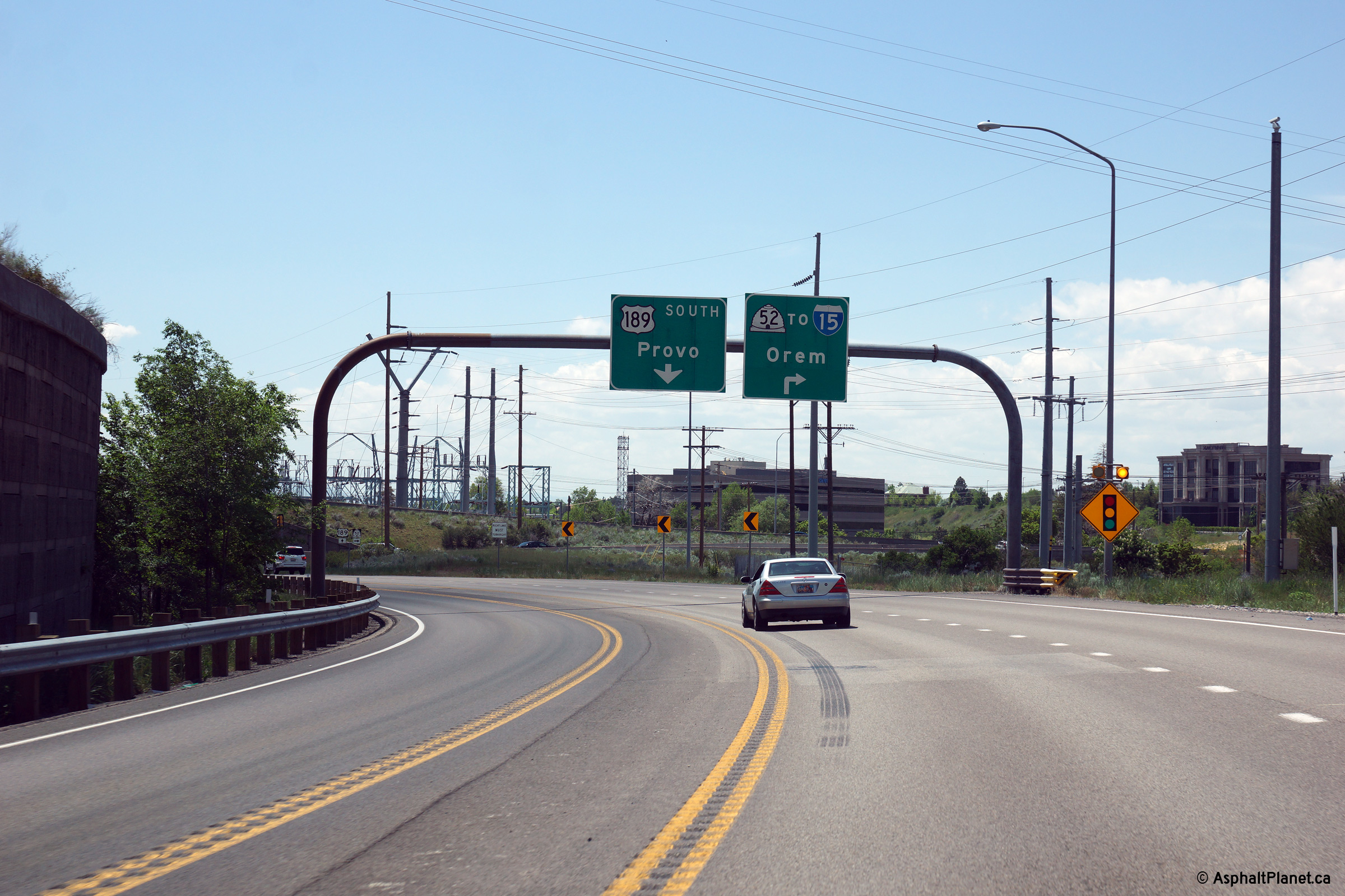
Utah County |
This view looks southerly approaching the signalized intersection with UT-52. A flyover ramp links UT-52 East to US-189 North, so the pictured traffic light only alternates flow between southbound US-189, and the dual left turn from northbound US-189 and UT-52 West. |
 |
||
|
Photographed by: AsphaltPlanet.ca |
Date: 5/19/2014 |
High-res: (1440x960) (2400x1600) |
||
|
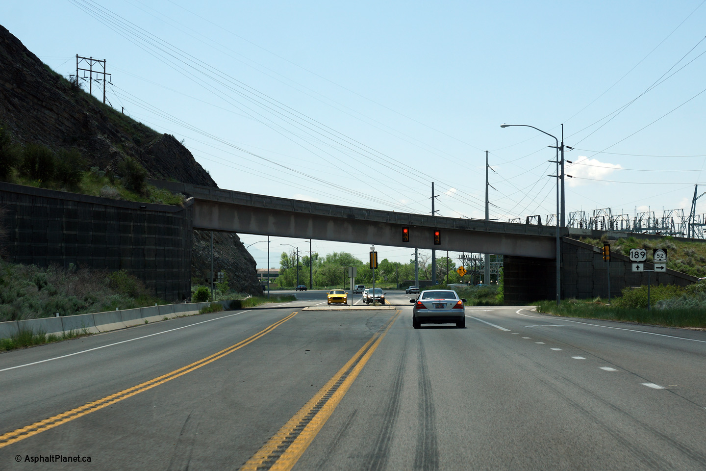
Utah County |
Overhead signage approaching the traffic signal at the UT-52 intersection. While US-189 continues as a four-lane highway south of the UT-52 intersection, the right hand lane from the Provo Canyon Highway departs US-189 for UT-52 at this intersection. |
 |
||
|
Photographed by: AsphaltPlanet.ca |
Date: 5/19/2014 |
High-res: (1440x960) (2400x1600) |
||
|
Utah County |
Southerly view approaching the UT-52 intersection. |
 |
||
|
Photographed by: AsphaltPlanet.ca |
Date: 5/19/2014 |
High-res: (1440x960) (2400x1600) |
||
|
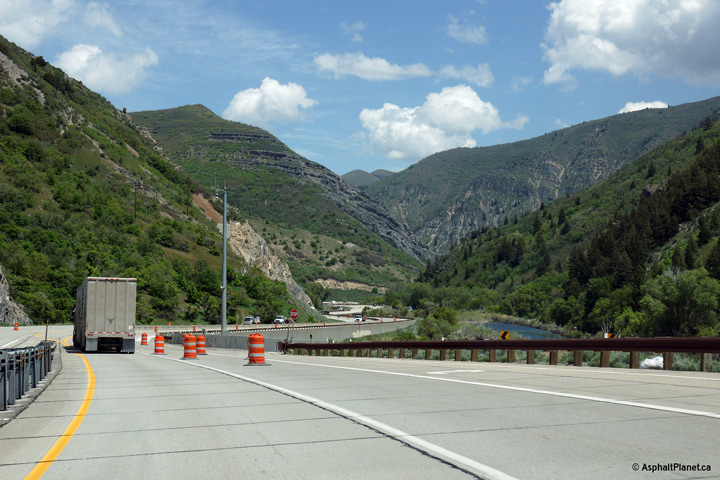
Utah County |
Northerly view along US-189 taken several miles north of the UT-52 intersection. Through the Provo River Canyon, US-189 is generally an at-grade four lane divided highway. |
 |
||
|
Photographed by: AsphaltPlanet.ca |
Date: 5/19/2014 |
High-res: (1440x960) (2400x1600) |
||
|
Utah County |
This view looks northerly at the southern access road to Bridal Vale Falls. Note the sign on the right advising northbound traffic not to stop during the wintertime due to the risk of avalanches. |
 |
||
|
Photographed by: AsphaltPlanet.ca |
Date: 5/19/2014 |
High-res: (1440x960) (2400x1600) |
||
|
Utah County |
Northerly view a short distance beyond the access road to Bridal Vale Falls. The current alignment of US-189 had to built on a high embankment over the access road to Bridal Vale Falls within the steeply sided valley. |
 |
||
|
Photographed by: AsphaltPlanet.ca |
Date: 5/19/2014 |
High-res: (1440x960) (2400x1600) |
||
|
Utah County |
Northerly view as US-189 winds through a series of reversing curves alongside the Provo River just over half a mile south of the South Fork Road intersection. |
 |
||
|
Photographed by: AsphaltPlanet.ca |
Date: 5/19/2014 |
High-res: (1440x960) (2400x1600) |
||
|
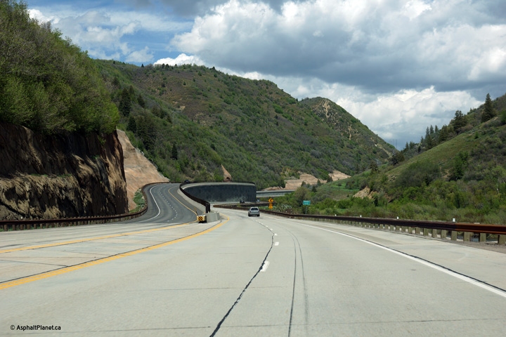
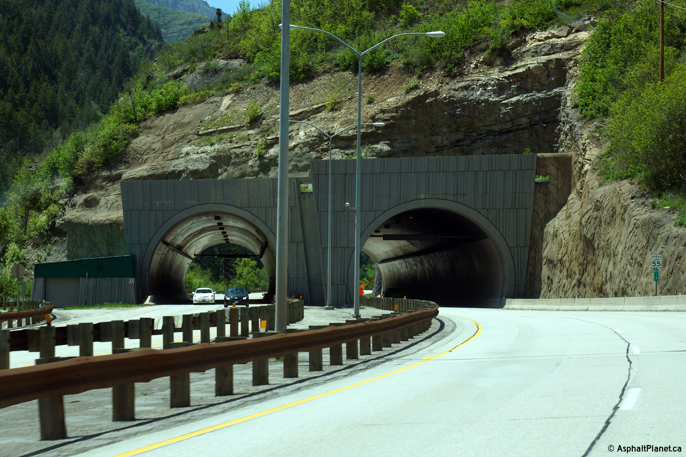
Utah County |
Two views looking northerly at the twin tunnels that are situated halfway up the Provo Canyon Highway. While most of US-189 was notched out of the steep valley walls of the Provo River Valley, the valley was too narrow at this location for the highway to be carved into the valley walls. |
 |
||
|
High-res: (1440x960) (2400x1600) |
||||
 |
||||
|
Photographed by: AsphaltPlanet.ca |
Date: 5/15/2014 |
High-res: (1440x960) (2400x1600) |
||
|
Utah County |
Close-up view of the northbound portal of the northbound tunnel. The twin bored tunnels at this location are the only tunnels along the Provo Canyon Highway. |
 |
||
|
Photographed by: AsphaltPlanet.ca |
Date: 5/15/2014 |
High-res: (1440x960) (2400x1600) |
||
|
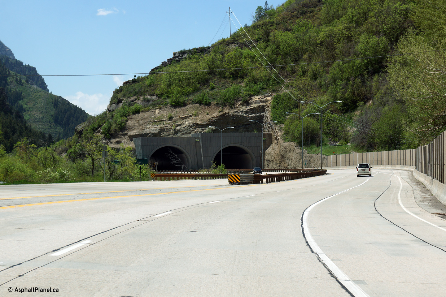
Utah County |
Two views looking southerly through the twin tunnels just south of the UT-92 intersection. |
 |
||
|
High-res: (1440x960) (2400x1600) |
||||
 |
||||
|
Photographed by: AsphaltPlanet.ca |
Date: 5/19/2014 |
High-res: (1440x960) (2400x1600) |
||
|
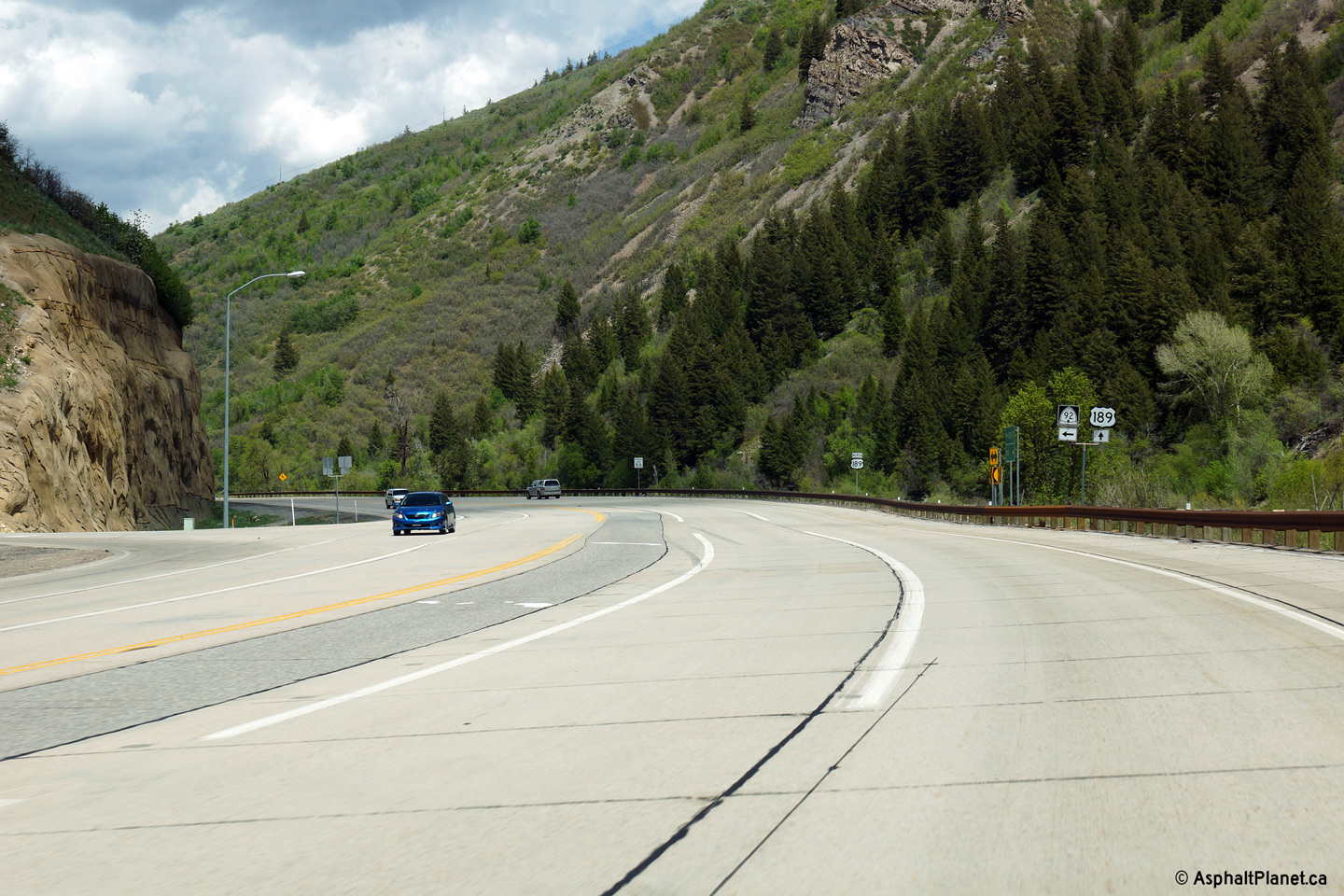
Utah County |
This view looks northerly at the UT-92 intersection. UT-92 is an east-west highway that heads up the mountain range adjacent to various ski resorts before descending back into the valley and terminating at I-15. |
 |
||
|
Photographed by: AsphaltPlanet.ca |
Date: 5/15/2014 |
High-res: (1440x960) (2400x1600) |
||
|
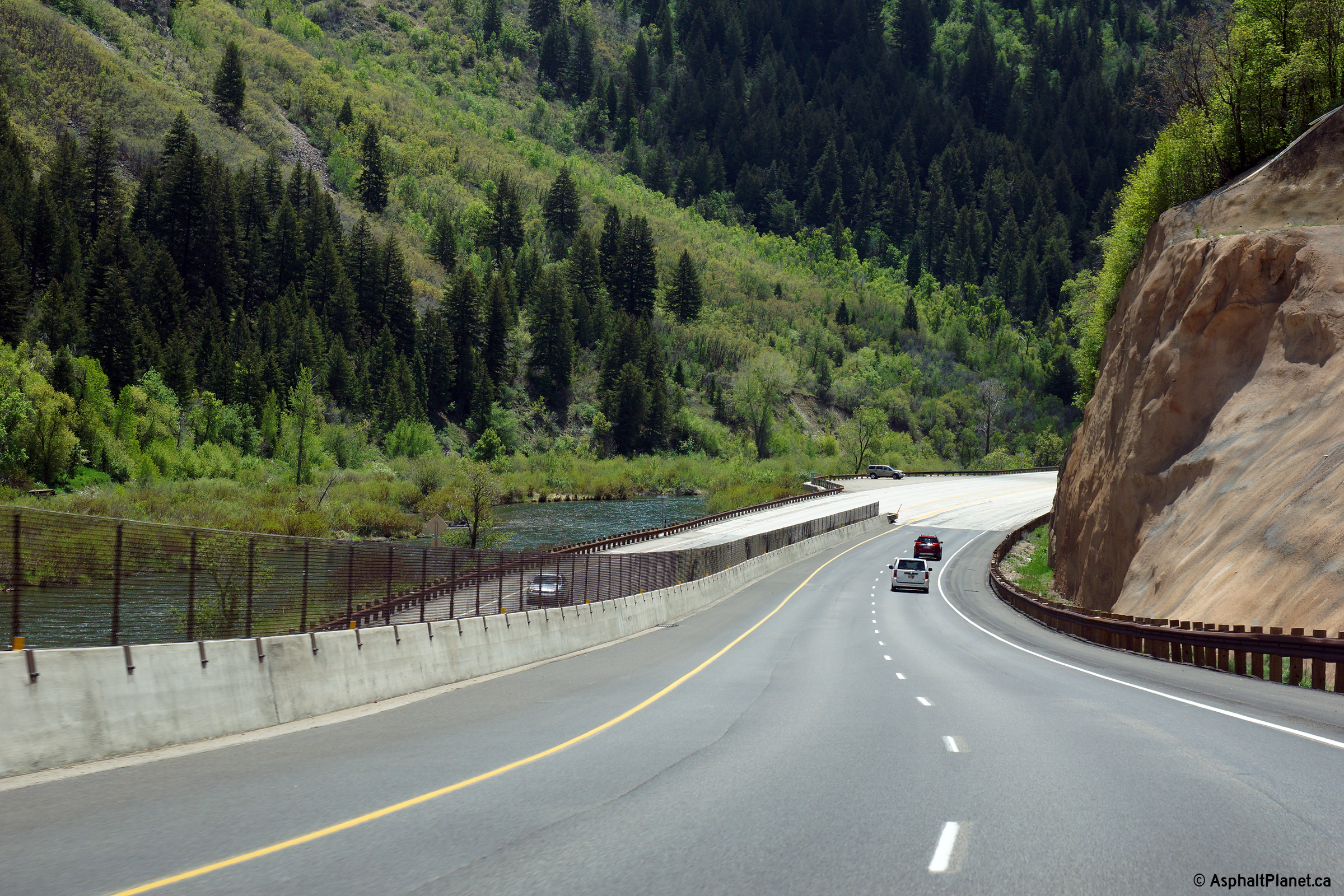
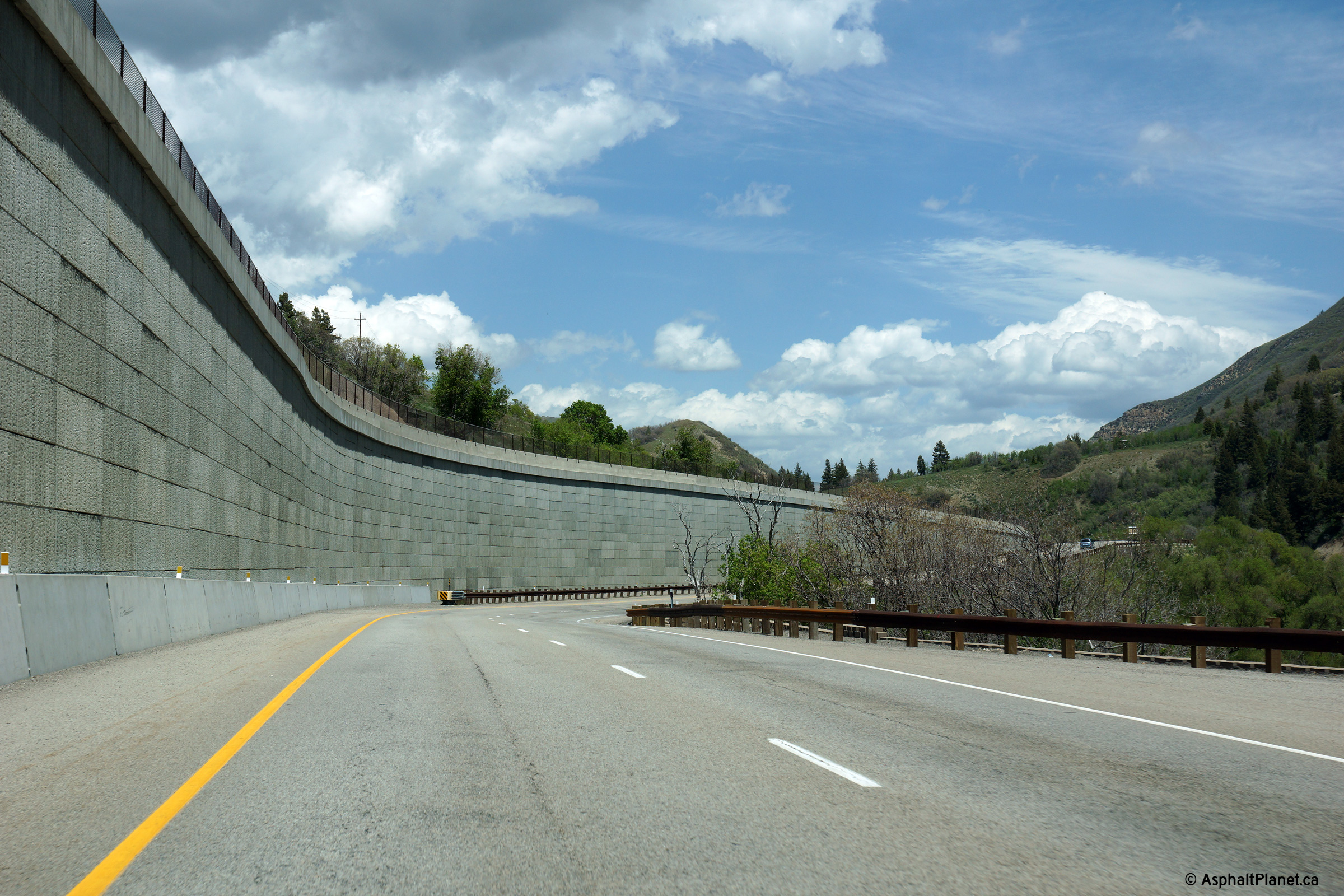
Utah County |
Two views looking northerly about 200 yards north of the UT-92 intersection. For a short distance through this part of the Provo River Canyon, the separate carriageways of US-189 have been built on different elevations of the hillside. |
 |
||
|
High-res: (1440x960) (2400x1600) |
||||
 |
||||
|
Photographed by: AsphaltPlanet.ca |
Date: 5/19/2014 |
High-res: (1440x960) (2400x1600) |
||
|
Wasatch County |
This view looks southerly as the southbound lanes of US-189 descend down the hillside and rejoin the northbound lanes of the highway. |
 |
||
|
Photographed by: AsphaltPlanet.ca |
Date: 5/19/2014 |
High-res: (1440x960) (2400x1600) |
||
|
Wasatch County |
Two views looking northerly along the multi-level portion of US-189. |
 |
||
|
High-res: (1440x960) (2400x1600) |
||||
 |
||||
|
Photographed by: AsphaltPlanet.ca |
Date: 5/19/2014 |
High-res: (1440x960) (2400x1600) |
||
|
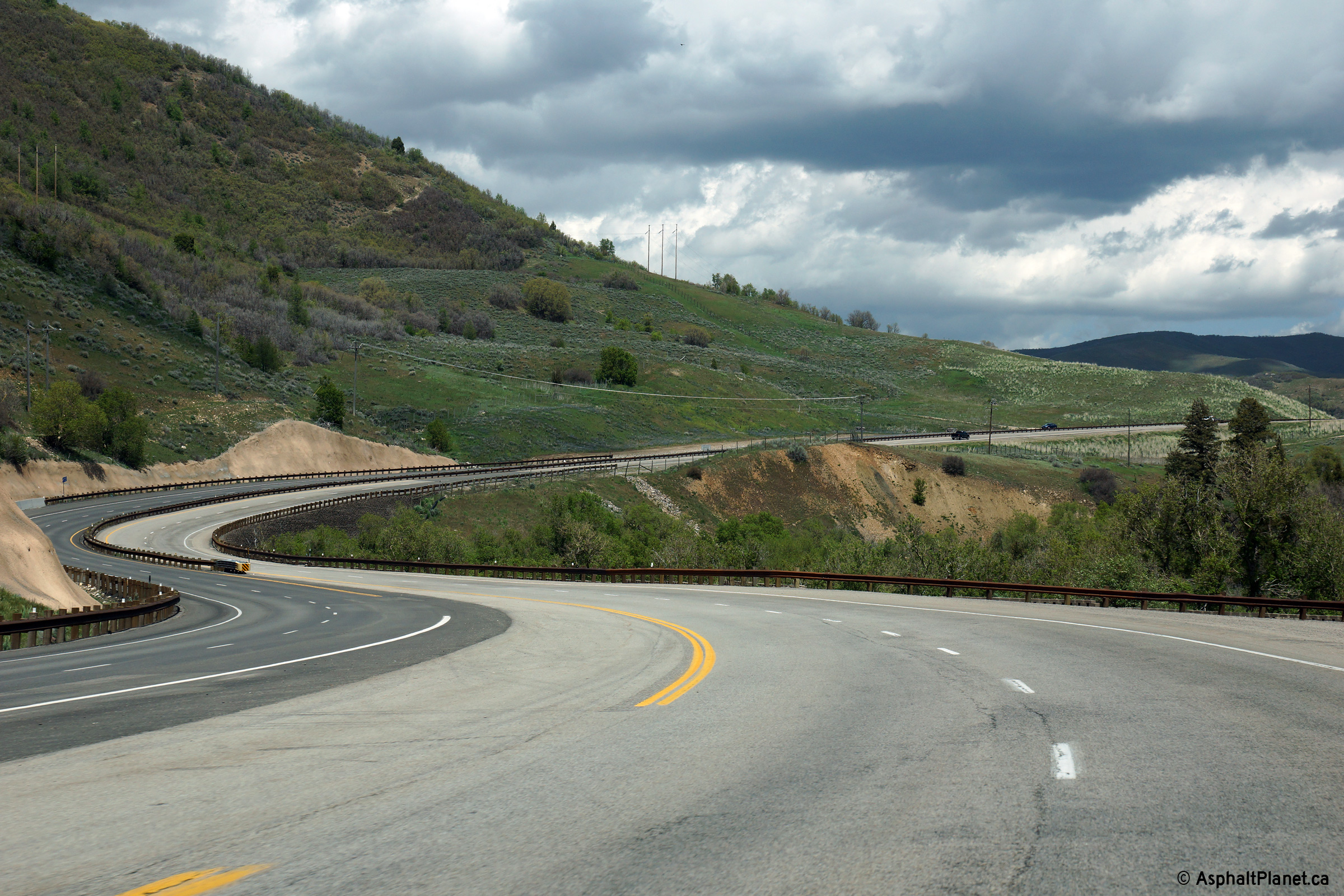
Wasatch County |
The northbound and southbound carriageways of US-189 merge after about a mile of multi-level highway. I am not certain that the photographs adequately capture how much fun the Provo Canyon Highway was to drive. The highway is akin to a roller coaster, with undulating vertical geometry and tight turns. I drove the Provo Canyon Highway twice northbound and once southbound when I visited the area in May, 2014. |
 |
||
|
Photographed by: AsphaltPlanet.ca |
Date: 5/19/2014 |
High-res: (1440x960) (2400x1600) |
||
|
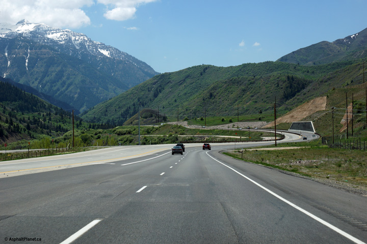
Wasatch County |
Southerly view along US-189 about a mile south of the Deer Creek Reservoir, as US-189 begins its descent into the Provo River Canyon. |
 |
||
|
Photographed by: AsphaltPlanet.ca |
Date: 5/19/2014 |
High-res: (1440x960) (2400x1600) |
||
|
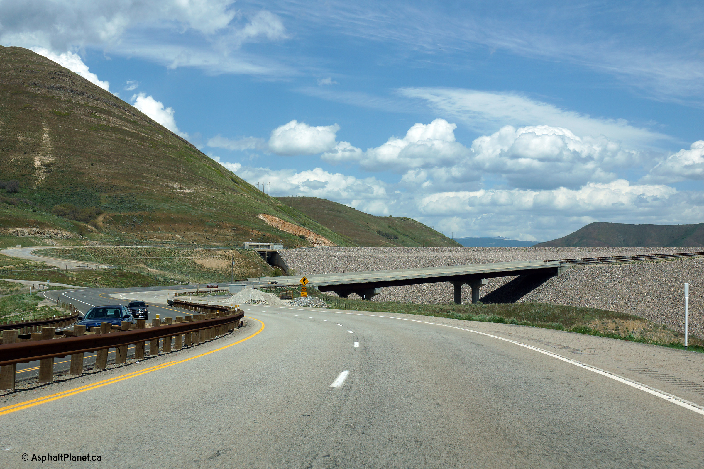
Wasatch County |
Northerly view as US-189 winds around a sharp curve just below the top of the Deer Creek Reservoir Dam. |
 |
||
|
Photographed by: AsphaltPlanet.ca |
Date: 5/19/2014 |
High-res: (1440x960) (2400x1600) |
||
|
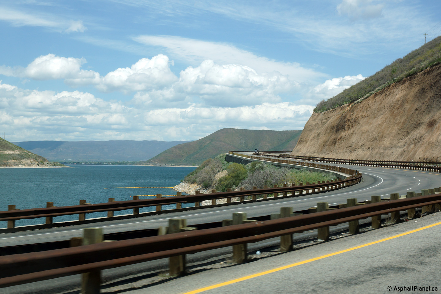
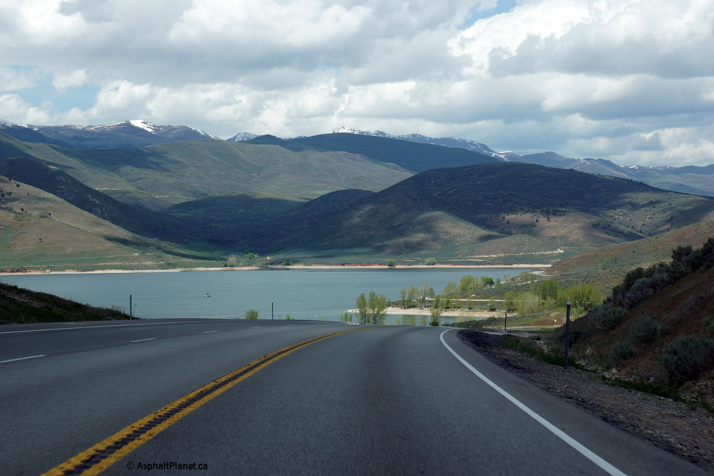
Wasatch County |
This view looks northerly as US-189 winds along the eastern edge of the Deer Creek Reservoir. This photo is located about half a mile north of the dam. |
 |
||
|
Photographed by: AsphaltPlanet.ca |
Date: 5/19/2014 |
High-res: (1440x960) (2400x1600) |
||
|
Wasatch County |
Southerly view just as US-189 widens to a four lane highway before it begins to descend the Provo River Canyon. |
 |
||
|
Photographed by: AsphaltPlanet.ca |
Date: 5/15/2014 |
High-res: (1440x960) (2400x1600) |
||
|
Wasatch County |
Northerly view at the northern end of the multilane divided highway. The multilane highway narrows to a two-way two lane, single carriageway highway about a mile north of the Deer Creek Reservoir Dam. |
 |
||
|
Photographed by: AsphaltPlanet.ca |
Date: 5/19/2014 |
High-res: (1440x960) (2400x1600) |
||
|
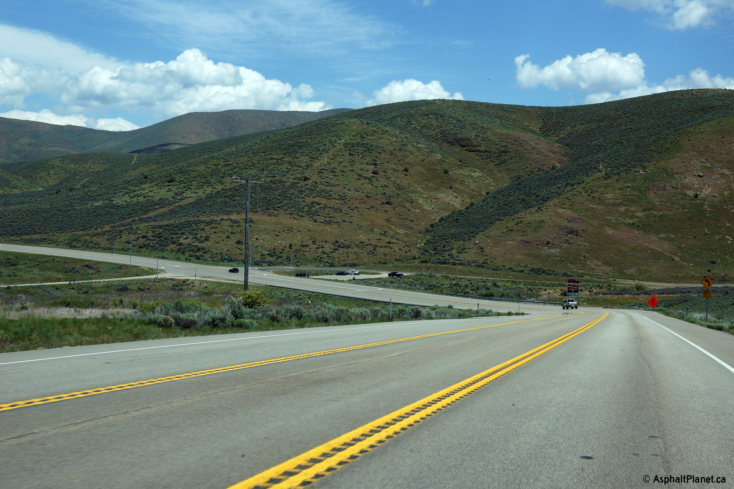
Wasatch County |
This view looks northerly as US-189 rounds a substantial (nearly 180 degree) curve about 2 miles north of the Deer Creek Reservoir Dam. |
 |
||
|
Photographed by: AsphaltPlanet.ca |
Date: 5/19/2014 |
High-res: (1440x960) (2400x1600) |
||
|
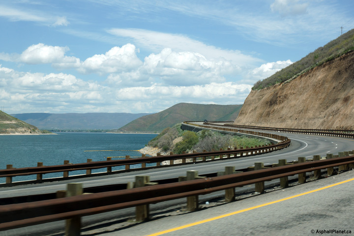
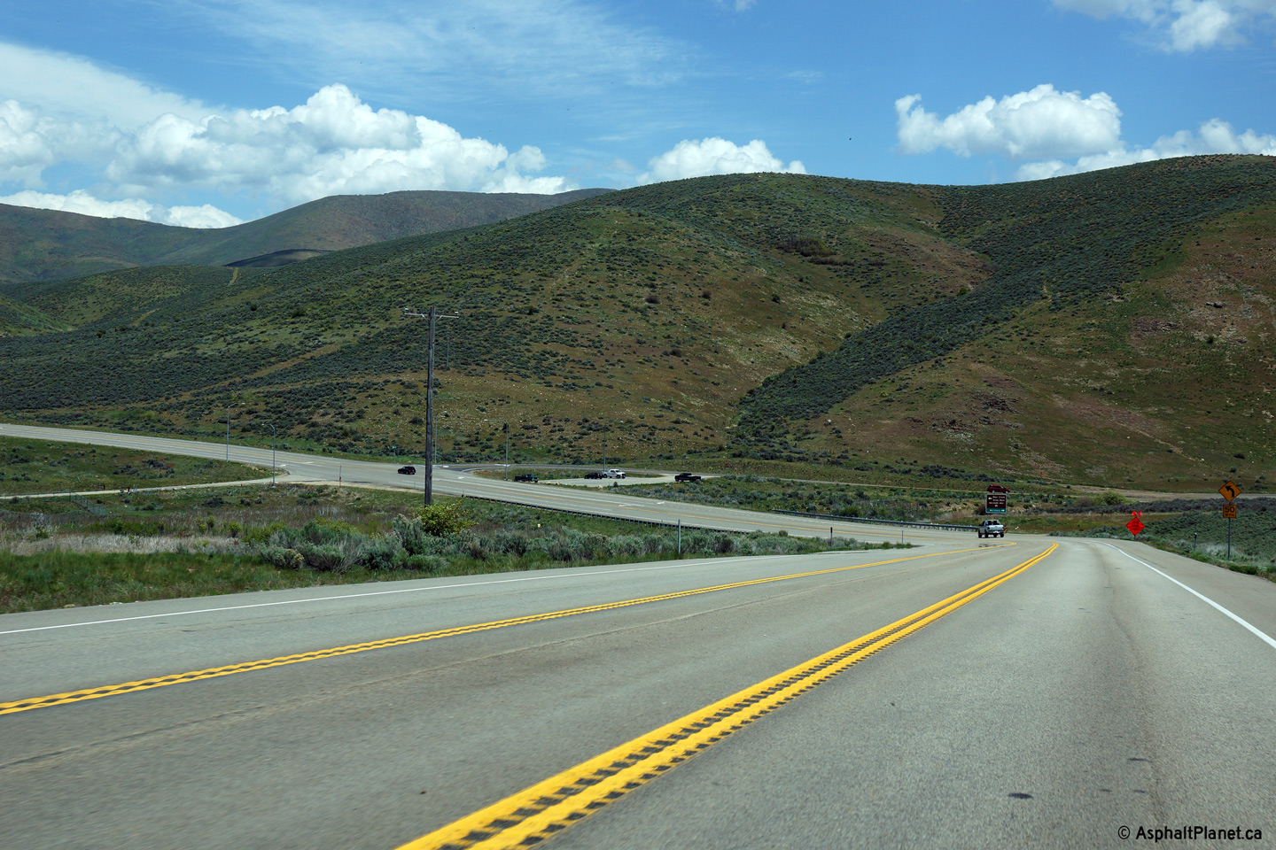
Wasatch County |
View looking northerly about 5 miles north of the Deer Creek Dam towards the reservoir of the same name. |
 |
||
|
Photographed by: AsphaltPlanet.ca |
Date: 5/19/2014 |
High-res: (1440x960) (2400x1600) |
||
|
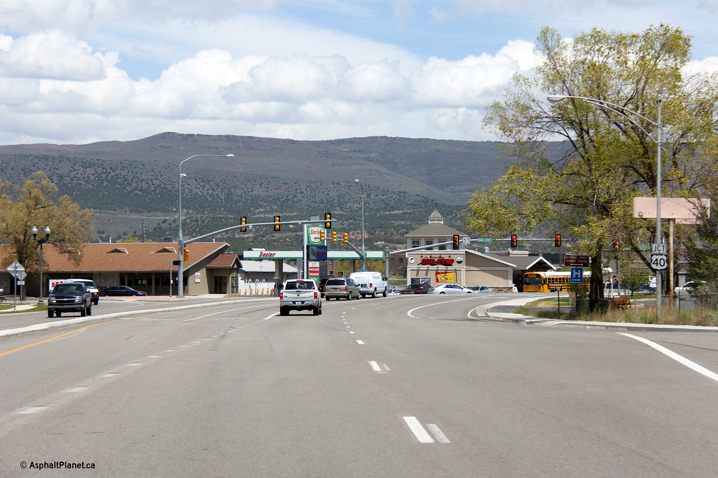
Wasatch County |
Northerly view at the US-40 junction at Heber City. |
 |
||
|
Photographed by: AsphaltPlanet.ca |
Date: 5/15/2014 |
High-res: (1440x960) (2400x1600) |
||
<- US-189 UT Highways
US-191 ->
AsphaltPlanet.ca
© 2013-14 AsphaltPlanet.ca.
AsphaltPlanet@asphaltplanet.ca
Page Created: July 21st, 2014.
Last Updated: July 21st`, 2014.