AsphaltPlanet.ca > Texas > Interstate 820
Pictures on this page are arranged in order clockwise around the length of the Interstate 820. The zero marker is at I-20 south-west of Downtown Fort Worth, the furthest southwest point along the loop. Clockwise oriented photos are left-aligned, while counter-clockwise photos appear right aligned in the photo column below. Center-line pictures are centered within the last column.
|
Location |
Description |
Photo |
||
|
Clock- |
Counter clock- |
|||
|
Tarrant County Fort Worth |
View looking southerly at the western terminus of Interstate 820 from the Texas Ranch Road overpass. |
 |
||
|
Date: 11/3/2012 |
High-res: (1440x960) (2400x1600) | |||
|
Tarrant County Fort Worth |
View looking northerly along Interstate 820 from the Texas Ranch Road. Interstate 820 is a loop interstate that leads motorists around the western, northern, and eastern edges of the Fort Worth Metro area. |
 |
||
|
Date: 11/3/2012 |
High-res: (1440x960) (2400x1600) | |||
|
Tarrant County Fort Worth |
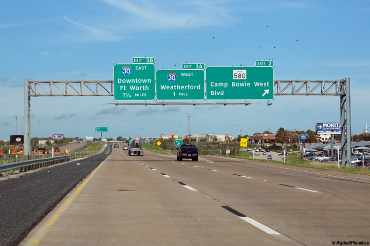
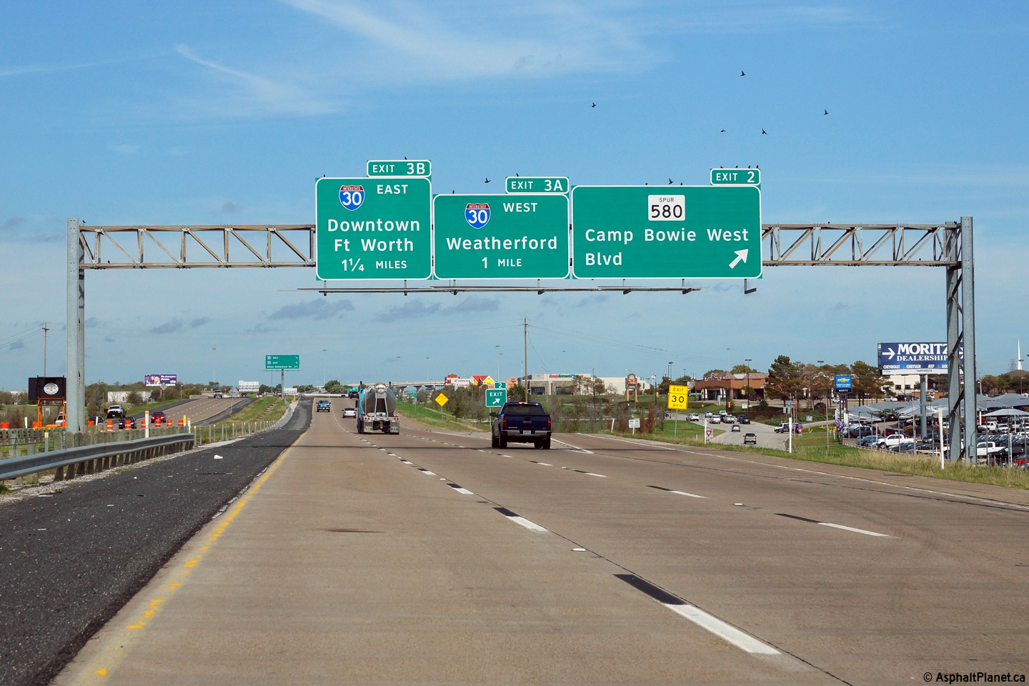
Signage assembly at the northbound off-ramp to Spur 580. |
 |
||
|
Date: 11/14/2015 |
High-res: (1440x960) (2400x1600) | |||
|
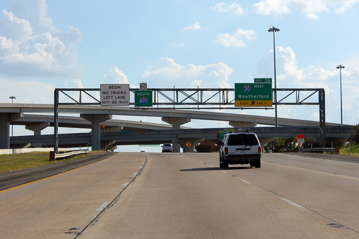
Tarrant County Fort Worth |
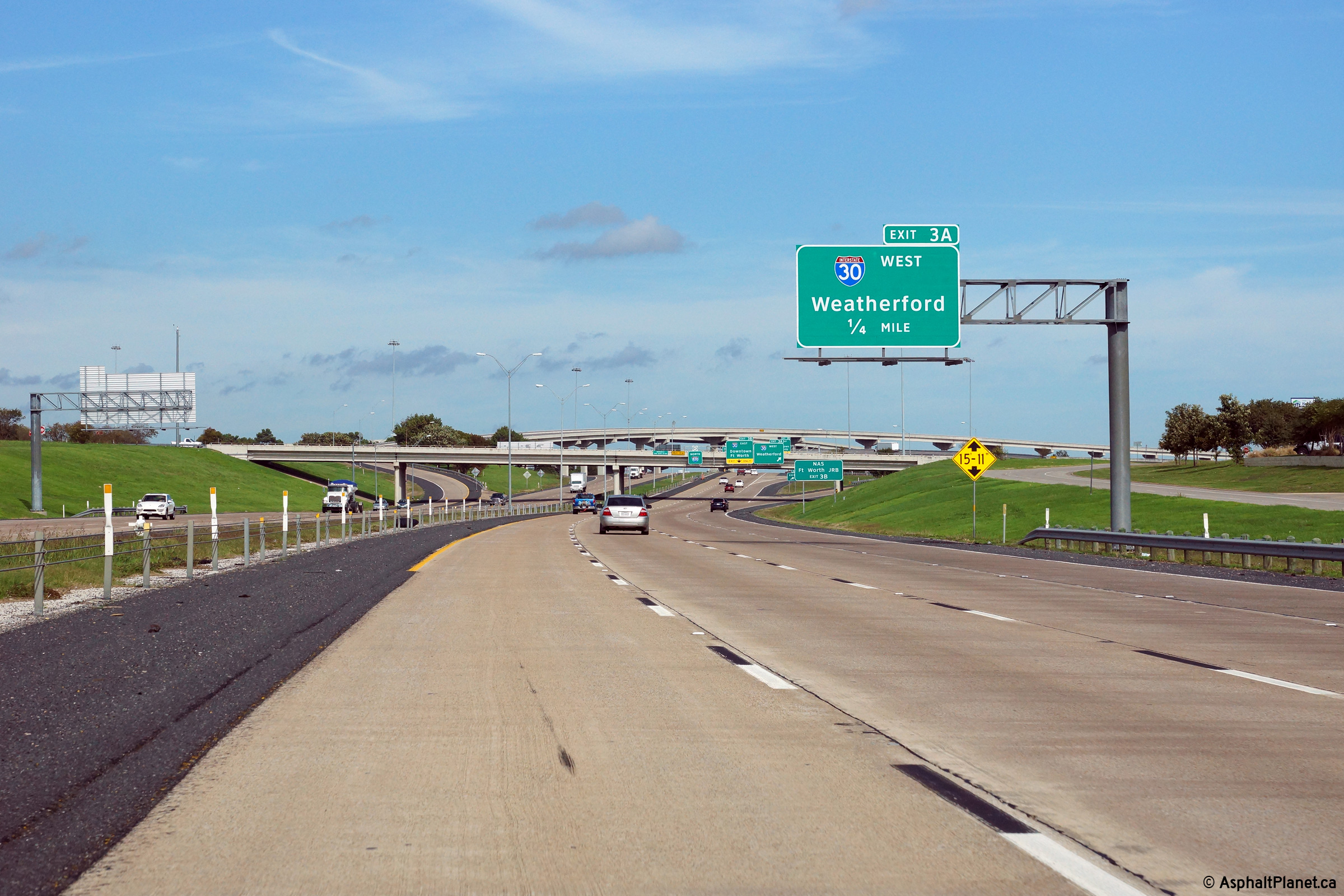
Northbound advanced signage for the ramp to I-30 West. |
 |
||
|
Date: 11/14/2015 |
High-res: (1440x960) (2400x1600) | |||
|
Tarrant County Fort Worth |
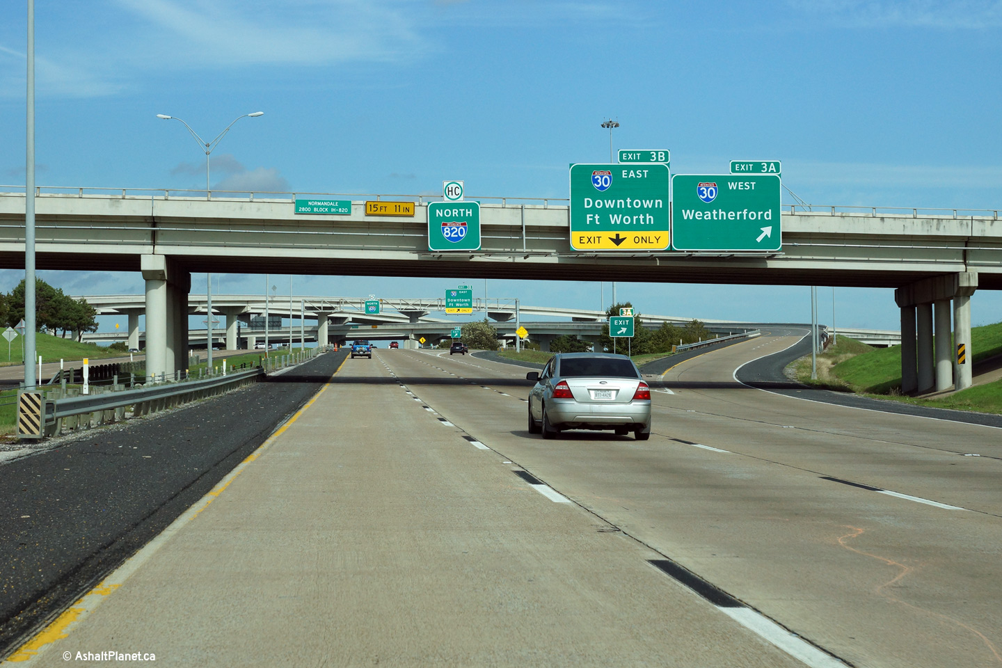
Signage for the ramp to I-30 West has been affixed to the Normandale Street overpass. |
 |
||
|
Date: 11/14/2015 |
High-res: (1440x960) (2400x1600) | |||
|
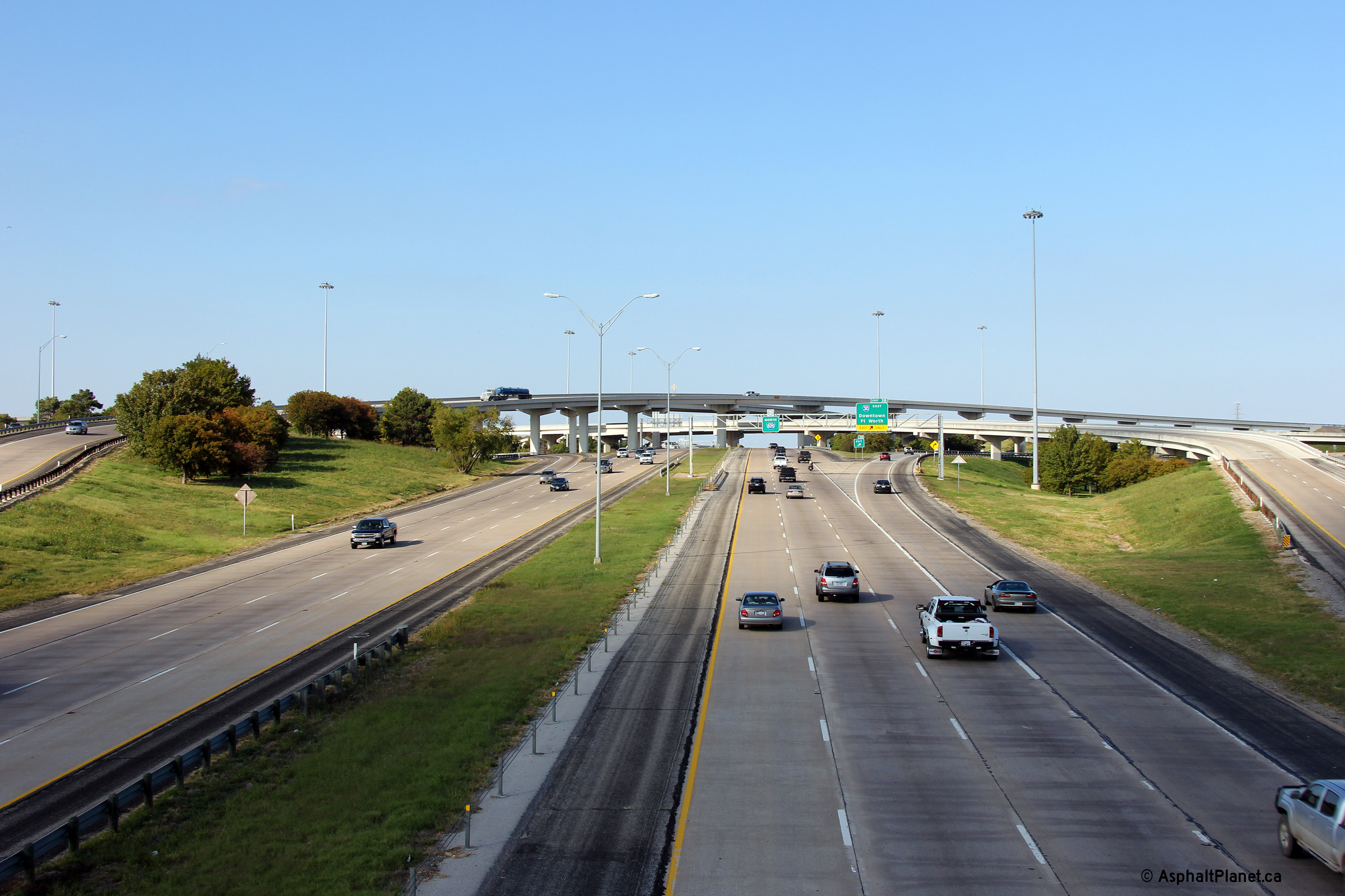
Tarrant County Fort Worth |
Two views looking southerly from the Normandale Street overpass, immediately south of the I-30 interchange. |
 |
||
| High-res: (1440x960) (2400x1600) | ||||
 |
||||
|
Date: 11/3/2012 |
High-res: (1440x960) (2400x1600) | |||
|
Tarrant County Fort Worth |
View looking northerly along I-820 from the Normandale Street overpass towards the stack interchange with I-30. |
 |
||
|
Date: 11/3/2012 |
High-res: (1440x960) (2400x1600) | |||
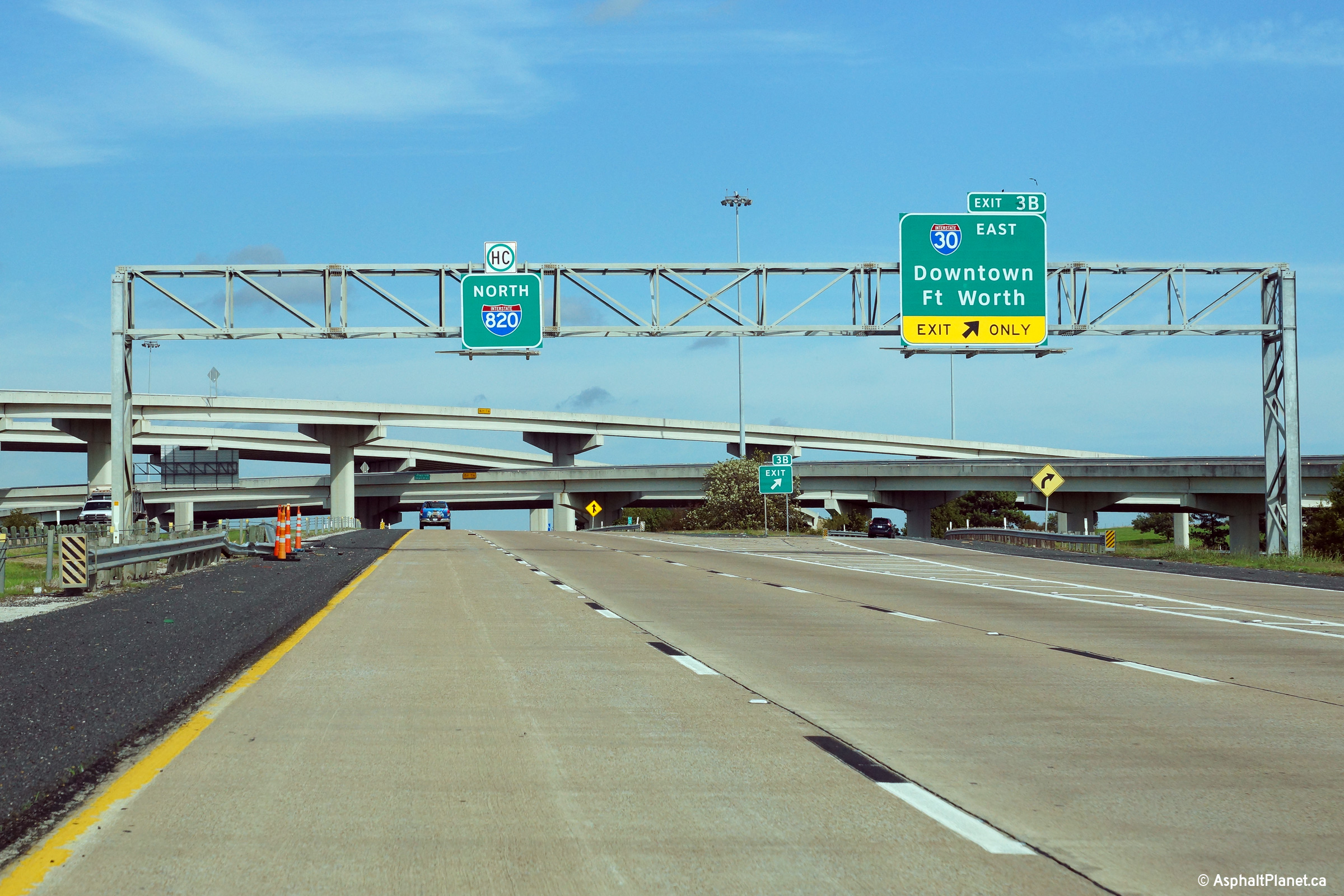
|
Tarrant County Fort Worth |
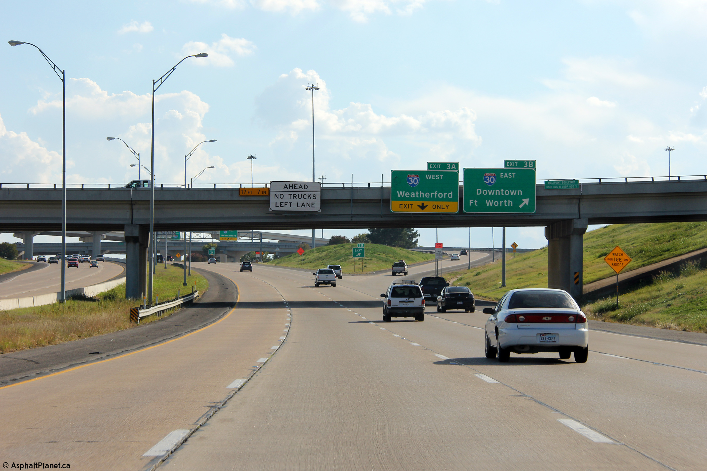
Overhead signage for the ramp to I-30 East which leads traffic towards Downtown Forth Worth. |
 |
||
|
Date: 11/14/2015 |
High-res: (1440x960) (2400x1600) | |||
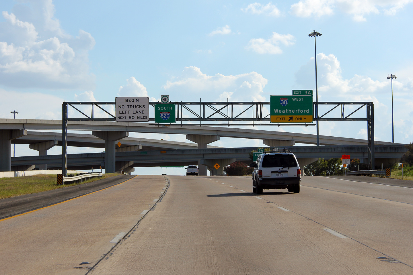
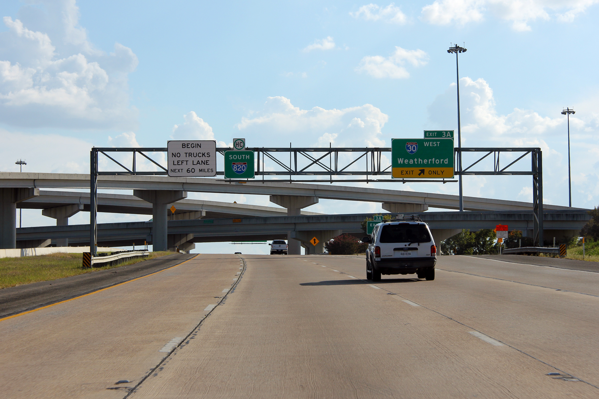
|
Tarrant County Fort Worth |
Southbound signage at the off-ramp to I-30 West. |
 |
||
|
Date: 11/3/2012 |
High-res: (1440x960) (2400x1600) | |||
|
Tarrant County Fort Worth |
Signage at the southbound off-ramp to I-30 East. |
 |
||
|
Date: 11/3/2012 |
High-res: (1440x960) (2400x1600) | |||
|
Tarrant County Fort Worth |
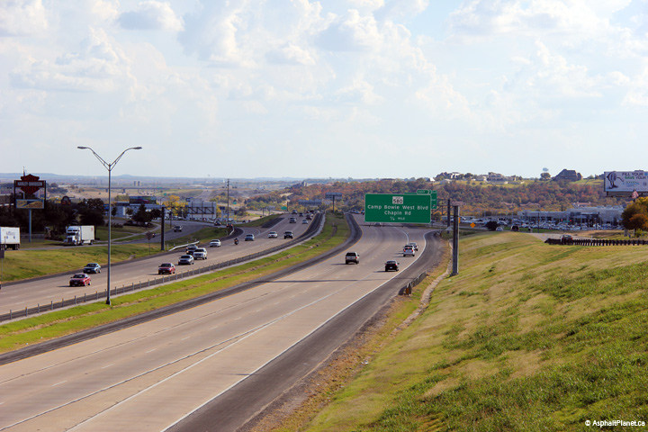
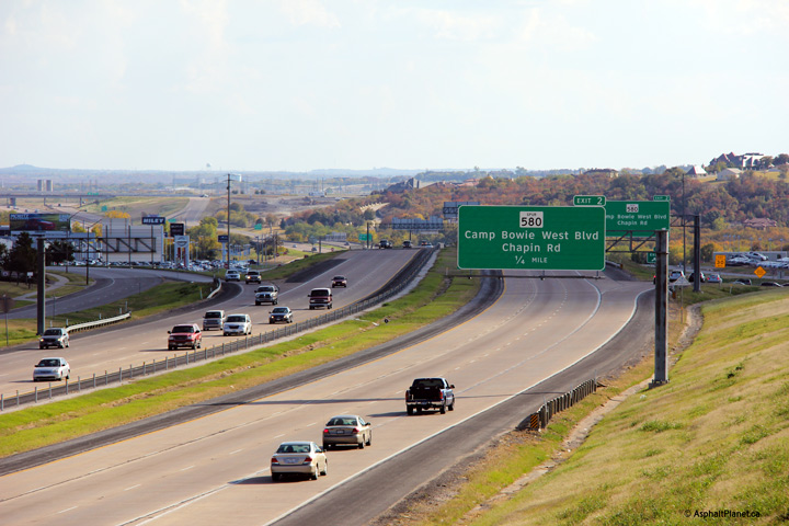
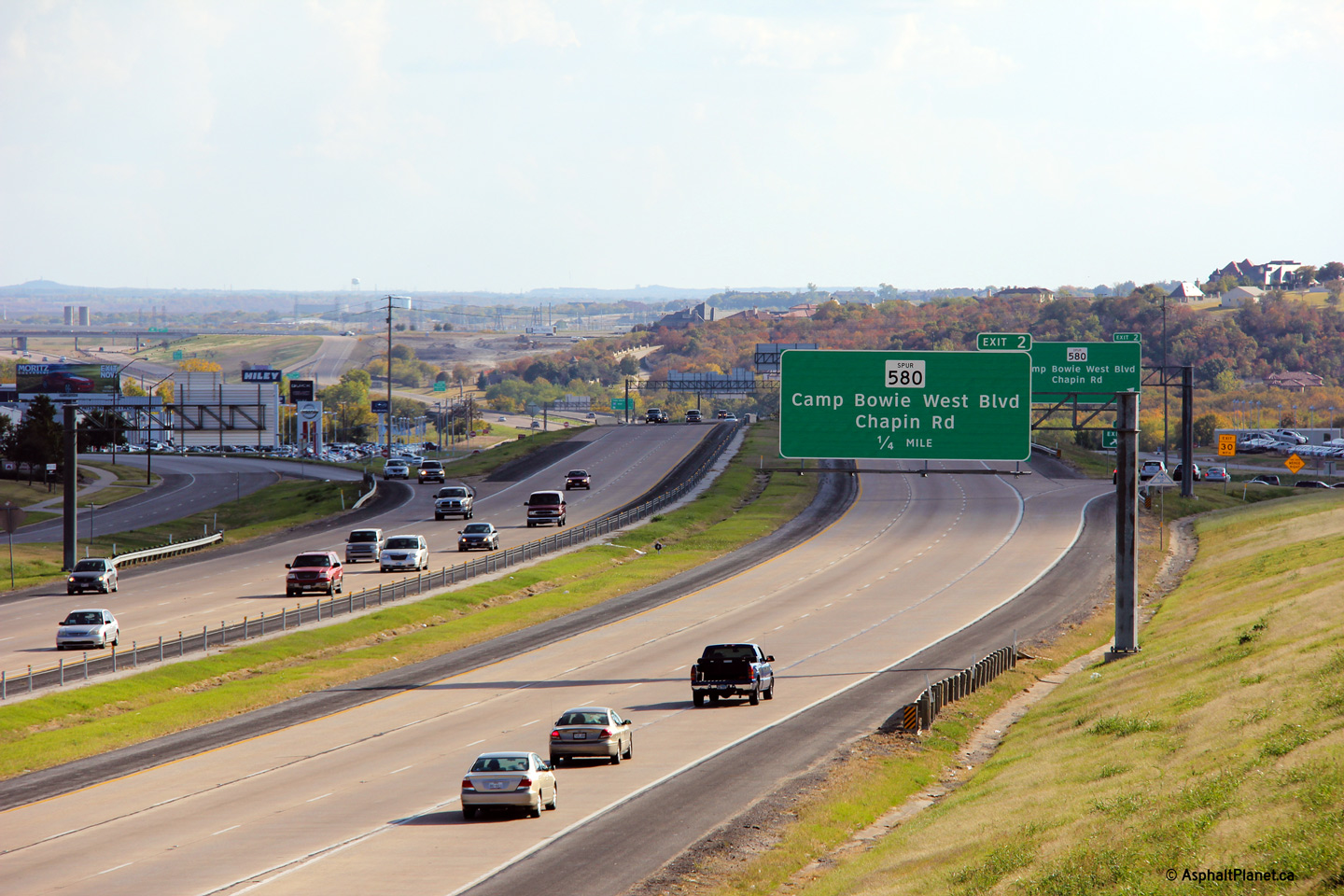
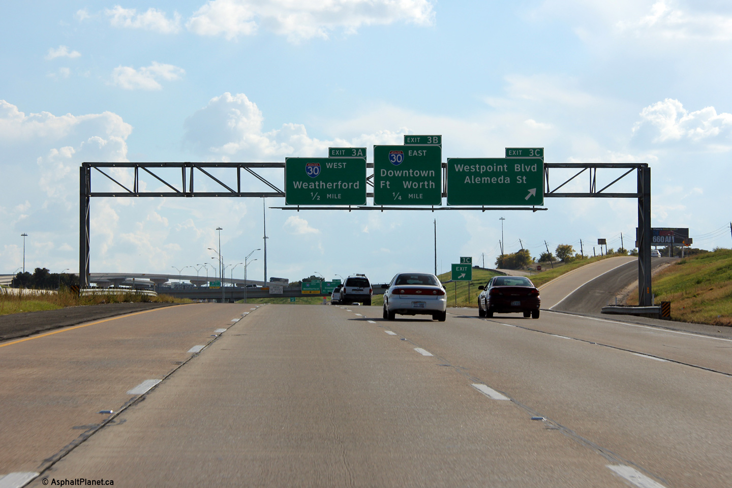
Southbound off-ramp to Westbound Boulevard. |
 |
||
|
Date: 11/3/2012 |
High-res: (1440x960) (2400x1600) | |||
|
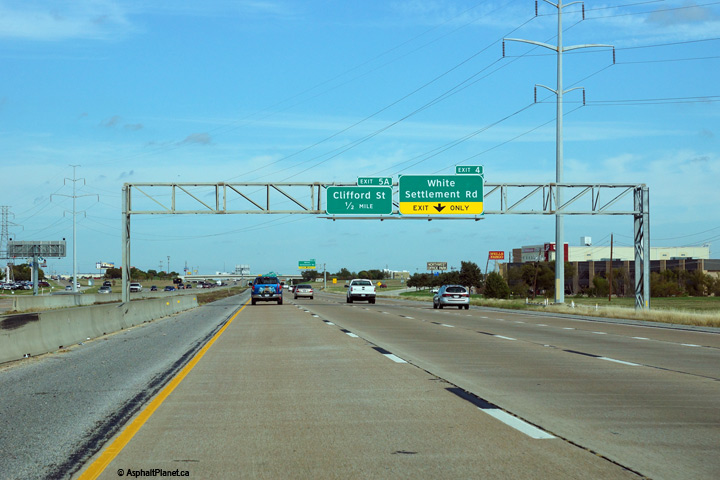
Tarrant County Fort Worth |
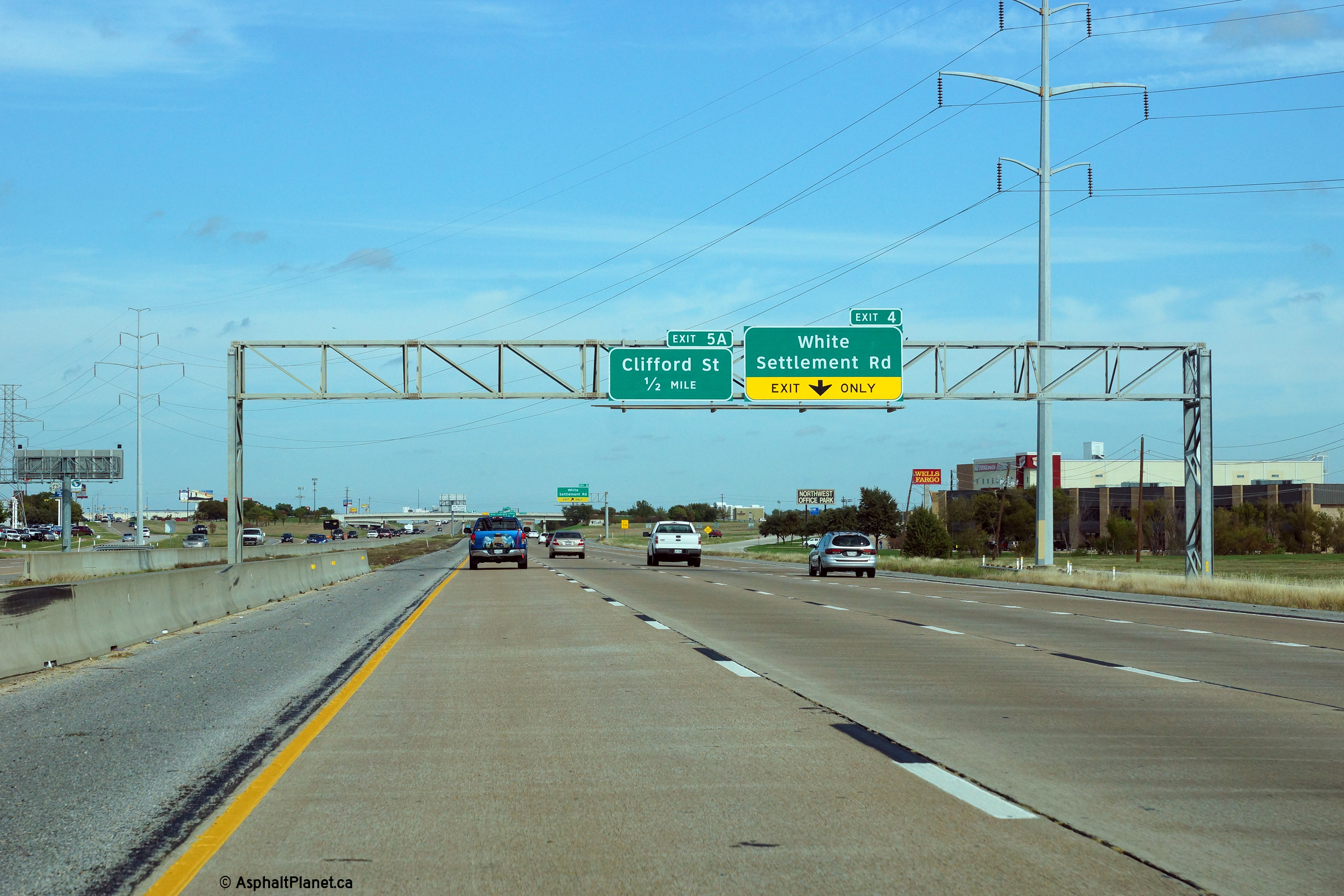
Advanced signage for the both the interchanges to White Settlement Road and Clifford Street. |
 |
||
|
Date: 11/14/2015 |
High-res: (1440x960) (2400x1600) | |||
|
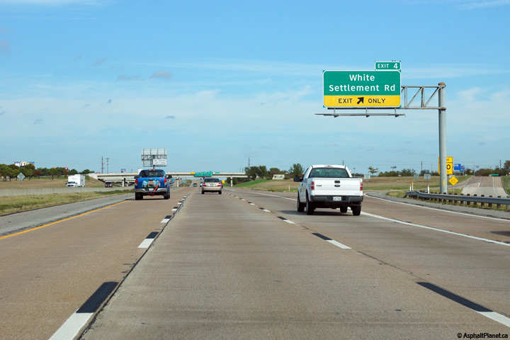
Tarrant County Fort Worth |
Signage at the northbound off-ramp to White Settlement Road. |
 |
||
|
Date: 11/14/2015 |
High-res: (1440x960) (2400x1600) | |||
|
Tarrant County Fort Worth |
View looking westerly from the Las Vegas Trail overpass. |
 |
||
|
Date: 11/3/2012 |
High-res: (1440x960) (2400x1600) | |||
|
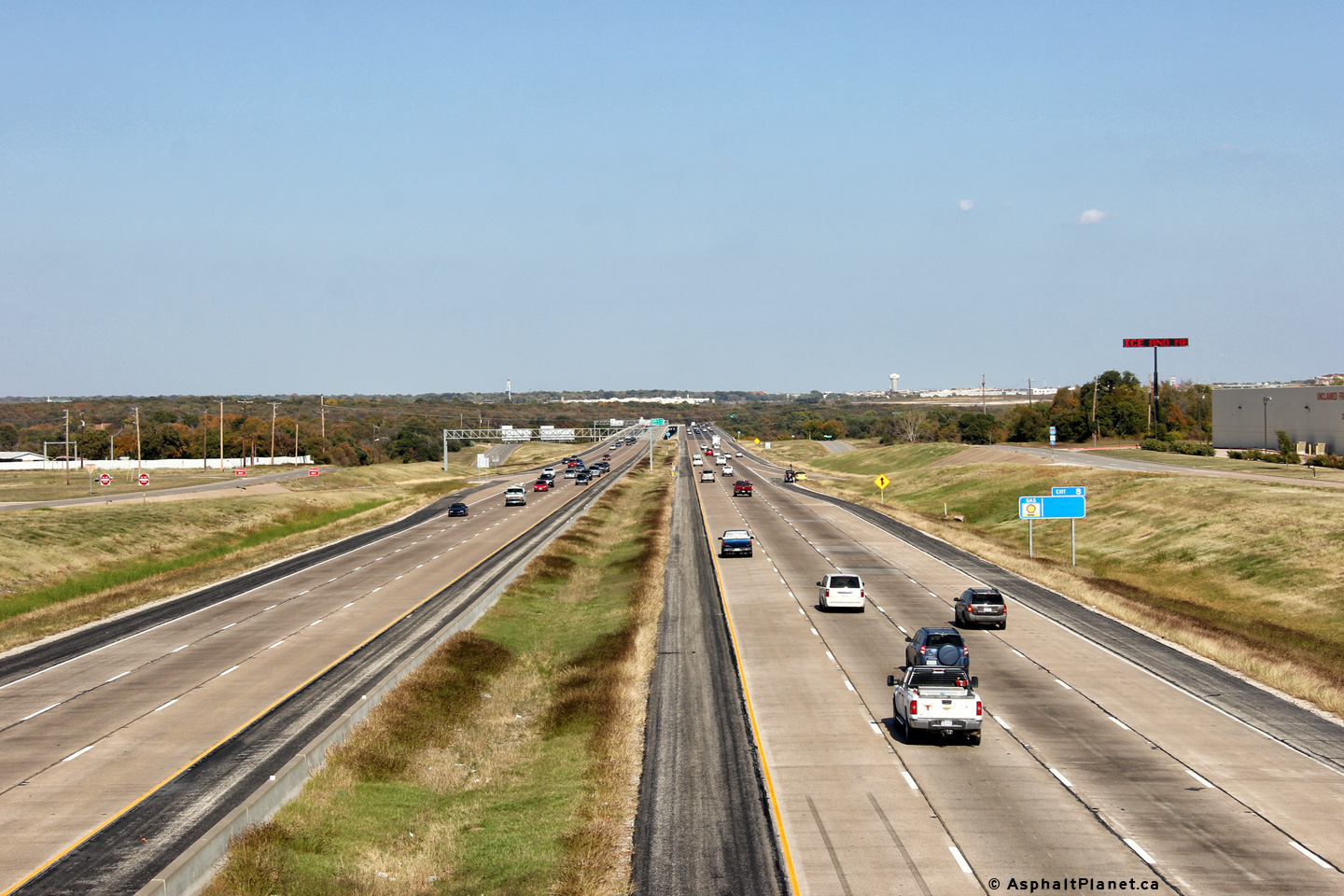
Tarrant County Fort Worth |
View looking easterly along I-820 from the Las Vegas Trail overpass. To the east of this interchange, I-820 crosses overtop of Lake Worth. |
 |
||
|
Date: 11/3/2012 |
High-res: (1440x960) (2400x1600) | |||
|
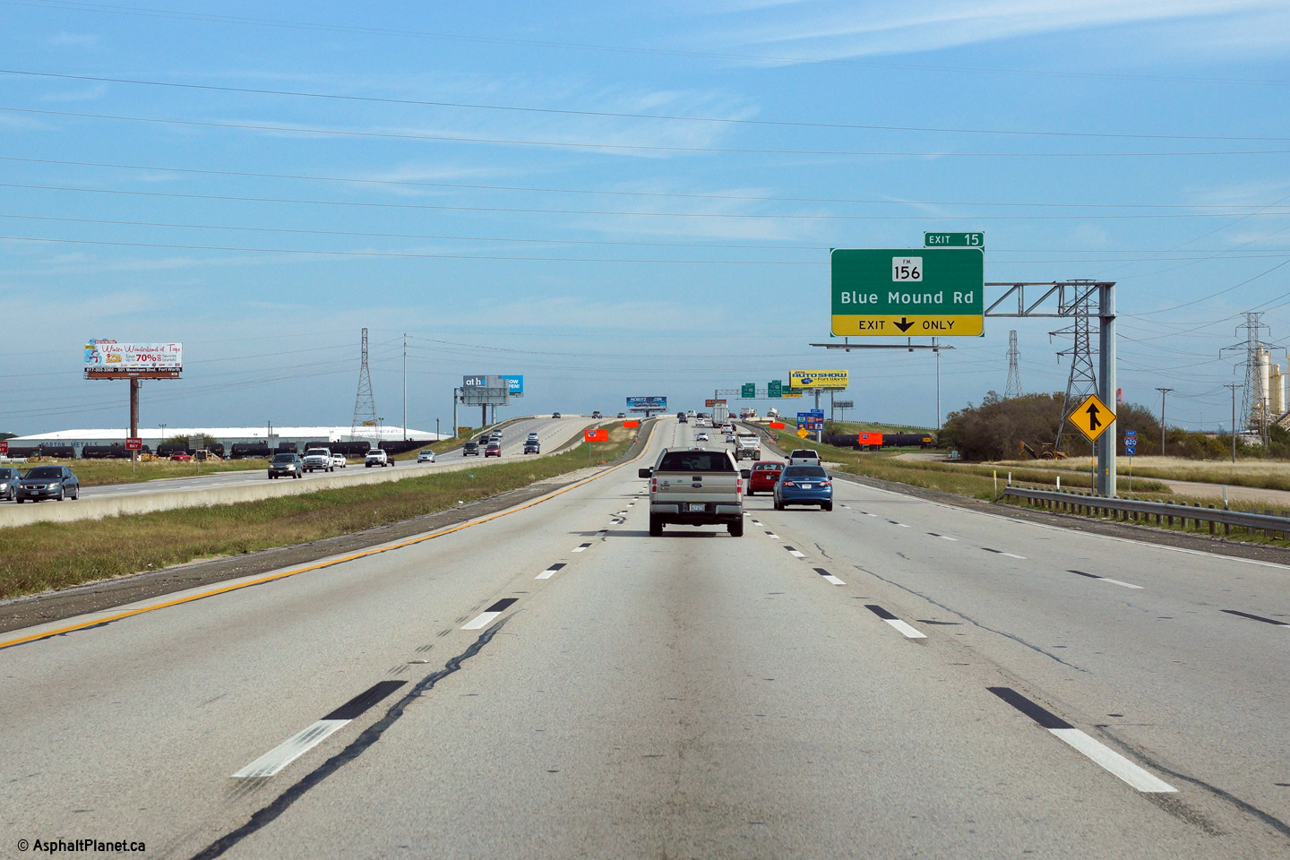
Tarrant County Fort Worth |
Eastbound advanced signage for the Blue Mound Road interchange. |
 |
||
|
Date: 11/14/2015 |
High-res: (1440x960) (2400x1600) | |||
|
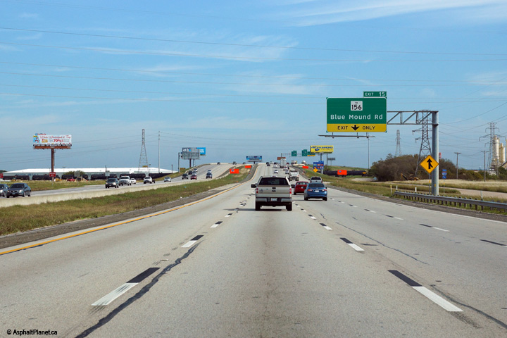
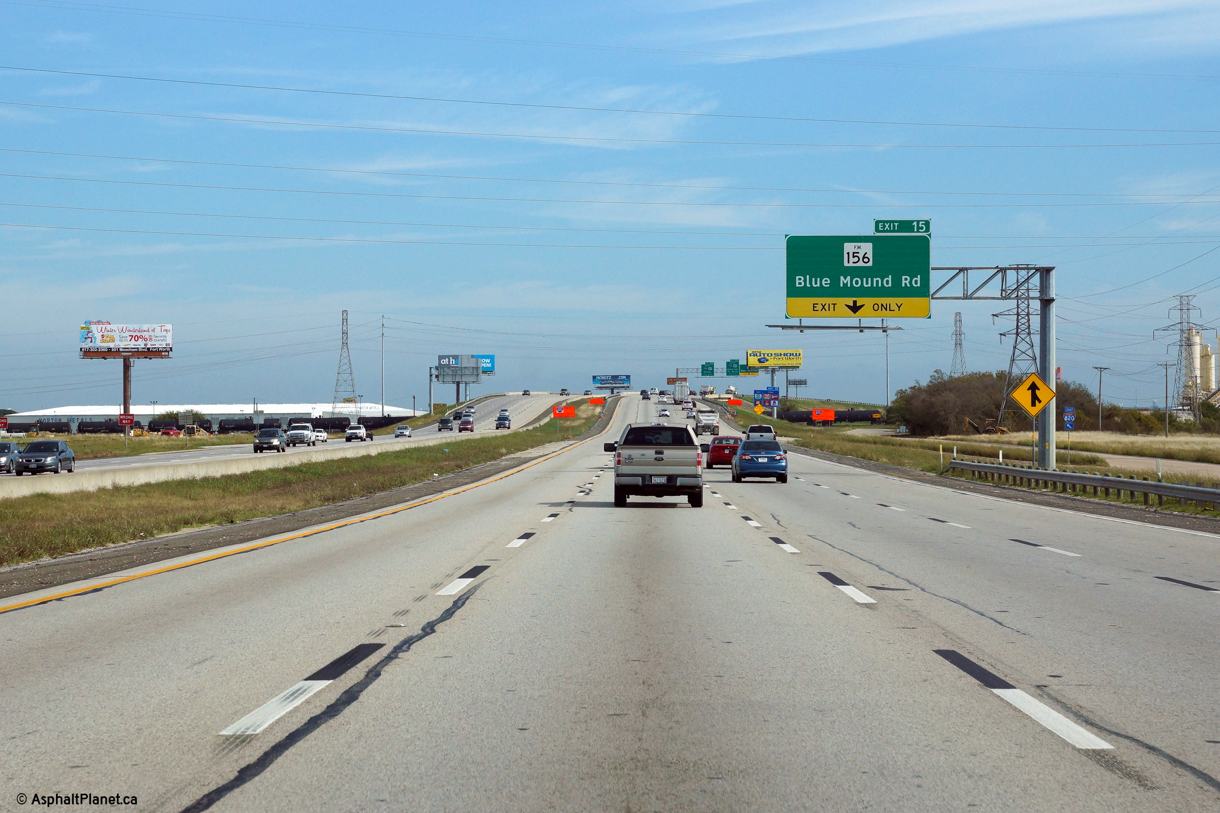
Tarrant County Fort Worth |
View at the eastbound off-ramp to Blue Mound Road. |
|
||
|
Date: 11/14/2015 |
High-res: (1440x960) (2400x1600) | |||
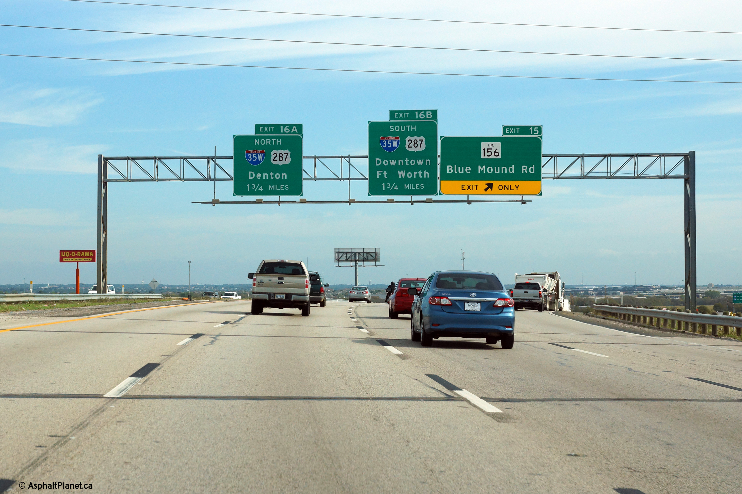
|
Tarrant County Fort Worth |
Eastbound view at the I-35W interchange. |
 |
||
|
Date: 11/14/2015 |
High-res: (1440x960) (2400x1600) | |||
| I-35W is the western leg of Interstate 35, running through Fort Worth. Click here for I-35W images. | ||||
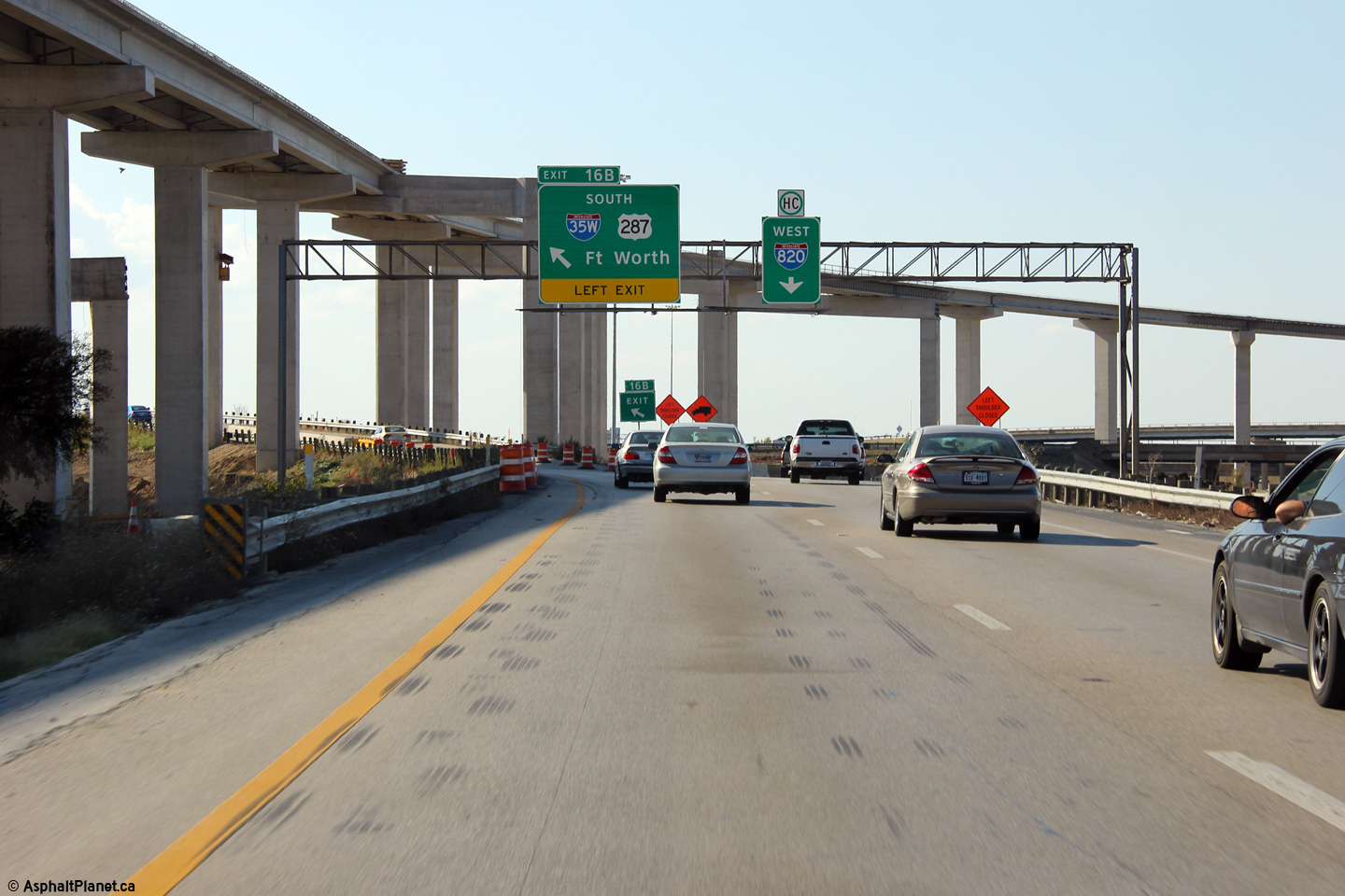
|
Tarrant County Fort Worth |
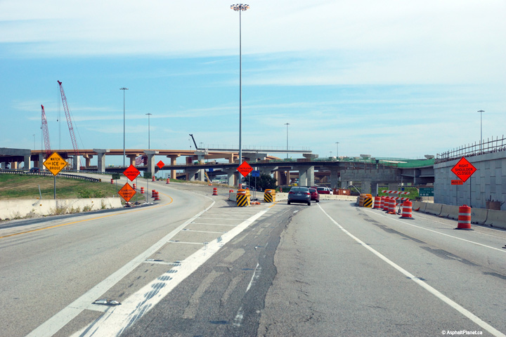
Signage at the left hand exit from I-820 West to I-35W South. When this photo was taken, construction was underway on the high-speed ramp from I-35W South to the I-820 Eastbound Express lanes. This ramp is now open to traffic is work is now underway to reconstruct the general purpose lanes of this interchange. |
 |
||
|
Date: 11/3/2012 |
High-res: (1440x960) (2400x1600) | |||
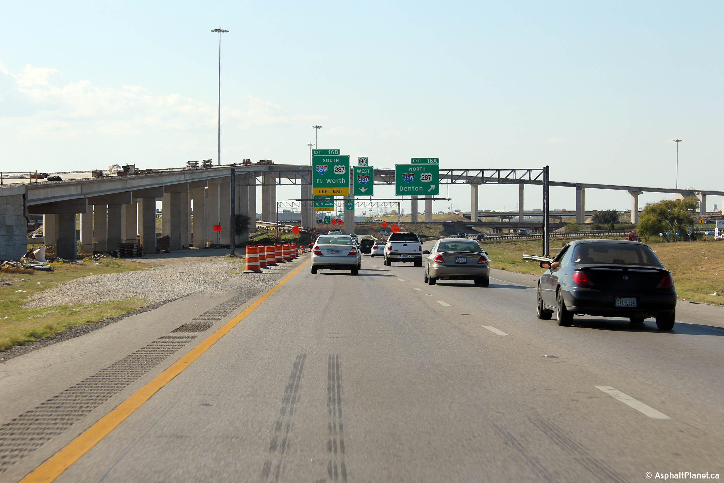
|
Tarrant County Fort Worth |
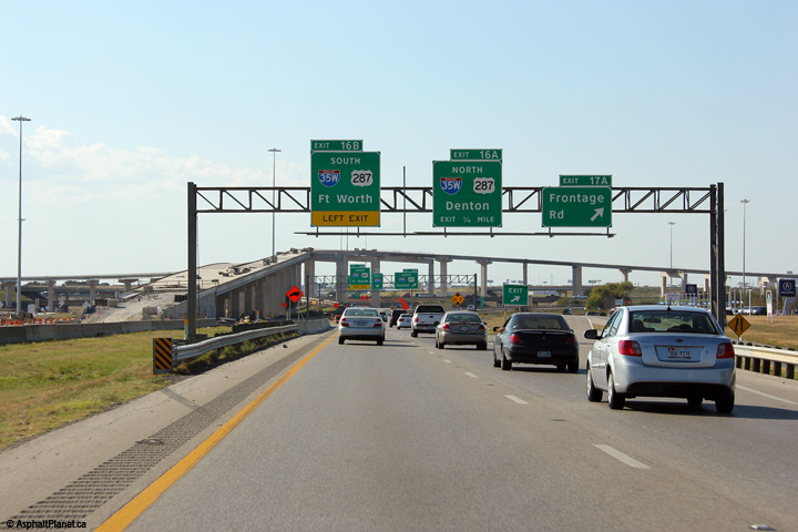
Two views at the off-ramp to I-35W North. Construction is underway to relocate this off-ramp onto a new structure. |
 |
||
| High-res: (1440x960) (2400x1600) | ||||
|
Tarrant County Fort Worth |
 |
|||
|
Photo #1: 11/3/2012. Photo #2: 11/14/2015 |
High-res: (1440x960) (2400x1600) | |||
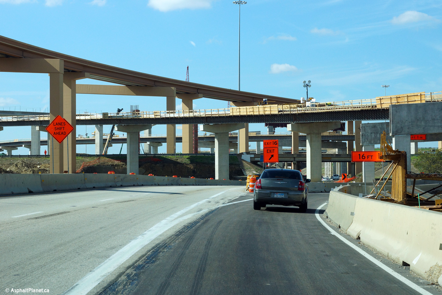
|
Tarrant County Fort Worth |
Signage at the off-ramp to the Frontage Road in advance of the I-35W interchange. This ramp was closed when I visited Dallas in 2015 as part of the construction to replace the I-820/I-35W interchange. |
 |
||
| High-res: (1440x960) (2400x1600) | ||||
|
Tarrant County Fort Worth |
 |
|||
|
Photo #1: 11/3/2012. Photo #2: 11/14/2015 |
High-res: (1440x960) (2400x1600) | |||
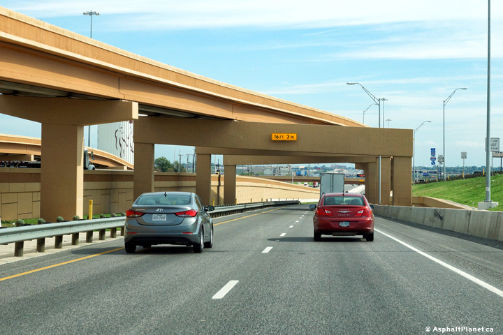
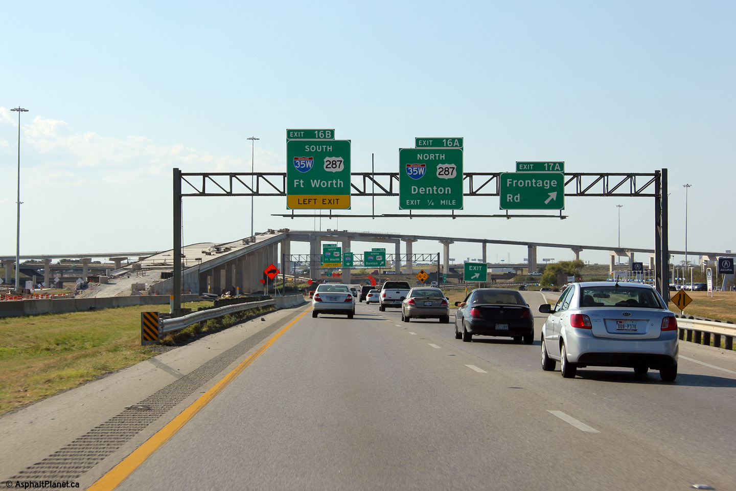
|
Tarrant County Fort Worth |
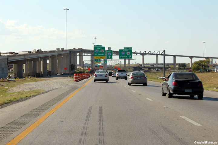
2015 view looking westerly approaching the I-35W interchange. |
 |
||
| Date: 11/14/2015 | High-res: (1440x960) (2400x1600) | |||
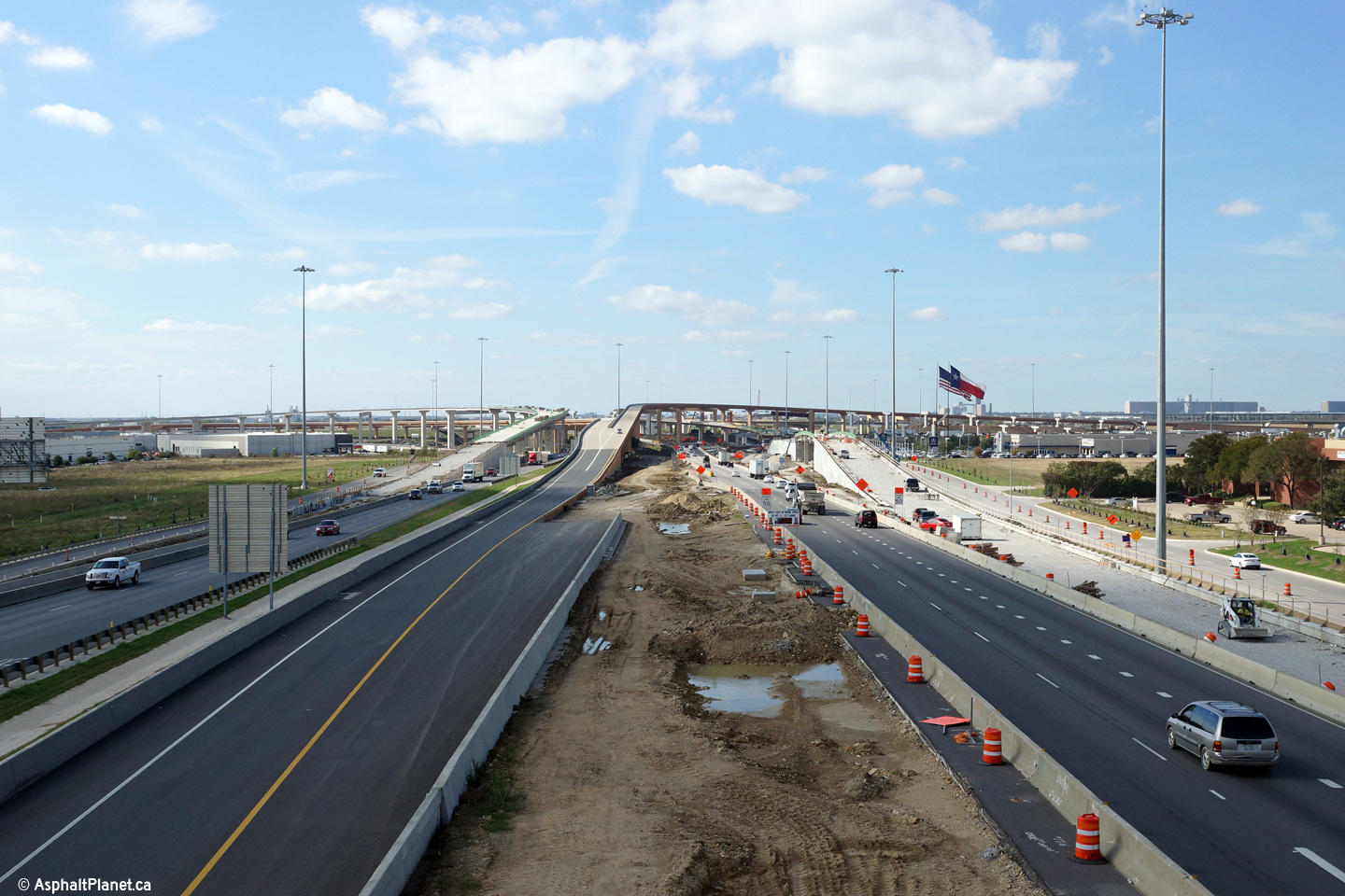
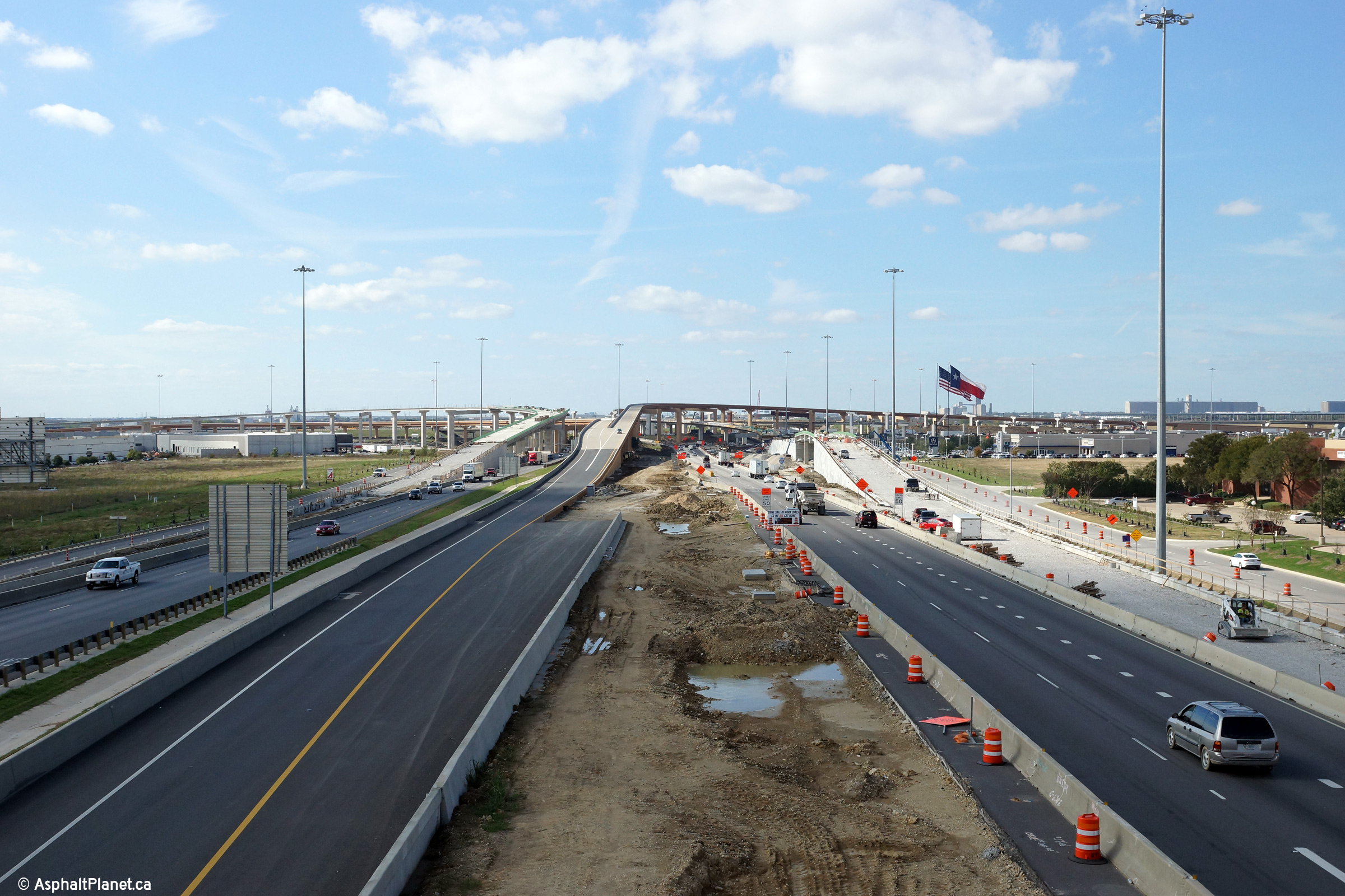
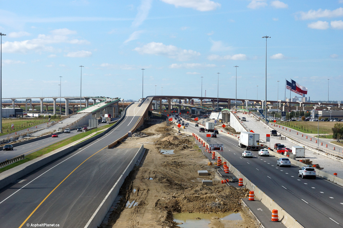
|
Tarrant County Fort Worth |
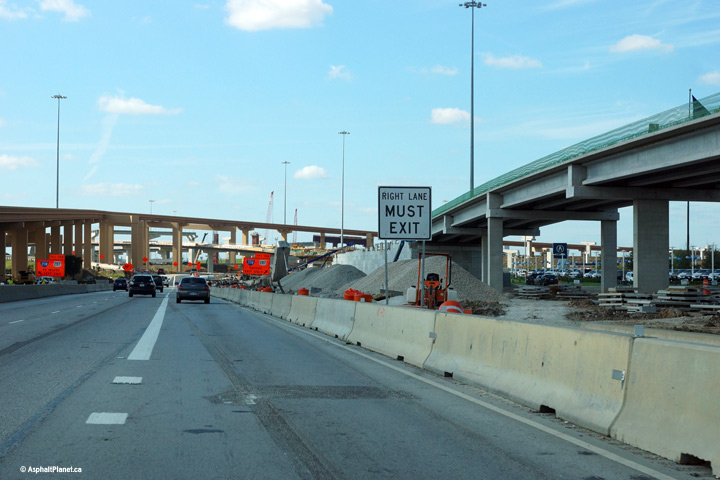
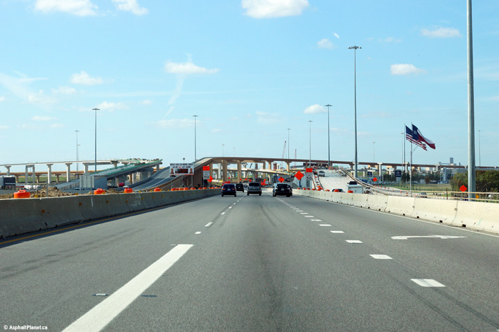
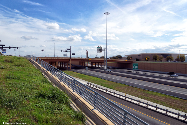
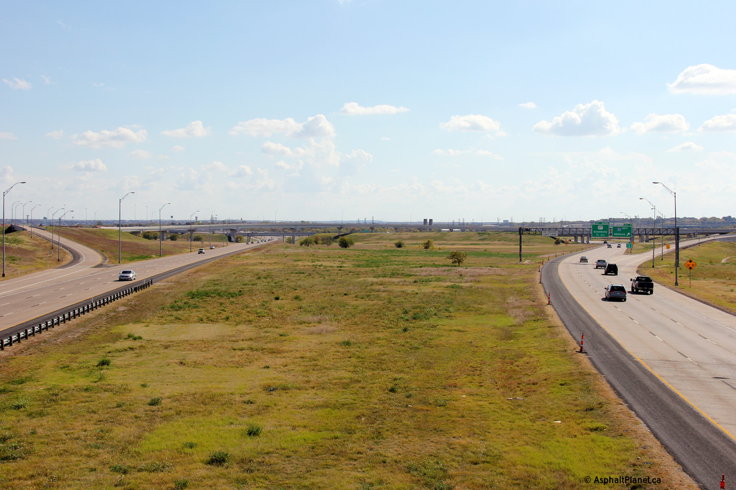
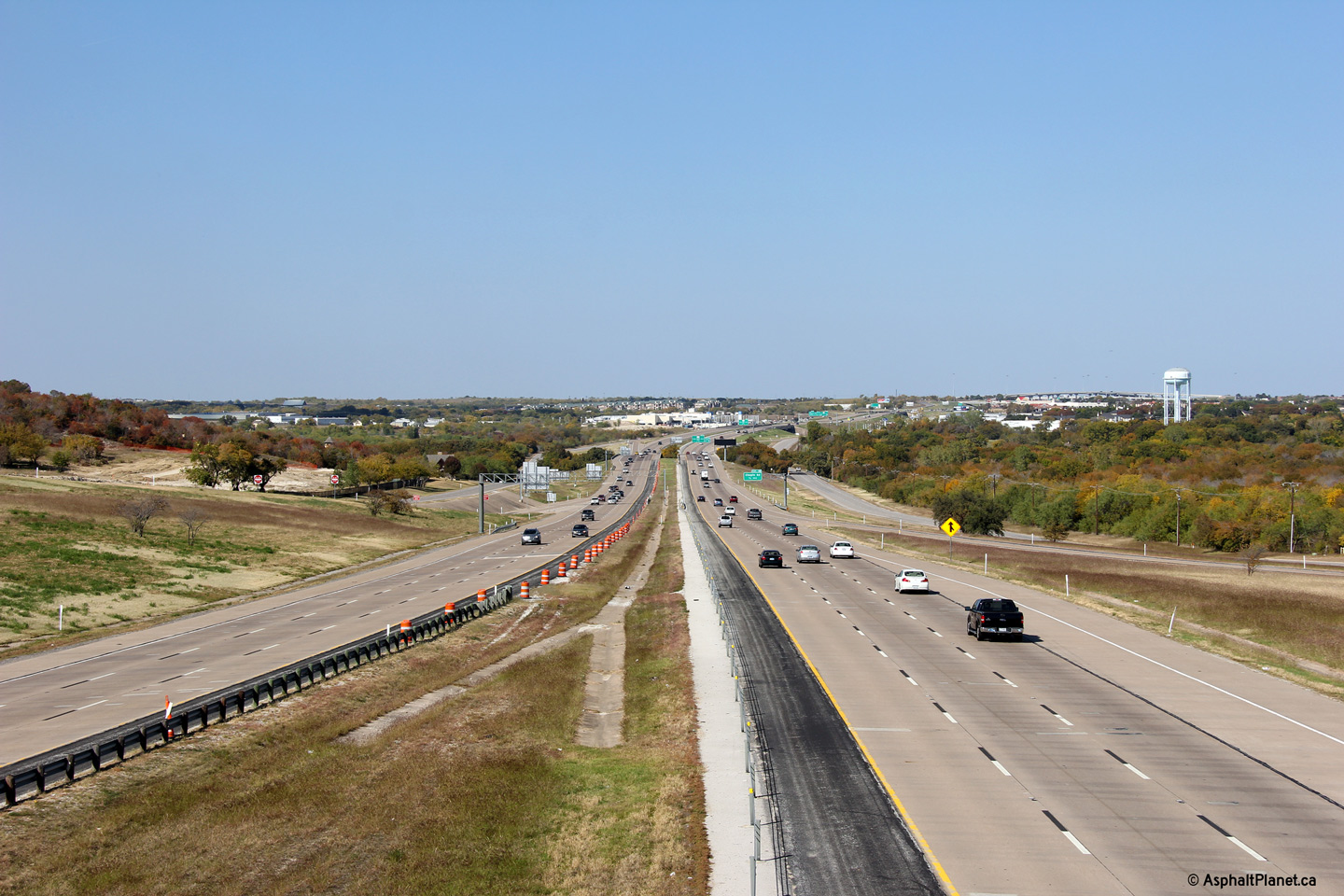
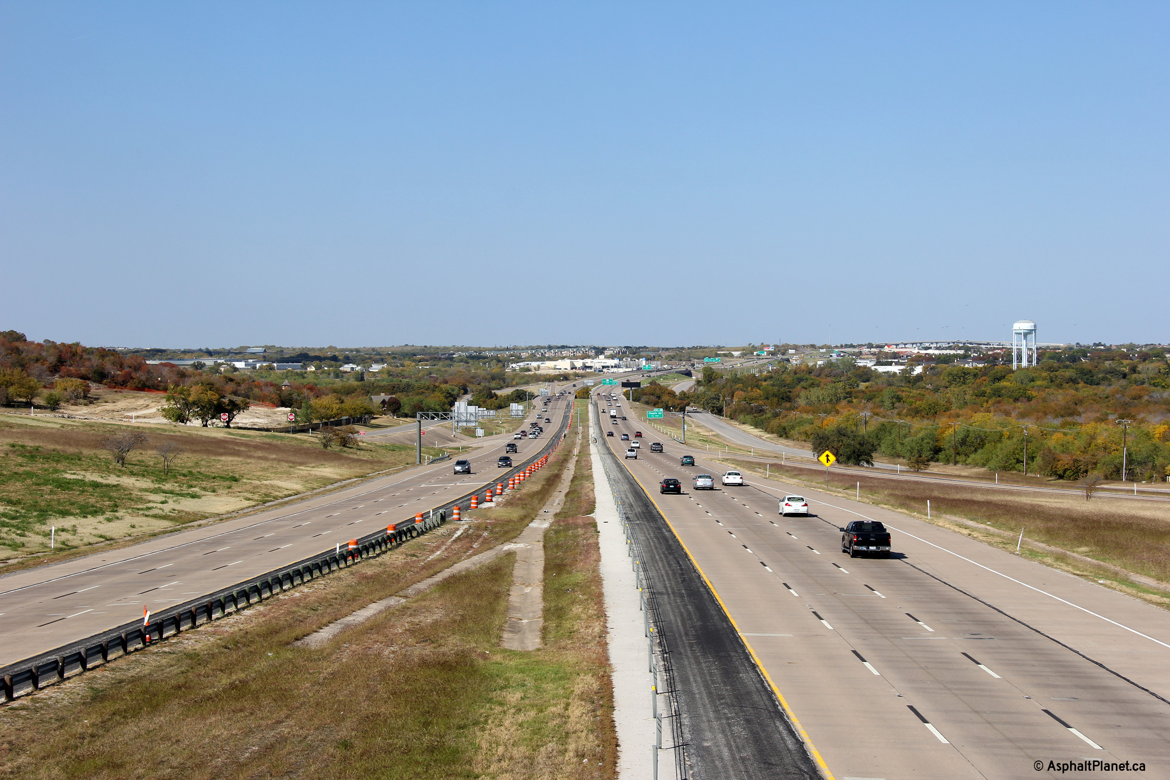
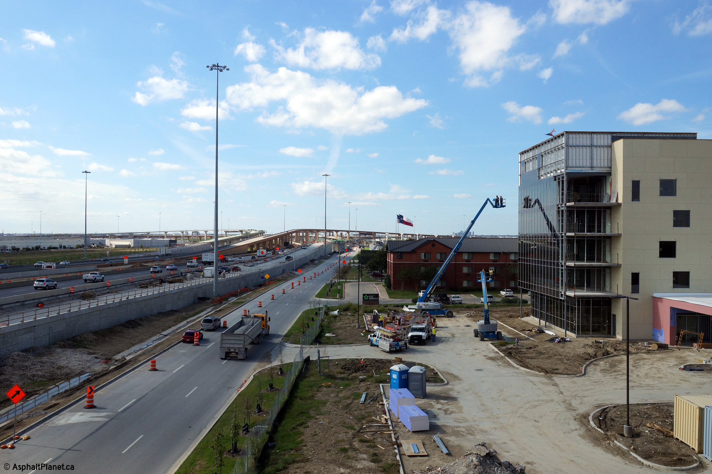
A series of views looking westerly from the Riverside Drive overpass along I-820. At the time that these photos were taken, construction was underway to substantially upgrade and reconfigure the interchange between I-820 and I-35W. Construction was also underway to widen and upgrade I-35W in the vicinity of I-820. Before construction started, north of Downtown Forth Worth, I-35W was certainly among the most dated of freeways in the Dallas-Fort Worth Metroplex. |
 |
||
| High-res: (1440x960) (2400x1600) | ||||
 |
||||
| High-res: (1440x960) (2400x1600) | ||||
 |
||||
|
Date: 11/14/2015 |
High-res: (1440x960) (2400x1600) | |||
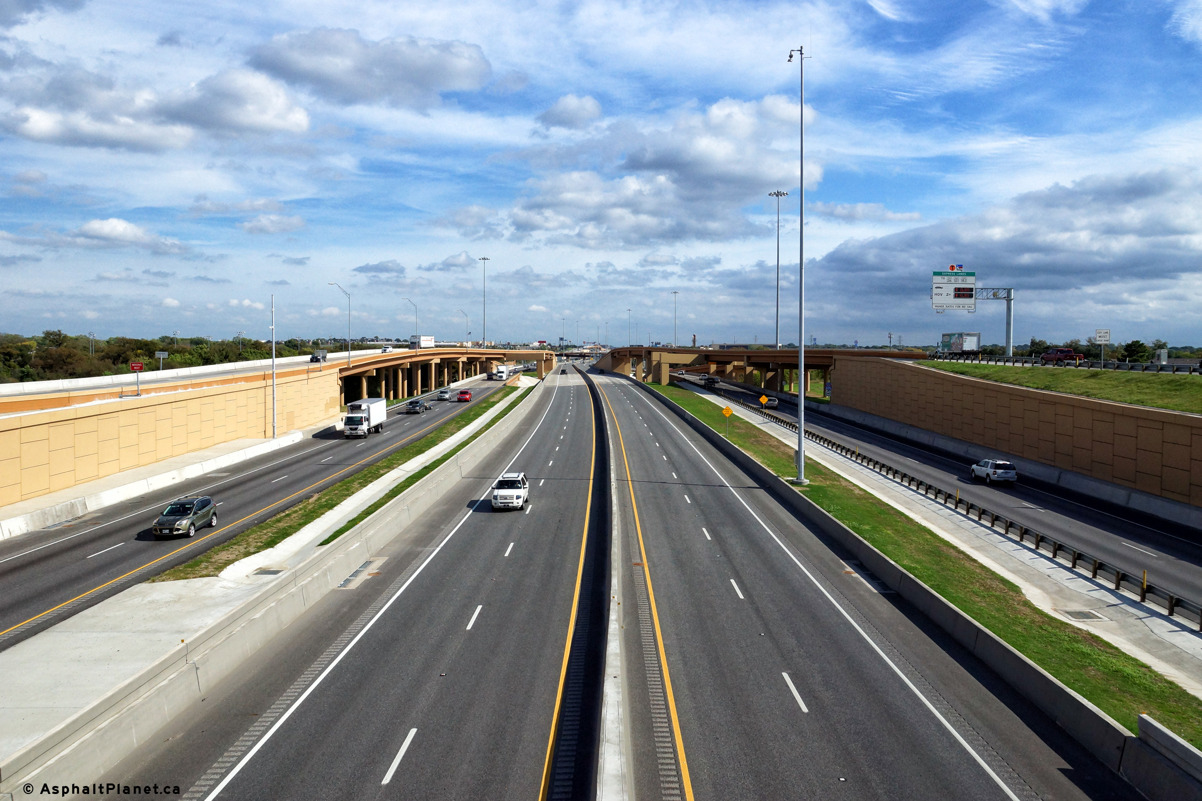
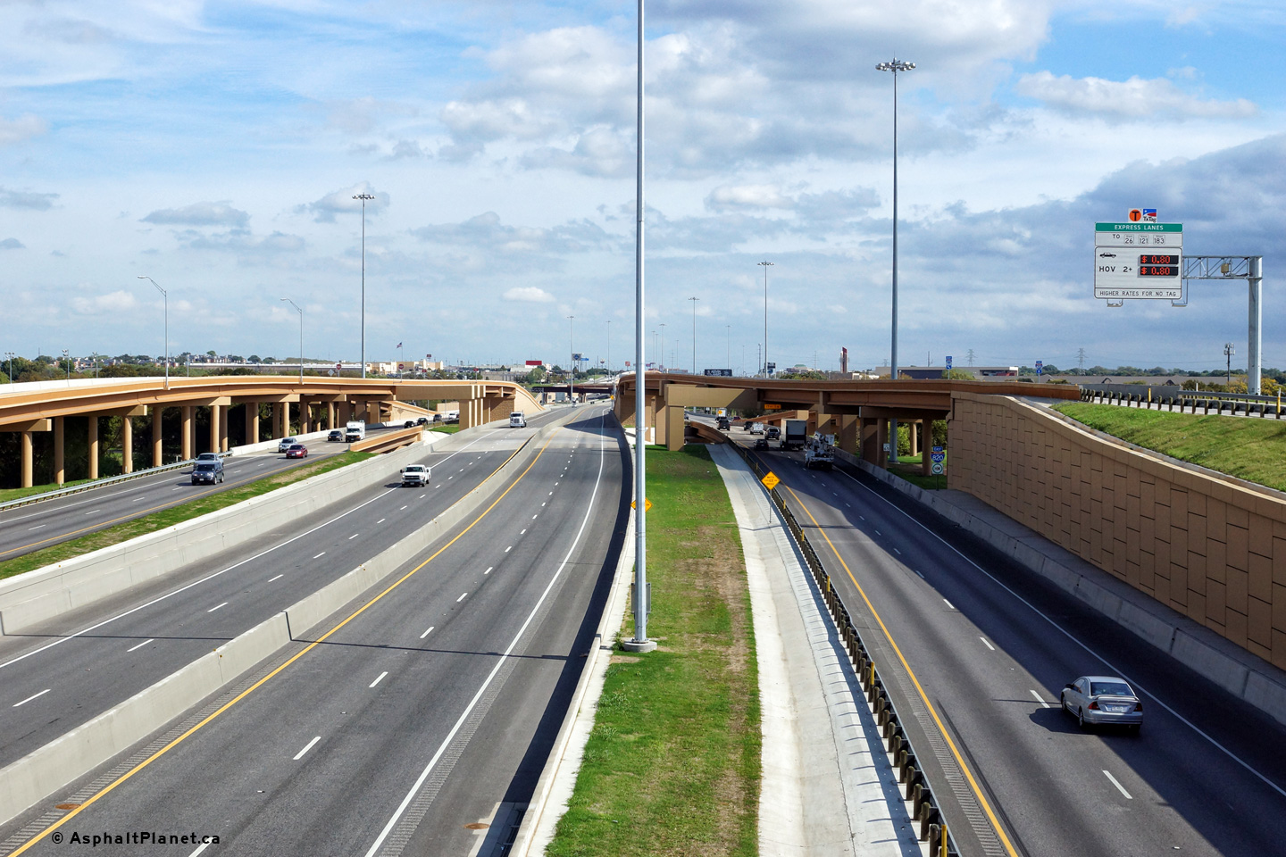
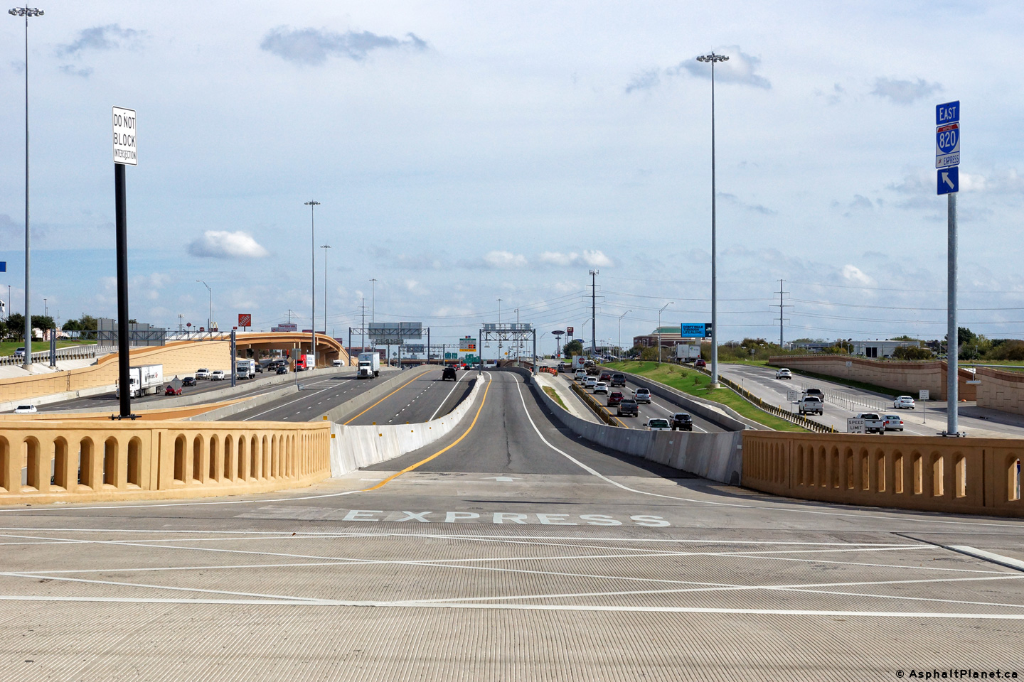
|
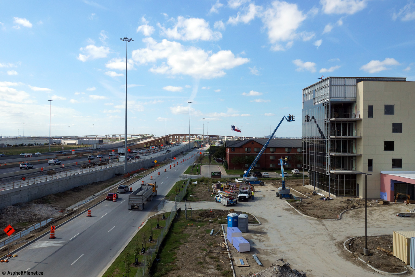
Tarrant County Fort Worth |
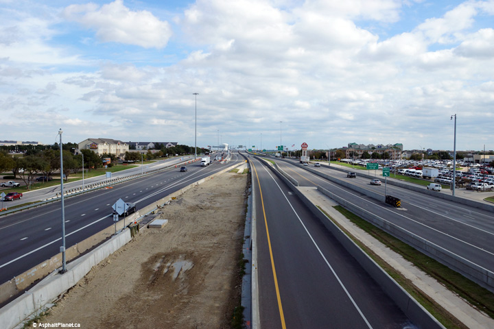
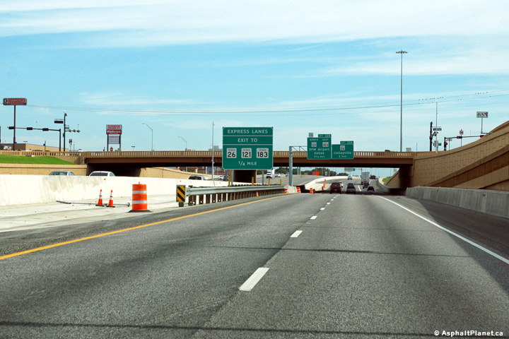
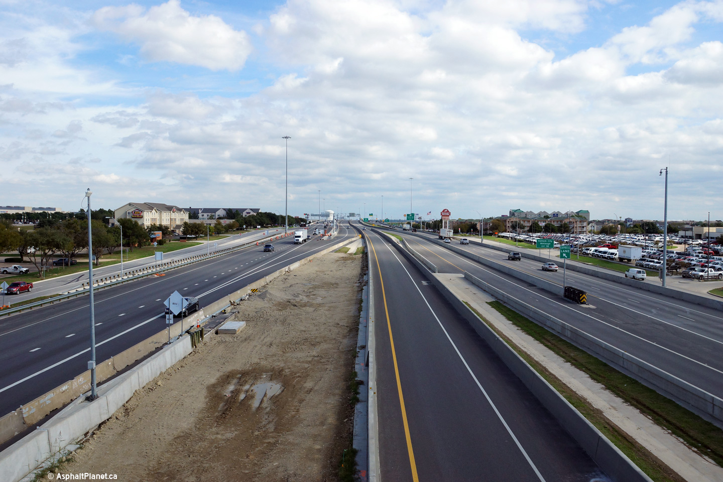
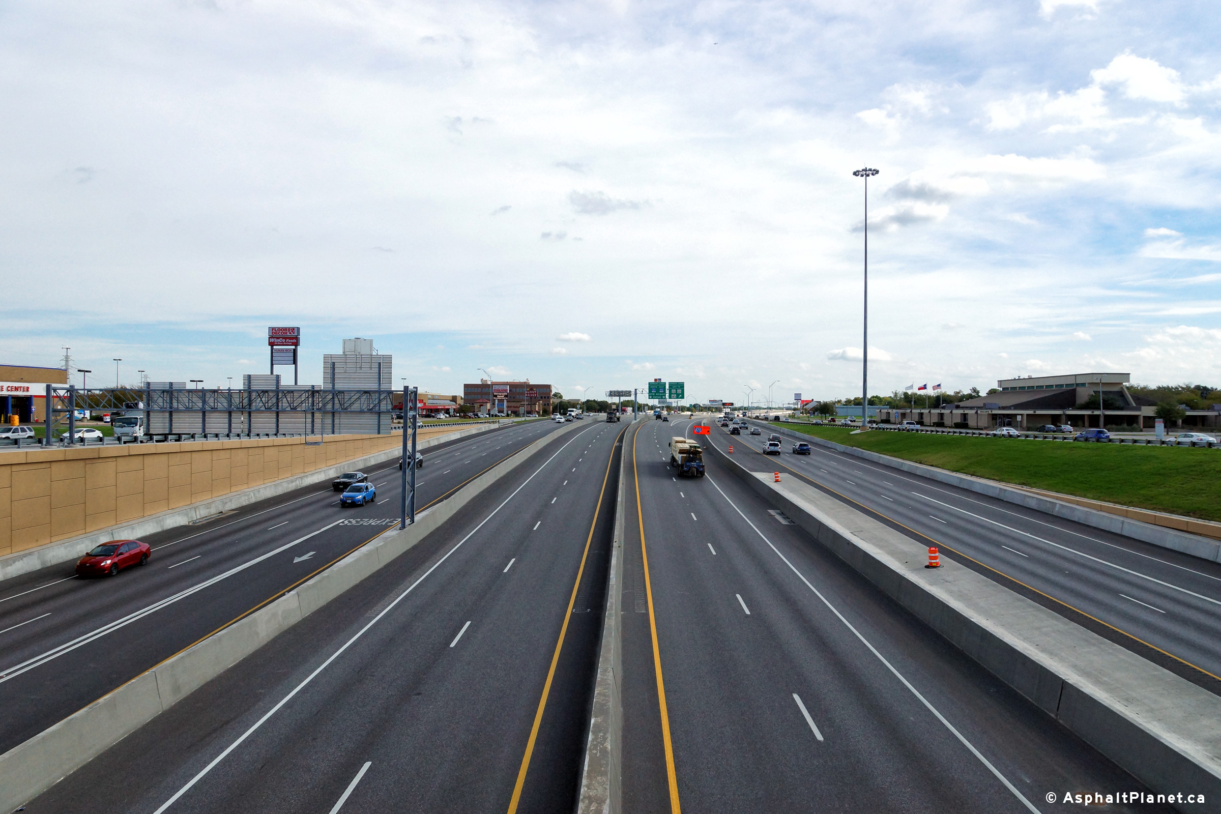
View looking easterly from the Riverside Drive overpass along I-820. The I-820 Express lanes begin from this location easterly. |
 |
||
|
Date: 11/14/2015 |
High-res: (1440x960) (2400x1600) | |||
|
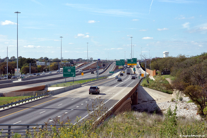
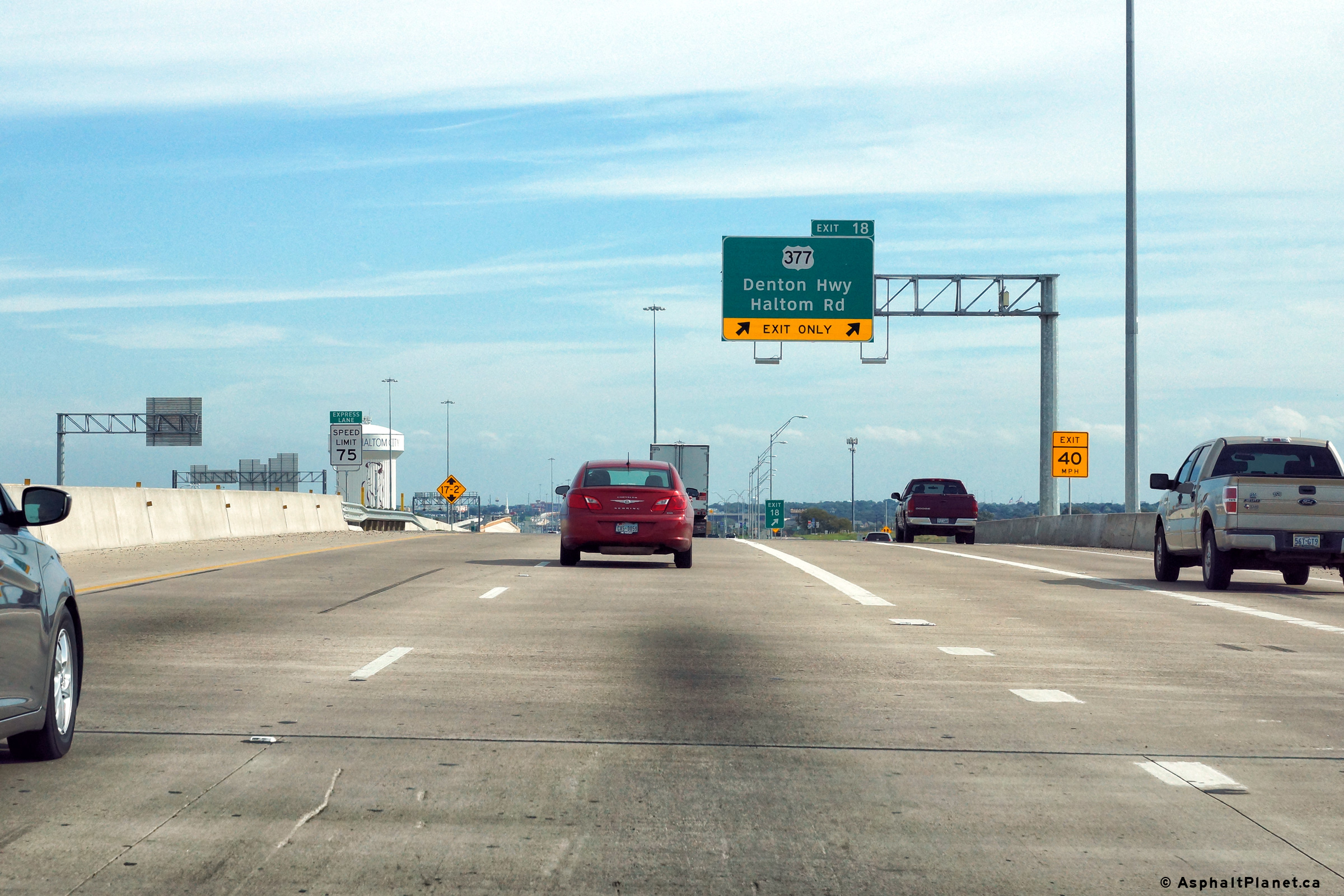
Tarrant County Haltom City |
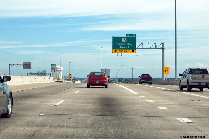
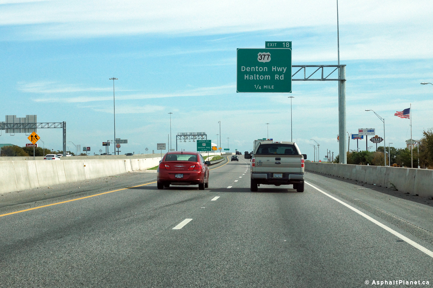
Eastbound advanced signage for the off-ramp to US-377 and Haltom Road. |
 |
||
|
Date: 11/14/2015 |
High-res: (1440x960) (2400x1600) | |||
|
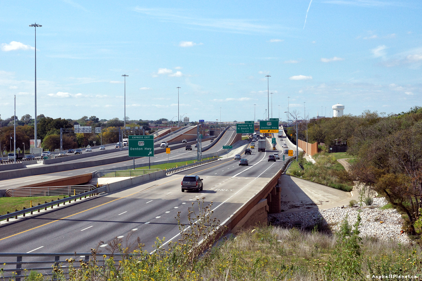
Tarrant County Haltom City |
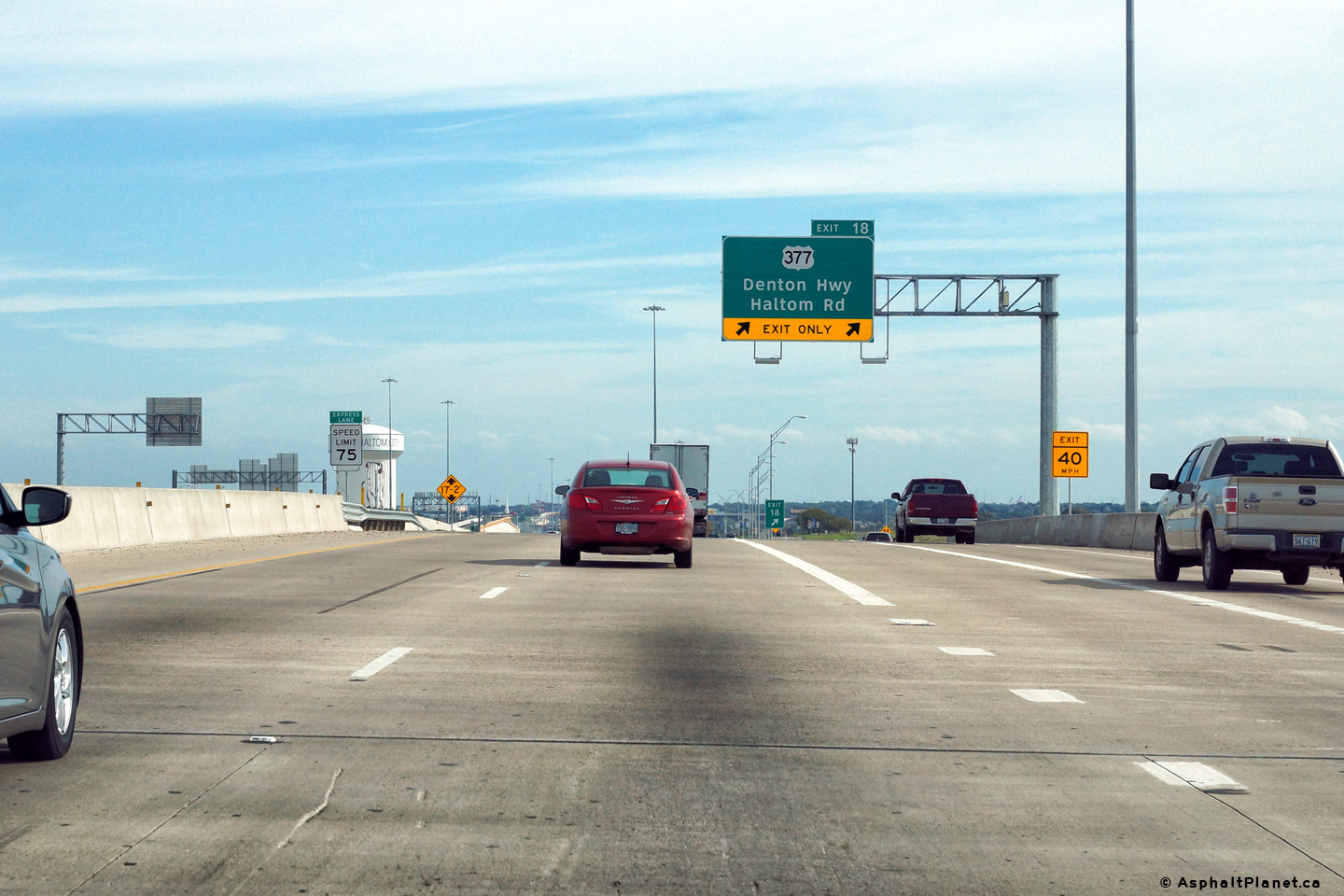
Easterly view approaching the US-377 interchange. US-377 and Haltom Road are separate exits in the westbound direction, and are signed as exits 19 and 18 respectively. |
 |
||
|
Date: 11/14/2015 |
High-res: (1440x960) (2400x1600) | |||
|
Tarrant County Haltom City |
View looking easterly as the eastbound lanes of I-820 pass beneath the exit from the tolled express lanes to US-377. |
 |
||
|
Date: 11/14/2015 |
High-res: (1440x960) (2400x1600) | |||
|
Tarrant County Haltom City |
View looking westerly from the US-377 (Denton Highway) overpass. |
 |
||
|
Date: 11/14/2015 |
High-res: (1440x960) (2400x1600) | |||
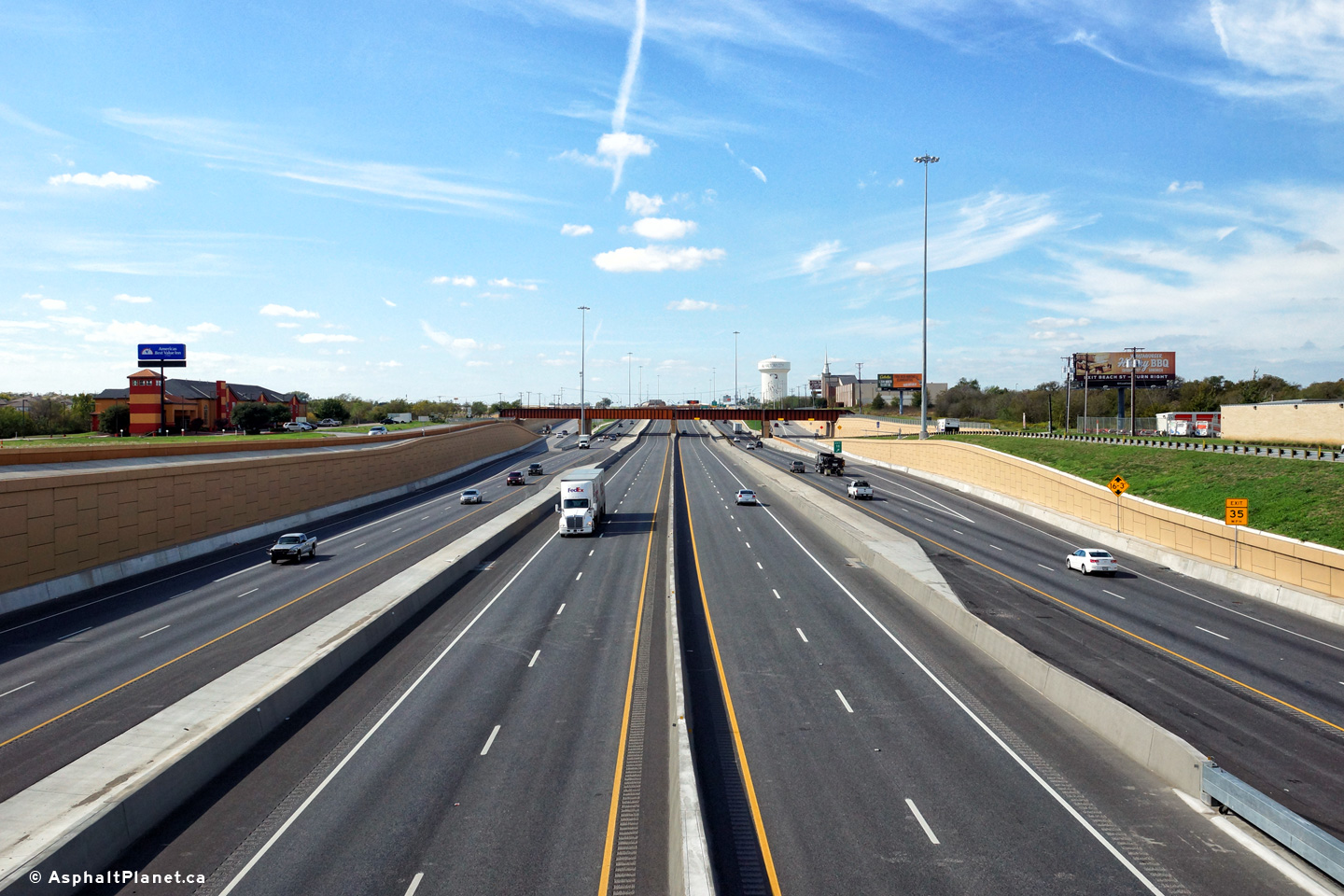
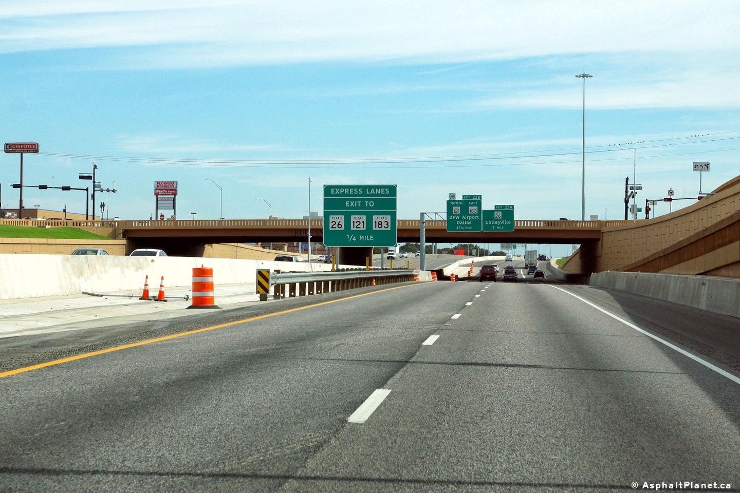
|
Tarrant County Haltom City |
A series of three views looking easterly from the US-377 interchange. As is visible in the photos, there are direct ramps between the US-377 interchange and the tolled 820 Express Lanes. |
 |
||
| High-res: (1440x960) (2400x1600) | ||||
 |
||||
| High-res: (1440x960) (2400x1600) | ||||
 |
||||
|
Date: 11/14/2015 |
High-res: (1440x960) (2400x1600) | |||
|
Tarrant County Haltom City |
View looking easterly as Interstate 20 passes beneath the ramp that carries traffic entering the freeway from US-377 to the I-820 Toll Express Lanes. |
 |
||
| High-res: (1440x960) (2400x1600) | ||||
 |
||||
|
Date: 11/14/2015 |
High-res: (1440x960) (2400x1600) | |||
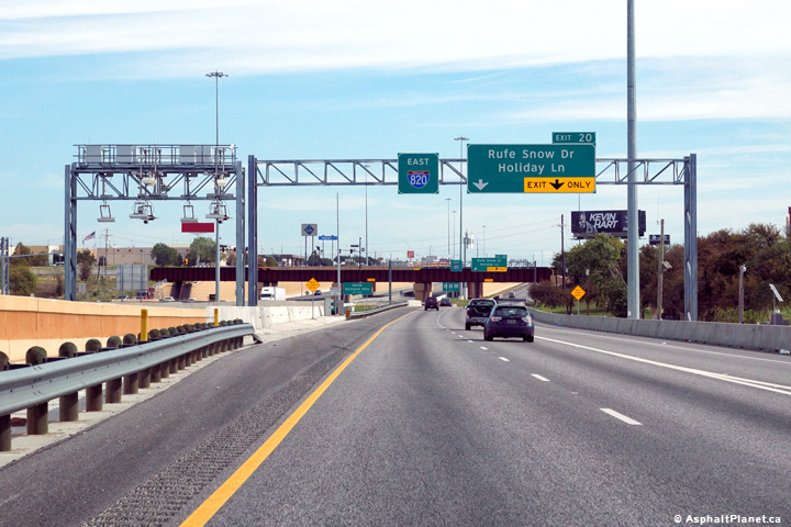
|
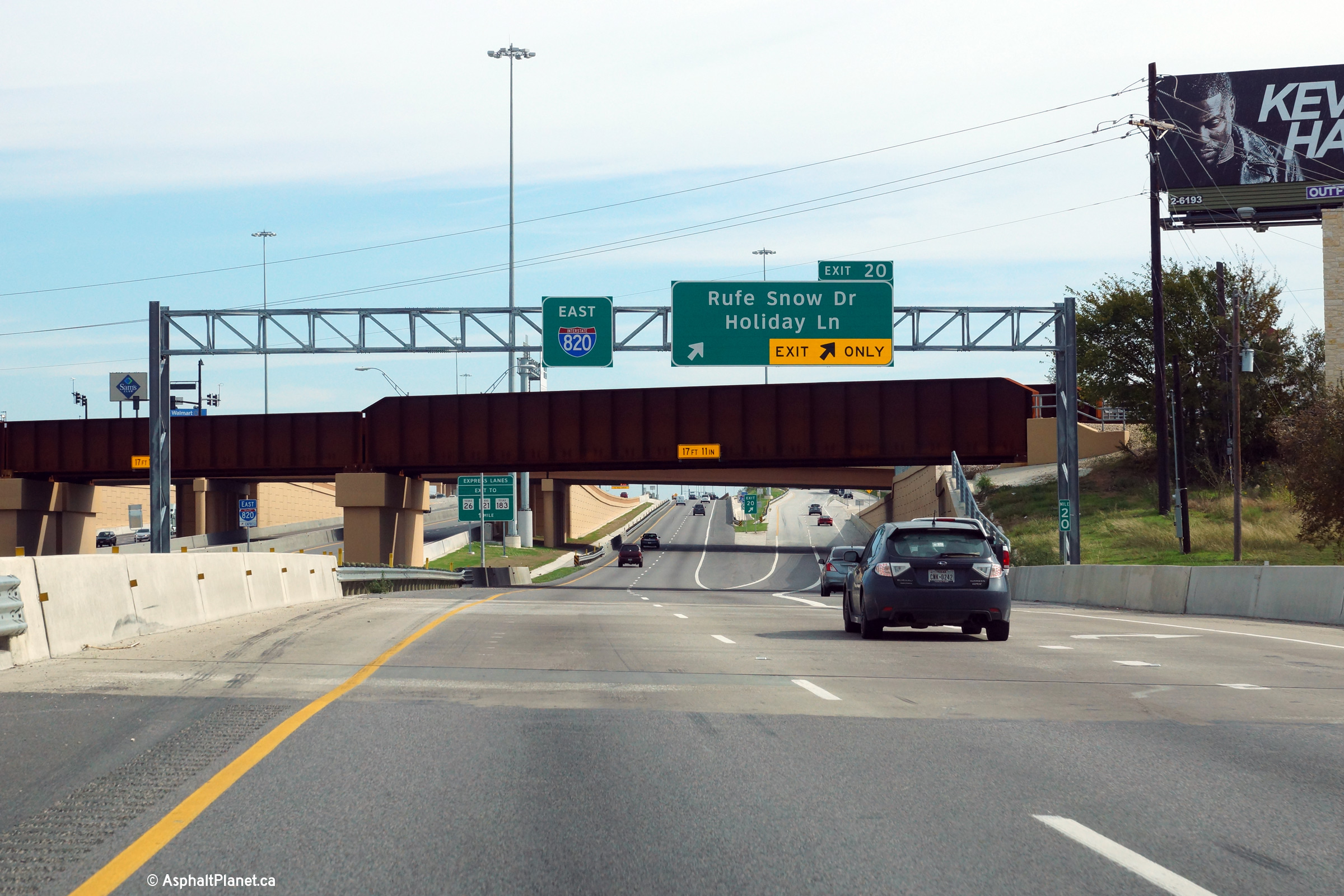
Tarrant County Haltom City |
The incoming on-ramp from the US-377 interchange quickly departs as the off-ramp to Rufe Snow Drive. |
 |
||
|
Date: 11/14/2015 |
High-res: (1440x960) (2400x1600) | |||
|
Tarrant County North Richland Hills |
View looking easterly along Interstate 20 at the eastbound off-ramp to Rufe Snow Drive. |
 |
||
|
Date: 11/14/2015 |
High-res: (1440x960) (2400x1600) | |||
|
Tarrant County North Richland Hills |
Immediately west of the Iron Horse Railway, Interstate 820 crosses Big Fossil Creek. |
 |
||
|
Date: 11/14/2015 |
High-res: (1440x960) (2400x1600) | |||
|
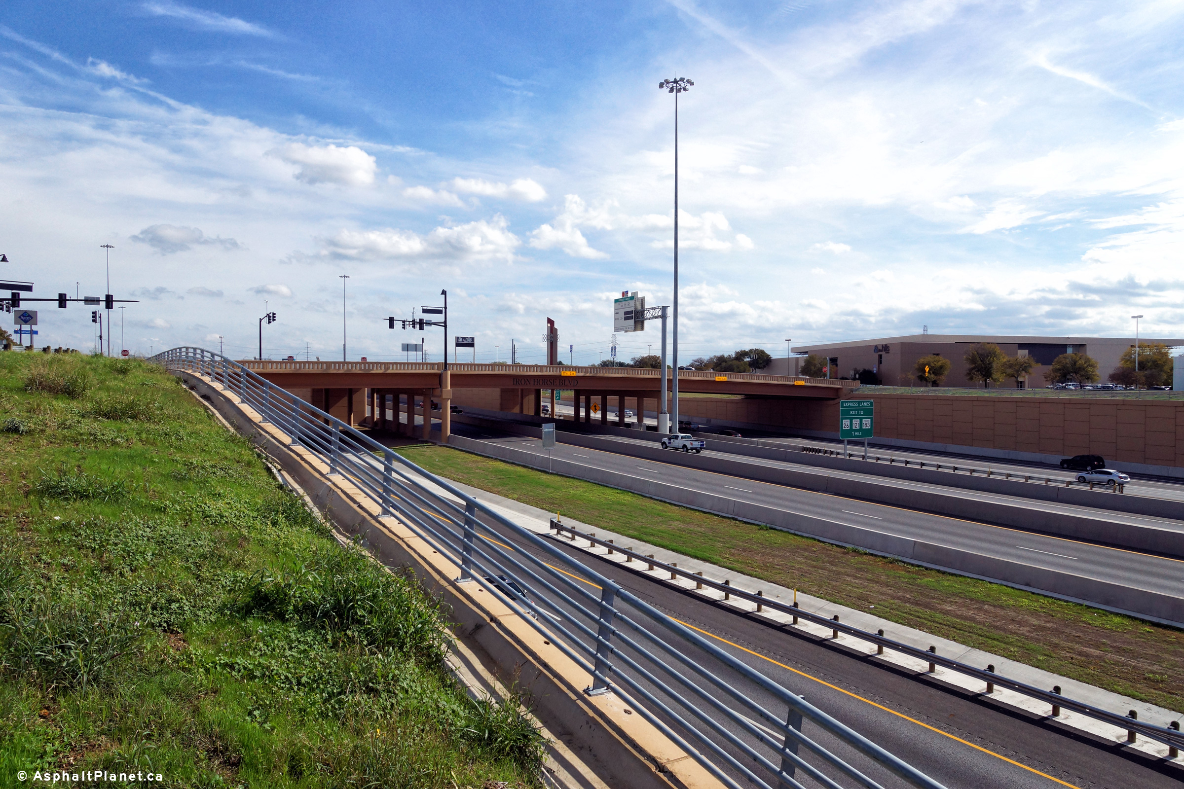
Tarrant County North Richland Hills |
View looking easterly from the side of the Iron Horse Railway tracks towards the Iron Horse Boulevard overpass. |
 |
||
|
Date: 11/14/2015 |
High-res: (1440x960) (2400x1600) | |||
|
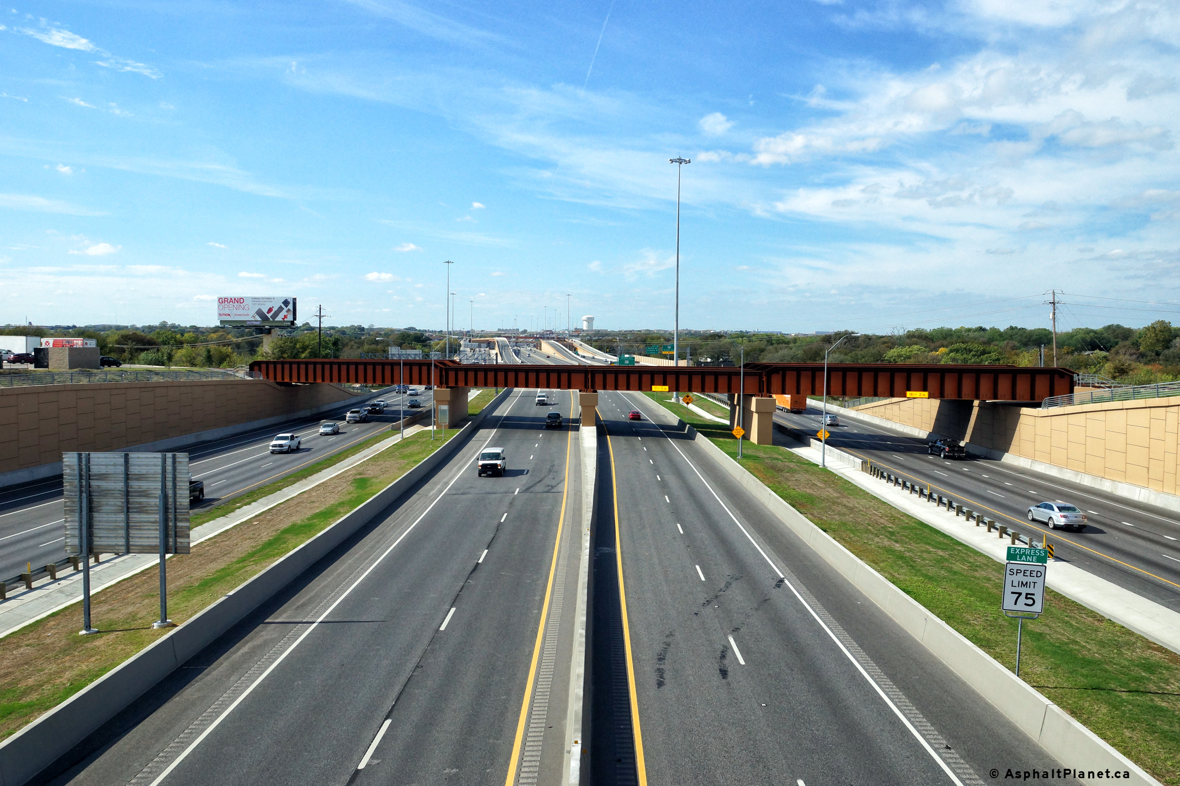
Tarrant County North Richland Hills |
View looking westerly from the Iron Horse Boulevard overpass along Interstate 820. Immediately west of the aptly named Iron Horse Boulevard are the Iron Horse Railway tracks. |
 |
||
|
Date: 11/14/2015 |
High-res: (1440x960) (2400x1600) | |||
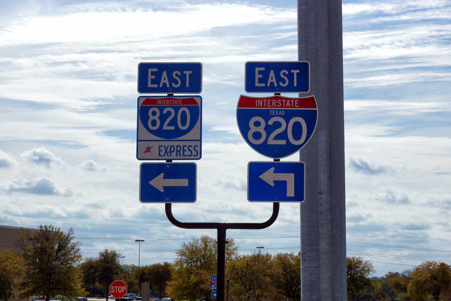
|
Tarrant County North Richland Hills |
Shields for Interstate 820 and the Interstate 820 Express Lanes along Iron Horse Boulevard. The fact that the 820 Express lanes are a tolled facility, is not explicitly noted on this (and other) signage. |
 |
||
|
Date: 11/14/2015 |
High-res: (1440x960) | |||
|
Tarrant County North Richland Hills |
Two views looking easterly from the Iron Horse Boulevard overpass towards Interstate 820. There is not a sidewalk along the eastern side of the bridge, as instead there are ramps directly from Iron Horse Boulevard to the tolled express lanes. |
 |
||
| High-res: (1440x960) (2400x1600) | ||||
 |
||||
|
Date: 11/14/2015 |
High-res: (1440x960) (2400x1600) | |||
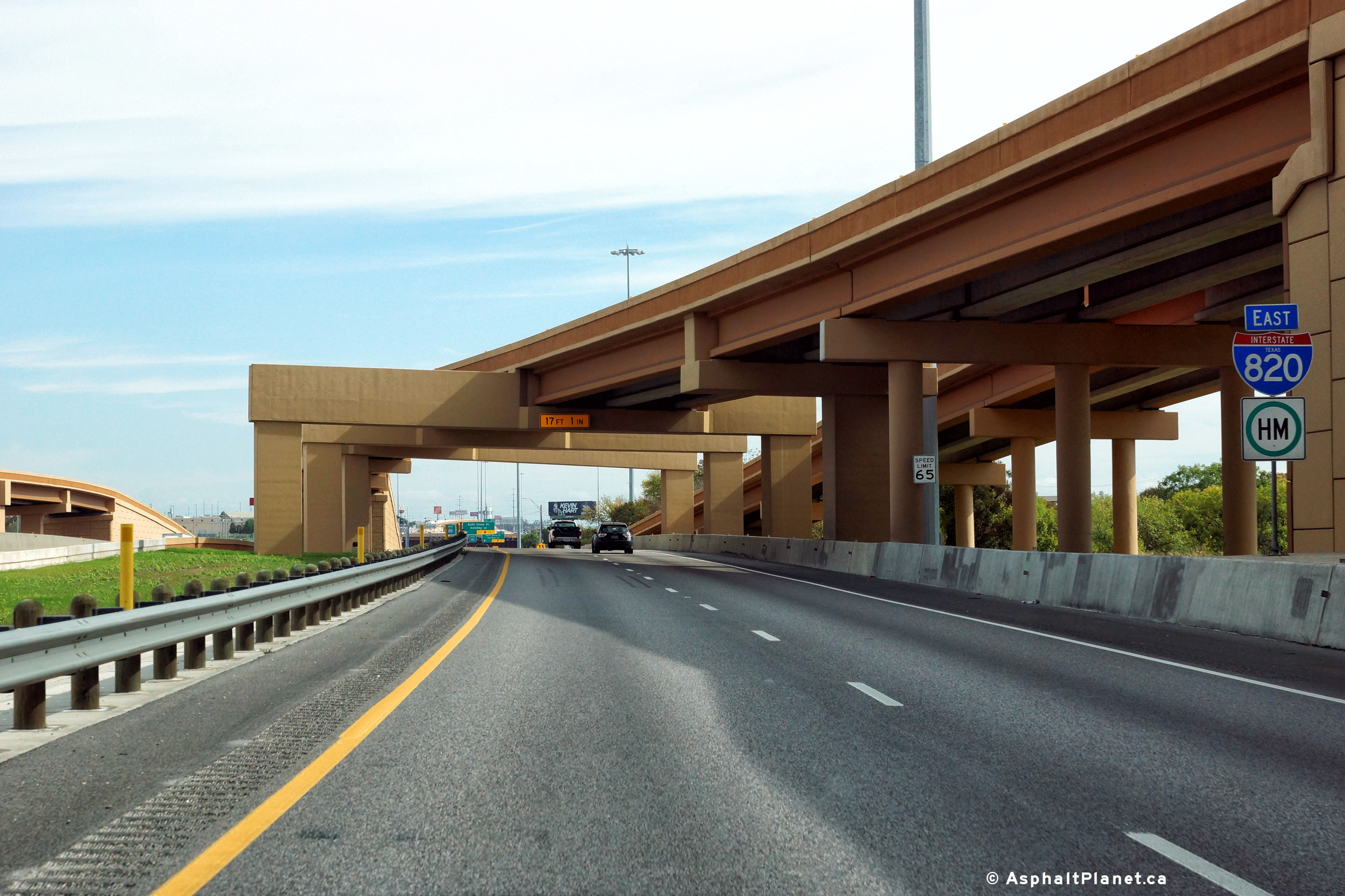
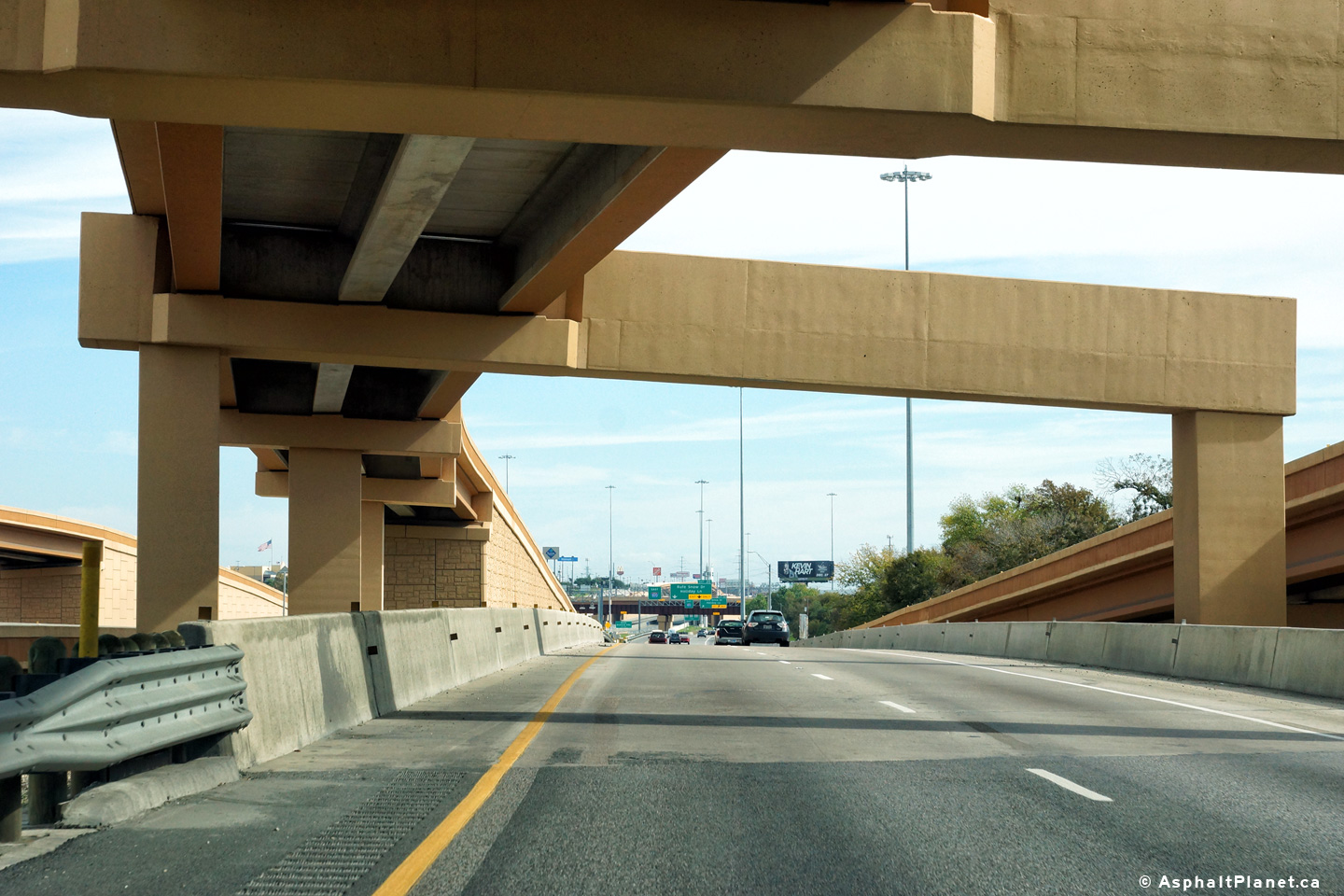
|
Tarrant County North Richland Hills |
Eastbound signage in both the tolled express lanes and the mainline lanes in advance of the Rufe Snow Drive overpass. |
 |
||
| High-res: (1440x960) (2400x1600) | ||||
 |
||||
|
Date: 11/14/2015 |
High-res: (1440x960) (2400x1600) | |||
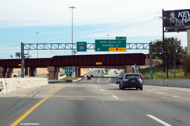
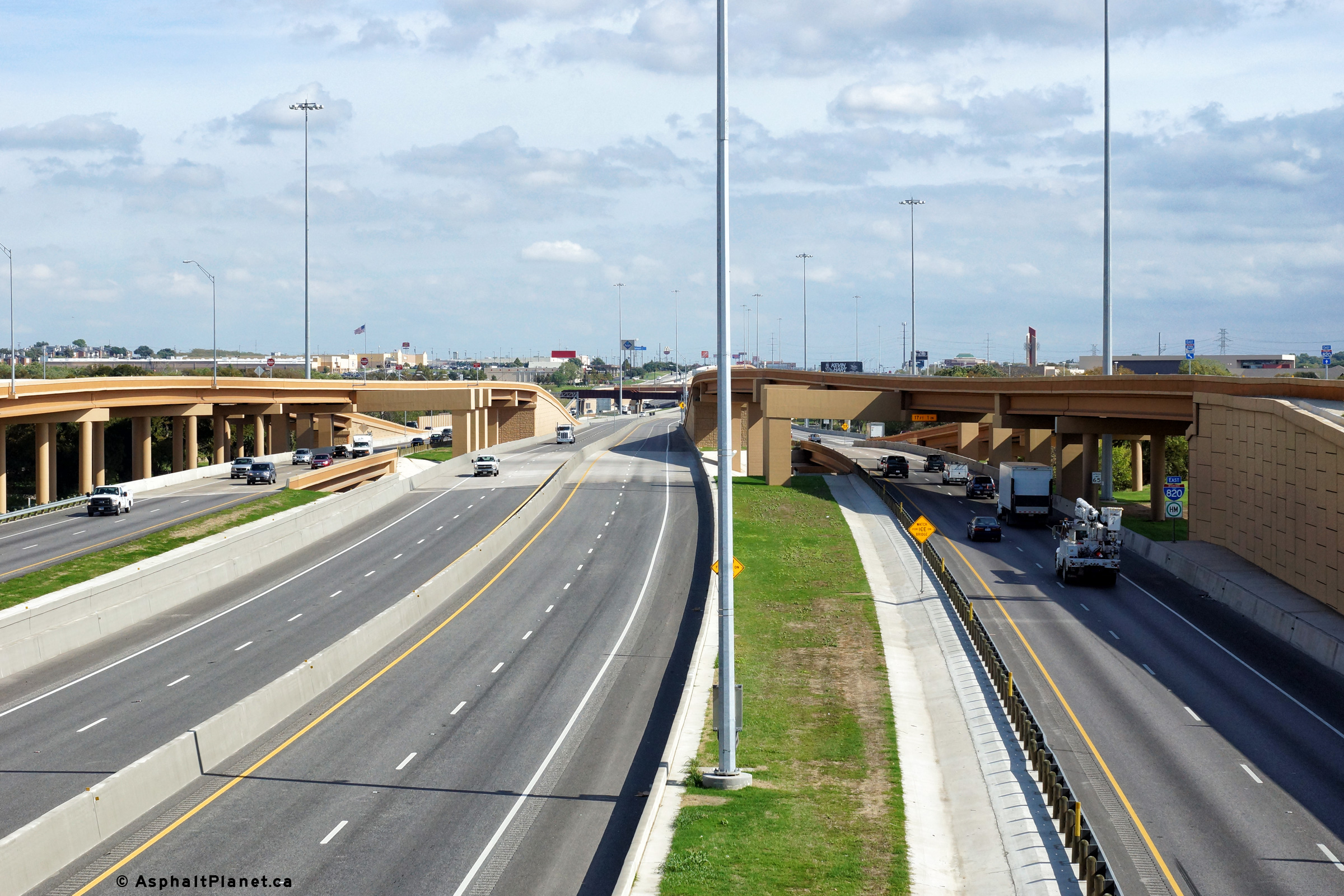
|
Tarrant County North Richland Hills |
Two views looking westerly along Interstate 820 from the Rufe Snow Drive overpass. |
 |
||
| High-res: (1440x960) (2400x1600) | ||||
 |
||||
|
Date: 11/14/2015 |
High-res: (1440x960) (2400x1600) | |||
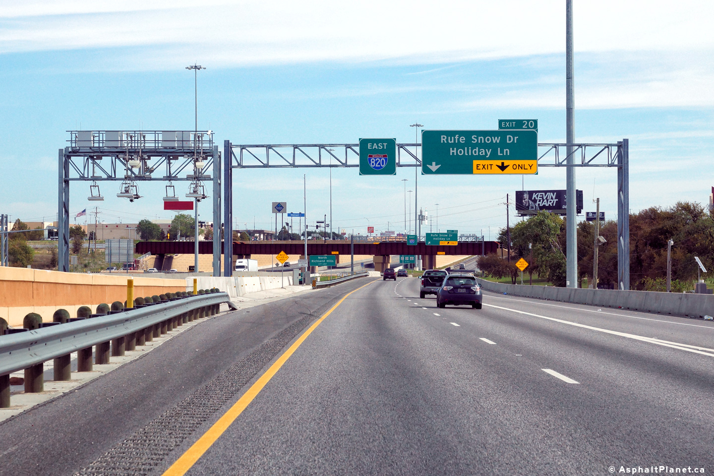
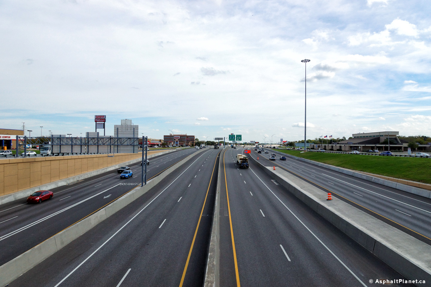
|
Tarrant County North Richland Hills |
Easterly view along Interstate 820 from the Rufe Snow Drive overpass. |
 |
||
|
Date: 11/14/2015 |
High-res: (1440x960) (2400x1600) | |||
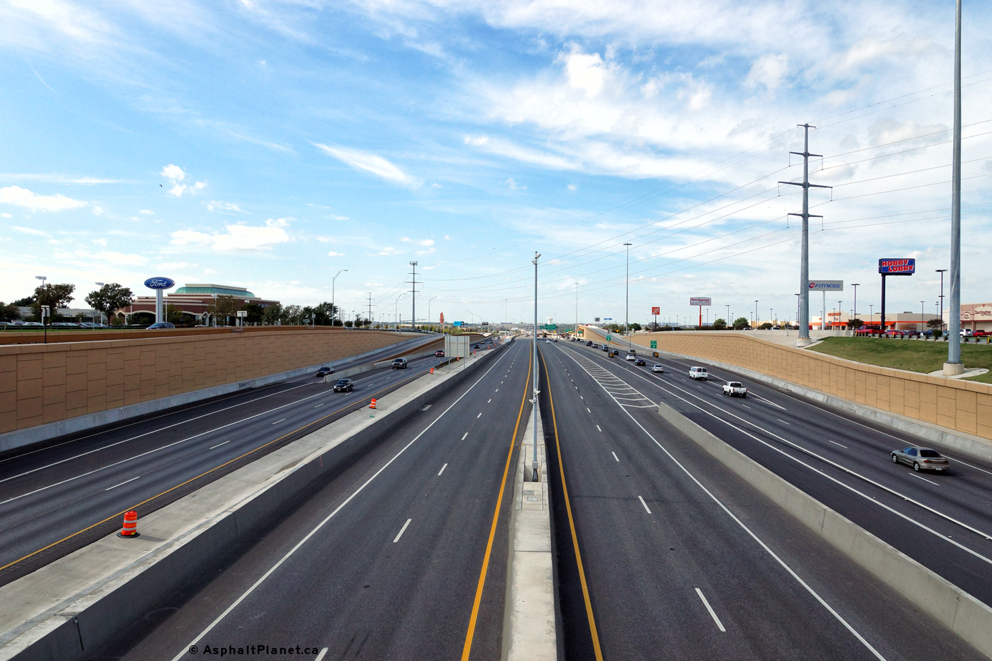
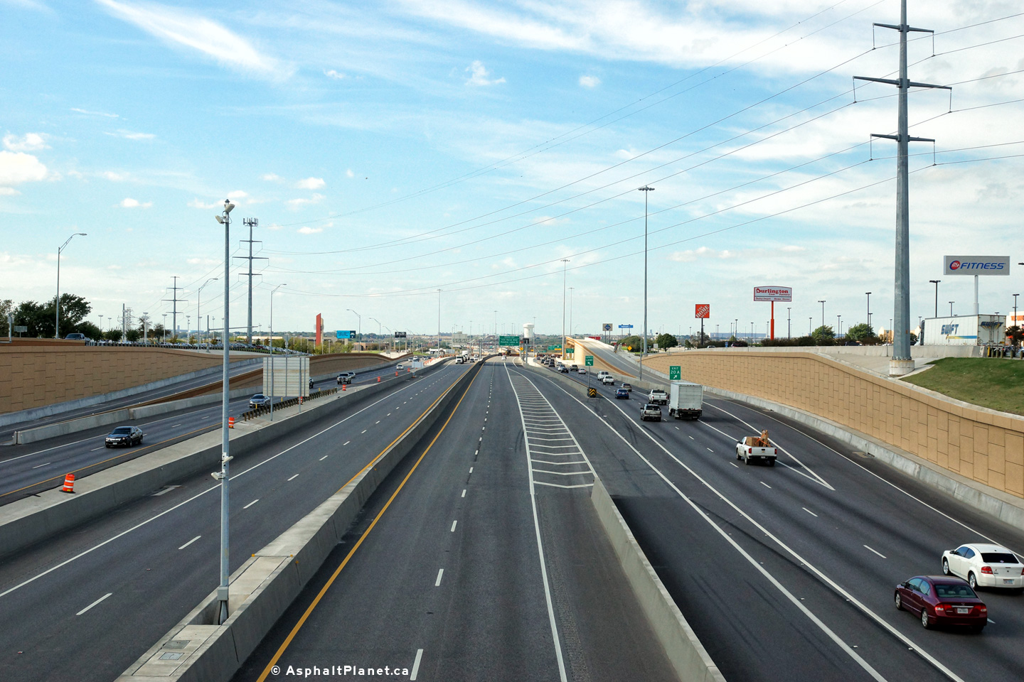
|
Tarrant County North Richland Hills |
Two views as the eastbound off-ramp to Texas Highway 26 departs from the right hand side of the freeway. The off-ramp to Texas Highway 26 is located a short distance upstream of the large interchange that links I-820 to Texas Highways 181 and 183. |
 |
||
| High-res: (1440x960) (2400x1600) | ||||
 |
||||
|
Date: 11/14/2015 |
High-res: (1440x960) (2400x1600) | |||
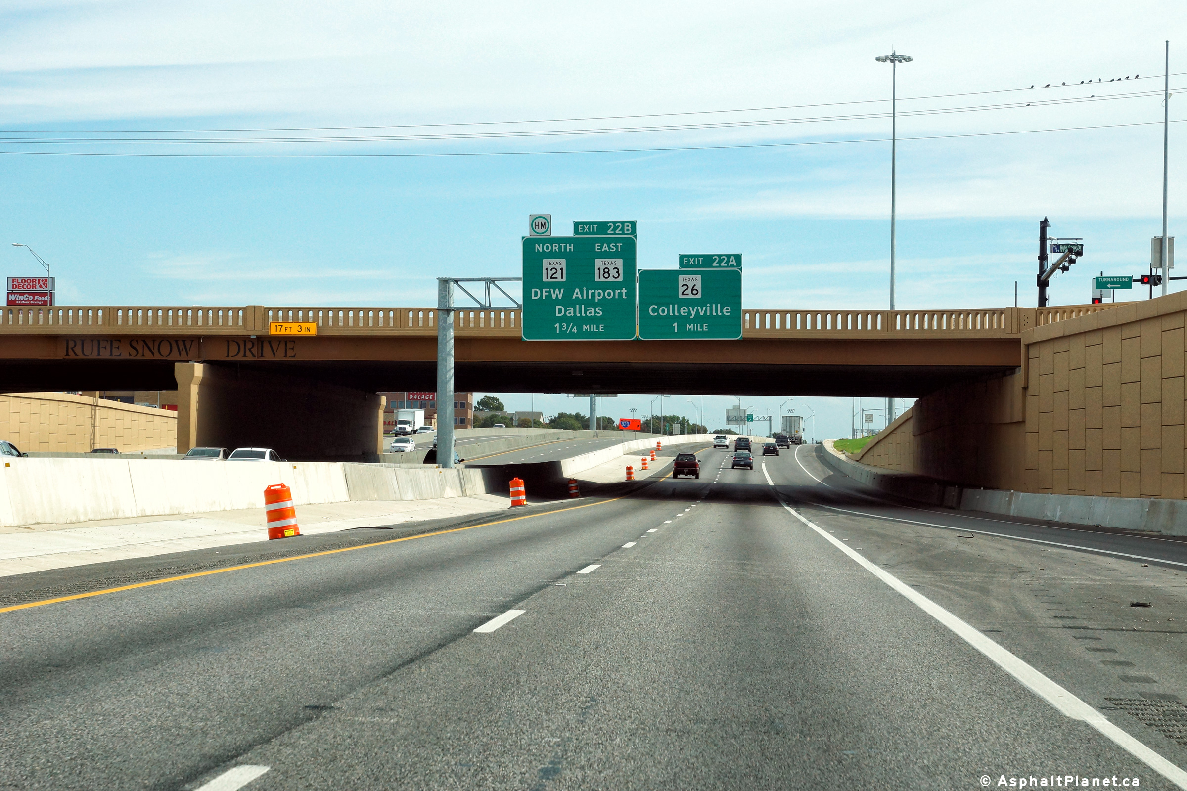
|
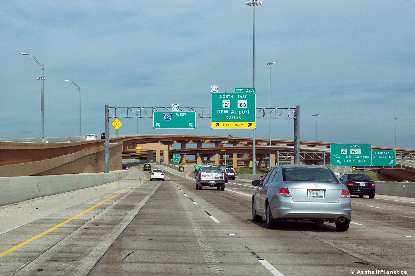
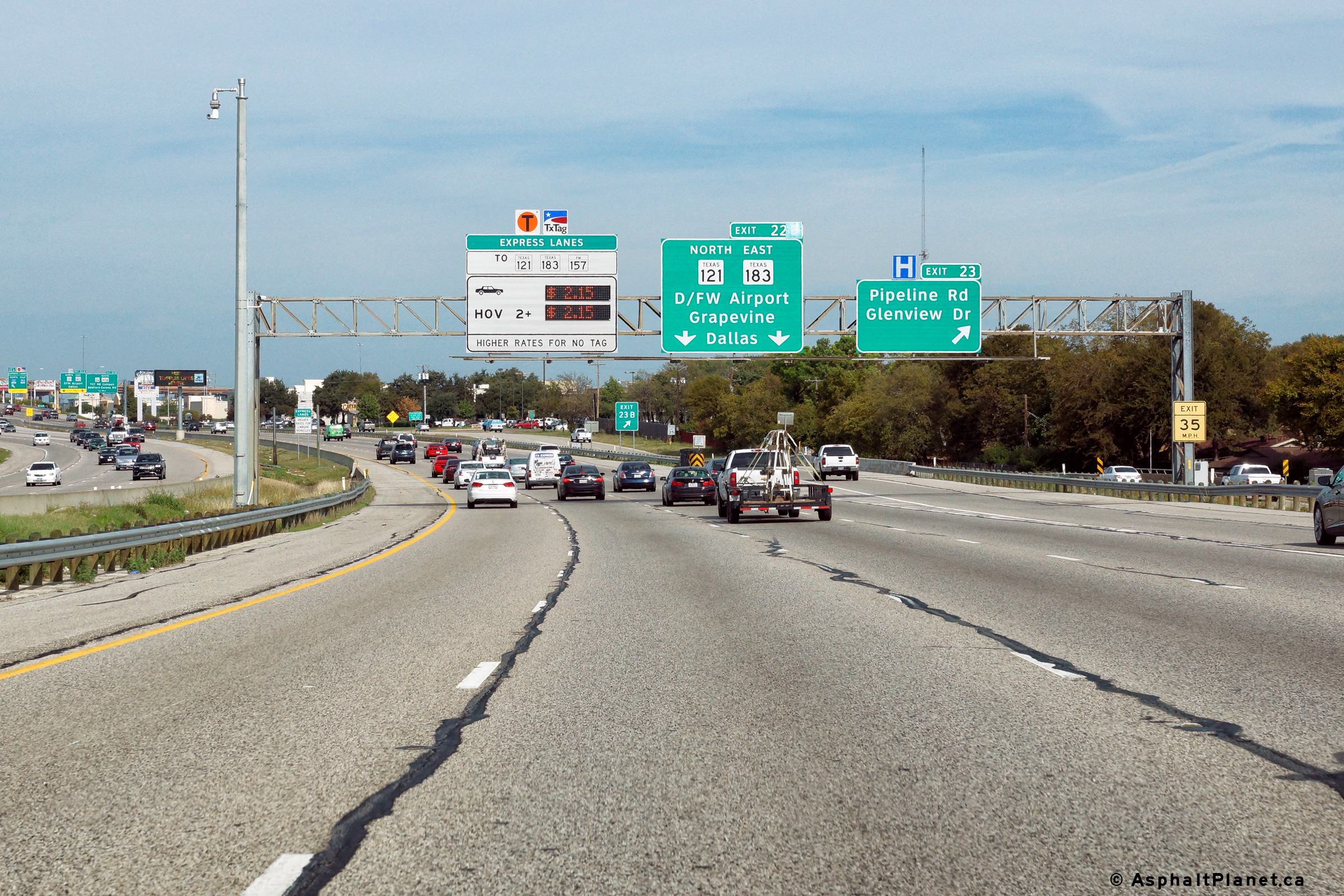
Tarrant County North Richland Hills |
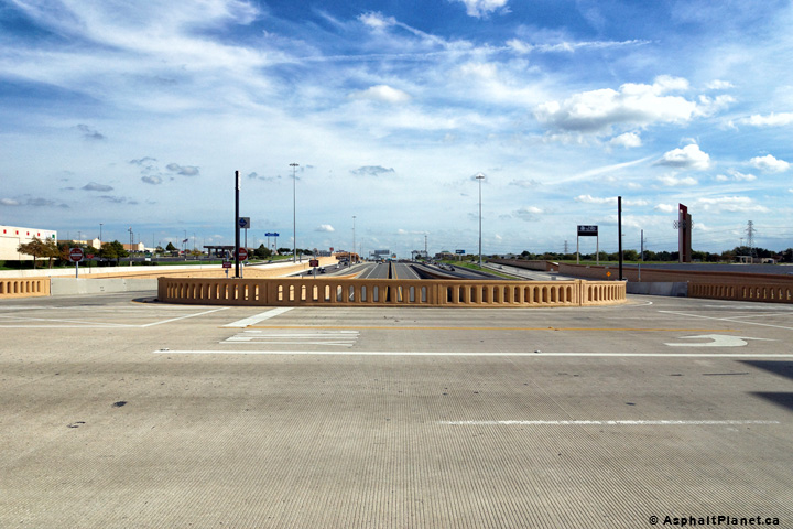
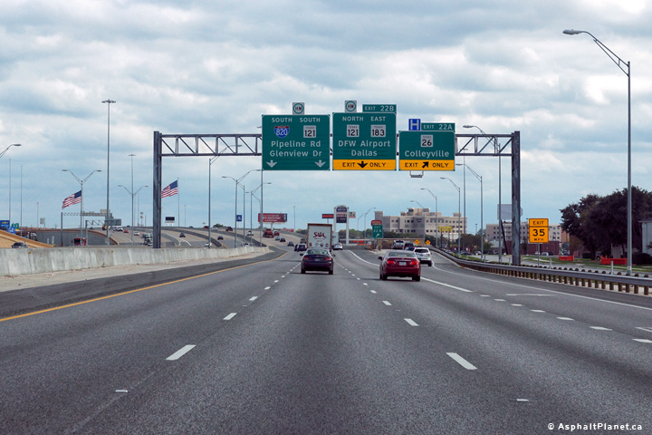
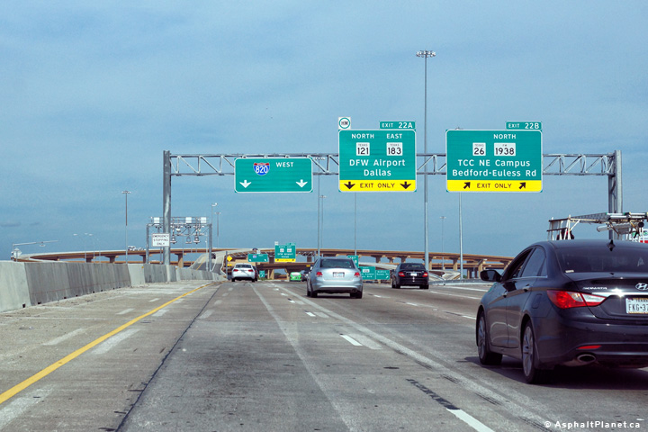
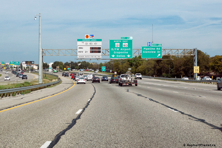
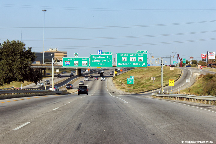
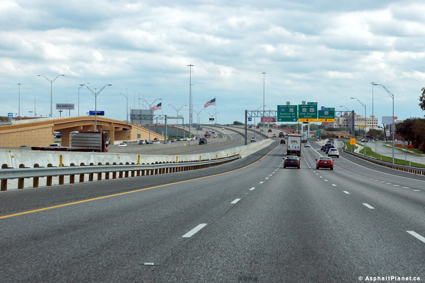
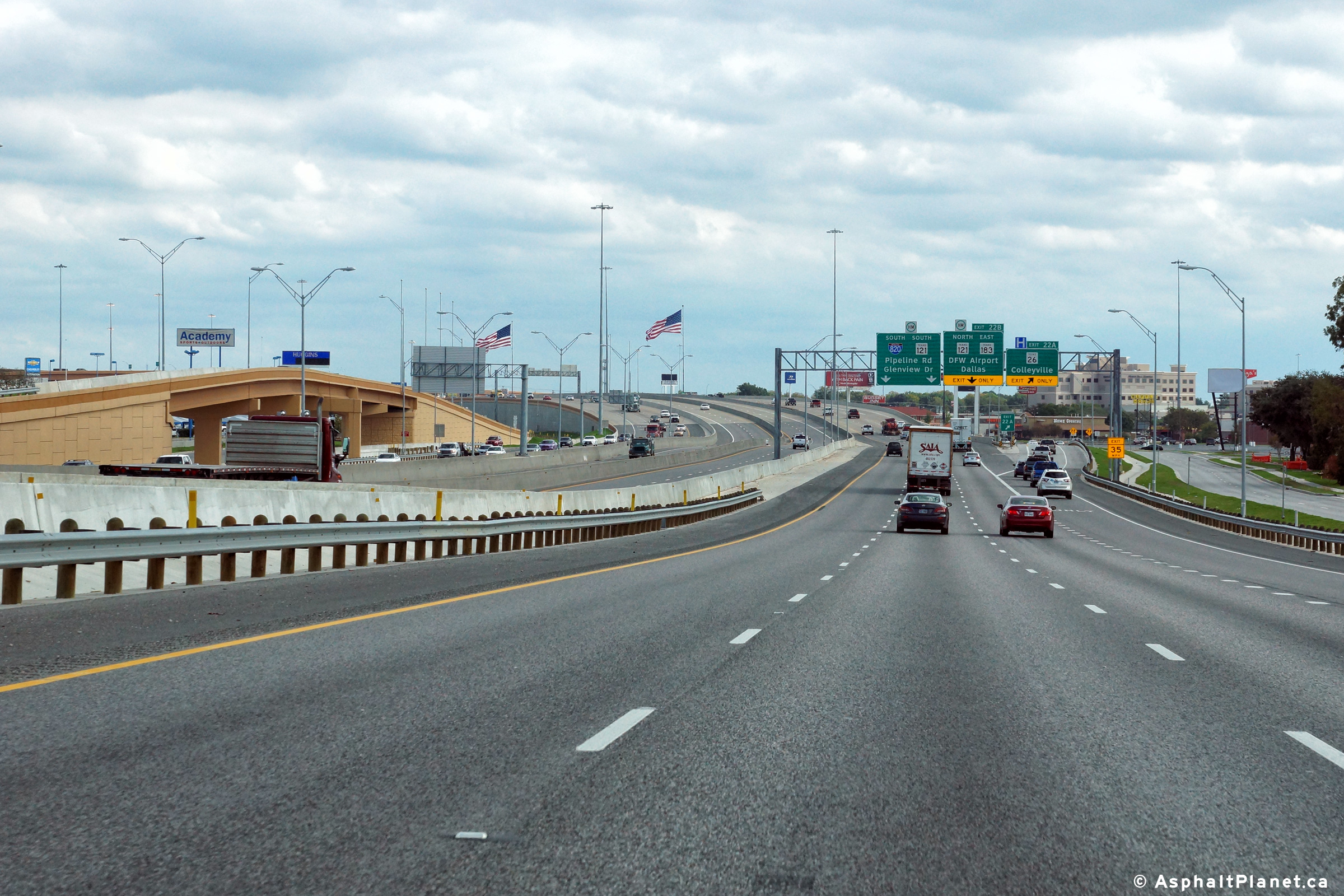
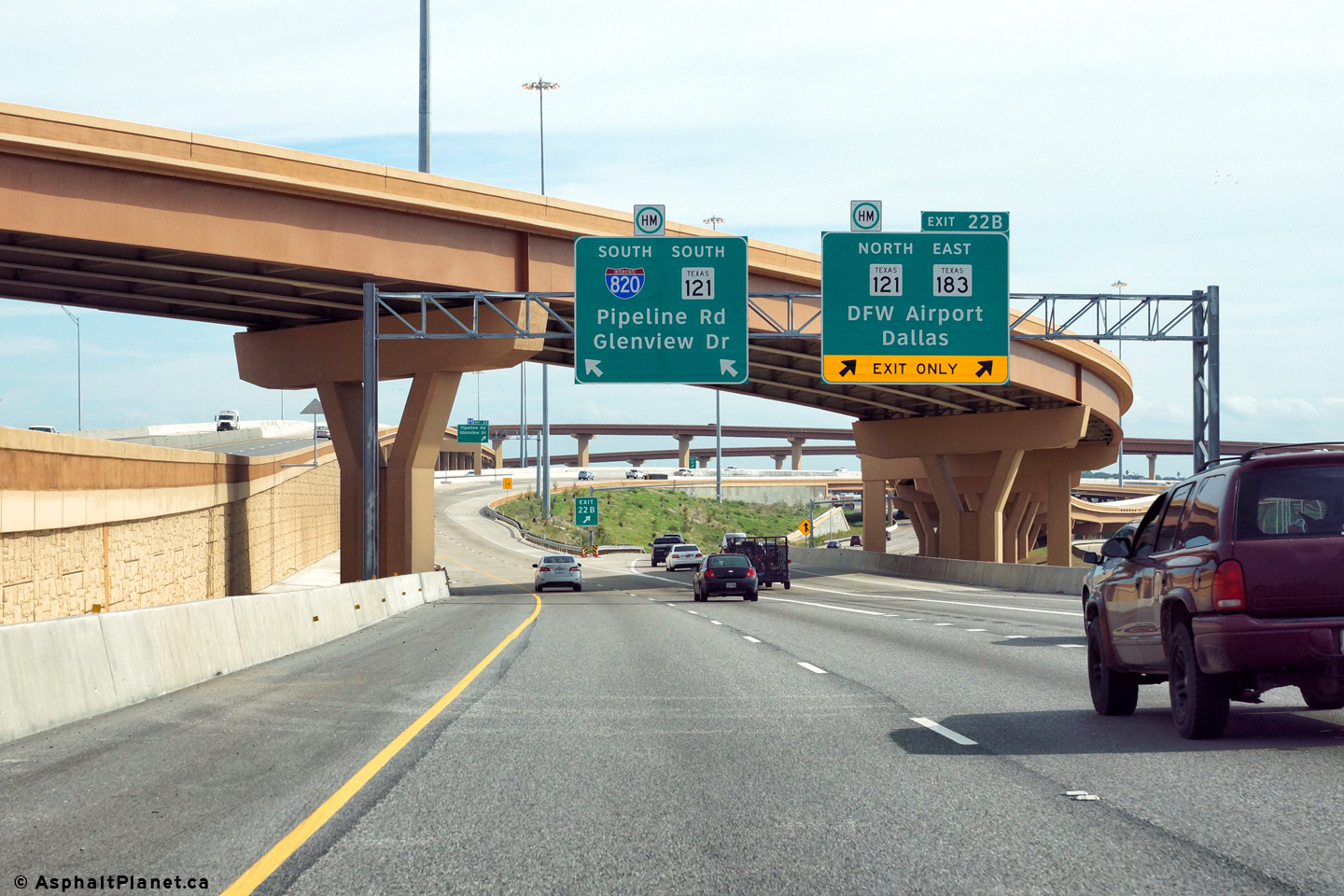
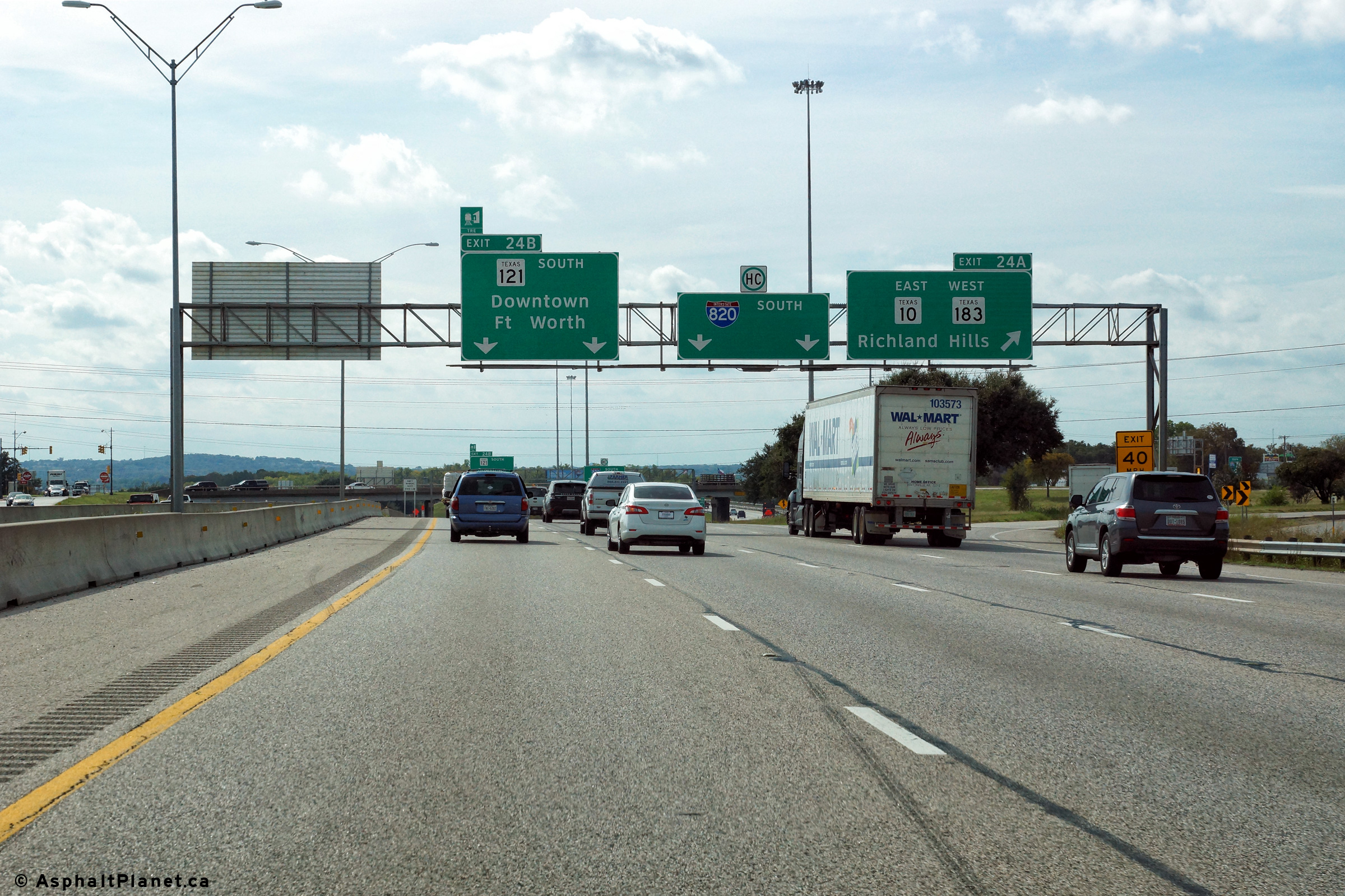
View looking easterly at the split to TX-121 North and TX-183 East. Beyond this interchange, the eastbound lanes of I-820 curve 90 degrees to the south, and I-820 East becomes I-820 South. |
 |
||
|
Date: 11/14/2015 |
High-res: (1440x960) (2400x1600) | |||
|
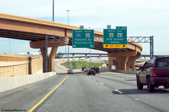
Tarrant County North Richland Hills |
The ramp to Pipeline Road and Glenview Drive exits the southbound lanes of I-820 Just beyond the split to TX-121 North and and TX-183 East. |
 |
||
|
Date: 11/14/2015 |
High-res: (1440x960) (2400x1600) | |||
|
Tarrant County North Richland Hills |
Two views looking westerly on the ramp that links I-820 North to I-820 West as it passes beneath the flyover that carries the ramps between the I-820 Express Lanes and the 121 Toll Express Lanes. |
 |
||
| High-res: (1440x960) (2400x1600) | ||||
 |
||||
|
Date: 11/14/2015 |
High-res: (1440x960) (2400x1600) | |||
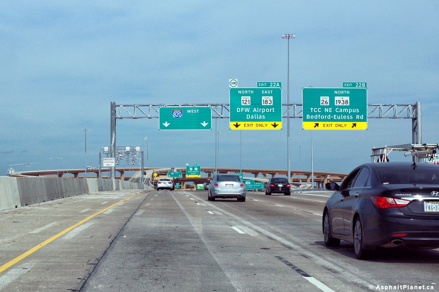
|
Tarrant County North Richland Hills |
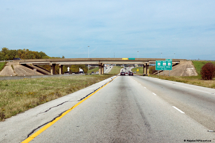
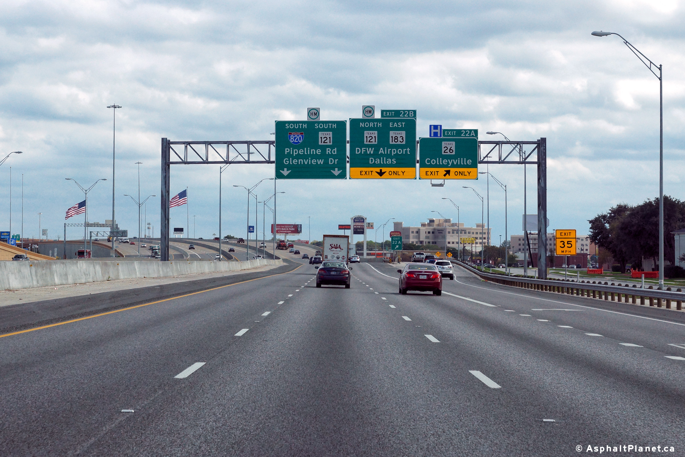
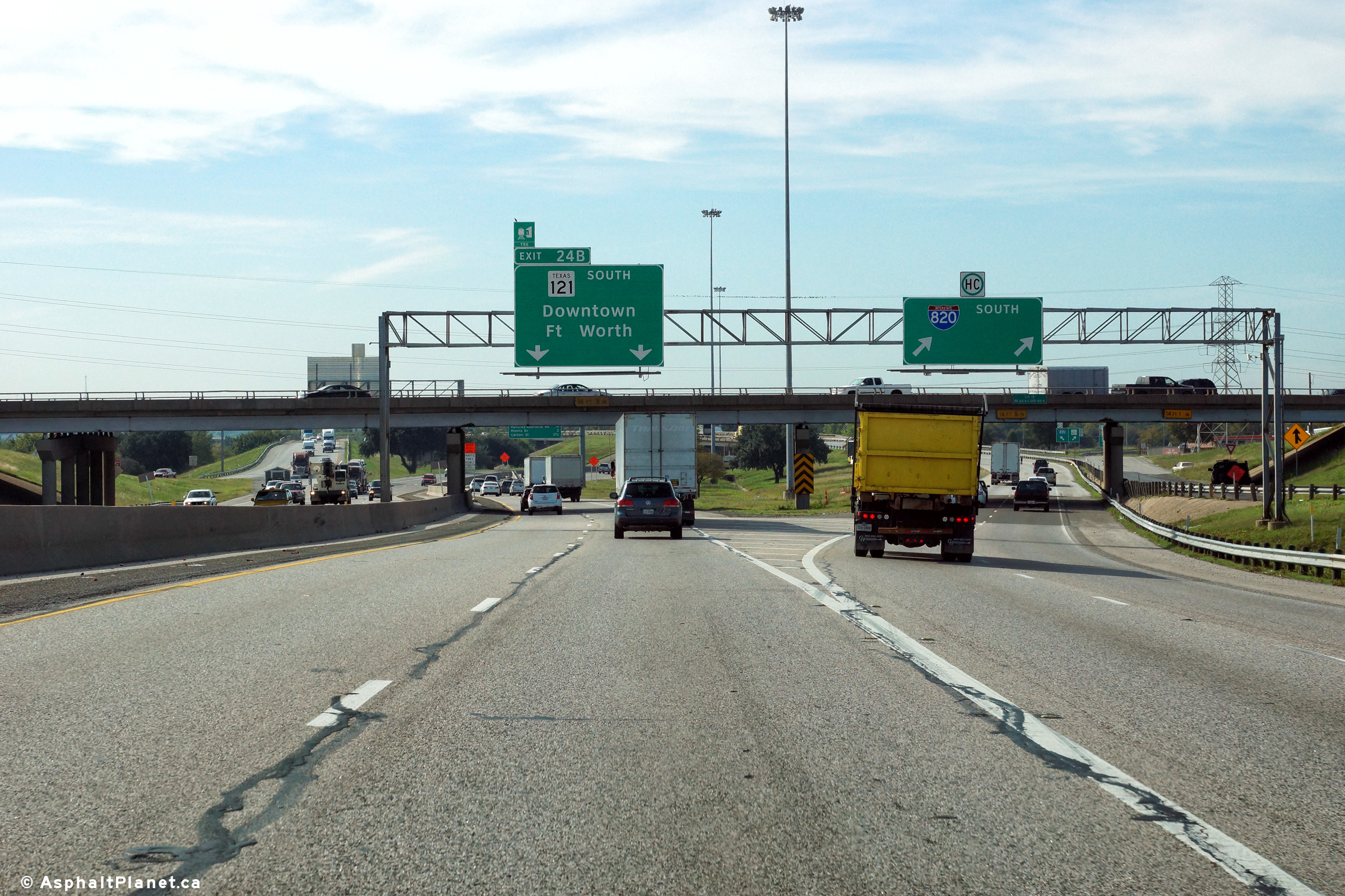
Signage at the off-ramp to TX-121 North and TX-183 East. Beyond this interchange, I-820 North becomes I-820 west as the interstate curves 90 degrees to the west at this interchange. |
 |
||
| High-res: (1440x960) (2400x1600) | ||||
 |
||||
|
Date: 11/14/2015 |
High-res: (1440x960) (2400x1600) | |||
|
Tarrant County North Richland Hills |
Signage at the northbound off-ramp to TX-26 in advance of the TX-121/TX-183 interchange. |
 |
||
|
Date: 11/14/2015 |
High-res: (1440x960) (2400x1600) | |||
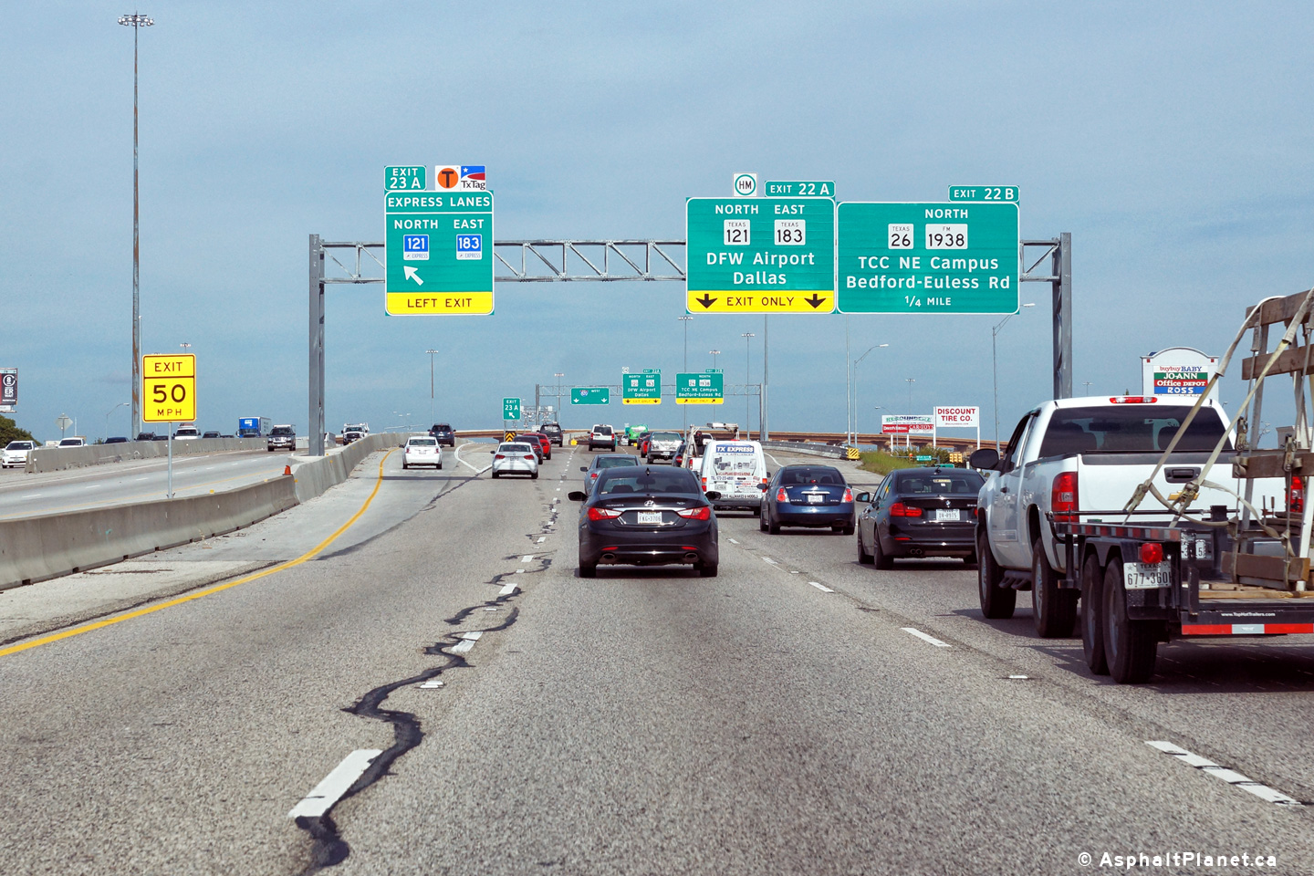
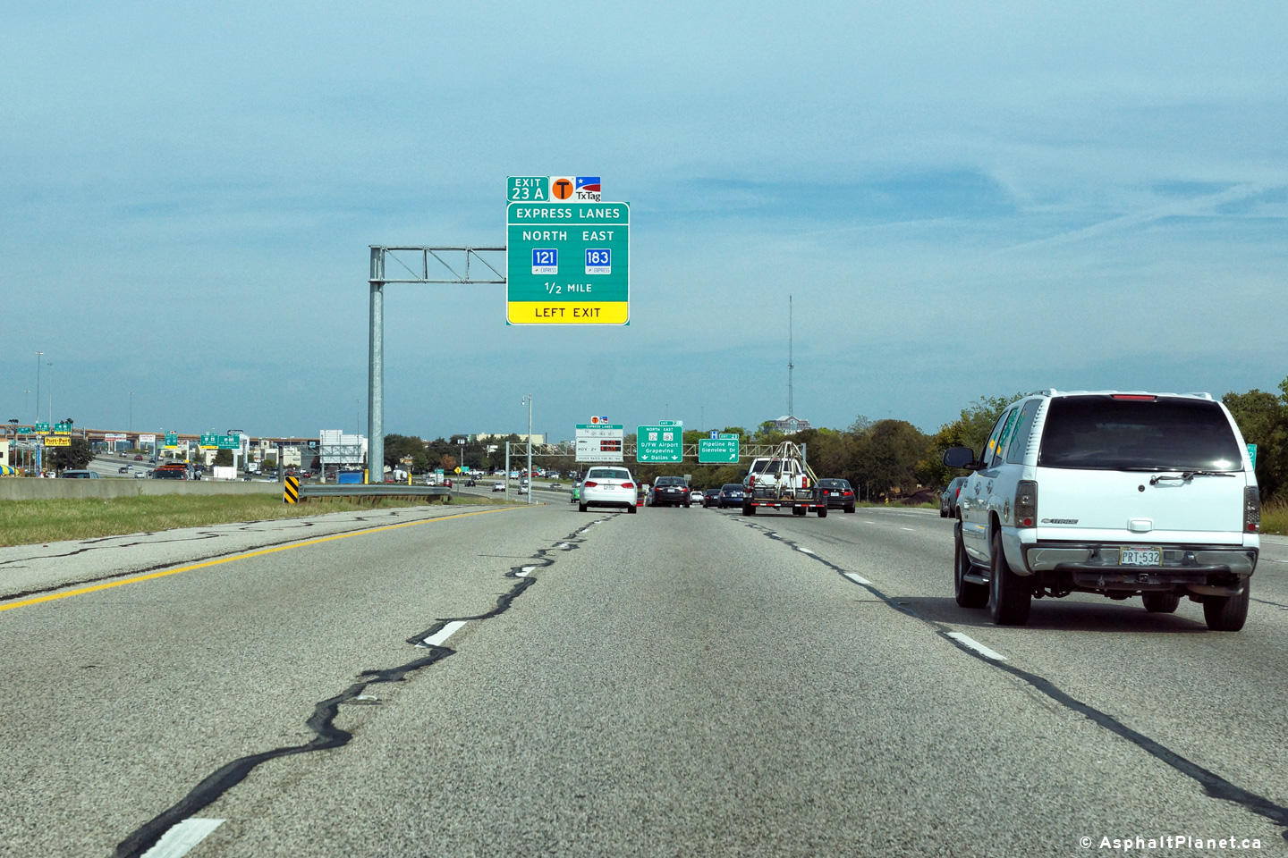
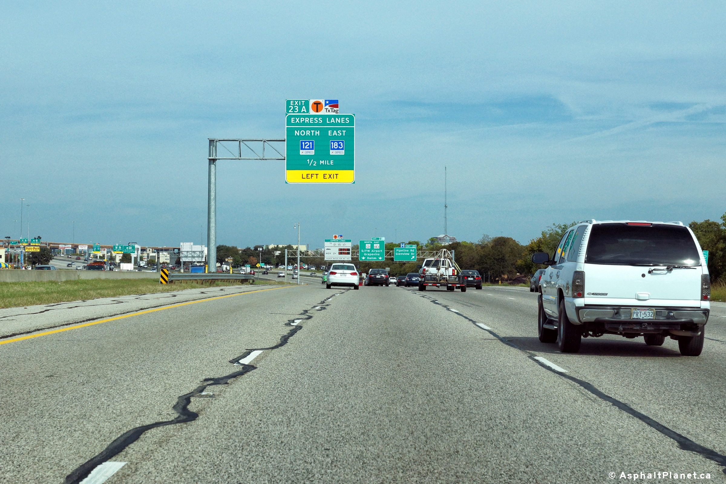
|
Tarrant County North Richland Hills |
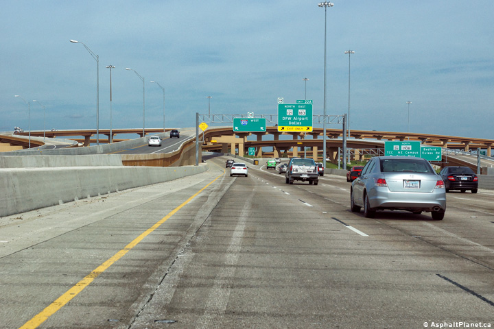
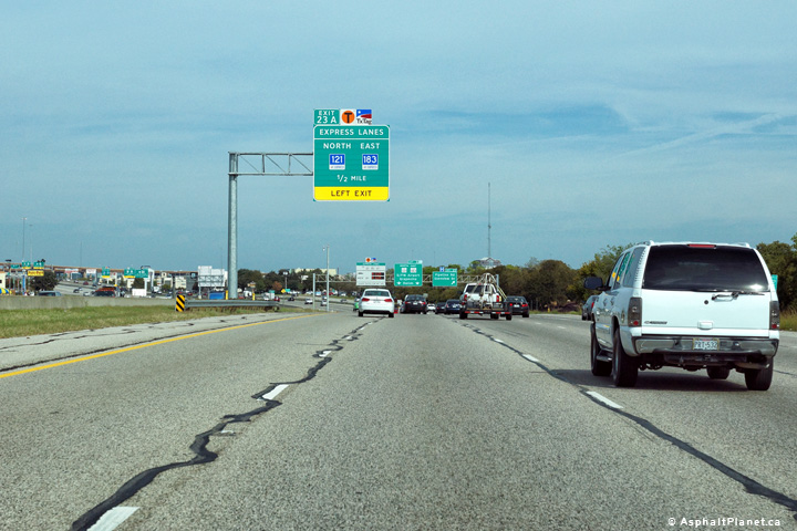
Signage for the ramp to the 121/183 Express lanes that lead easterly from the I-820 interchange. Somewhat surprisingly, there is not a similar connection between I-820 North and the westbound I-820 Express Lanes for several miles. |
 |
||
|
Date: 11/14/2015 |
High-res: (1440x960) (2400x1600) | |||
|
Tarrant County North Richland Hills |
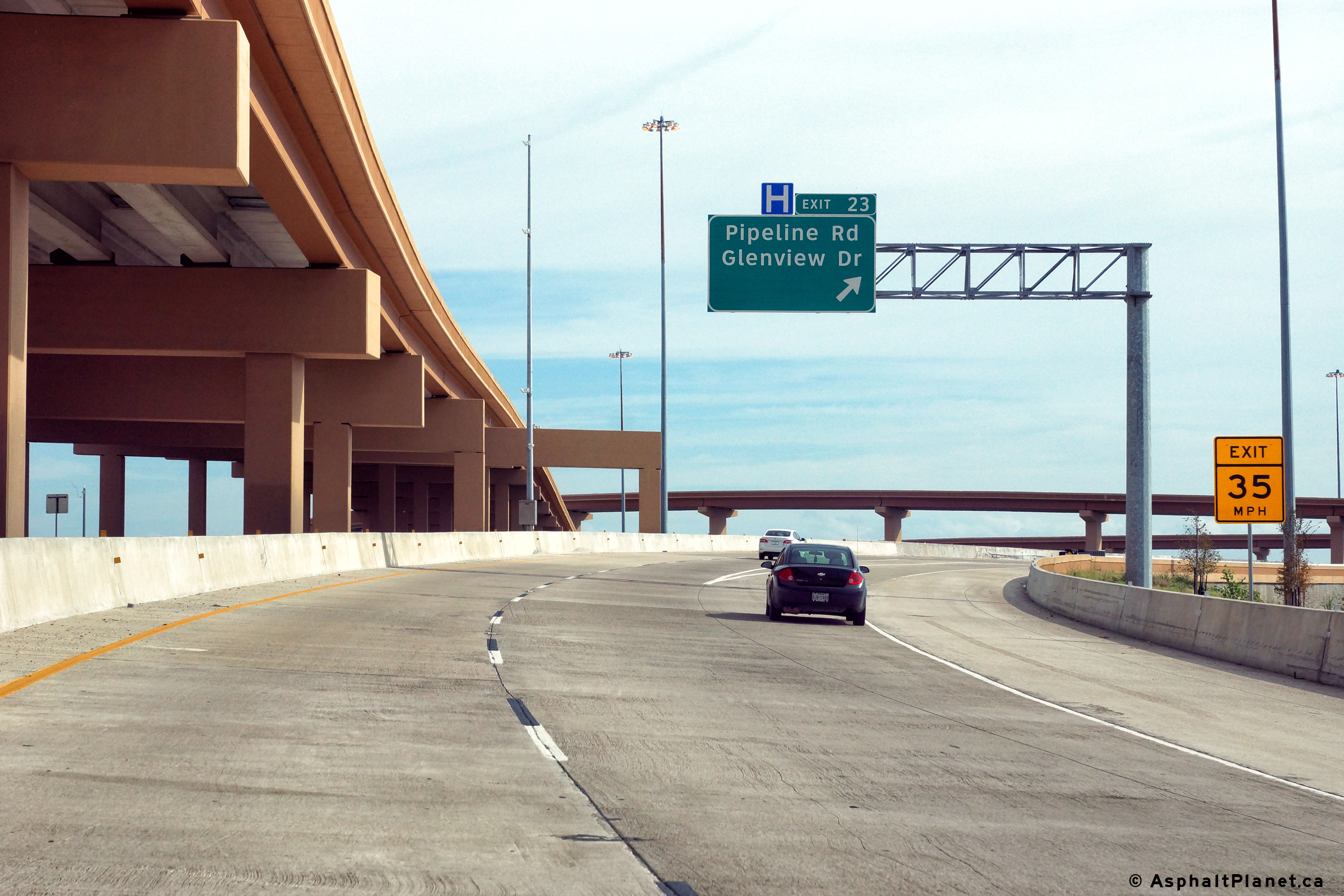
Northbound view at the off-ramp to Pipeline Road and Glenview Drive. |
 |
||
|
Date: 11/14/2015 |
High-res: (1440x960) (2400x1600) | |||
|
Tarrant County North Richland Hills |
Northbound advanced signage for the 121 and 183 tolled express lanes. |
 |
||
|
Date: 11/14/2015 |
High-res: (1440x960) (2400x1600) | |||
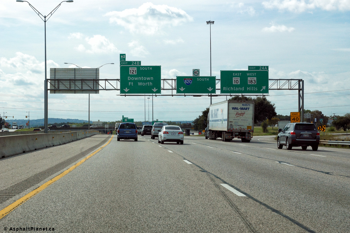
|
Tarrant County Forth Worth |
Southerly view at the off-ramp to Texas Highways 10 and 183. |
 |
||
|
Date: 11/14/2015 |
High-res: (1440x960) (2400x1600) | |||
|
Tarrant County Forth Worth |
Southerly view at the off-ramp to Texas Highway 121 South. Texas 121 South leads southwesterly from this point into Downtown Fort Worth. I-820 continues its nearly due south trajectory towards I-20 southeast of Downtown Fort Worth. |
 |
||
|
Date: 11/14/2015 |
High-res: (1440x960) (2400x1600) | |||
|
Tarrant County Hurst |
Northbound off-ramp to the exit to Texas Highways 10, 183 and 121. There is not a direct connection to the 121 South Freeway from I-820 North, so traffic must use surface streets to make the connection. Direct connections are planned to be added during a future reconstruction and widening project along I-820. |
 |
||
|
Date: 11/3/2012 |
High-res: (1440x960) (2400x1600) | |||
|
Tarrant County Forth Worth |
In advance of the Trinity Boulevard overpass stands this advanced signage for the Highway 10, 121, and 183 interchange. |
 |
||
|
Date: 11/14/2015 |
High-res: (1440x960) (2400x1600) | |||
|
Tarrant County Forth Worth |
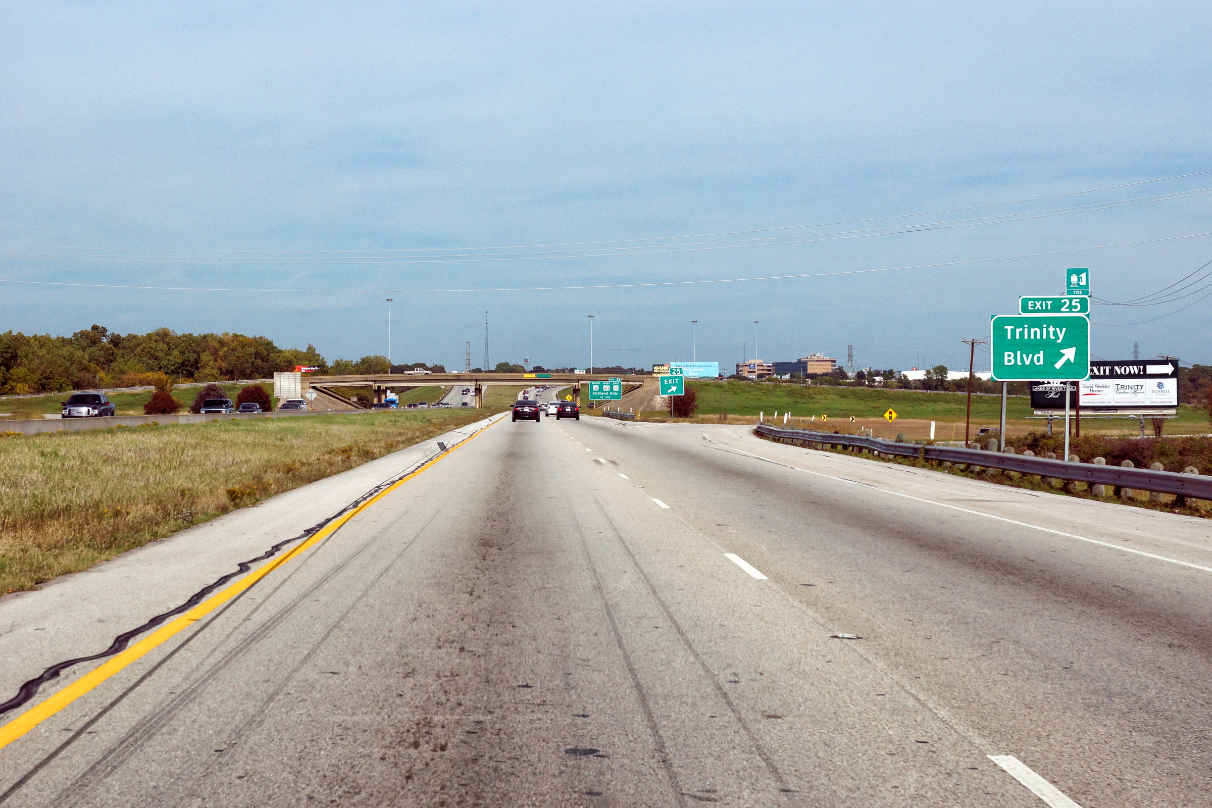
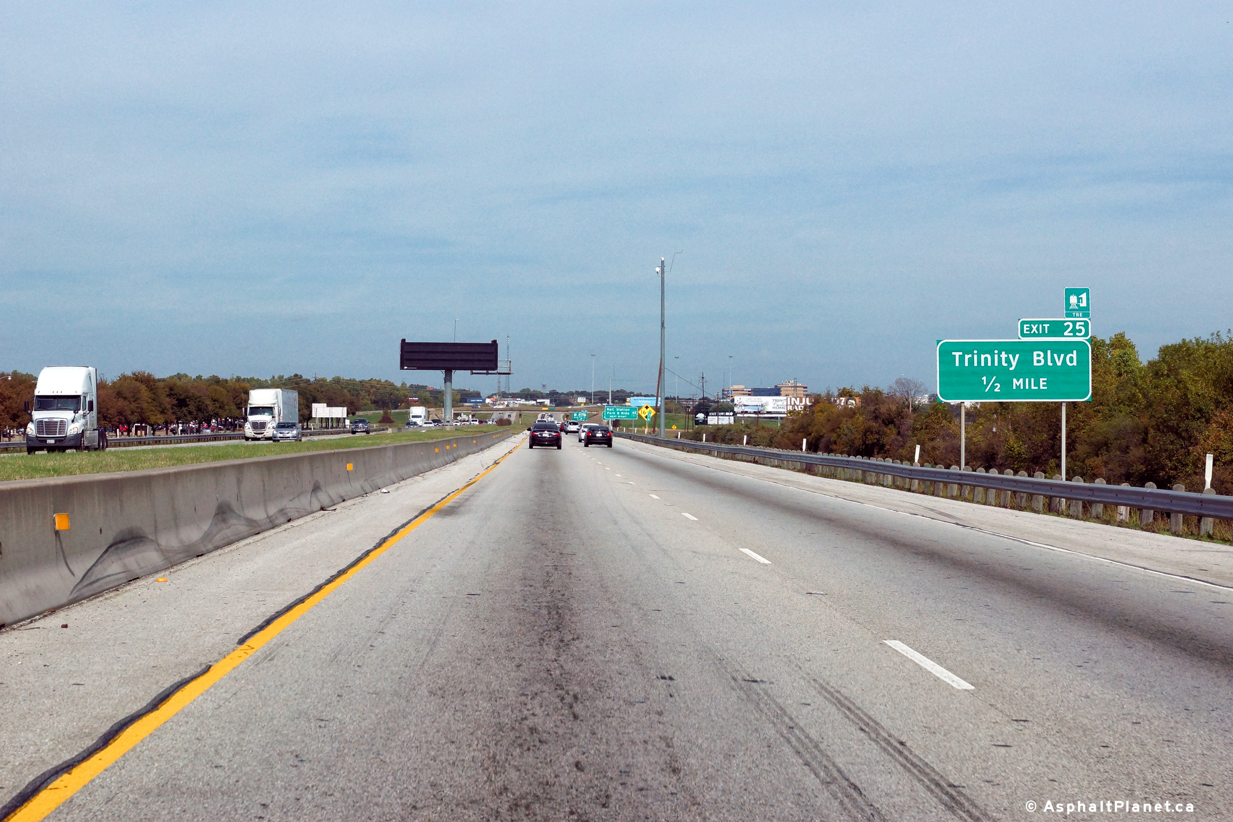
Northerly view at the off-ramp to Trinity Boulevard. |
 |
||
|
Date: 11/14/2015 |
High-res: (1440x960) (2400x1600) | |||
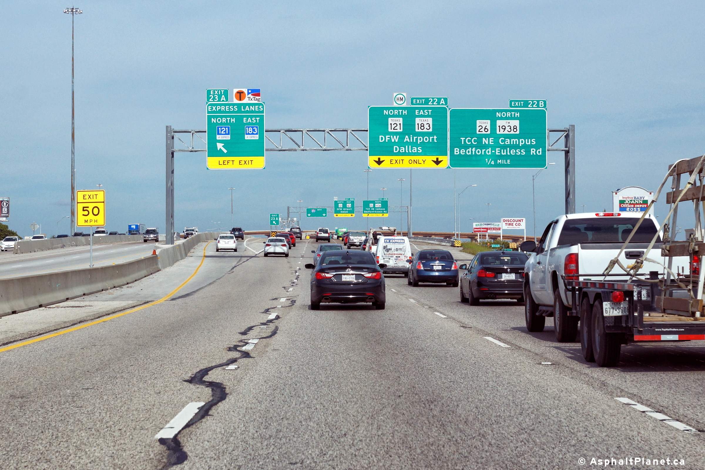
|
Tarrant County Forth Worth |
Signage for the ramp to the 121/183 Express lanes that lead easterly from the I-820 interchange. Somewhat surprisingly, there is not a similar connection between I-820 North and the westbound I-820 Express Lanes for several miles. |
 |
||
|
Date: 11/14/2015 |
High-res: (1440x960) (2400x1600) | |||
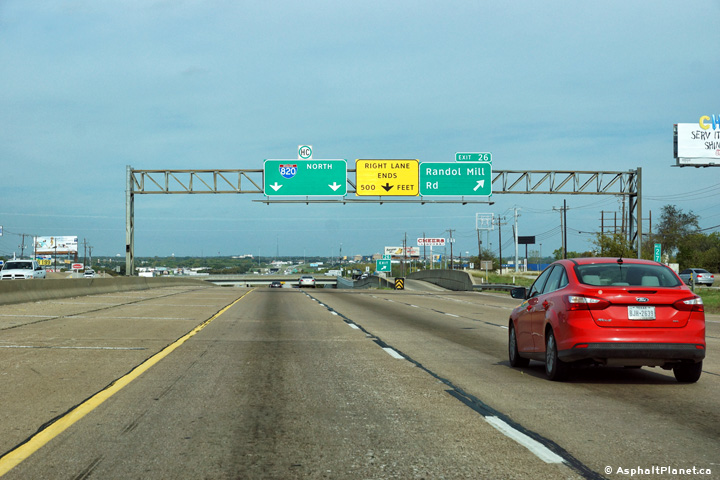
|
Tarrant County Forth Worth |
View looking northerly through the Randol Mill Road interchange. The section of I-820 that was improved as part of the I-30 interchange reconstruction project ends just north of the Randol Mill Road interchange. TxDOT has planned to widen I-820 north of this interchange towards TX-121 in the future. |
 |
||
|
Date: 11/14/2015 |
High-res: (1440x960) (2400x1600) | |||
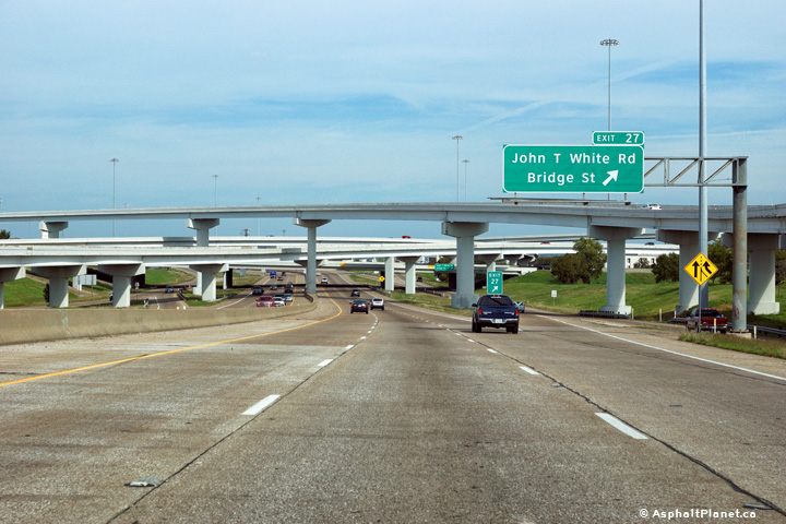
|
Tarrant County Forth Worth |
View looking northerly at the off-ramp to Randol Mill Road. I-820 narrows to four lanes north of the Randol Mill Road interchange. |
 |
||
|
Date: 11/14/2015 |
High-res: (1440x960) (2400x1600) | |||
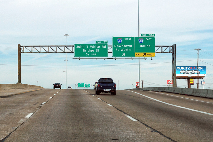
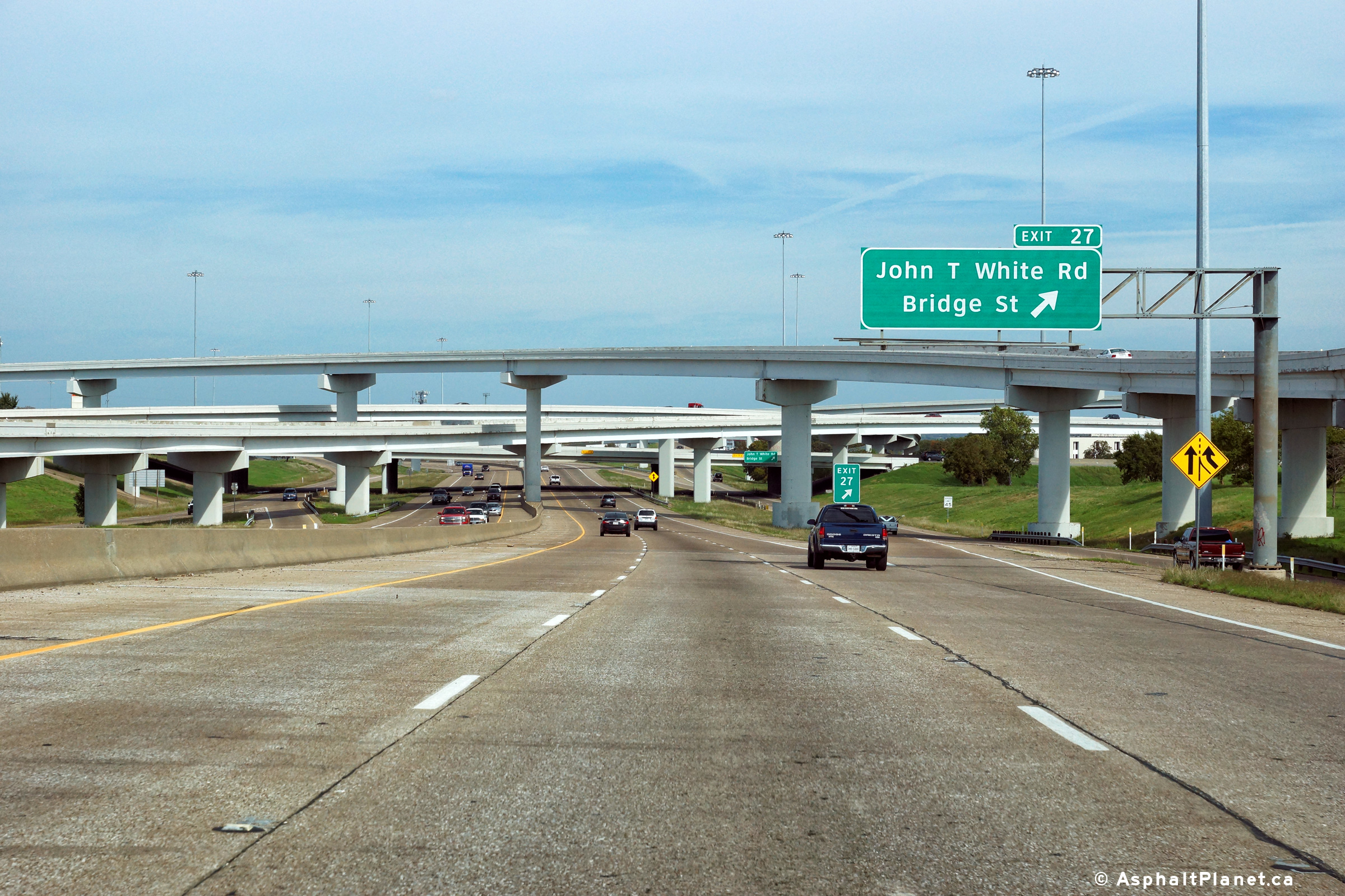
|
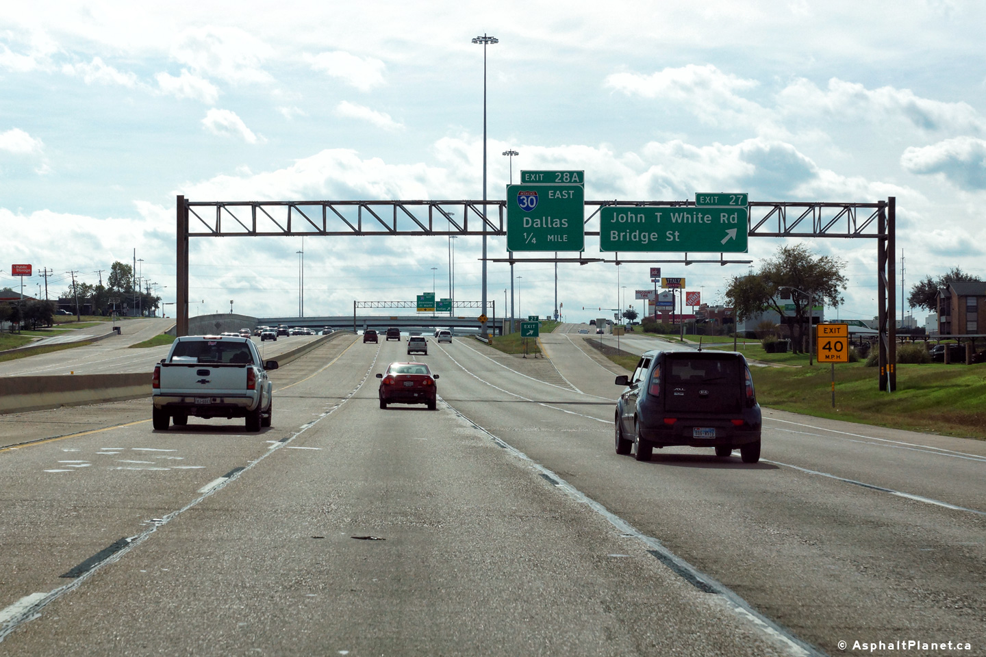
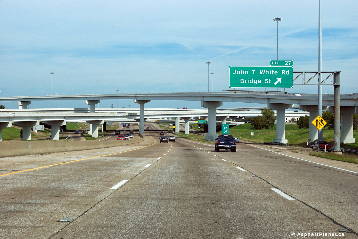
Tarrant County Forth Worth |
View looking southerly at the off-ramp to John T While Road. The interstate 30 interchange is situated just beyond this interchange. |
 |
||
|
Date: 11/14/2015 |
High-res: (1440x960) (2400x1600) | |||
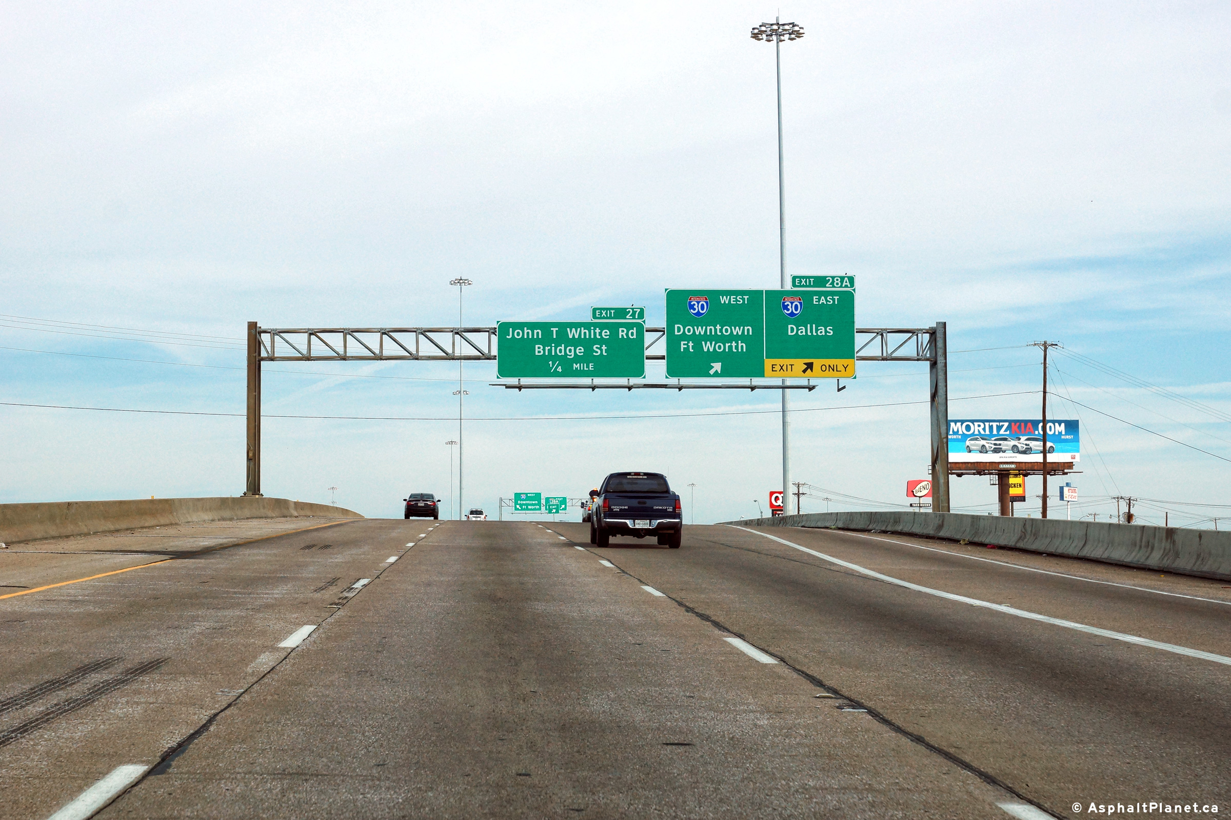
|
Tarrant County Forth Worth |
Southbound signage at the ramp to Interstate 30. |
 |
||
|
Date: 11/14/2015 |
High-res: (1440x960) (2400x1600) | |||
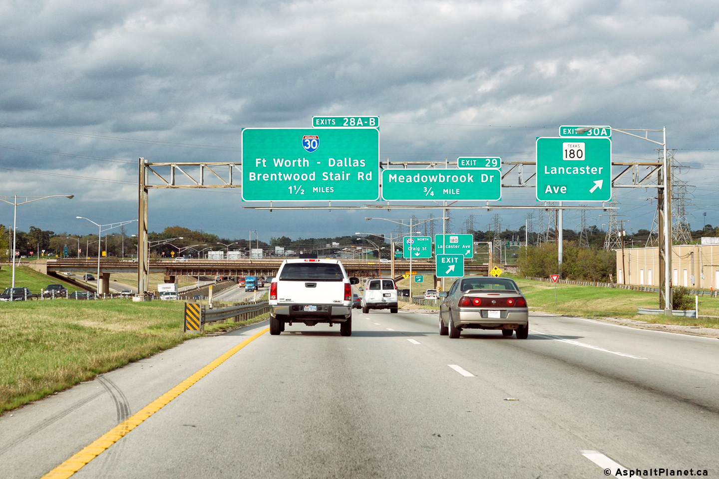
|
Tarrant County Forth Worth |
The exit to Brentwood Stair Road exits from the southbound side of I-820 through the middle of the I-30 interchange. |
 |
||
|
Date: 11/14/2015 |
High-res: (1440x960) (2400x1600) | |||
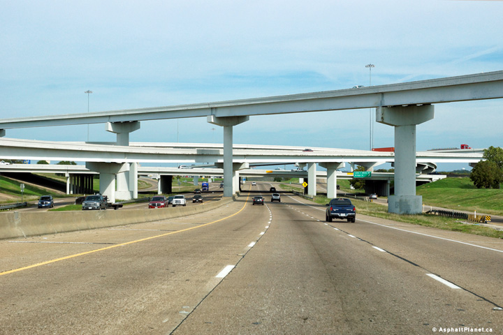
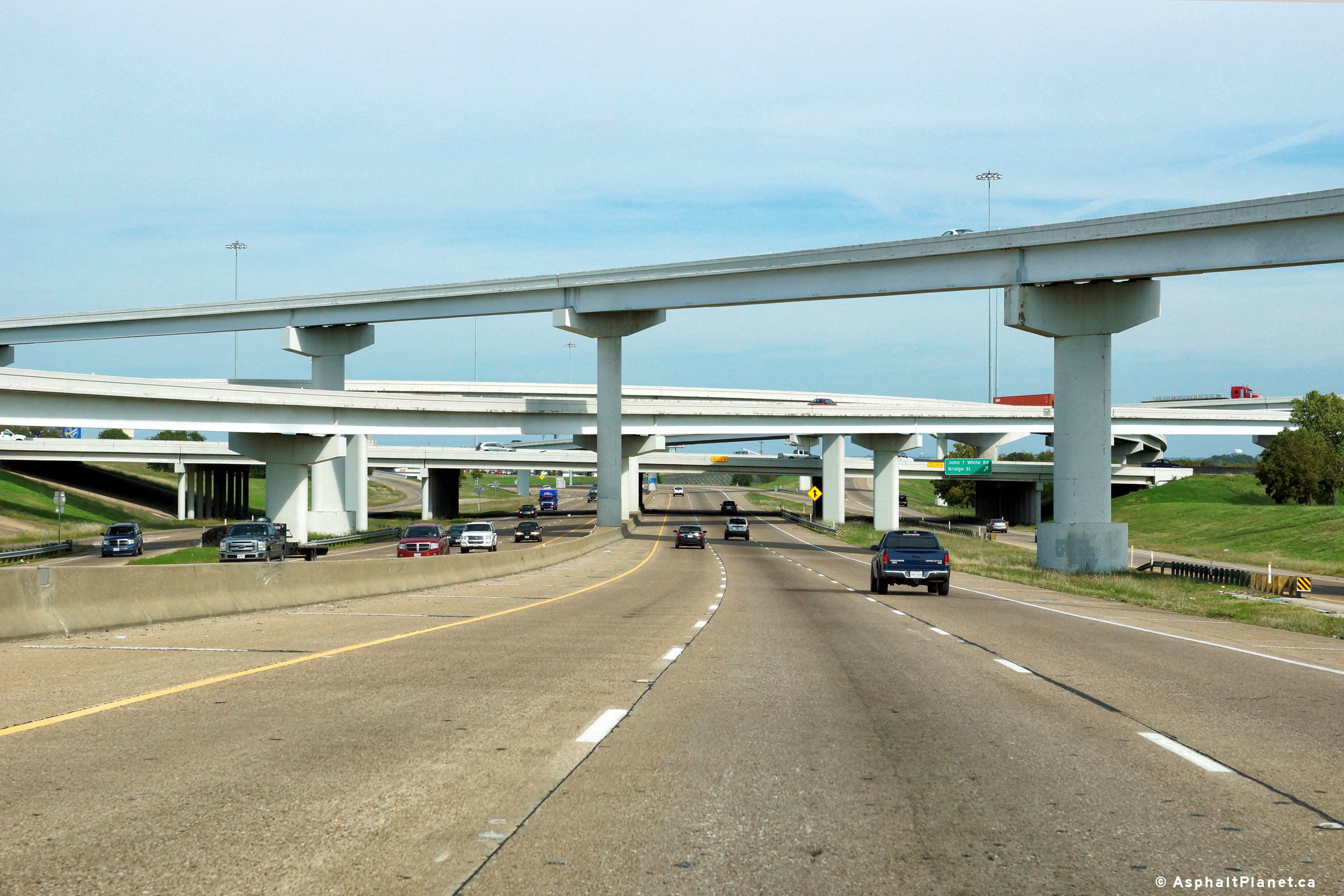
|
Tarrant County Forth Worth |
View looking northerly through the I-30 interchange. I-820 is the lowest level of this four level interchange. Additionally, note the rather unique raised pavement rumble strip that is particularly visible along the inner shoulder of I-280. Few roads have been designed with such a raised rumble strip in northern Texas. |
 |
||
|
Date: 11/14/2015 |
High-res: (1440x960) (2400x1600) | |||
|
Tarrant County Forth Worth |
The Frontage Roads for I-820 continue through the Interstate 30 interchange. |
 |
||
|
Date: 11/14/2015 |
High-res: (1440x960) (2400x1600) | |||
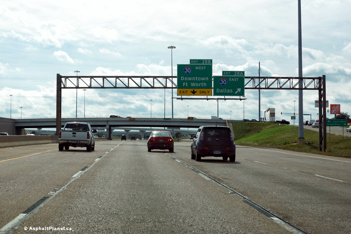
|
Tarrant County Forth Worth |
Northbound signage for the off-ramp to Interstate 30. |
 |
||
|
Date: 11/14/2015 |
High-res: (1440x960) (2400x1600) | |||
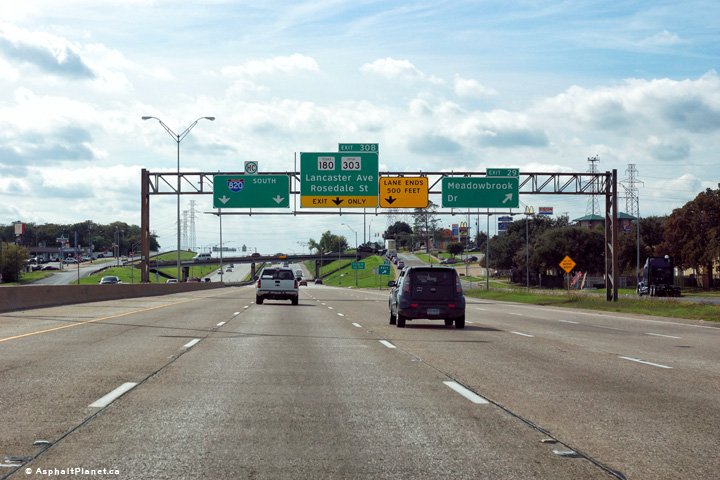
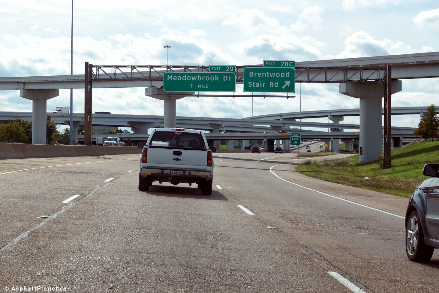
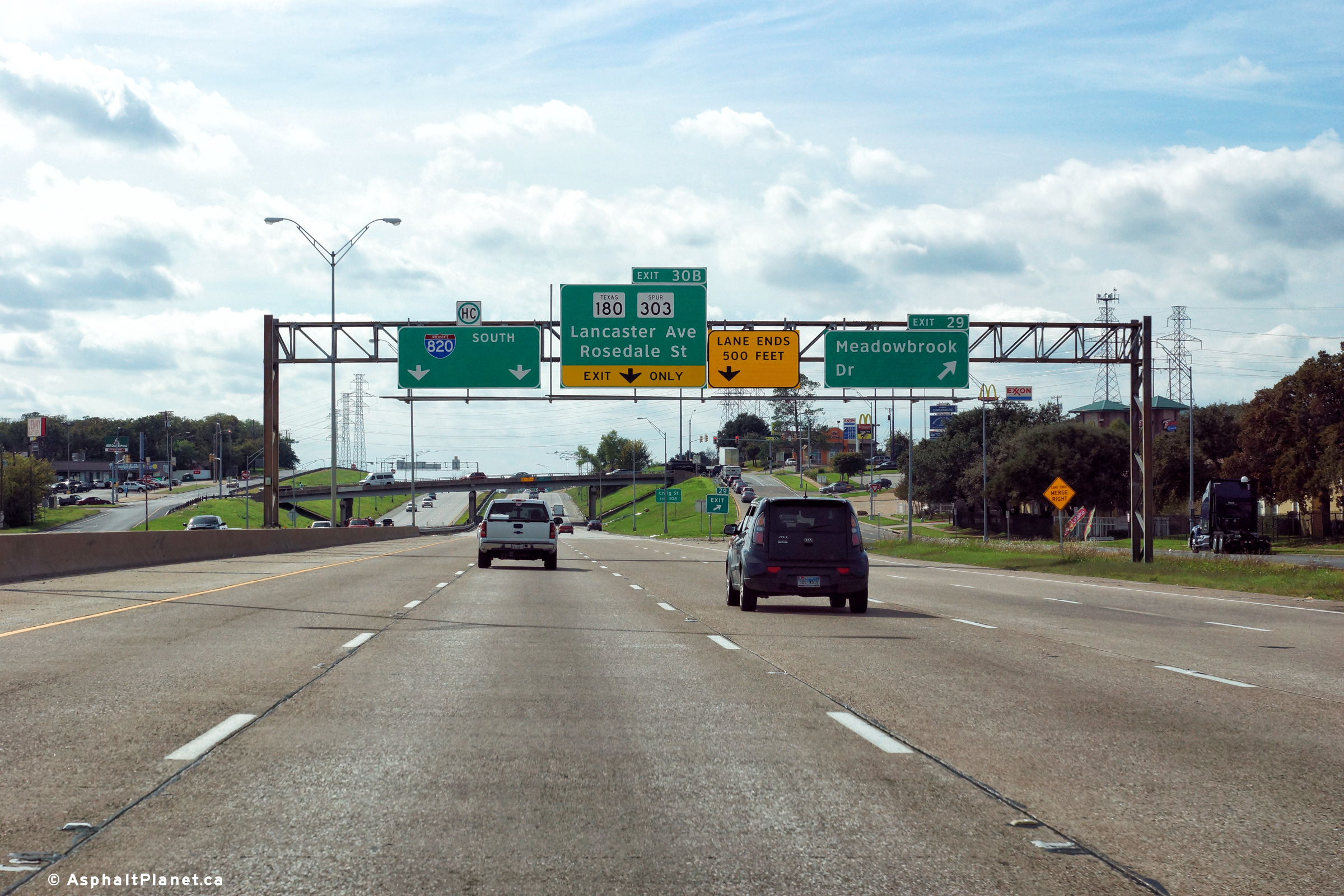
|
Tarrant County Forth Worth |
Southerly view at the off-ramp to Meadowbrook Drive. Interstate 820 narrows from eight to four lanes shortly beyond the I-30 interchange. |
 |
||
|
Date: 11/3/2012 |
High-res: (1440x960) (2400x1600) | |||
|
Tarrant County North Richland Hills |
Northbound view at the off-ramp to Lancaster Street. |
 |
||
|
Date: 11/14/2015 |
High-res: (1440x960) (2400x1600) | |||
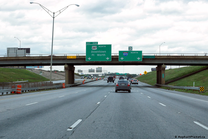
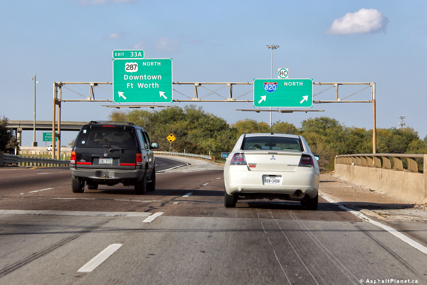
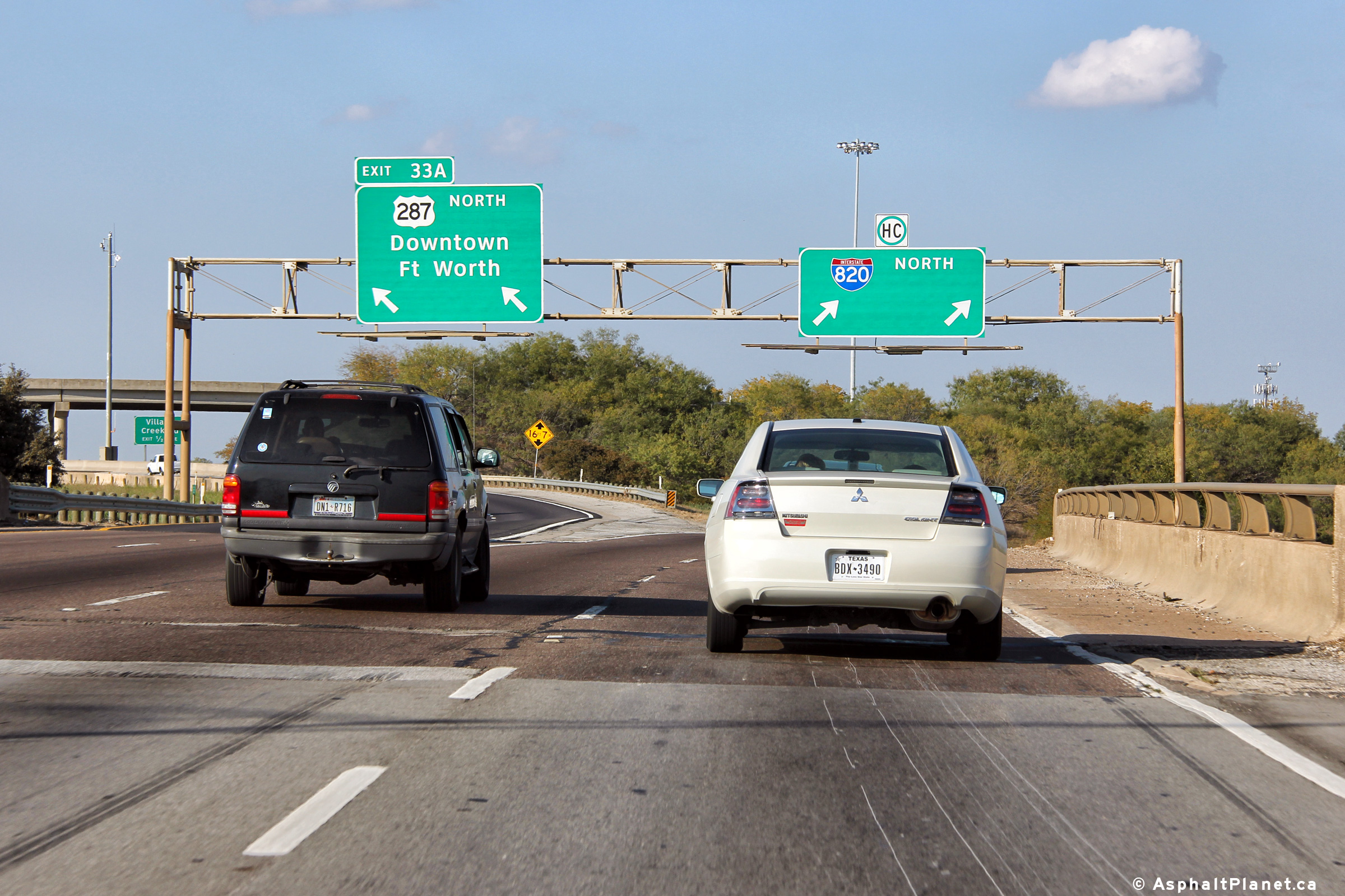
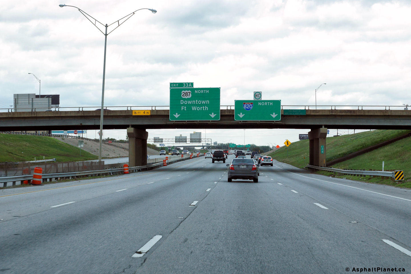
|
Tarrant County North Richland Hills |
Northbound signage at the split between US-287 and I-820. US-287 and I-820 will meet again at the I-35W interchange. |
 |
||
|
Date: 11/14/2015 |
High-res: (1440x960) (2400x1600) | |||
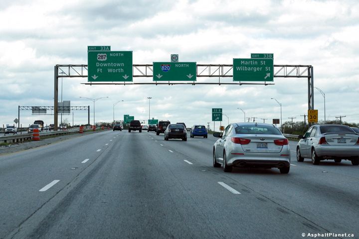
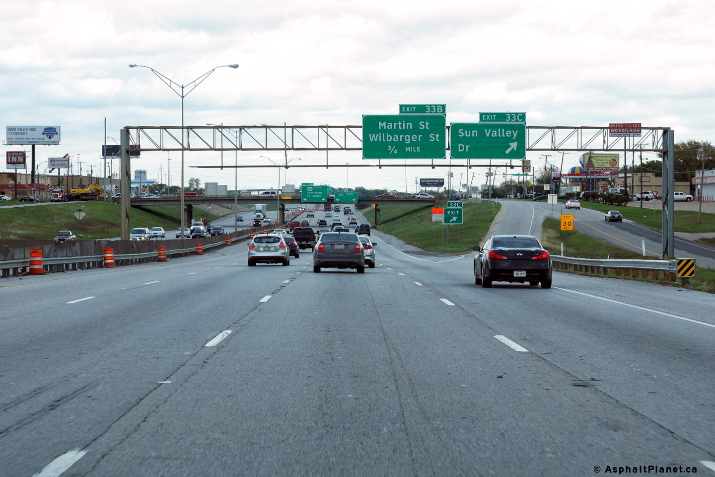
|
Tarrant County North Richland Hills |
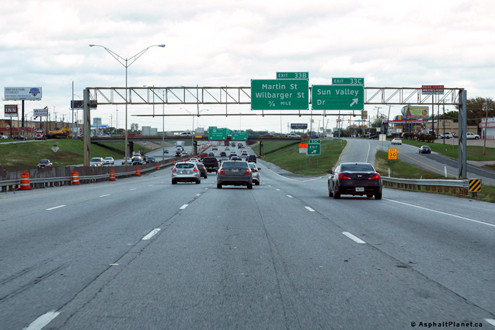
View looking northerly at the off-ramp to Martin Street and Wilbarger Street. US-287 and I-820 split a short distance downstream of this interchange. |
 |
||
|
Date: 11/14/2015 |
High-res: (1440x960) (2400x1600) | |||
|
Tarrant County North Richland Hills |
Advanced signage for the US-287 interchange has been affixed to the Sun Valley Drive interchange. |
 |
||
|
Date: 11/14/2015 |
High-res: (1440x960) (2400x1600) | |||
|
Tarrant County North Richland Hills |
Northbound advanced signage approaching the Sun Valley Drive interchange. |
 |
||
|
Date: 11/14/2015 |
High-res: (1440x960) (2400x1600) | |||
<- I-635
TX Highways
SH-824 ->
AsphaltPlanet.ca
© 2006-2016 AsphaltPlanet.ca.
AsphaltPlanet@asphaltplanet.ca
Page Created: December 30, 2015.
Last Updated: November 22, 2016.
