|
|
|
|
|
|
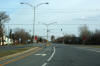
West-
Bound
|
|
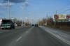
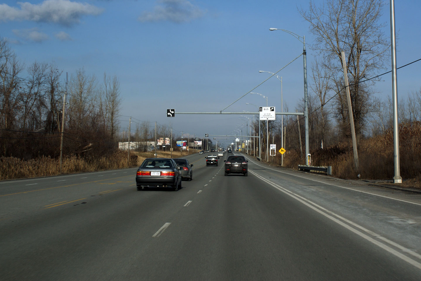
MRC du Haut-Saint-Laurent
Ormstown
|
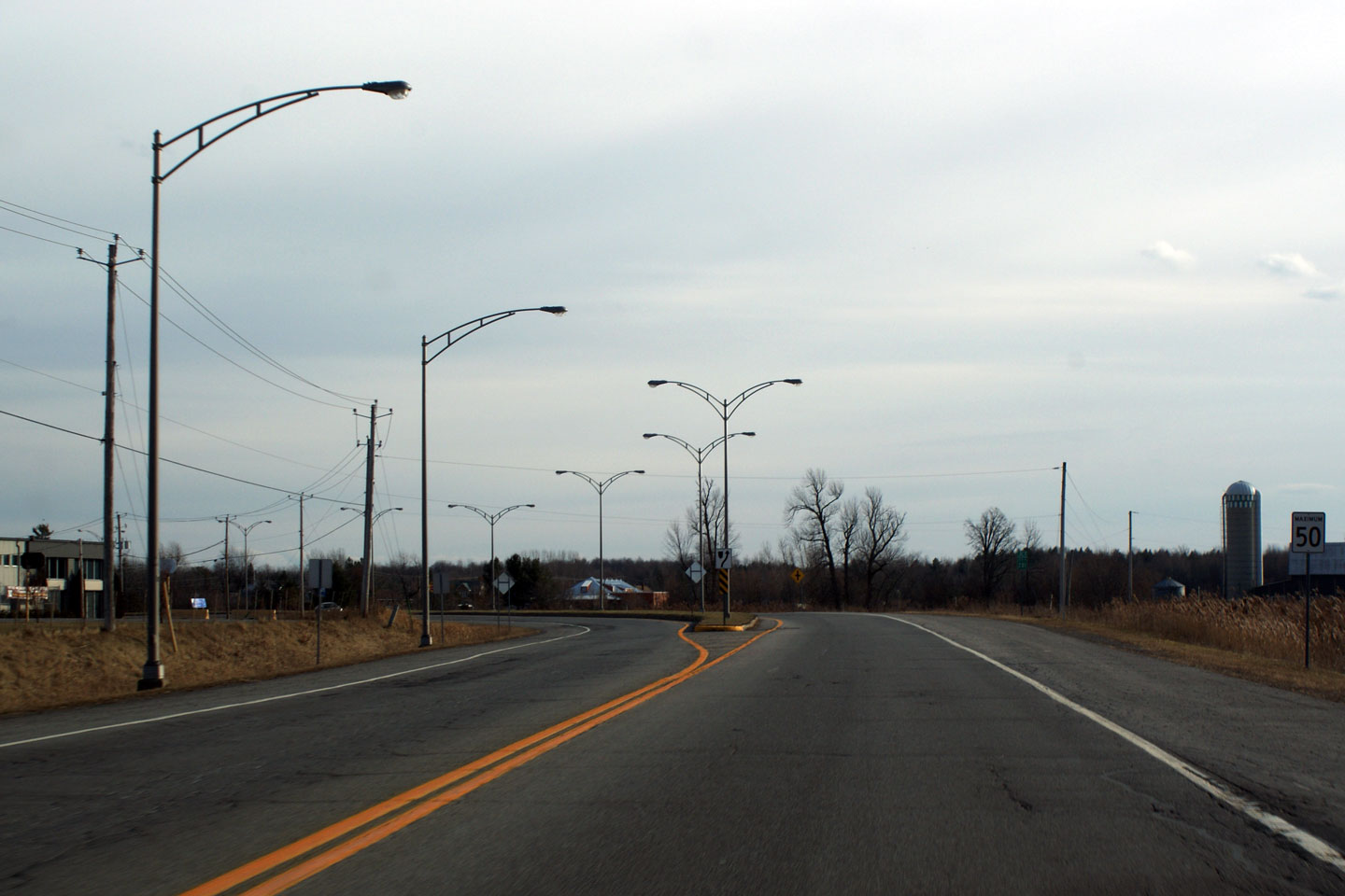
Route
138 between the R-201 junctions along the Ormstown By-pass. |

High-res |
|
Photographed by: AsphaltPlanet.ca |
Date: 12/7/2008 |
|
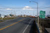
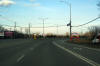
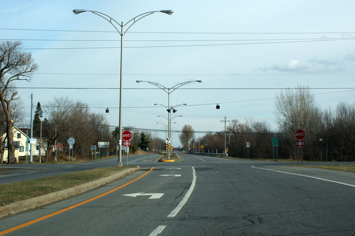
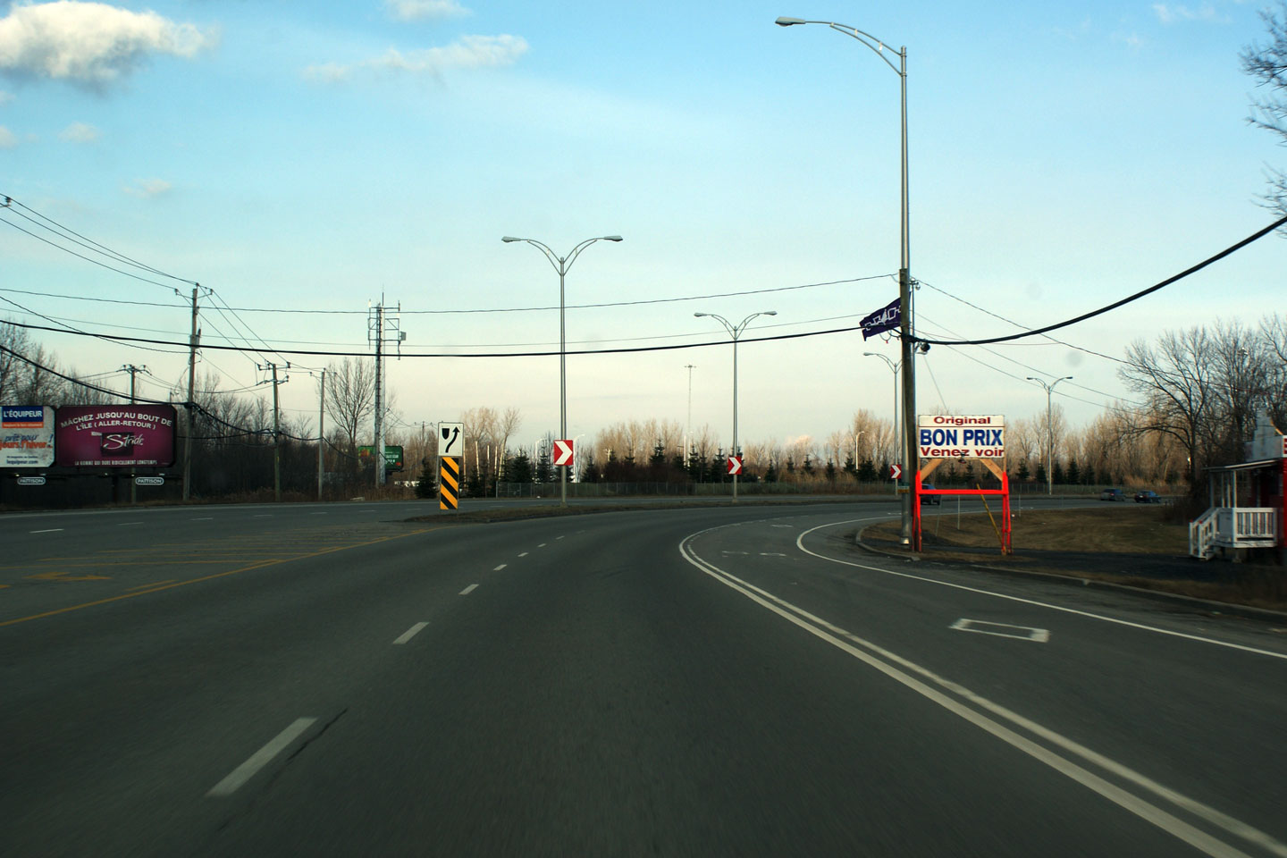
MRC du Haut-Saint-Laurent
Ormstown
|
View
looking easterly approaching the Route 201-South junction. I find
it amazing how well built so many rural Quebec intersections are.
Especially considering that these large intersections are controlled by
a 4-way-stop. |
High-res |
|
Photographed by: AsphaltPlanet.ca |
Date: 12/7/2008 |
|
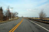
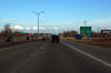
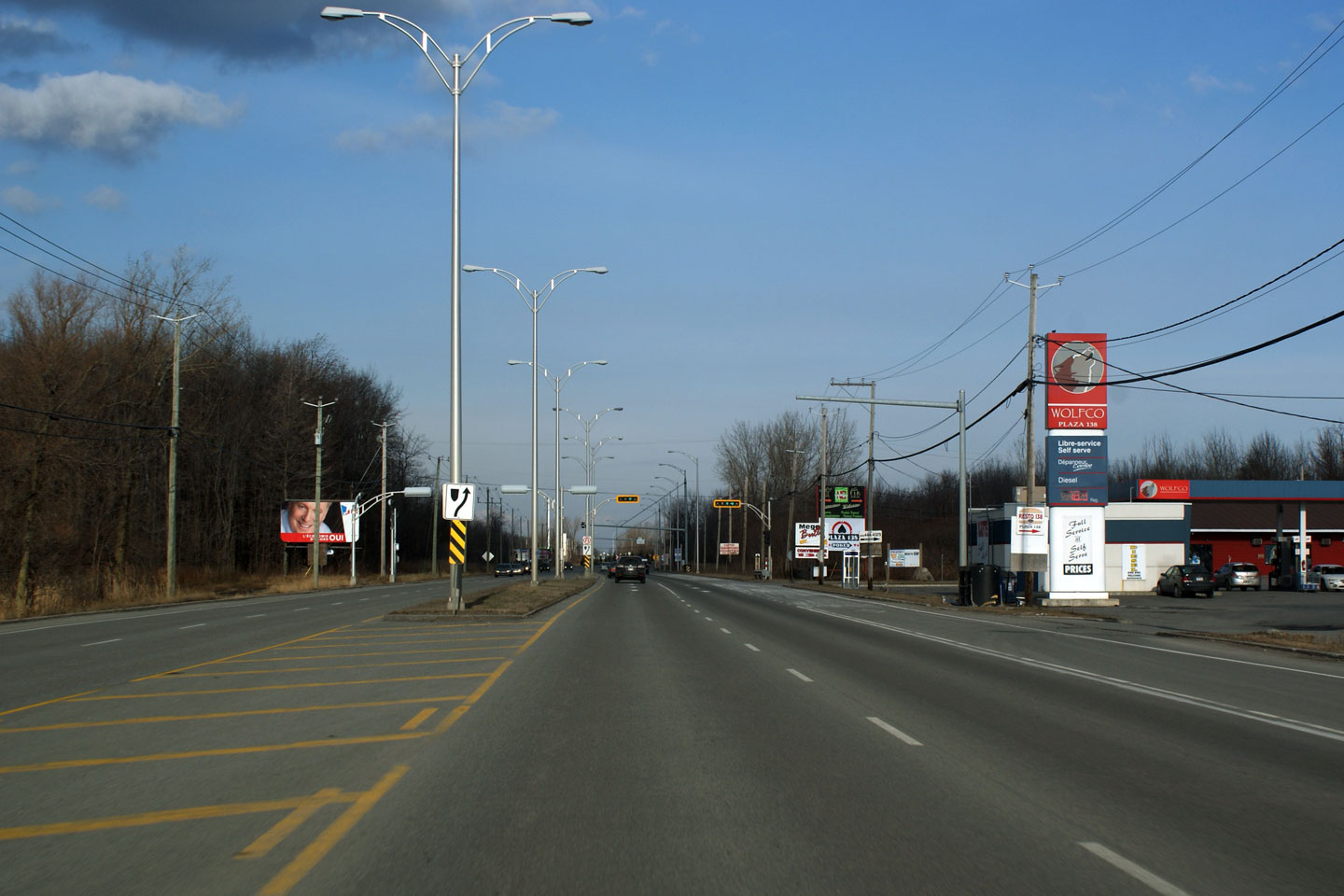
MRC du Haut-Saint-Laurent
Ormstown
|
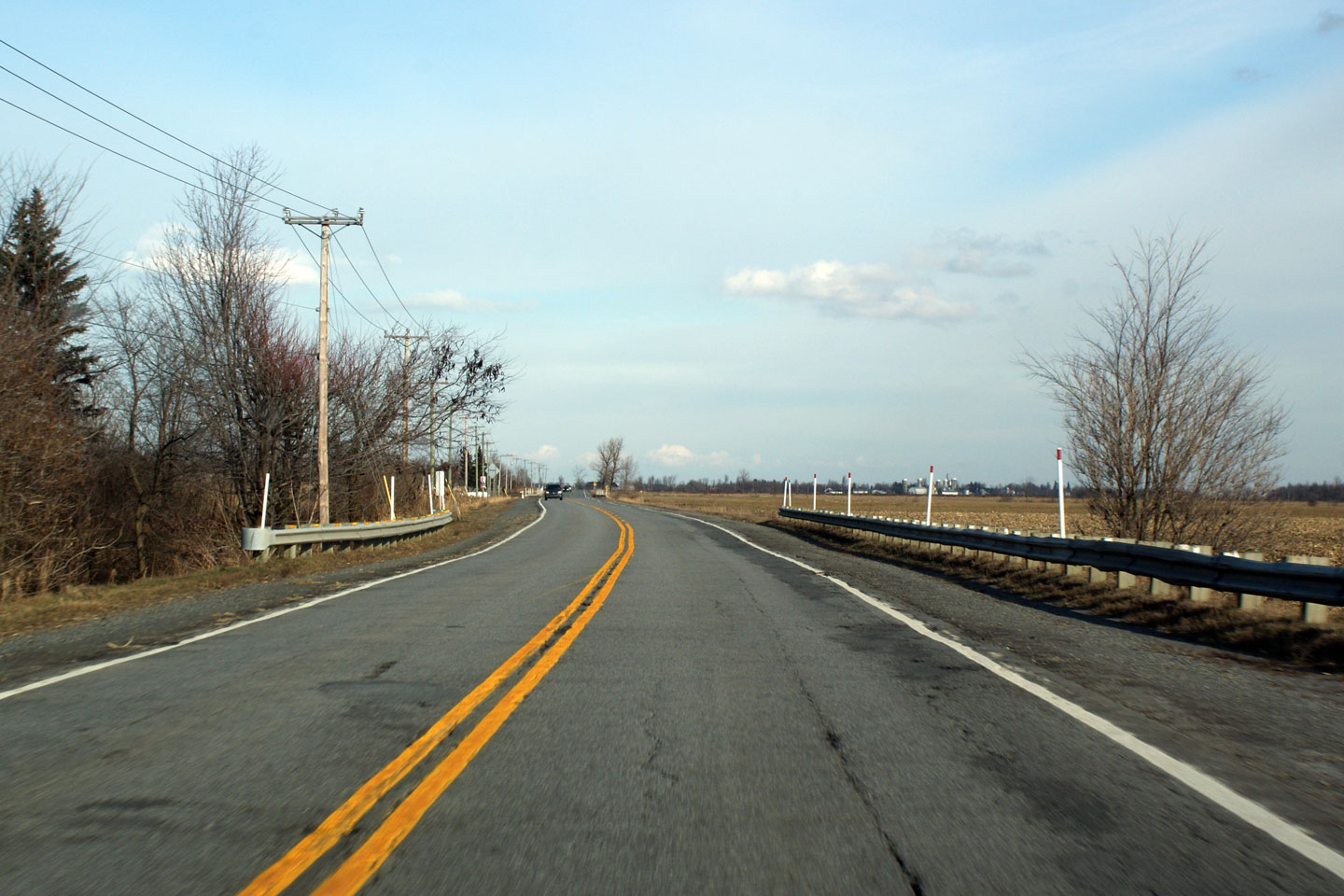
Route
138 in the vicinity of Allan's Corners. Route 138 follows the
shores of the narrow Chateauguay River southwest of Montreal. |
High-res |
|
Photographed by: AsphaltPlanet.ca |
Date: 12/7/2008 |
|
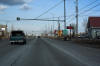
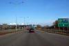
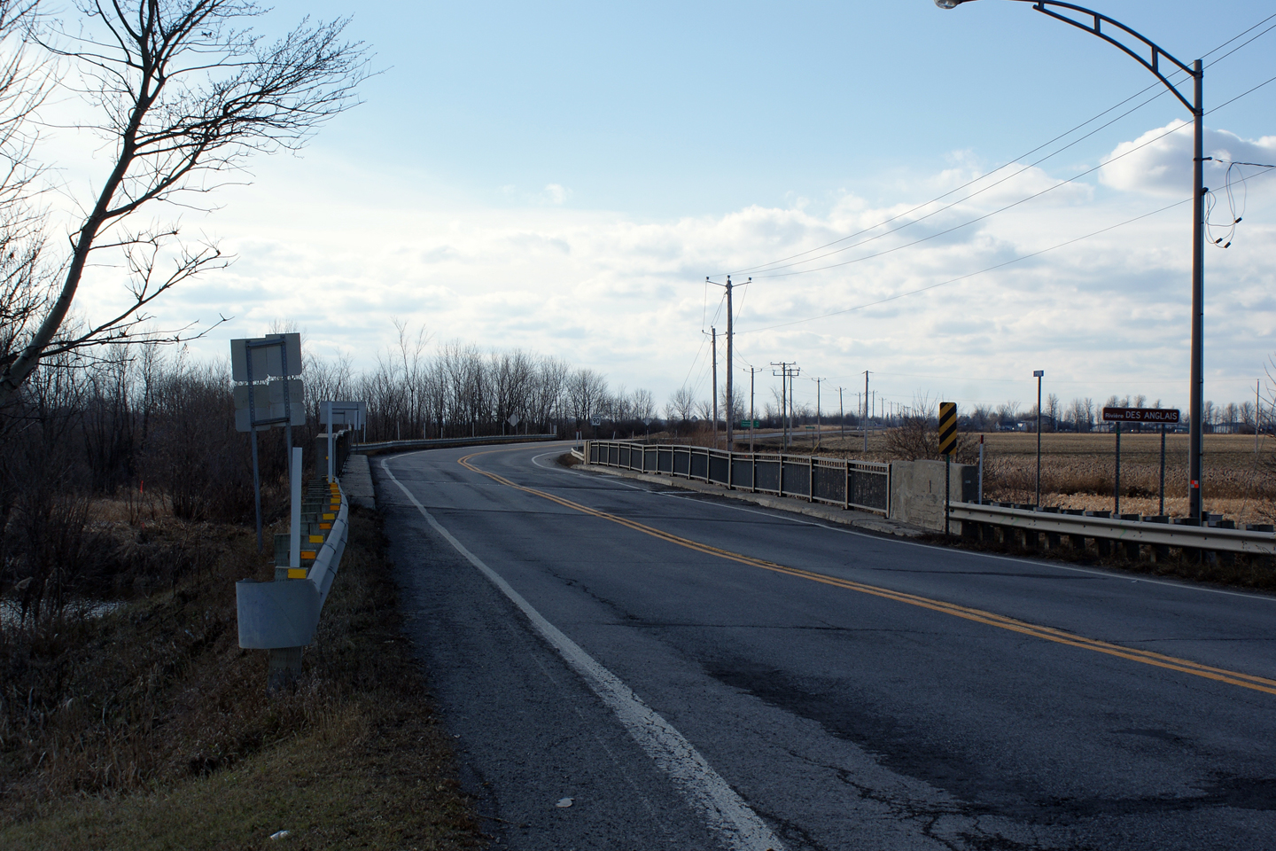
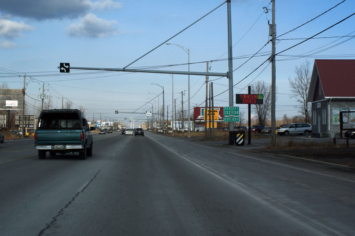
MRC de Roussellon
Sainte-Martine
|
View
of the Riviere des Anglais Bridge along R-138. Something
about this structure just doesn't look right to me. |
 |
|
Photographed by: AsphaltPlanet.ca |
Date: 12/7/2008 |
High-res |
|
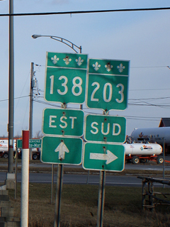
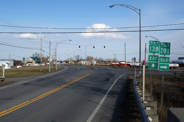
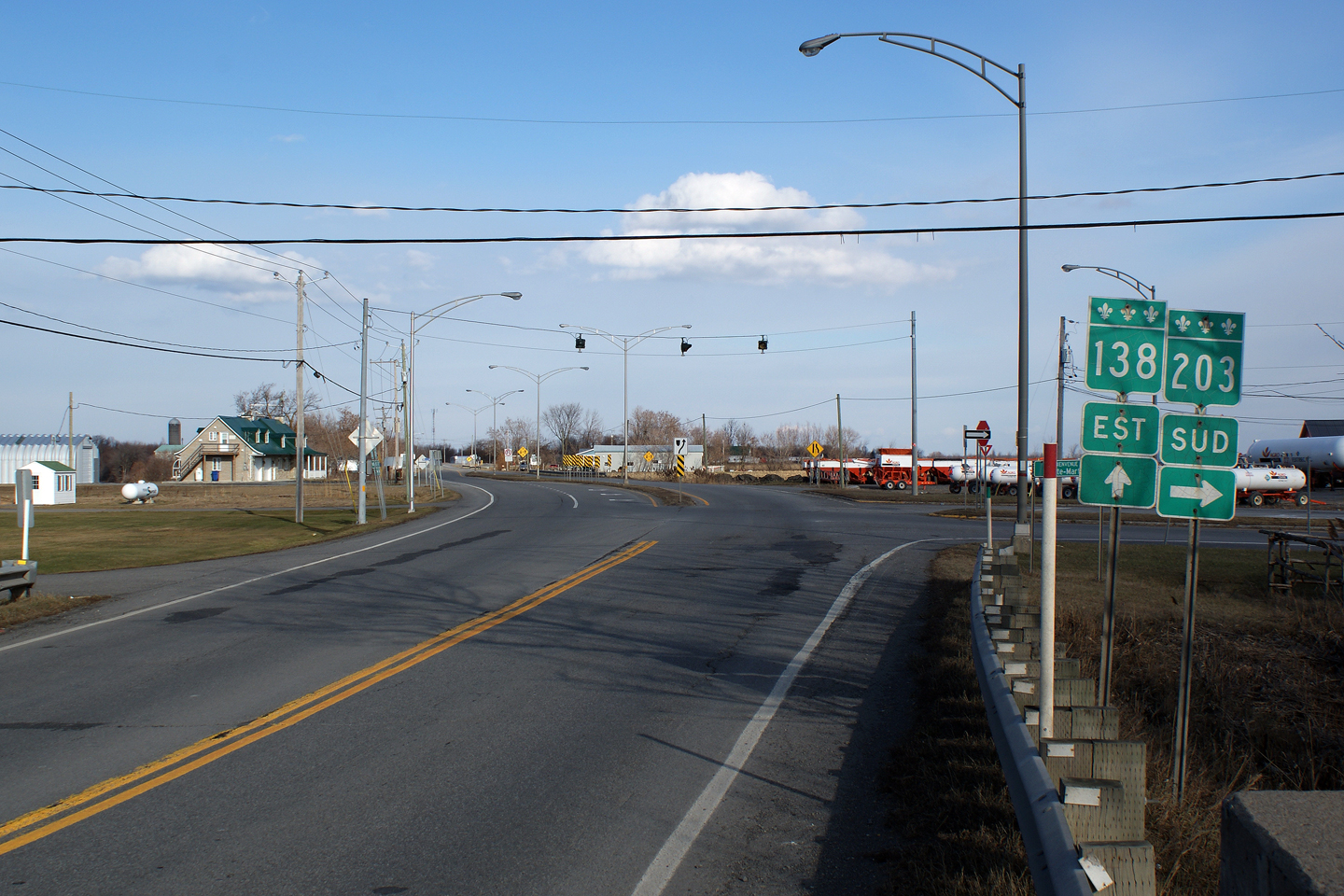
MRC de Roussellon
Sainte-Martine
|
View
of the R-203 intersection. |
 |
|
Photographed by: AsphaltPlanet.ca |
Date: 12/7/2008 |
High-res |
|
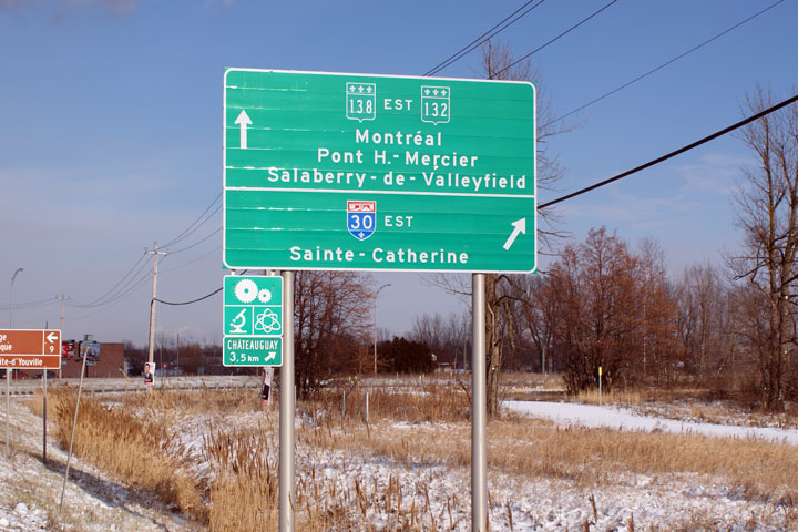
MRC de Roussellon
Mercier
|
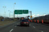
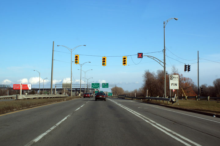
In
the southeastern part of Chateauguay, R-138 widens to 5-lanes.
This photo marks the approach to A-30 and R-132 West. |
 |
|
Photographed by: AsphaltPlanet.ca |
Date: 12/7/2008 |
High-res |
|
MRC de Roussellon
Mercier
|
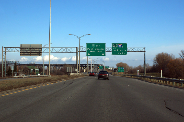
R-138
meets A-30 and R-132 at a dual intersection. At the time this
photo was taken, A-30 terminated at R-138, however design and
construction is underway to extend A-30 as far west as Vaudreuil. |
 |
|
Photographed by: AsphaltPlanet.ca |
Date: 12/7/2008 |
|
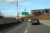
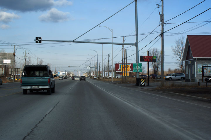
MRC de Roussellon
Mercier
|
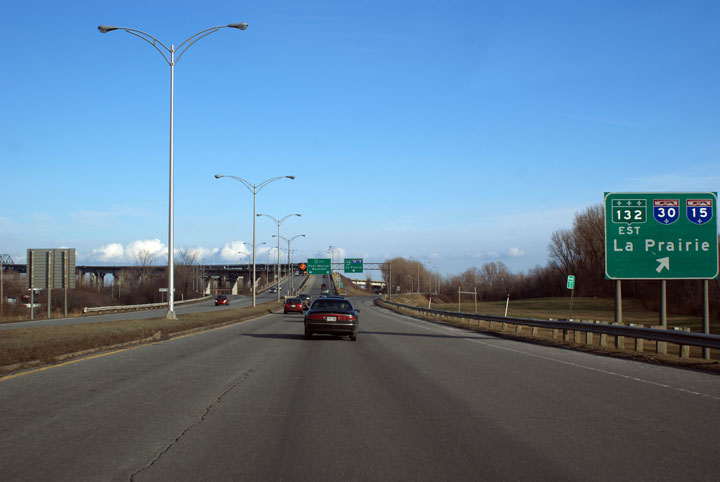
Signage
for Route 132 West. |

|
|
Photographed by: AsphaltPlanet.ca |
Date: 12/7/2008 |
High-res |
|
MRC de Roussellon
Chateauguay
|
East
of A-30, A-132 follows A-138 into the Kahnawake Mohawk Territory.
Highway's 132 and 138 are two of Quebec's longest and most important
two-lane highways. Highway 132 generally follows the South shore
of the Saint Lawrence River stretching from New York State to Gaspe.
Highway 138 generally follows the north shore terminating in the remote
fishing village of ___________. |
 |
|
Photographed by: AsphaltPlanet.ca |
Date: 12/7/2008 |
High-res |
|
MRC de Roussellon
Chateauguay
|
Easterly
view at the St-Francis intersection. |
|
|
Photographed by: AsphaltPlanet.ca |
Date: 12/7/2008 |
High-res |
|
MRC de Roussellon
Chateauguay
|
Prioritized
bus lanes are common place in Metro Montreal. This diamond lane
speeds busses around morning congestion. Route 132/138 is the only
logical route from southwestern Quebec into Montreal. |
 |
|
Photographed by: AsphaltPlanet.ca |
Date: 12/7/2008 |
High-res |
|
MRC de Roussellon
Reserve Indienne Kahnawake 14
|
Easterly
view at the beginning of the divided highway through the Kahnawake 14
Indian Reserve. The approach to the Mercier Bridge is a full
freeway. Notice the English on the gas station pictured at right.
Because Highway 132/138 the highway is passing through an Indian
Reserve, Quebec's draconian language laws do not need to be observed. |

High-res |
|
Photographed by: AsphaltPlanet.ca |
Date: 12/7/2008 |
|
MRC de Roussellon
Reserve Indienne Kahnawake 14
|
The
traffic circle at Old Blind Lady Hill Road was replaced by a signalized
at-grade intersection in 2004. |
High-res |
|
Photographed by: AsphaltPlanet.ca |
Date: 12/7/2008 |
|
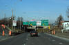
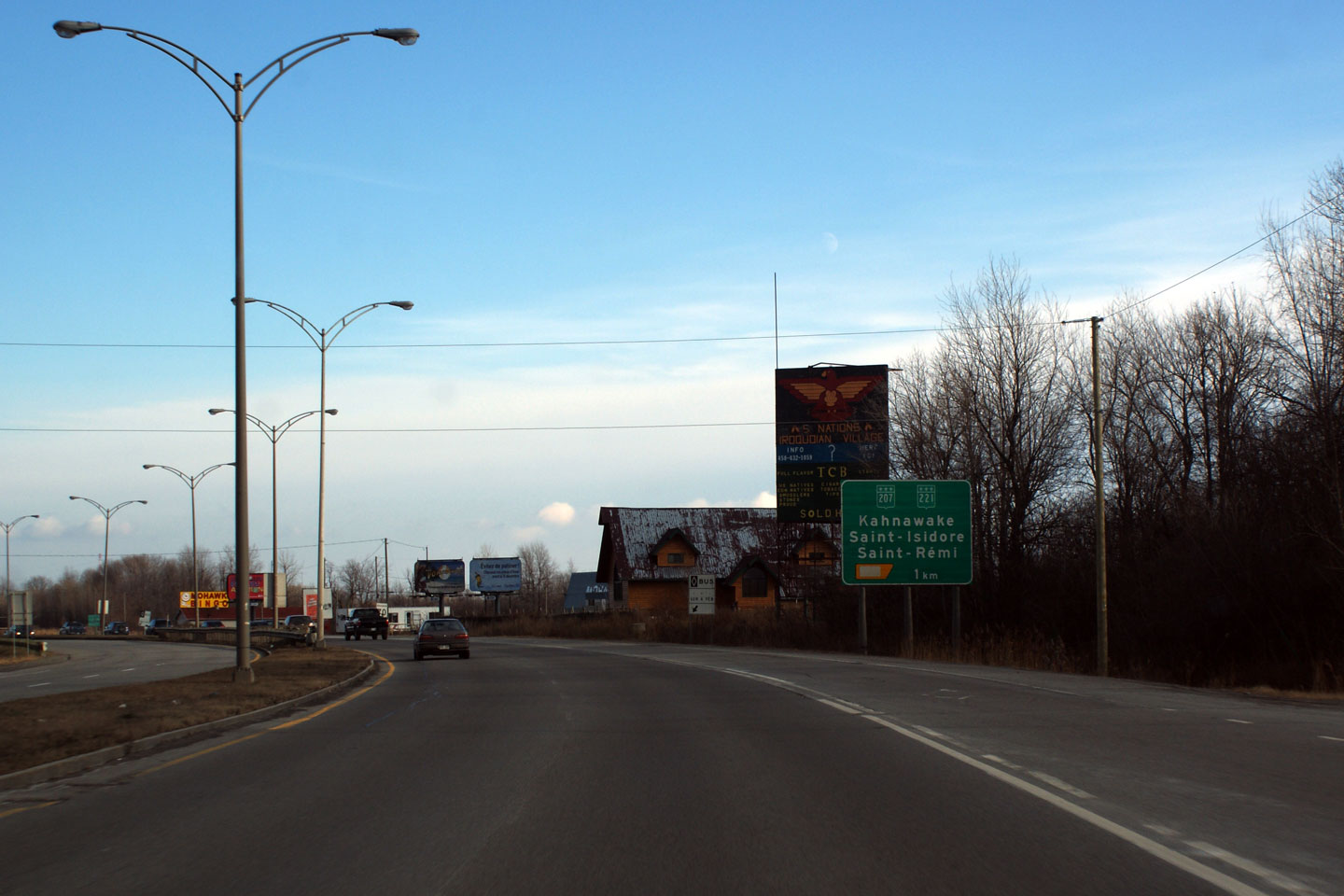
MRC de Roussellon
Reserve Indienne Kahnawake 14
|
Ground
mounted advanced signage for the R-207/R-221 interchange. |

High-res |
|
Photographed by: AsphaltPlanet.ca |
Date: 12/7/2008 |
|
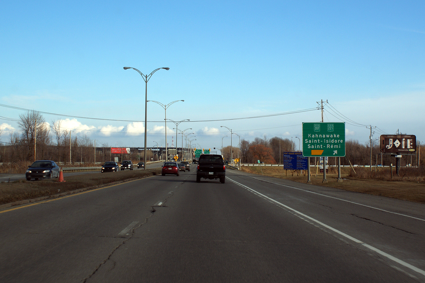
MRC de Roussellon
Reserve Indienne Kahnawake 14
|
Guide
signage for the ramp to R-207 and R-221. |
High-res |
|
Photographed by: AsphaltPlanet.ca |
Date: 12/7/2008 |
|
MRC de Beauharnois-Salaberry
Salaberry-de-Valleyfield
|
Due
to the lack of merge lanes from the R-207/R-221 interchange the ramp
terminals are signal controlled during peak periods. |

High-res |
|
Photographed by: AsphaltPlanet.ca |
Date: 12/7/2008 |
|
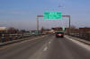
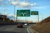
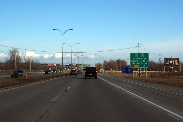
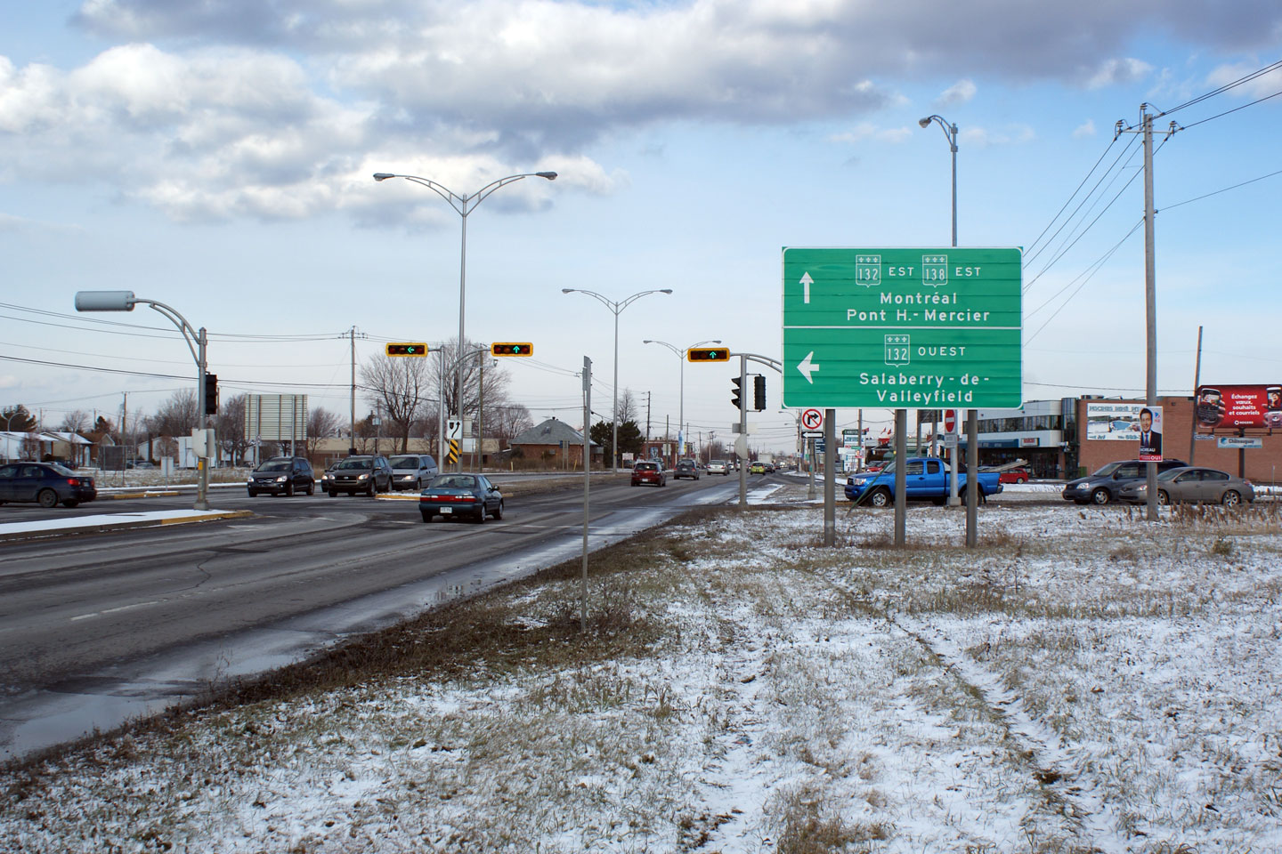
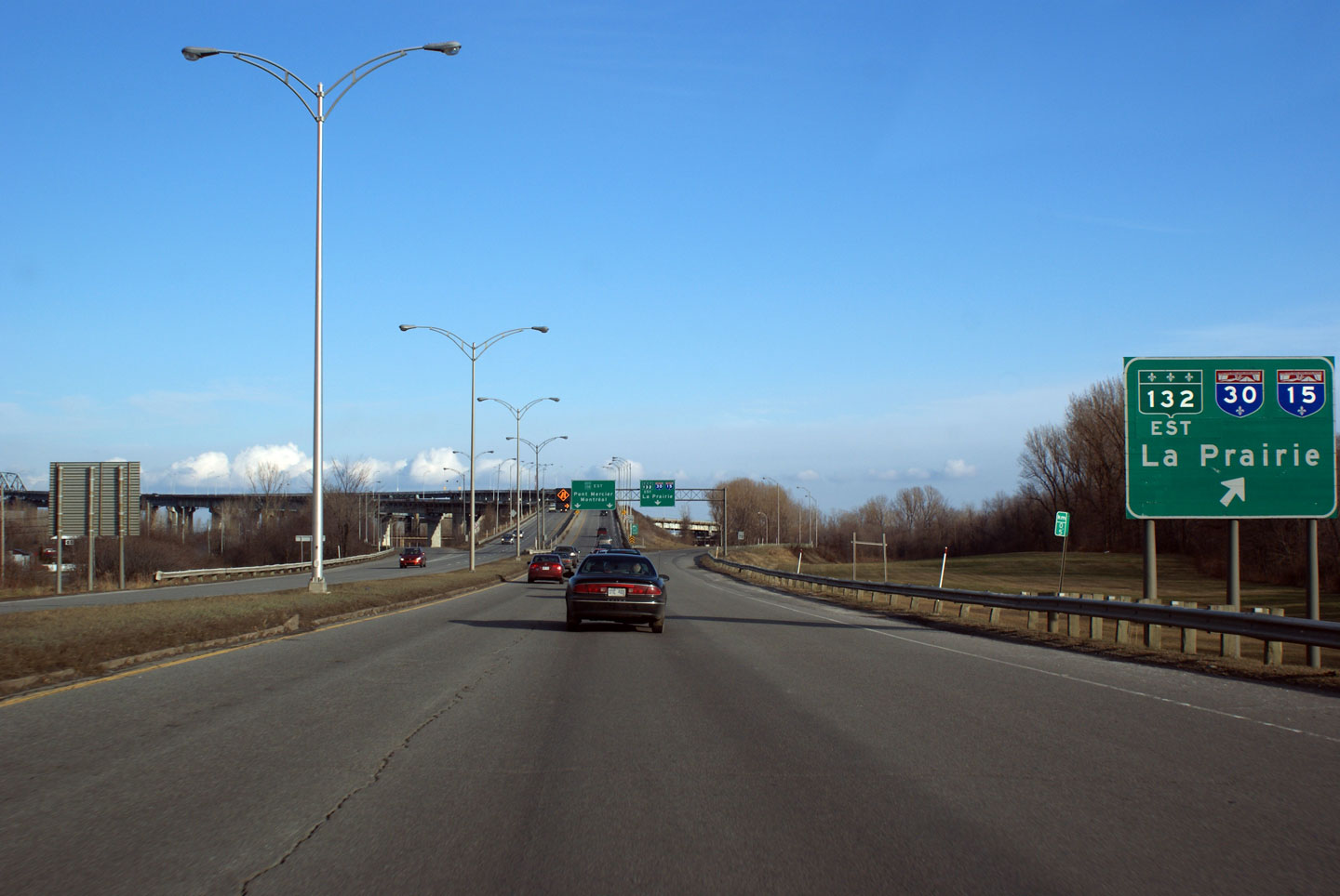
MRC de Beauharnois-Salaberry
Salaberry-de-Valleyfield
|
Overhead
signage for the R-132 East intersection. |

High-res |
|
Photographed by: AsphaltPlanet.ca |
Date: 12/7/2008 |
|
MRC de Roussellon
Reserve Indienne Kahnawake 14
|
Ground
mounted signage for the ramp to R-132 East. |
High-res |
|
Photographed by: AsphaltPlanet.ca |
Date: 12/7/2008 |
|
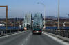
MRC de Roussellon
Reserve Indienne Kahnawake 14
|
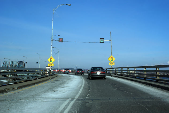
There
is no merge lane for traffic entering the bridge from R-132.
During rush hour traffic is controlled by traffic signals. In
off-peak times each approach is reduced to a single lane for freeflow
merging. |

High-res |
|
Photographed by: AsphaltPlanet.ca |
Date: 12/7/2008 |
|
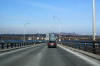
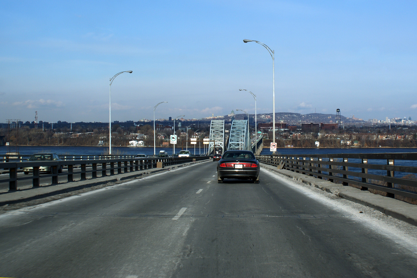
MRC de Roussellon
Reserve Indienne Kahnawake 14
|
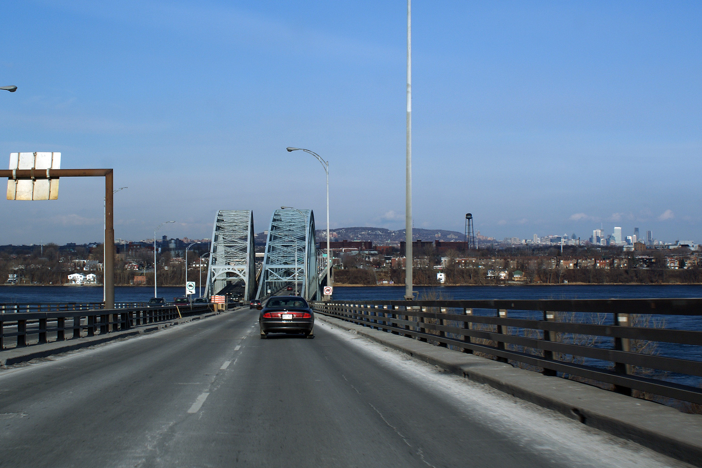
The
Mercier Bridge is comprised of two sets of twinned overhead through
truss bridges. The westbound bridge was completed in 1934, while
the newer eastbound span was added to address congestion problems in the
1960s. |
|
|
High-res |
 |
|
Photographed by: AsphaltPlanet.ca |
Date: 12/7/2008 |
High-res |
|
Agglomeration de Montreal
La Salle
|
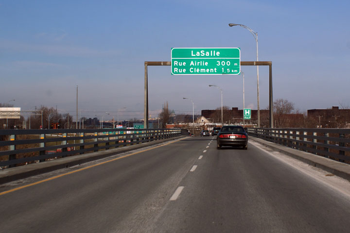
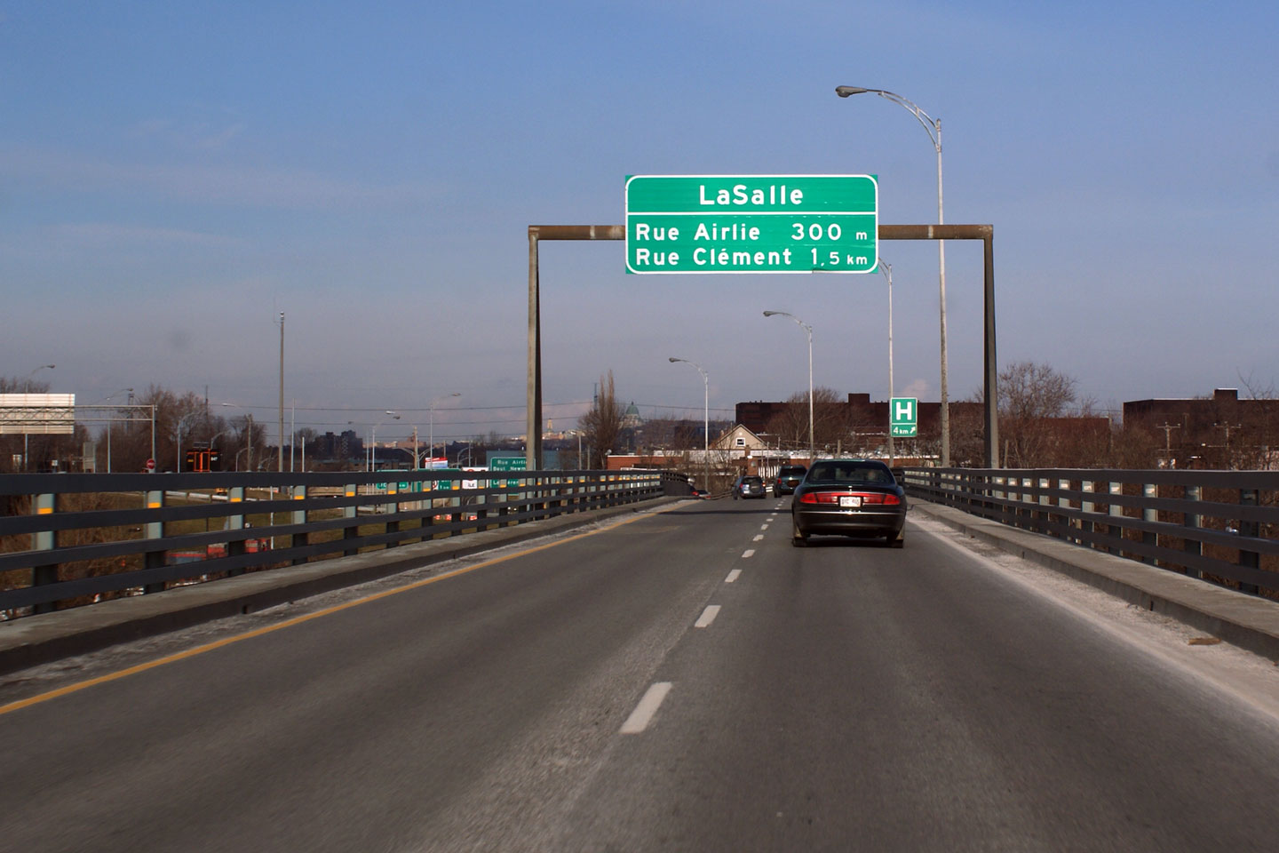
Signage
informing travelers of the first two exits in LaSalle once across the
Mercier Bridge. |
|
|
Photographed by: AsphaltPlanet.ca |
Date: 12/7/2008 |
High-res |
|
Agglomeration de Montreal
La Salle
|
Overhead
signage in LaSalle. Note the temporary cross-over between the
westbound and eastbound carriageways. This is remnants of a
reconstruction project that took place on the Mercier bridge. |
 |
|
Photographed by: AsphaltPlanet.ca |
Date: 12/7/2008 |
High-res |
|
Agglomeration de Montreal
La Salle
|
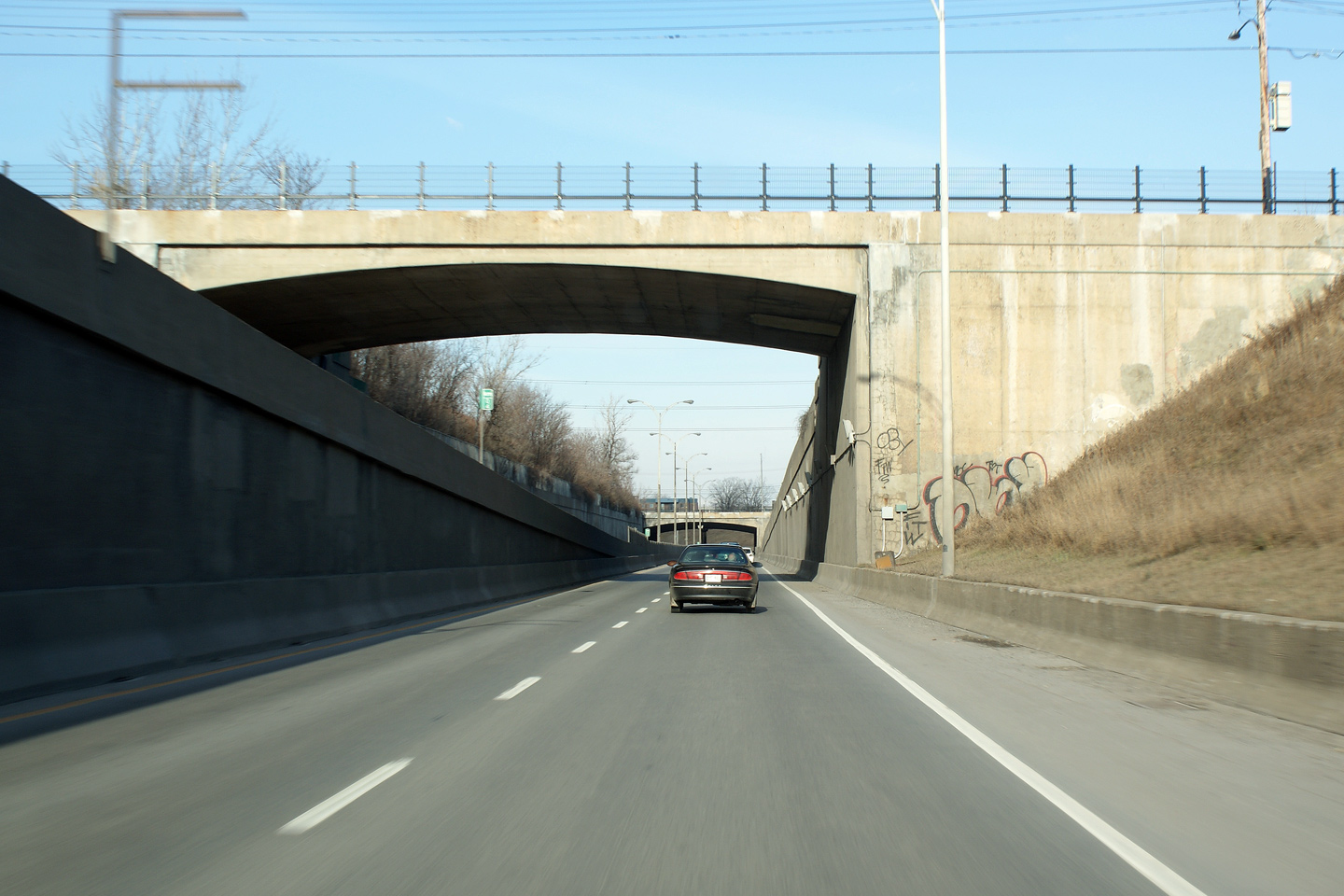
The
Airlie Road overpass appears quite high from the eastbound lanes of
Route 138. |

|
|
Photographed by: AsphaltPlanet.ca |
Date: 12/7/2008 |
High-res |
|
Agglomeration de Montreal
La Salle
|
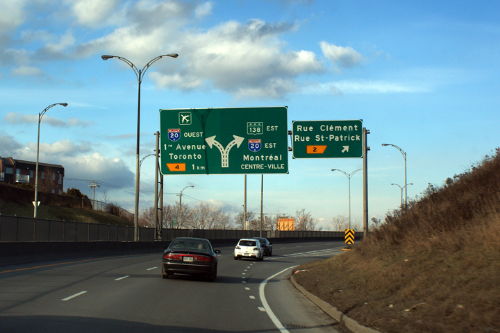
Eastbound
view in advance of the Rue Clement and Rue St Patrick interchange. |
|
|
Photographed by: AsphaltPlanet.ca |
Date: 12/7/2008 |
High-res |
|
Agglomeration de Montreal
La Salle
|
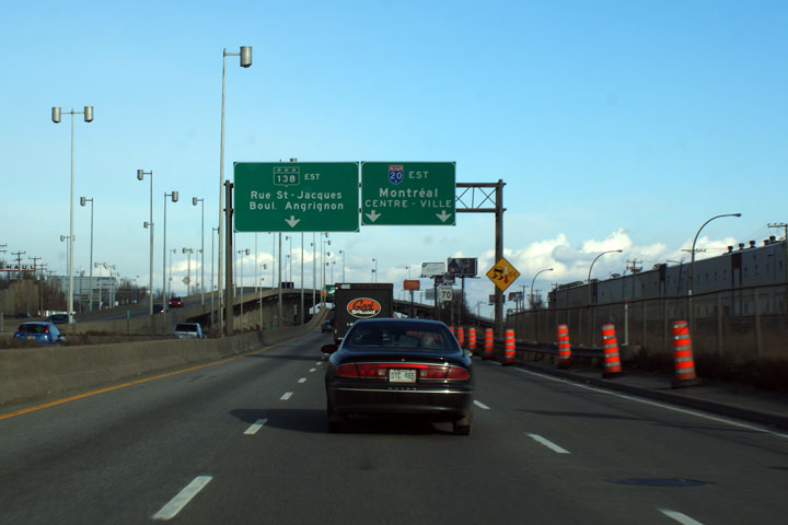
First
of two overhead diagram signs for the Autoroute 20 interchange. |
 |
|
Photographed by: AsphaltPlanet.ca |
Date: 12/7/2008 |
High-res |
|
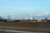
Agglomeration de Montreal
La Sud-Ouest
|
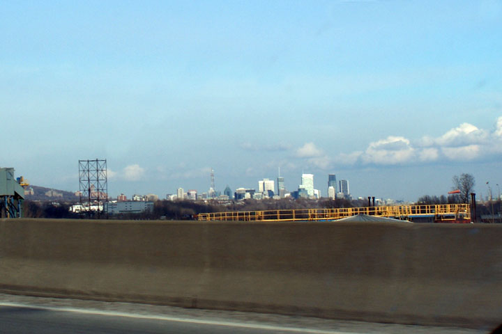
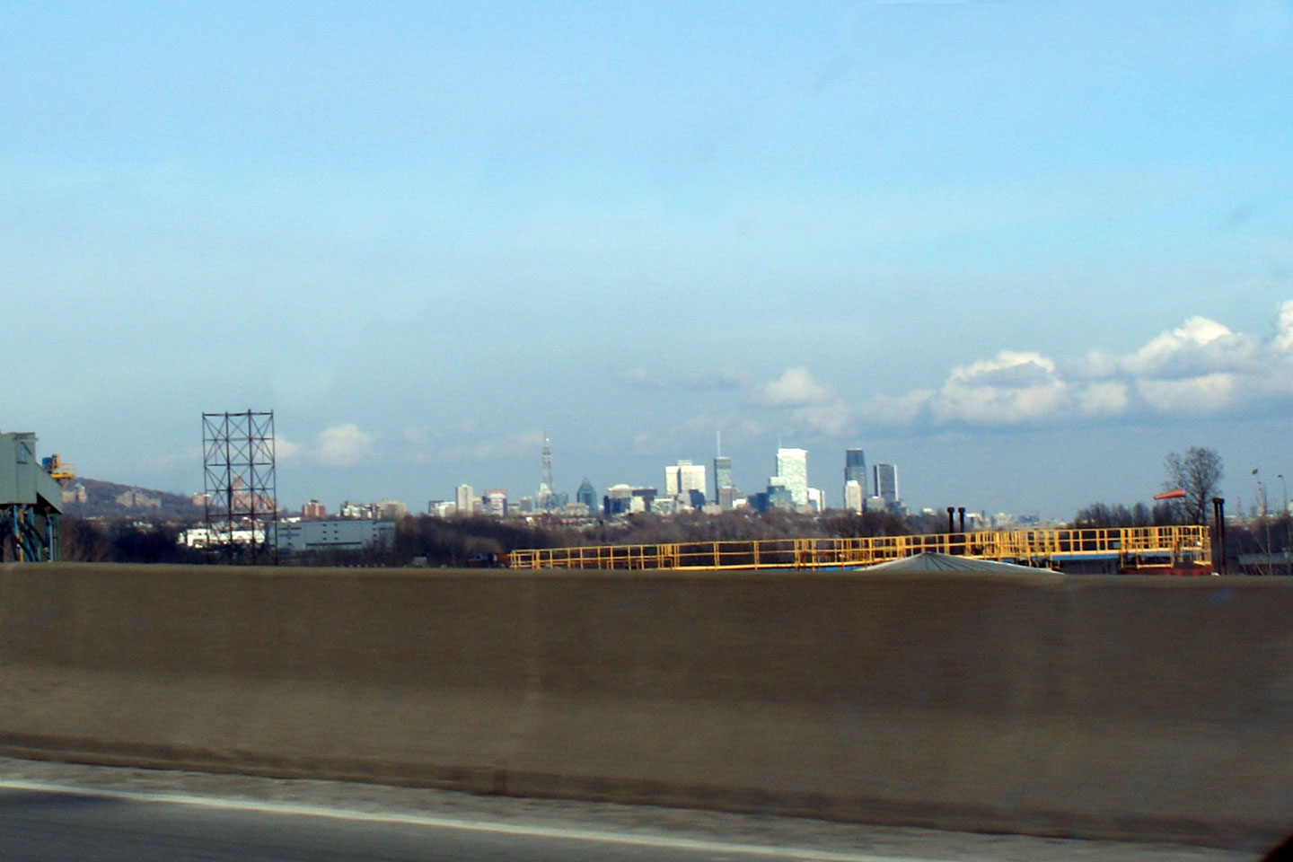
The
Montreal Skyline can be seen from R-138. |
|
|
Photographed by: AsphaltPlanet.ca |
Date: 12/7/2008 |
High-res |
|
Agglomeration de Montreal
La Sud-Ouest
|
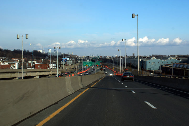
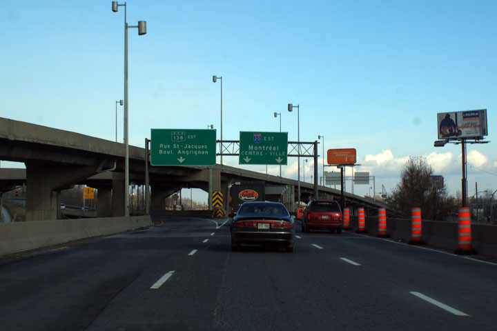
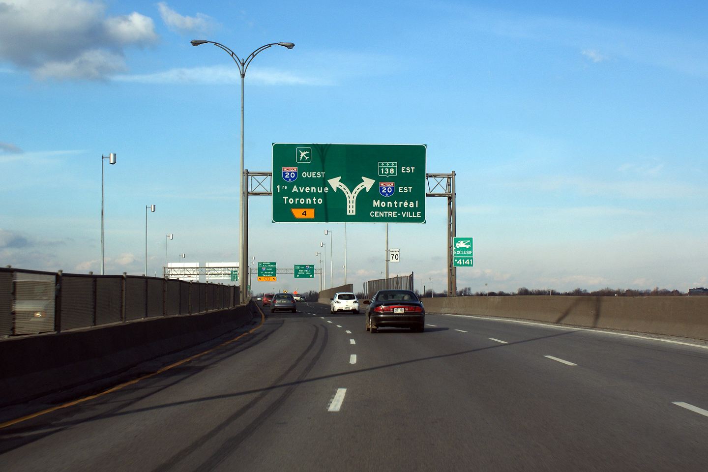
Second
of two overhead diagram signs overtop of R-138 in advance of A-20. |
|
|
Photographed by: AsphaltPlanet.ca |
Date: 12/7/2008 |
High-res |
|
Agglomeration de Montreal
La Sud-Ouest
|
R-138
Est follows A-20 for a short segment acting somewhat like a collector
lane. |
 |
|
Photographed by: AsphaltPlanet.ca |
Date: 12/7/2008 |
High-res |
|
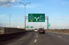
Agglomeration de Montreal
La Sud-Ouest
|
The
eastern A-20/R-138 interchange is particularly complex. At this
interchange the A-20 carriageways shift so that the eastbound lanes are
actually to the left of the westbound lanes. |
 |
|
Photographed by: AsphaltPlanet.ca |
Date: 12/7/2008 |
High-res |
|
Agglomeration de Montreal
La Sud-Ouest
|
R-138
departs to become a Montreal surface street from the left side of the
A-20 collector lanes. |

|
|
Photographed by: AsphaltPlanet.ca |
Date: 12/7/2008 |
High-res |


