AsphaltPlanet.ca > Québec > Autoroute 25
|
Southern Terminus: A-20 and R-132 interchange
in Longueuil.
Northern Terminus: R-158 between Saint-Roch-de-l'Achigan and Saint-Esprit. Regions: Agglomeration de Longueuil, Agglomeration de Montreal, MRC de Laval, MRC de Moulins, MRC de Montcalm Routing: A-25 begins its trek in the extreme Northeastern corner of Longueuil. The freeway crosses to Montreal Island through the LaFontaine Tunnel. The highway continues northwesterly to just north of A-40. At A-40 the Highway jogs wersterly along Boul Hentri-Bourassa, crossing into Laval via Pont Pie-IX. From Laval, the highway heads northerly, past A-440 and A-640 to R-158 just south of Saint-Esprit. Links:
|
Pictures on this page are arranged in order from south to north. A-25 North photos are left-aligned in the last column, while A-25 South photos are right-aligned. Center-line pictures are centered within the last column.
|
Location |
Description |
Photo |
|||
|
North- |
South- |
||||
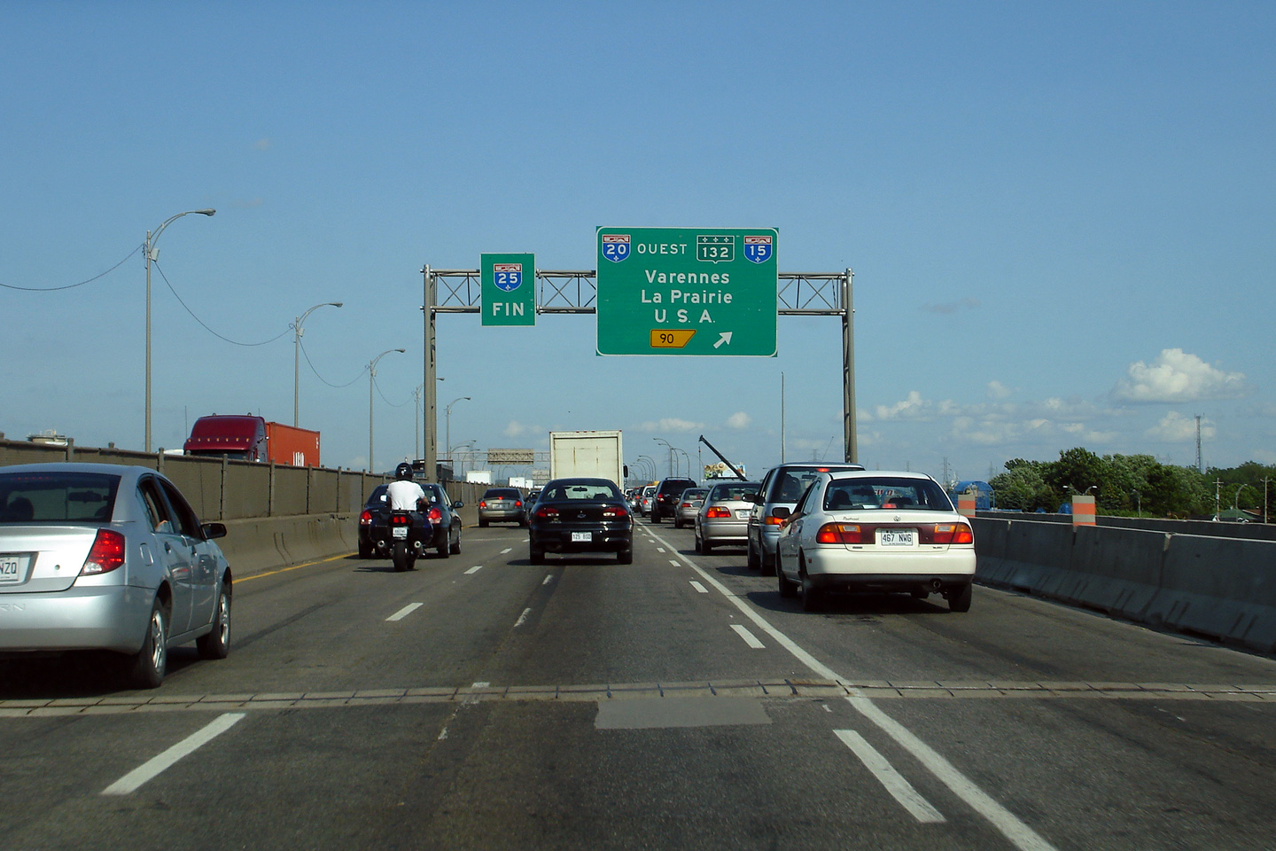
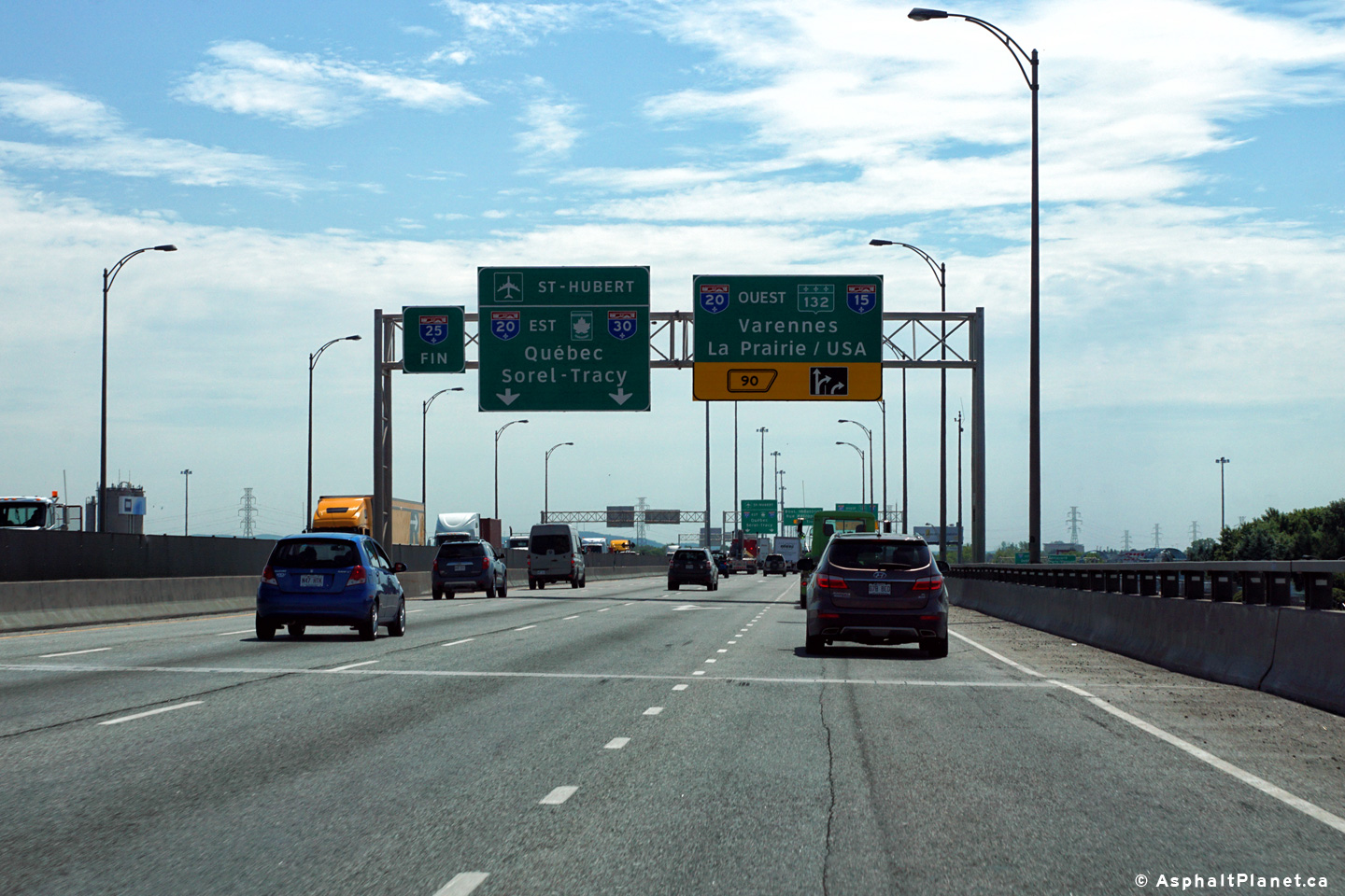
|
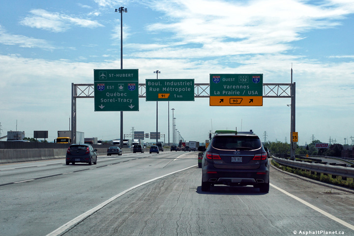
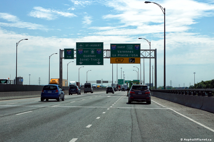
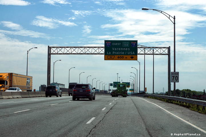
A-25 ends at a complex interchange with A-20 and R-132. Click here for A-20 West, here for A-20 East, and here for R-132. |
|||||
|
Agglomeration de Montreal |
Signage at the southern terminus of Autoroute 25 at Autoroute 20. Southbound A-25 traffic defaults to eastbound A-20 at this interchange. Traffic wishing to access westbound A-20 (towards the Champlain Bridge) or R-132 must follow the single lane ramp to the right.
Signalisation au terminus sud de l'autoroute 25 à l'autoroute 20. A-25 direction sud par défaut du trafic vers l'est à l'A-20 à cet échangeur. Trafic souhaitant accéder à l'A-20 direction ouest (vers le pont Champlain) ou R-132 doit suivre la rampe à une seule voie vers la droite. |
 |
|||
|
Date: 7/5/2006 |
High-res: (1440x960) (2400x1600) | ||||
|
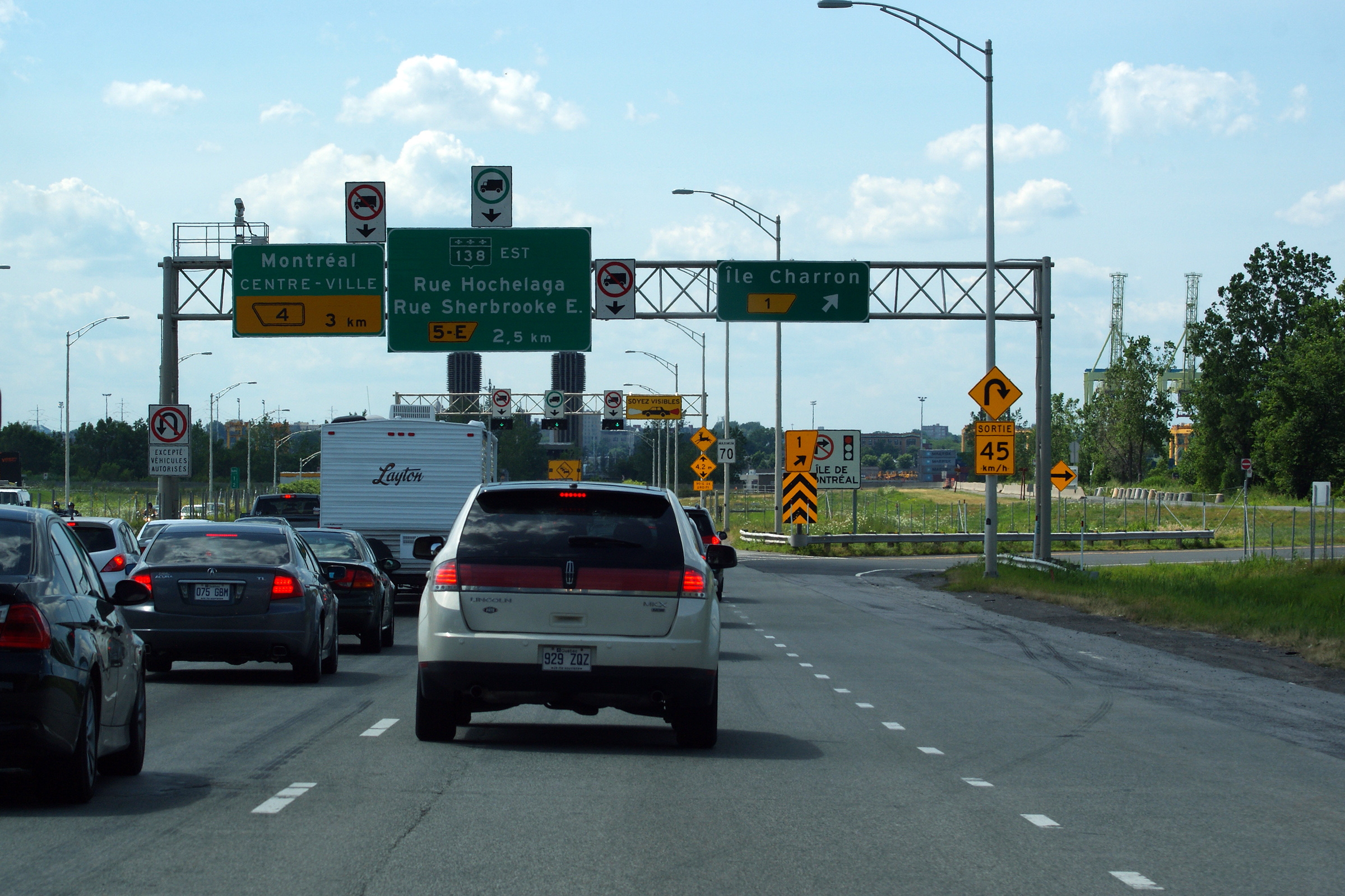
Agglomeration de Montreal |
Northbound ramp to Île Charron. The Île Charron interchange is of a unique 'looped windmill' cloverleaf design. Quebec's autoroutes often feature atypical interchange designs.
Rampe en direction nord jusqu'à l'île Charron. L'Ile Charron échange est de conception unique trèfle «moulin en boucle». Autoroutes du Québec comportent souvent l'échange de conceptions atypiques. |
|
|||
|
Date: 7/23/2011 |
High-res: (1440x960) (2400x1600) | ||||
|
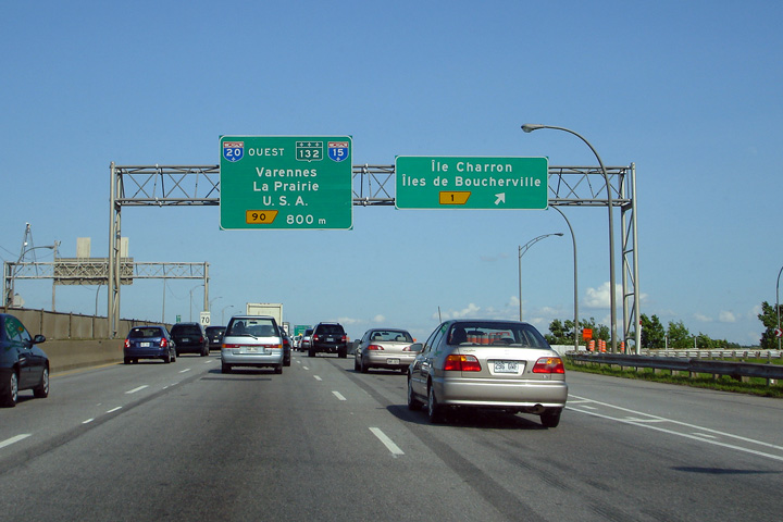
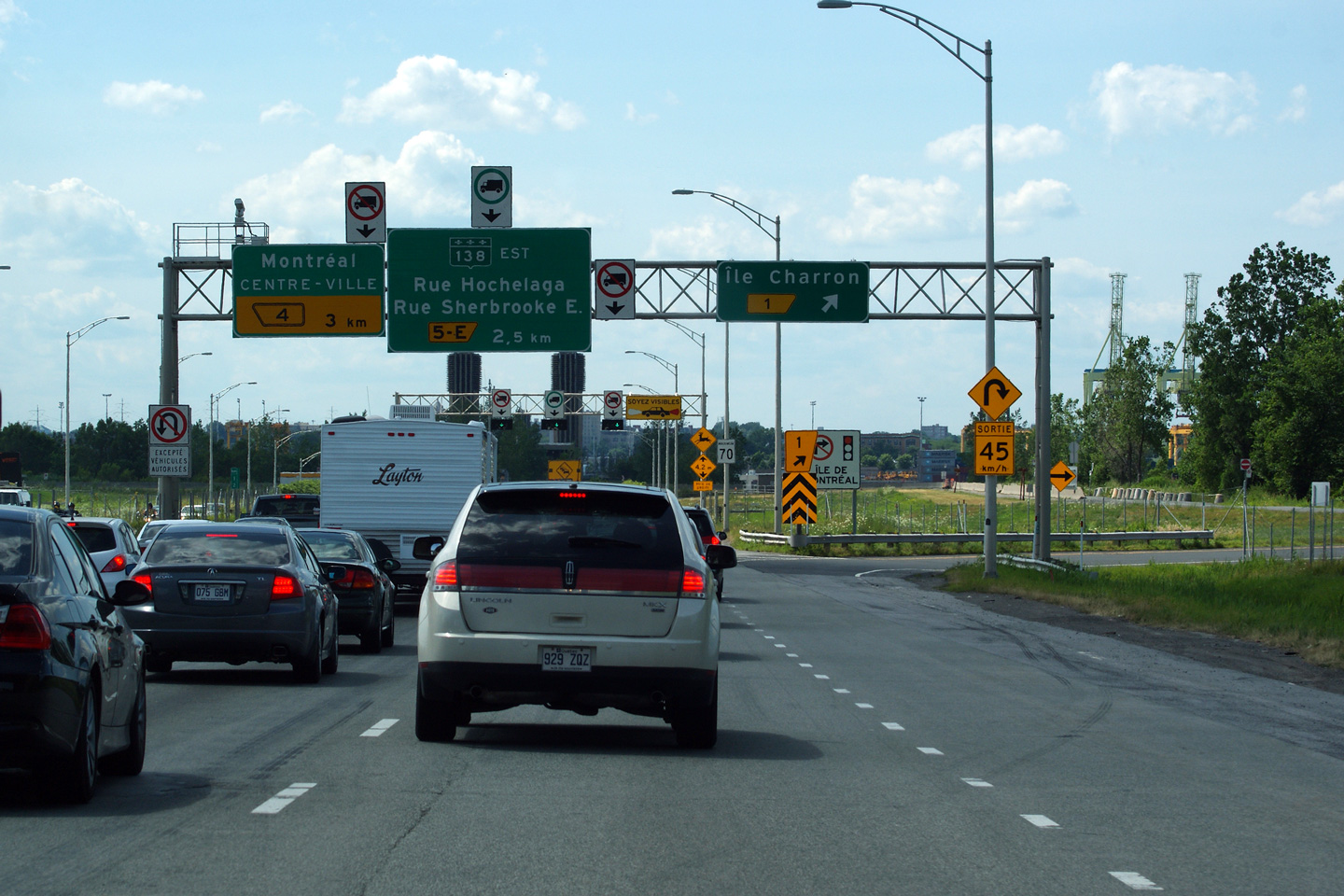
Agglomeration de Montreal |
Signage for the ramp to Île Charron. A-25 was under construction when this photo was taken. Ordinarily A-25 has an additional southbound lane between Île Charron and the Autoroute 20 interchange.
Signalisation pour la bretelle vers l'île Charron. A-25 était en construction quand cette photo a été prise. Ordinairement A-25 a une voie supplémentaire en direction sud entre l'Île Charron et l'échangeur de l'autoroute 20. |
 |
|||
|
Date: 7/5/2006 |
|||||
|
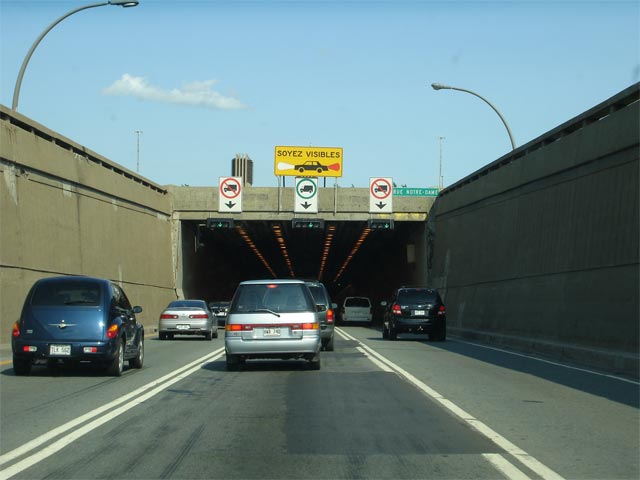
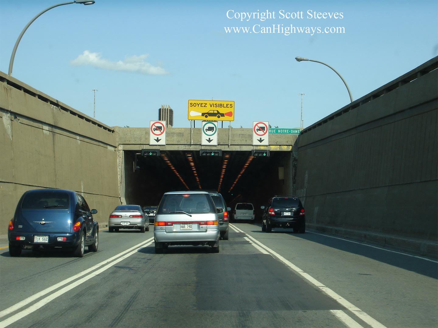
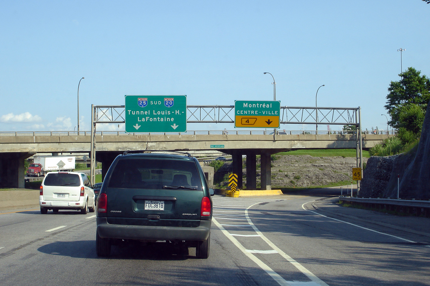
Agglomeration de Montreal |
View looking south through the approach to the LaFontaine Tunnel. Note the signage directing drivers to turn on their headlights when passing through the tunnel.
Vue vers le sud s'approche du tunnel Lafontaine. Notez la signalisation diriger les conducteurs à allumer leurs lumières pendant le passage par le tunnel. |
 |
|||
|
Date: 7/5/2006 |
High-res | ||||
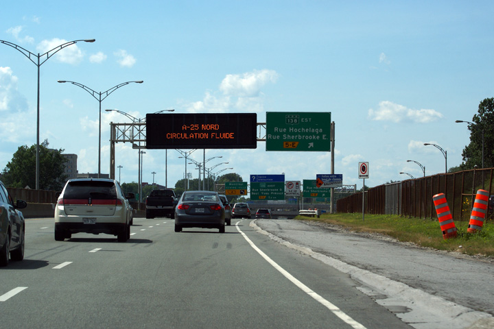
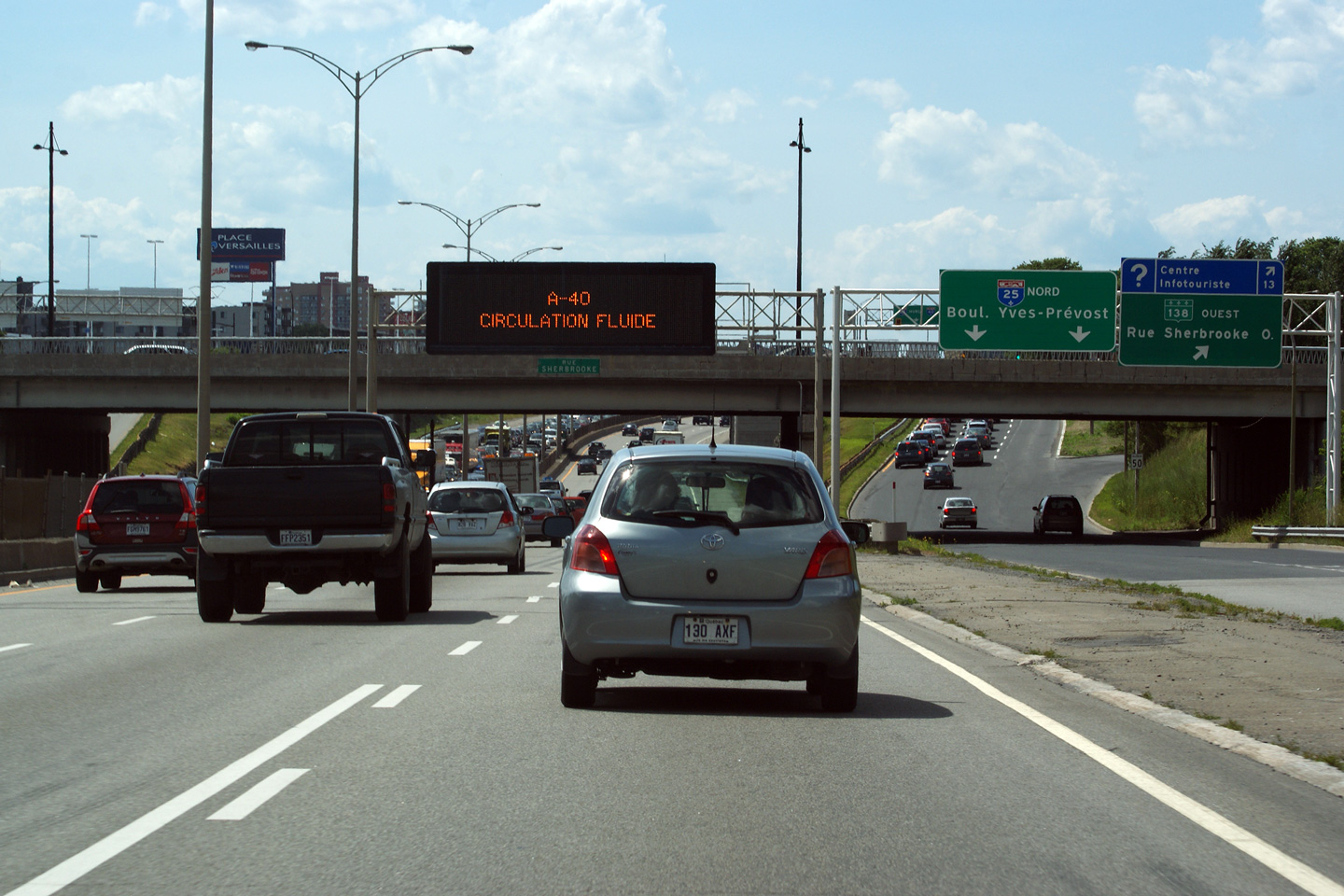
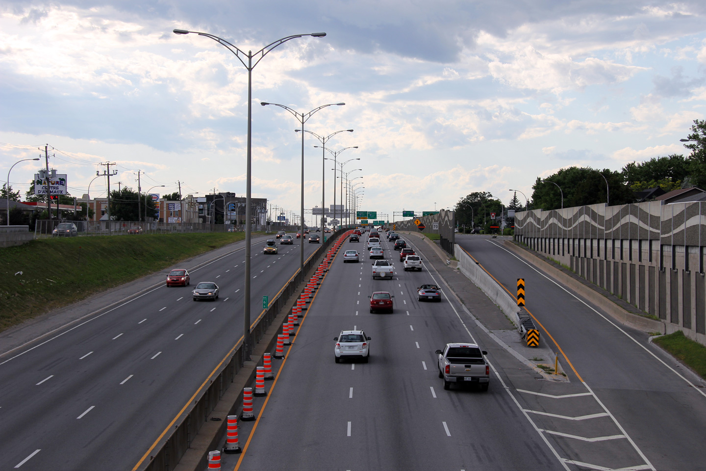
| Agglomeration de Montreal |
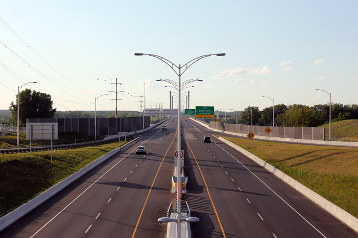
Advanced turn-off signage posted alongside a changeable message sign that announces smooth traffic along Autoroute 25 north.
Signalisation avancée posté à côté d'un panneau à message variable qui annonce une circulation fluide sur l'autoroute 25 nord. |
 |
|||
|
Date: 7/23/2011 |
High-res: (1440x960) (2400x1600) | ||||
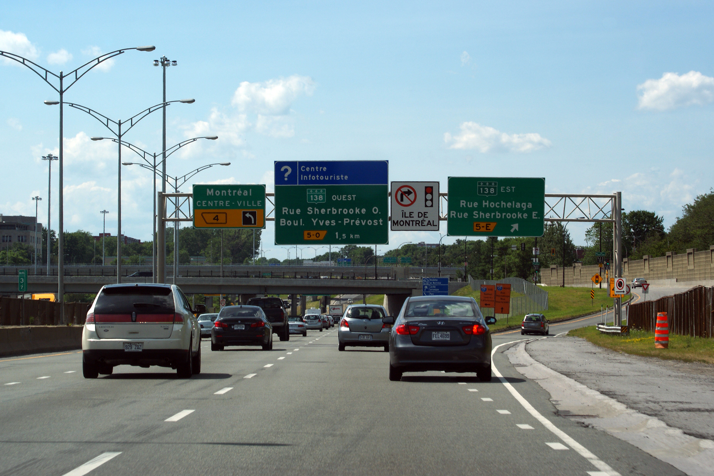
| Agglomeration de Montreal |
Northbound view as the ramp to Sherbrooke Street East departs from the right side of the freeway. The left most freeway lane departs for Soulingney Avenue just beyond this photo.
Vue vers le nord tant que la brettelle de la rue Sherbrooke Est départ de la droite de l'autoroute. Juste au-delà cette photo la voie la plus à gauche l'autoroute quitte pour Soulingney Avenue. |
 |
|||
|
Date: 7/23/2011 |
High-res: (1440x960) (2400x1600) | ||||
| Agglomeration de Montréal |
Exit for Avenue Souligney along the southbound A-25. Avenue Soulingney was the intended eastern terminus of A-720. Soulingney Ave leads about 2km west of A-25 before dead ending at Rue Dickson.
Sortie pour l'avenue Souligney le long de l'A-25 en direction sud. L'avenue Soulingney était destiné à la fin du A-720. Elle conduit à l'ouest à environ 2km de la A-25 avant de finir à la rue Dickson. |
 |
|||
|
Date: 7/5/2006 |
|||||
| Agglomeration de Montréal |
Driving northbound through the Sherbrooke Street interchange.
Circulait en direction nord à travers l'échangeur de la rue Sherbrooke. |
 |
|||
|
Date: 7/23/2011 |
High-res: (1440x960) (2400x1600) | ||||
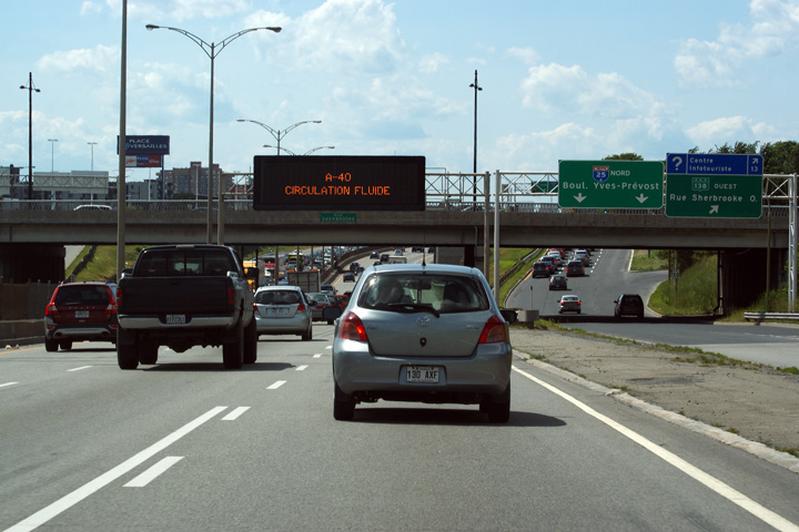
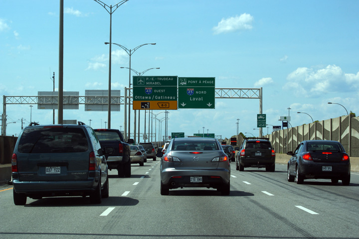
| Agglomeration de Montréal |
Advanced signage for the left-hand exit to Autoroute 40 West. Despite the downward facing arrow, the signage isn't really over any particular lane.
Signalisation avancée pour la sortie de gauche pour l'autoroute 40 Ouest. Malgré la flèche pointant vers le bas, la signalisation n'est pas vraiment plus aucune voie particulière. |
 |
|||
|
Date: 7/23/2011 |
High-res: (1440x960) (2400x1600) | ||||
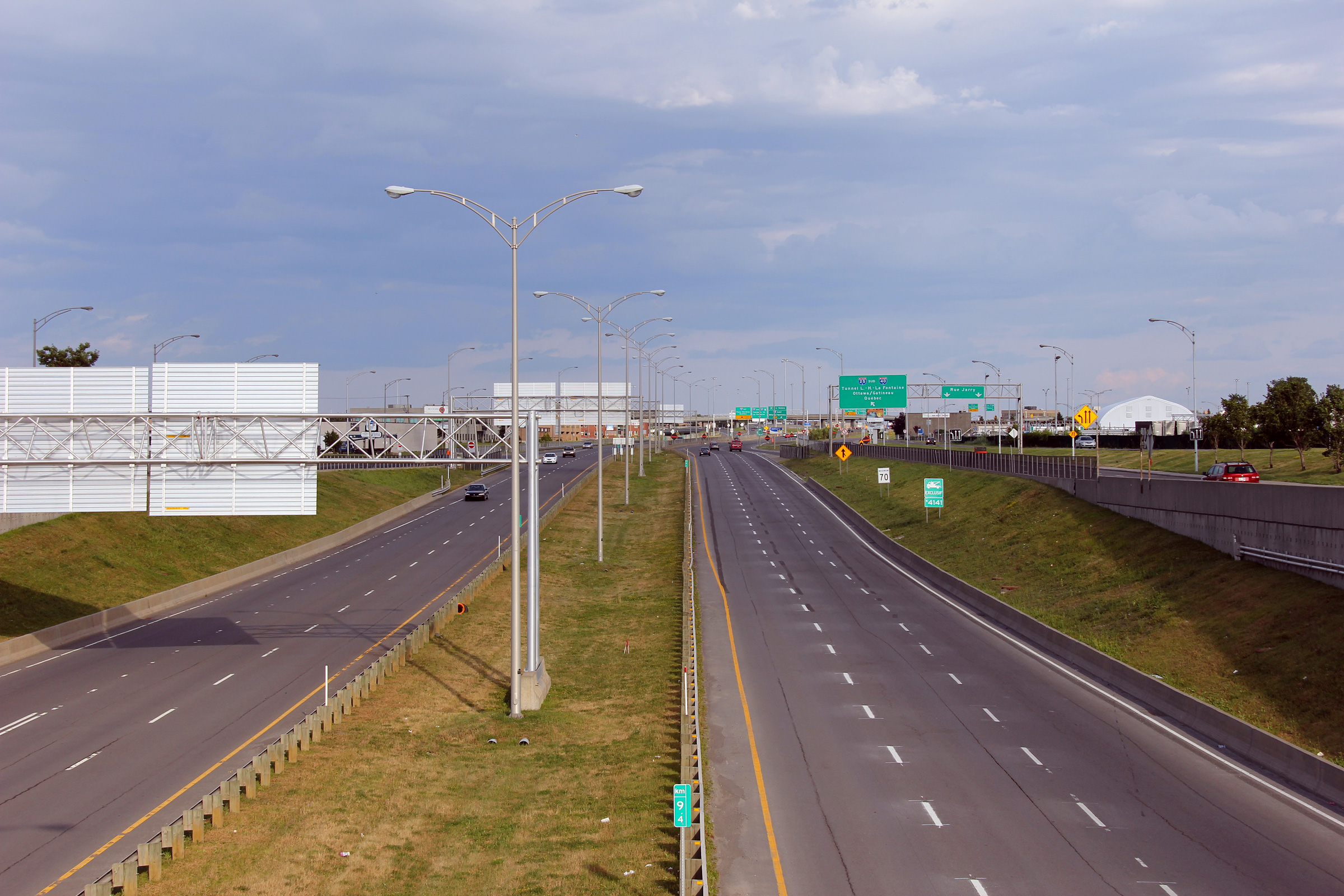
| Agglomeration de Montréal |
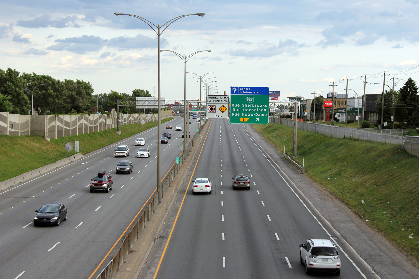
Southerly view towards Tunnel L. H. La Fontaine from the Boulevard Yves-Prévost overpass.
Vue en direction sud vers le tunnel LH La Fontaine à partir du viaduc du Boulevard Yves-Prévost. |
 |
|||
|
Date: 7/23/2011 |
High-res: (1440x960) (2400x1600) | ||||
| Agglomeration de Montréal |
Northbound view from Boulevard Yves-Prévost overpass. There isn't a southbound on-ramp that corresponds to the pictured northbound off-ramp.
Vue en direction nord à partir du viaduc du boulevard Yves-Prévost. Il n'ya pas une bretelle d'accès en direction sud que correspondent à la bretelle de sortie en direction nord dans cette photo. |
 |
|||
|
Date: 7/23/2011 |
High-res: (1440x960) (2400x1600) | ||||
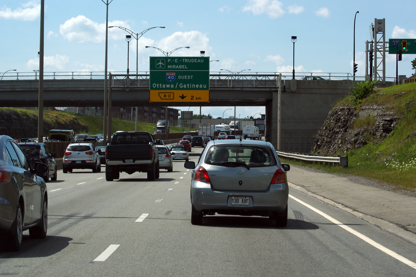
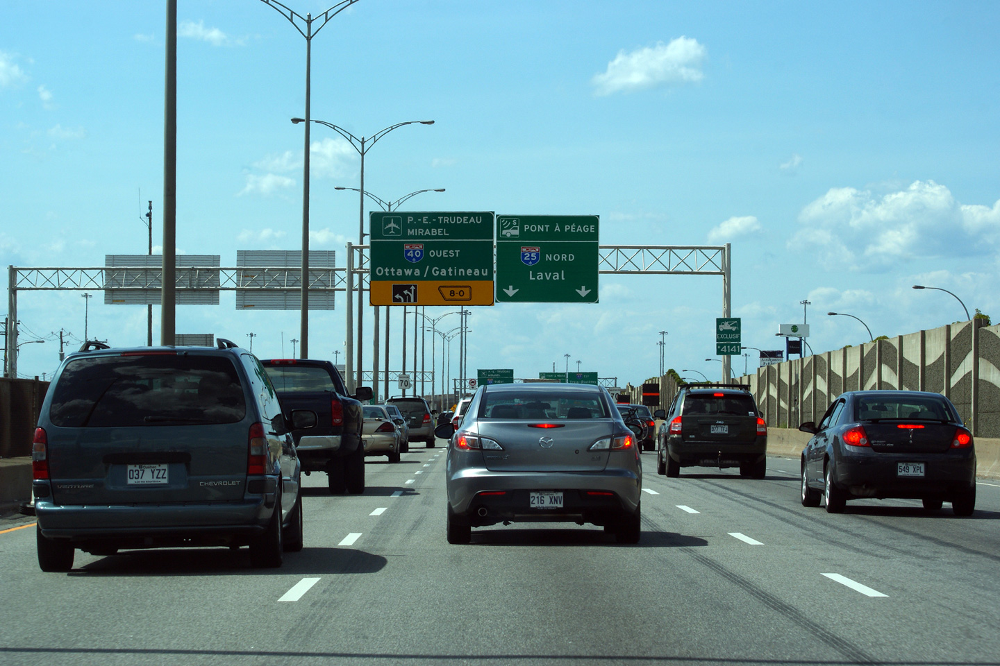
| Agglomeration de Montréal |
Advanced signage for the ramp to Autoroute 40 West.
Signalisation avancée pour la bretelle de sortie pour l'autoroute 40 Ouest. |
 |
|||
|
Date: 7/23/2011 |
High-res: (1440x960) (2400x1600) | ||||
| Agglomeration de Montréal |
Signage as the two-lane exit ramp departs the left side of Autoroute 25 for Autoroute Metropolitaine West.
Signalisation de la bretelle de sortie à deux voies quitte le côté gauche de l'autoroute 25 pour l'autoroute Métropolitaine Ouest. |
 |
|||
|
Date: 7/23/2011 |
High-res: (1440x960) (2400x1600) | ||||
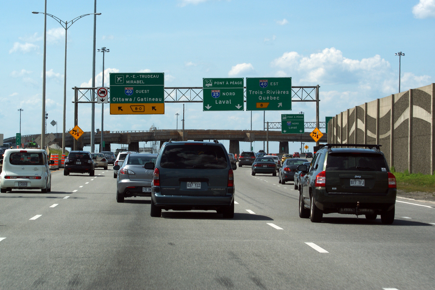
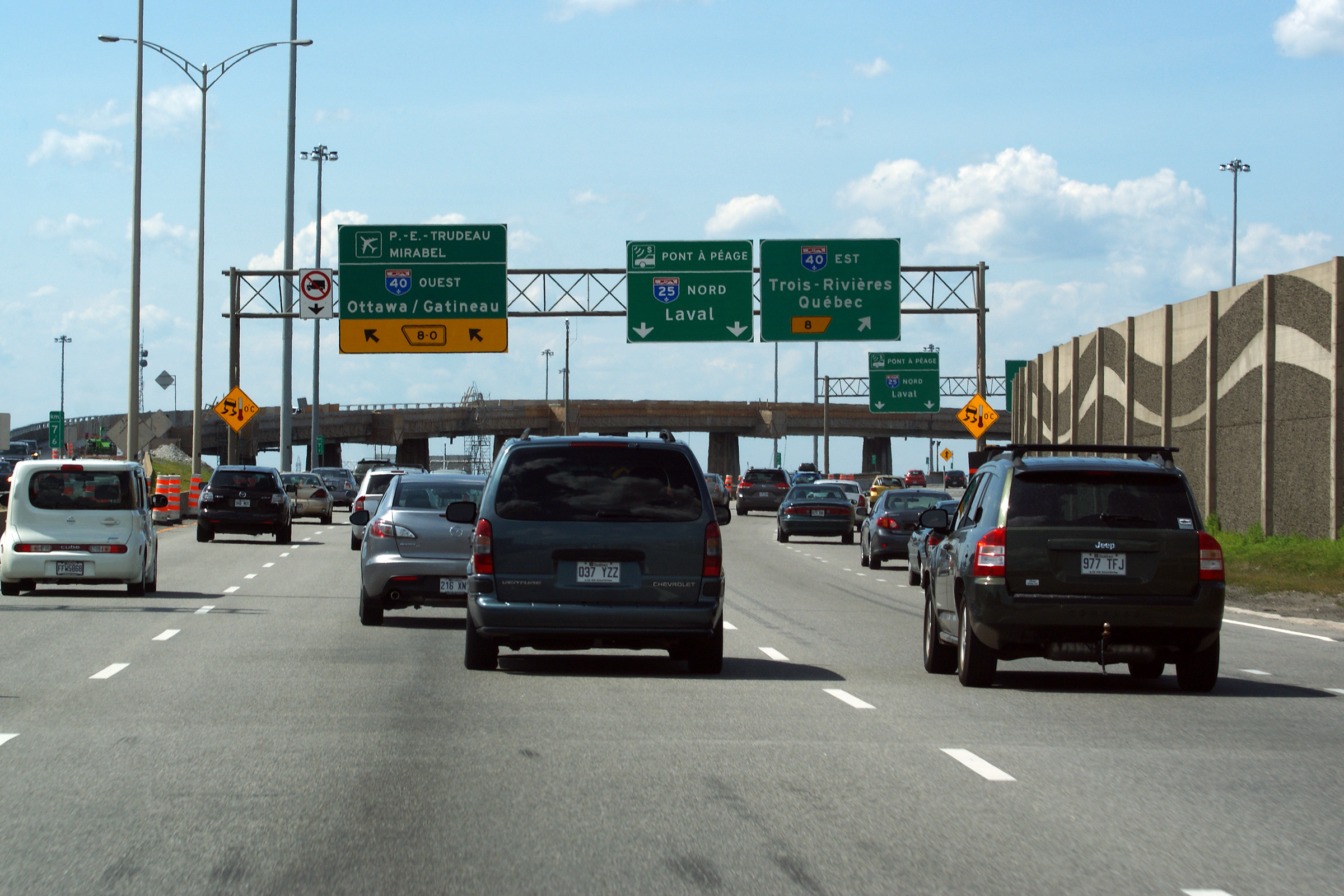
| Agglomeration de Montréal |
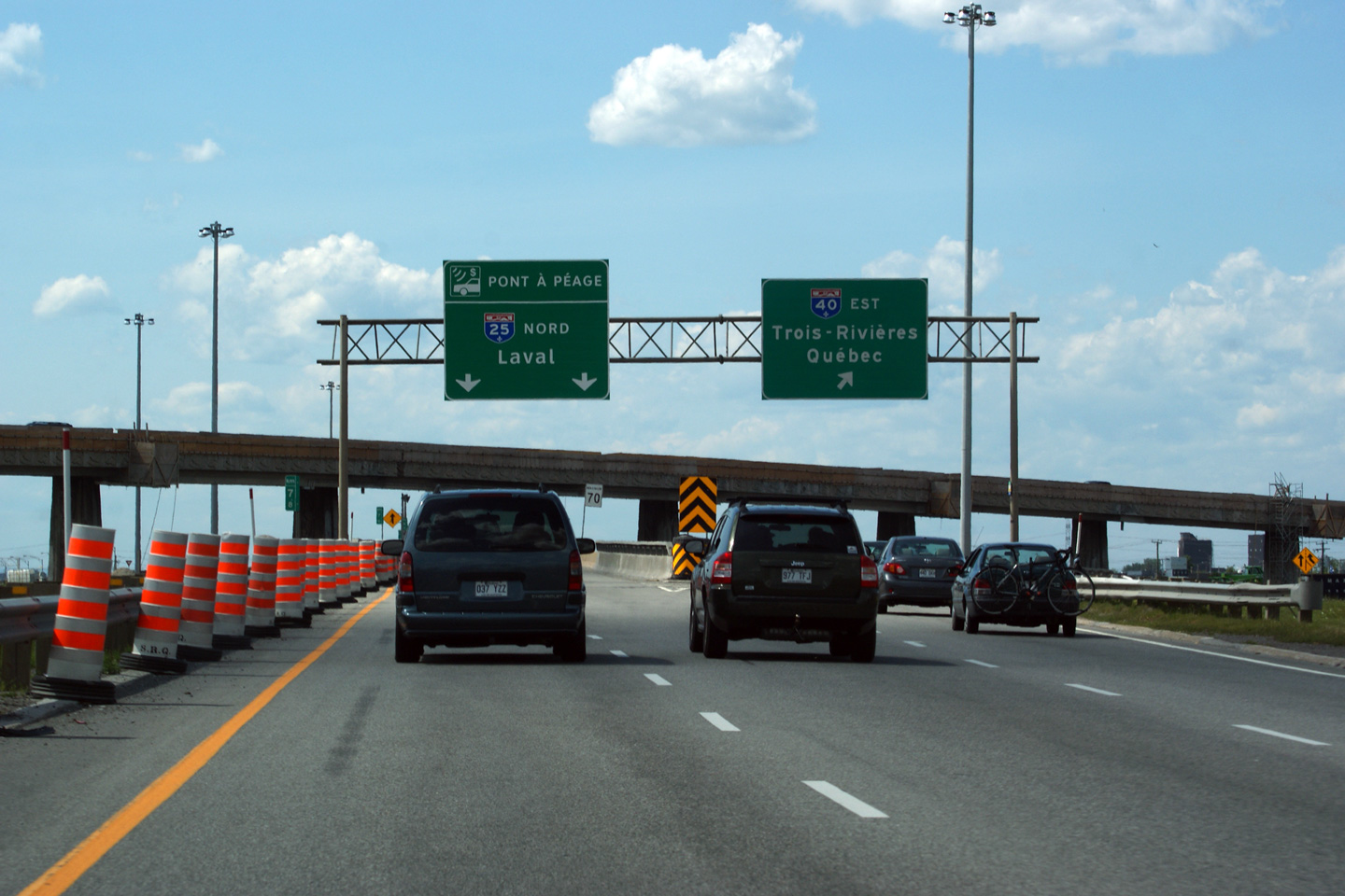
Northerly view along Autoroute 25 at the ramp to Autoroute 40 East.
Vue nord le long de l'autoroute 25 à la rampe d'accès à l'autoroute 40 Est. |
|
|||
|
Date: 7/23/2011 |
High-res: (1440x960) (2400x1600) | ||||
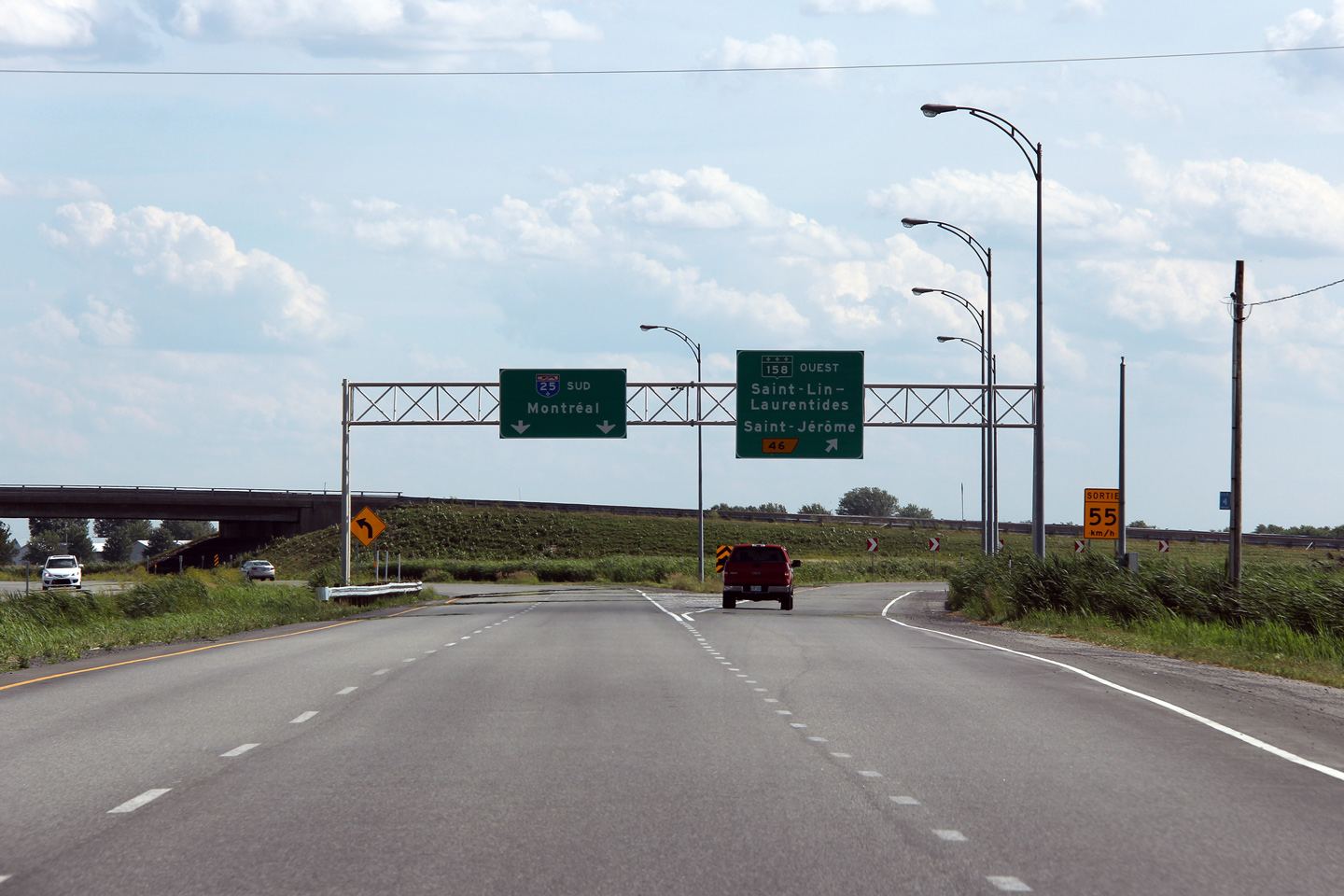
|
A-25 meets A-40 in Montreal-Est. Click here for A-40 images. |
|||||
| Agglomeration de Montréal |
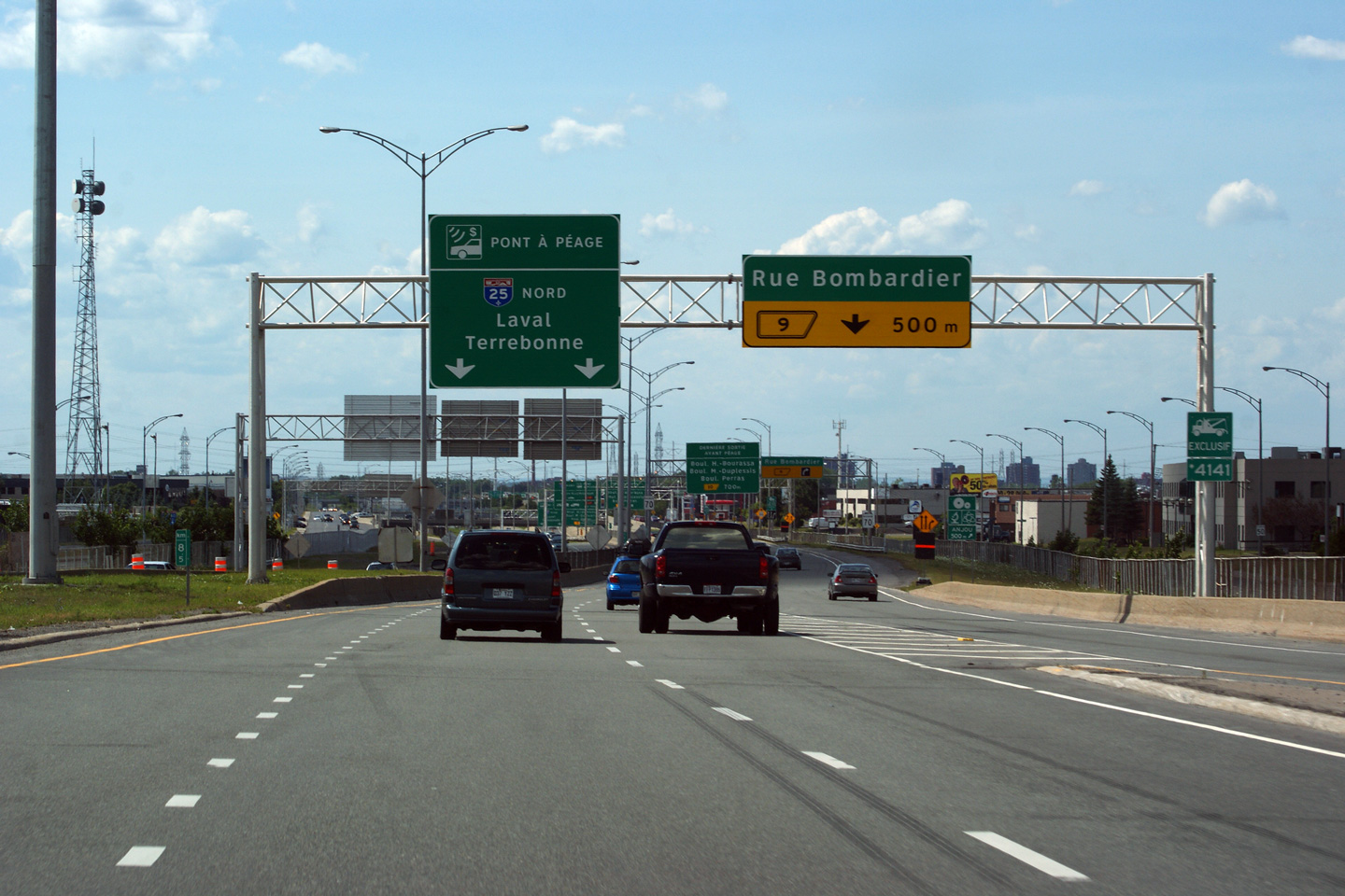
Northbound view as the on-ramp from Autoroute 40 West joins Autoroute 25 North, only to quickly depart for Rue Bombardier.
Vue en direction nord tant que la bretelle de l'autoroute 40 Ouest rejoint l'autoroute 25 Nord, seule rapidement partent pour la rue Bombardier. |
|
|||
|
Date: 7/23/2011 |
High-res: (1440x960) (2400x1600) | ||||
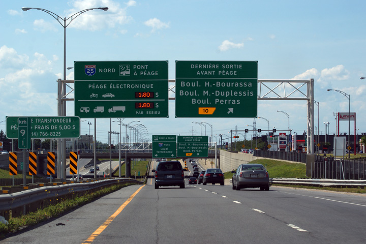
| Agglomeration de Montréal |
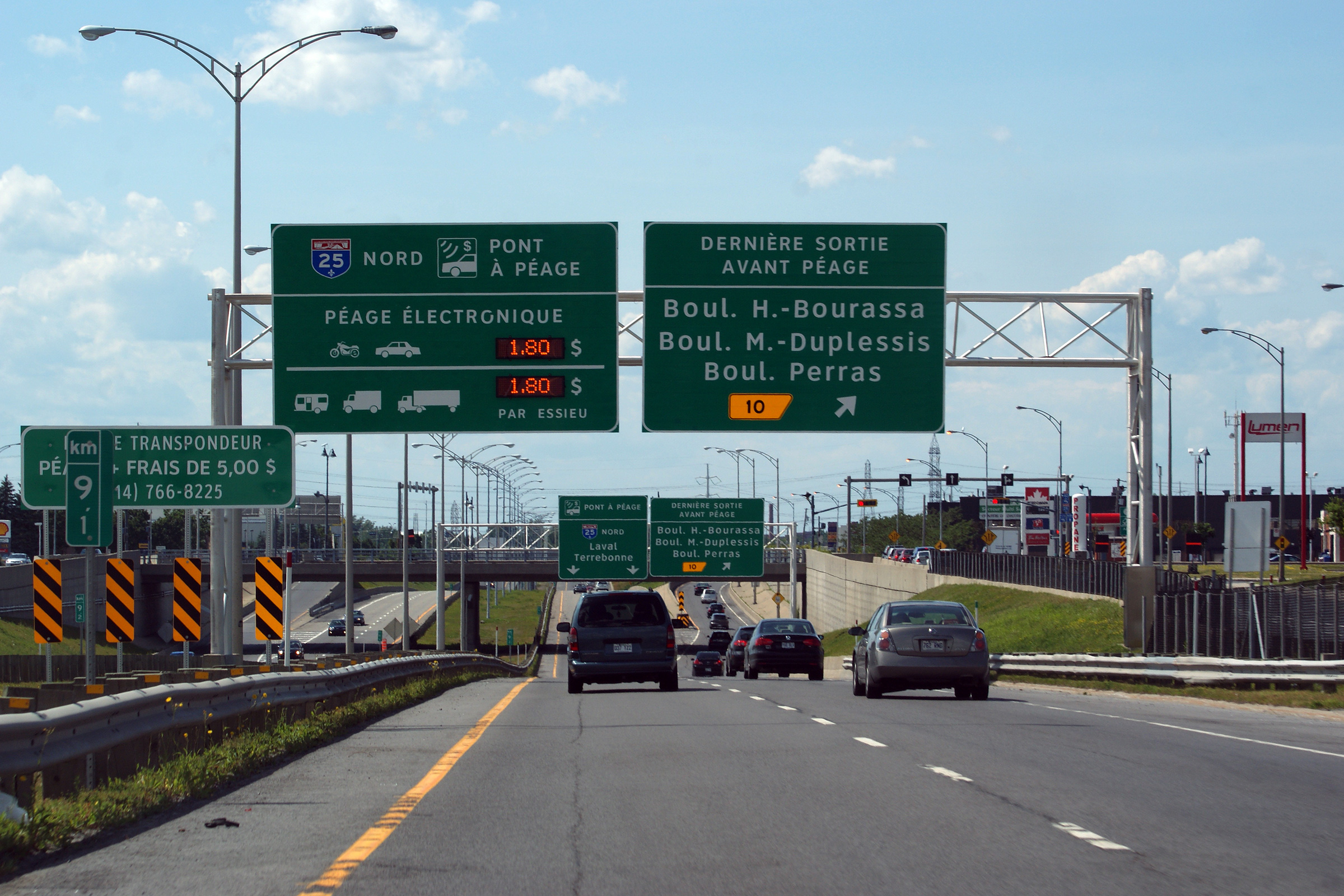
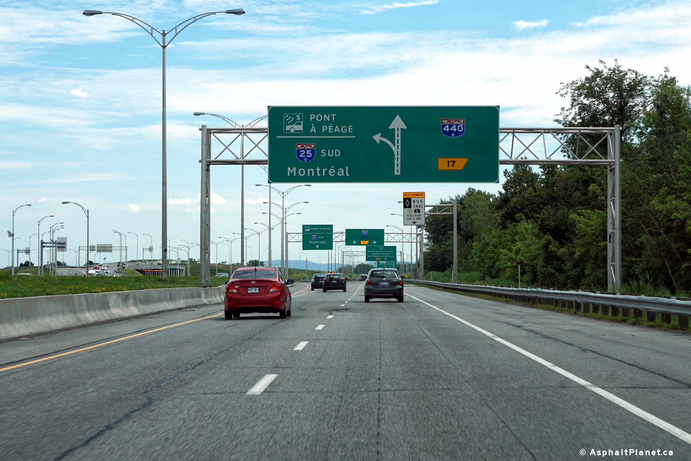
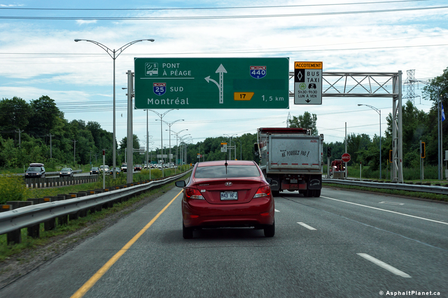
Northbound advanced signage for the ramp to exit 10. As is indicated by the signage, exit 10 is the final northbound exit along Autoroute 25 before the toll bridge to Laval. The toll rate schedule is as indicated on the signage.
Signalisation avancée pour la rampe jusqu'à la sortie 10. Comme il est indiqué par la signalisation, la sortie 10 est la dernière sortie en direction nord sur l'autoroute 25 avant le pont à péage à Laval. Le calendrier des taux de péage comme cela est indiqué sur la signalisation. |
|
|||
|
Date: 7/23/2011 |
High-res: (1440x960) (2400x1600) | ||||
| Agglomeration de Montréal |
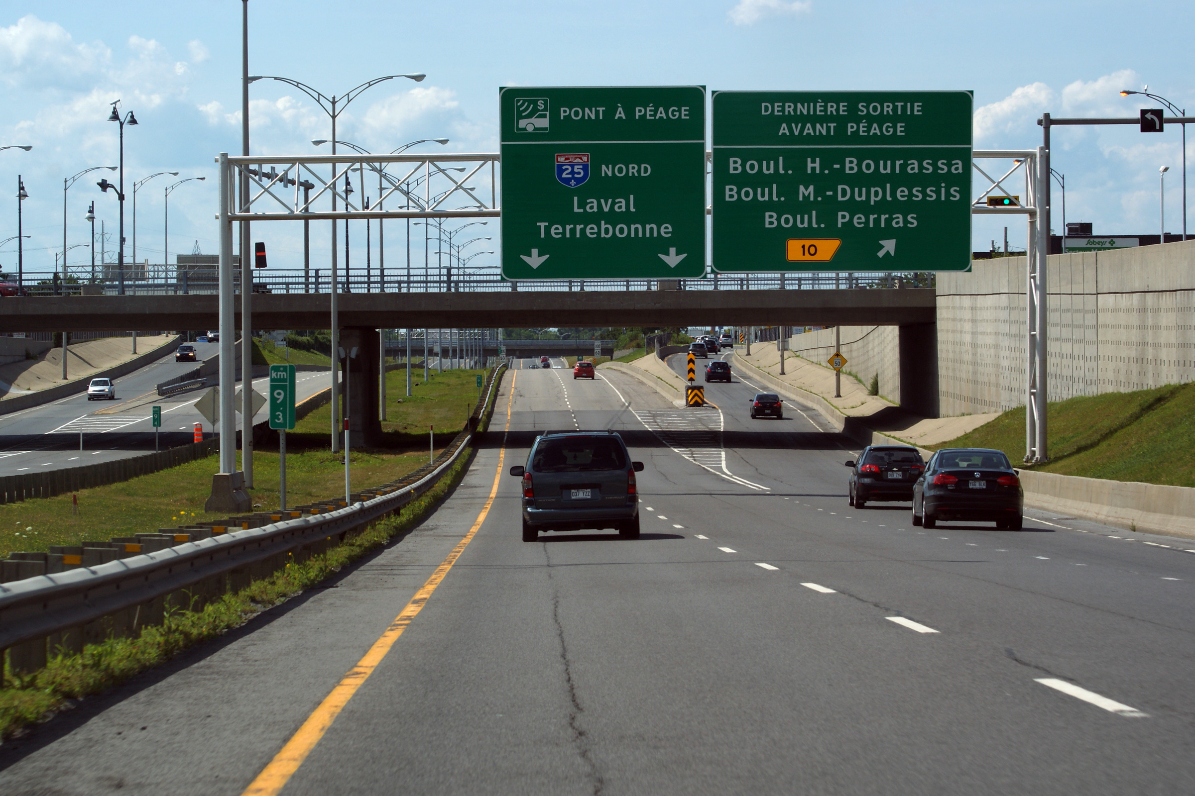
Overhead signage for exit #10.
Signalisation aérienne pour la sortie n ° 10. |
 |
|||
|
Date: 7/23/2011 |
High-res: (1440x960) (2400x1600) | ||||
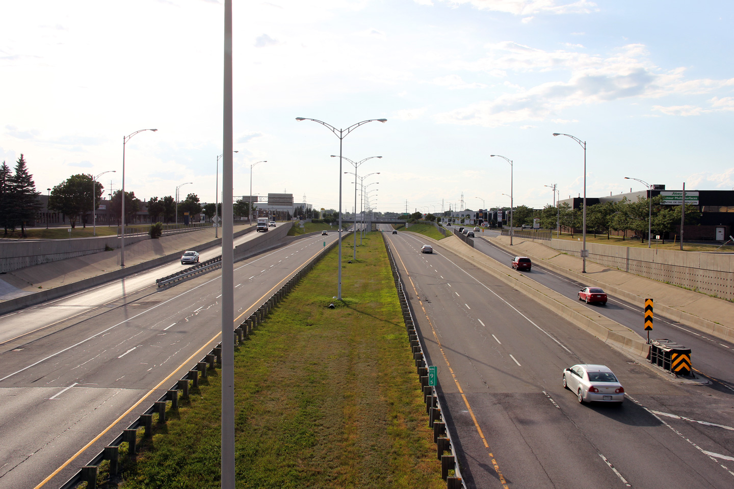
| Agglomeration de Montréal |
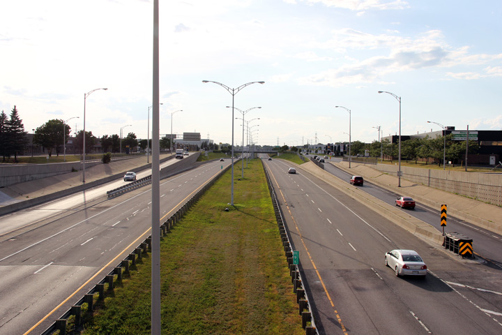
Southerly view from the Rue Bombardier overpass. The southbound carriageway was recently restriped for three through lanes.
Vue sud du viaduc de la rue Bombardier. La chaussée en direction sud a été repeint pour trois voies. |
|
|||
|
Date: 7/23/2011 |
High-res: (1440x960) (2400x1600) | ||||
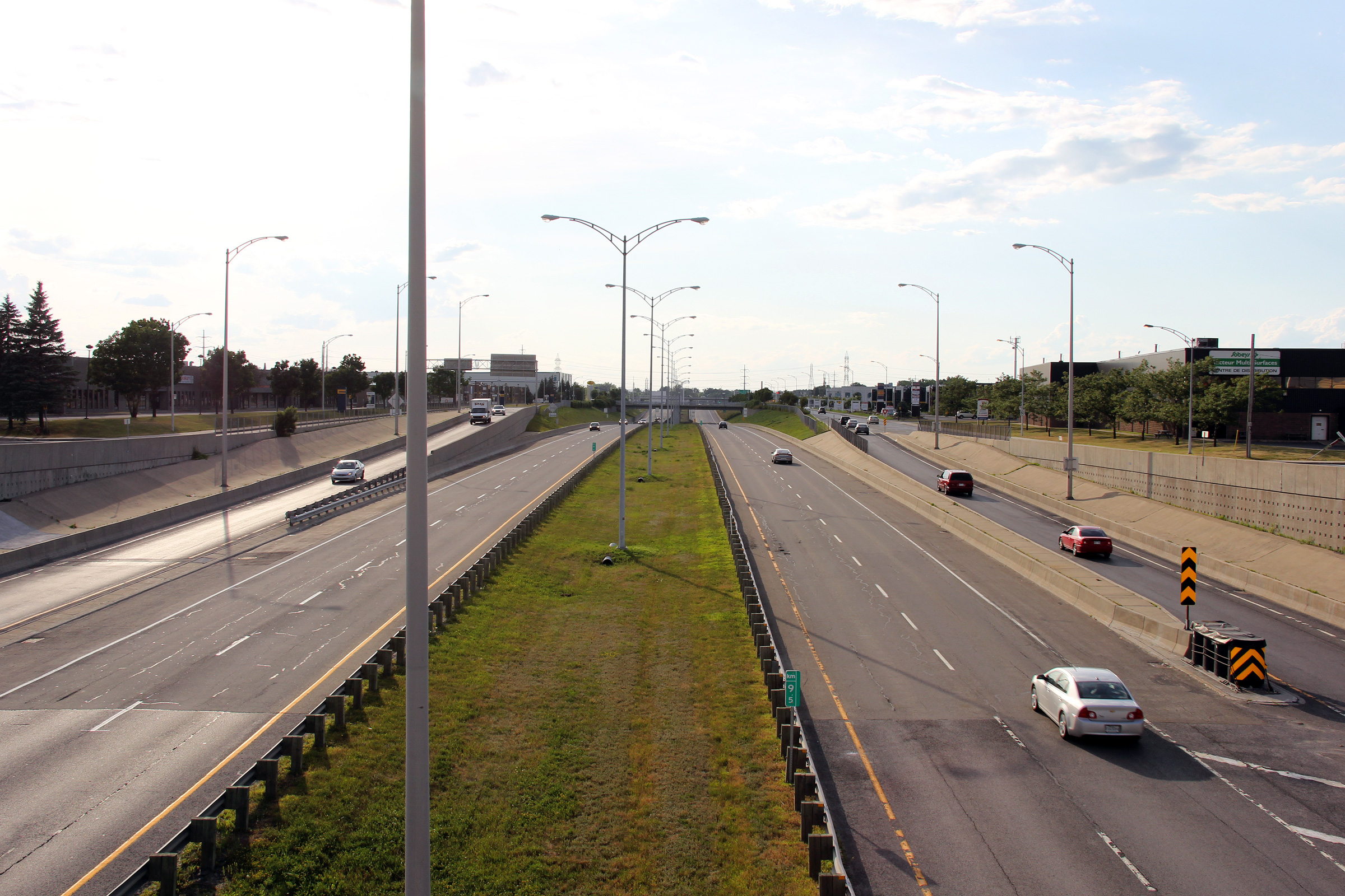
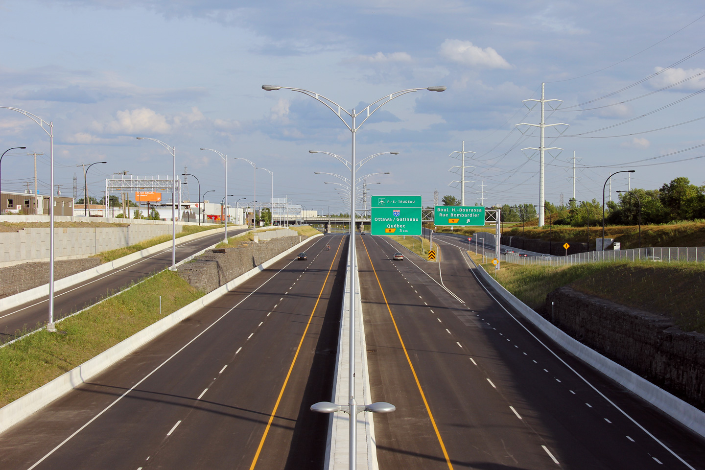
| Agglomeration de Montréal |
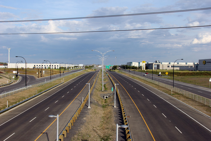
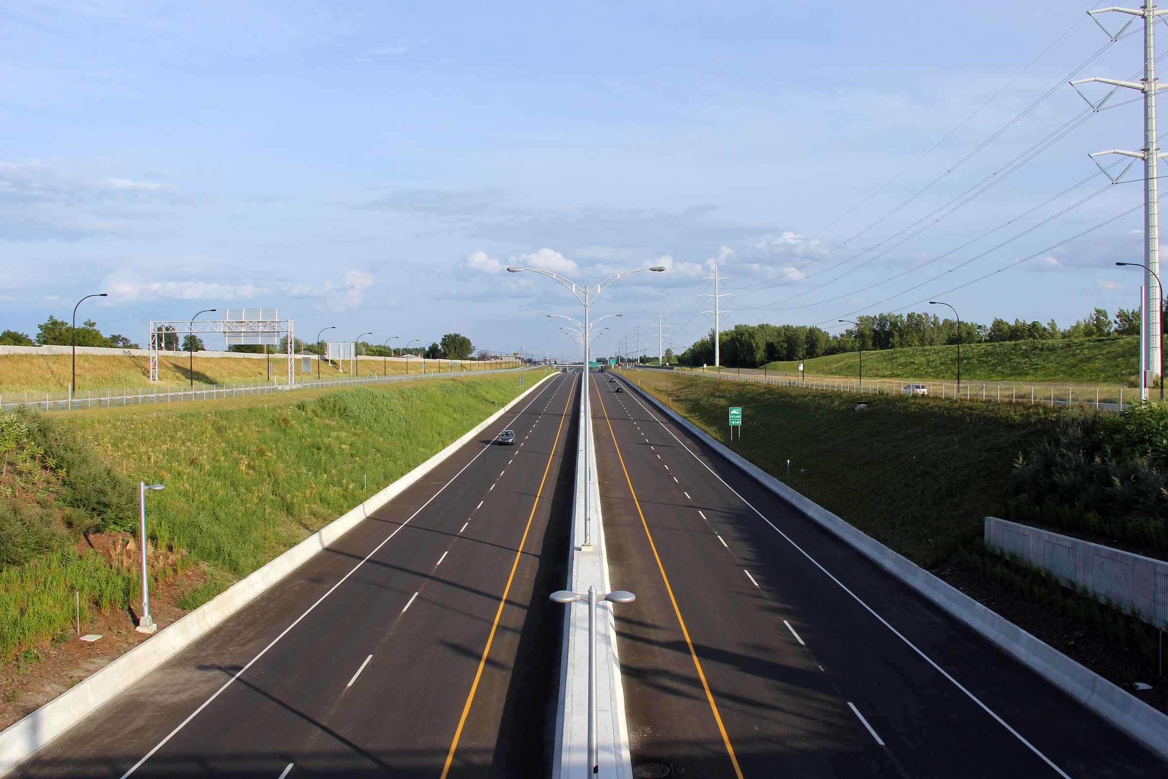
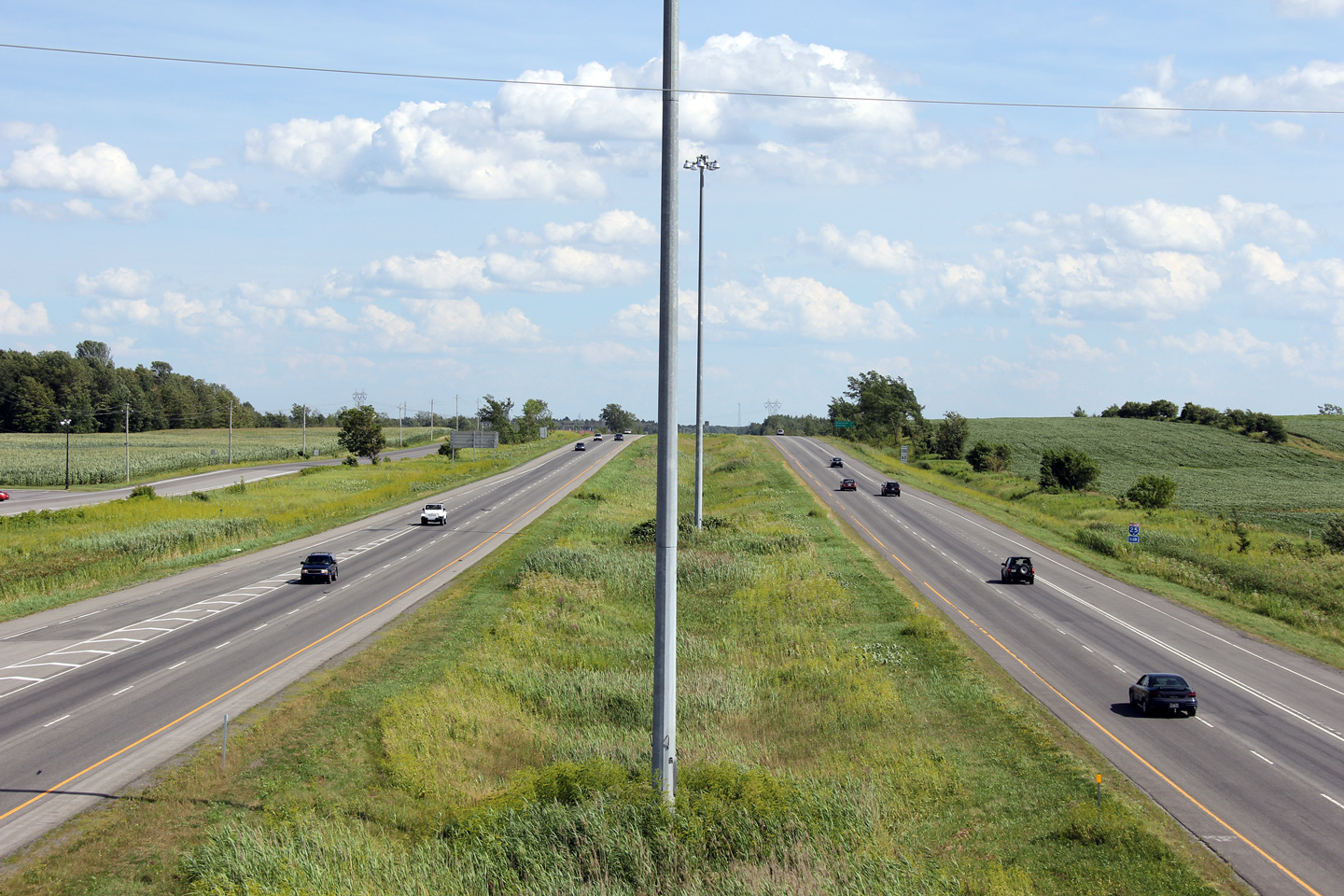
Northerly view along Autoroute 25 from the Rue Bombardier overpass. The portion of freeway between Rue Bombardier and Boul Henri-Bourassa opened to traffic in 2002.
Vue nord le long de l'autoroute 25 de la viaduc de la rue Bombardier. La portion d'autoroute entre la rue Bombardier et boulevard Henri-Bourassa ouvert à la circulation en 2002. |
|
|||
|
Date: 7/23/2011 |
High-res: (1440x960) (2400x1600) | ||||
| Agglomeration de Montréal |
Southerly view from the Boul. Henri-Bourassa overpass.
Vue vers le sud à partir du viaduc du boul. Henri-Bourassa. |
|
|||
|
Date: 7/23/2011 |
High-res: (1440x960) (2400x1600) | ||||
| Agglomeration de Montréal |
This view looks northerly from the Boul. Henri-Bourassa overpass towards the CN Railway overhead.
Cette vue est vers le nord du viaduc du Boul. Henri-Bourassa vers le viaduc de la voie ferrée CN. |
|
|||
|
Date: 7/23/2011 |
High-res: (1440x960) (2400x1600) | ||||
| Agglomeration de Montréal |
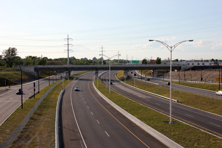
View looking to the south from the Boul. Maurice-Duplessis overpass.
Vue vers le sud à partir du viaduc de la boul. Maurice-Duplessis. |
 |
|||
|
Date: 7/23/2011 |
High-res: (1440x960) (2400x1600) | ||||
| Agglomeration de Montréal |
Northerly view from Boul. Maurice-Duplessis. Maurice Duplessis was the 16th Premiere of Quebec, serving the National Assembly of Quebec between 1936 and 1939.
Vue vers le nord du boul. Maurice-Duplessis. Maurice Duplessis a été la 16e première ministère du Québec. Maurice Duplessis a été le chef de l'Assemblée nationale du Québec entre les années 1936 et 1939. |
|
|||
|
Date: 7/23/2011 |
High-res: (1440x960) (2400x1600) | ||||
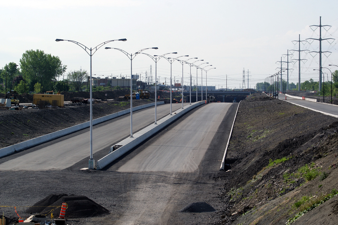
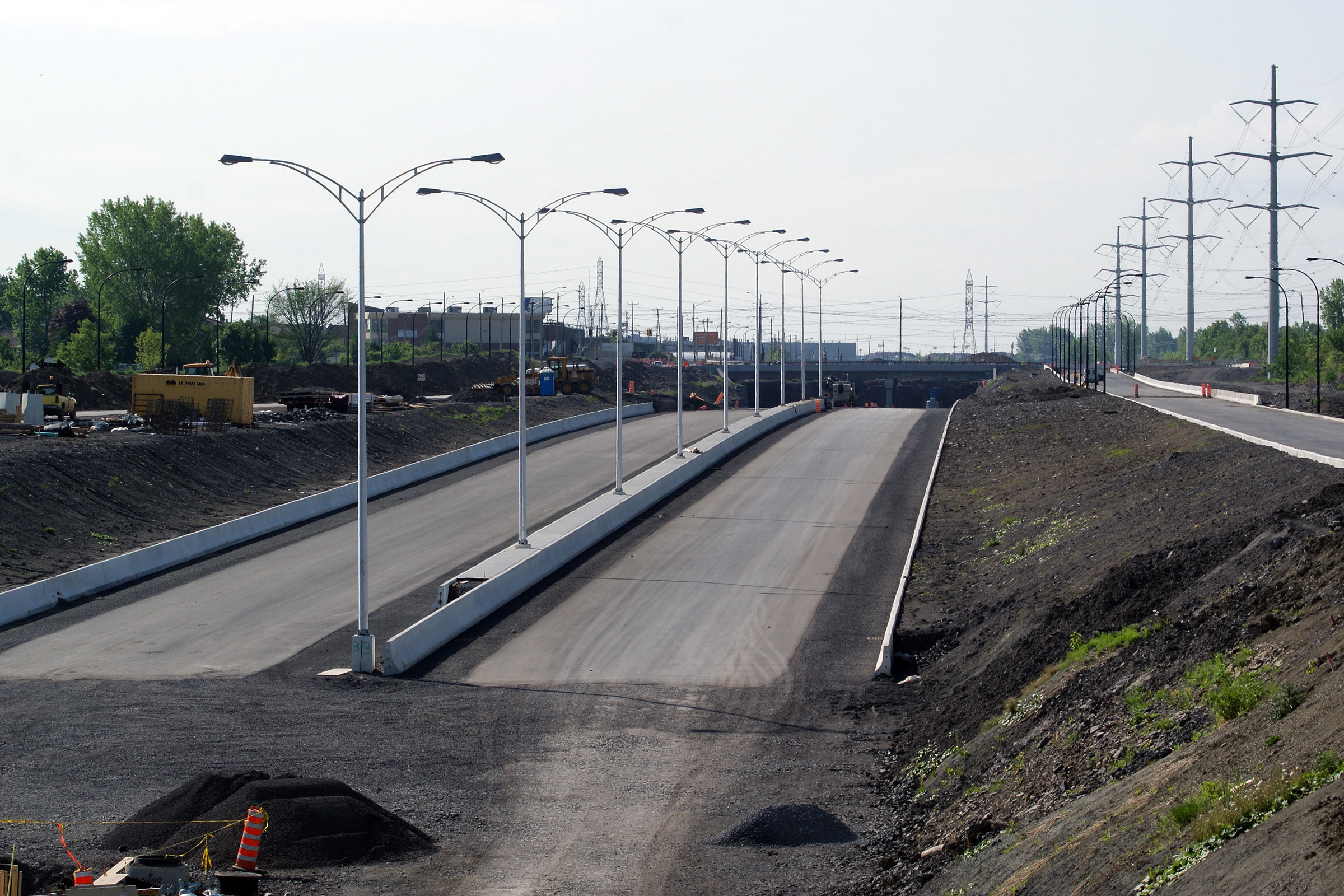
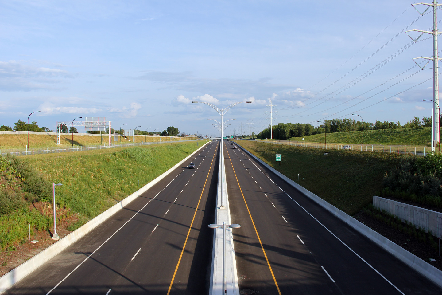
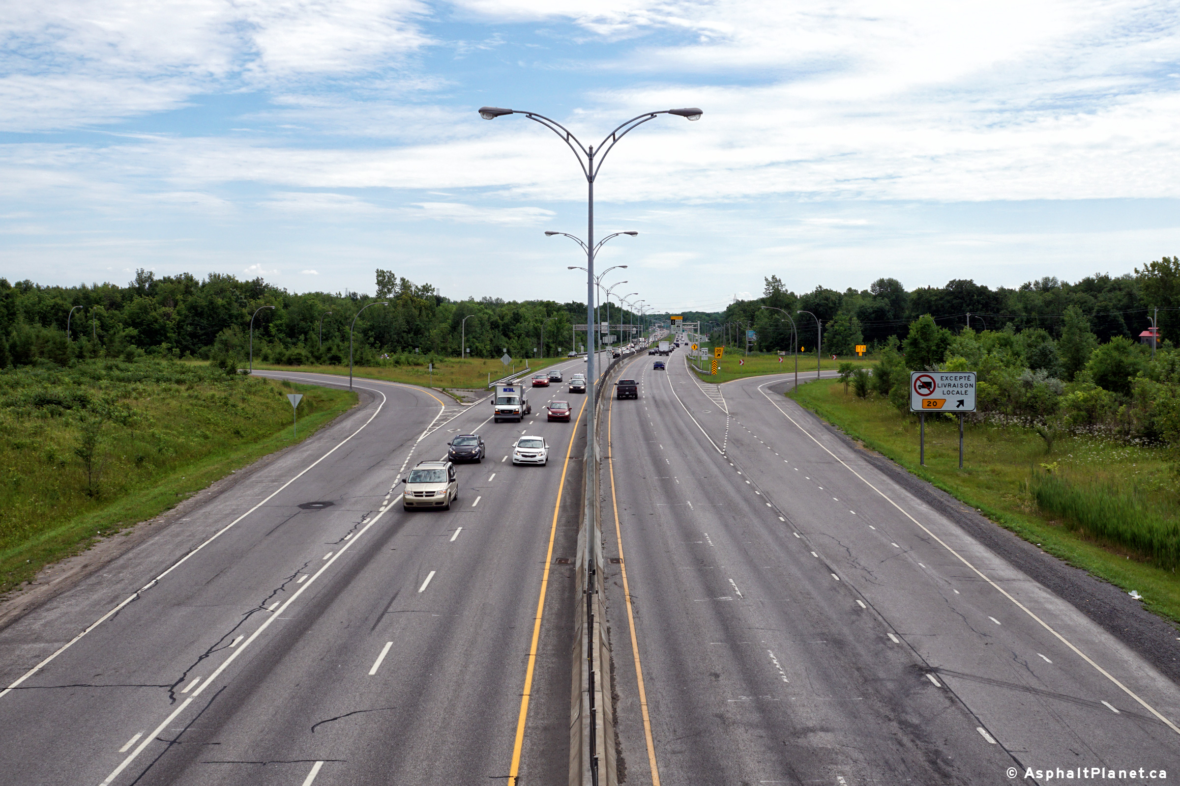
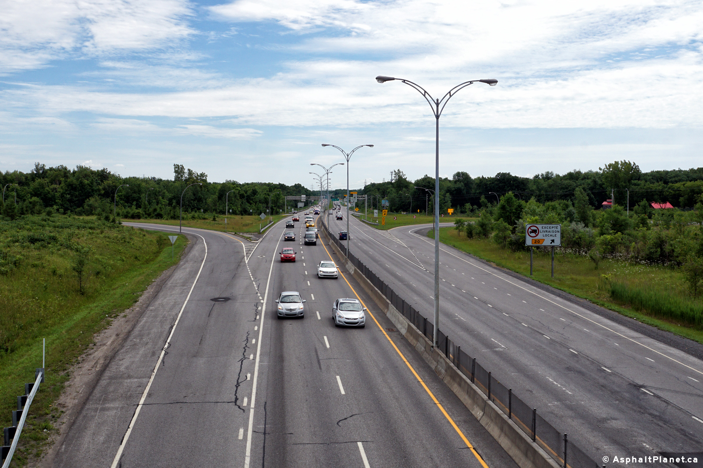
| Agglomeration de Montréal |
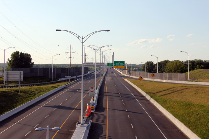
Two views looking southerly from the Boul. Perras overpass in Northern Montréal. The upper photo obviously shows a highway that is still very much under construction. The lower photo was taken about two months after this section of Autoroute 25 was opened to traffic.
Deux vues vers le sud du viaduc de la boul. Perras dans le nord de Montréal. La photo du haut représente évidemment une route qui est encore très en construction. La photo du bas a été prise environ deux mois après cette section de l'autoroute 25 a été ouvert à la circulation. |
|
|||
| High-res: (1440x960) (2400x1600) | |||||
|
|
|||||
|
Date: 7/23/2011 |
High-res: (1440x960) (2400x1600) | ||||
| Agglomeration de Montréal |
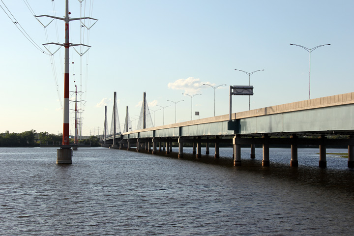
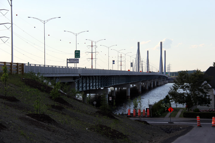
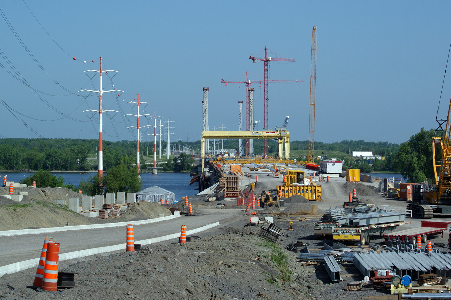
A series of views of the new bridge that carries Autoroute 25 traffic between Montréal and Laval.
Une série de vues du nouveau pont qui transporte la circulation de l'autoroute 25 entre Montréal et Laval. |
|
|||
| High-res: (1440x960) (2400x1600) | |||||
 |
|||||
| High-res: (1440x960) (2400x1600) | |||||
|
|
|||||
|
Date: 7/23/2011 |
High-res: (1440x960) (2400x1600) | ||||
| Agglomeration de Montréal |
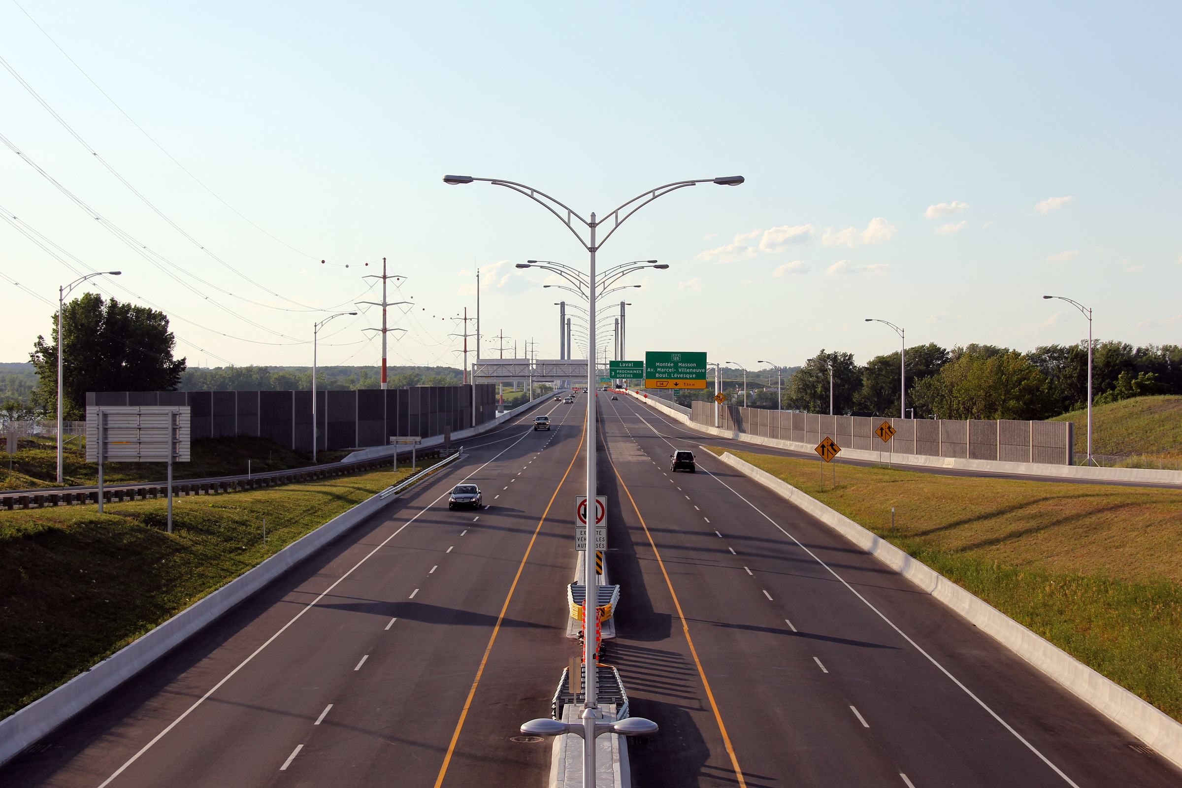
View of both the eastern and western facades of Autoroute 25's new (opened in May 2011) cable stayed suspension bridge that links Montreal to Laval.
Vue sur les façades est et ouest de la nouvelle pont (ouvert en mai 2011) à haubans de suspension qui relie Montréal à Laval de l'autoroute 25. |
|
|||
| High-res: (1440x960) (2400x1600) | |||||
|
|
|||||
|
Date: 7/23/2011 |
High-res: (1440x960) (2400x1600) | ||||
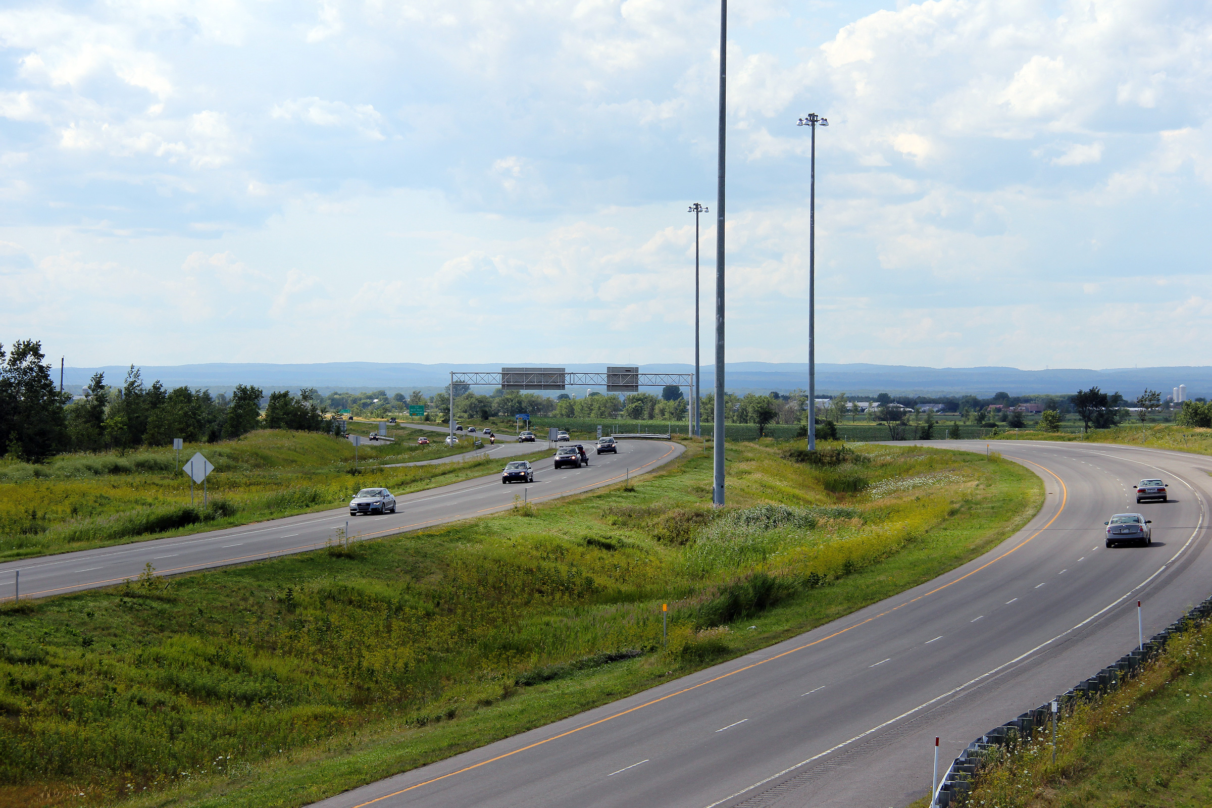
|
M.R.C. de Laval |
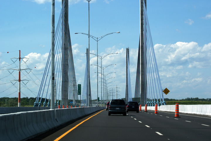
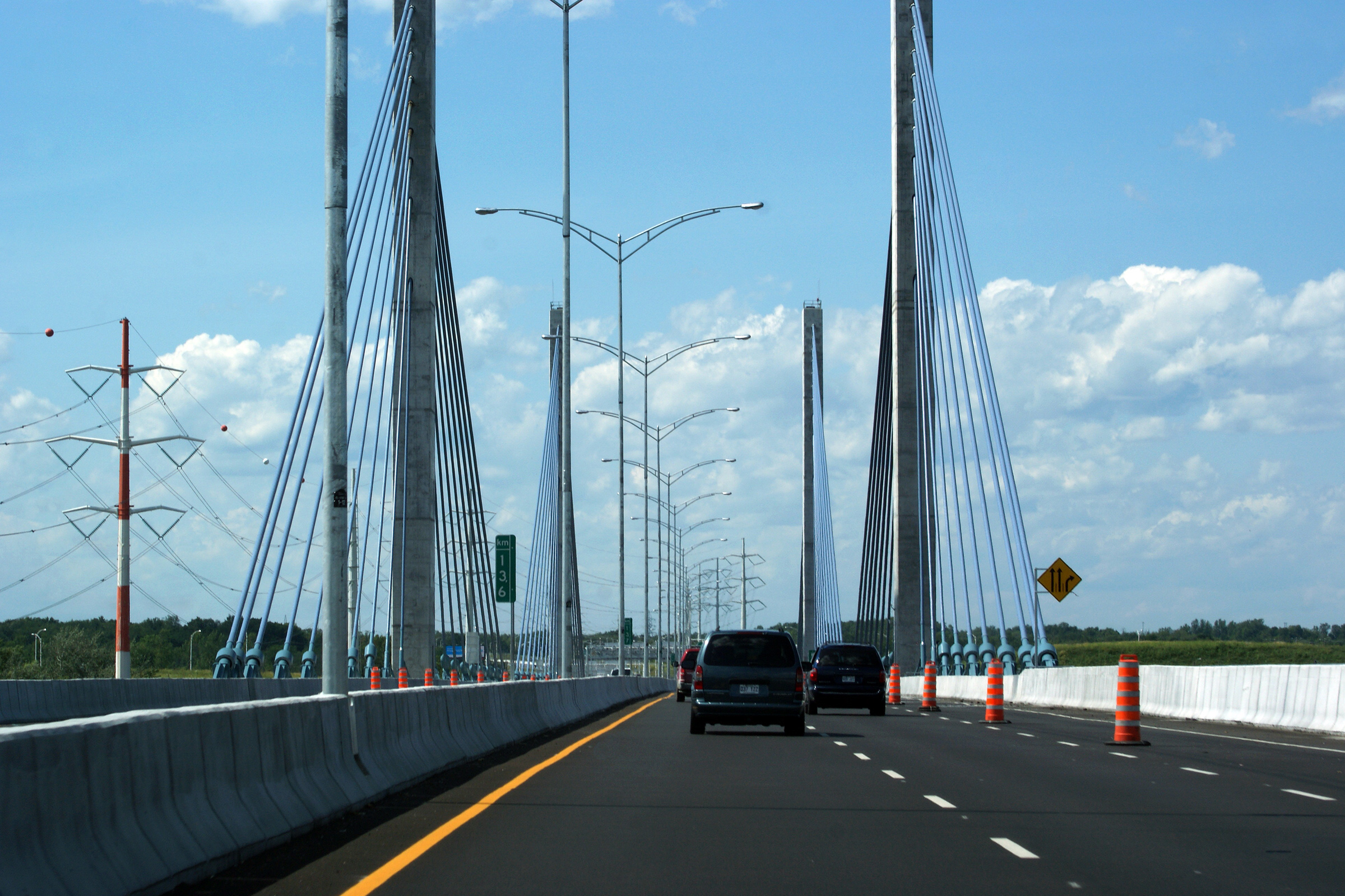
Northerly view along Autoroute 25 as the freeway crosses the cable-stayed main span of the Rivière des Prairies bridge.
Vue nord le long de l'autoroute 25 tant que l'autoroute traverse la haubans travée principale du pont Rivière des Prairies. |
|
|||
|
Date: 7/23/2011 |
High-res: (1440x960) (2400x1600) | ||||
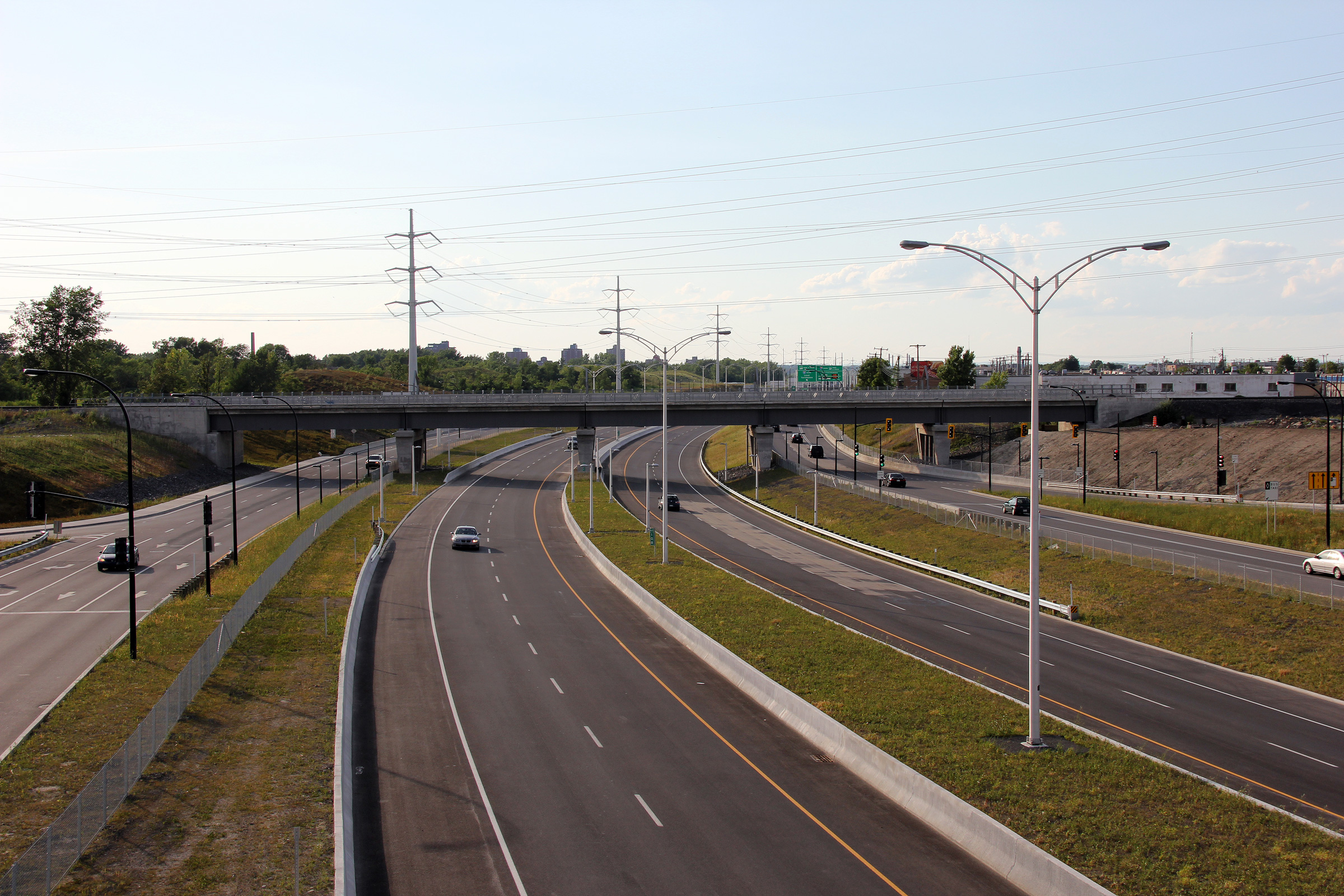
|
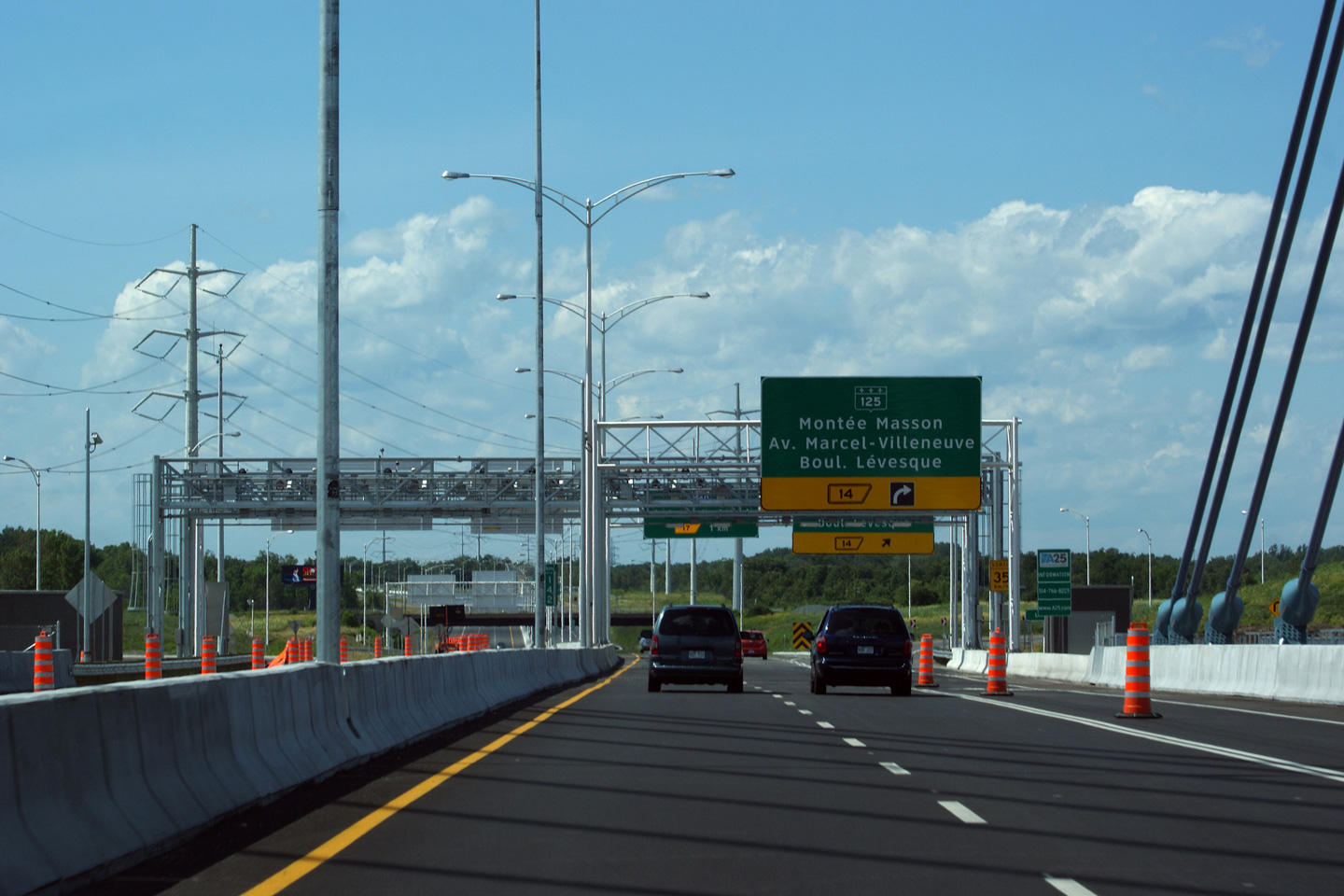
M.R.C. de Laval |
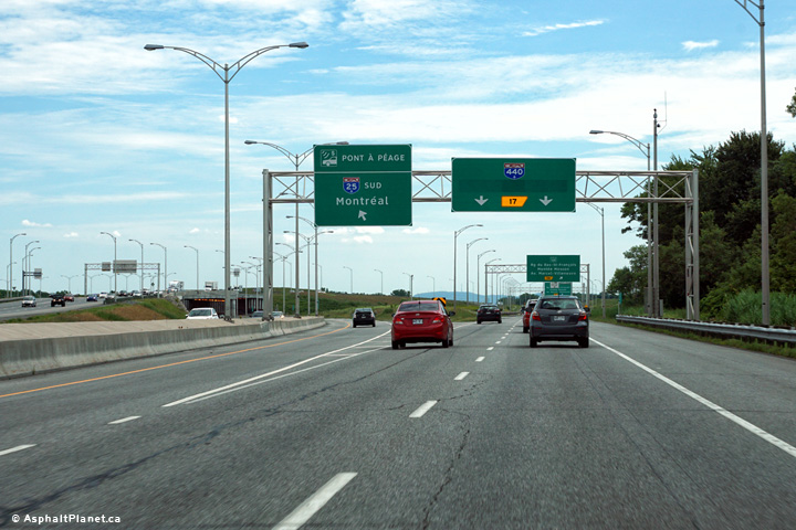
Northbound advanced signage for the Route 125 interchange located just before the bridge's electronic tolling equipment.
Signalisation avancée pour l'échangeur de la route 125 située juste avant de l'équipement de péage électronique du pont. |
 |
|||
|
Date: 7/23/2011 |
High-res: (1440x960) (2400x1600) | ||||
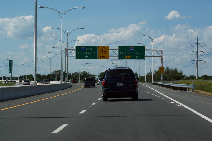
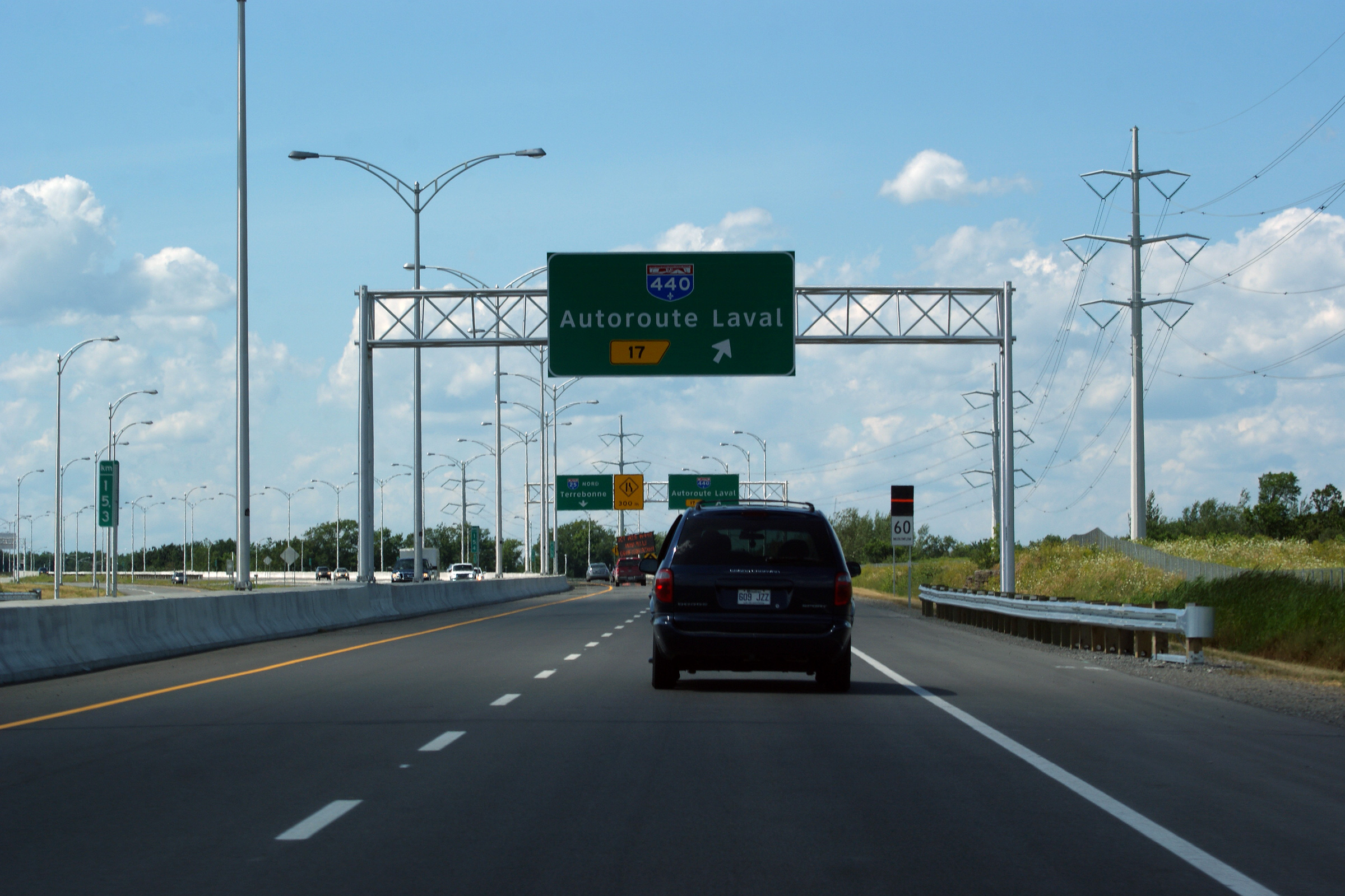
|
M.R.C. de Laval |
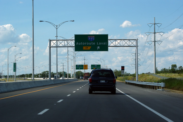
Northbound advanced signage for the ramp to Autoroute Laval.
Signalisation avancée en direction nord pour autoroute Laval. |
 |
|||
|
Date: 7/23/2011 |
High-res: (1440x960) (2400x1600) | ||||
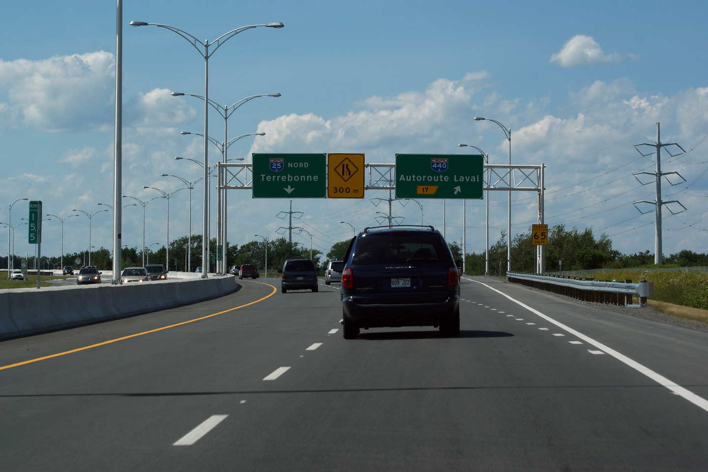
|
M.R.C. de Laval |
Northbound signage for the off-ramp to Autoroute Laval. The northbound carriageway of A-25 narrows to a single lane prior to the incoming on-ramp from Autoroute Laval.
Signalisation en direction nord de la bretelle de sortie de l'autoroute Laval. La chaussée nord de l'A-25 rétrécit à une voie avant l'arrivée de la bretelle d'éntrée de l'autoroute Laval. |
|
|||
|
Date: 7/23/2011 |
High-res: (1440x960) (2400x1600) | ||||
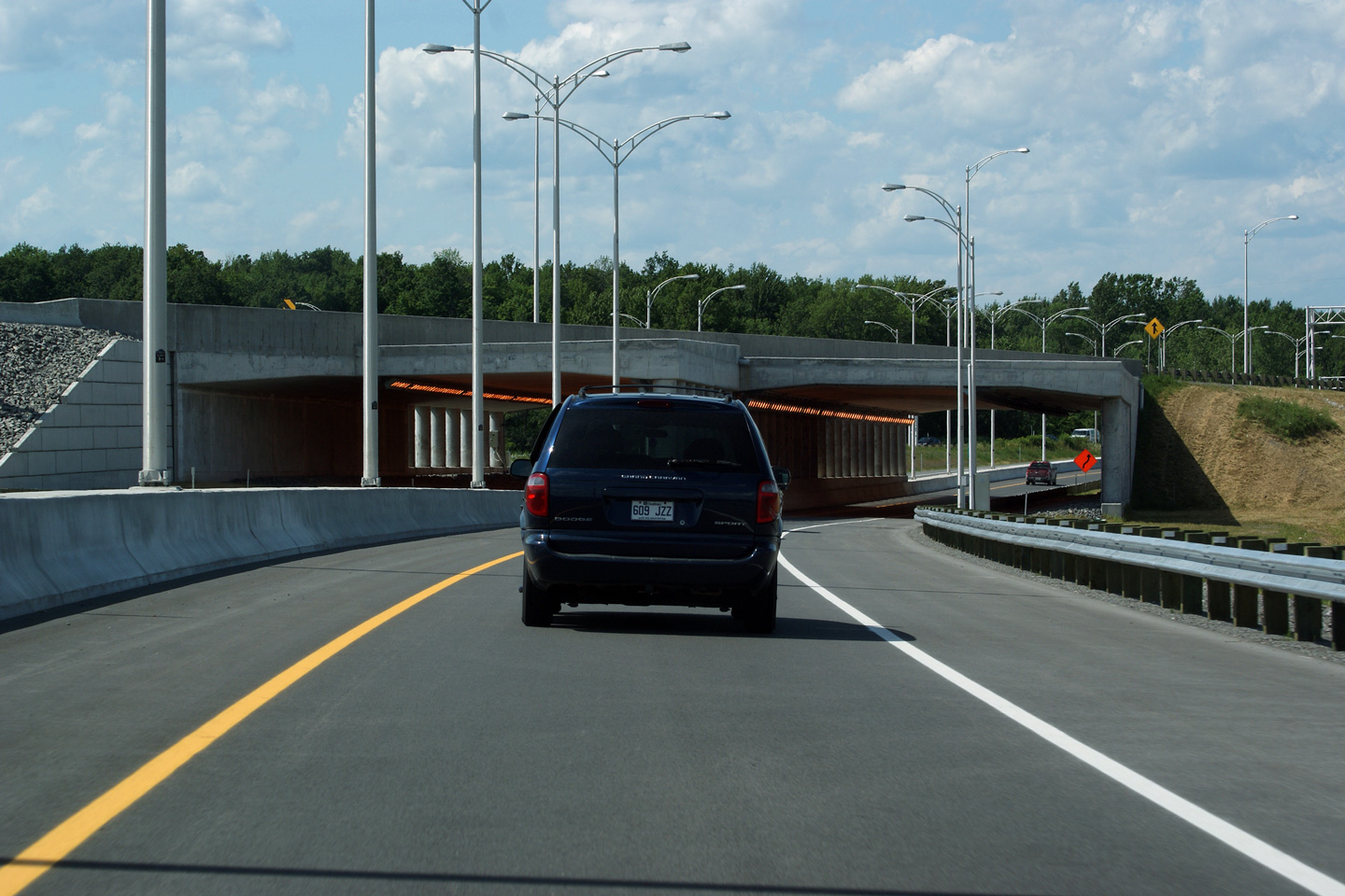
|
M.R.C. de Laval |
View as Autoroute 25 passes underneath of the eastbound onramp from Autoroute Laval.
Conduite dessous de la bretelle d'accès vers l'est de l'autoroute Laval. |
 |
|||
|
Date: 7/23/2011 |
High-res: (1440x960) (2400x1600) | ||||
|
Autoroute 40 is the Laval Autoroute which crosses Montréal's northern suburb from A-13 east to A-25. Click here for A-440 images. |
|||||
|
M.R.C. de Laval |
Southerly view at the A-440 interchange.
Vue en direction sud à l'échangeur avec l'A-440. |
 |
|||
|
Date: 7/5/2006 |
High-res: (1440x960) (2400x1600) | ||||
|
M.R.C. de Laval |
Advanced signage for the Autoroute 440 interchange.
Signalisation avancée pour l'autoroute 440. |
 |
|||
|
Date: 7/5/2006 |
High-res: (1440x960) (2400x1600) | ||||
|
M.R.C. de Laval |
First of two advanced signs for the Autoroute 440 interchange. Note that the text naming A-440 as "Autoroute Laval" has been covered over.
Signalisation avancée pour l'autoroute 440. |
 |
|||
|
Date: 7/5/2006 |
High-res: (1440x960) (2400x1600) | ||||
|
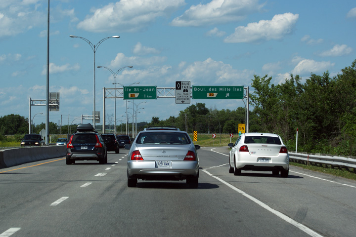
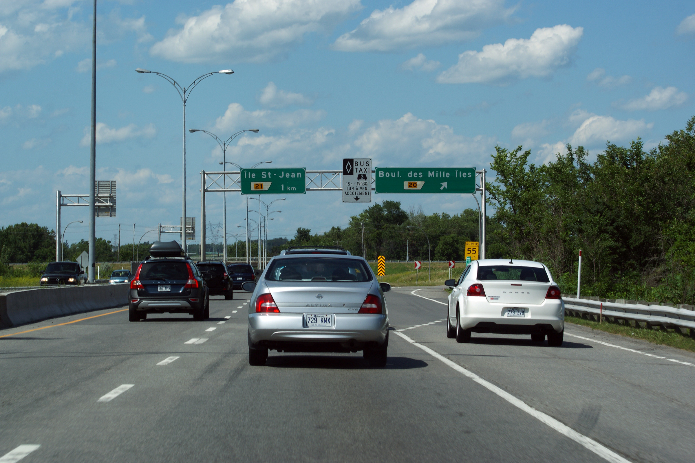
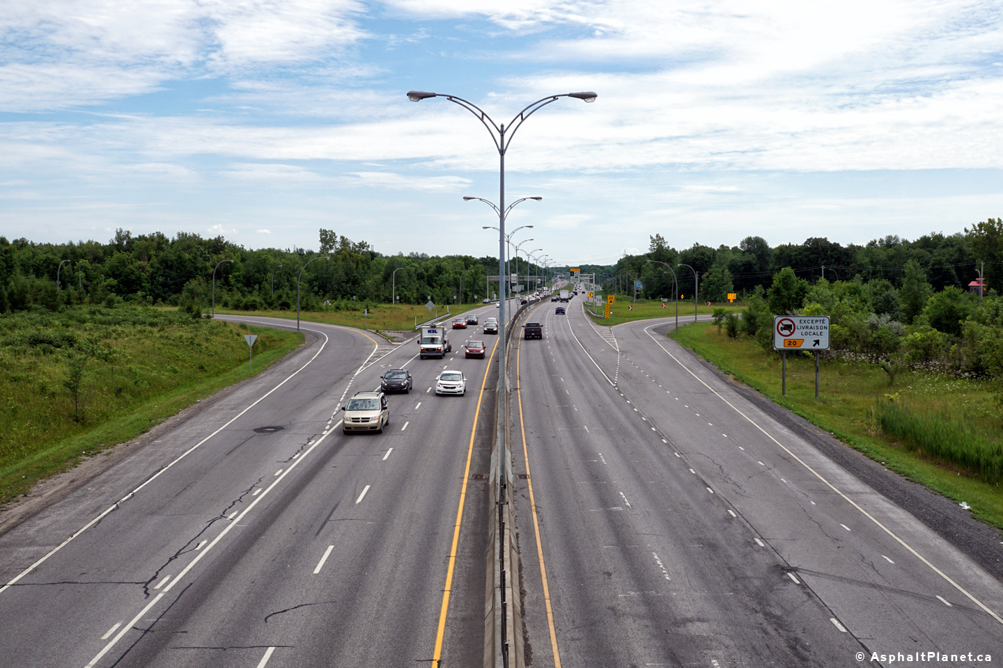
M.R.C. de Laval |
Northbound guide signage at the ramp to Boul des Mille Îles. Through his interchange, the right shoulder lane of the freeway is reserved for buses, taxis and high occupancy vehicles during weekday afternoon rush hour.
Signalisation en direction nord à la bretelle vers le boul des Mille Îles. Grâce à son échangeur, la voie de l'accotement droite de l'autoroute est réservée pour les autobus, les taxis et les véhicules à occupation multiple pendant l'heure de pointe l'après-midi. |
 |
|||
|
Date: 7/23/2011 |
High-res: (1440x960) (2400x1600) | ||||
|
M.R.C. de Laval |
Two views looking southerly from the Boul des Milles-Iles overpass.
Vues en direction sud du pont du boul des Milles-Iles. |
|
|||
| High-res: (1440x960) (2400x1600) | |||||
|
M.R.C. de Laval |
|
||||
|
Date: 7/23/2011 |
High-res: (1440x960) (2400x1600) | ||||
|
M.R.C. de Laval |
Northerly view along Autoroute 25 from the Rue Bombardier overpass. The portion of freeway between Rue Bombardier and Boul Henri-Bourassa opened to traffic in 2002.
Vue nord le long de l'autoroute 25 de la viaduc de la rue Bombardier. La portion d'autoroute entre la rue Bombardier et boulevard Henri-Bourassa ouvert à la circulation en 2002. |
|
|||
|
Date: 7/23/2011 |
High-res: (1440x960) (2400x1600) | ||||
|
MRC de Moulins |
Driving through the Île St Jean interchange.
Conduire à travers l'échangeur de l'Île St Jean. |
 |
|||
|
Date: 7/23/2011 |
High-res: (1440x960) (2400x1600) | ||||
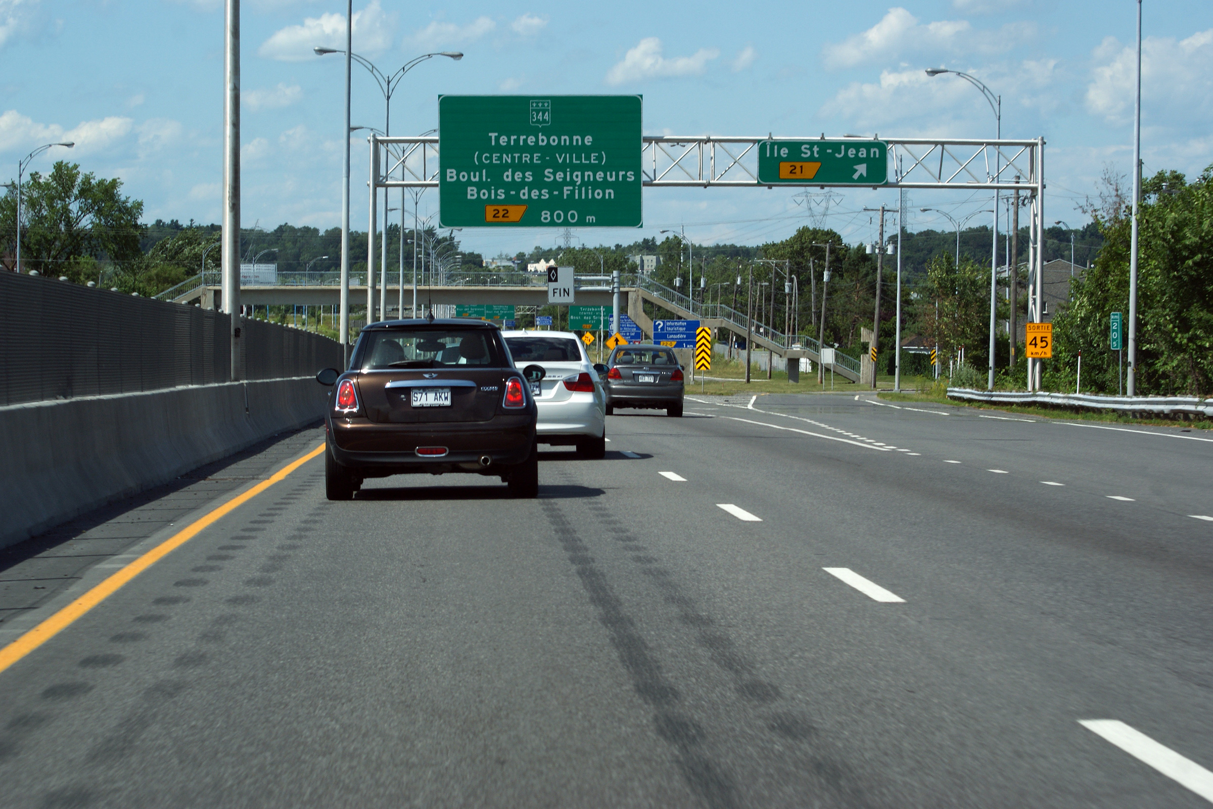
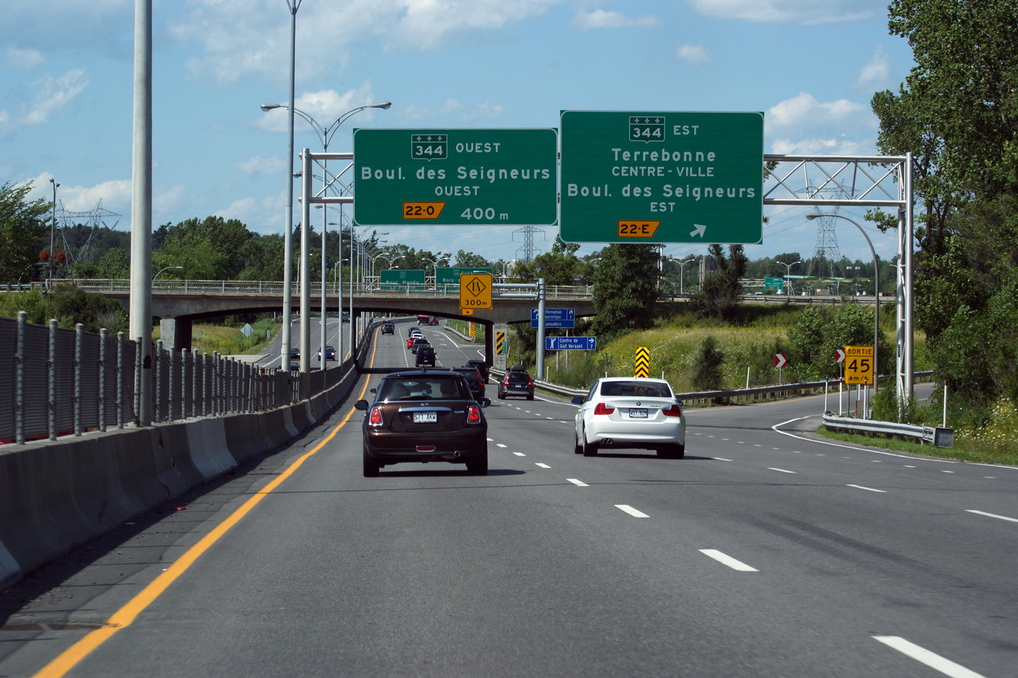
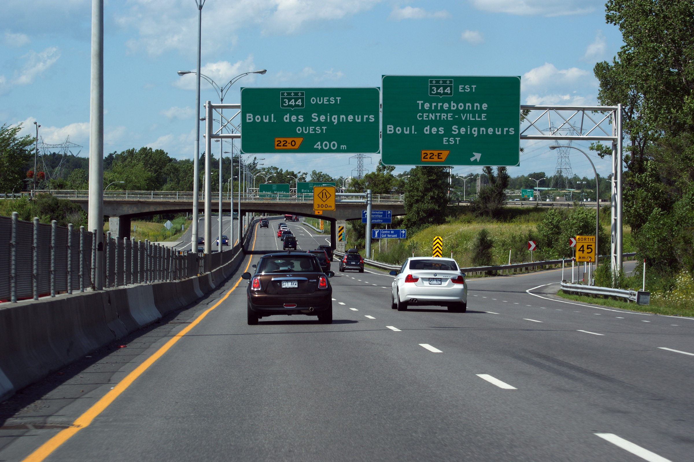
|
MRC de Moulins |
Driving through the Route 344 interchange along Autoroute 25.
Conduire à travers l'échangeur de la route 344 sur l'autoroute 25. |
 |
|||
|
Date: 7/23/2011 |
High-res: (1440x960) (2400x1600) | ||||
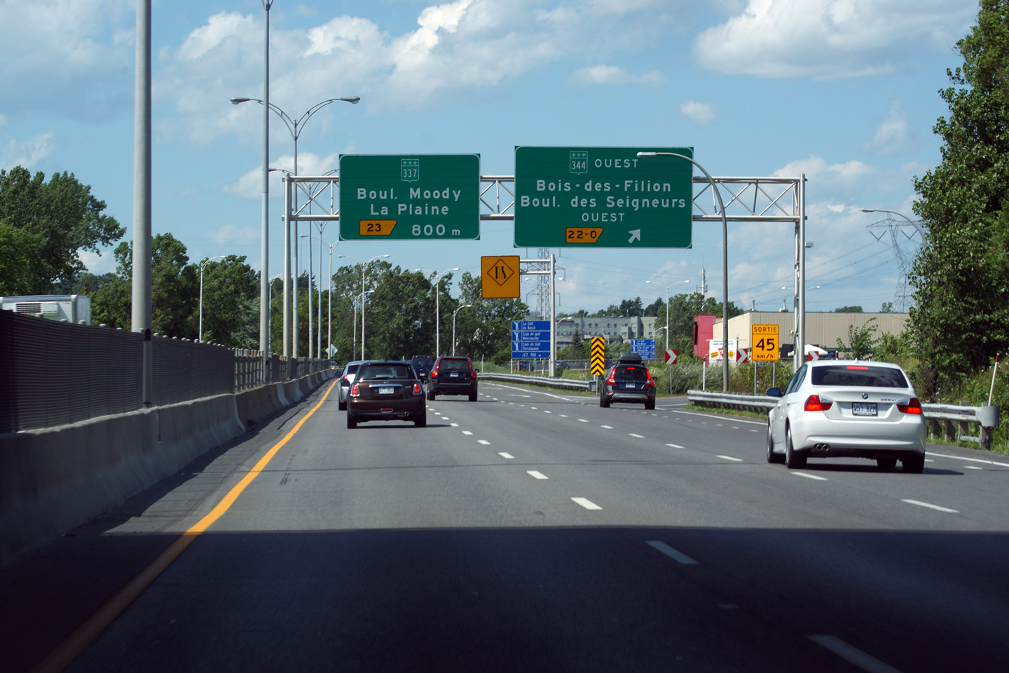
|
MRC de Moulins |
This view is taken from underneath of the Route 344 overpass.
Cette vue a été prise par le dessous de la Route 344 viaduc. |
 |
|||
|
Date: 7/23/2011 |
High-res: (1440x960) (2400x1600) | ||||
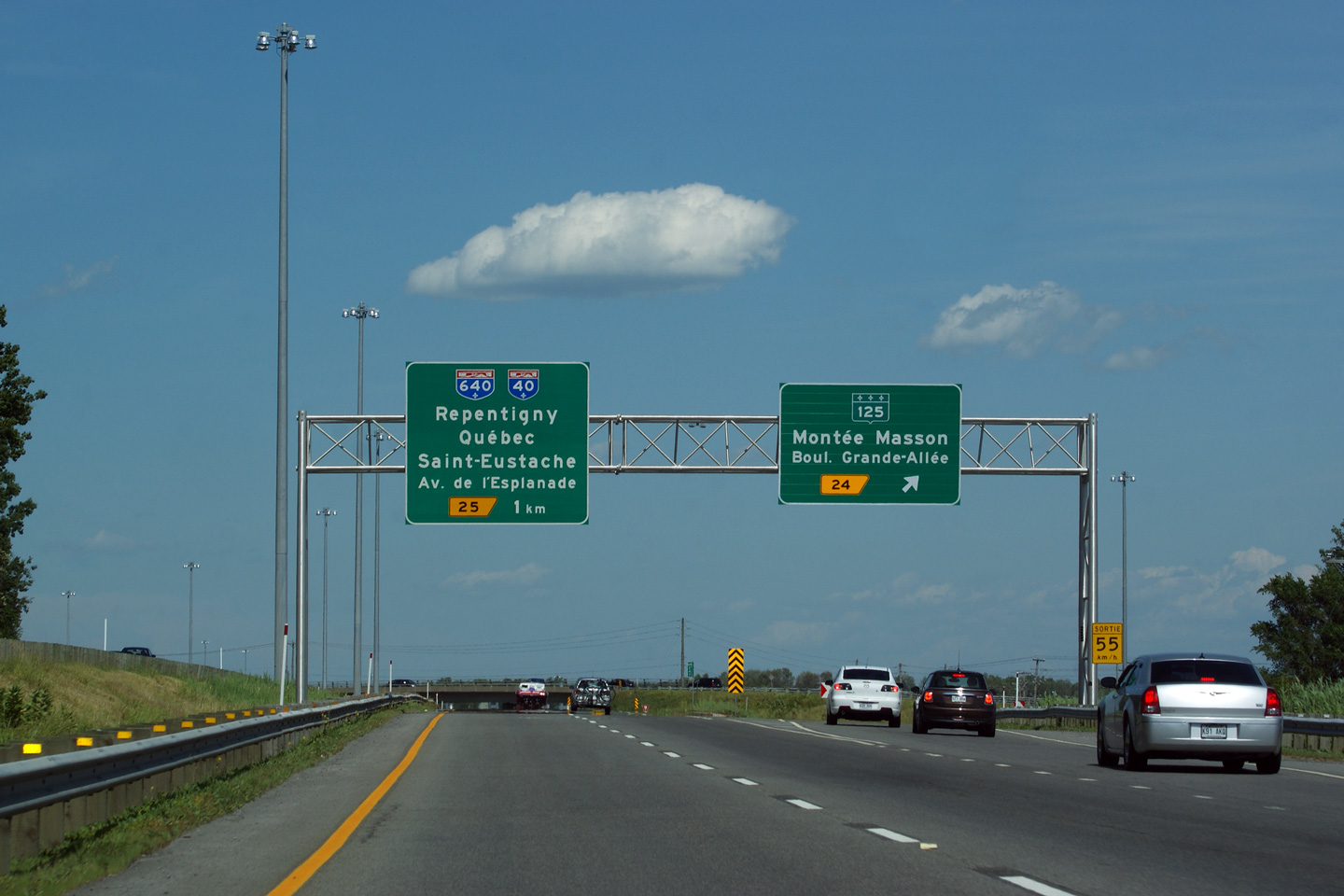
|
MRC de Moulins |
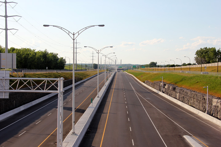
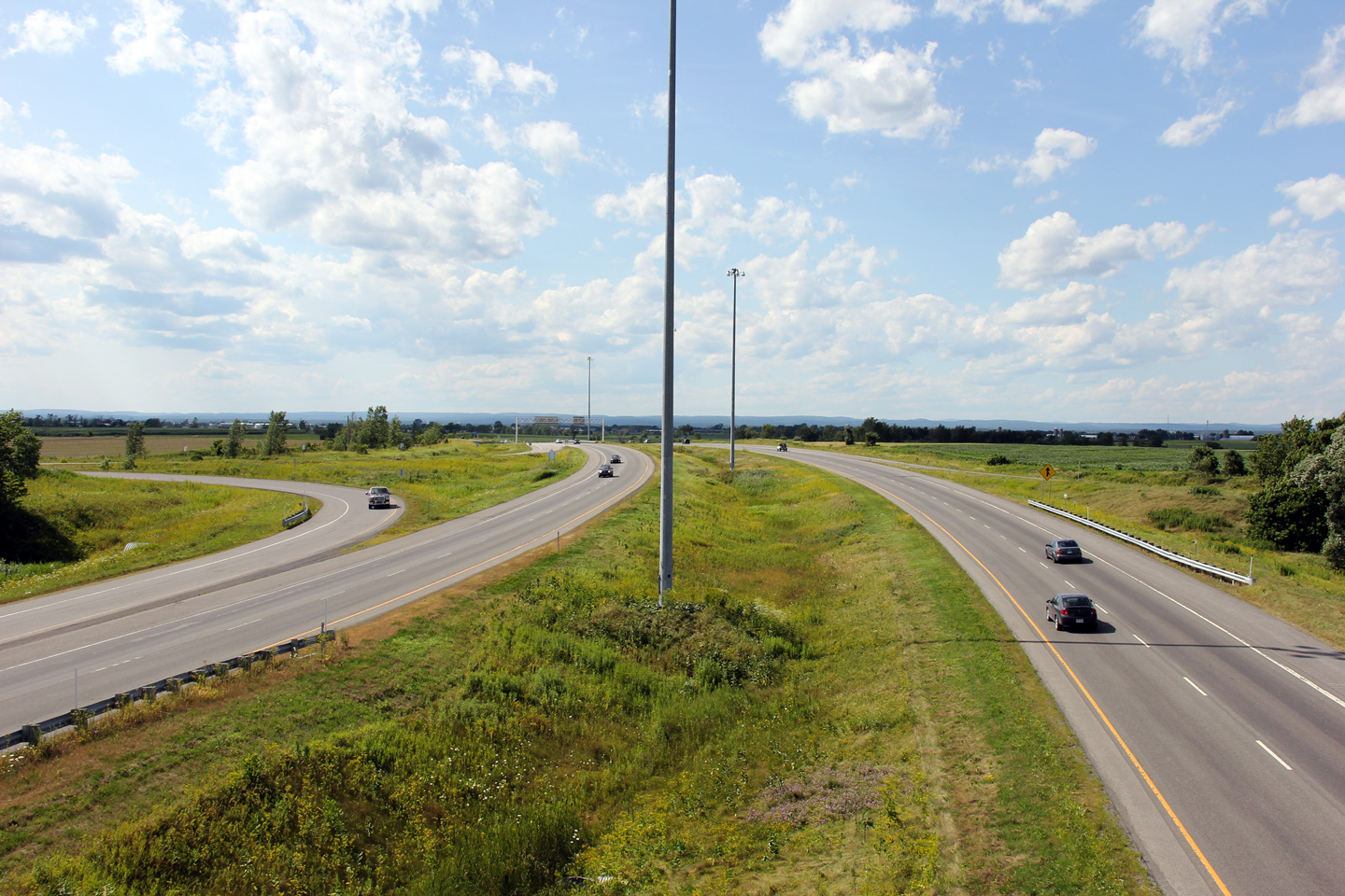
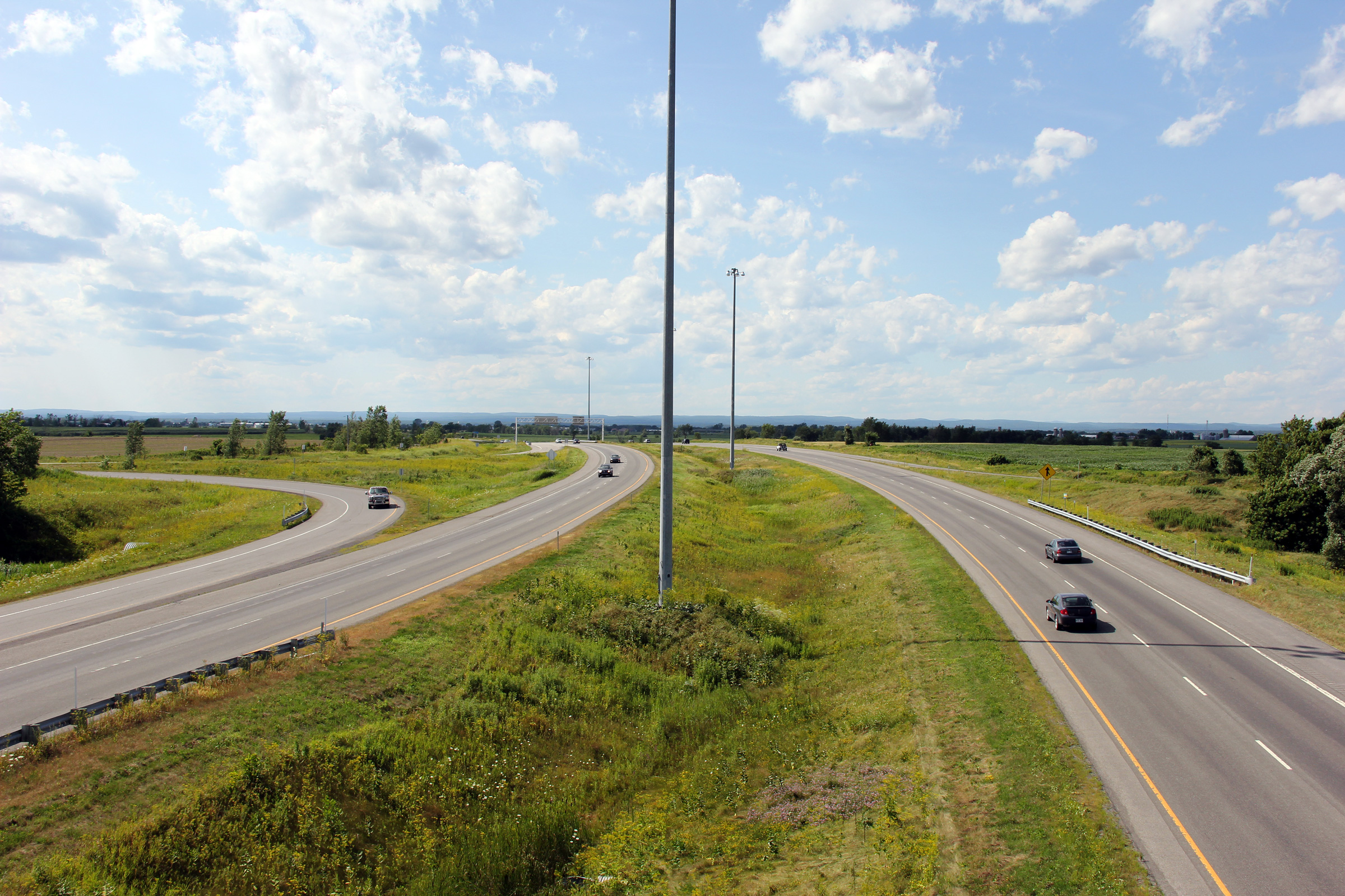
Northerly view at Route 125.
Vue en direction nord à Route 125. |
 |
|||
|
Date: 7/23/2011 |
High-res: (1440x960) (2400x1600) | ||||
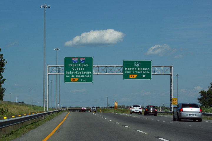
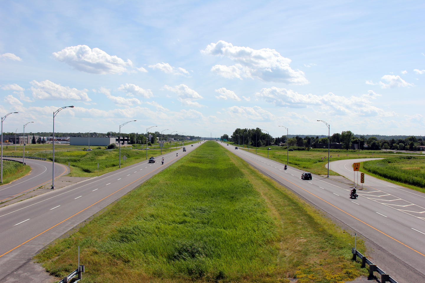
|
MRC de Moulins |
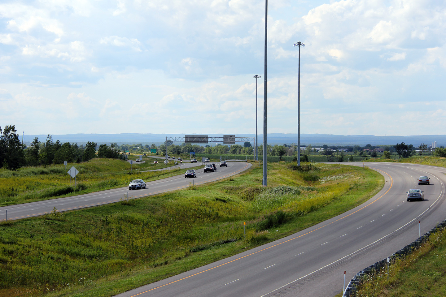
Overhead signage at the ramp to the Autoroute 640 cloverleaf interchange.
Signalisation aérienne à la bretelle de sotrie pour l'échangeur en trèfle de l'autoroute 640. |
|
|||
|
Date: 7/23/2011 |
High-res: (1440x960) (2400x1600) | ||||
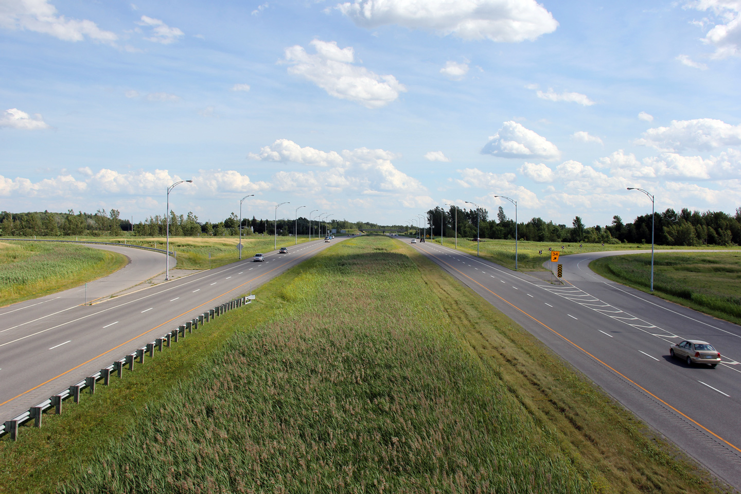
|
MRC de Moulins |
Southerly view from the Chemin Saint-Marie overpass.
Vue en direction sud à partir du viaduc du chemin Sainte-Marie. |
 |
|||
|
Date: 7/23/2011 |
High-res: (1440x960) (2400x1600) | ||||
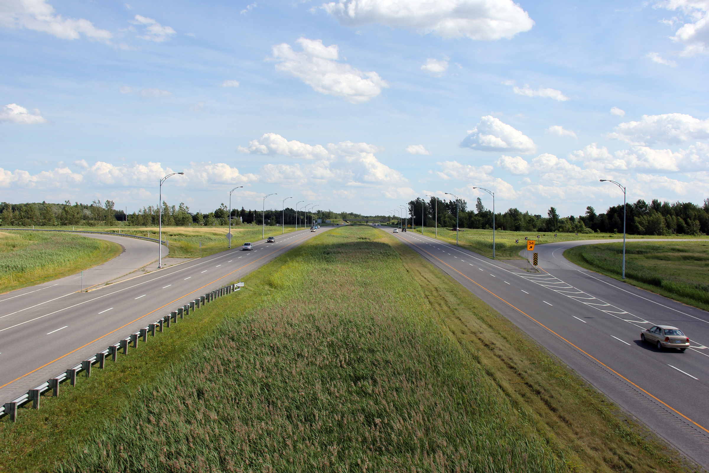
|
MRC de Moulins |
Southerly view from Chemin Saint-Henri.
Vue vers le sud du chemin Saint-Henri |
 |
|||
|
Date: 7/23/2011 |
High-res: (1440x960) (2400x1600) | ||||
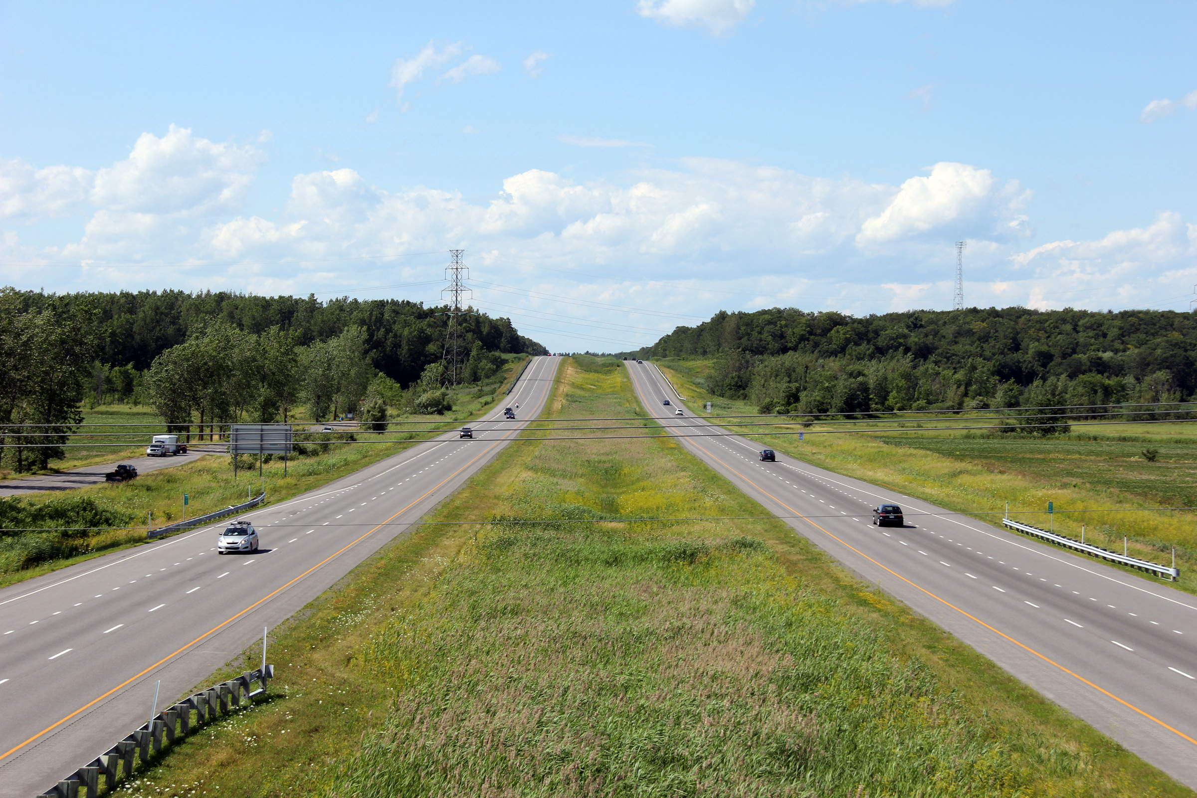
|
MRC de Moulins |
Two views looking northerly from Chemin Saint-Henri.
Deux vues regardant au nord du chemin Saint-Henri |
 |
|||
| High-res: (1440x960) (2400x1600) | |||||
 |
|||||
|
Date: 7/23/2011 |
High-res: (1440x960) (2400x1600) | ||||
|
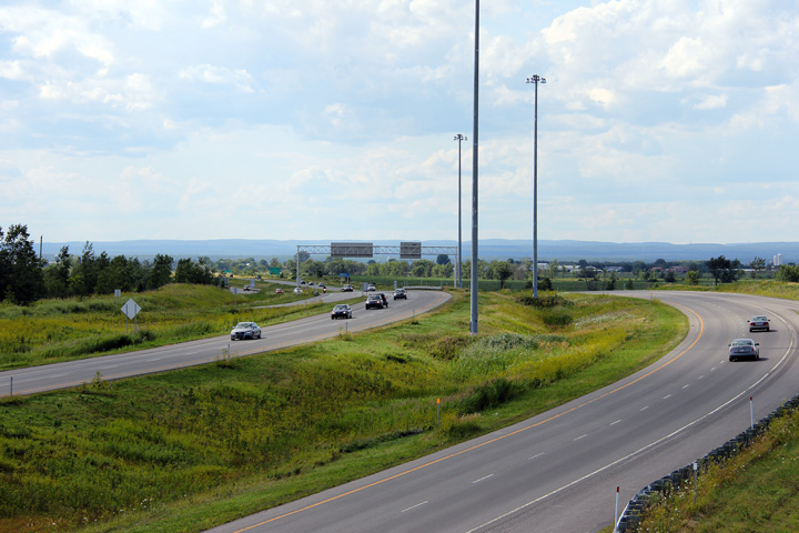
M.R.C. de Montcalm Saint-Roch Ouest |
Southerly view from the Rang de la Rivière Nord overpass.
Vue en direction sud du viaduc du Rang de la Rivière Nord |
 |
|||
|
Date: 7/23/2011 |
High-res: (1440x960) (2400x1600) | ||||
|
M.R.C. de Montcalm Saint-Roch Ouest |
Two views looking north from the Rang de la Rivière Nord overpass.
Deux points de vue vers le nord à partir du viaduc du rang de la Rivière Nord. |
 |
|||
| High-res: (1440x960) (2400x1600) | |||||
 |
|||||
|
Date: 7/23/2011 |
High-res: (1440x960) (2400x1600) | ||||
|
M.R.C. de Montcalm Saint-Esprit |
This is the first signage along Autoroute 25 south.
Cette signalisation est le première sur l'autoroute 25 sud. |
 |
|||
|
Date: 7/23/2011 |
High-res: (1440x960) (2400x1600) | ||||
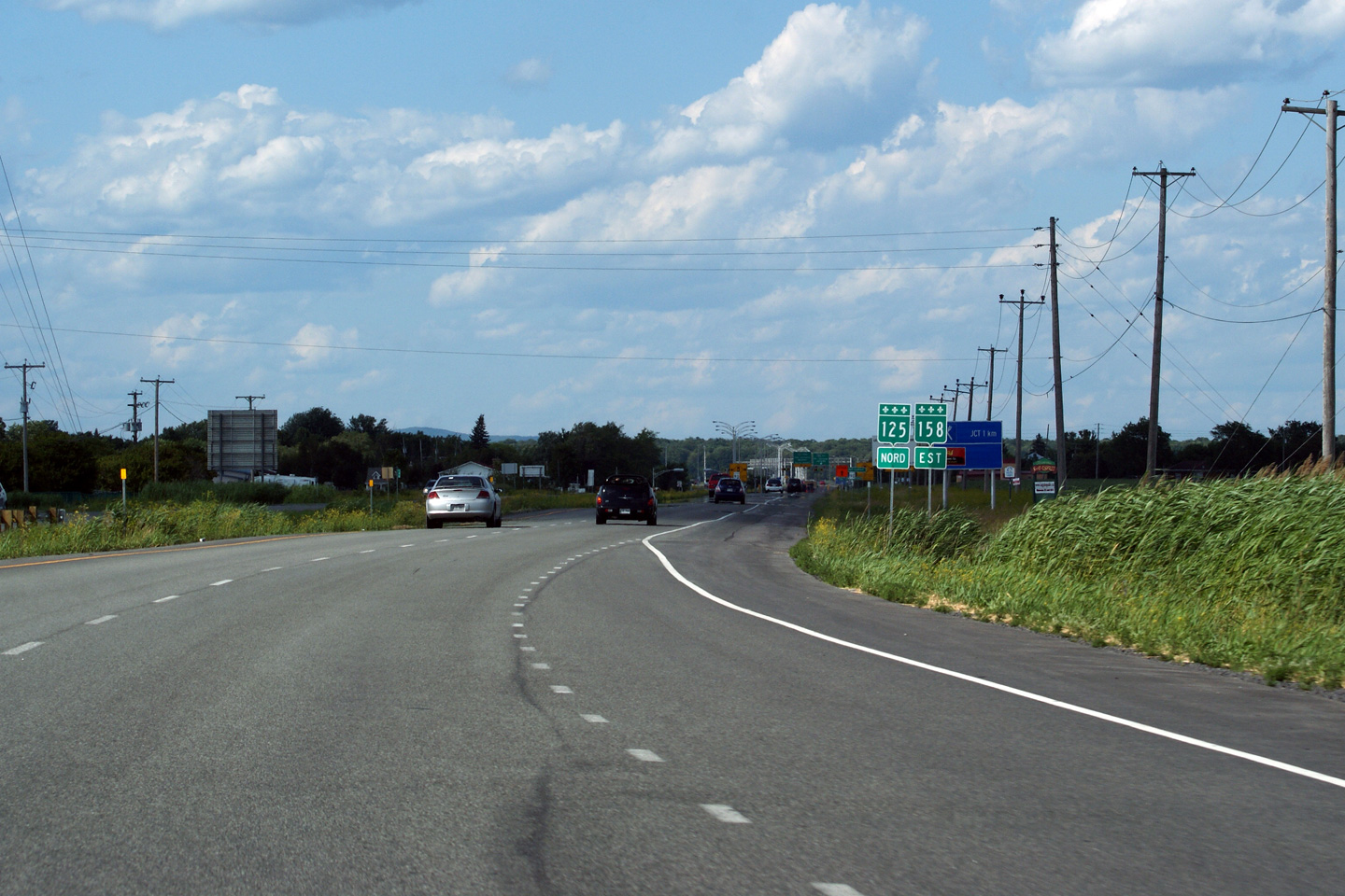
|
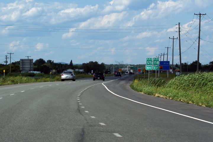
M.R.C. de Montcalm Saint-Esprit |
Northbound reassurance marker for Highway 125 and 158.
Signalisation pour la route 125 et 158 en direction nord. |
 |
|||
|
Date: 7/23/2011 |
High-res: (1440x960) | ||||
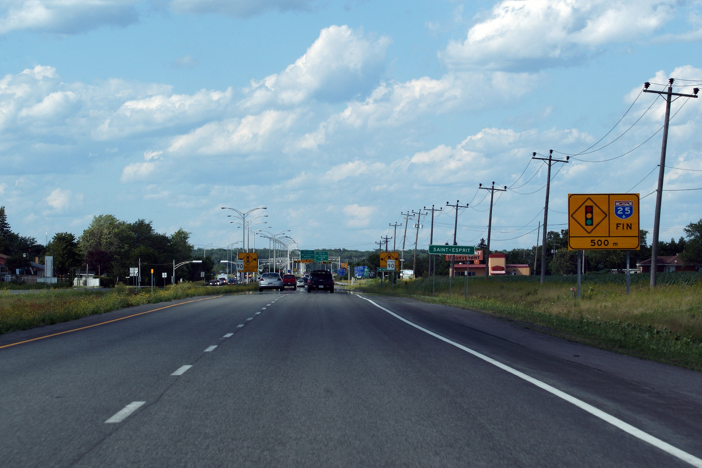
|
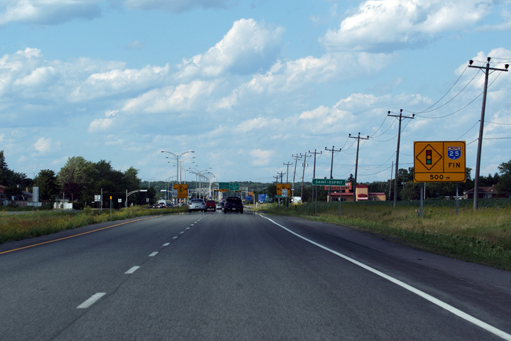
M.R.C. de Montcalm Saint-Esprit |
Finally, the signage that announces the northern terminus of Autorute 25.
Finalement, le signalisation qui annonce l'extrémité nord de l'autoroute 25 |
 |
|||
|
Date: 7/23/2011 |
High-res: (1440x960) (2400x1600) | ||||
<- A-20
PQ Highways
A-30 ->
Asphaltplanet.ca
© 2010 AsphaltPlanet.ca.
AsphaltPlanet@asphaltplanet.ca
Page Created: December 13, 2008.
Last Updated: September 26 2011.


