AsphaltPlanet.ca > Québec > Autoroute 20 > Page 6
|
Autoroute 20 |
| <- Page 5 |
|
Page 7 -> |
Pictures on this page are arranged in order from west to east. A-20 East photos are left-aligned in the last column, while A-20 west photos are right-aligned. Center-line pictures are centered within the last column.
|
Location |
Description |
Photo |
||
|
East- |
West- |
|||
|
Autoroute 73 is the principle north-south Autoroute through the Québec City region, crossing the Saint Lawrence River via the Pierre Laporte suspension bridge. Click here for A-73 images. |
||||
|
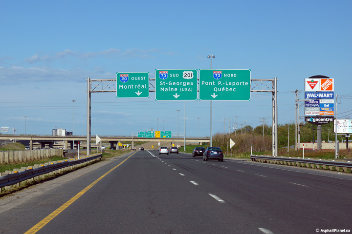
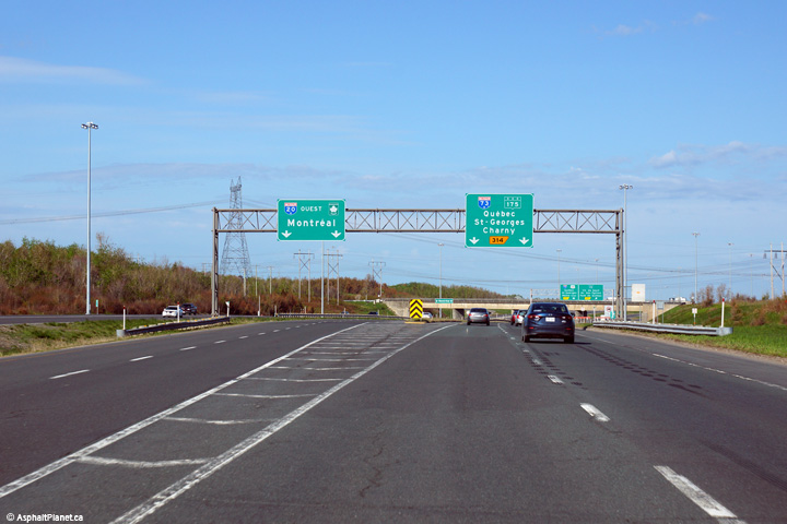
Lévis |
Signage as the westbound off-ramp to Autoroute 73 departs from the collector lanes of Autoroute 20. |
|
||
|
Date: 5/25/2015 |
High-res: (1440x960) (2400x1600) | |||
|
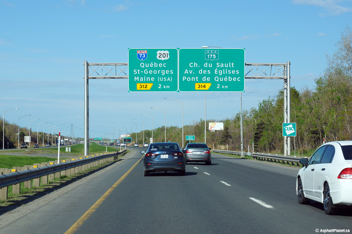
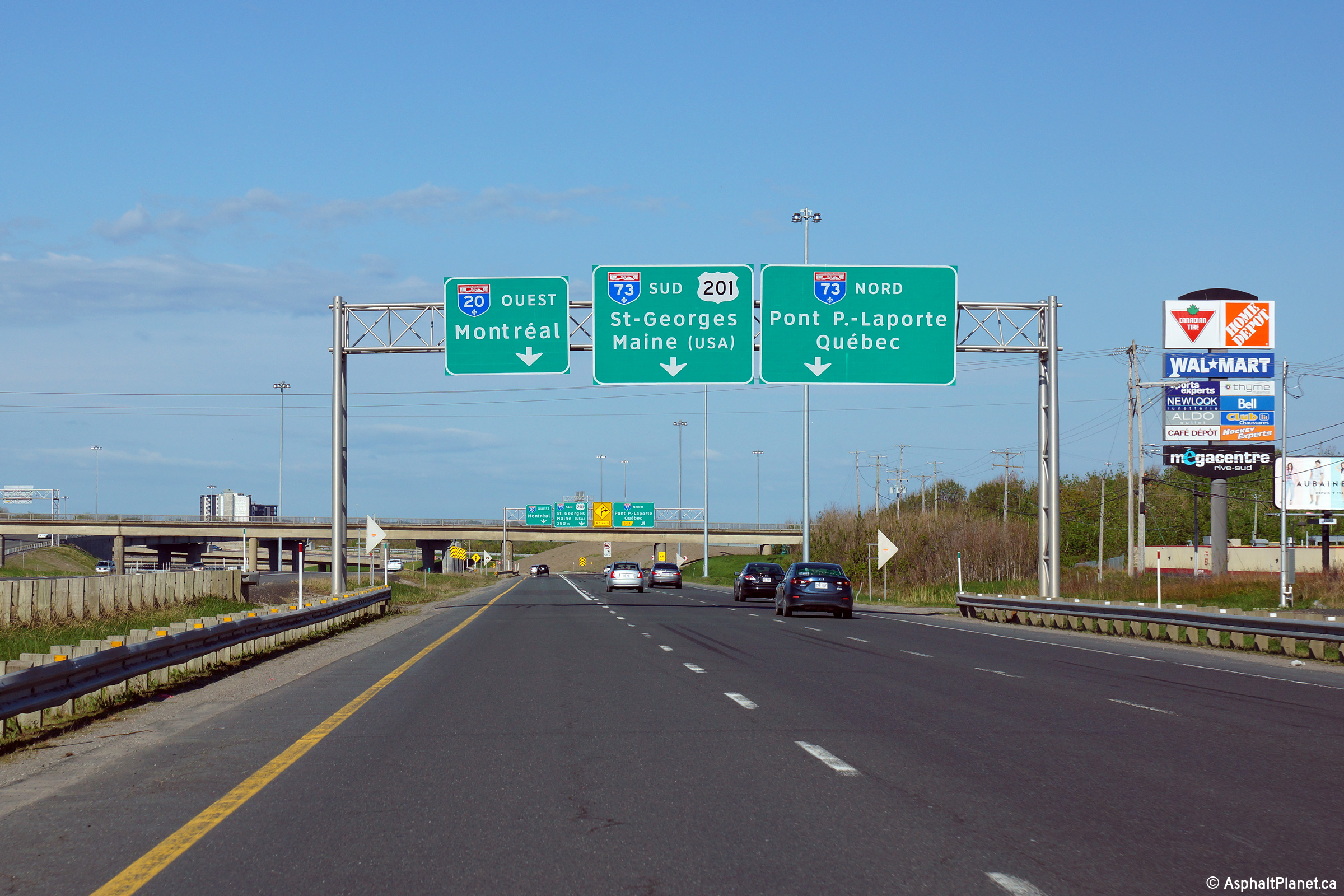
Lévis |
Westbound advanced signage in advance of the Autoroute 73 interchange. |
|
||
|
Date: 5/25/2015 |
High-res: (1440x960) (2400x1600) | |||
|
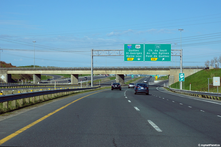
Lévis |
Signage at the off-ramp to Route 175 from the westbound collector lanes of Autoroute 20. |
|
||
|
Date: 5/25/2015 |
High-res: (1440x960) (2400x1600) | |||
|
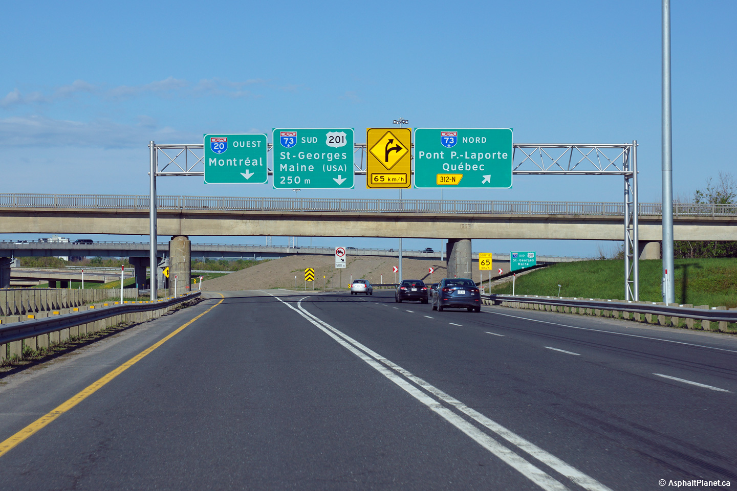
Lévis |
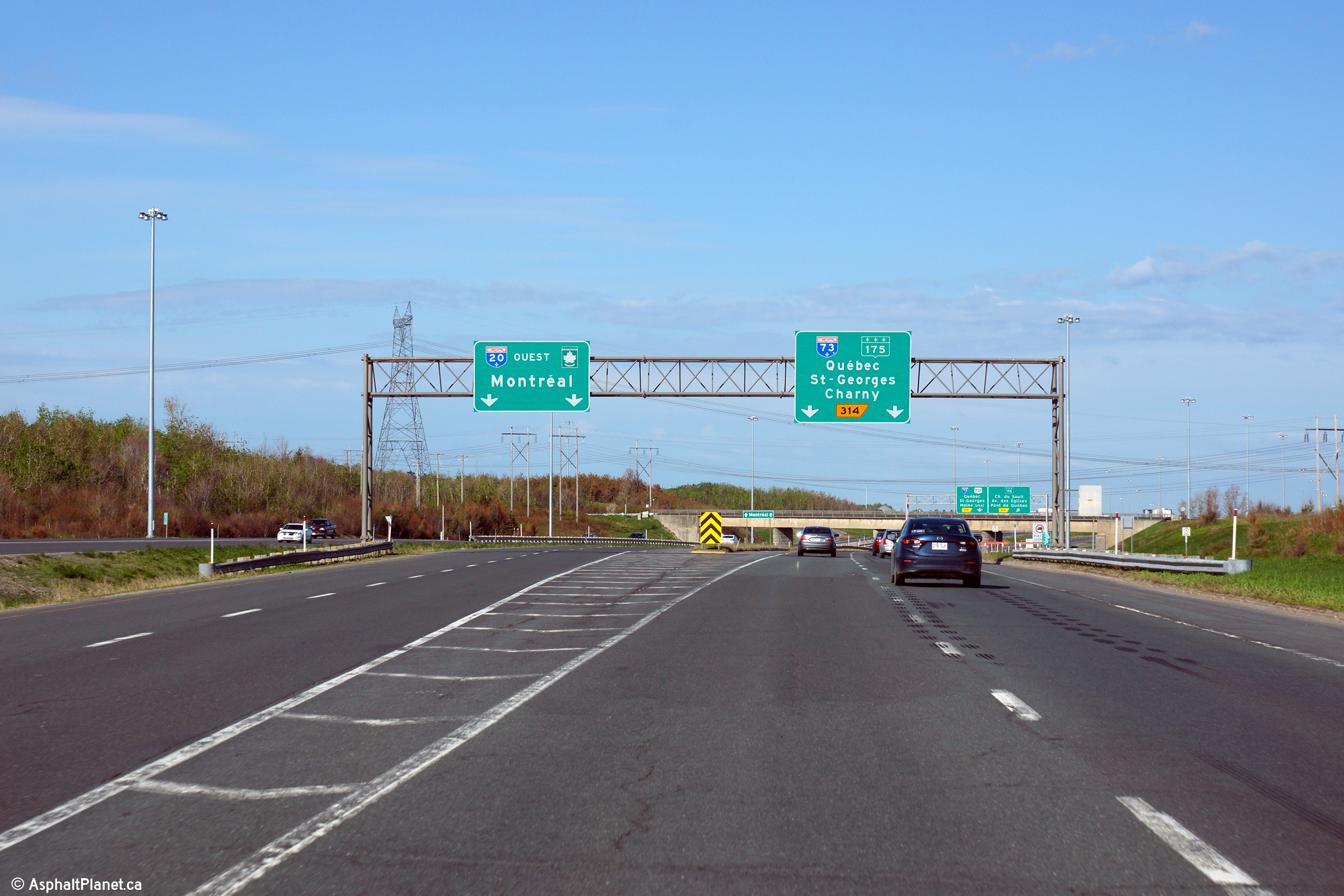
Westerly view as the ramp lanes to Autoroute 73 and Route 175 depart from the mainline lanes of Autoroute 20. The ramp lanes for A-73 and R-175 form a short set of collector lanes. Through traffic along Autoroute 20 can continue through the collector lanes and rejoin Autoroute 20 at the A-73 interchange. |
|
||
|
Date: 5/25/2015 |
High-res: (1440x960) (2400x1600) | |||
|
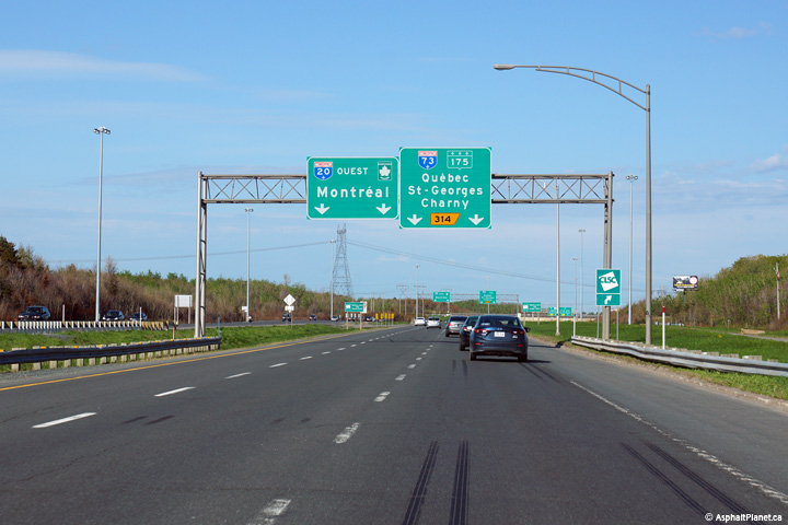
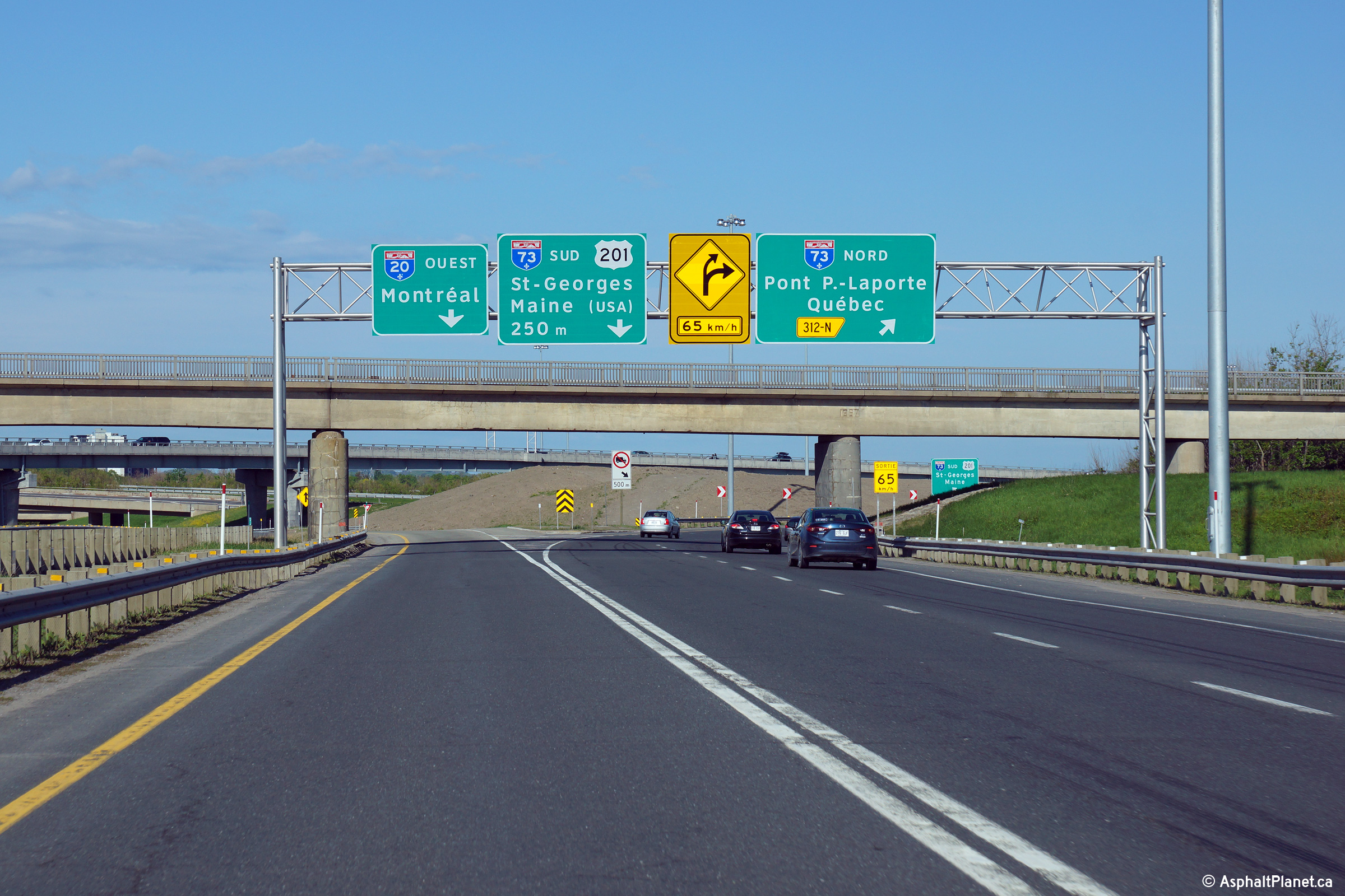
Lévis |
Westerly advanced signage in advance of the ramps to both Autoroute 73 and Route 175. |
|
||
|
Date: 5/25/2015 |
High-res: (1440x960) (2400x1600) | |||
|
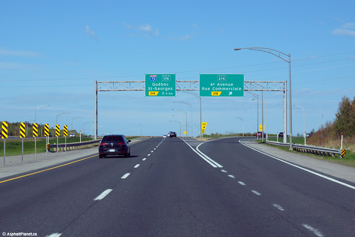
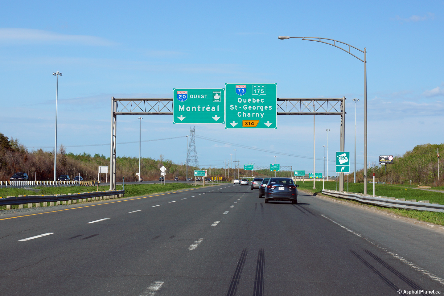
Lévis |
Advanced signage for the Autoroute 73 and Route 175 interchanges. |
|
||
|
Date: 5/25/2015 |
High-res: (1440x960) (2400x1600) | |||
|
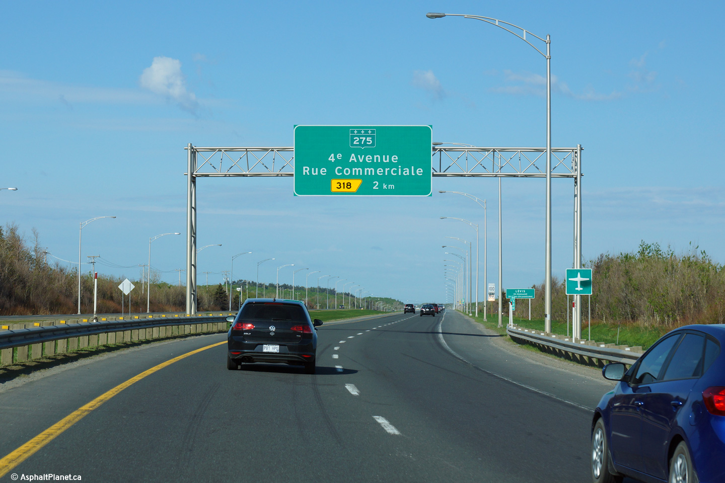
Lévis |
Westbound signage at the off-ramp to Route 275. |
|
||
|
Date: 5/25/2015 |
High-res: (1440x960) (2400x1600) | |||
|
Lévis |
Advanced signage for the Route 275 interchange. |
|
||
|
Date: 5/25/2015 |
High-res: (1440x960) (2400x1600) | |||
|
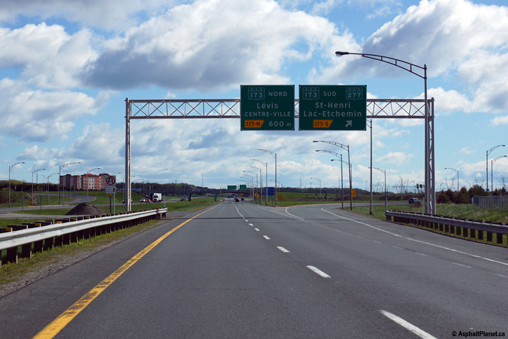
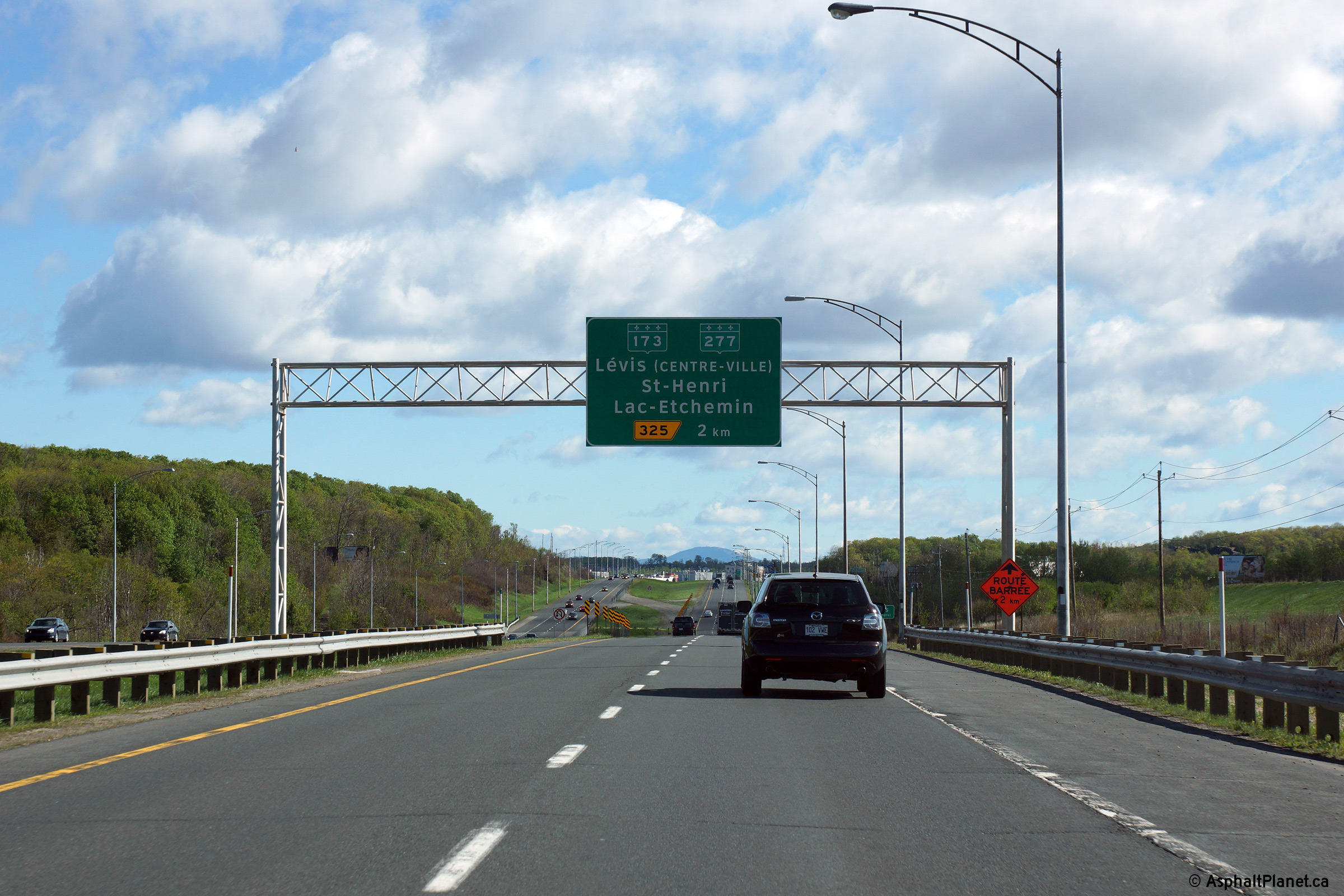
Lévis |
Advanced signage for the Route 173 interchange. Route 173 is the principal route in to Downtown Lévis. |
|
||
|
Date: 5/24/2015 |
High-res: (1440x960) (2400x1600) | |||
|
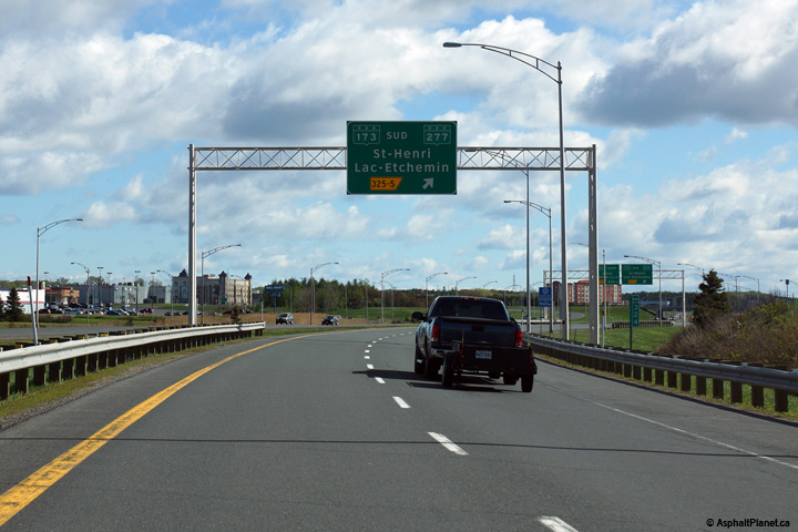
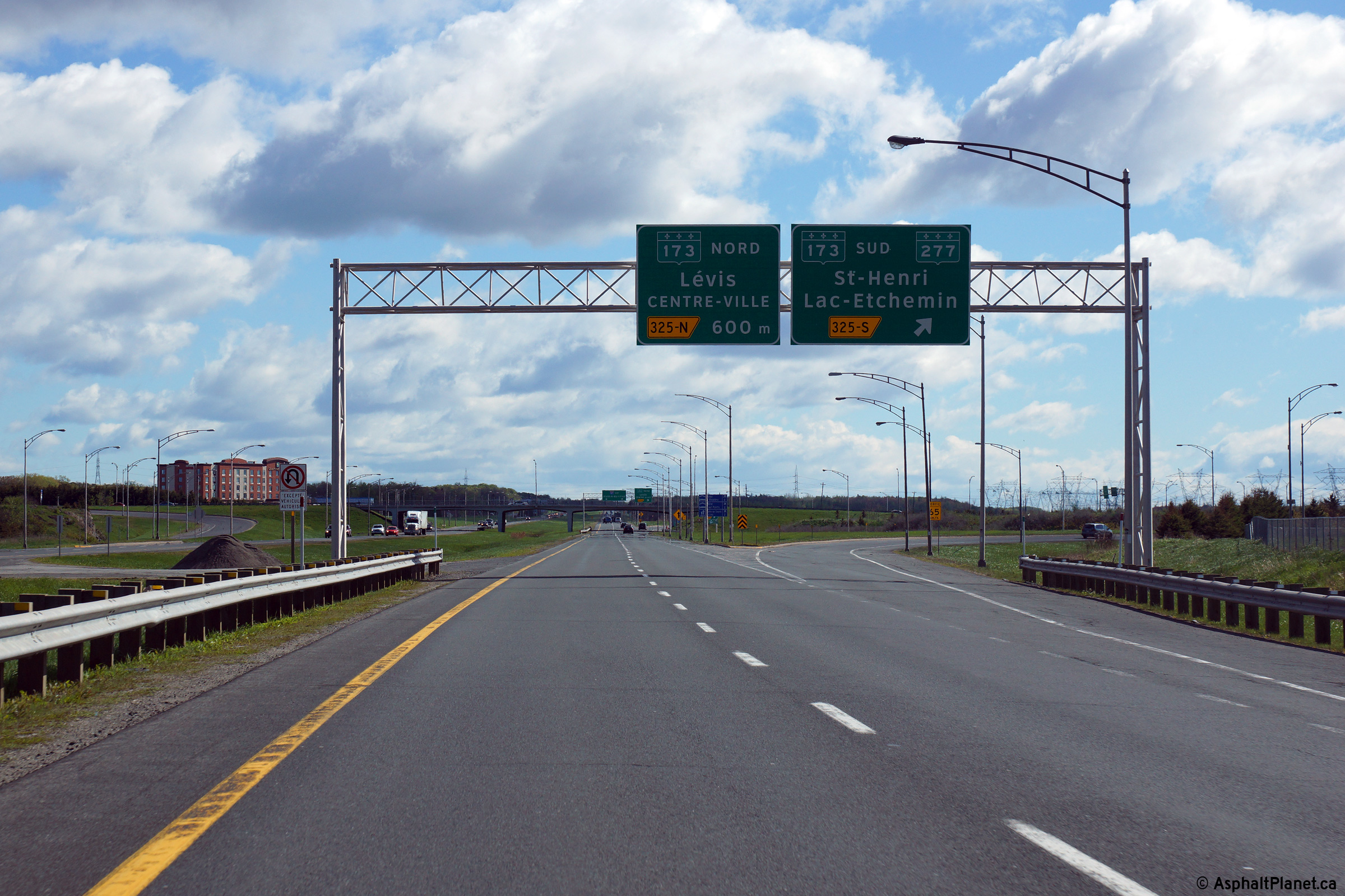
Lévis |
Advanced signage for the ramp to Route 173 South. |
 |
||
|
Date: 5/24/2015 |
High-res: (1440x960) (2400x1600) | |||
|
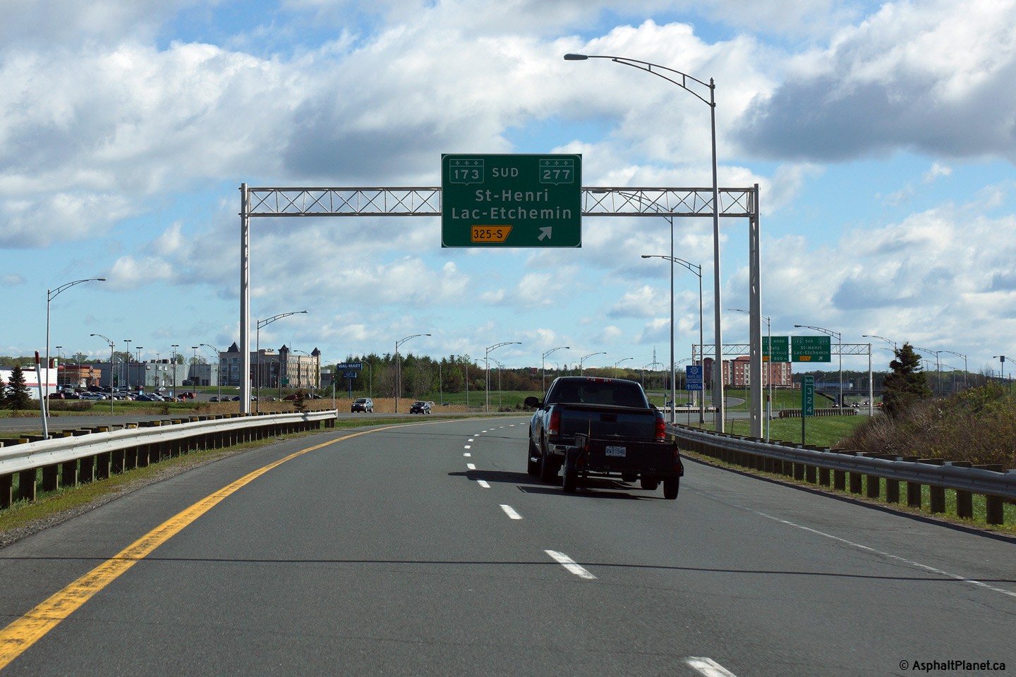
Lévis |
Signage at the ramp to Route 173 South. |
 |
||
|
Date: 5/24/2015 |
High-res: (1440x960) (2400x1600) | |||
|
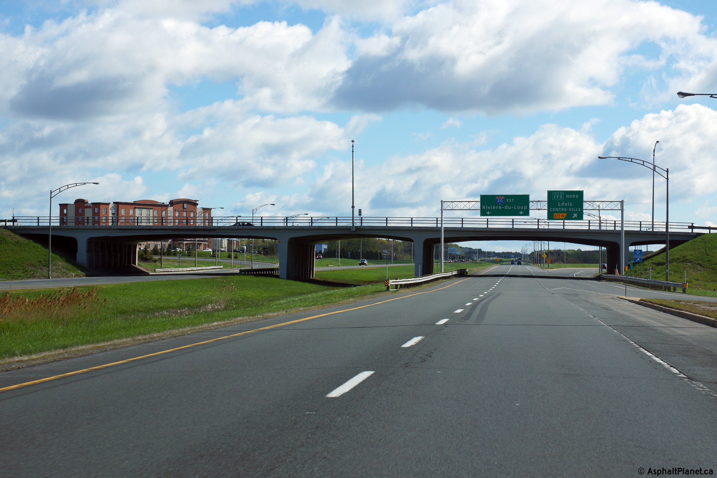
Lévis |
View approaching the off-ramp to Route 173 North. Route 173 crosses Autoroute 20 on an attractive multi-span concrete rigid frame arch bridge. |
 |
||
|
Date: 5/24/2015 |
High-res: (1440x960) (2400x1600) |
|||
<- Page 5 Back to Autoroute 20 Index Page 7 ->
© 2006-2015 AsphaltPlanet.ca.
AsphaltPlanet@asphaltplanet.ca
Page Created: July 1, 2015.
Last Updated: July 1, 2015.


