
AsphaltPlanet.ca > Québec > Autoroute 20 > Page 1
|
Autoroute 20 |
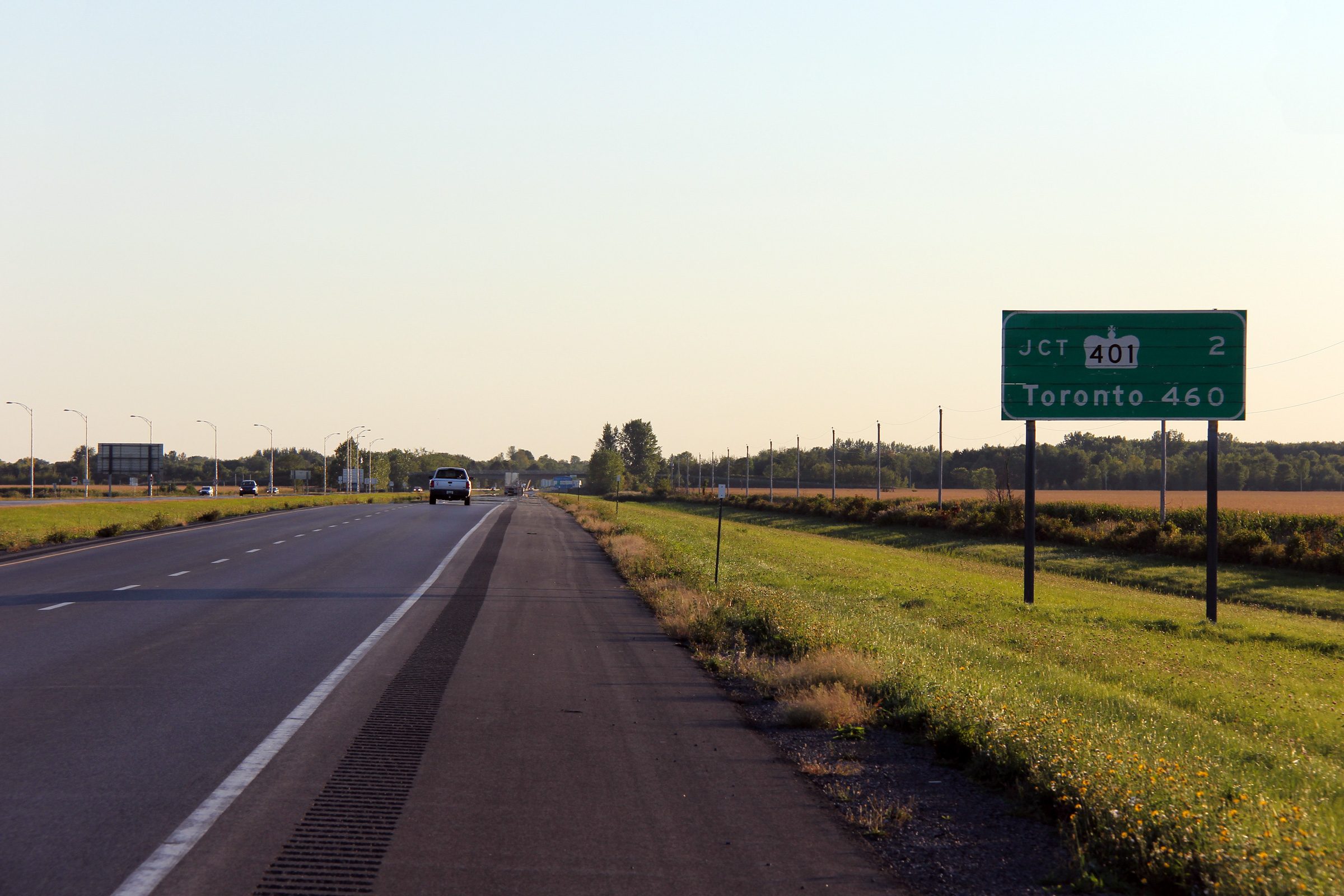
| <- ON 401 |
|
Page 2 -> |
Pictures on this page are arranged in order from west to east. A-20 East photos are left-aligned in the last column, while A-20 west photos are right-aligned. Center-line pictures are centered within the last column.
|
Location |
Description |
Photo |
||
|
East- |
West- |
|||
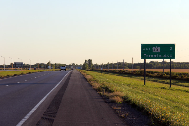
| A-20 continues westerly into Ontario as Highway 401 (The Macdonald-Cartier Freeway). Click here for Highway 401 images. | ||||
|
MRC de Vaudreuil-Soulagnes |
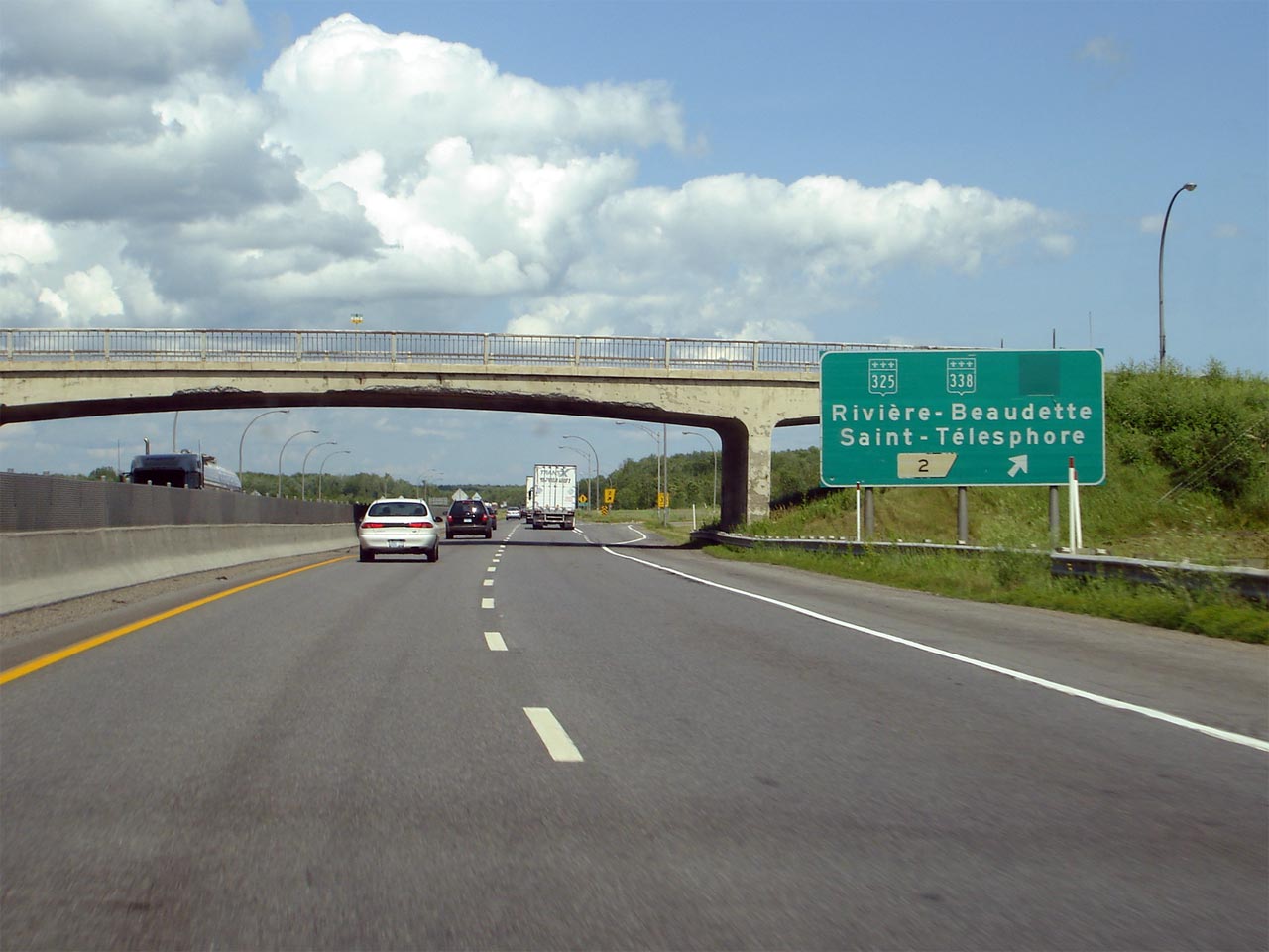
Advanced signage for the Route 325 and 338 interchange. This is the first interchange along A-20 east of Ontario's Highway 401. |
 |
||
|
Date: 7/5/2006 |
||||
|
MRC de Vaudreuil-Soulagnes |
The final westbound destination signage along Autoroute 20 approaching the Ontario border. |
|
||
|
Date: 9/18/2011 |
High-res: (1440x960) (2400x1600) |
|||
|
MRC de Vaudreuil-Soulagnes |
The second eastbound advanced sign for the Route 325 and 338 interchange is located just before two closely spaced single span concrete rigid frame overpasses. |

|
||
|
Date: 7/5/2006 |
||||
|
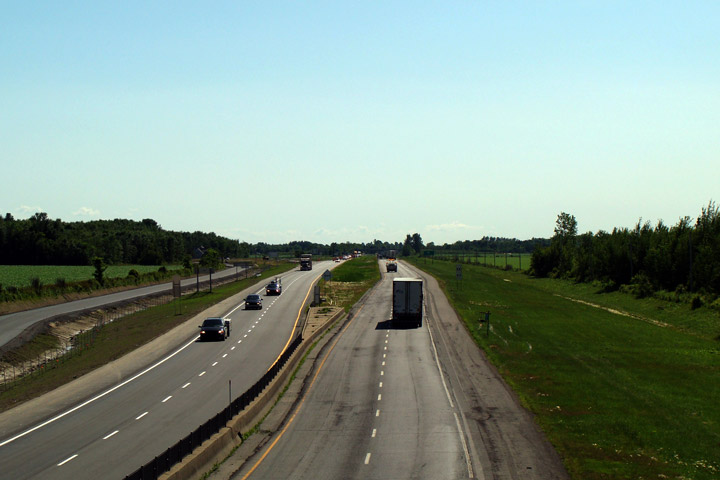
MRC de Vaudreuil-Soulagnes |
View looking westerly along A-20 towards its western terminus at the Ontario-Quebec Boundary. |
 |
||
|
Date: 7/9/2009 |
High-res | |||
|
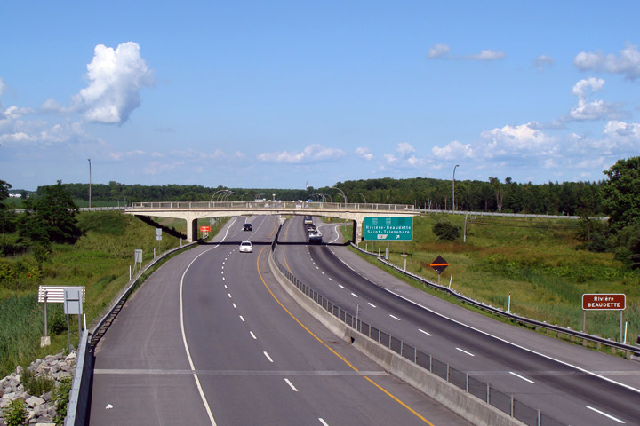
MRC de Vaudreuil-Soulagnes |
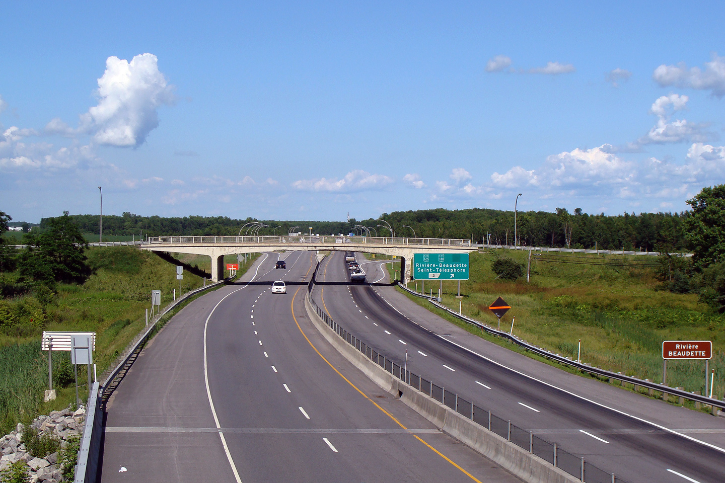
Easterly view from the Ste-Claire Road overpass towards the western-most interchange along A-20. The pictured R-325 overpass looks worse for wear than its actual condition since the concrete sealant that adorns the structure has been allowed to slowly flake away over the years. The western reach of A-20 was completed in the early 1960s, predating the completion of Ontario's Highway 401 to the Quebec border |
 |
||
|
Date: 7/9/2009 |
High-res | |||
|
MRC de Vaudreuil-Soulagnes |
Route 325 crosses A-20 at this overpass, while Route 338 begins heading east to Montreal from this location. Route 338 is the equivalent to Ontario's Highway 2, which before A-20 and Highway 401 was the main road between Montreal and Toronto. |
|
||
|
Date: 7/5/2006 |
High-res | |||
|
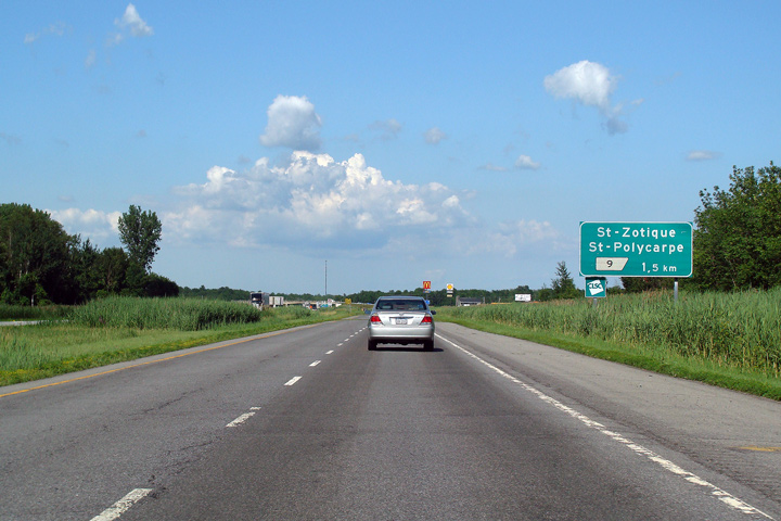
MRC de Vaudreuil-Soulagnes |
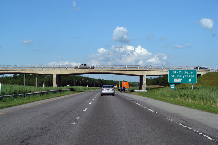
Advanced signage for Exit 9. Notice that a comma is used to show that Exit 9 is located 1.5km from this sign post. The comma and period are reversed in French Language jurisdictions than they are in their English speaking counterparts. Unlike the rest of Canada, in Quebec, one hundred-thousand-dollars would be written as such: $100.000,00. |
|
||
|
Date: 7/5/2006 |
||||
|
MRC de Vaudreuil-Soulagnes |
View at Exit 9. There is nothing particularly remarkable about this photo, though I always find it striking just how old everything about the Autoroute network is. From the overpass, to the driving surface to the signage -- everything about this freeway is dated. |
|
||
|
Date: 7/5/2006 |
||||
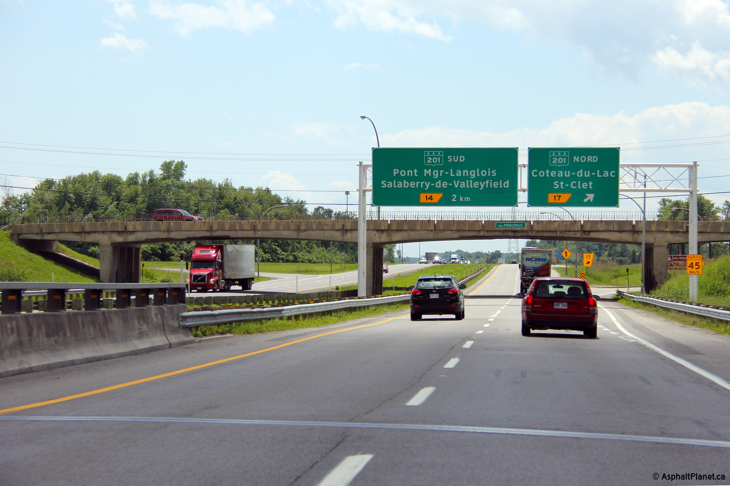
|
MRC de Vaudreuil-Soulagnes |
Overhead exit at exit 12, with an advanced sign for Route 201. Route 201 is unique as it is the only 200-series secondary highway in Quebec to cross north of the St. Lawrence River. |

|
||
|
Date: 7/5/2006 |
||||
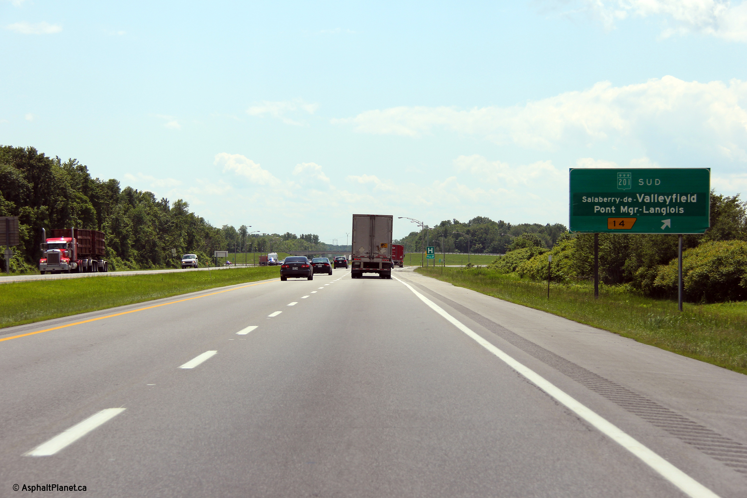
|
MRC de Vaudreuil-Soulagnes |
Second advanced sign for the Route 201 south exit. Notice the median crossovers to the left of the sign that are used to divert traffic between opposing carriageways during construction. |
|
||
|
Date: 7/5/2006 |
||||
|
R-201 is the principal link from A-20 to A-30 through extreme western Quebec. Click here for R-201 images. |
||||
|
MRC de Vaudreuil-Soulagnes |
View looking westerly at the Route 201 North interchange. |
|
||
|
Date: 6/19/2013 |
High-res: (1440x960) (2400x1600) |
|||
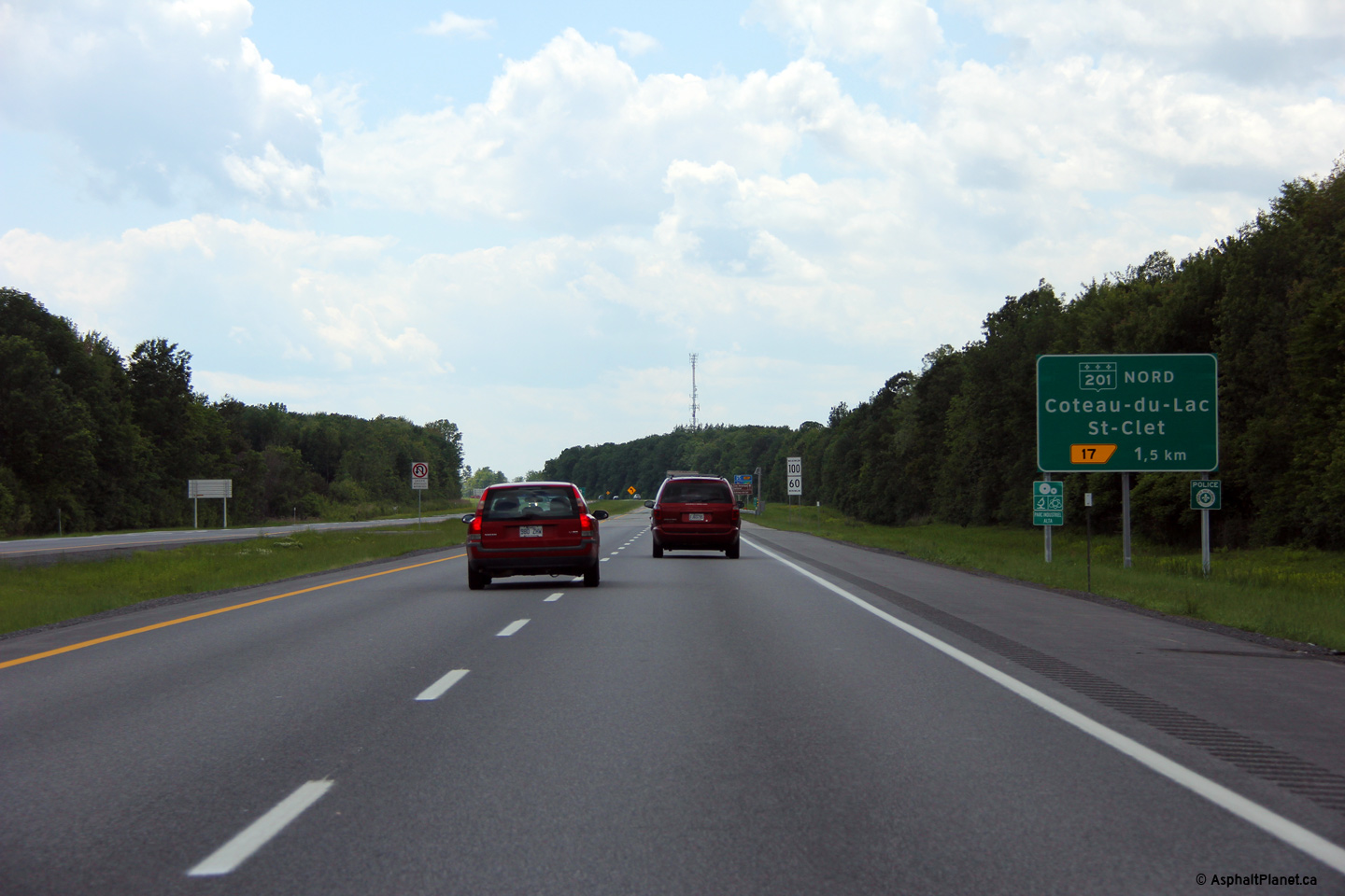
|
MRC de Vaudreuil-Soulagnes |
Signage for the Route 201 north exit. Route 201 is multiplexed along A-20 for roughly 3km. |

|
||
|
Date: 7/5/2006 |
High-res: (1440x960) |
|||
|
MRC de Vaudreuil-Soulagnes |
View looking westerly at the Route 201 North interchange. |
|
||
|
Date: 6/19/2013 |
High-res: (1440x960) (2400x1600) |
|||
|
MRC de Vaudreuil-Soulagnes |
Westbound advanced signage for the R-201 North interchange. |
|
||
|
Date: 6/19/2013 |
High-res: (1440x960) (2400x1600) |
|||
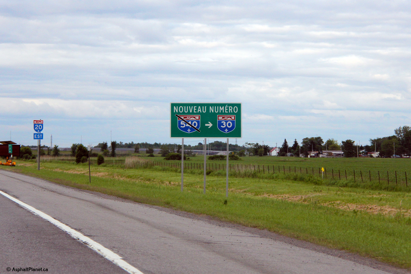
|
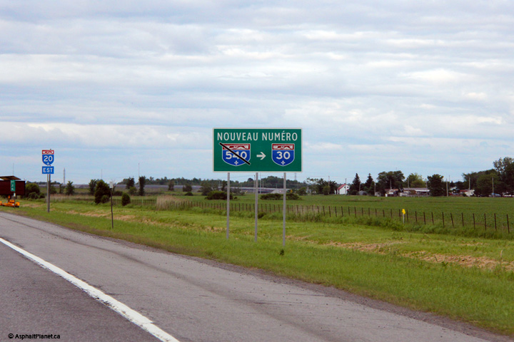
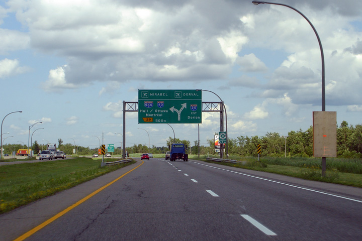
MRC de Vaudreuil-Soulagnes |
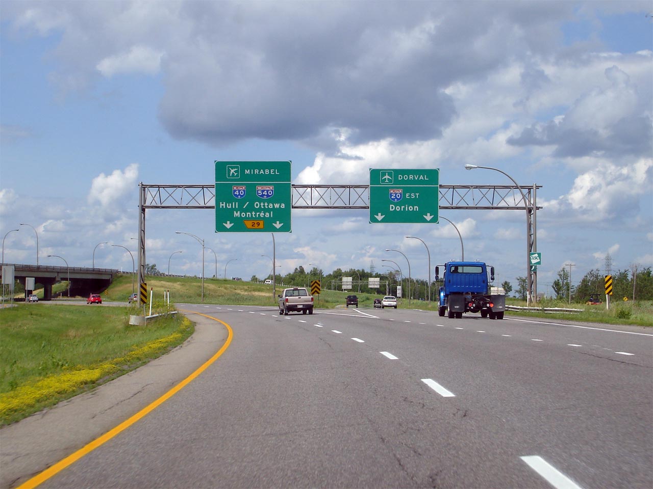
Signage advising motorists that Autoroute 540 has been renumbered as Autoroute 30. |
 |
||
|
Date: 6/18/2013 |
High-res: (1440x960) | |||
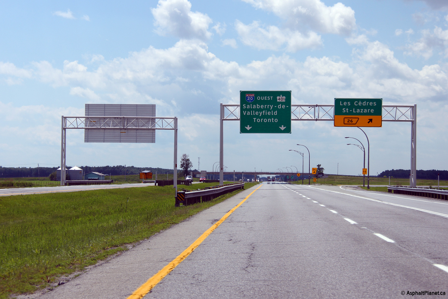
|
MRC de Vaudreuil-Soulagnes |
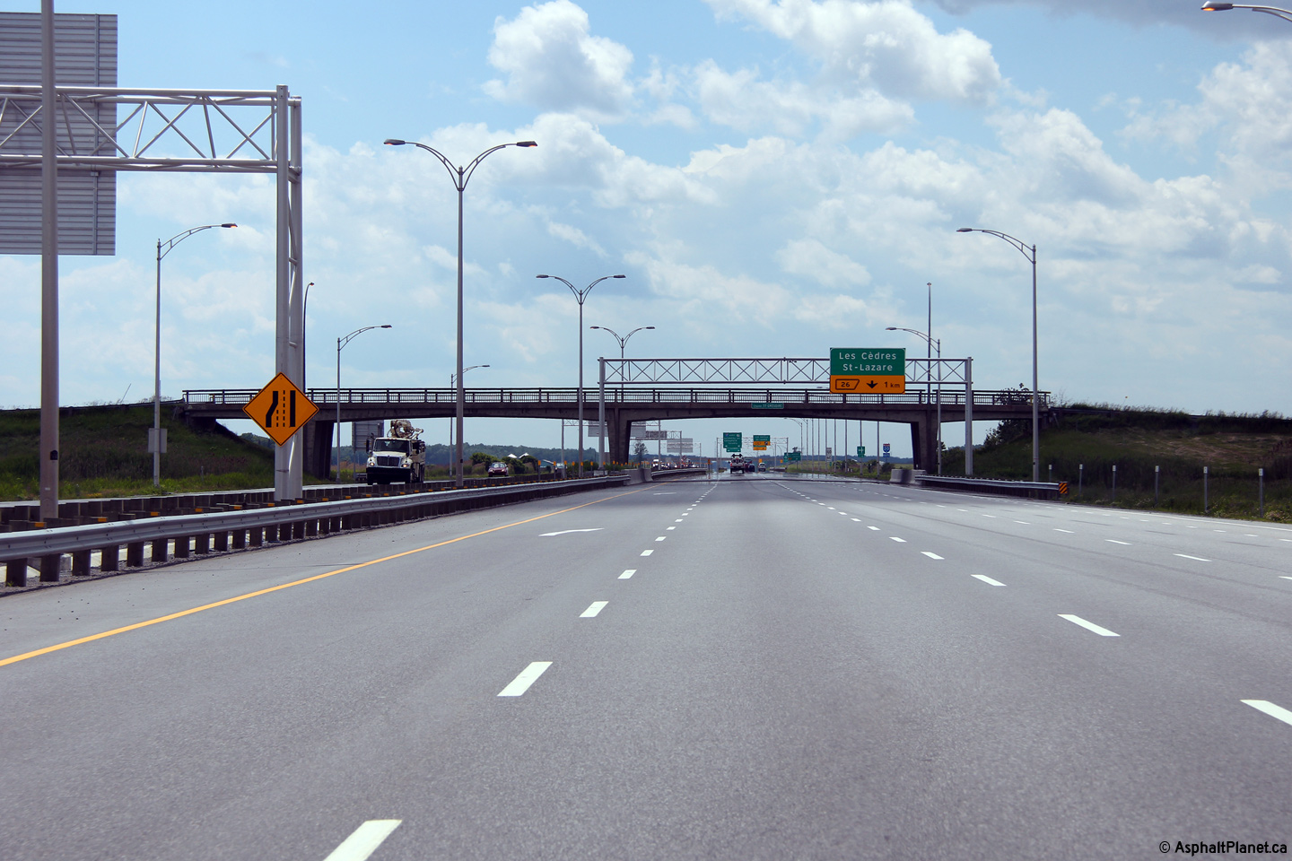
Signage at the westbound off-ramp to the Les Cèdres interchange. Beyond this interchange, Autoroute 20 has a standard four lane (two per direction) cross-section westerly to the Ontario border and beyond. |
|
||
|
Date: 6/19/2013 |
High-res: (1440x960) (2400x1600) |
|||
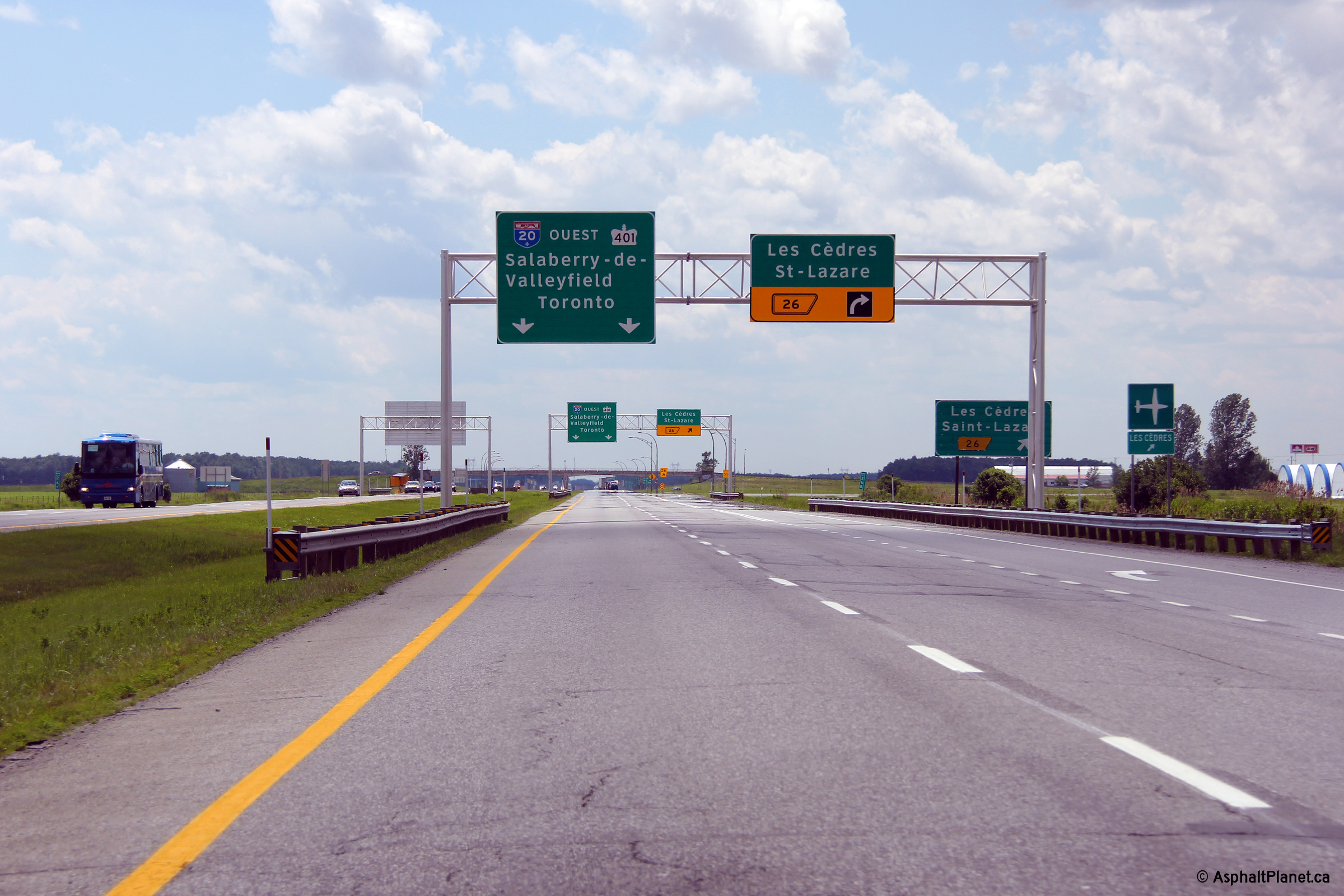
|
MRC de Vaudreuil-Soulagnes |
Westbound advanced signage for the Les Cèdres interchange. |
|
||
|
Date: 6/19/2013 |
High-res: (1440x960) (2400x1600) |
|||
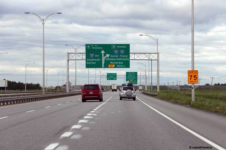
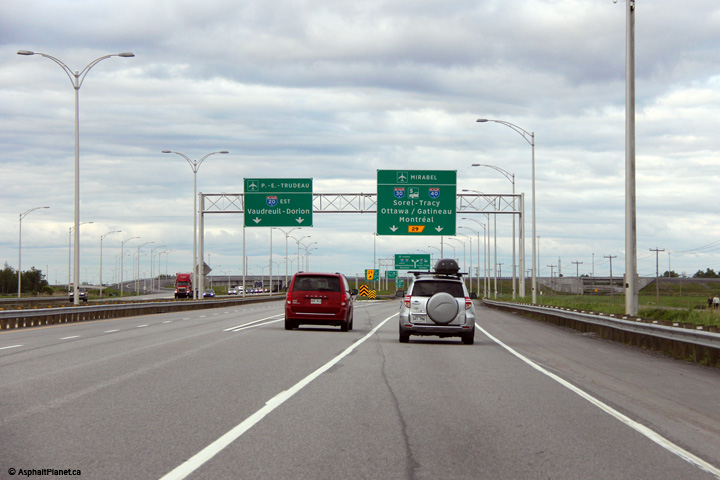
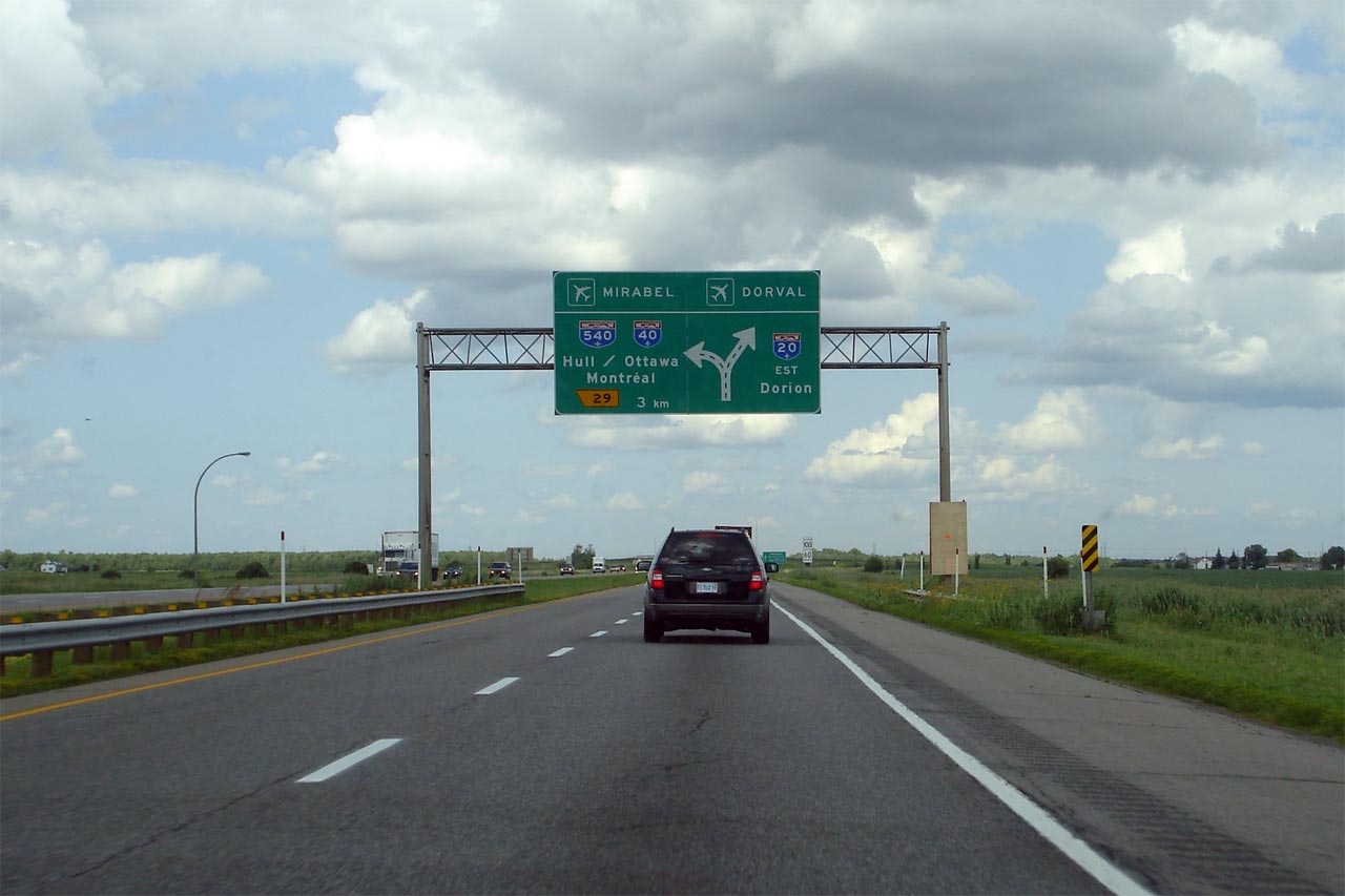
|
MRC de Vaudreuil-Soulagnes |
Two views looking easterly approaching the Autoroute 30/540 interchange. This is the first of a series of large diagram signs in advance of the large interchange.
Photo #1: 7/5/2006 |
 |
||
| High-res: (1440x960) | ||||
 |
||||
|
Date: as noted |
High-res: (1440x960) (2400x1600) | |||
|
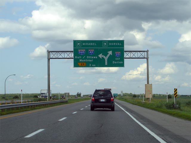
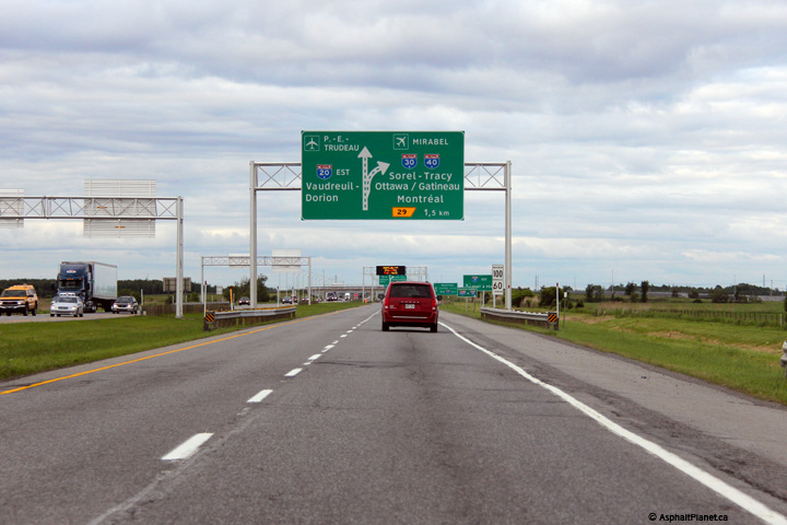
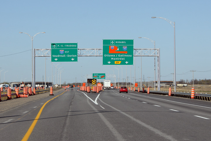
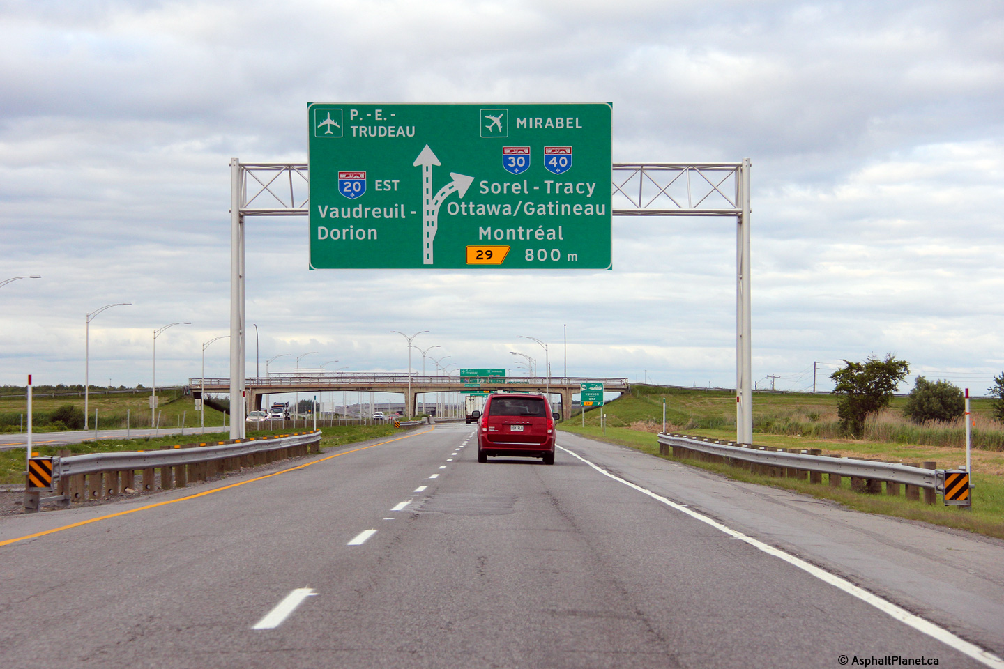
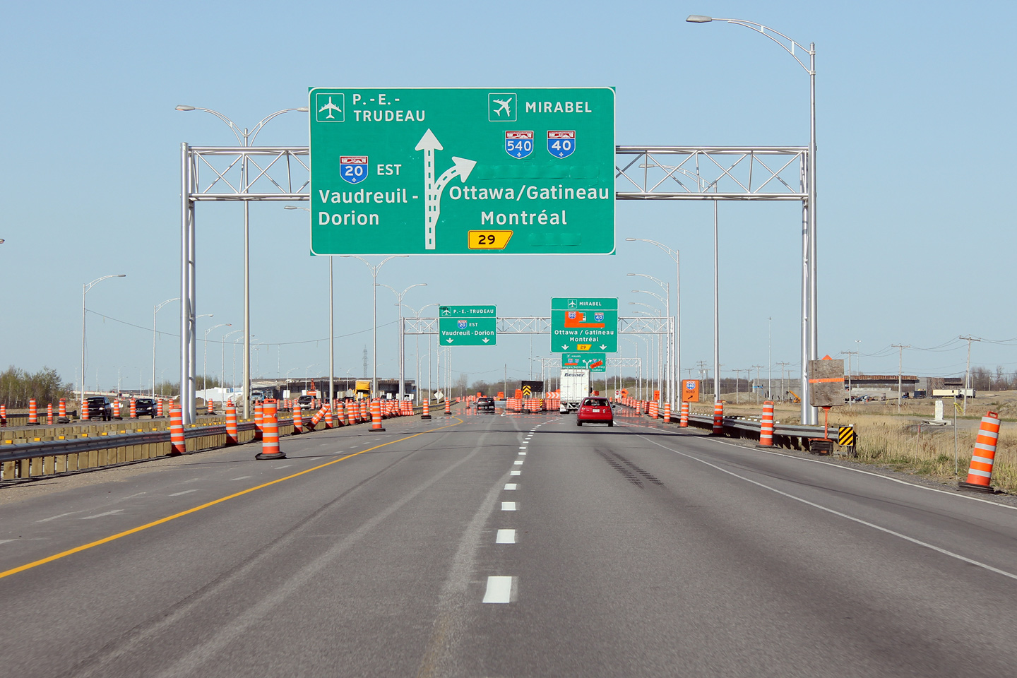
MRC de Vaudreuil-Soulagnes |
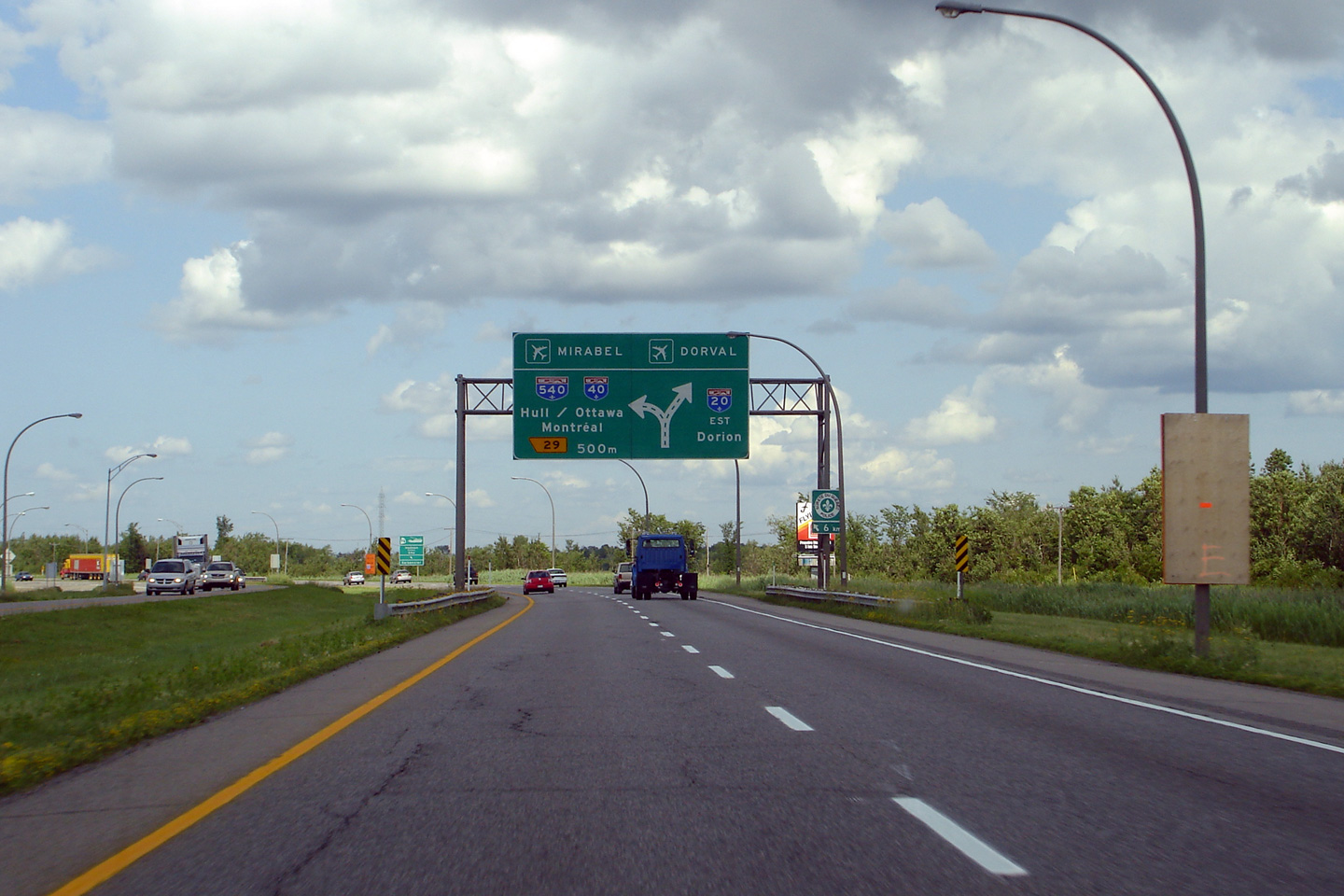
Second overhead signage for the Autoroute 30 interchange. A considerable amount of information is displayed to motorists on this large sign board. Autoroute 30 forms the southern by-pass of Montreal Island. |
 |
||
|
Date: 7/5/2006 |
High-res: (1440x960) (2400x1600) | |||
|
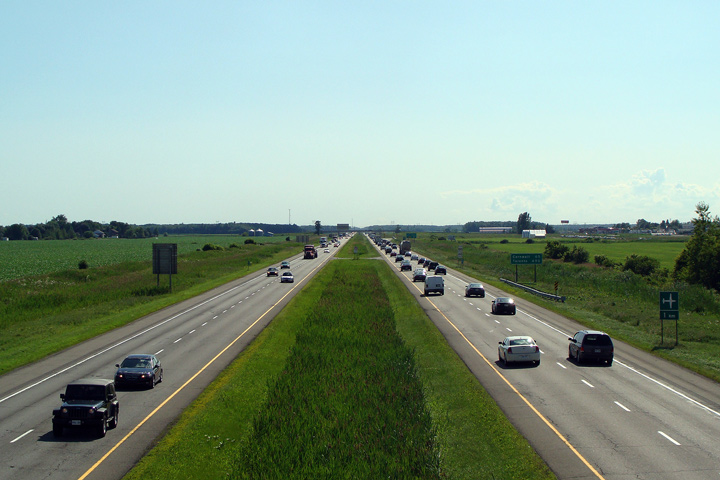
MRC de Vaudreuil-Soulagnes |
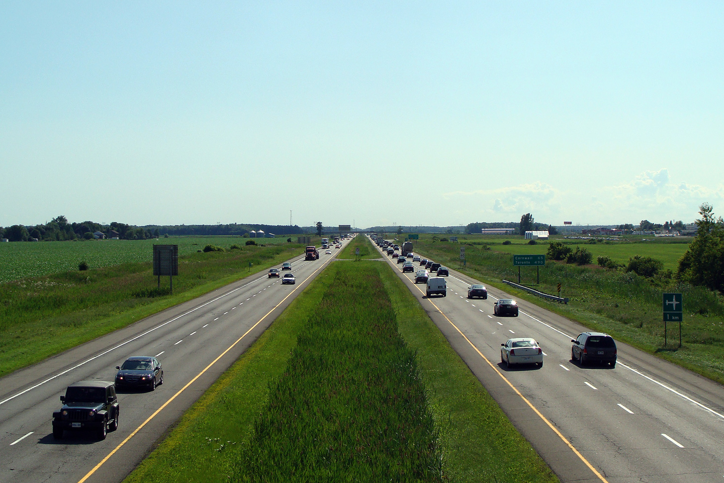
View looking westerly from St. Gregoire Road. Note how busy A-20 is leading west towards Ontario. This photo was taken before construction of the nearby Autoroute 30 interchange had commenced. The cross-section was widened as part of the Autoroute 30 construction. |
 |
||
|
Date: 7/9/2009 |
High-res: (1440x960) | |||
|
MRC de Vaudreuil-Soulagnes |
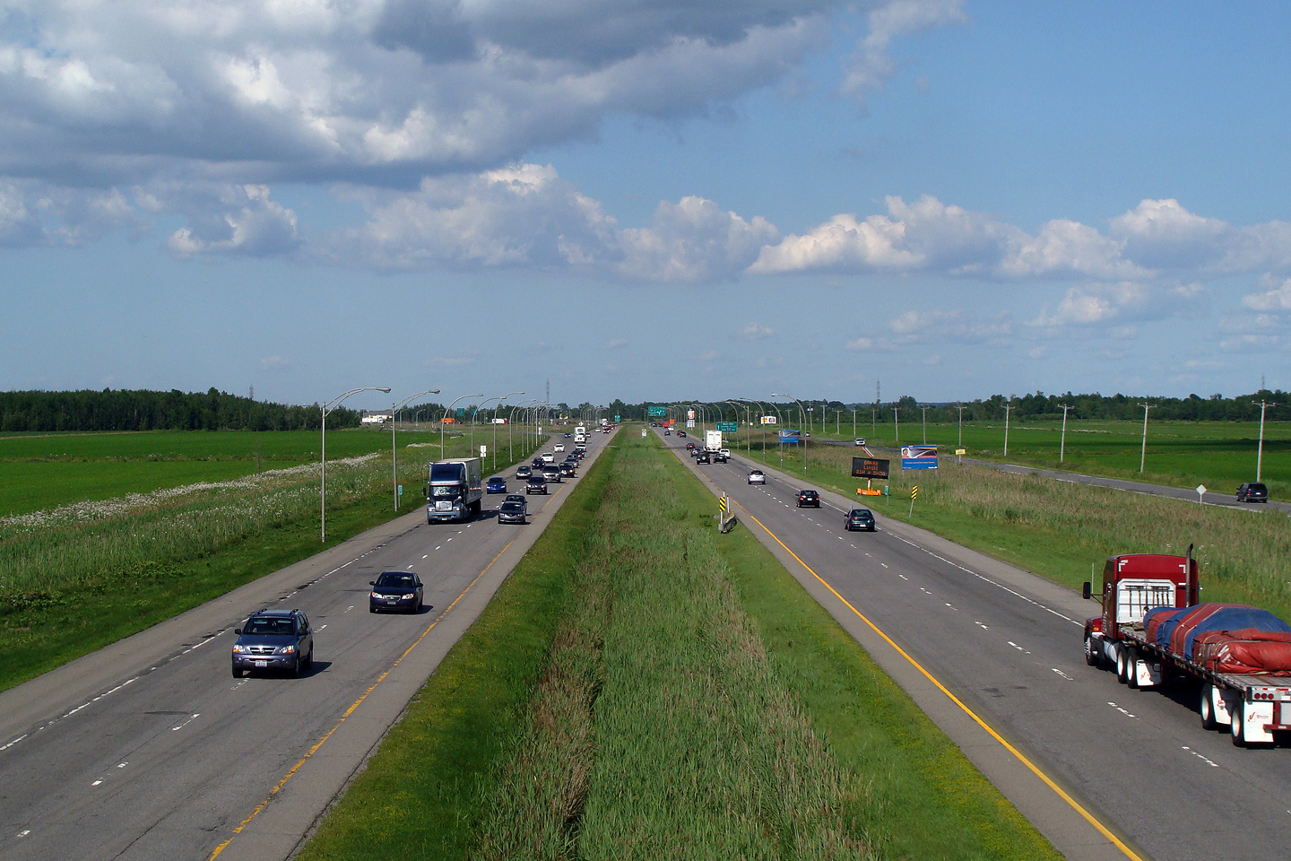
Easterly view from St. Gregoire Road. This view looks easterly towards the former Autoroute 540 interchange. This photo is out of date, as the interchange was substantially reconfigured as part of the construction of Autoroute 30. |
 |
||
|
Date: 7/9/2009 |
High-res: (1440x960) | |||
|
MRC de Vaudreuil-Soulagnes |
Westbound signage approaching the Les Cèdres interchange. The westbound lanes of Autoroute 20 have a considerable cross-section at this point. The extra lanes are caused by the incoming ramps from the Autoroute 30 interchange. Autoroute 20 quickly narrows to a four lane freeway (two per direction) beyond the Les Cèdres interchange. |
|
||
|
Photographer: SScott Steeves |
Date: 6/19/2013 |
High-res: (1440x960) (2400x1600) |
||
|
MRC de Vaudreuil-Soulagnes |
Despite the signalized intersections through Dorion, traffic bound for Downtown Montreal is directed to continue eastbound along A-20. |
 |
||
|
Date: 7/5/2006 |
||||
|
MRC de Vaudreuil-Soulagnes |
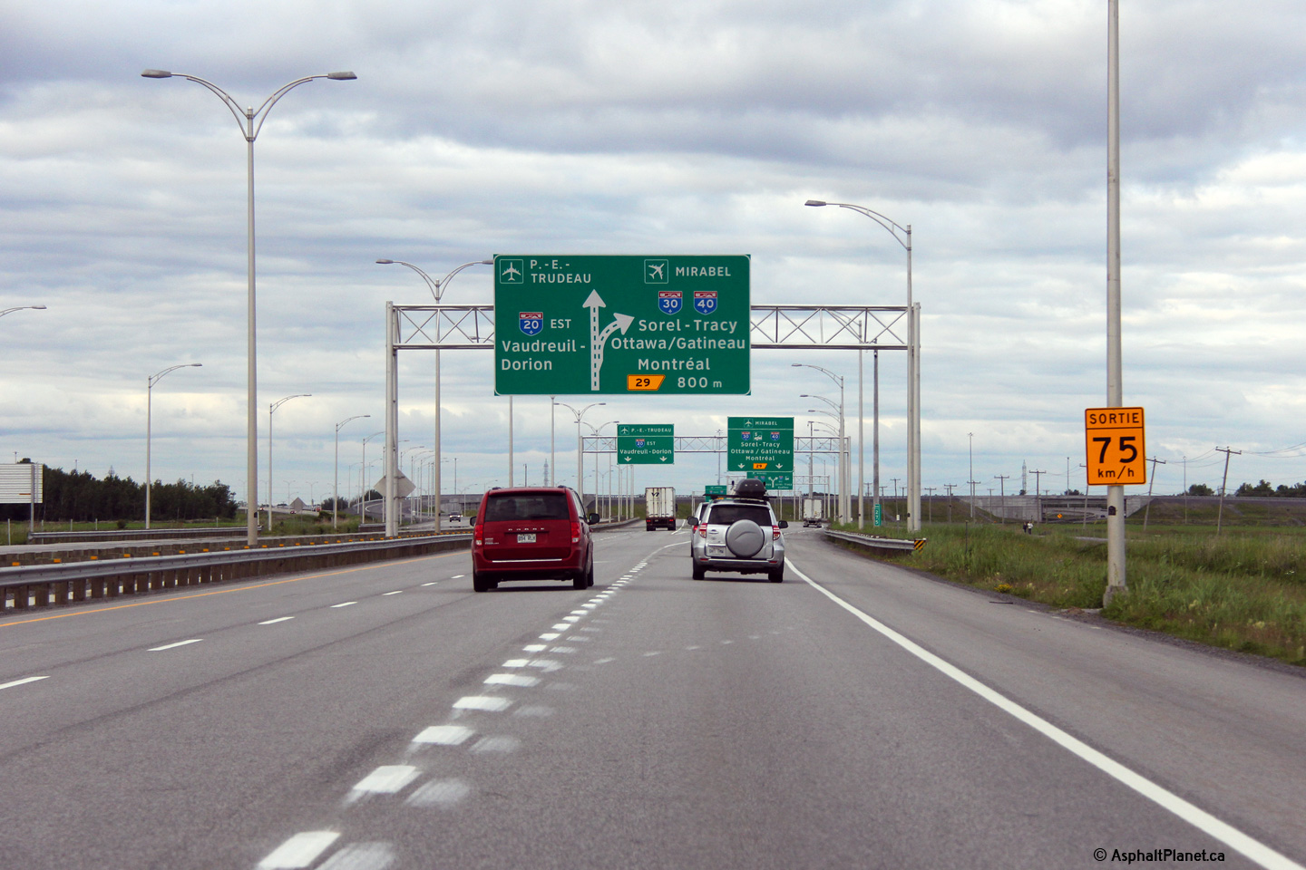
Final eastbound advanced signage for the Autoroute 30/540 interchange.
Photo #1: 7/5/2006 |
 |
||
| High-res: (1440x960) | ||||
 |
||||
| High-res: (1440x960) | ||||
 |
||||
|
Date: as noted |
High-res: (1440x960) (2400x1600) |
|||
|
MRC de Vaudreuil-Soulagnes |
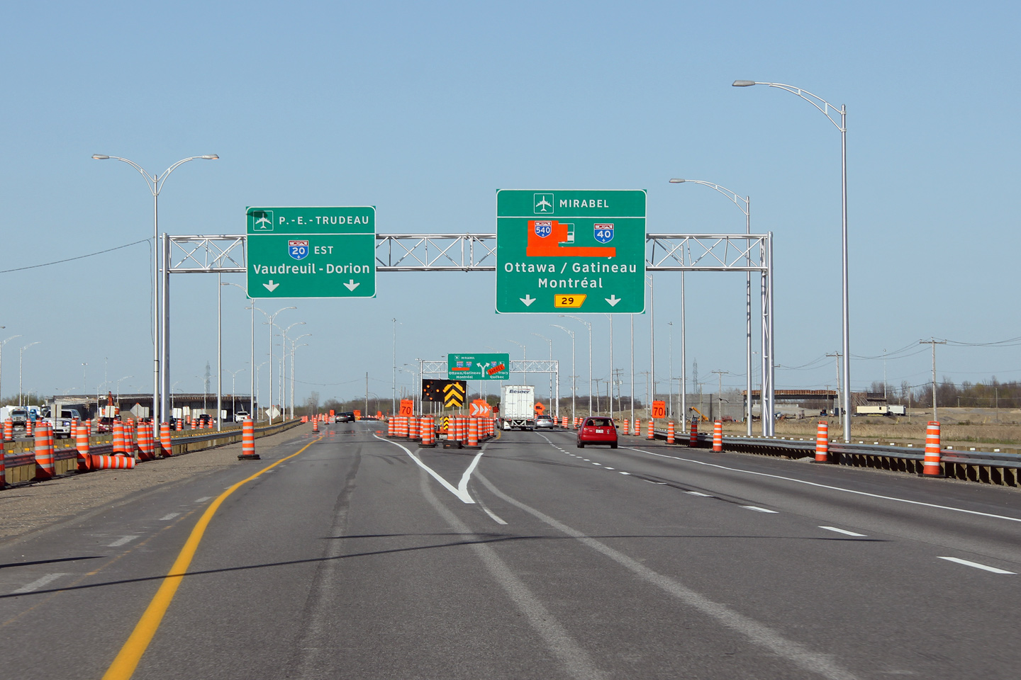
Signage as the ramp to Autoroute 30 (née 540) departs from the mainline lanes of Autoroute 20 east. The gore point was moved a considerable distance to the west during the construction project.
Photo #1: 7/5/2006 |
|
||
| High-res: (1440x960) | ||||
 |
||||
|
High-res: (1440x960) |
||||
 |
||||
|
Date: as noted |
High-res: (1440x960) (2400x1600) |
|||
|
Autoroute 30 forms the southern by-pass of Montreal, starting at A-40 in Vaudreuil and following the South Shore to Sorel-Tracy. Click here for A-30 images. |
||||
<- ON 401 Back to Autoroute 20 Index Page 2 ->
© 2006-16 Scott Steeves. AsphaltPlanet@asphaltplanet.ca
Page Created: December 13, 2008.
Last Updated: January 17, 2016.


