QUEEN ELIZABETH WAY
Early 1990s
Regional Municipality of Halton
 |
Overhead gantry located on the Toronto-bound QEW at the Highway 403 (east) exit in Oakville. Highway 403 was not a continuous route for 23 kilometres between Burlington and Oakville until 2002. May of 1995. |
| Overhead diagram sign located on the Hamilton-bound QEW in advance of the Dorval Drive/Kerr Street interchange in Oakville. For some reason, lane distribution is not indicated on this sign. April of 1991. |
 |
| Overhead gantry located on Hamilton-bound QEW at the Dorval Drive/Kerr Street interchange in Oakville. April of 1991. |
 |
| Overhead gantry located on Hamilton-bound QEW at the Third Line Road interchange in Oakville. Here we get to see one of the earlier examples of a box shaped gantry, that were used by the MTC/MTO for a short time during the early and mid 1990s. April of 1991. |
 |
| Overhead gantry located on Hamilton-bound QEW at the Highway 25/Bronte Road interchange. The upward pointing arrow on the sign to the right looks a bit long and narrow compared to the standard. April of 1991. |
 |
| Facing Hamilton-bound along the QEW in Oakville towards the Burloak Drive interchange. Burloak Drive is the boundary between Oakville and Burlington. April of 1991. |
 |
| Overhead diagram signage located on the Hamilton-bound QEW in advance of the Highway 403 (Freeman) interchange. As many of you may be, I was shocked to learn after viewing this picture that Plains Road was accessible from the QEW in the early 1990s. April of 1991. |
 |
| Overhead gantry for the Highway 2/North Shore Boulevard exit located on the Niagara-bound QEW in Burlington. May of 1993. |
 |
| Looking Niagara-bound along the QEW from the base of Burlington Skyway in Burlington. April of 1991. |
 |
Regional Municipality of Hamilton-Wentworth
| Niagara-bound QEW as it descends the Burlington Bay Skyway. Surprisingly little has changed about this stretch of roadway in the last 20 years. April of 1991. |
 |
| Somewhat blury shot of the approach to the Woodward Avenue exit on the Niagara-bound QEW in Hamilton. April of 1991. |
 |
| Overhead gantry located on the Niagara-bound QEW at the Highway 20/Centennial Parkway interchange. Long before the days of the Red Hill Creek Expressway. April of 1991. |
 |
Regional Municipality of Niagara
| Looking Niagara-bound along the QEW towards the Martindale Road overpass in St. Catharines. April of 1991. |
 |
 |
Facing Toronto-bound along the QEW towards the Ontario Street interchange in St. Catharines. It seems like this section of the QEW is always under some sort of construction. April of 1991. |
 |
Looking Toronto-bound on the QEW in St. Catharines, about 500 metres east of the Ontario Street exit. Notice the substandard median strip. April of 1993. |
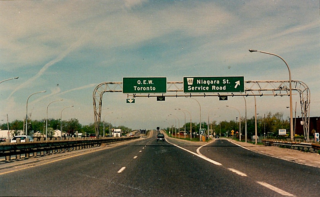  |
Overhead gantry located on the Toronto-bound QEW at the Niagara Street/North Service Road exit in St. Catharines. Notice that this section of the QEW is illuminated with unusual "tube" lighting. First Photo: April of 1991. Second Photo: April of 1993. |
| Ascending the Garden City Skyway, Niagara-bound on the QEW in St. Catharines. Not sure what Averill did with that "bridge ices" sign, but it does not look completely natural. April of 1991. |
 |
| View of the Niagara-bound QEW from atop the Garden City Skyway Bridge in St. Catharines. The impressive Garden City Skyway allows motor vehicle traffic to travel along the QEW without being disrupted by crossing ships on the Welland Canal. April of 1995. |
 |
| Facing Niagara-bound on the QEW as it descends along the Garden City Skyway bridge. The Welland Canal acts as the boundary between the City of St. Catharines and the Town of Niagara on the Lake . April of 1991. |
 |
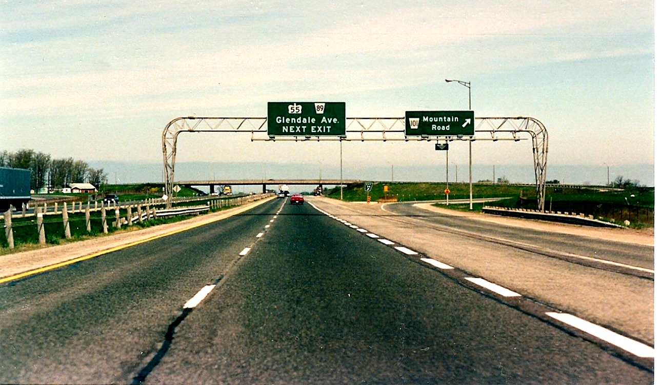
| Facing Niagara-bound on the QEW, about 1 kilometre westerly of the Highway 55/Glendale Avenue interchange in Niagara on the Lake. April of 1995. |
 |
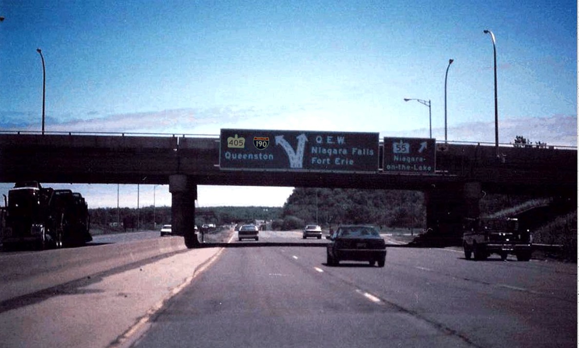
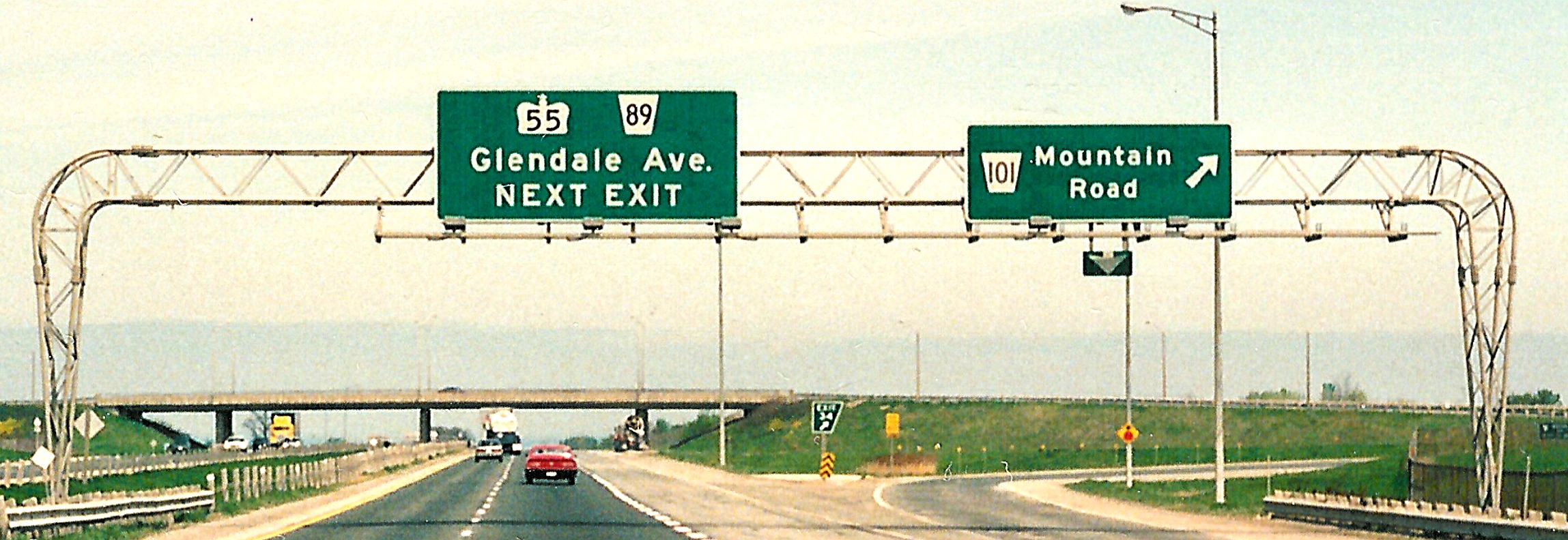
| Looking Niagara-bound on the QEW at the Highway 55/Glendale Avenue interchange. Highway 405 interchange barely visible in the background. Also, the overhead gantry in the opposing carriageway is the same gantry pictured in the photo below, but with TWO arrow tabs. April of 1991. |
 |
| Advance diagram signage for the Highway 405 interchange and exit signage for Highway 55 affixed to the Glendale Avenue overpass. This is facing Niagara-bound. Notice how the font for "Highway 55" changed slightly between 1991 amd 1994. First photo: April of 1994, Second photo: April of 1991. |
  |
 |
Overhead gantry located on the Toronto-bound QEW at the Highway 55/Glendale Avenue exit in Niagara on the Lake. The pullthrough signage could use a couple extra arrow tabs. April of 1993. |
 |
Distance sign located on the Toronto-bound QEW just west of the Highway 405 interchange in Niagara-on-the-Lake. May of 1995. |
| Distorted view of the exit signage for Highway 405 located on the Niagara-bound QEW. April of 1991. |
 |
 |
Western terminus of Highway 405 as it merges with the Toronto-bound QEW in Niagara on the Lake. April of 1993. |
 |
View of the Highway 405 overpass from the Toronto-bound QEW in Niagara on the Lake. Highway 405 is only accessible from the Niagara-bound QEW. Also, checkout the 1950s style barriers and funky tube lighting on the overpass. April of 1991. |
| Overheand gantry located on the Niagara-bound QEW at the Mountain Road interchange. April of 1991. |
 |
  |
Overheand gantry located on the Toronto-bound QEW at the Mountain Road interchange. April of 1991. |
 |
500 metre advance signage for Mountain Road located on the Toronto-bound QEW in Niagara Falls. April of 1991. |
| Ground mounted diagram sign located in advance of the Highway 420 and Highway 20 interchanges on the Fort Erie-bound QEW in Niagara Falls. April of 1991. |
 |
| Facing Fort Erie-bound on the QEW at the Highway 420 interchange in Niagara Falls. Highway 420 represents the pre-1970s routing of the QEW before being extended southerly into Fort Erie, which explains why the 420 departs and arrives at the QEW from the left side. April of 1991. |
 |
 |
Distance sign located on the Toronto-bound QEW just outside of Fort Erie. April of 1991. |
| Fort Erie-bound QEW located just south of Gilmore Rd. Gantry going the other way denotes exit for Gilmore and 2km for Bowen Rd. Thanks to Greg Fox for helping me identify this shot. April of 1991. |
 |
| Facing east on the QEW at the Bertie Street exit in Fort Erie. April of 1991. |
 |
 |
Pull-through signage located on the Toronto-bound QEW at Thompson Road. It is unfortunate that "Queen Elizabeth Way" is rarely spelled out in its entirety on modern made MTO signage. April of 1991. |
 |
Overhead gantry located on the Toronto-bound QEW at Concession Road SOUTH exit. Really specific distance indicated on the next exit signage. It may be a relic from the conversion to metric during the lates 1970s (335m = ~100 feet). April of 1991. |
 |
Looking Toronto-bound on the QEW approaching the Concession Road interchange in Ft. Erie. This shot exemplifies the standard design of urban freeways in Ontario from the 1960s through 1990s. Without the overhead signage it'd be hard to distinguish this stretch of the QEW from, say, the westbound Highway 409 near Kipling Ave. in Toronto. April of 1991. |
| Last exit on the Fort Erie bound QEW before the US border. In the deep background the Peace Bridge is visible. April of 1991. |
 |
| Shot of the Peace Bridge from Niagara Blvd. in Fort Erie. The Peace bridge crosses the Niagara River, connecting the QEW in Ontario with I-190 in Buffalo, New York. April of 1991. |
 |
| This is at the very end of Hwy 3 at Central Ave. Per Greg Fox: this roadway "has been completely obliterated now and all eastbound Highway 3 traffic is now forced to use Central Avenue to access the bridge. My best guess is that the 'Local Traffic' loops back around to the Central Ave. nortbound connector road. Prior to this configuration, there were a series of traffic circles around Mather Arch (background) which linked the Niagara Pkwy with Hwy 3 and Hwy 3C". April of 1991. |
 |
 |
First interchange on the QEW just west of the Peace Bridge toll/customs area. Odd ordering of the control cities on the exit BGS. Windsor should be on the bottom I would think. April of 1991. |
 |
Off-centred view of the Ft. Erie terminus of the QEW, looking west towards Toronto. Highway 3/Central Avenue overpass in the background. Per Greg Fox: "A good shot of a blue Fort Erie population sign that no longer exists in any capacity. You can see the Central Ave. northbound loop in the background. The shot is standing from the former Goderich St. connector, technically the very first entrance to the QEW. The 'do not enter' ramp came down from Queen St. Both of these were eliminated just a few years ago". April of 1991. |
RETURN TO QUEEN ELIZABETH WAY - HOME PAGE