Secondary
Highway 663 - Secondary.OntHighways.com
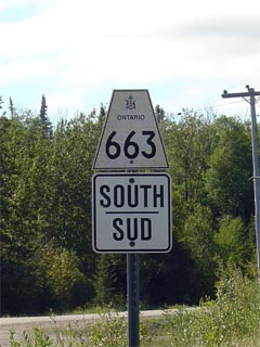
Highway 663 is a short secondary
highway that leads northerly from Highway 11 to the small community of Calstock.
Though the Highway 663 designation ends in the small community of Calstock, the
road continues northerly, leading to the community of Constance Lake and beyond.
Like most other Northern Ontario Highways, Highway 663 was not affected by
provincial downloading.
Secondary Highway 633 Shield
|
|
Southern
Terminus: Junction Highway 69 in
the hamlet of Cranberry Northern Terminus: Junction Highway 11 at the south end of the small
community of Trout Creek
Length: 5.3km
Multiplexes: None
Orientation: North-South
Regions Served: Cochrane District
AADT (2002):
510, for the entire length of Highway 663
Road Info: Not available. |
Communities and Intersections along and Highway 633 from South to North:
|
Proper
Municipality Name |
Community Name |
Distance |
Intersecting
Road |
| District of Cochrane |
----- |
0km / 5.3km |
King's
Highway 11 |
| District of Cochrane |
Calstock |
5.3km / 0km |
(CNR Crossing) |
|
Highway 663 ENDS |
Highway 633 - Images
Secondary.OntHighways.com
- Home
www.OntHighways.com - Home
Copyright (c) 2004-2007, Scott Steeves (Webmaster)
webmaster@onthighways.com
Page last updated: April 4th, 2006
Page created: July 17th, 2004