Secondary
Highway 556 - www.OntHighways.com
Highway 556 is a long east-west
secondary highway that leads motorists through the remote Algoma Highlands
between Heyden at Highway 17, and Highway 129. Though terminating only a
short distance north of Sault Ste. Marie along Highway 17, Highway 556 is an
amazingly remote secondary highway. Services are non-existed along the
route, nor are there any services along Highway 129 at the highway's eastern
end. It should further be noted that most of Highway 556 has not been
asphalted, and has been described as a bone-rattling ride. Motorists are
advised to take caution before venturing along Highway 556.
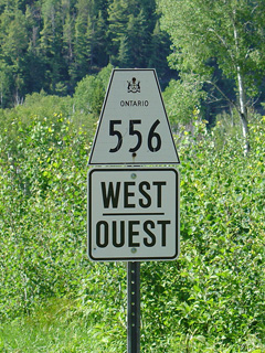
Secondary Highway 556 Shield
|
|
Western Terminus:
Junction Highway 17 - Heyden
Eastern Terminus:
Junction Highway 129
Length: 106.3km
Multiplexes: None
Orientation: East-West
Regions
Served: Algoma District
AADT
(2007): Highest: 1750, from Highway 17 easterly to Highway 552;
Lowest: 90, from Garden River easterly to Highway 129.
Road Info: Not Available. |
Communities and Intersections along and Highway 556 from West to East:
|
Proper
Municipality Name |
Community Name |
Distance |
Intersecting
Road |
| District of Algoma |
Heyden |
0km / 106.3km |
King's Highway 17 |
| District of Algoma |
Island Lake |
4.5km / 101.8km |
Secondary Highway 552 |
| District of Algoma |
----- |
25.8km / 80.5km |
Secondary Highway 532 |
| District of Algoma |
Ranger Lake |
--- |
----- |
| District of Algoma |
----- |
106.3km / 0km |
King's Highway 129 |
|
Highway 556 Ends |
<-
Highway 555
www.OntHighways.com - Home
Highway 557 ->
Copyright (c) 2004-2011, Scott Steeves
(Webmaster)
scott@asphaltplanet.ca
Page last updated: April 27th, 2011
Page created: April 27th, 2011