Secondary
Highway 533 - Secondary.OntHighways.com
Highway 533 runs parallel to the
Ottawa River between Highways 17 and 63 in Northeastern Ontario. It was
not affected by provincial downloading.
|
Secondary Highway 533 Shield |
|
Southern Terminus:
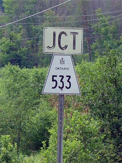
Junction Highway 17 in Mattawa
Northern Terminus: Junction Highway 63 south of Eldee
Length: 53.4km
Multiplexes: None
Orientation: North-South
Regions
Served: Nipissing District
AADT (2002):
Highest: 830, from Mattawa northerly to Highway 656;
Lowest: 190, from Highway 656 to Highway 63.
Road Info: Not Available. |
Communities and Intersections along and Highway 533 from South to North:
|
Proper
Municipality Name |
Community Name |
Distance |
Intersecting
Road |
| Town of Mattawa |
Mattawa |
0km / 53.4km |
King's Highway 17 |
| Mattawa Boundary |
Mattawa North Limits |
1.0km / 52.4km |
----- |
| District of Nipissing |
----- |
4.8km / 48.6km |
Secondary Highway 656 |
| District of Nipissing |
Crooked Lake |
30.7km / 22.7km |
----- |
| District of Nipissing |
----- |
53.4km / 0km |
King's Highway 63 |
|
Highway 533 ENDS |
Highway 533 - Images
Secondary.OntHighways.com - Home
www.OntHighways.com - Home
Copyright (c) 2004-2007, Scott Steeves (Webmaster)
webmaster@onthighways.com
Page last updated: May 28th, 2006
Page created: May 28th, 2006