Secondary
Highway 529A -
O N T H I G H W A Y S
Highway 529A is a short
spur highway leading west from Highway 529 to the small community of Bayfield
Inlet. Before current Highway 69 bypassed what is now Highway 529, highway
529A was known as Highway 529. It is common for secondary
highways suffixed with an 'A' to have once been part of their parent highway.
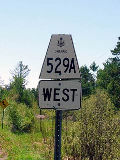
Secondary Highway 529A Shield
|
|
Western Terminus:
Bayfield Inlet Eastern Terminus:
Junction Highway 529 north of Pointe Au Baril Station
Length: 5.1 km
Multiplexes: None
Freeway: No
AADT (2002):
150, for the entire length of Highway 529A.
Road Info: Highway 529A
is paved for its entire (short) length. Rural speed limits along the
route are 80km/h and traffic volumes are negligable. |
Communities and Intersections along and Highway 637 from West to East:
|
Proper
Municipality Name |
Community Name |
Distance |
Intersecting
Road |
| Township of the Archipelago |
Bayfield Inlet |
0 km / 5.1 km |
----- |
| Township of the Archipelago |
----- |
5.1 km / 0 km |
Secondary Highway
529 |
|
Highway 607 Ends |
Secondary Highway 529A - Images
O N T
H I G H W A Y S - Home
Copyright (c) 2004 - 2005, Scott Steeves (Webmaster)
webmaster@onthighways.com
Page last updated: May 30th, 2005
Page created: May 30th, 2005