|
Proper Municipality Name |
Photo Description |
Photo |
|
Photos taken
from driver's perspective appear offset from centre-line Photos: |
East-
Bound |
West-
Bound |
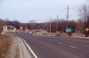
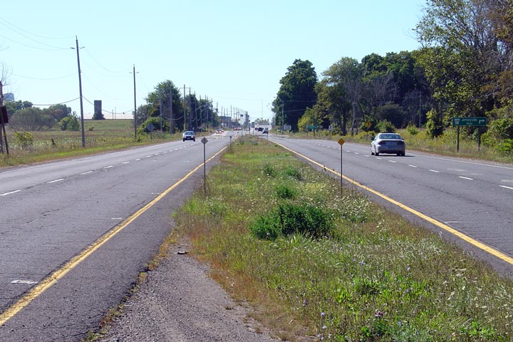
| City of Brant County |
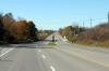
Easterly view along Highway 53 approaching the Pleasant Ridge Road
intersection. The City of Brantford is found just a little bit further
east of this photo, at the bottom of the pictured long grade.
Photo taken: March 21st, 2009. |
Low Res
High Res |
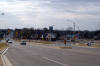
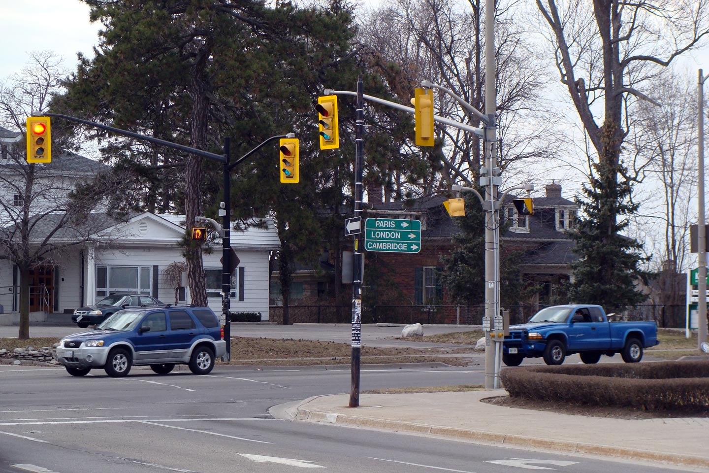
| City of Brantford |
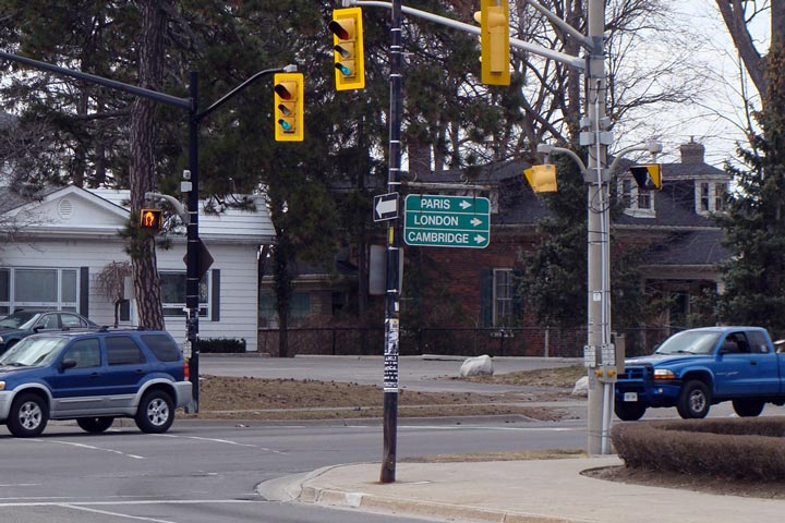
Westerly view at the directional sign at the western end of Dalhousie Street
in Downtown Brantford. Historically, at this junction, Highway 2 and
Highway 24-North continued to the right bound for Paris and Cambridge, while
Highway 53 and Highway 24-South continued to the left bound for Burford and
Simcoe.
Photo taken: March 21st. 2009. |
 Low
Res Low
Res
High Res |
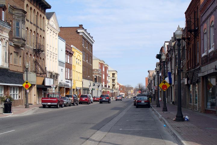
| City of Brantford |
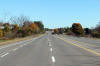
Easterly view along Highway 2/53 along Colborne Street in Brantford.
Downtown Brantford has an alarming number of abandoned buildings.
Photo taken: March 21st, 2009. |
 Low
Res Low
Res
High Res |
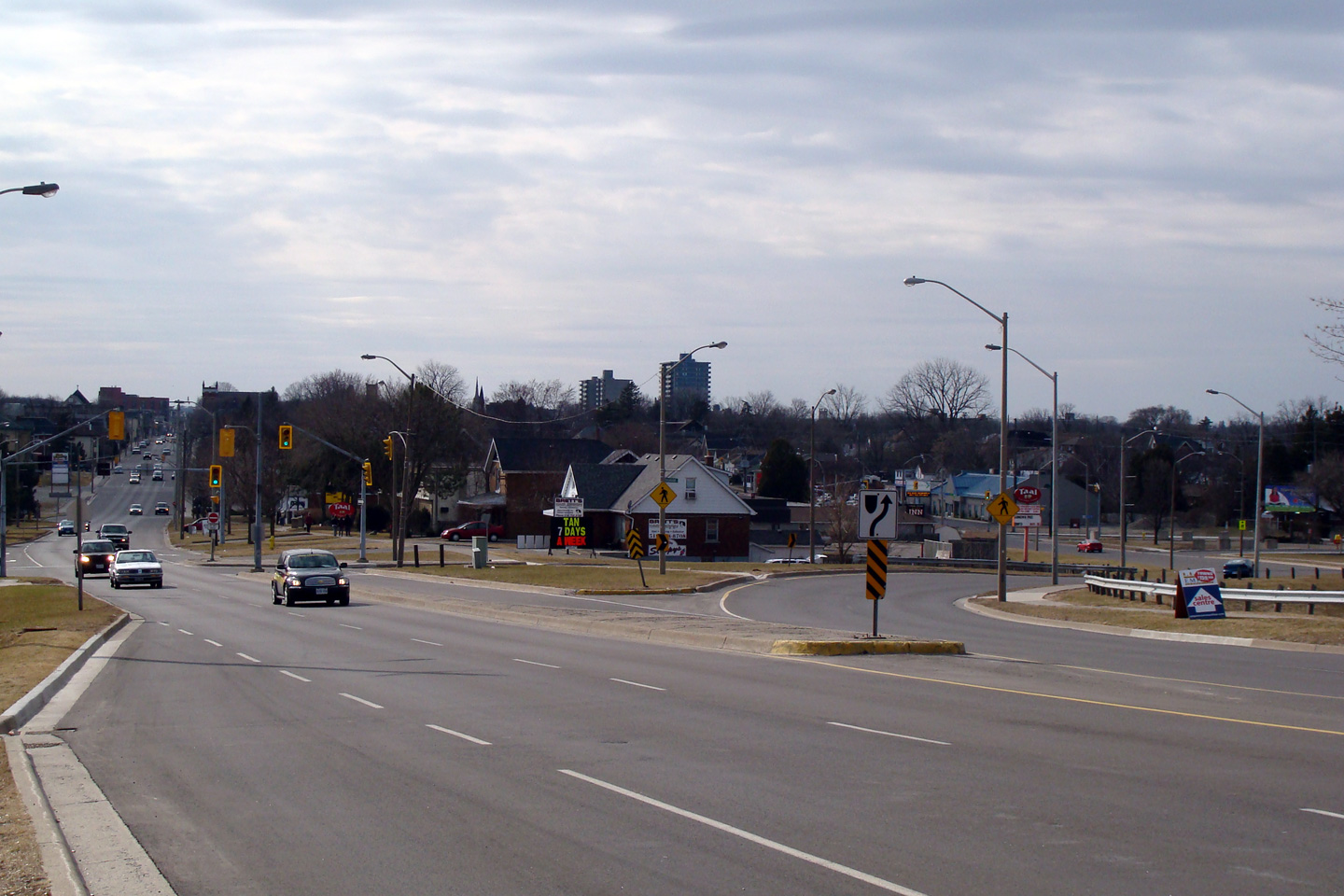
| City of Brantford |
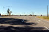
View looking westerly as Highway 2/53 splits into a pair of single direction
two-way streets just east of Downtown Brantford.
Photo taken: March 21st, 2009. |
Low Res
High Res |
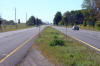
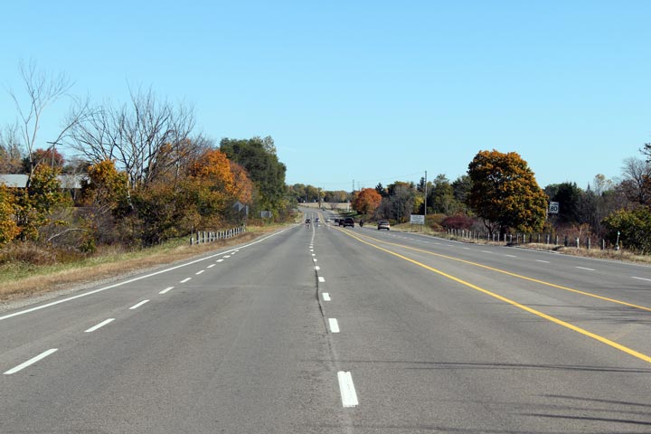
| City of Brant County |
View looking westerly along Highway 2/53 from the twin Fairchild Creek
bridges. Highway 2/53 is generally not a divided highway between
Brantford and Ancaster, in this case, however, the highway has widened only to cross
the twin Fairchild Creek bridges.
Photo taken: September 19th, 2004. |
Low Res
High Res |
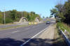
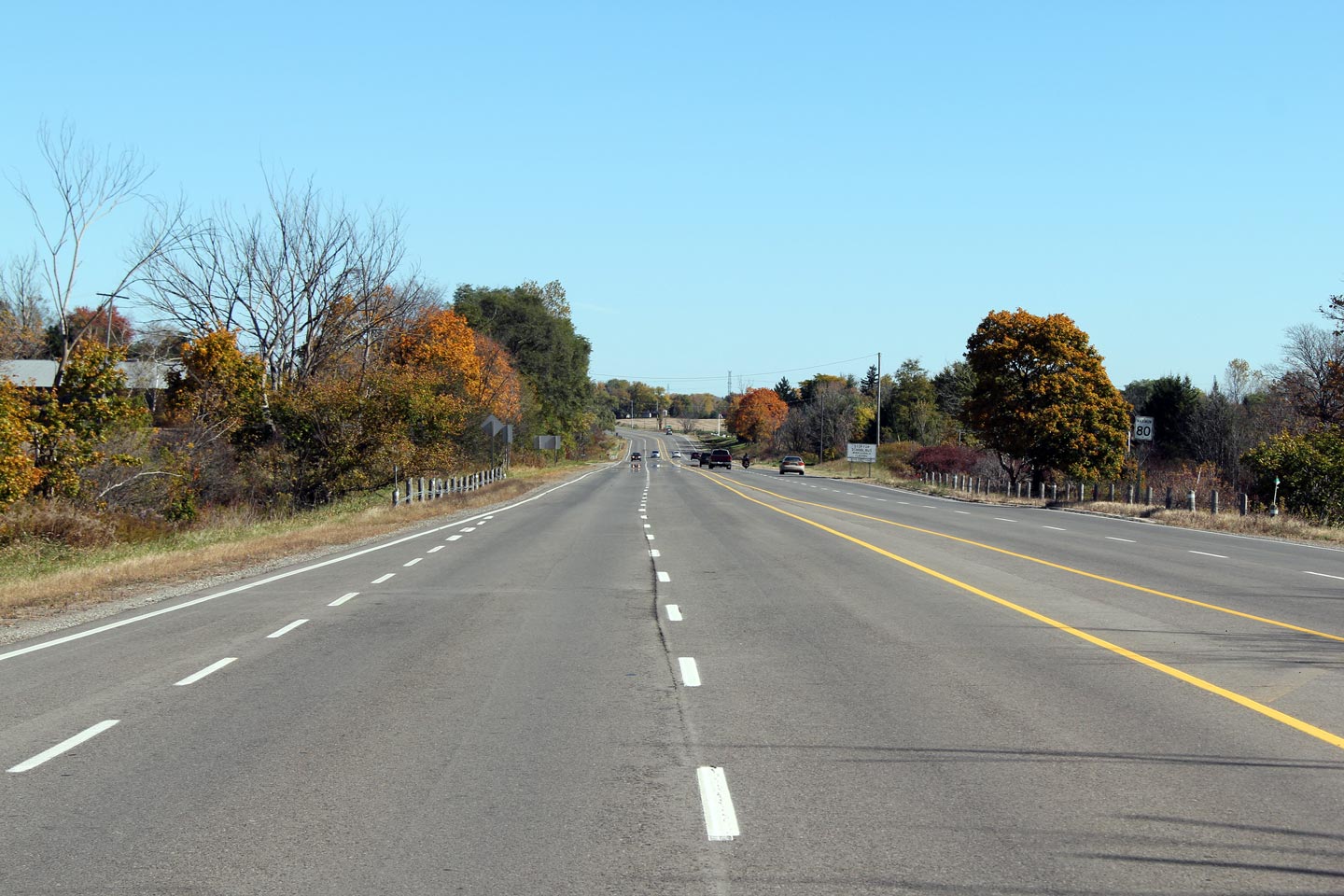
| City of Brant County |
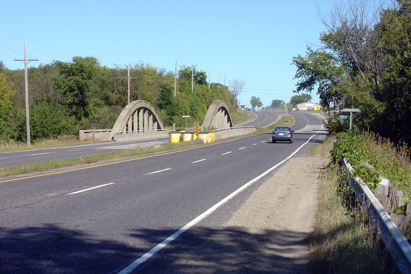
Easterly view along Highway 2/53 approaching the dual Fairchilds Creek
bridges.
Photo taken: September 19th, 2004. |
Low Res
High Res |
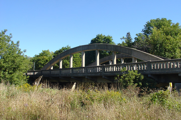
| City of Brant County |
View looking southerly at the northern elevation of the 1931 concrete bowstring bridge over Fairchilds Creek. When this photo was taken in 2004, the aging
bowstring bridge was in deteriorating condition. In 2005, the
structure was extensively rehabilitated.
Photo taken: September 19th, 2004. |

Low Res
High Res |
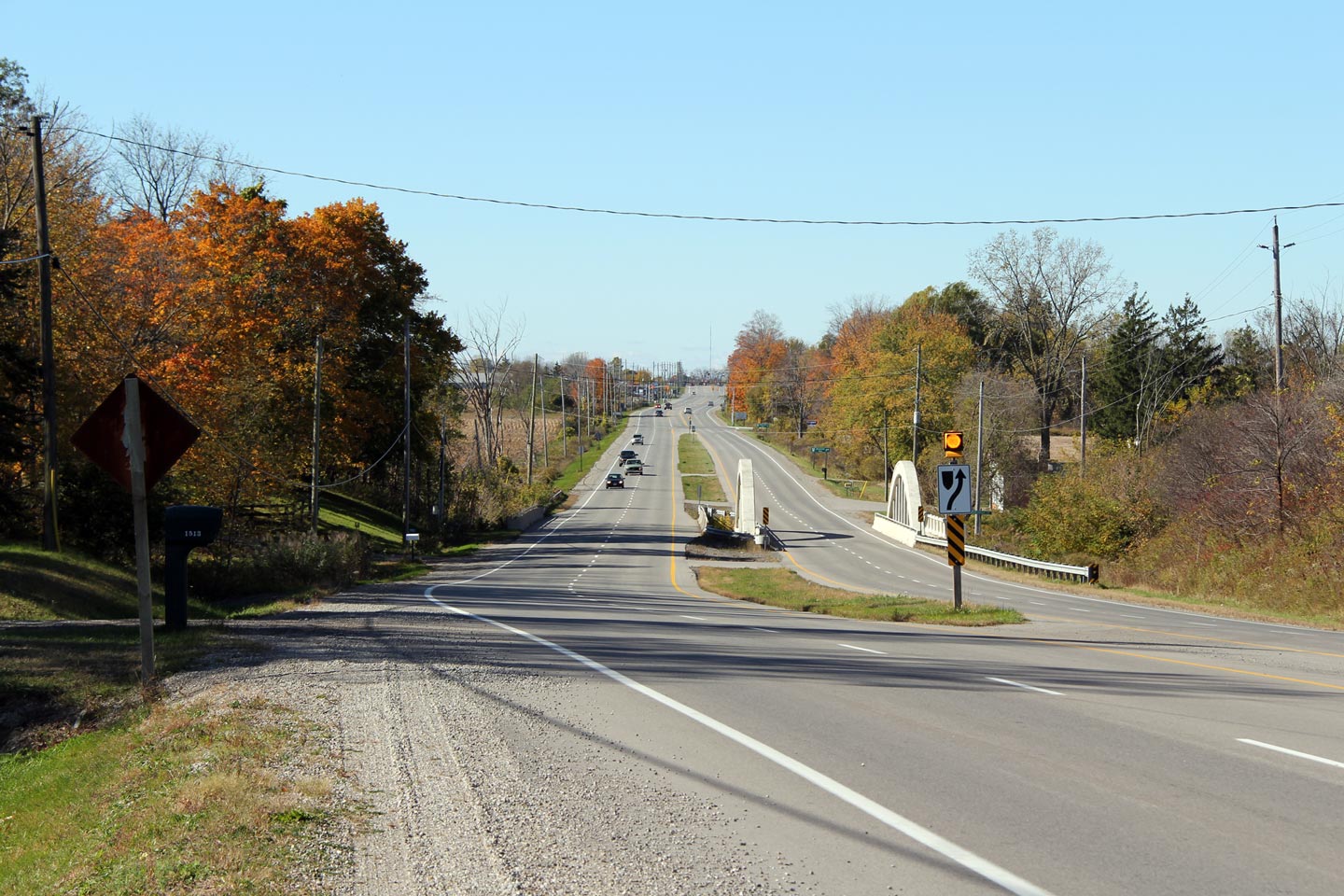
| City of Brant County |
Two views looking westerly across the twin Fairchilds Creek Bridges. The Bowstring Bridge on the right of the photo was
completed in 1931 and
rehabilitated in 2005. The rehabilitation of the 1931 Fairchilds
Creek bridge proved to be one of Ontario's most detailed and historically
accurate rehabilitations of a concrete bowstring bridge.
Photos taken: October 15th, 2010. |
(720x480)
(1440x960)
(2400x1600)

(720x480)
(1440x960)
(2400x1600) |
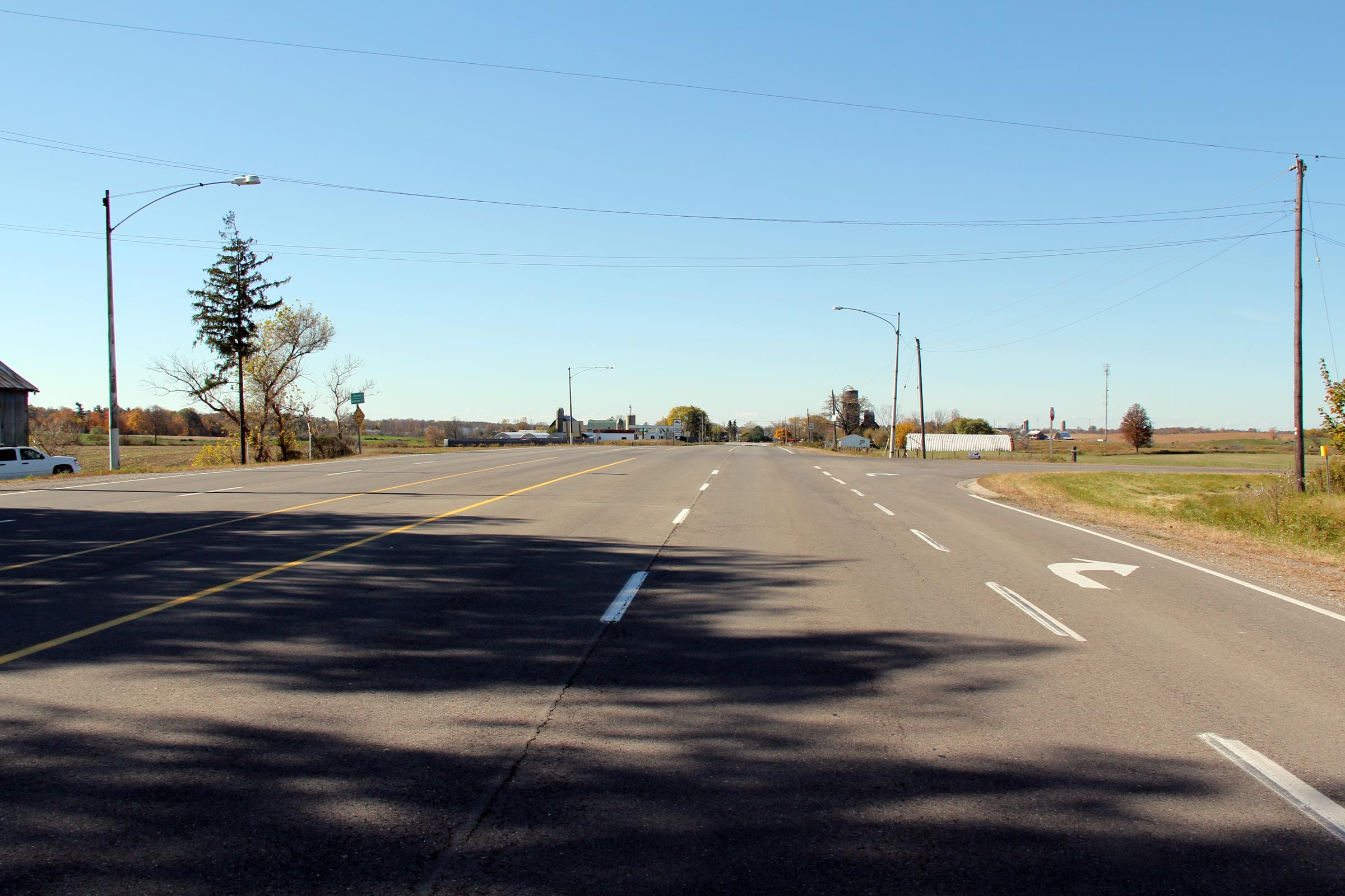
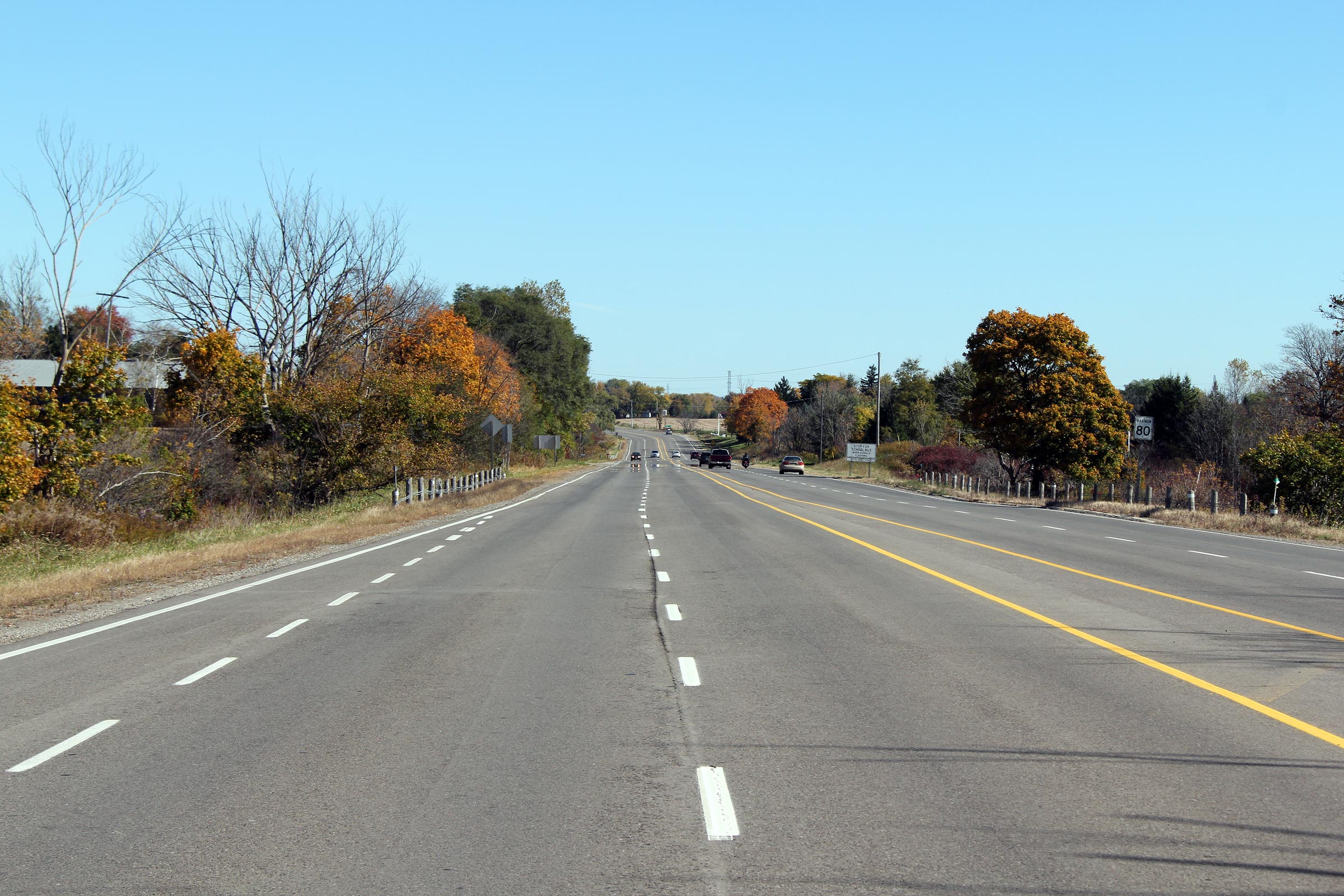
| City of Hamilton |
Westerly view along Highway 2/53 at the Sunny Ridge Road intersection.
Take notice of the vintage light standards that stand beside this near
deserted highway. The luminaries have new.
Photo taken: October 16th, 2010. |
(720x480)
(1440x960)
(2400x1600) |
| City of Hamilton |
Looking easterly along Highway 2/53 from the Sunny Ridge Road intersection.
Photo taken: October 16th, 2010. |
(720x480)
(1440x960)
(2400x1600) |
|
Highway 52 progresses northerly
from Highway 2/53 bound for Copetown and Highway 5 and 8.
Click here for Highway 52 images. |


