King's Highway 406 - Images


Highway 406 Twinning Images

Highway 406 Images


During the 2006 and 2007 construction seasons, Highway 406 will be widened from a 2-lane at-grade expressway to a 4-lane freeway between Port Robinson Road and the current end of the divided freeway about 1km south of Beaverdams Road.  This construction is expected to be completed by mid-Summer 2007.

During the years 2012 and 2015, the remainder of Highway 406 was widened to four lanes through Welland, between East Main Street and Port Robinson Road. 

Highway 406 Twinning (2006-2007) - Thorold (Beaverdams Road to Port Robinson Road)
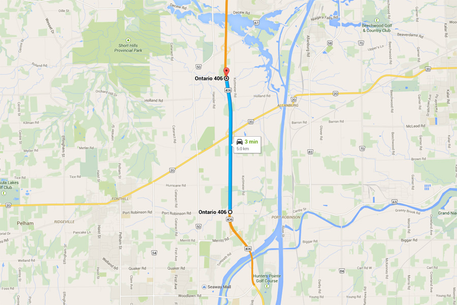
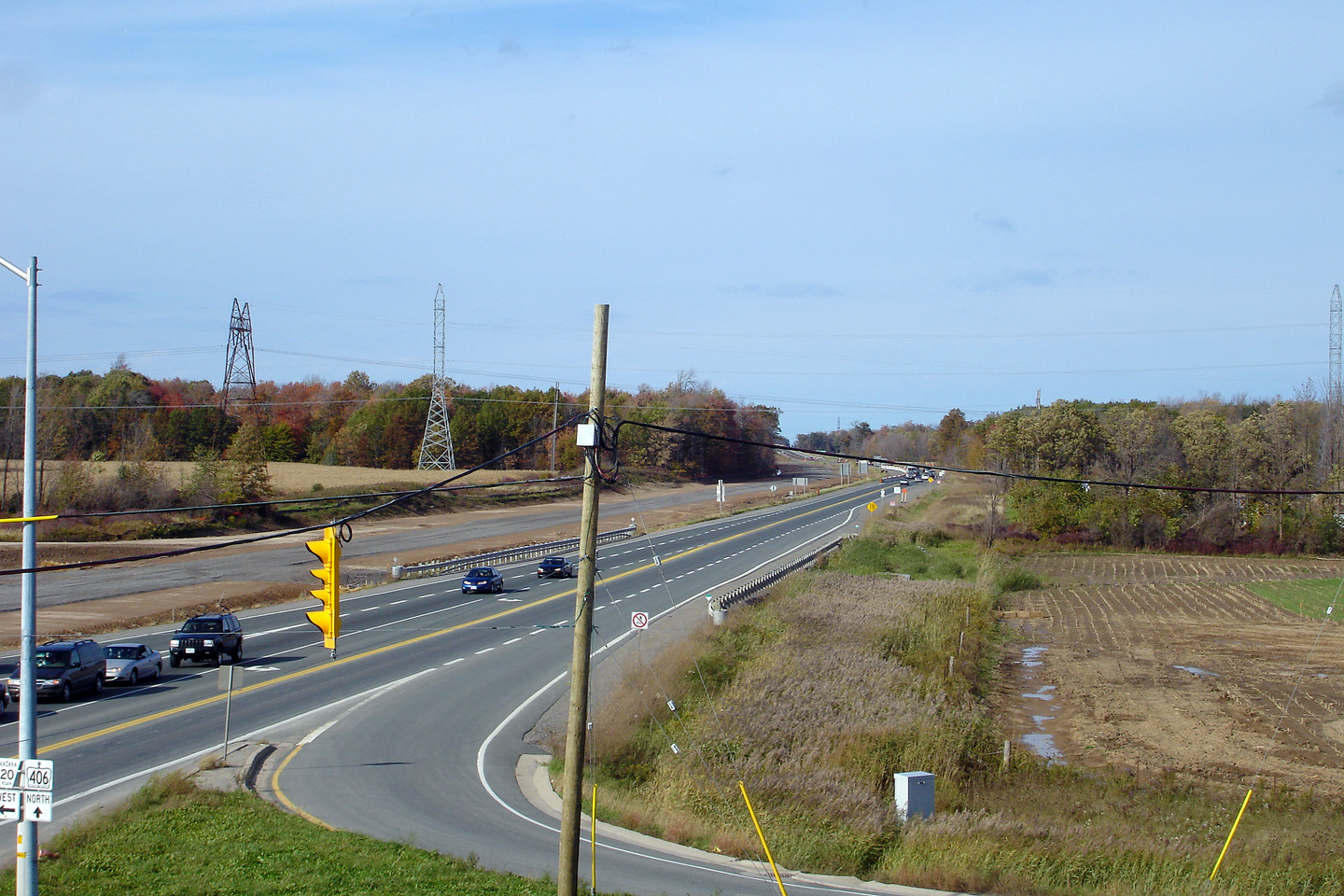
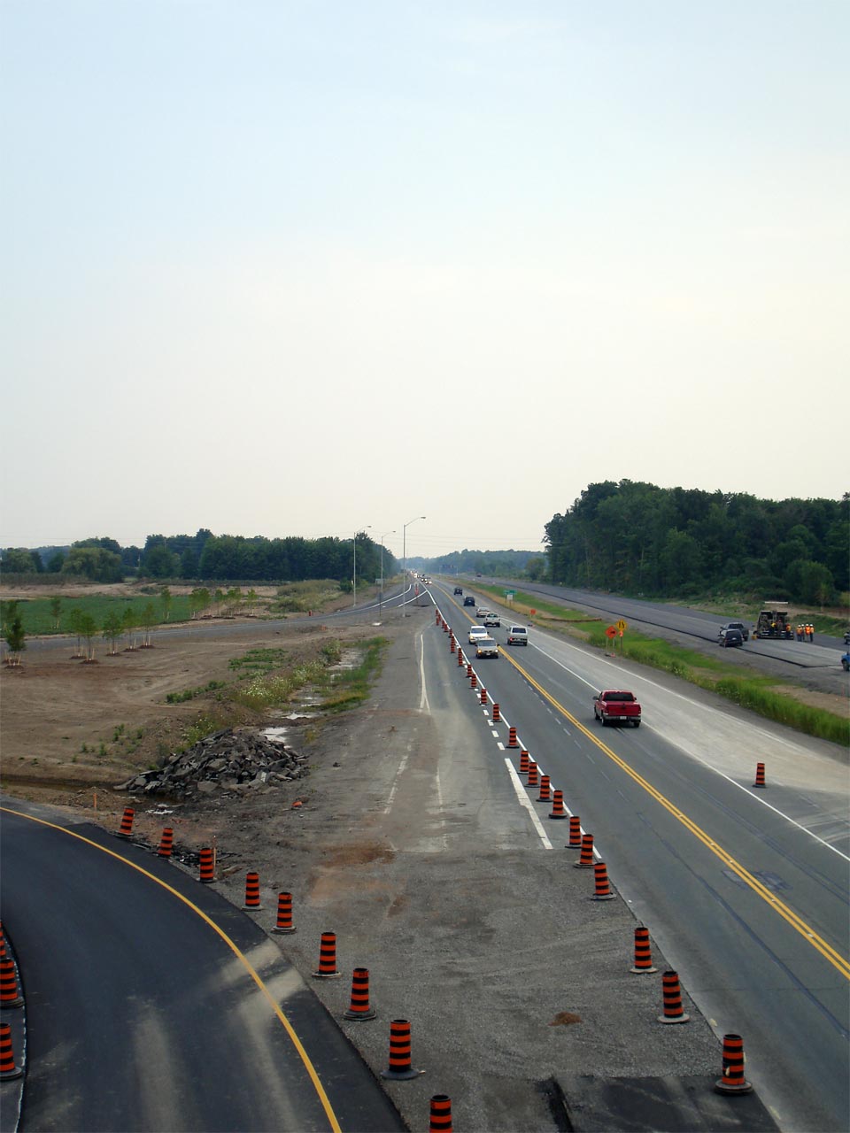
Pre Construction Photos - Taken July 7th, 2005.

(720x480)     (1440x960)

(720x480)     (1440x960)

(720x480)     (1440x960)

(720x480)     (1440x960)
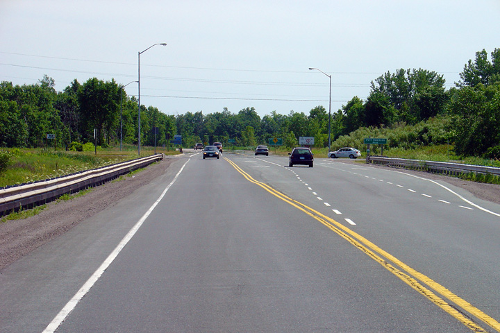
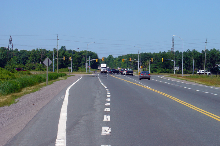
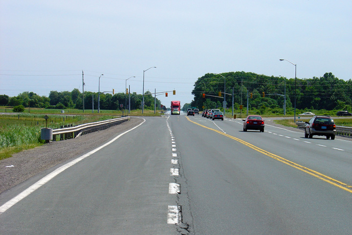
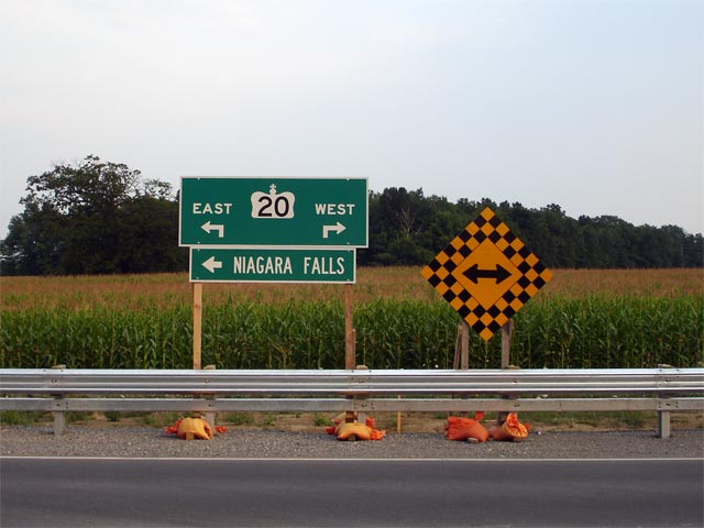
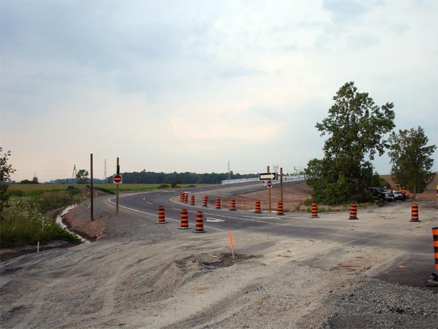
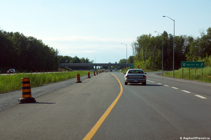
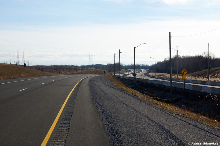
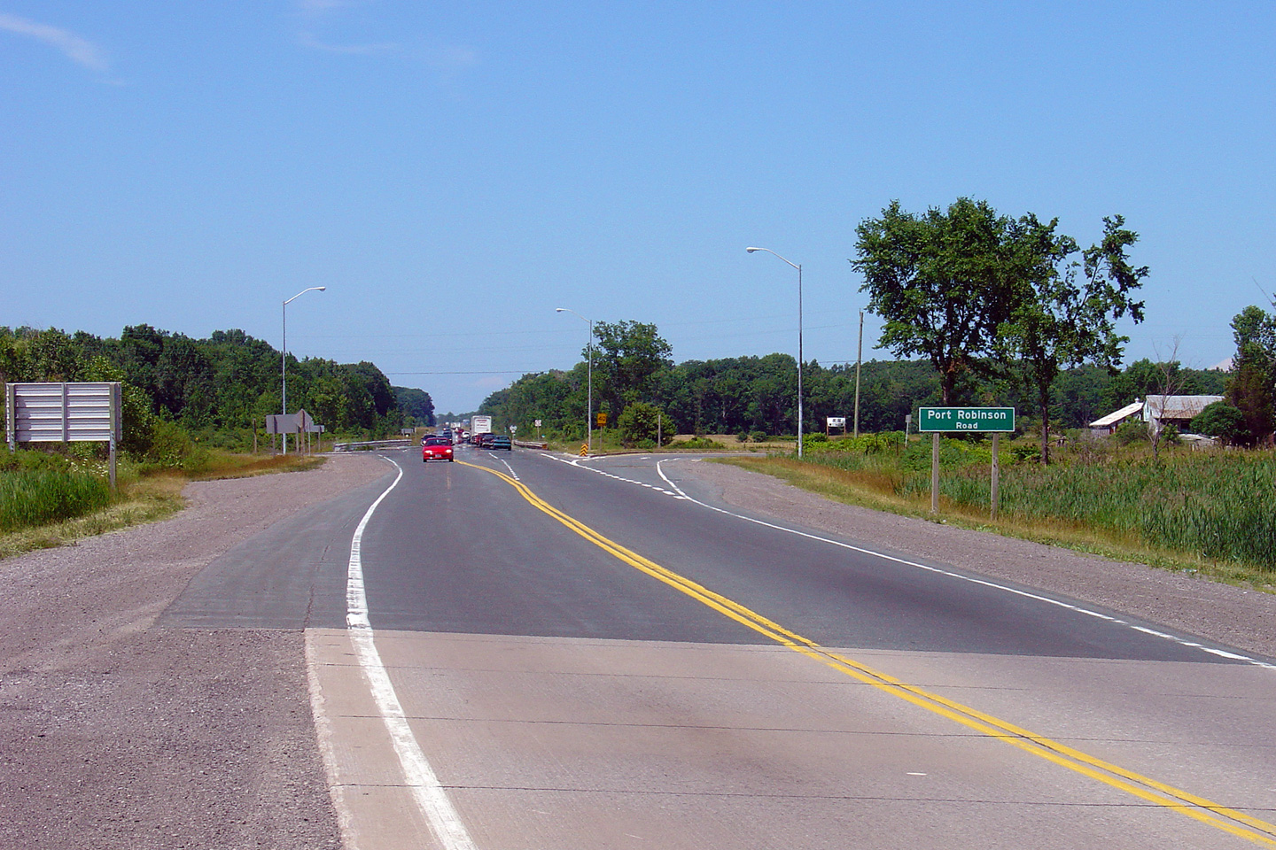
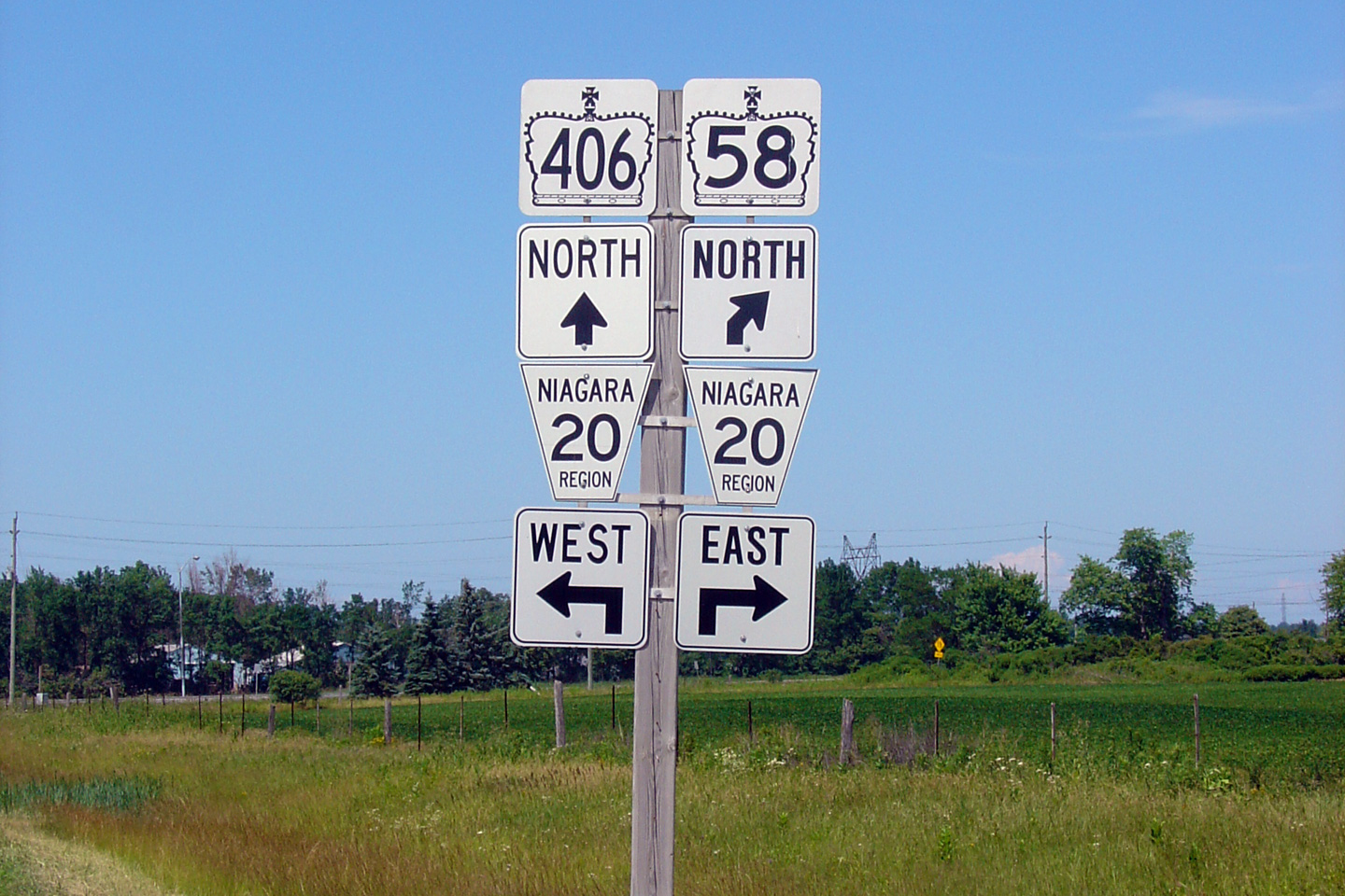
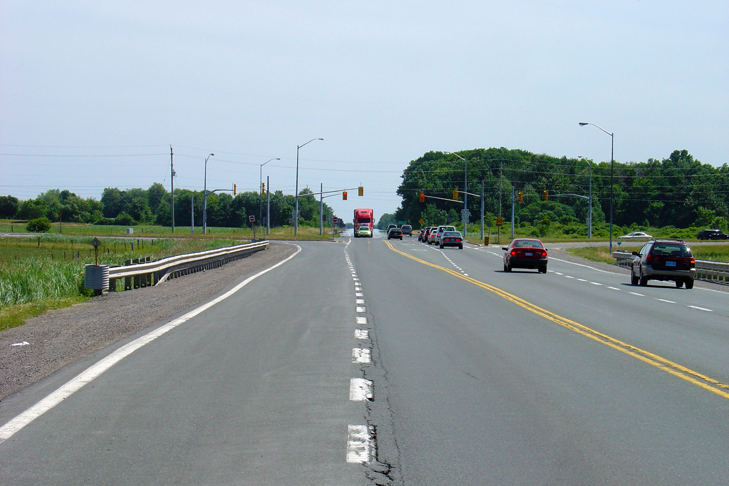
Looking northerly towards the Port Robinson Road intersection along Highway 406.  This junction will not be altered as part of the reconstruction Looking south towards the Port Robinson Road intersection.  The 4-lane highway will Junction assembly for northbound vehicles approaching the Highway 20 intersection View looking north along Highway 406 approaching the Highway 20 intersection

(720x480)     (1440x960)

(720x480)    (1440x960)

(720x480)    (1440x960)

(720x480)    (1440x960)

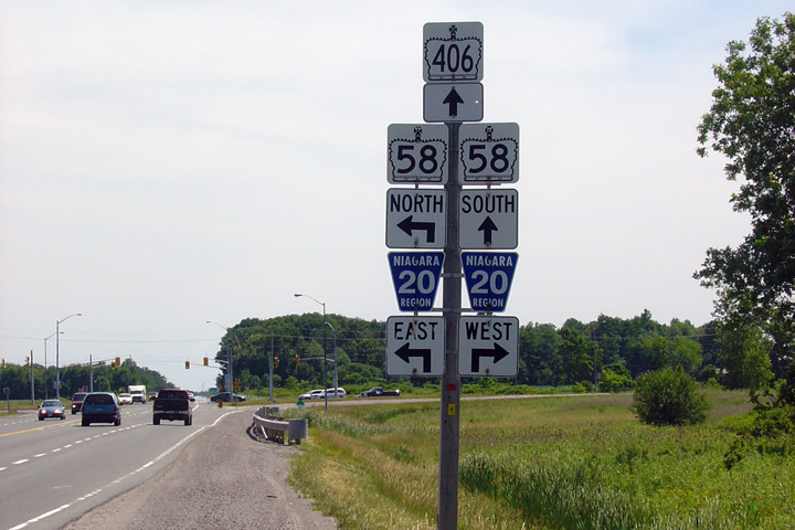
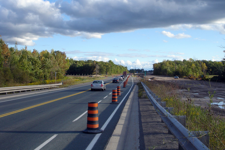
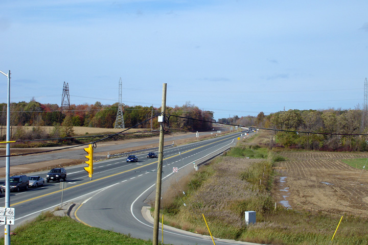
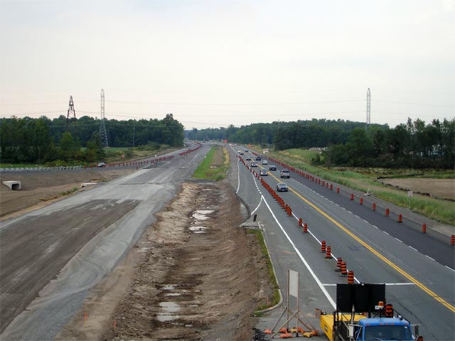
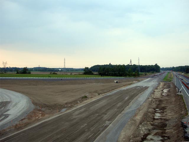
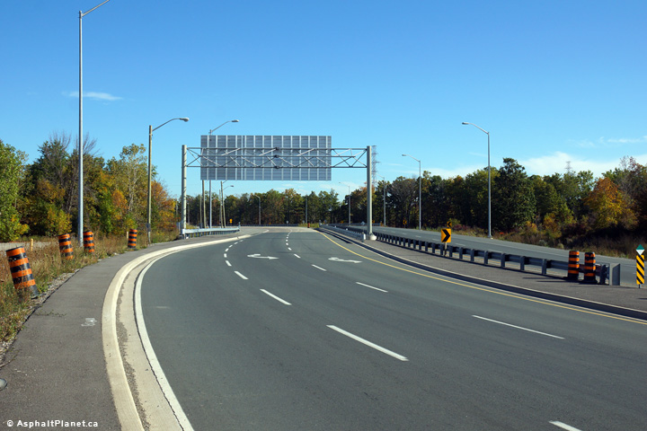
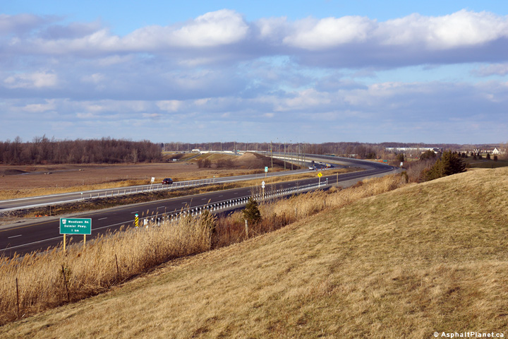
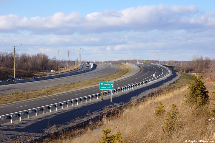
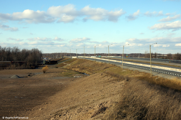
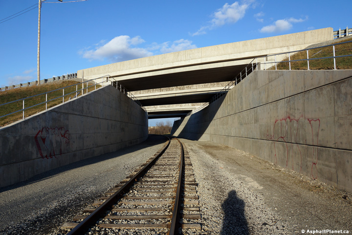
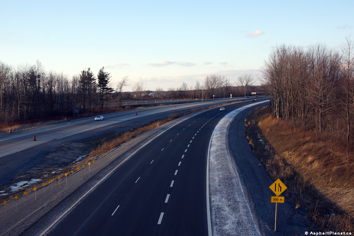
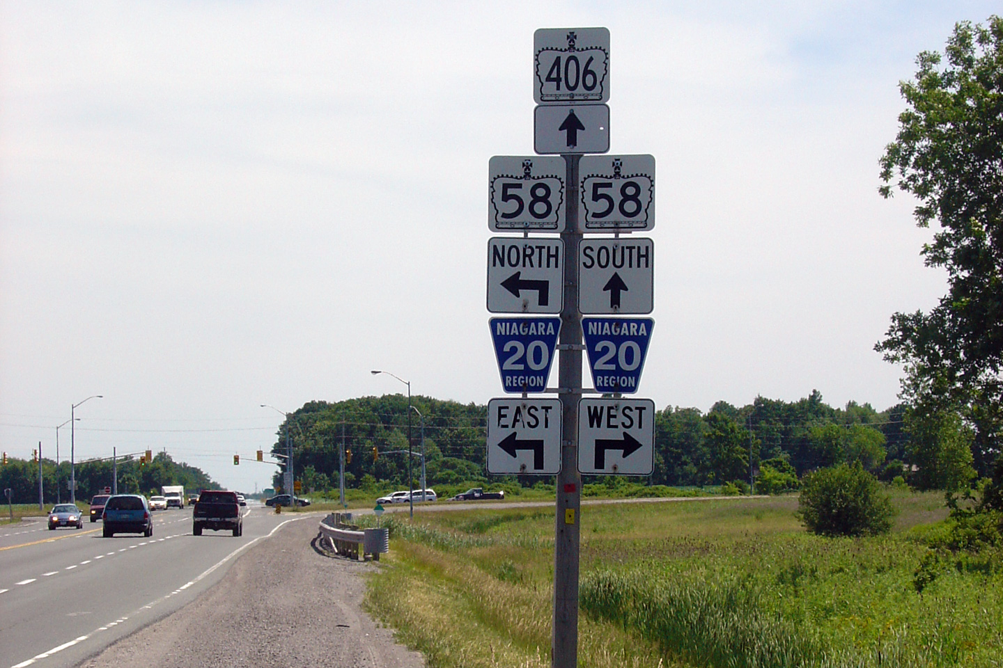
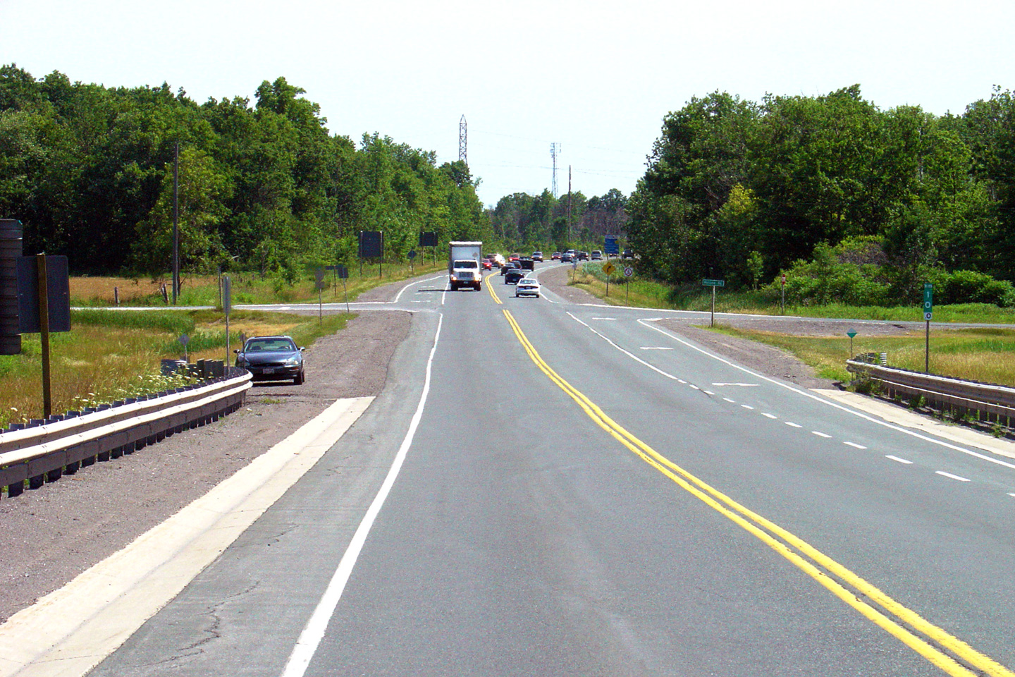
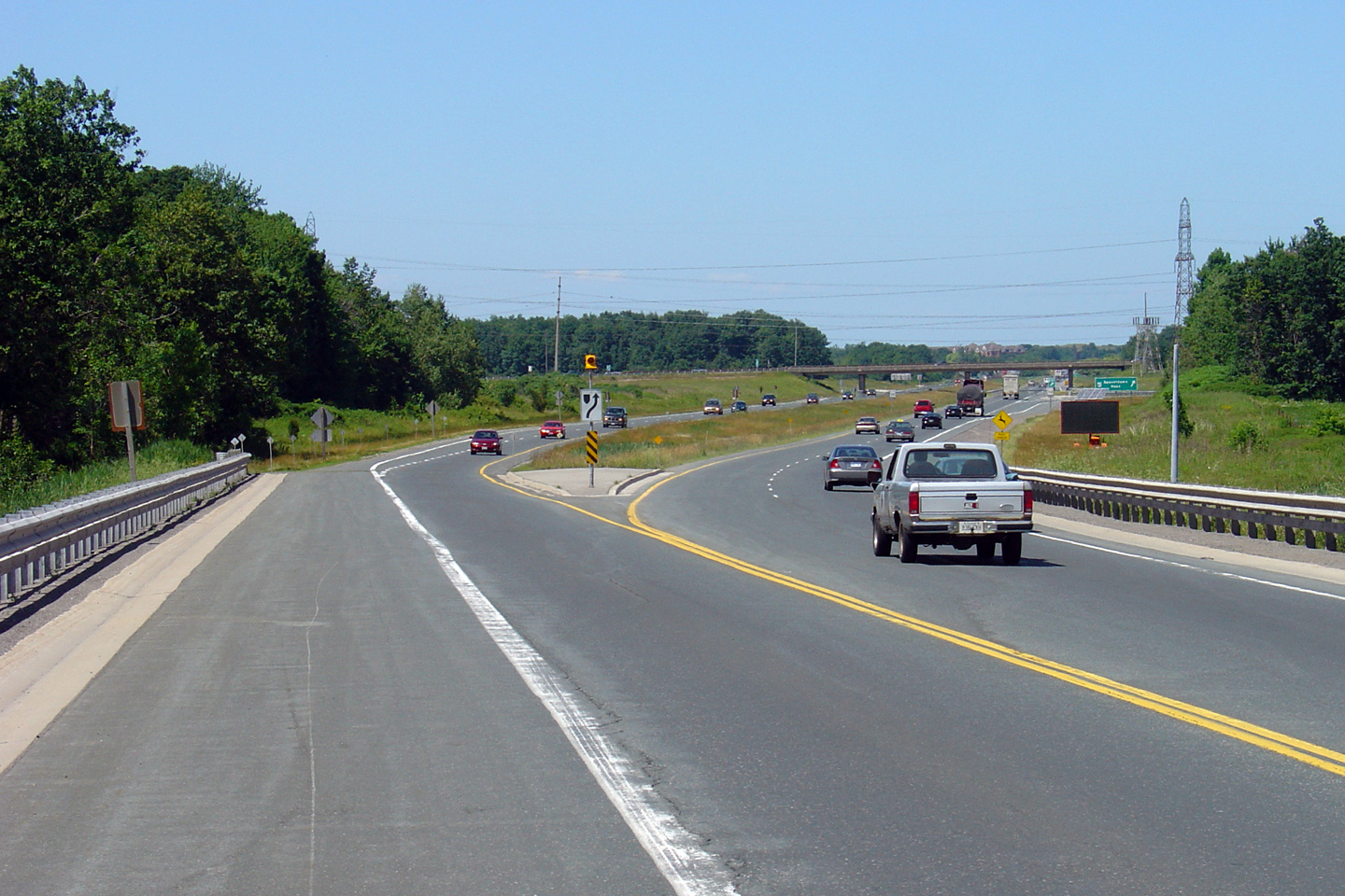
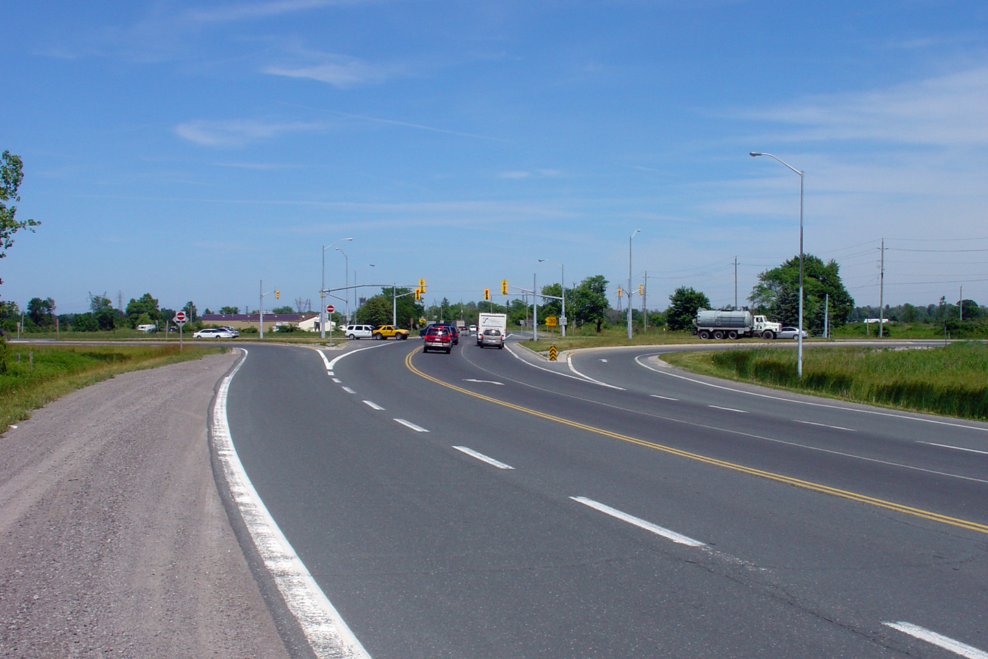
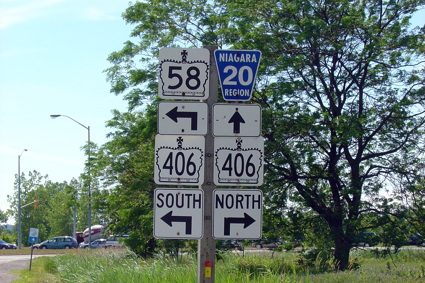
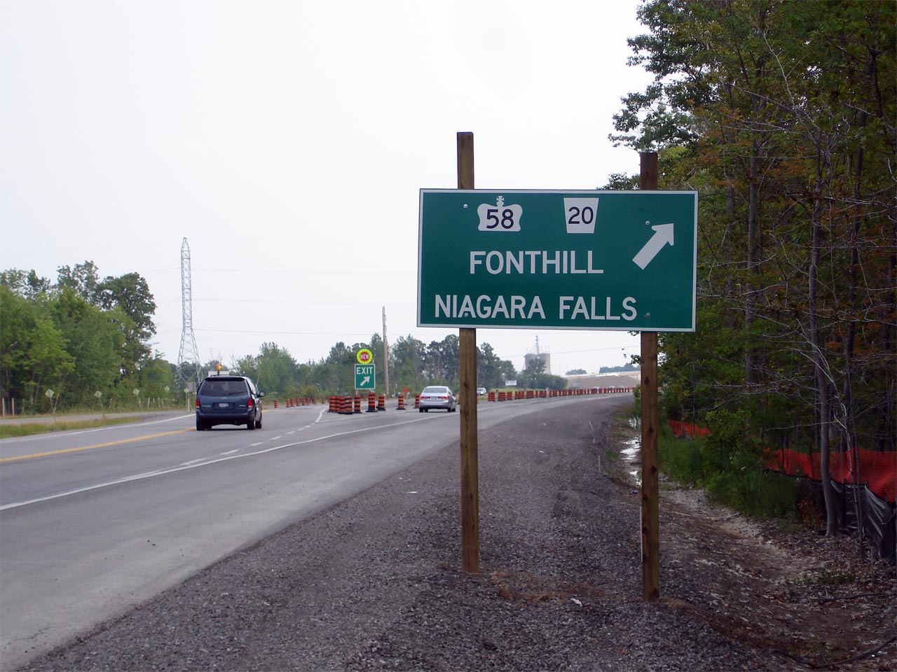
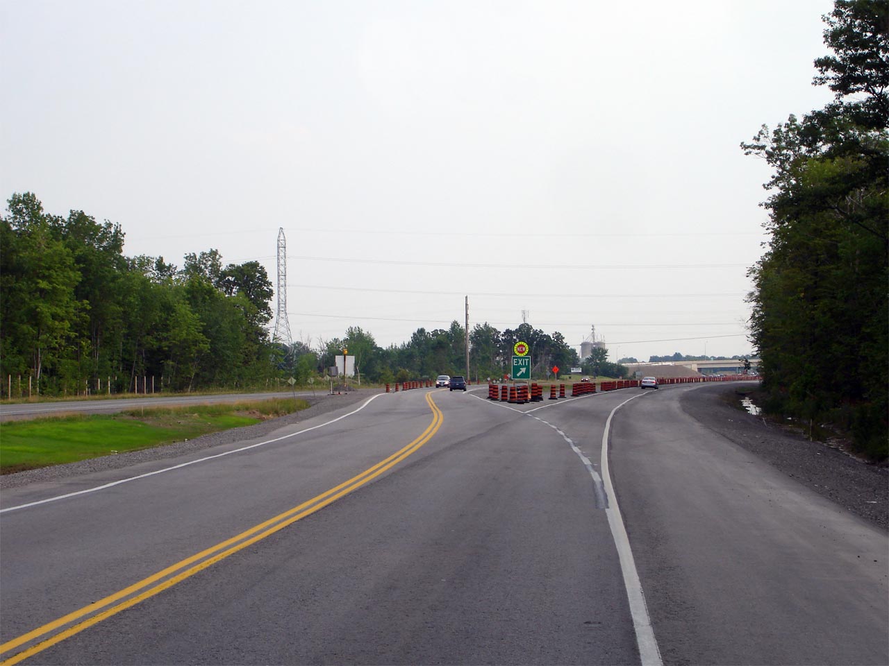
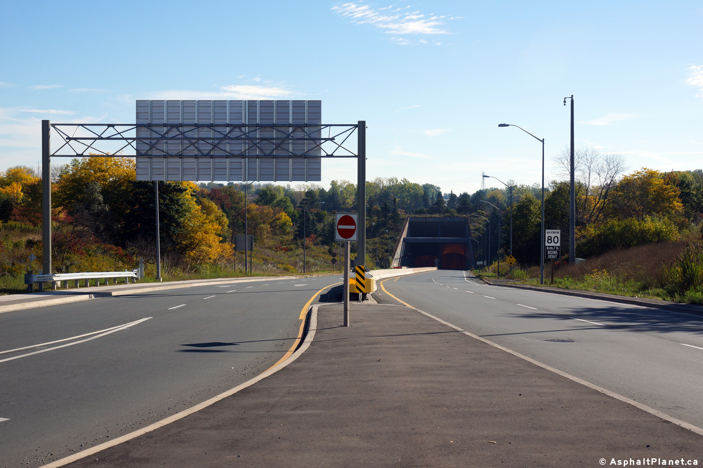
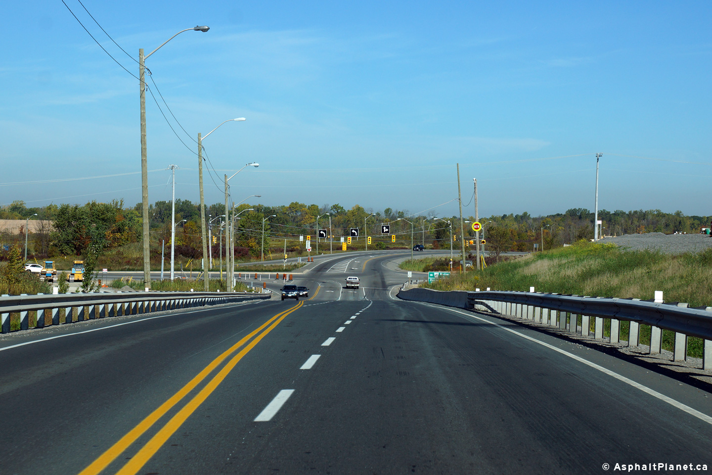
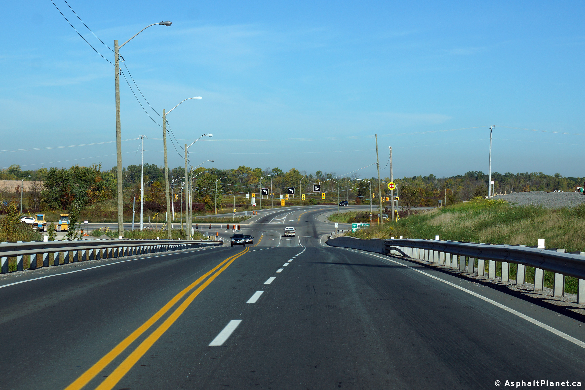
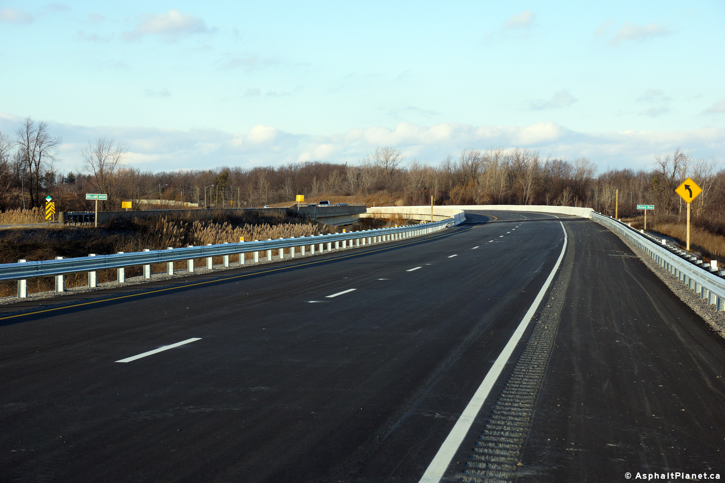
View looking southerly approaching the Highway 20 intersection along Highway 406. Junction assembly denoting the Highway 20 intersection for southbound traffic on Highway 406.  Notice that Highway 58 is still indicated at this junction. Looking south along Highway 406 at the Holland Road at-grade intersection.  Surprisingly a flyover is not being constructed at this location. Looking northerly towards the pre-2005 start of the divided highway about 1km south of Beaverdams Road

(720x480)     (1440x960)

(720x480)     (1440x960)

(720x480)     (1440x960)

(720x480)     (1440x960)
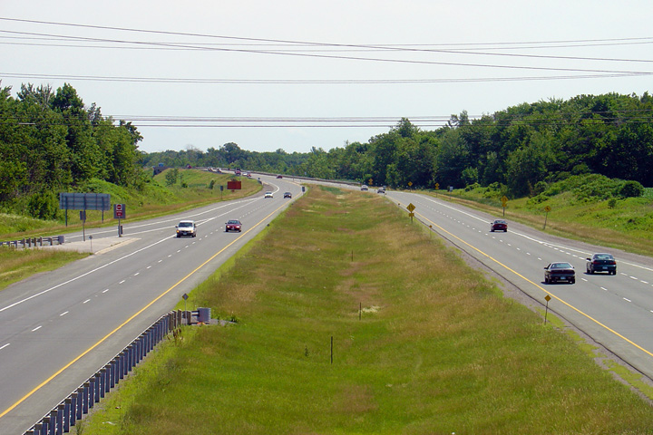
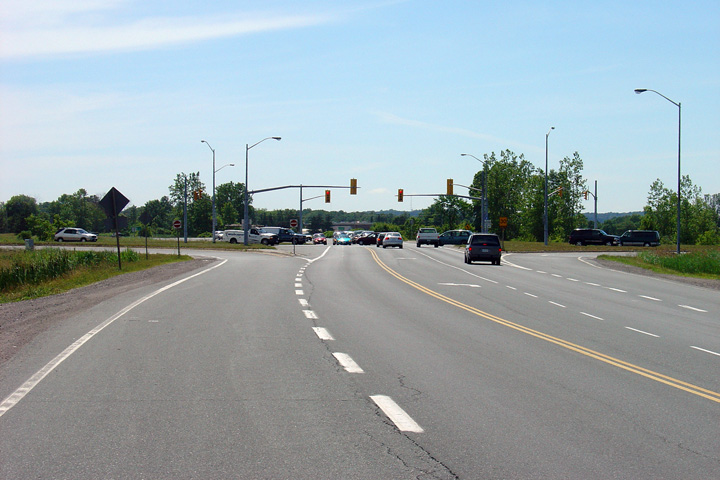
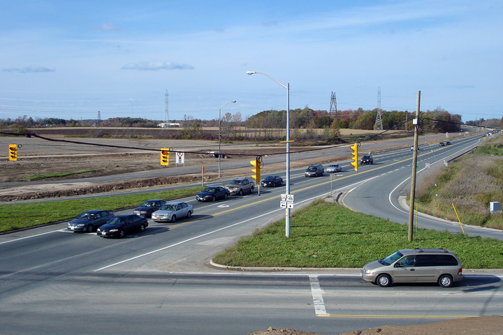
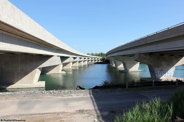
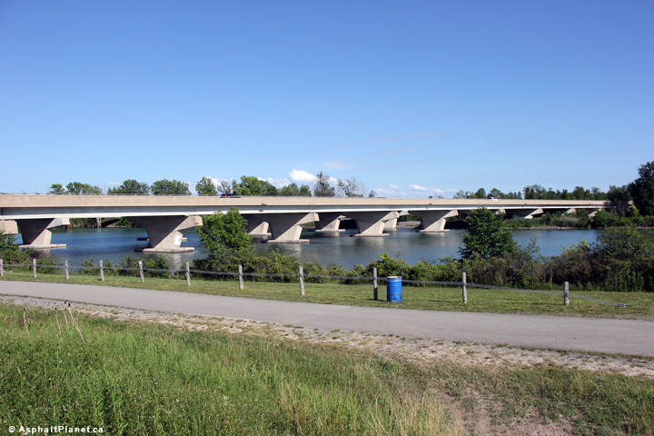
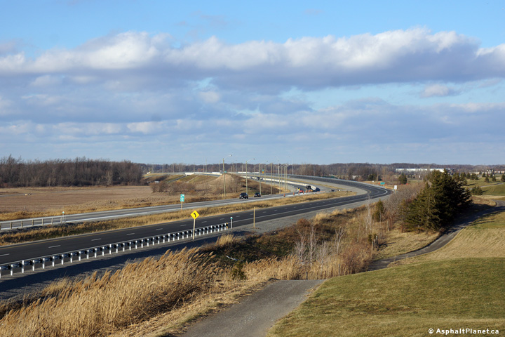
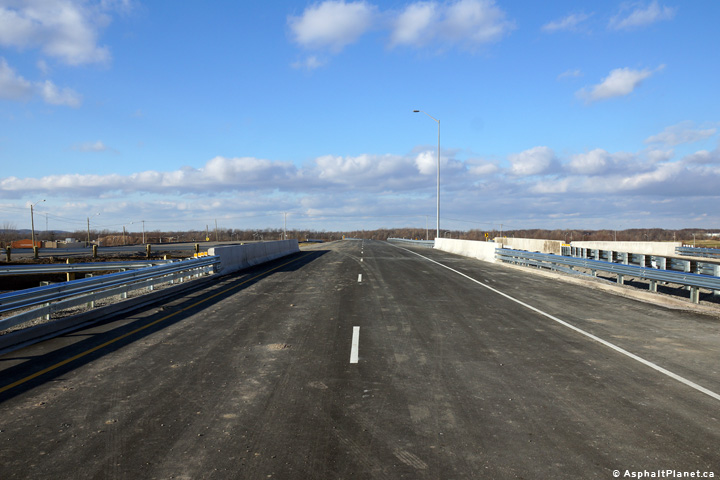
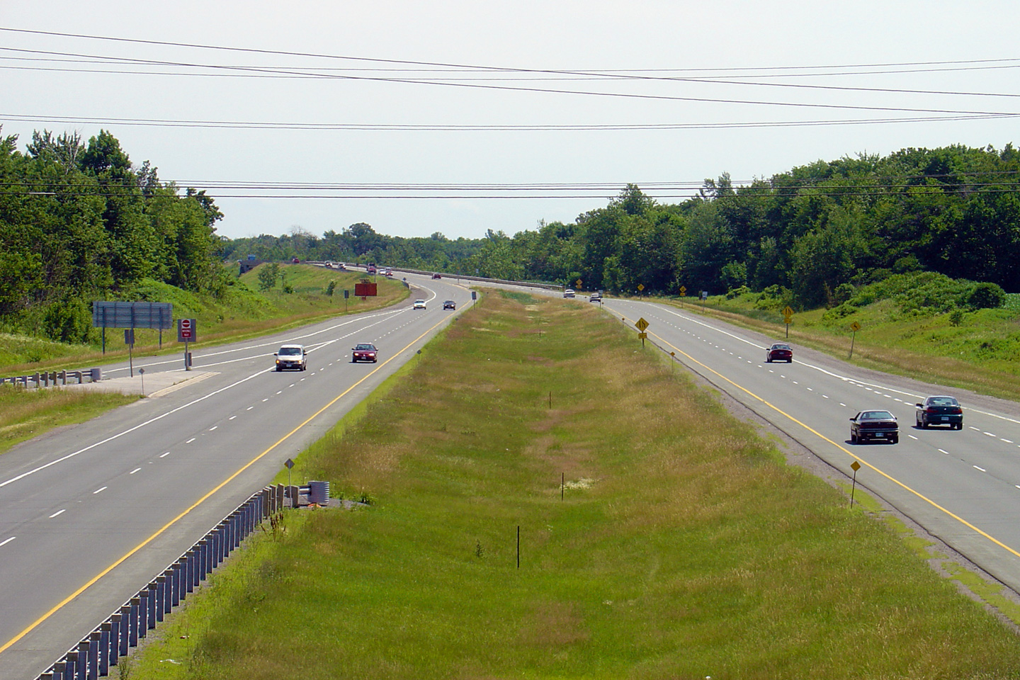
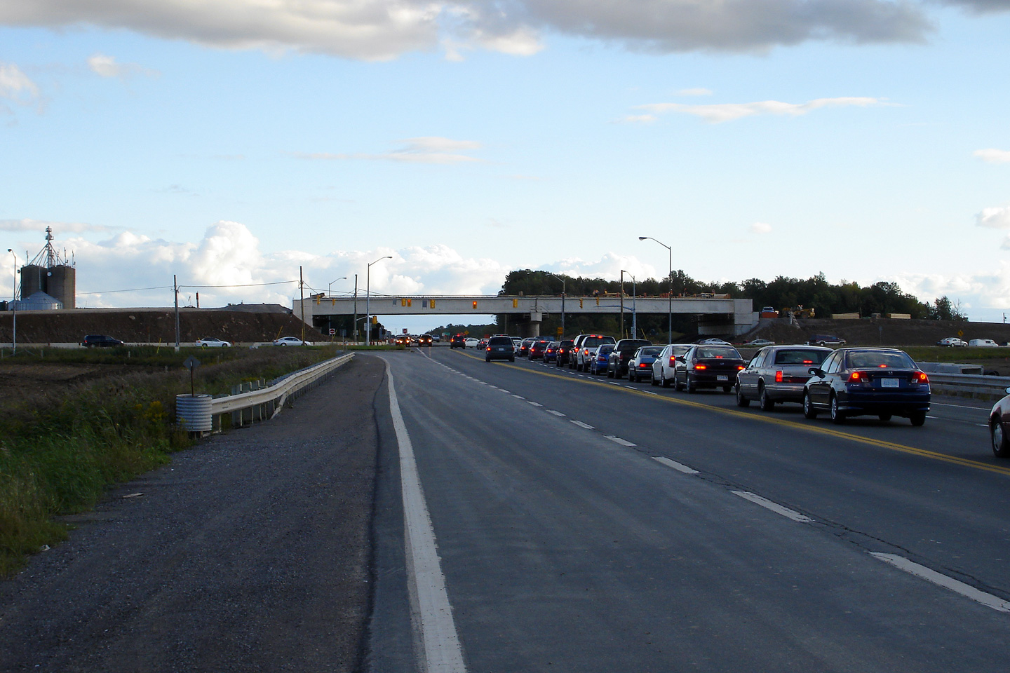
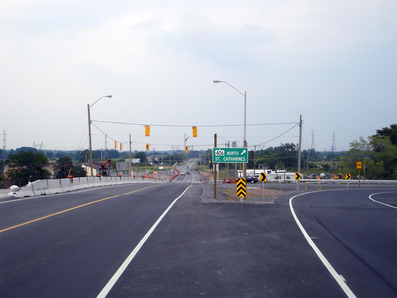
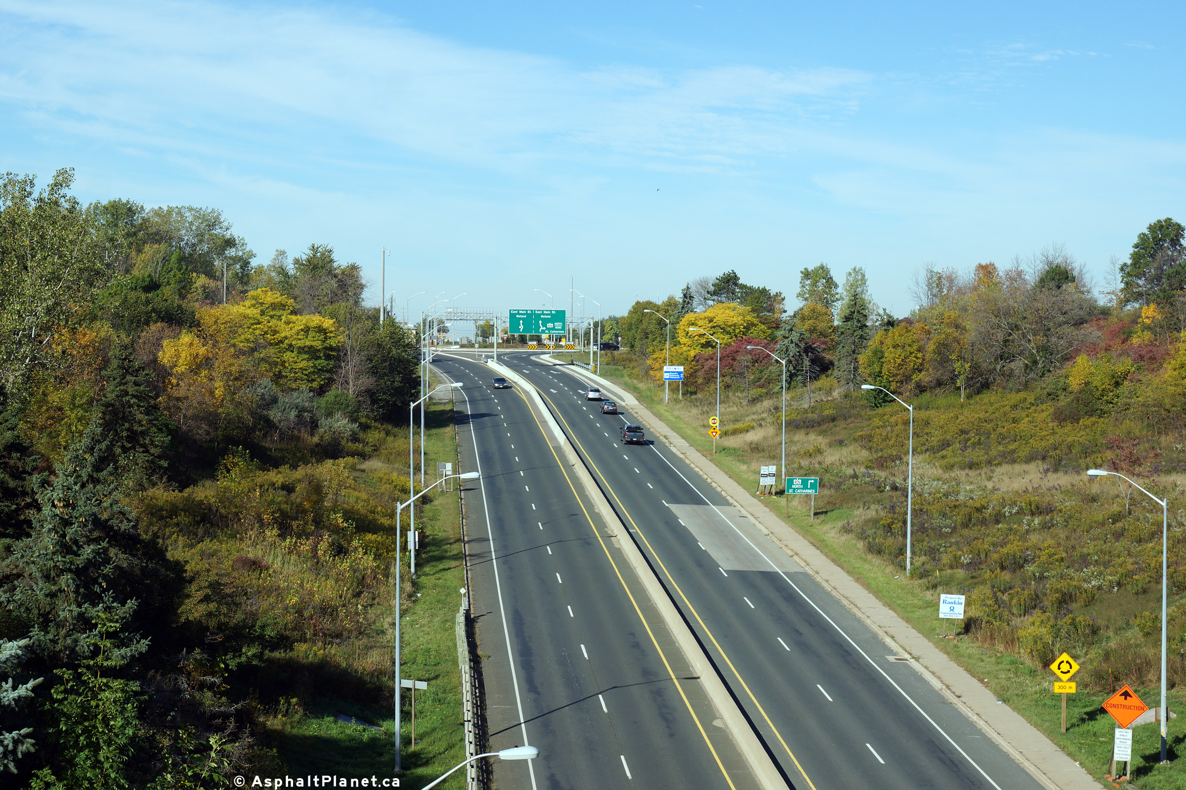
Looking south from the Beaverdams Road overpass towards the southern end of the divided highway. View looking easterly along Highway 20 at the Highway 406 intersection.  The new overpass is located on the right side of picture. Eastbound signage approaching the Highway 406 intersection on Highway 20. Looking westerly towards the Highway 406 intersection along Highway 20.

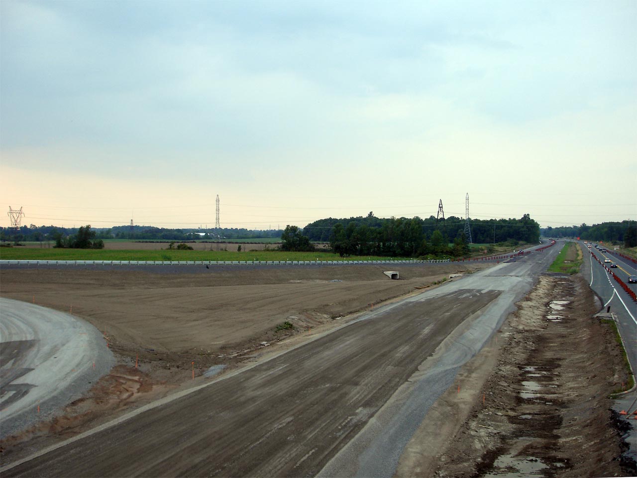
Photos taken: September 20th, 2006

(720x480)     (1440x960)

(720x480)     (1440x960)

(720x480)     (1440x960)

(720x480)     (1440x960)
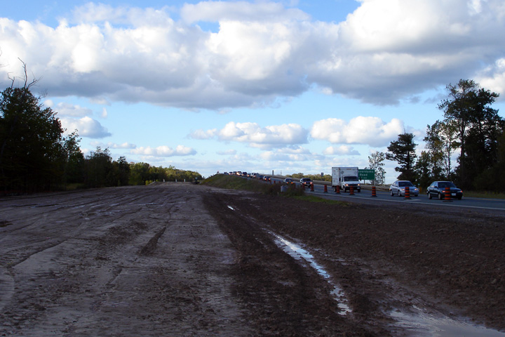
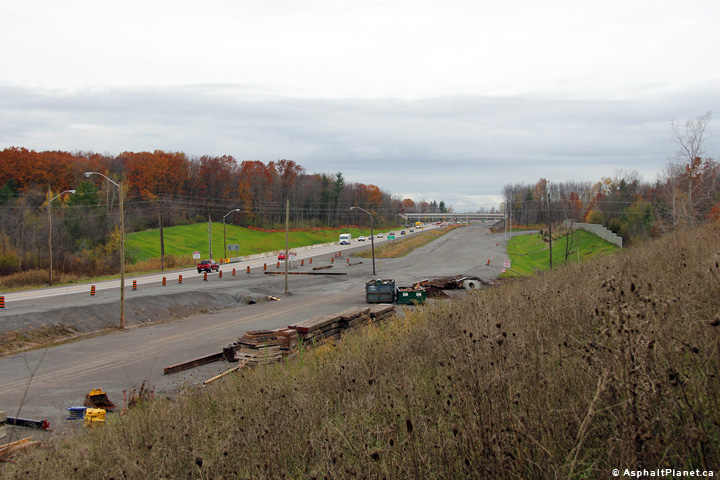
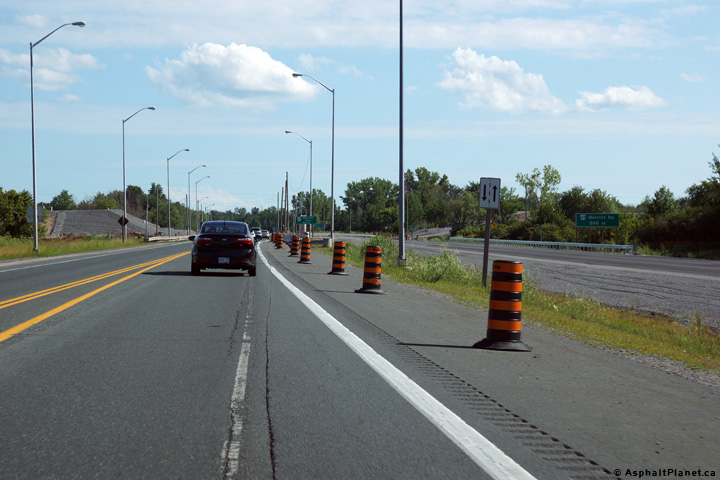
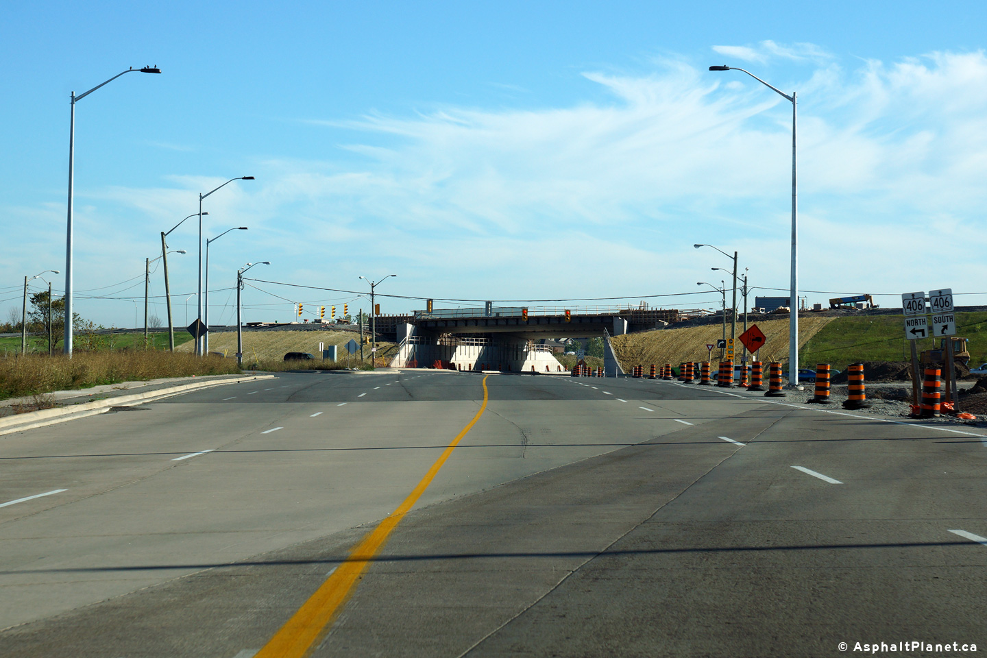
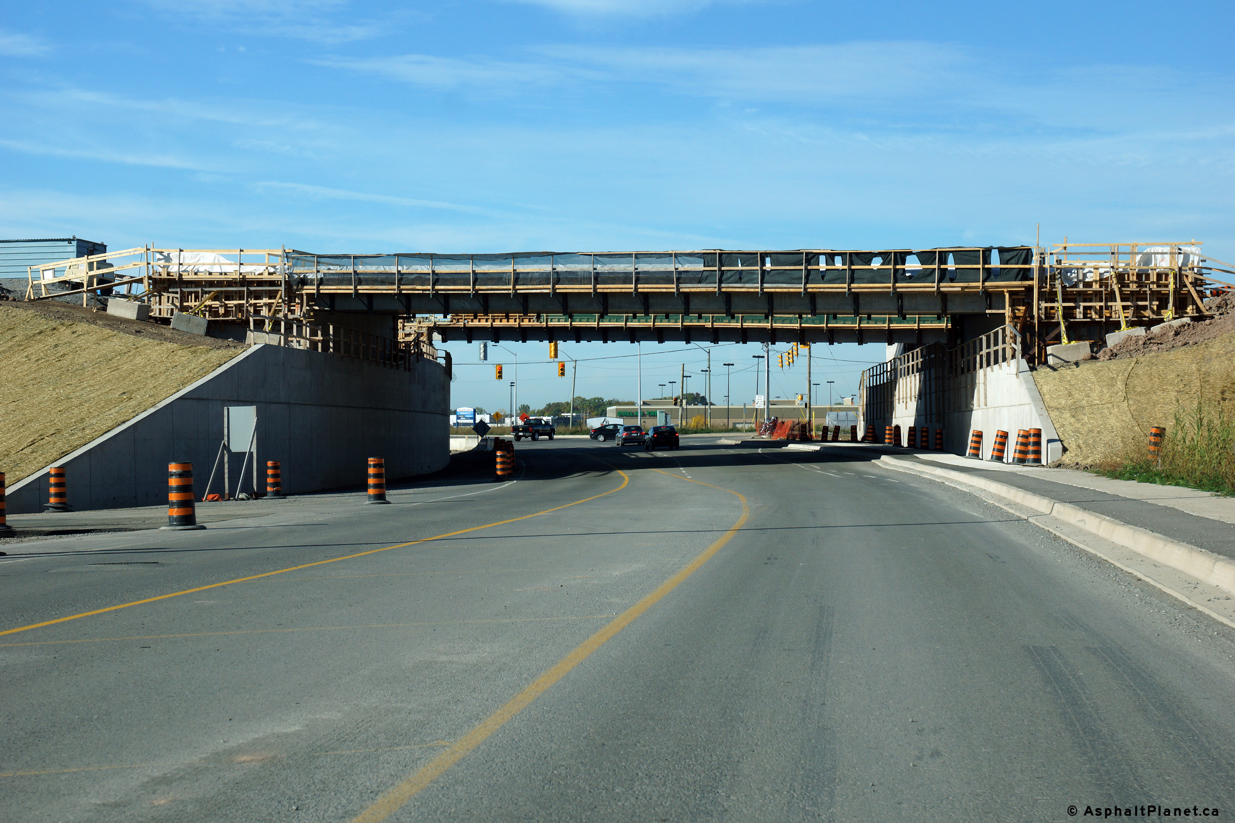
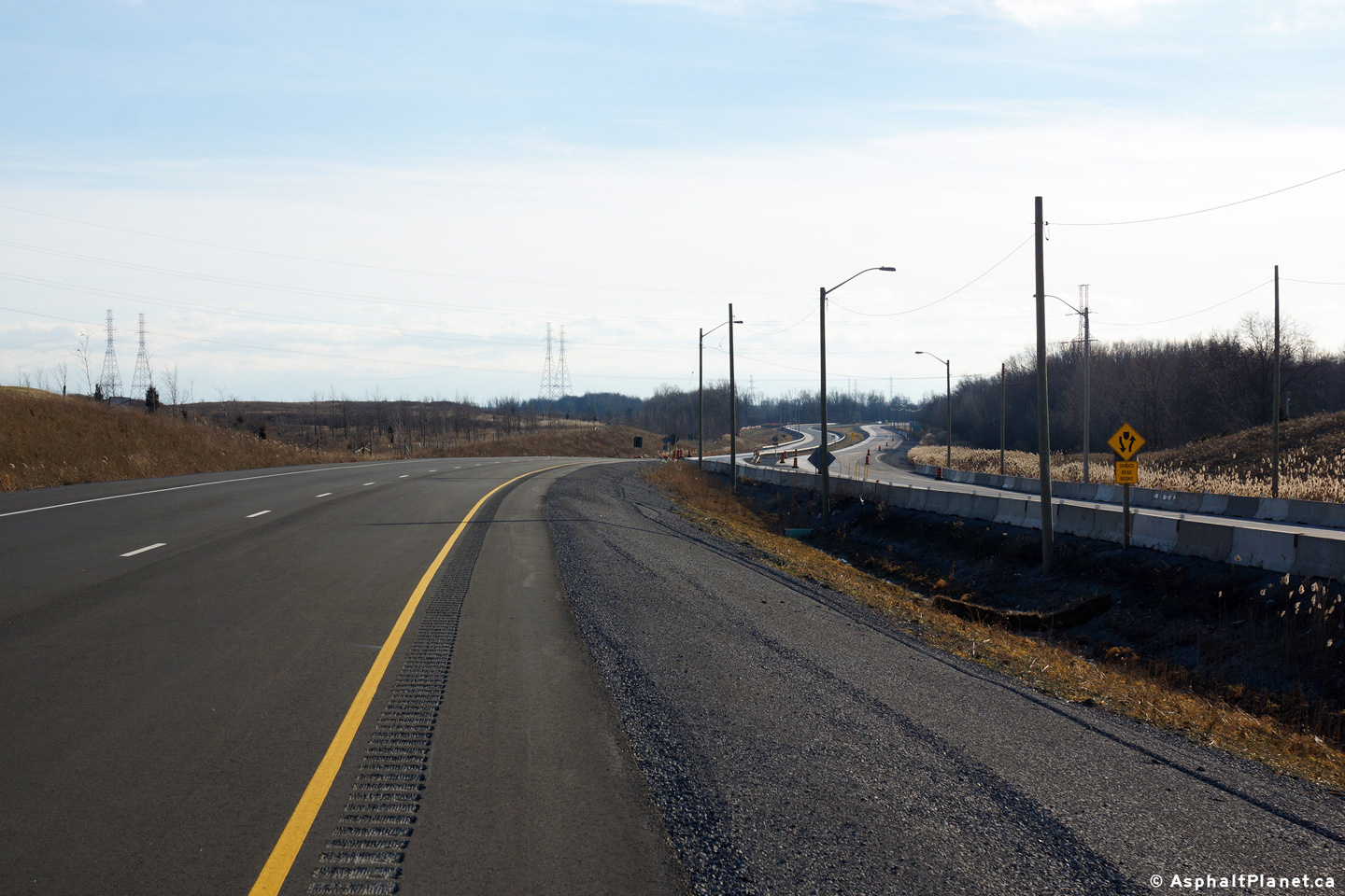
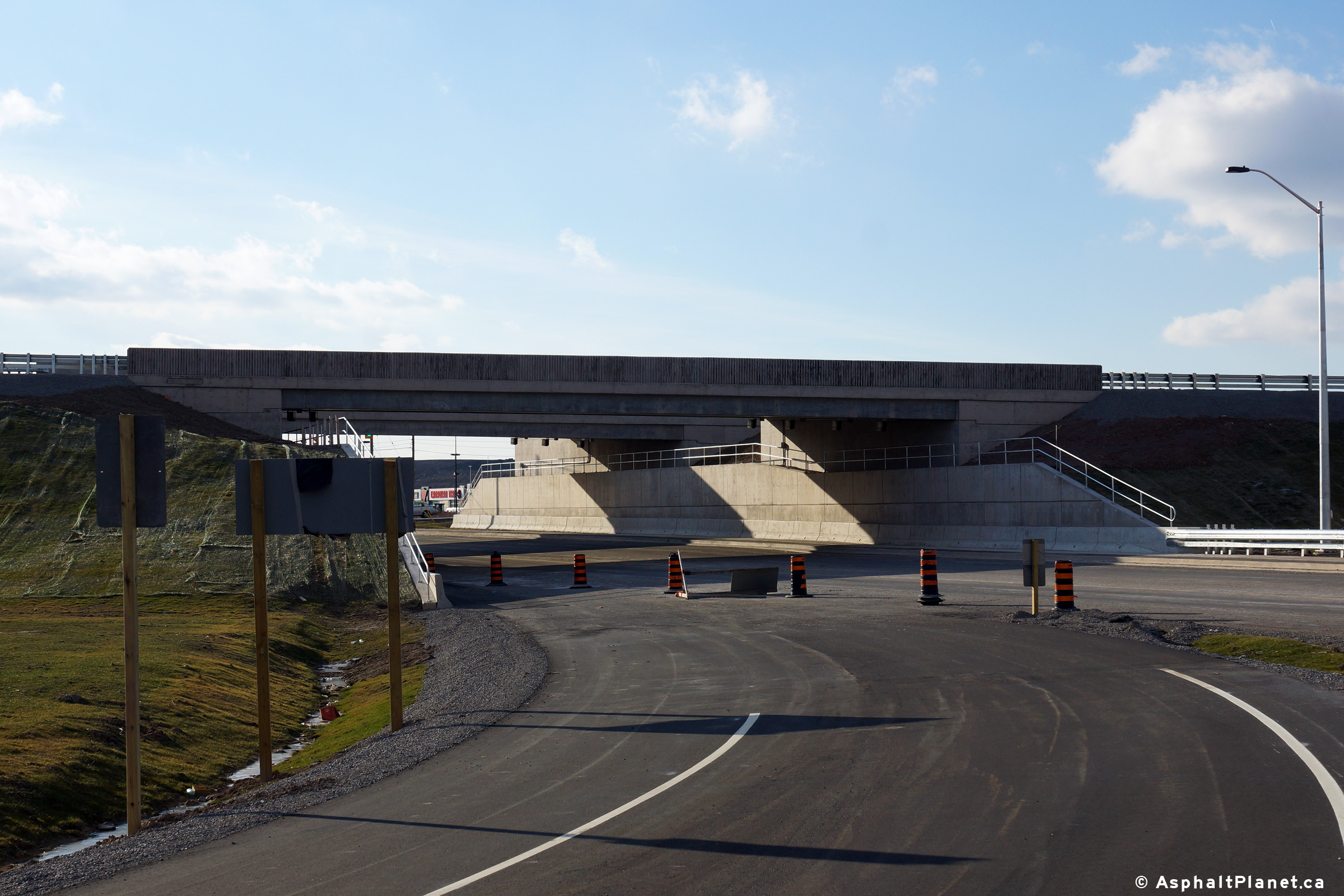
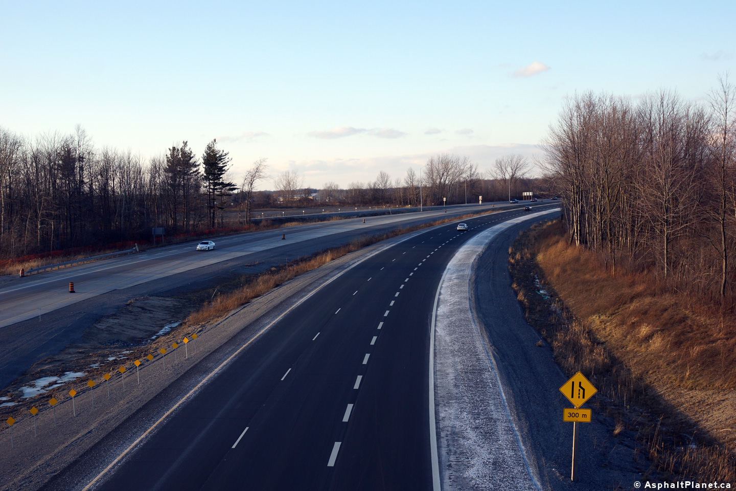
View looking south towards the Under Construction Highway 20 overpass.  This will be the only cross-over on the section of Highway 406 that is being twinned Looking south at the site of the Holland Road intersection.  Access to and from Holland Road was closed during the Summer of 2006. Looking north from just north of the former Holland Road intersection towards the railway overhead. Looking north on the future southbound lanes towards the former railway alignment.

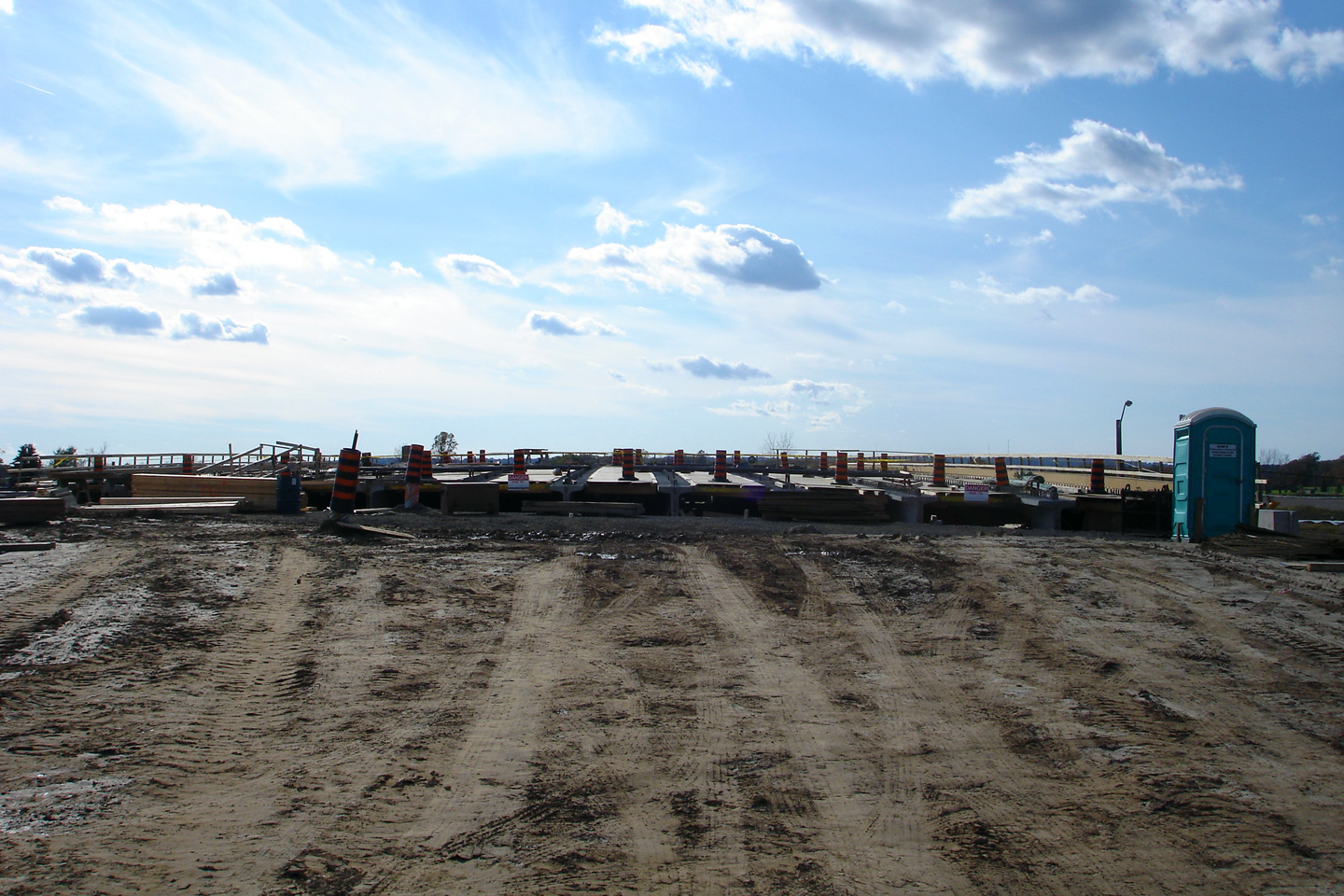
Photos taken: October 15th, 2006

(720x480)     (1440x960)

(720x480)     (1440x960)

(720x480)     (1440x960)

(720x480)     (1440x960)
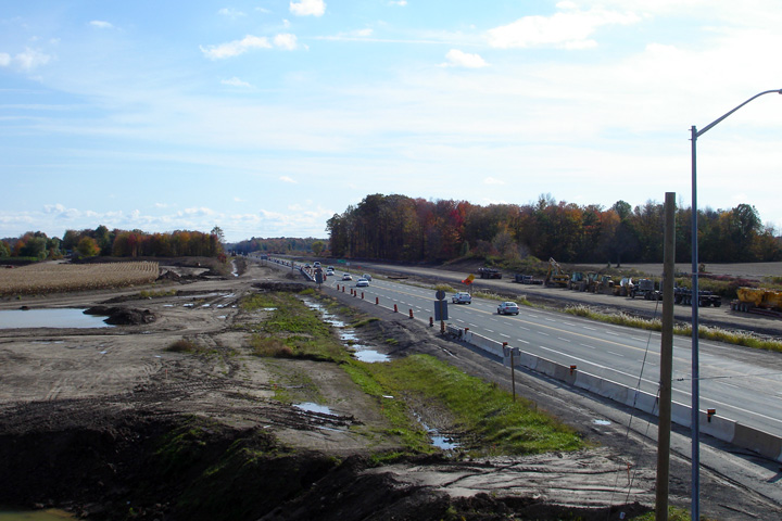
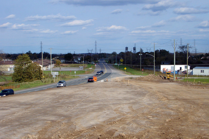
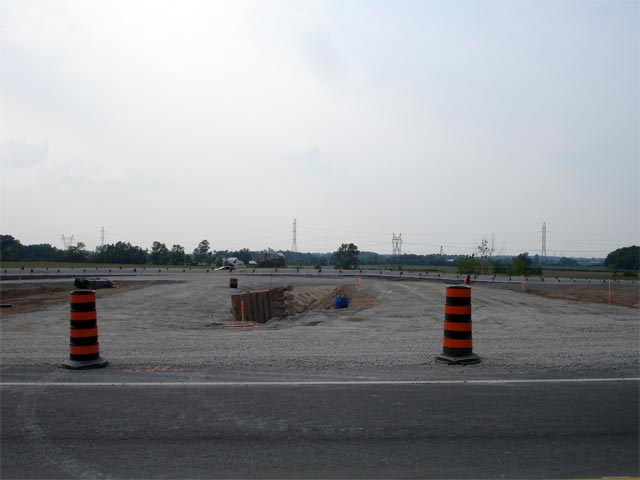
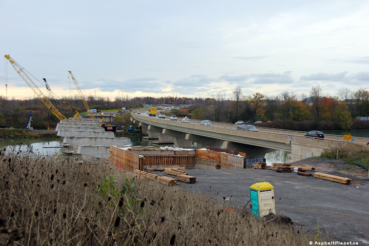
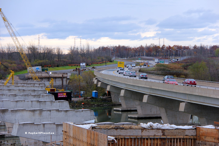
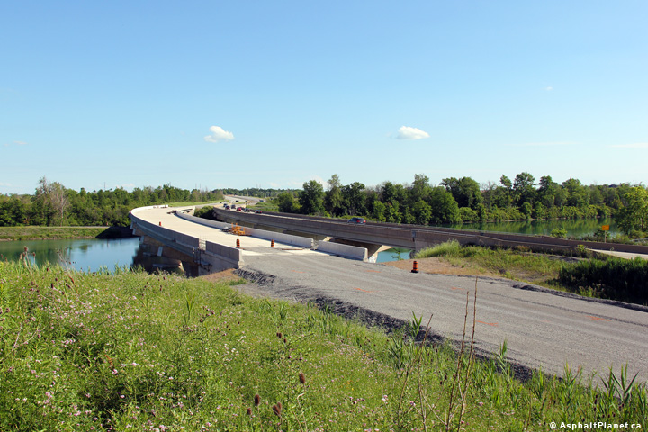
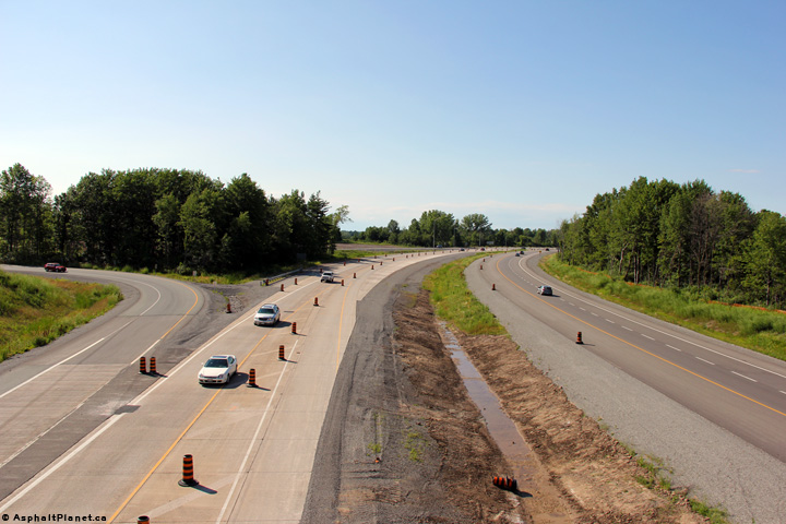
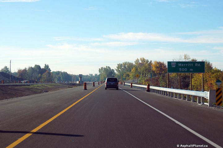
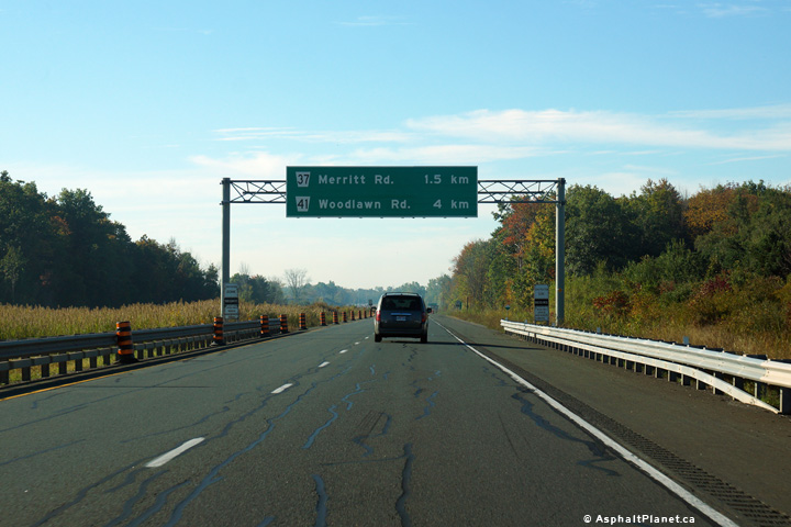
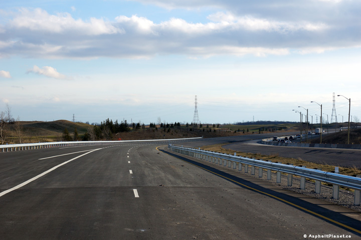
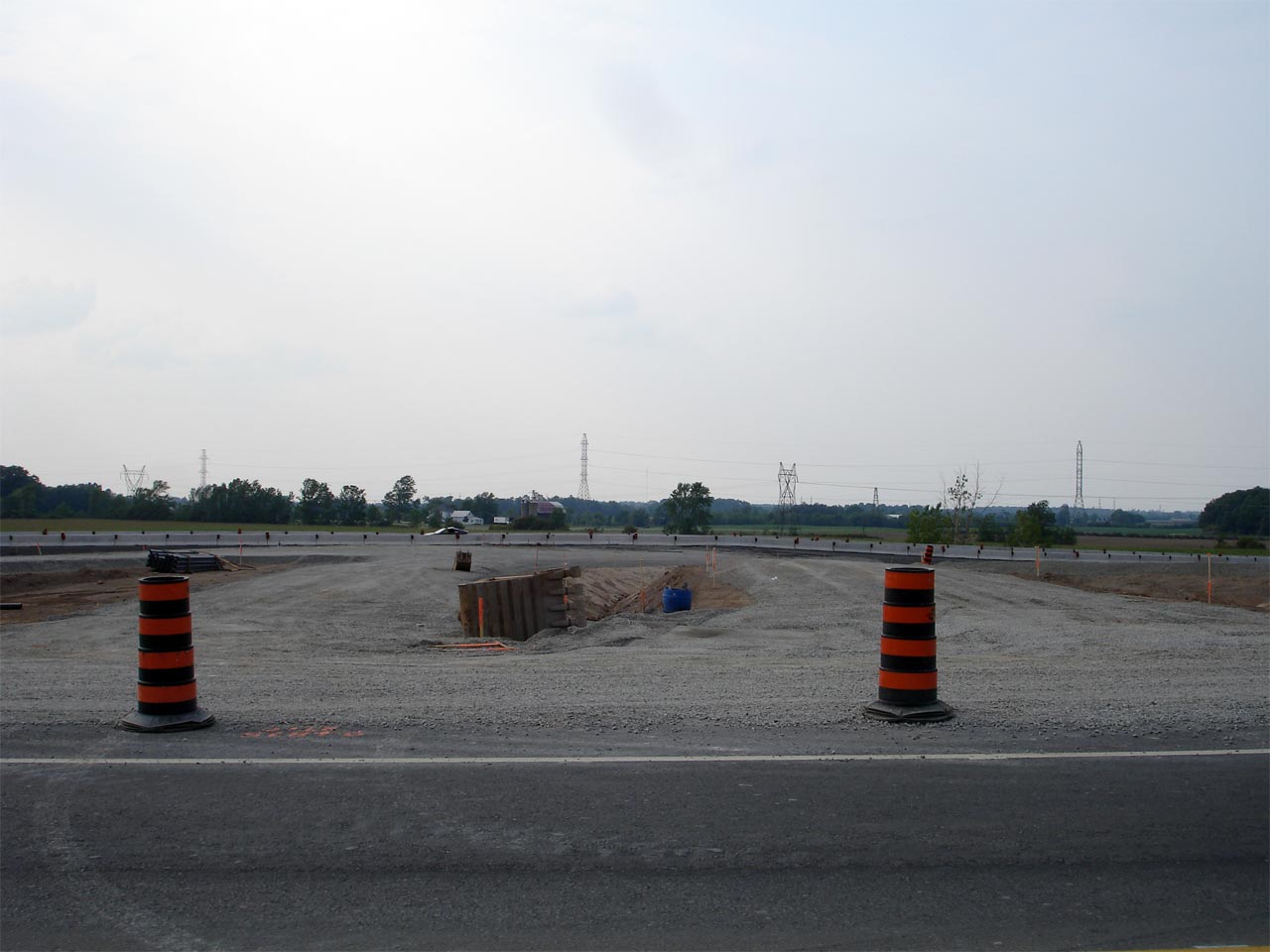
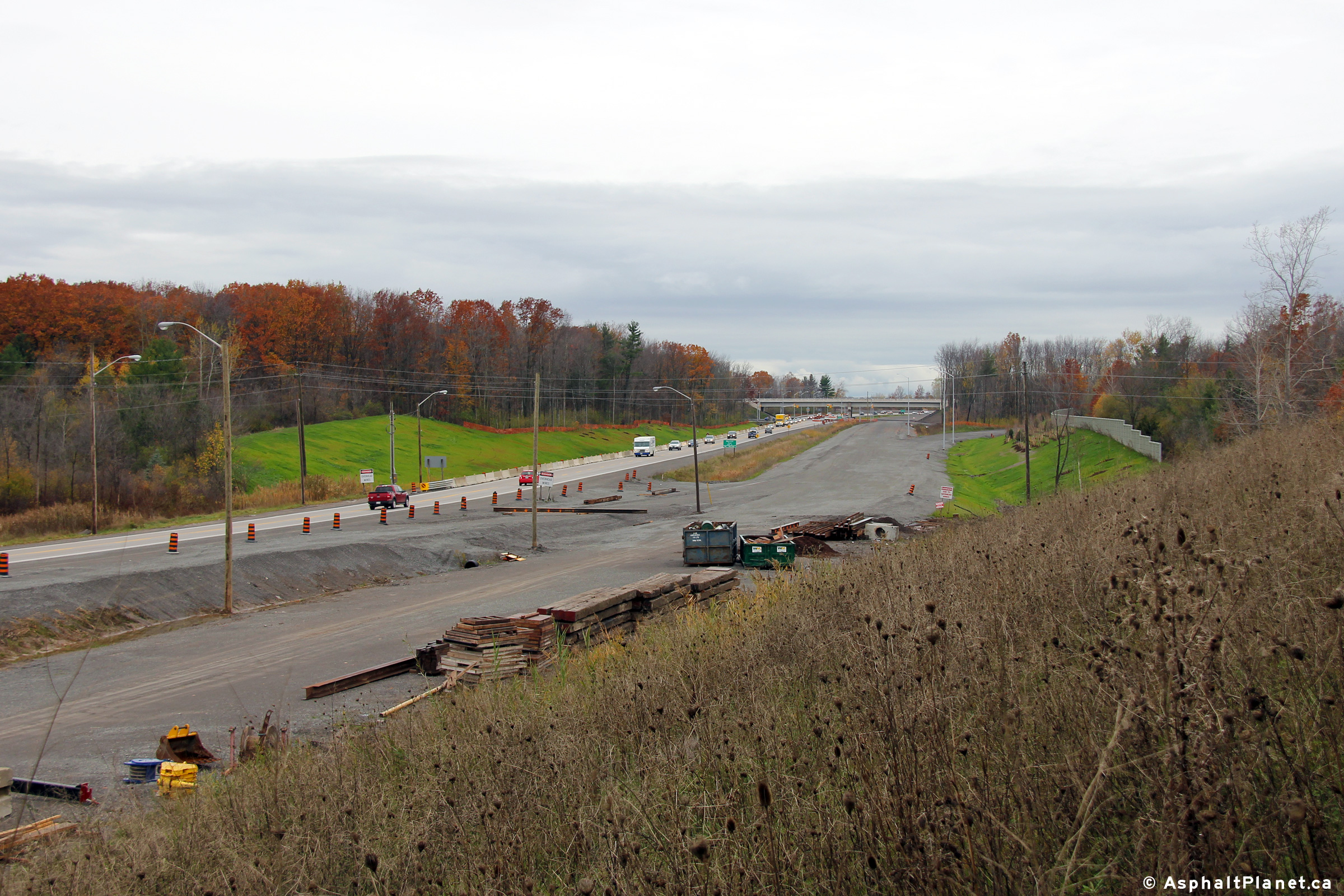
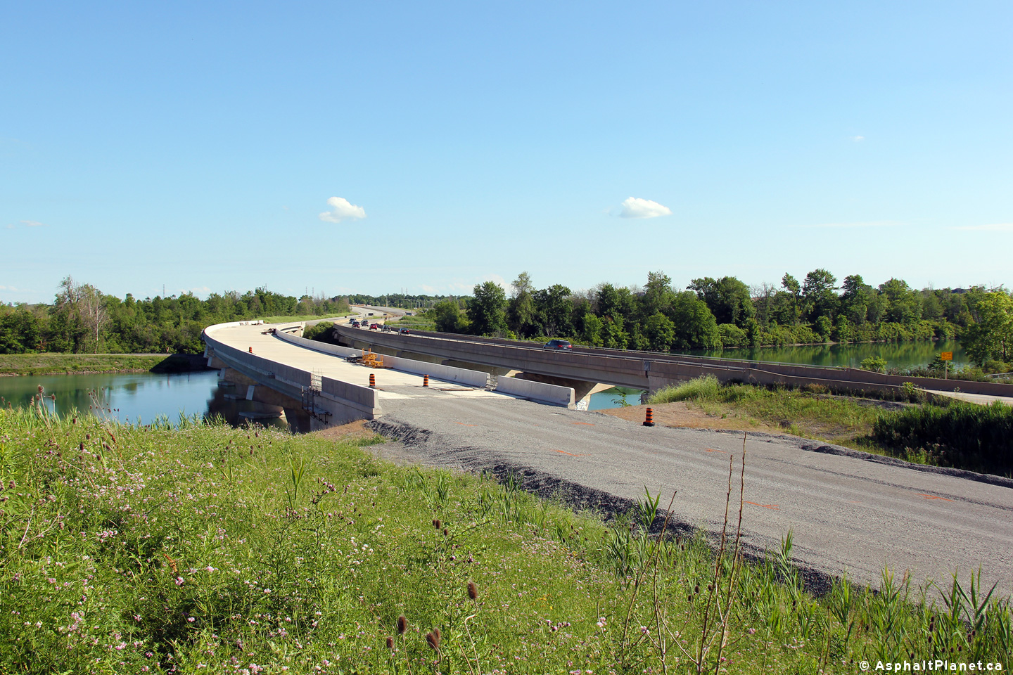
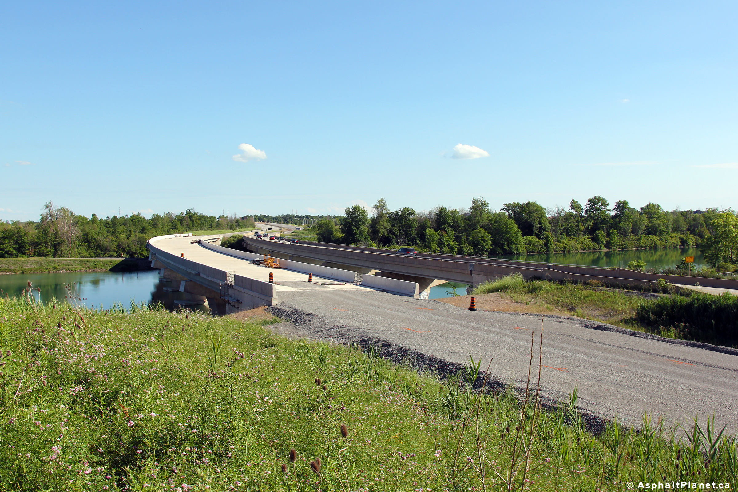
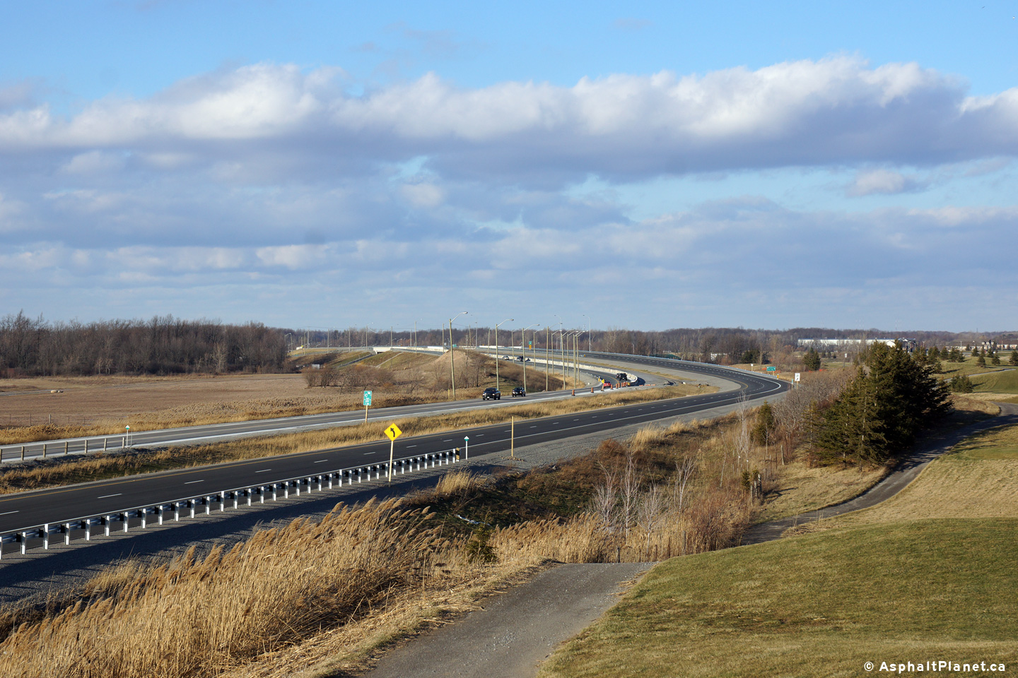
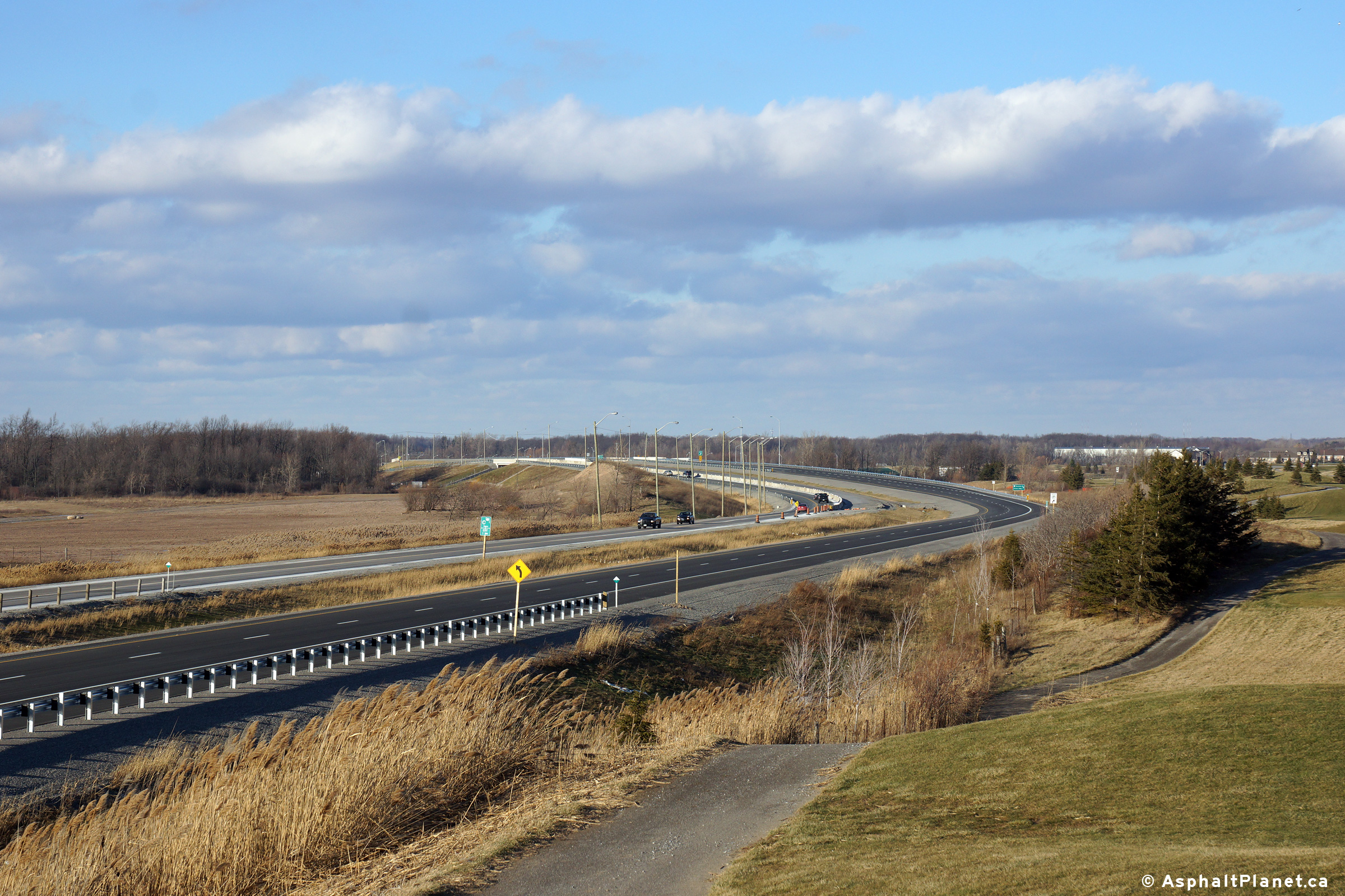
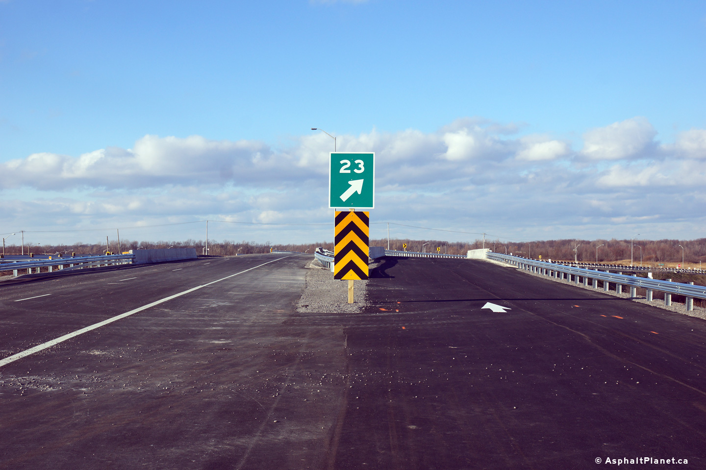
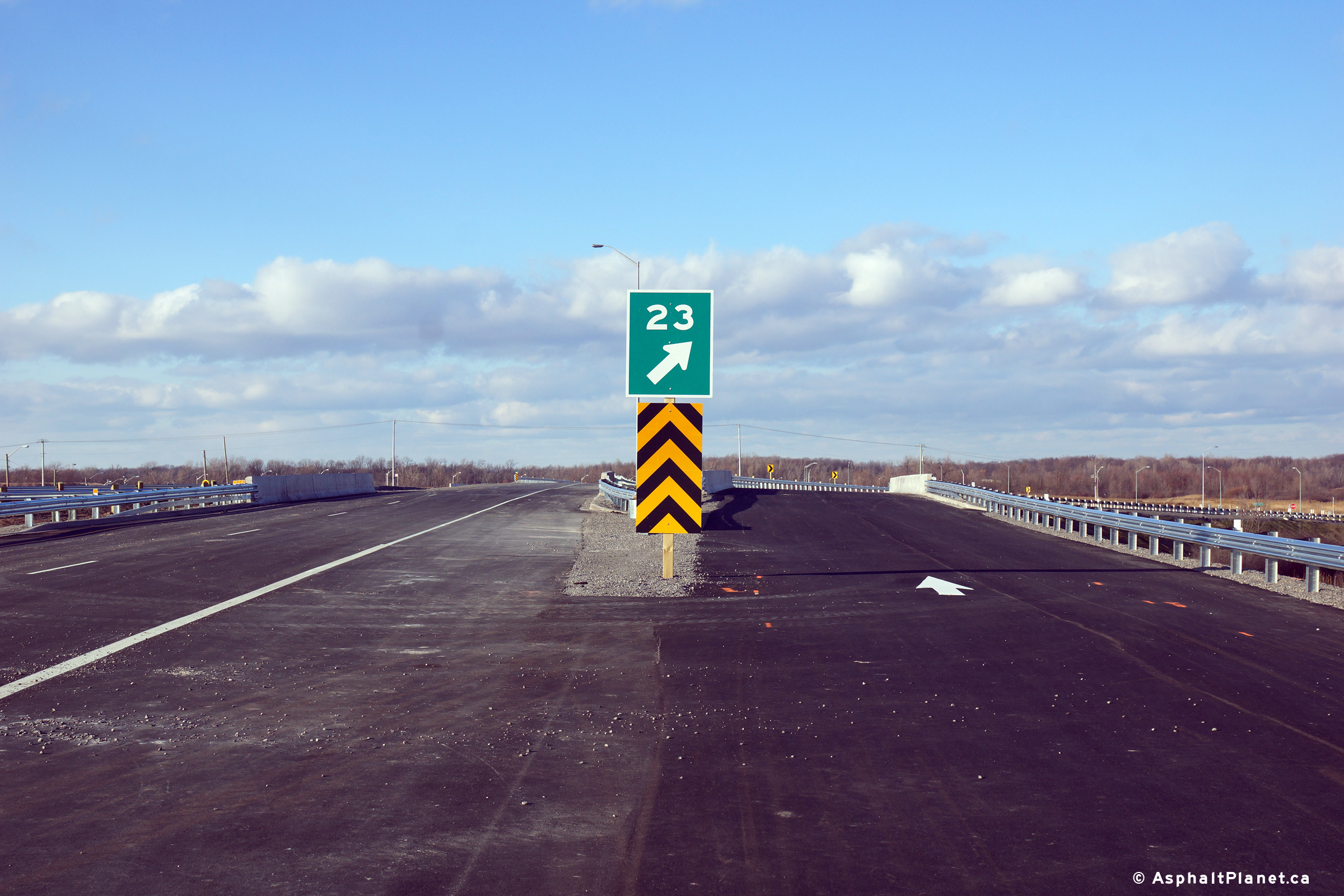
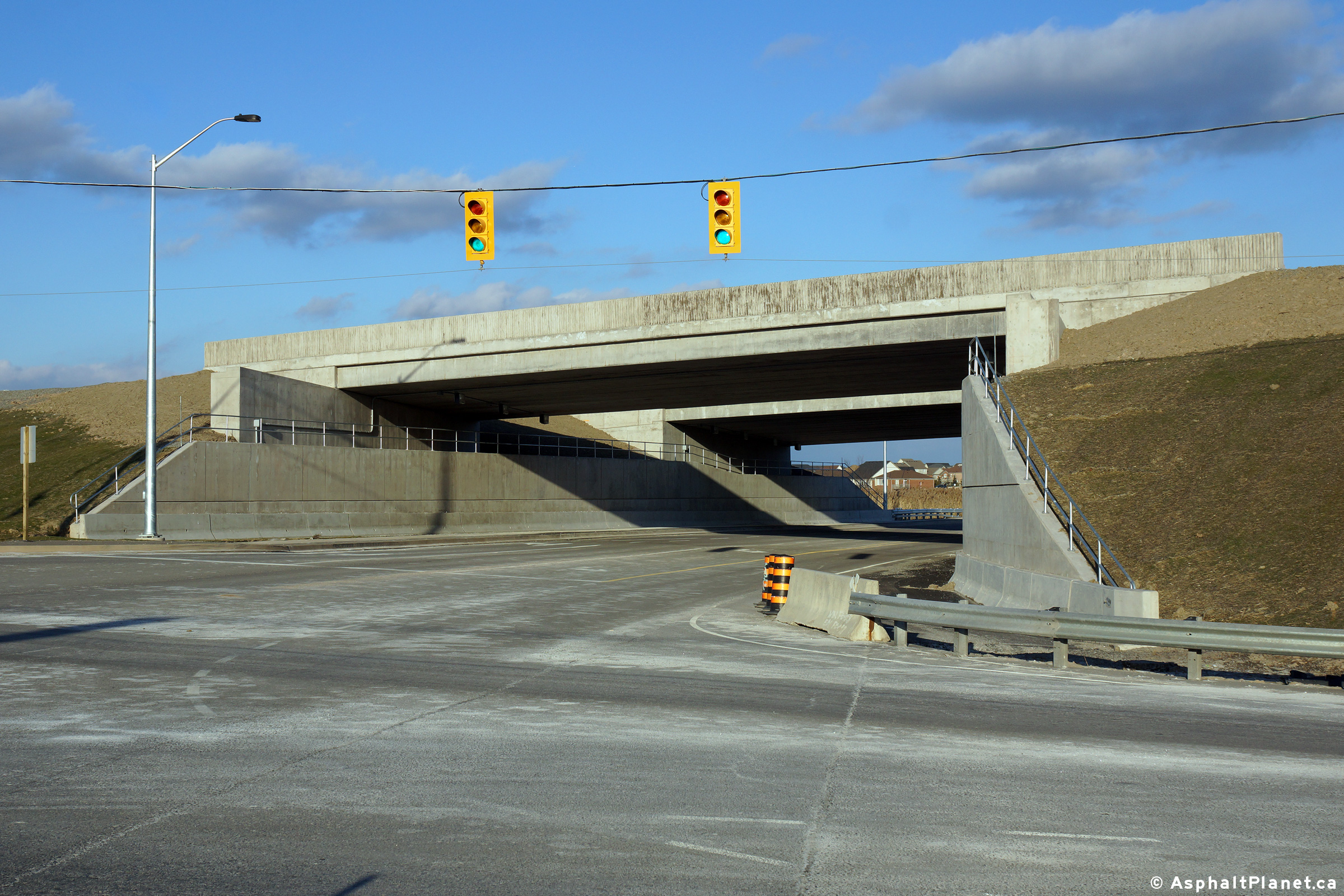
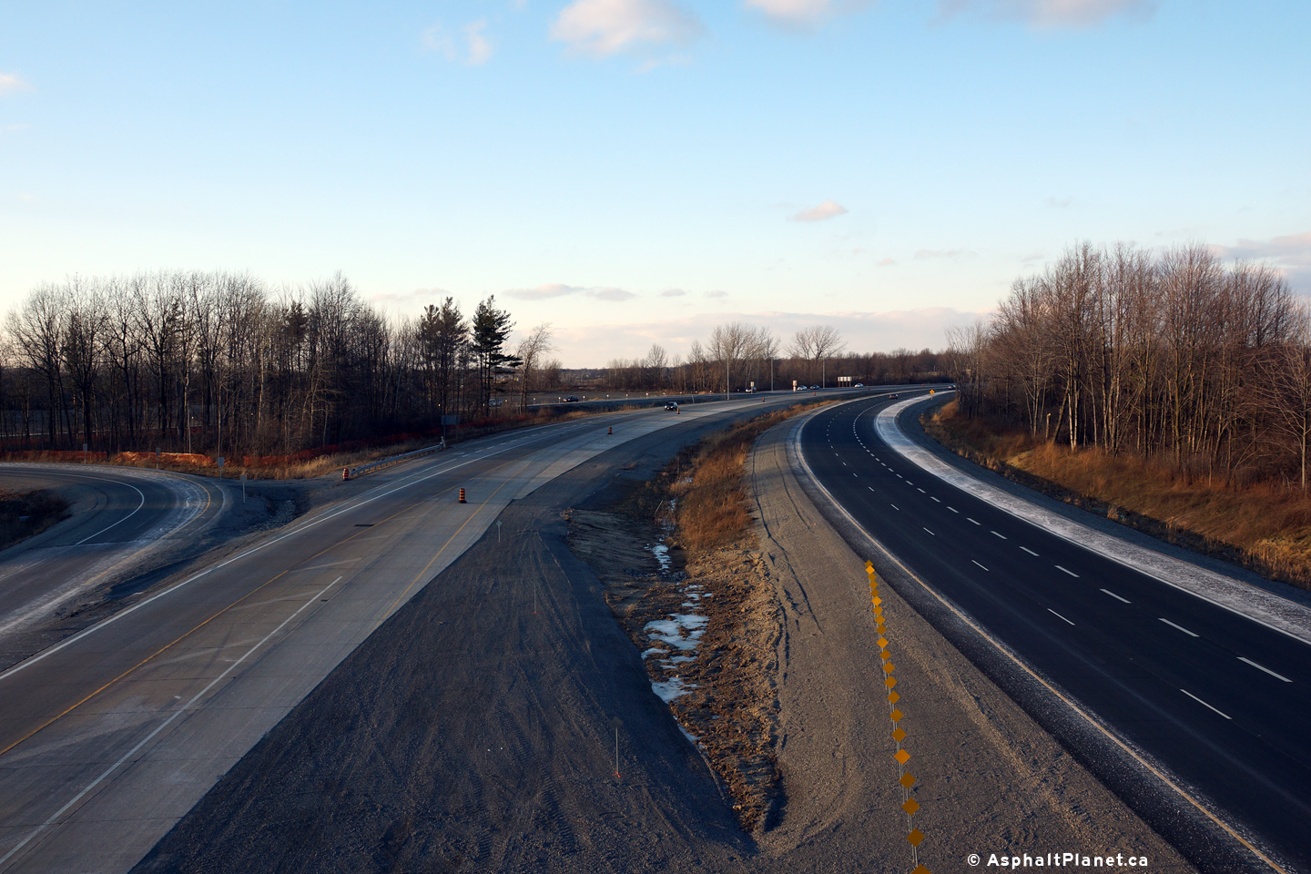
View of supports for a future overhead sign that will denote the southern end of the freeway. Looking south from the Highway 20 overpass.  The future southbound carriageway is almost ready to be paved. Looking north along the 406 from the Highway 20 overpass.  Surprisingly, Highway 406 will meet Highway 20 at a Parclo A2 interchange. A broader view looking north of the 406 from the Highway 20 overpass.
 
(720x480)     (1440x960)

(720x480)     (1440x960)
 
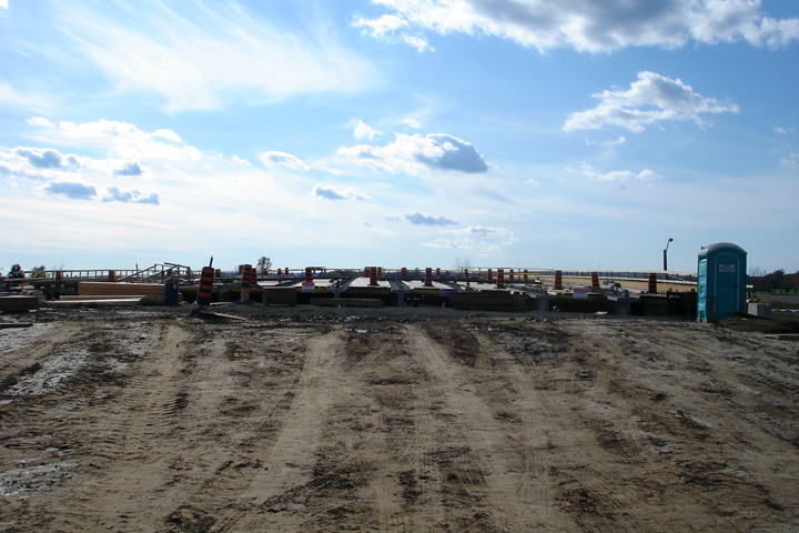
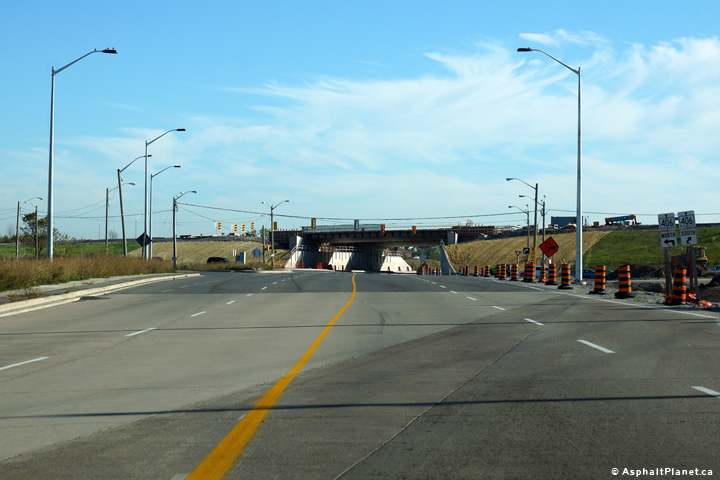
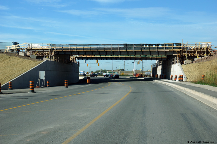
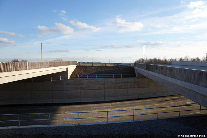
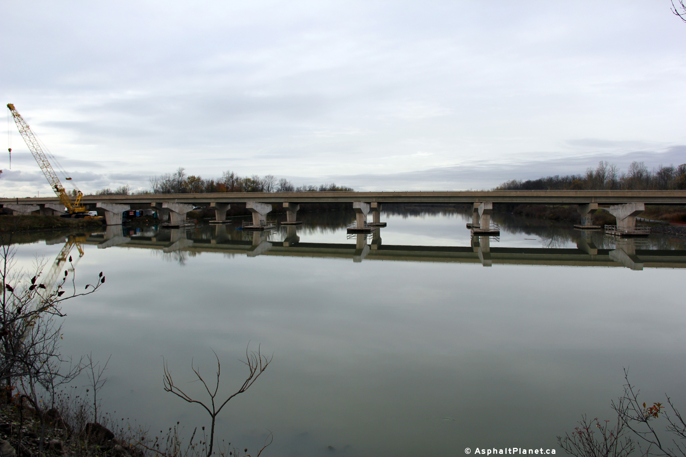
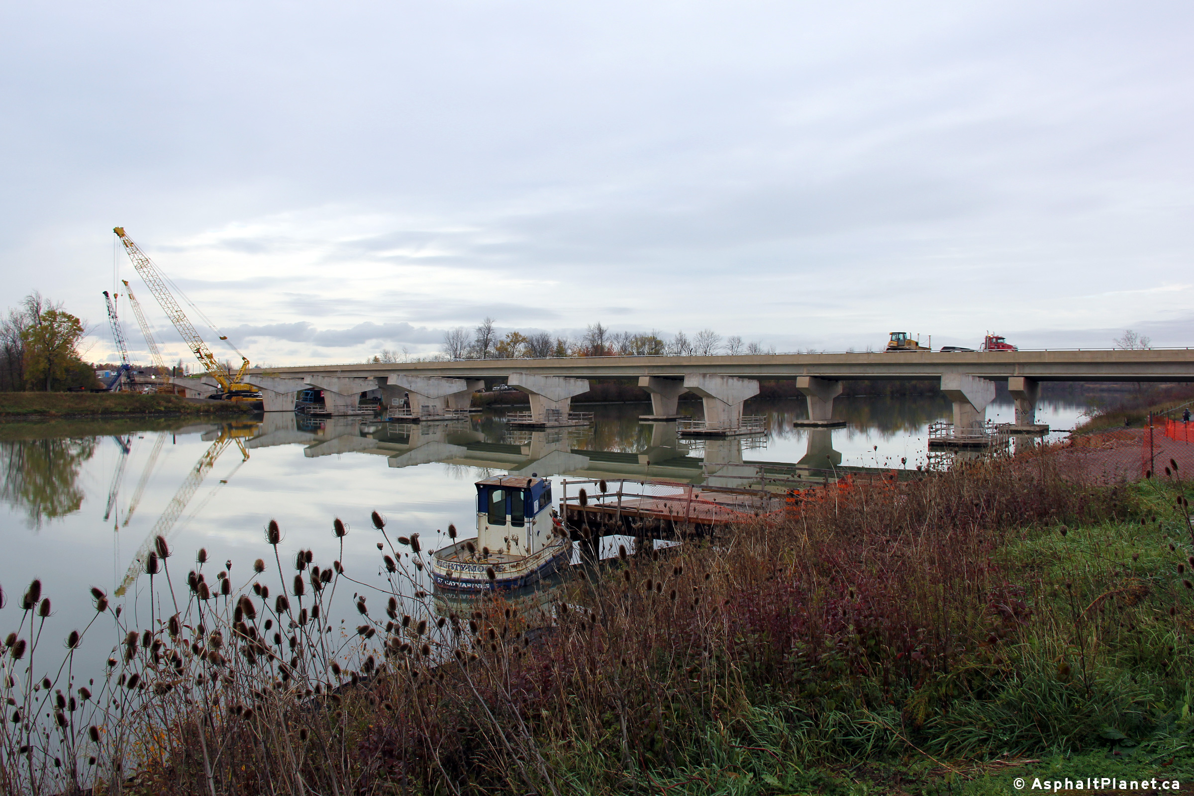
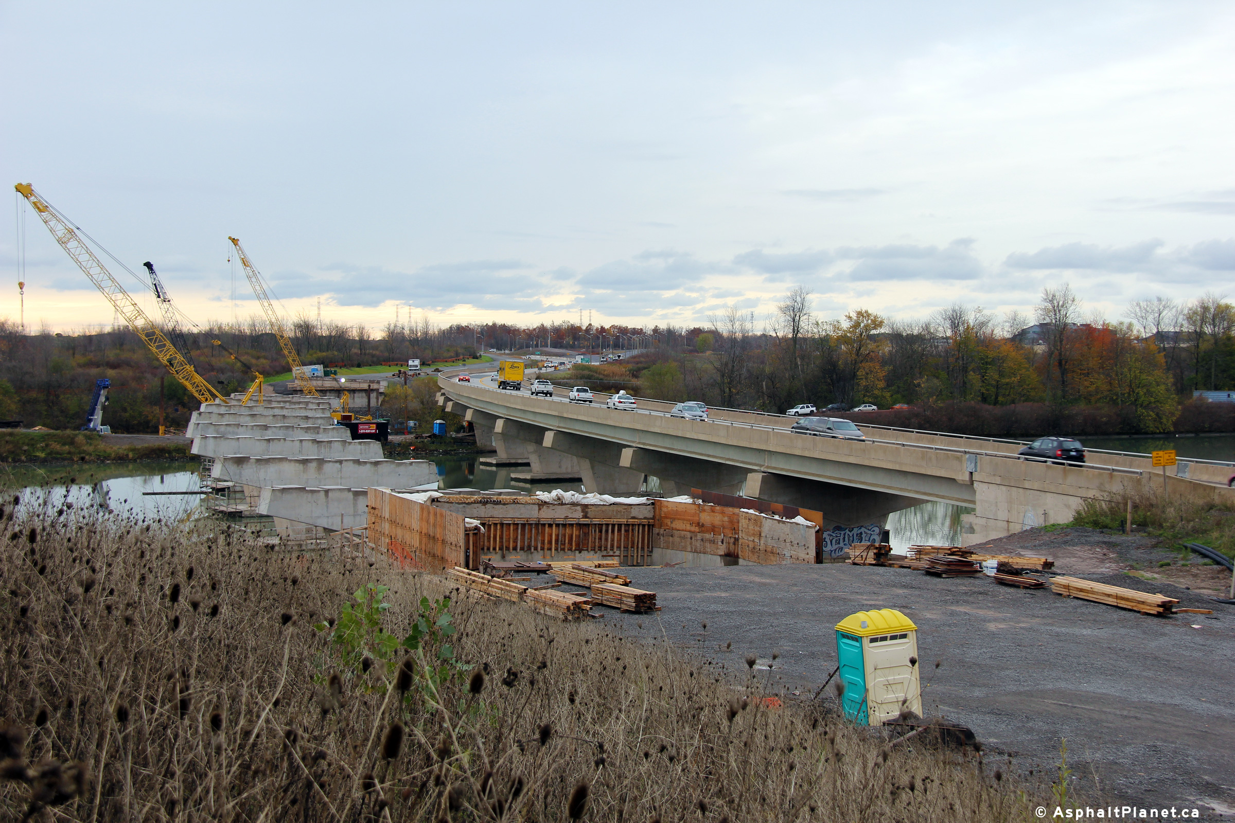
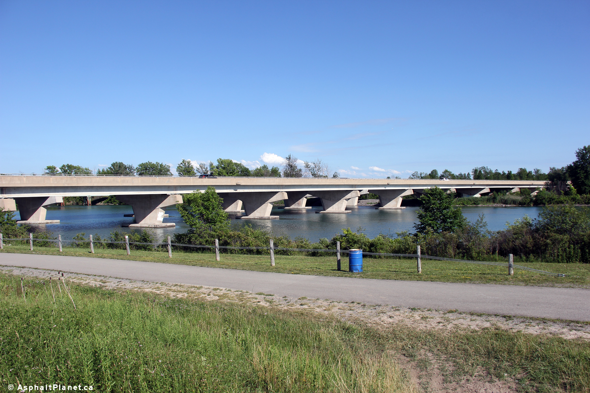
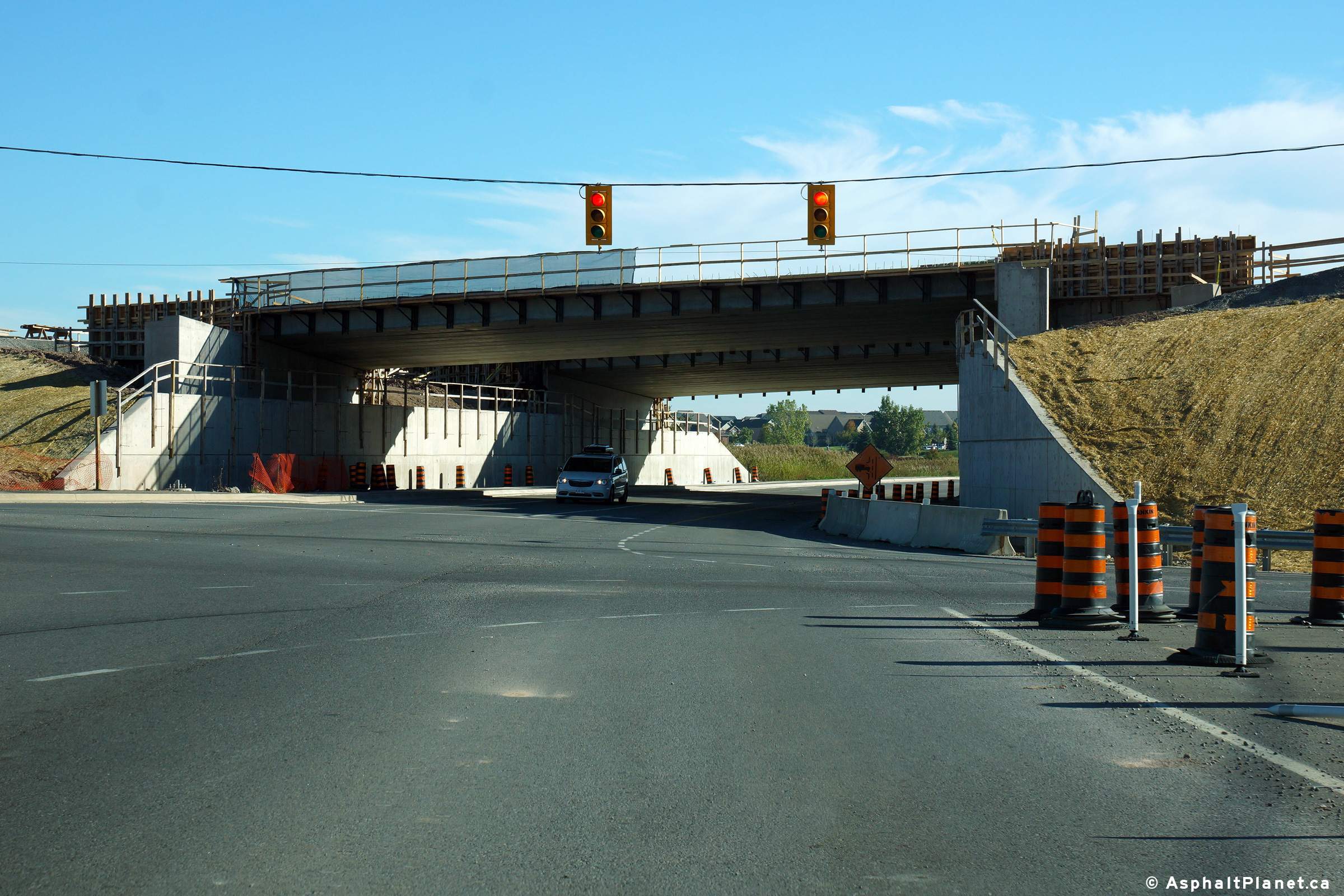
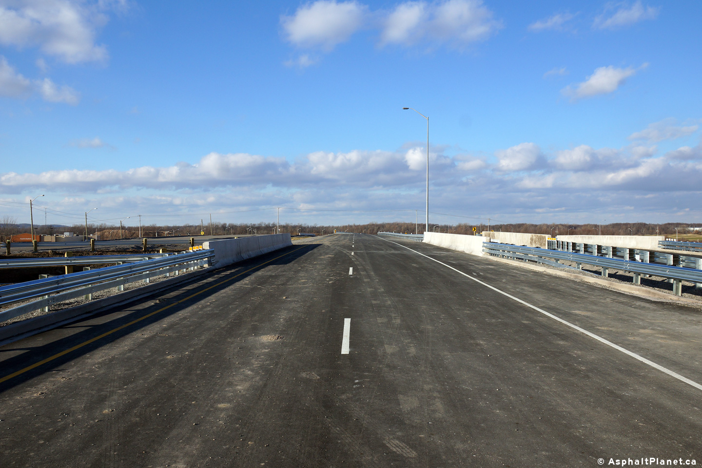
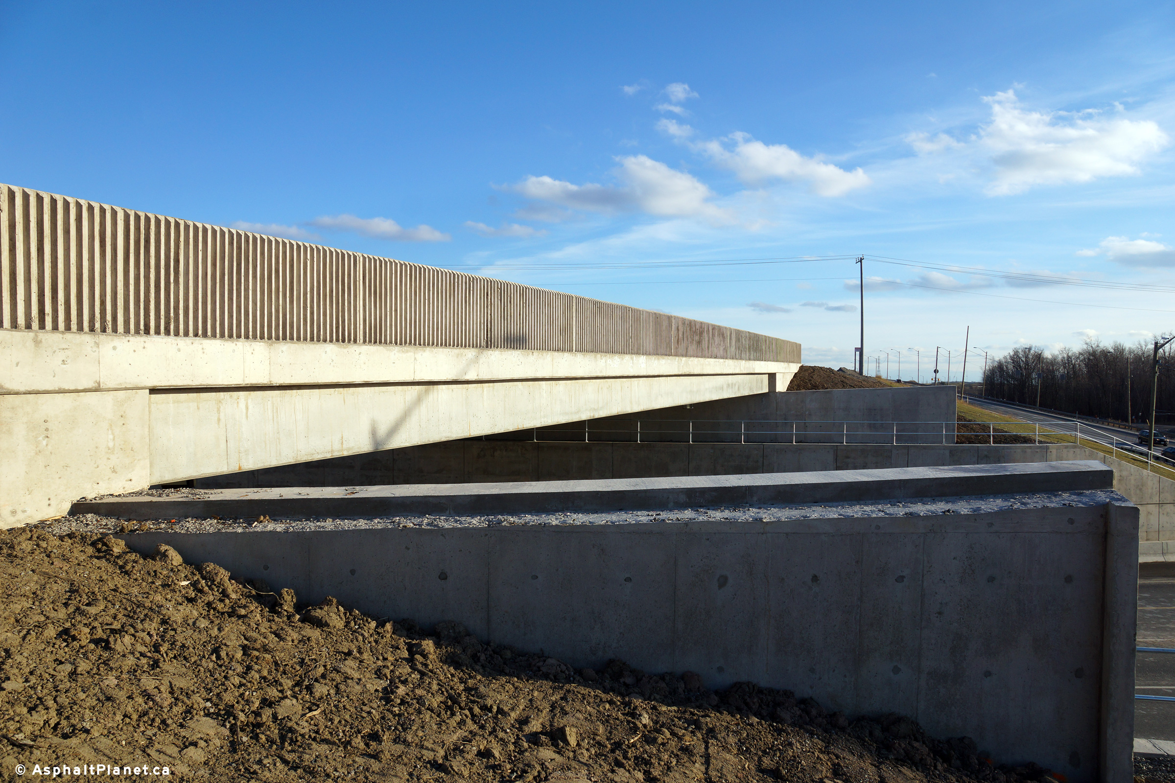
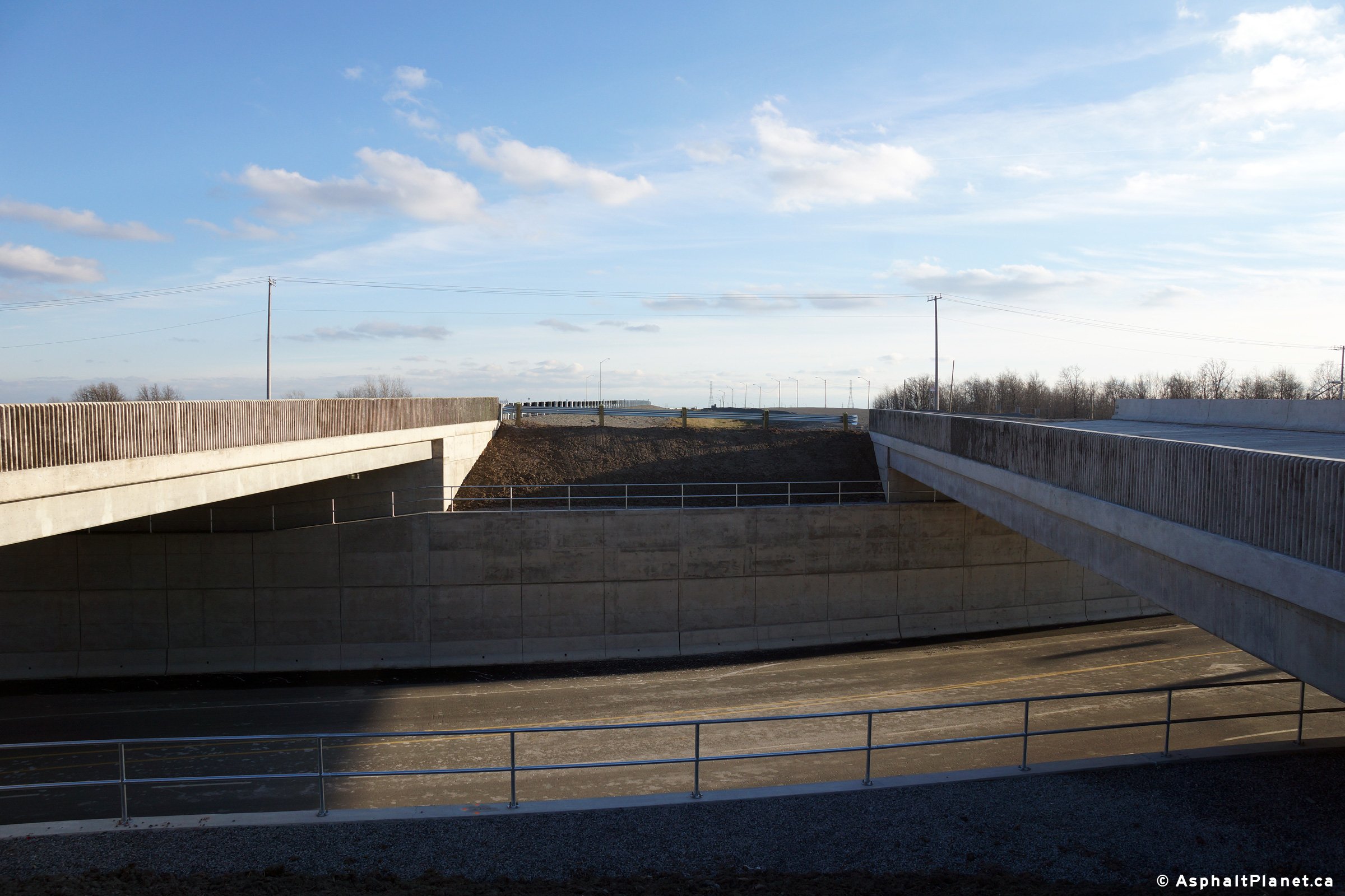
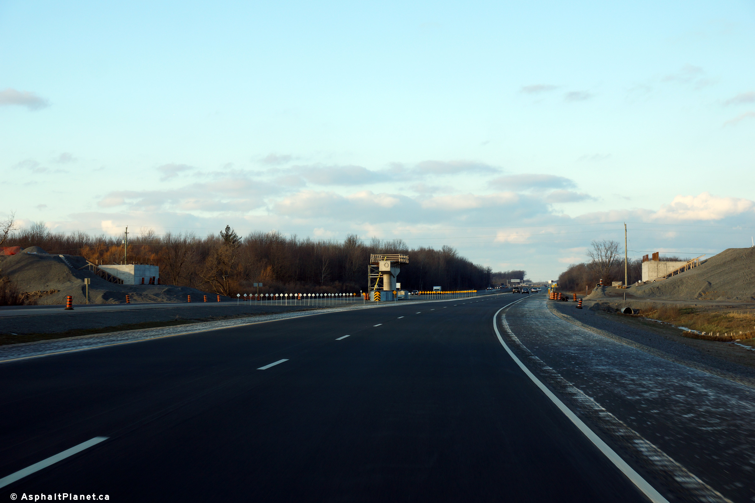
  Looking west towards the under construction Highway 20 overpass over the 406.  The concrete I-beam supports are in place, and forms are being placed for the concrete deck. Looking east from the Highway 20 overpass towards Niagara Falls.  The new overpass will actually straighten Highway 20's alignment in the vicinity of the 406.  

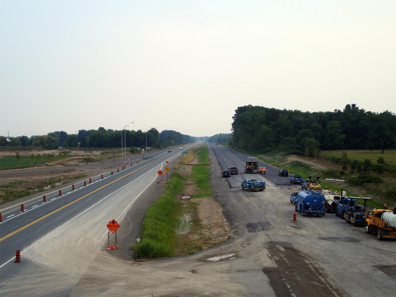
Photos taken: July 25th, 2007

(720x480)     (1440x960)

(720x480)     (1440x960)

(720x480)     (1440x960)

(720x480)     (1440x960)

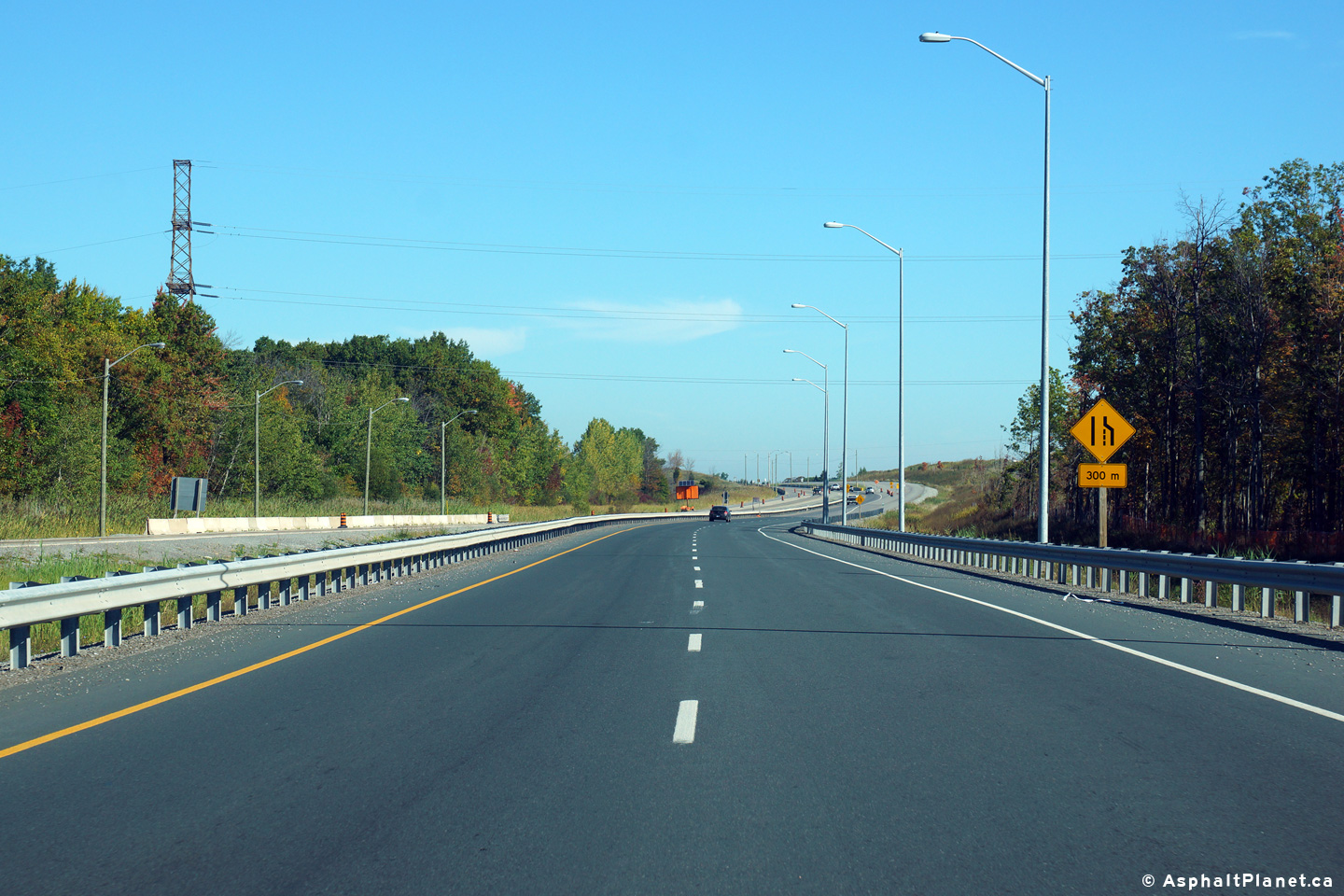
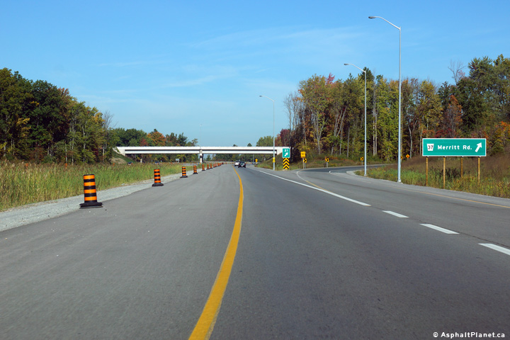
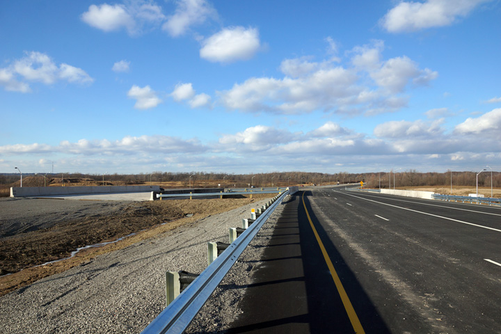
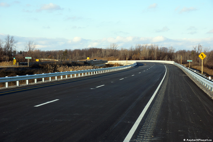
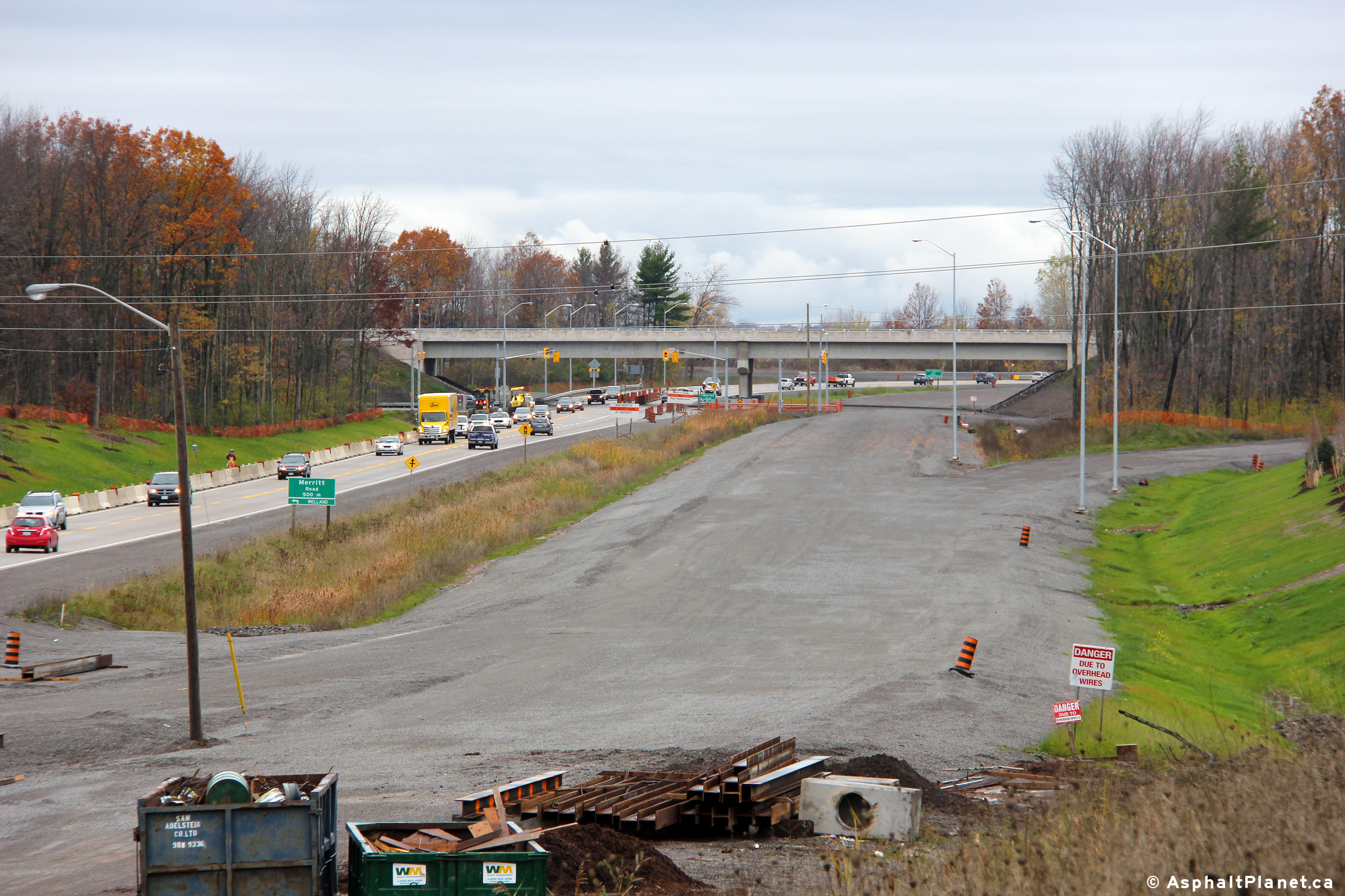
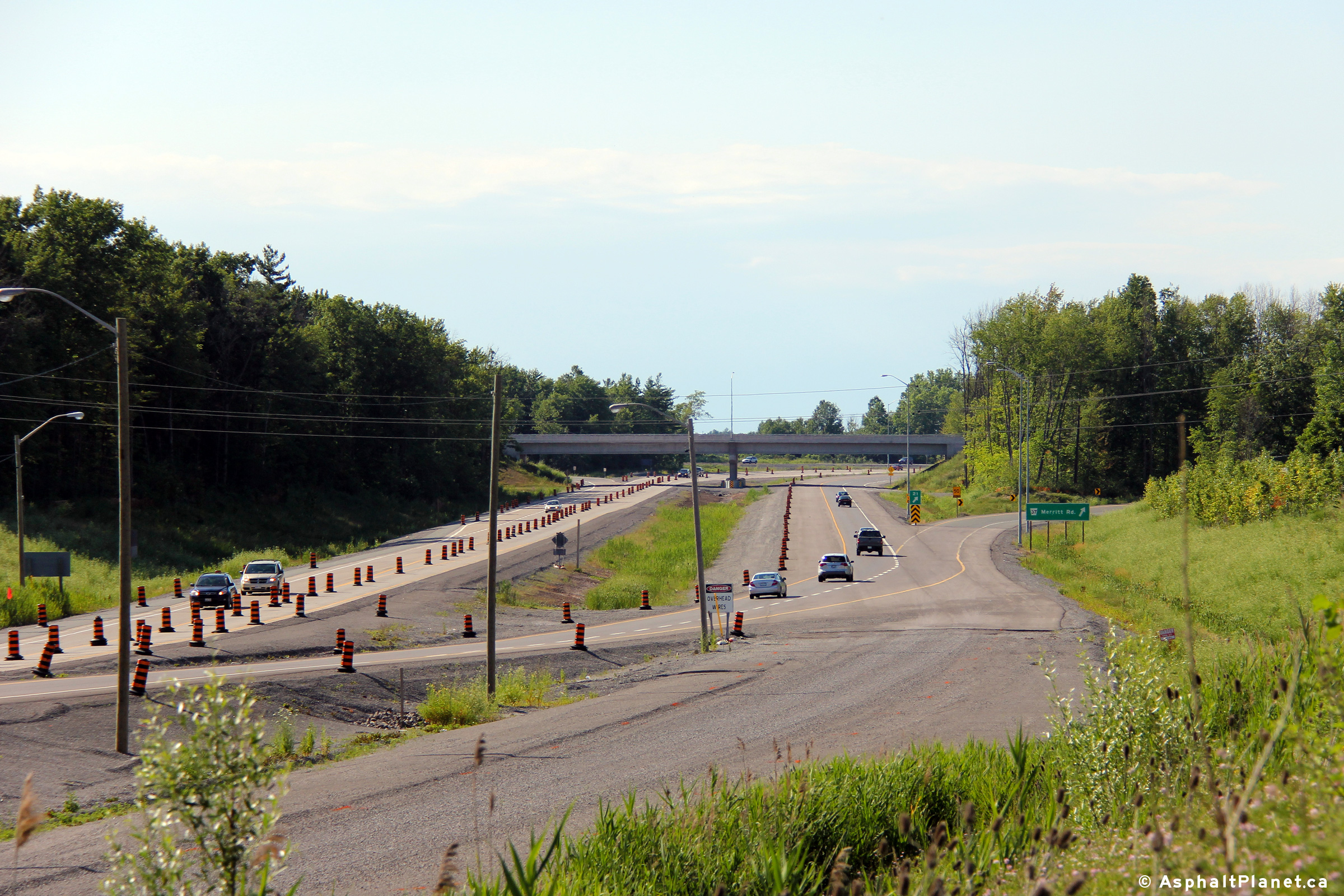
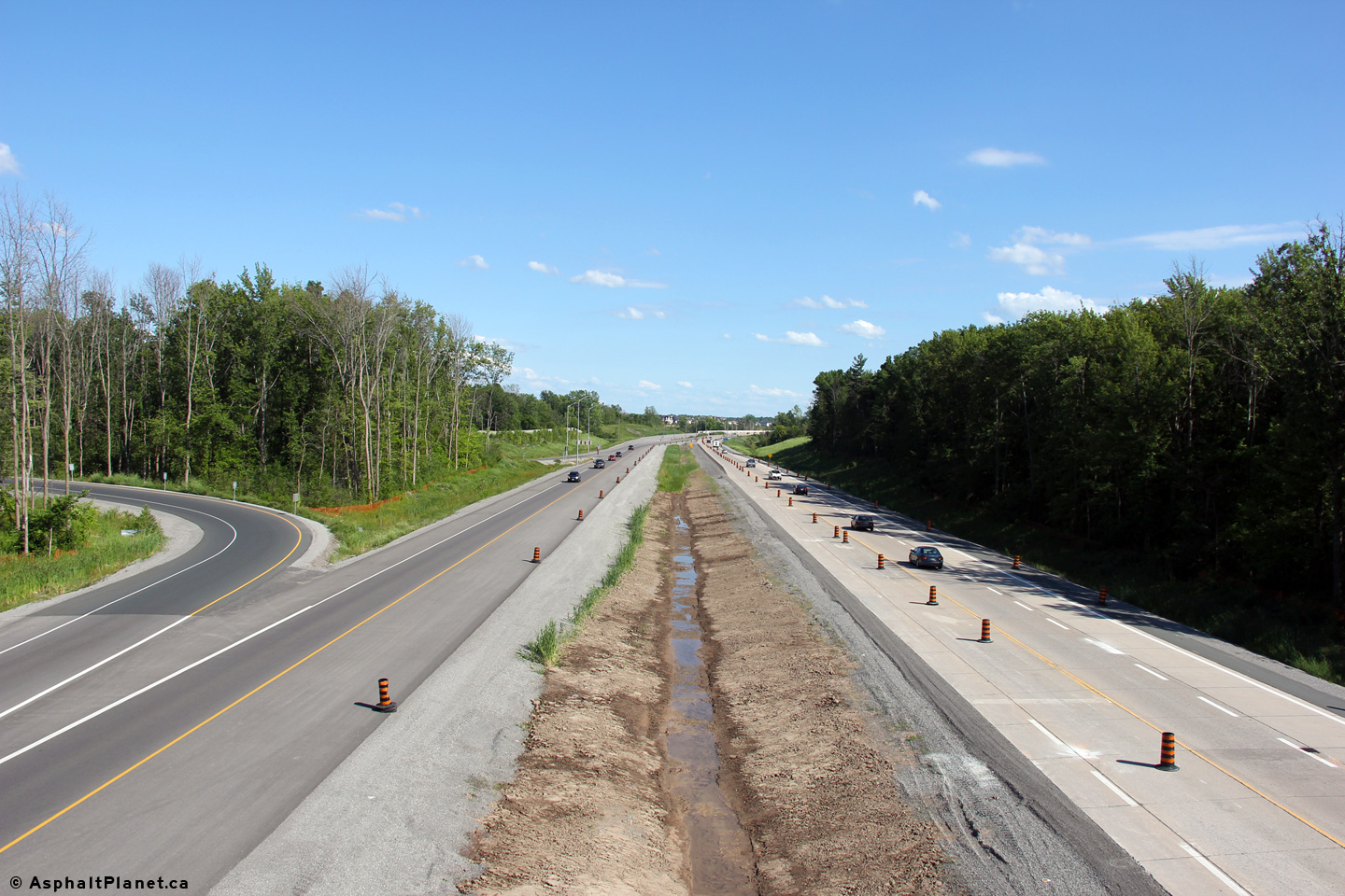
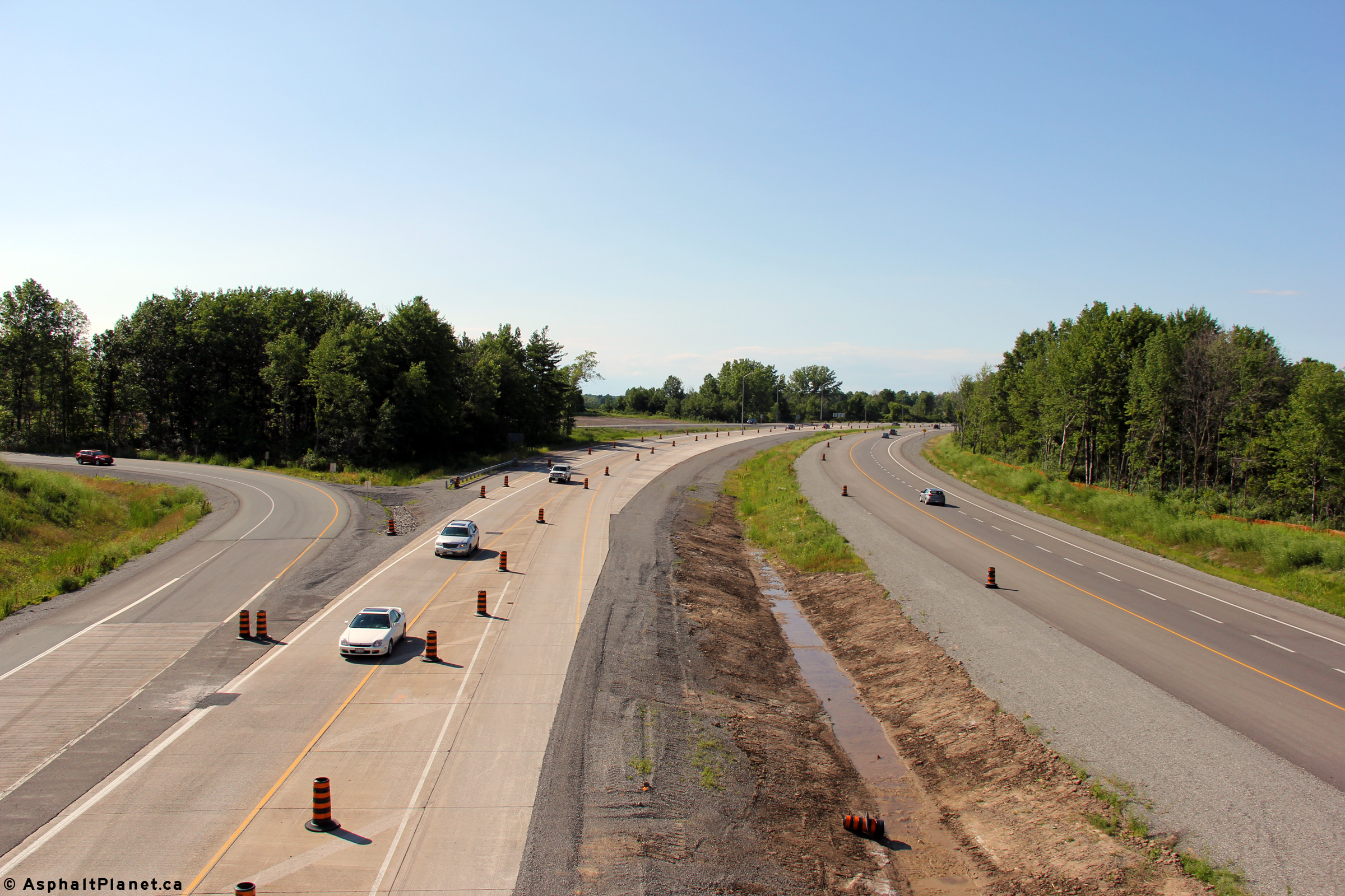
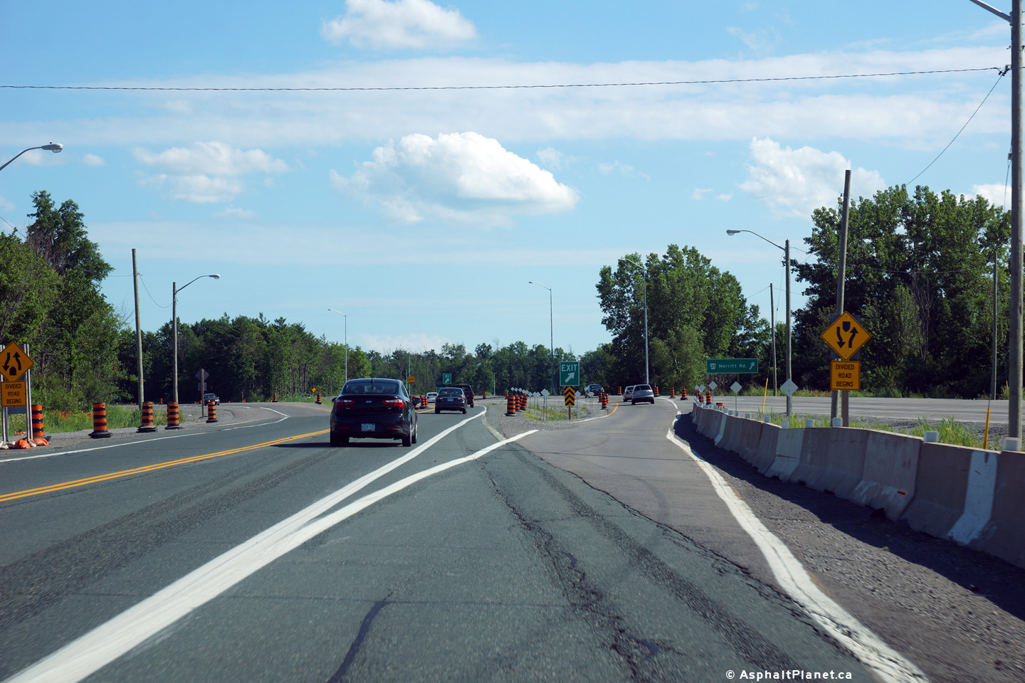
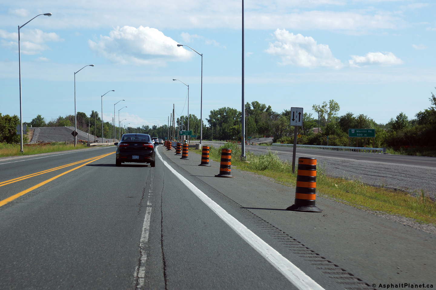
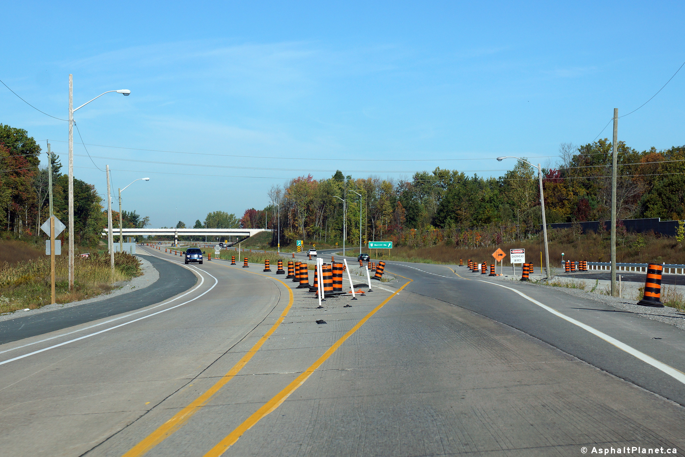
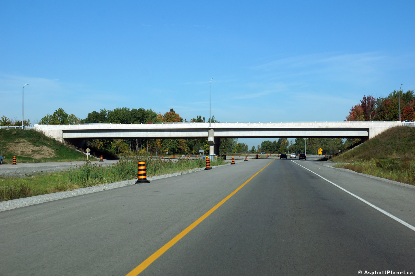
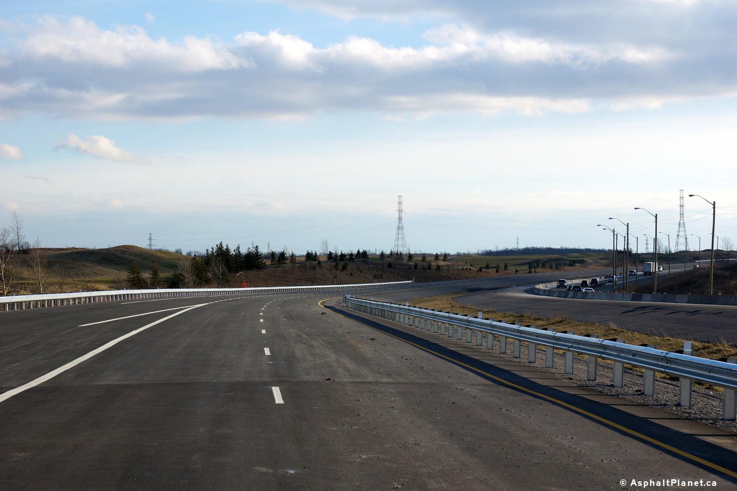
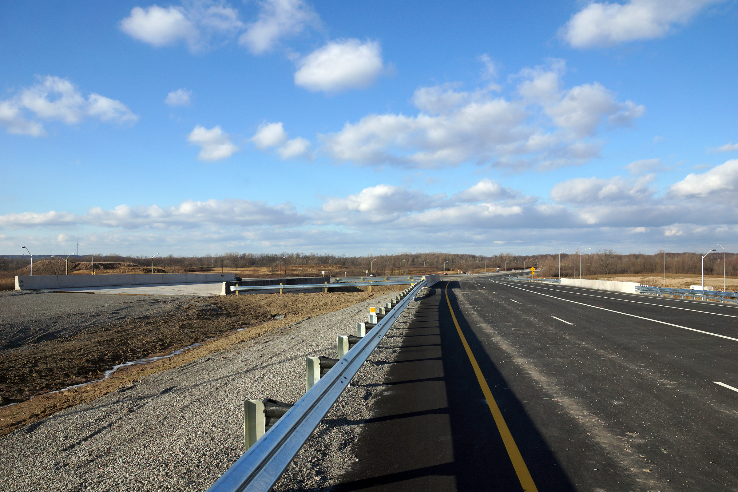
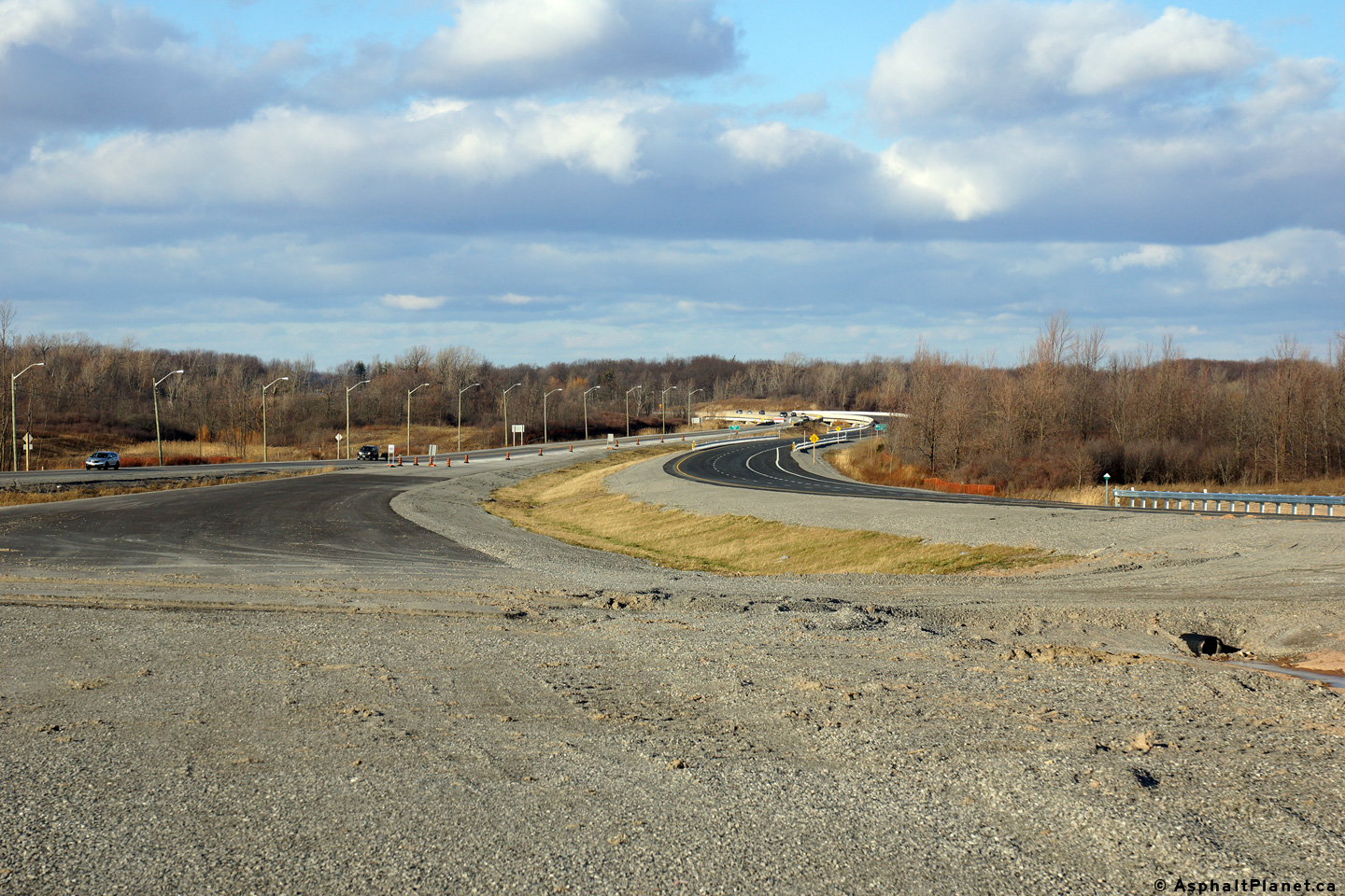
View looking northerly from the Highway 20 overpass along Highway 406.  Notice the old curb and lane markings for the former at-grade intersection, Another view looking northerly from the Highway 20 overpass.  Grading is nearing completion on the southbound ramps. View looking southerly along Highway 406 from the Highway 20 overpass. Another view looking southerly.  Again, note the pavement markings from the former at-grade intersection

(720x480)     (1440x960)

(720x480)     (1440x960)

(720x480)     (1440x960)

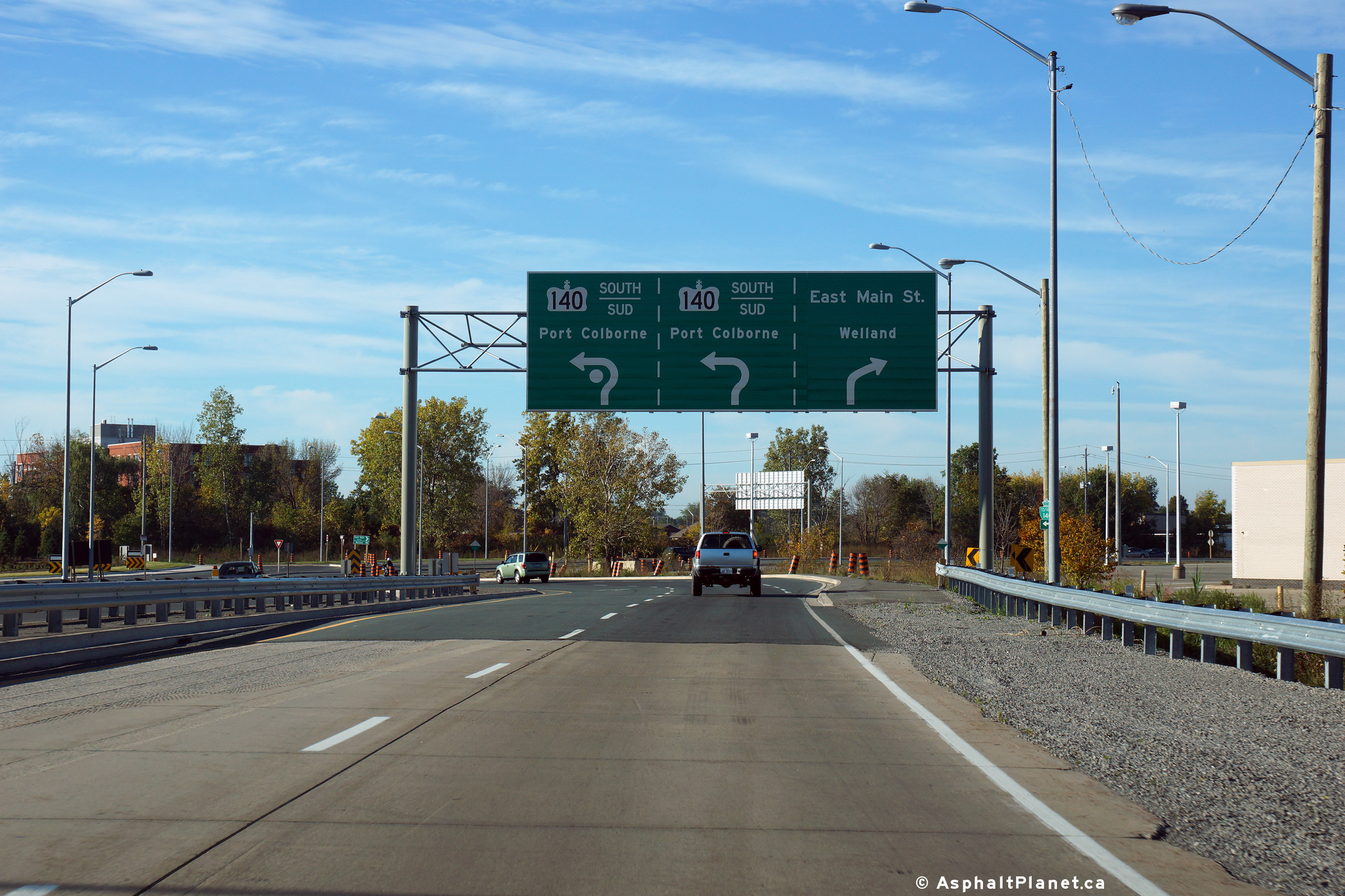
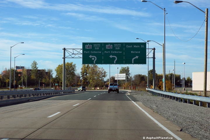
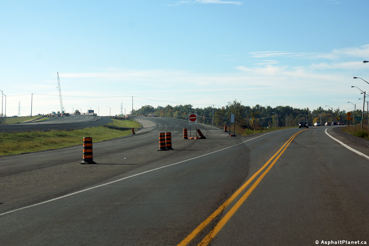
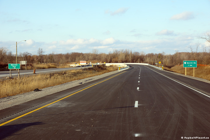
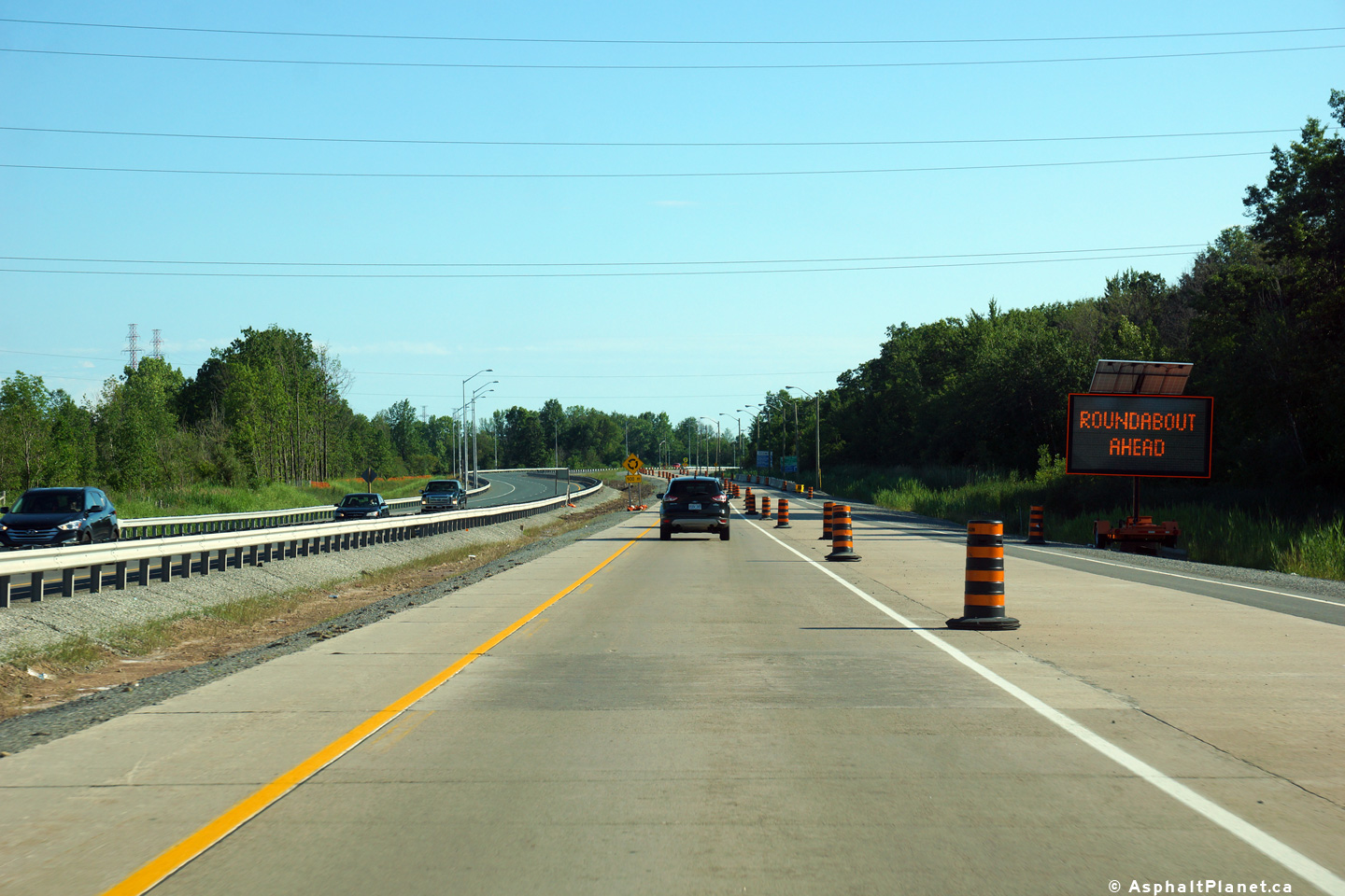
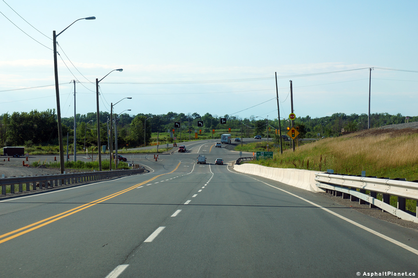
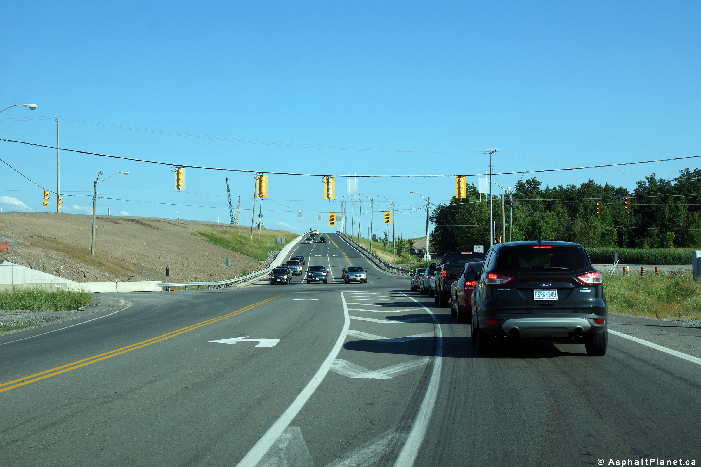
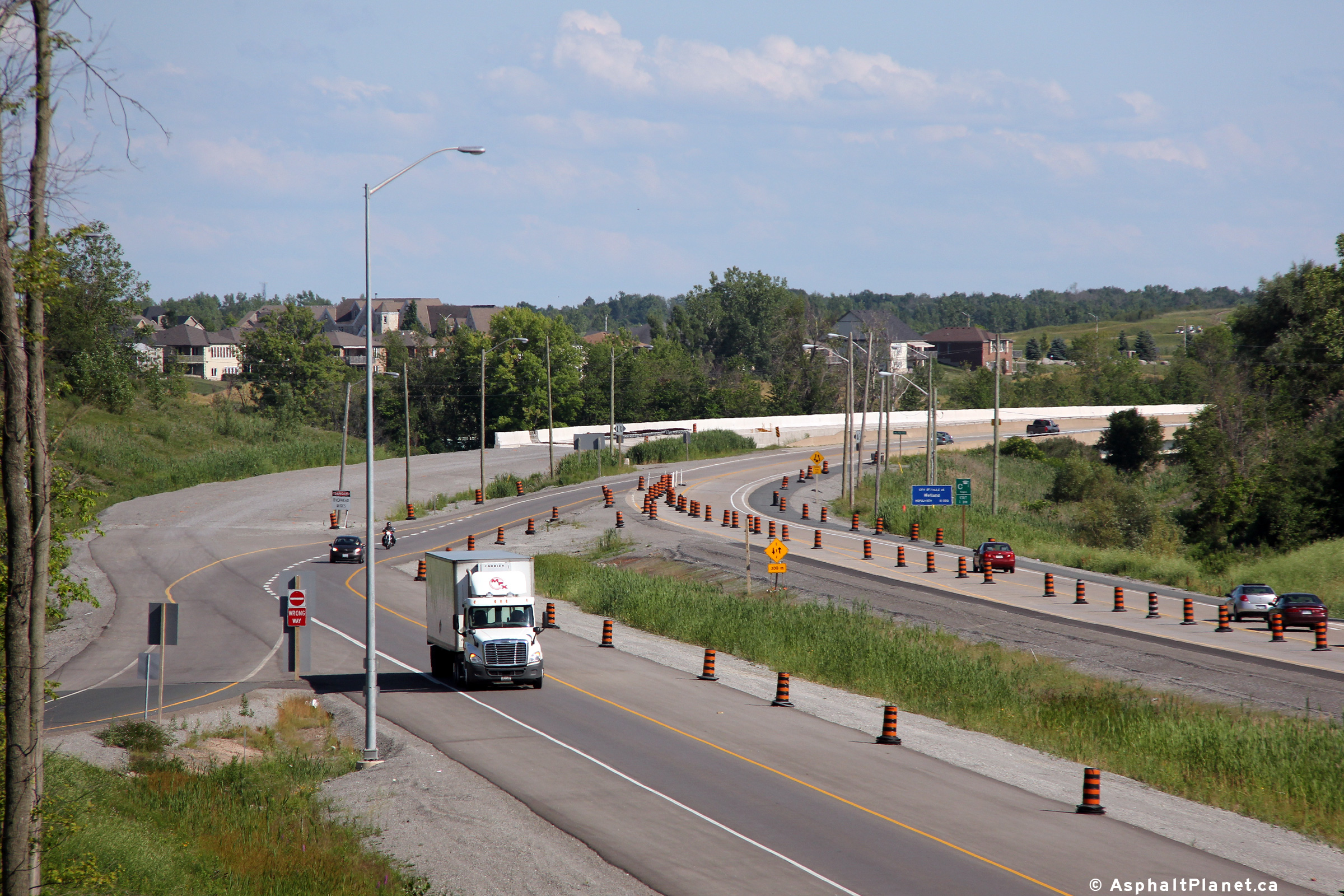
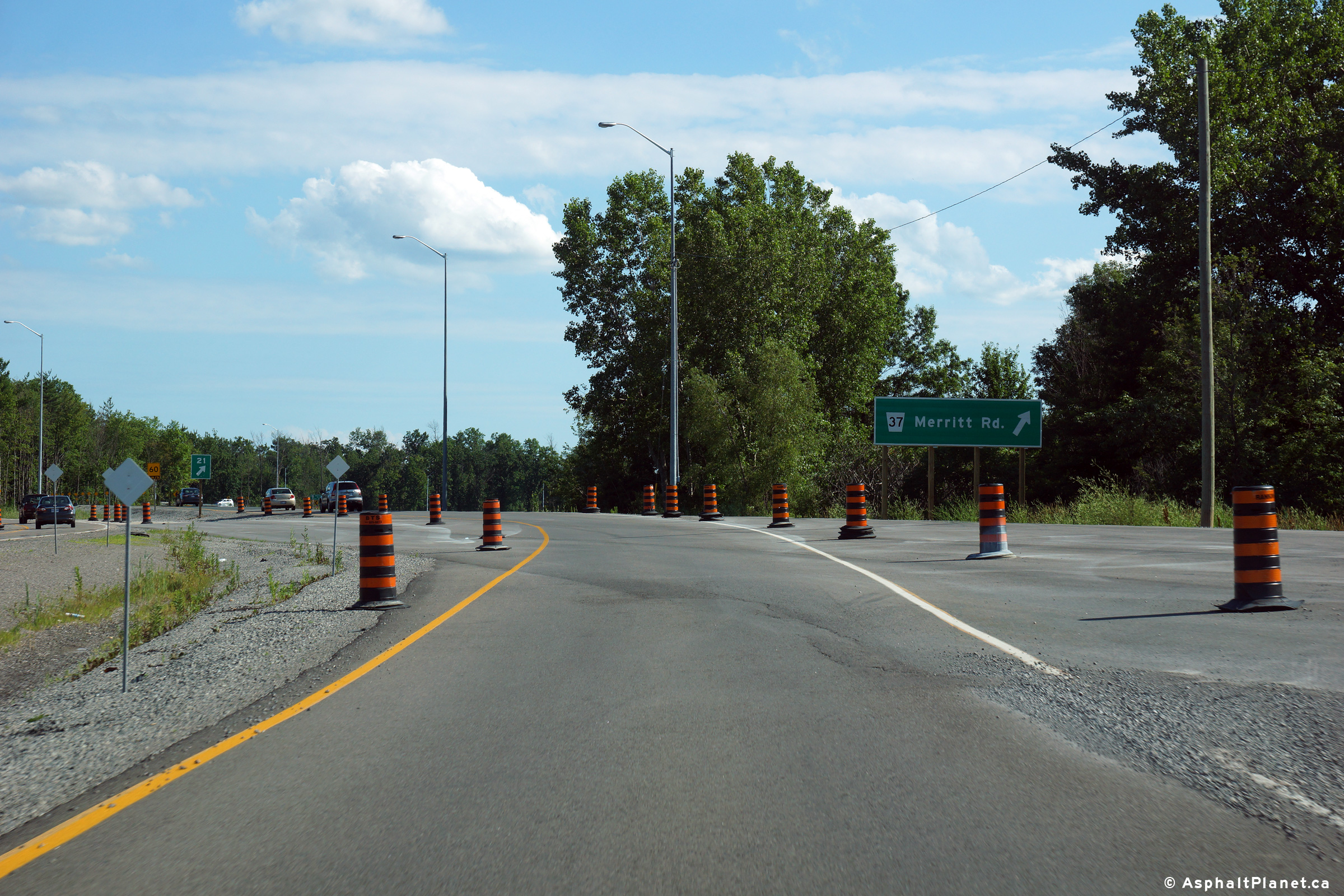
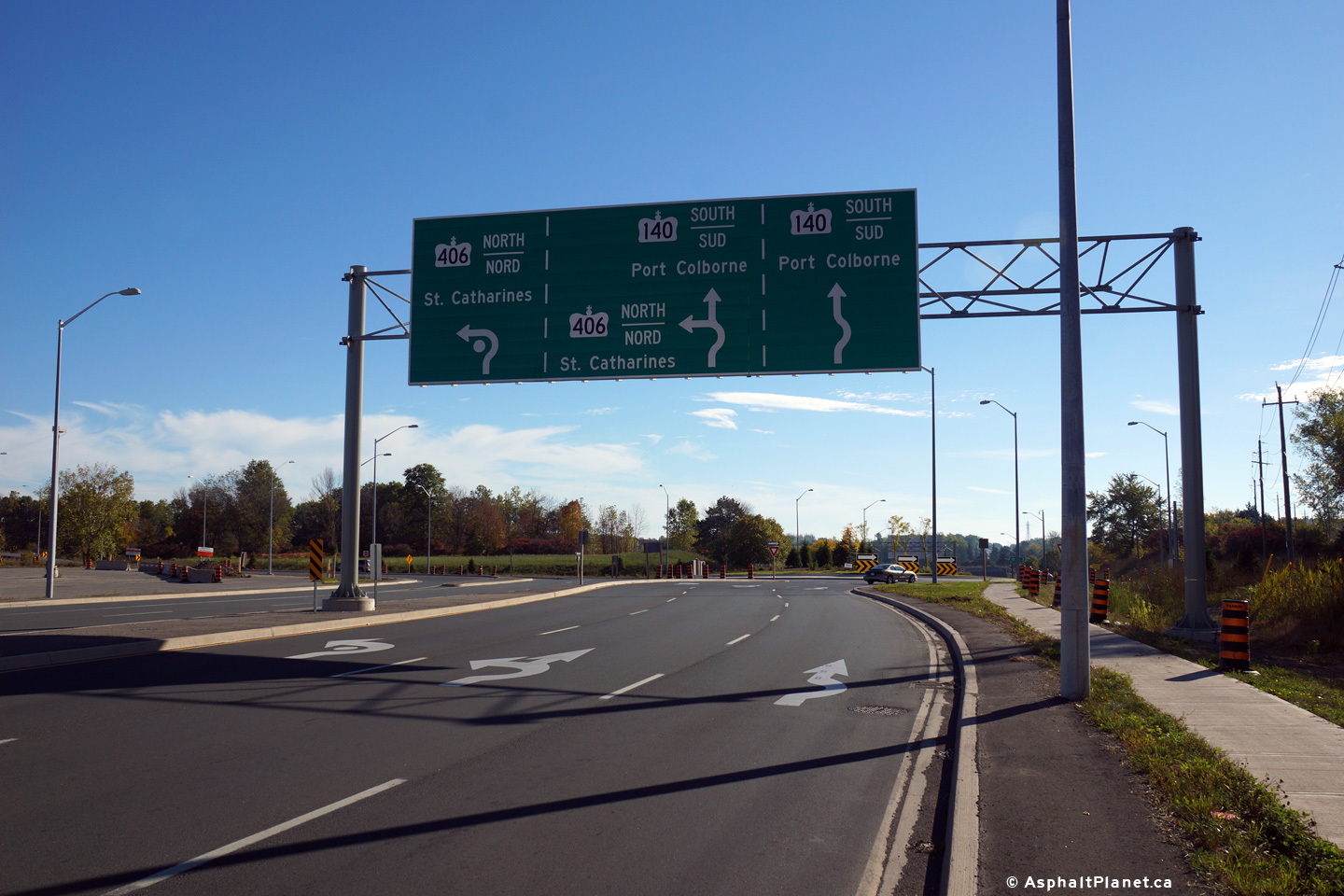
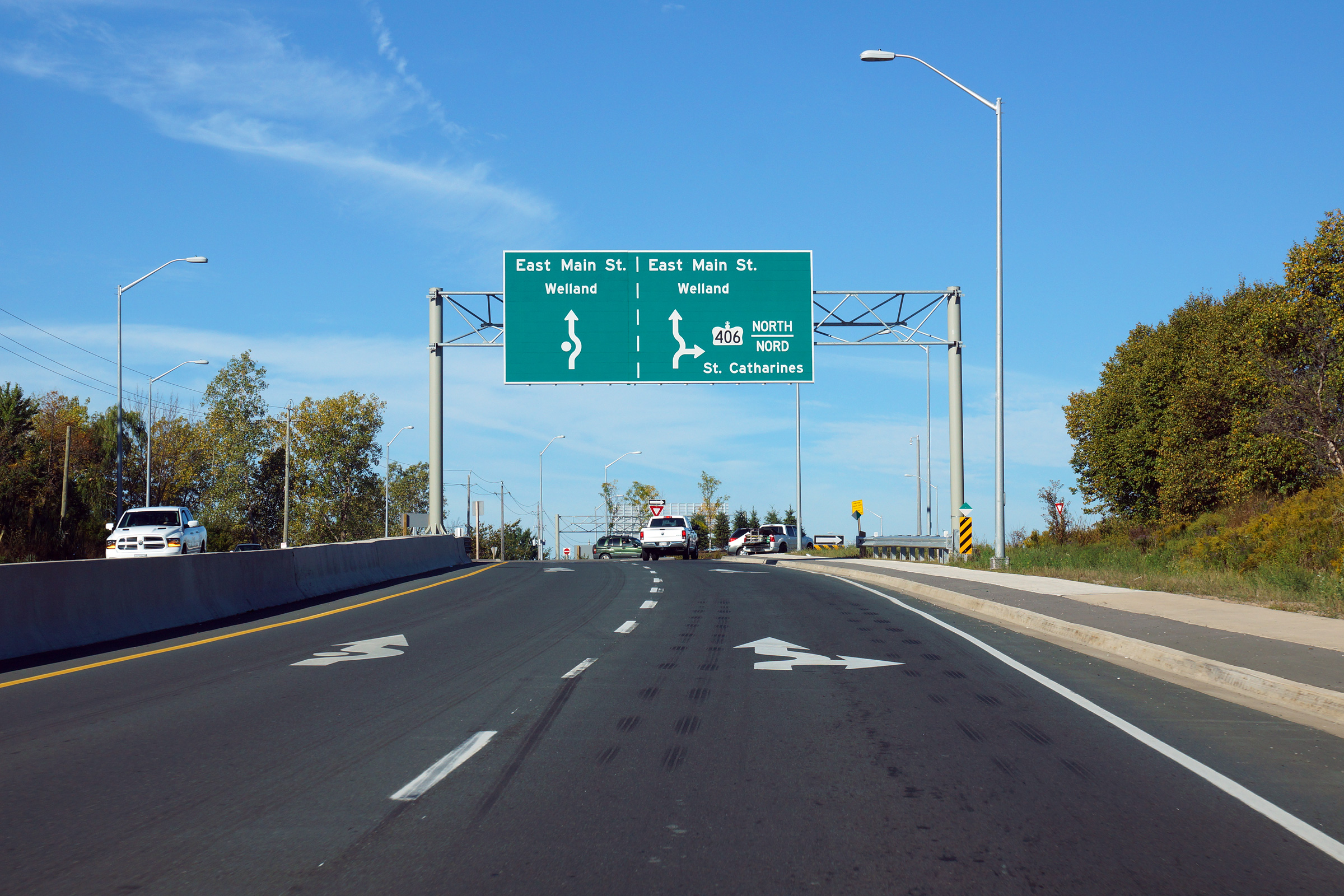
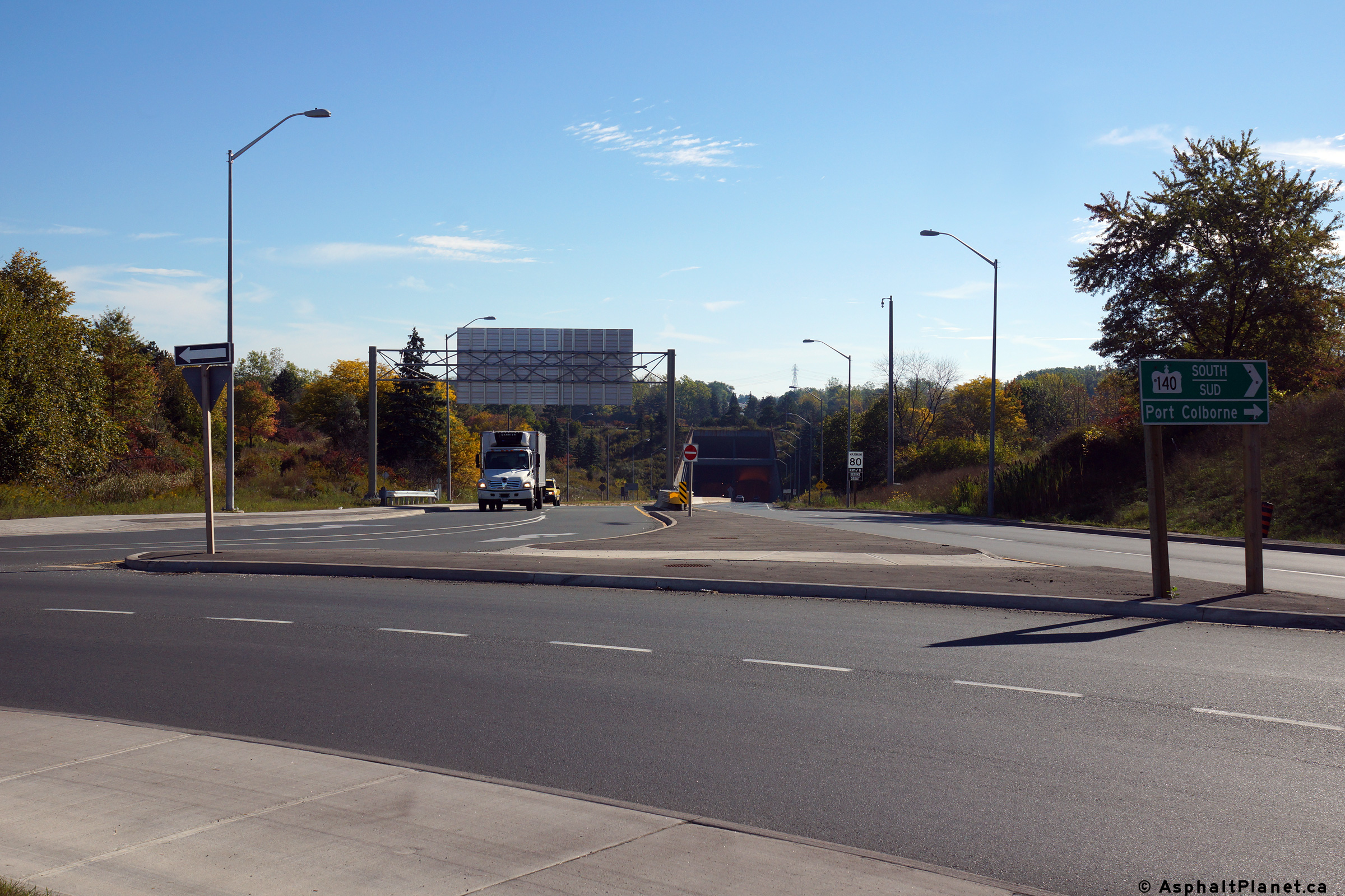
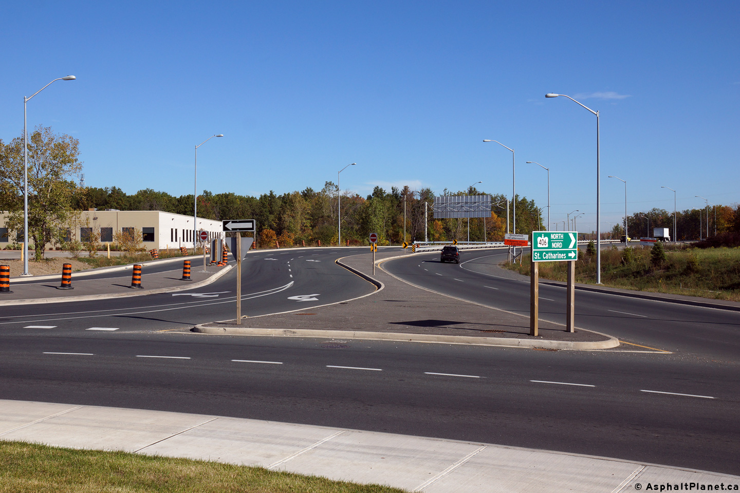
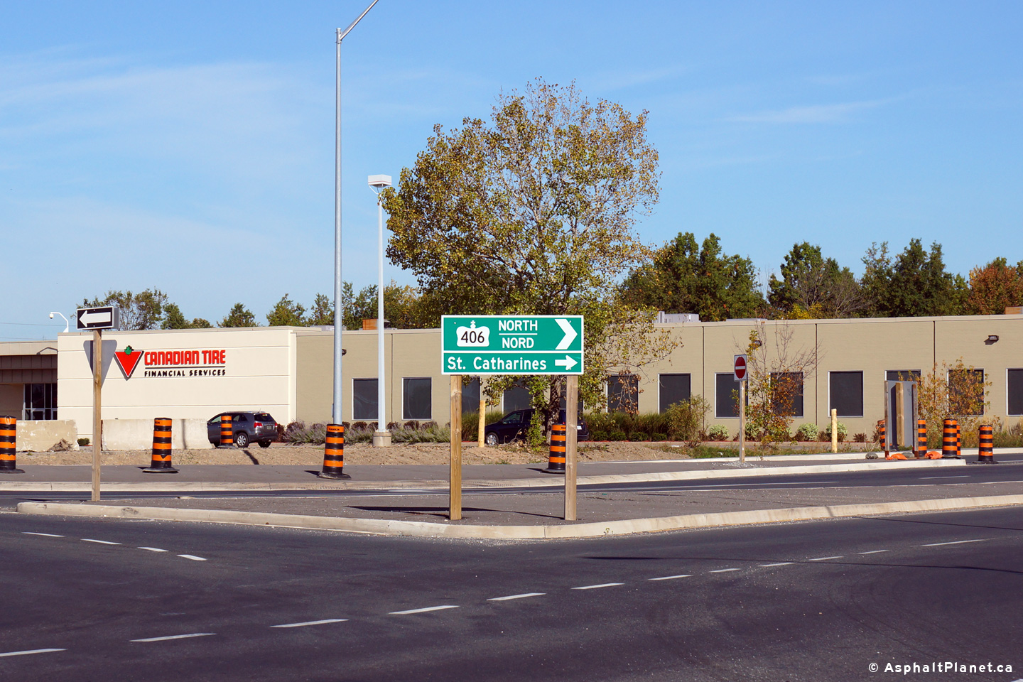
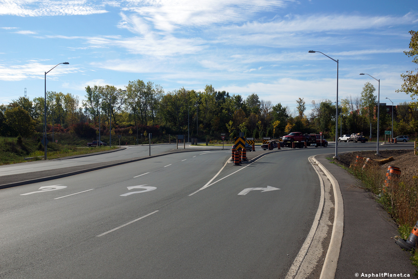
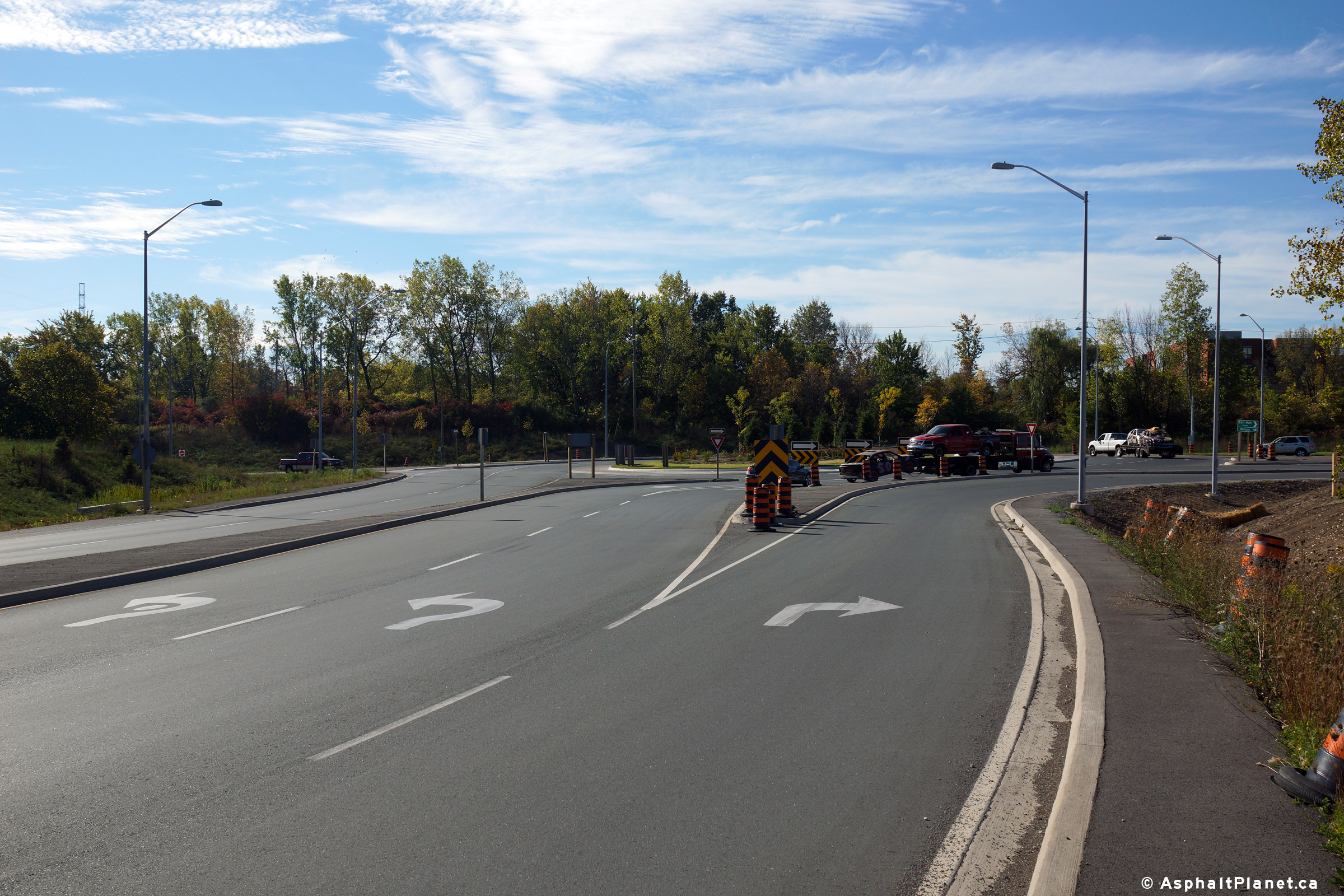
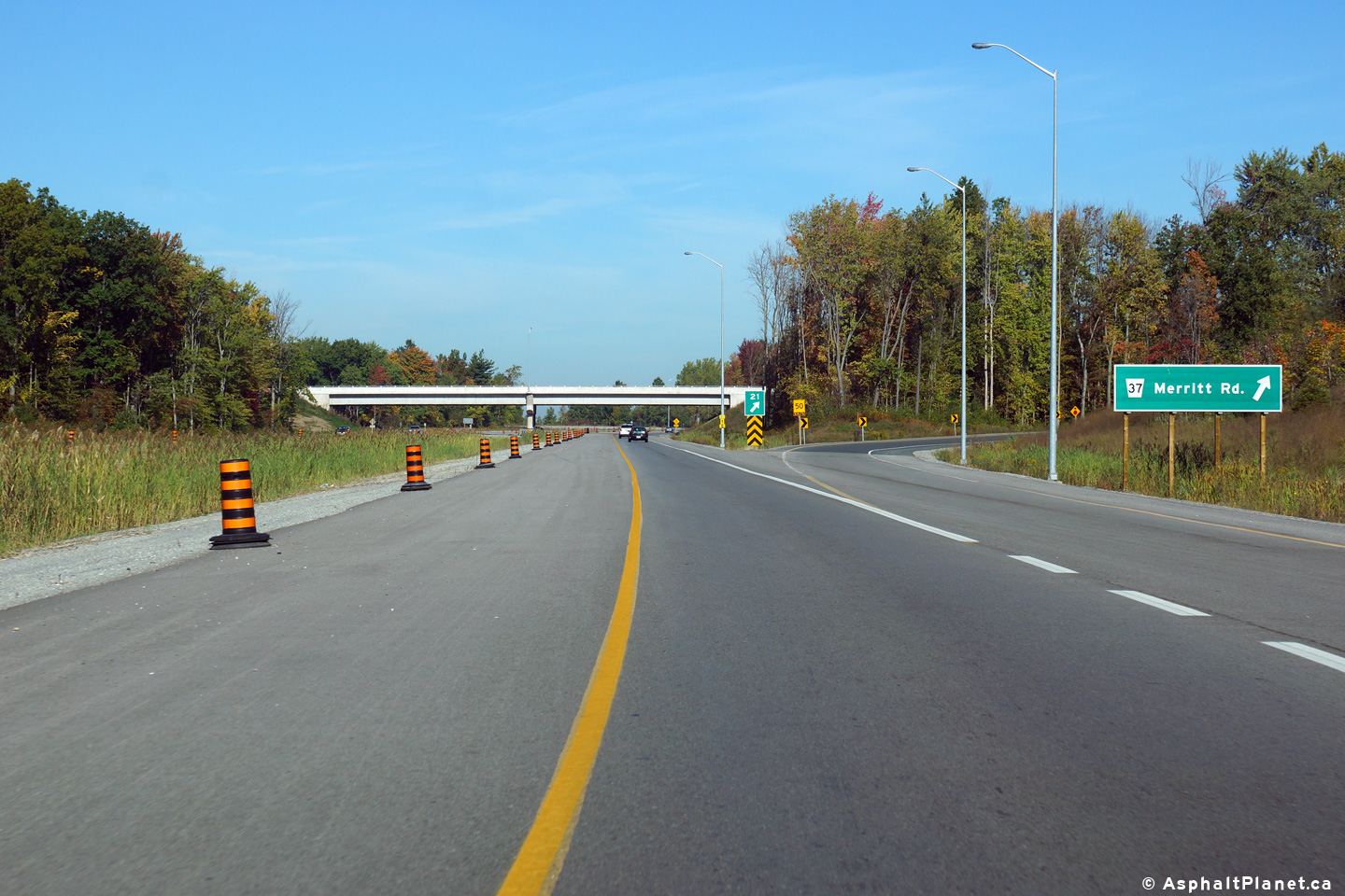
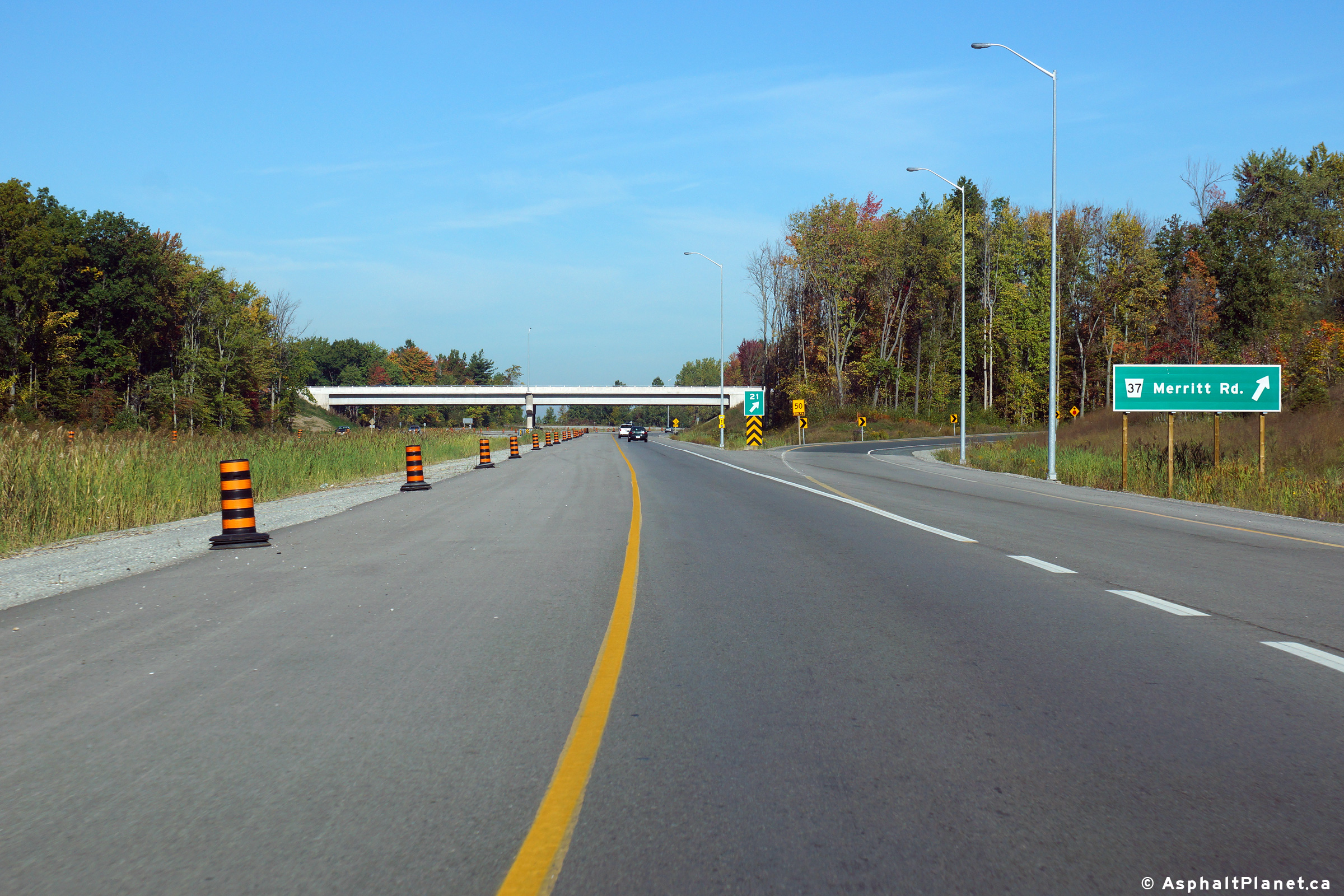
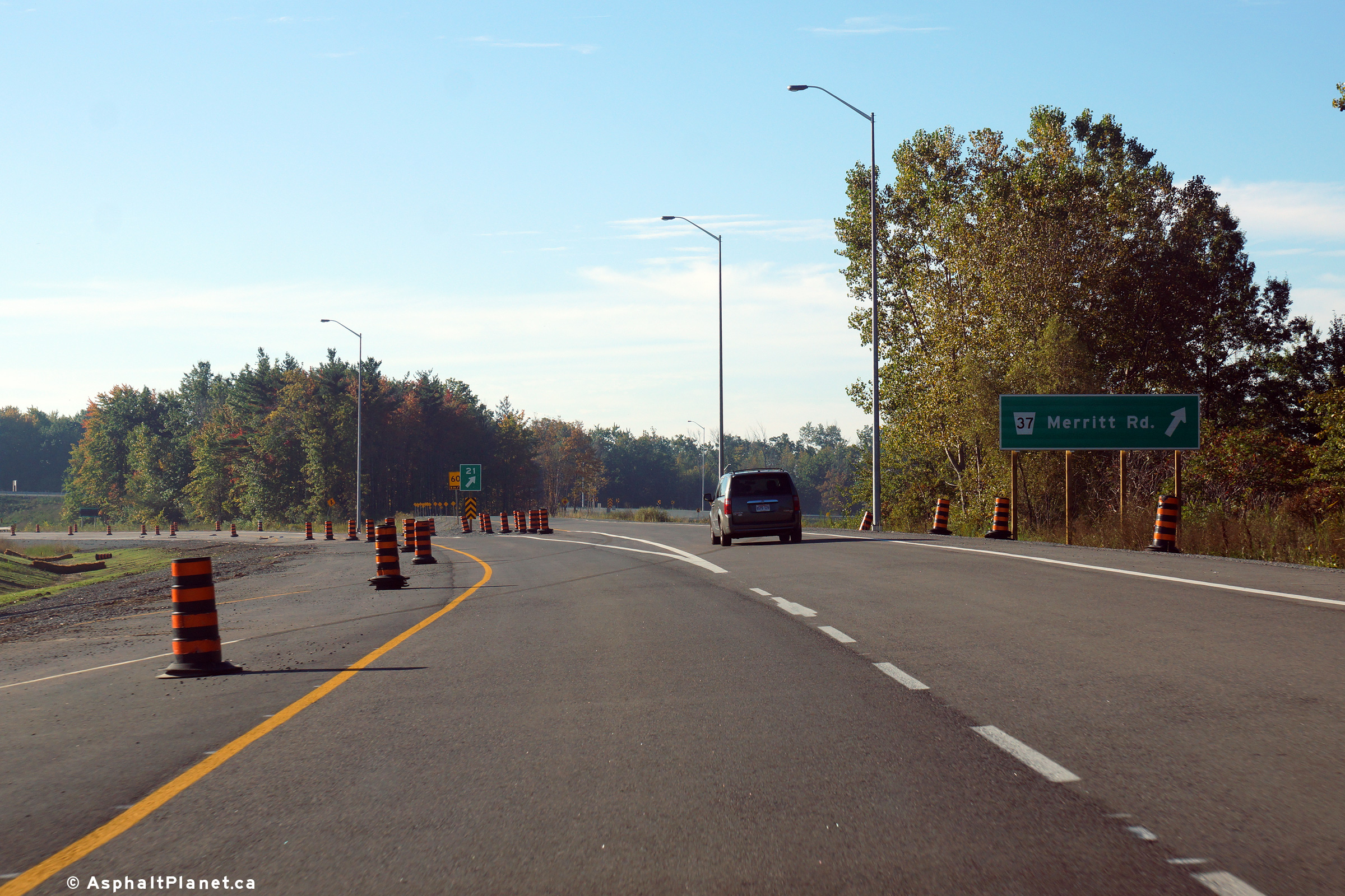
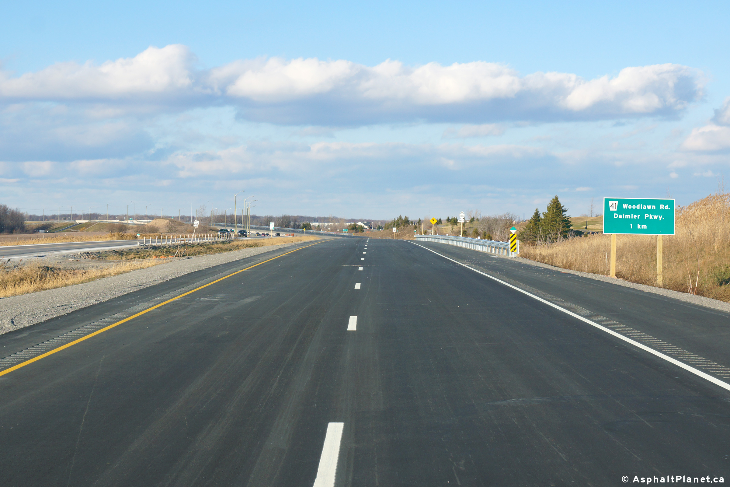
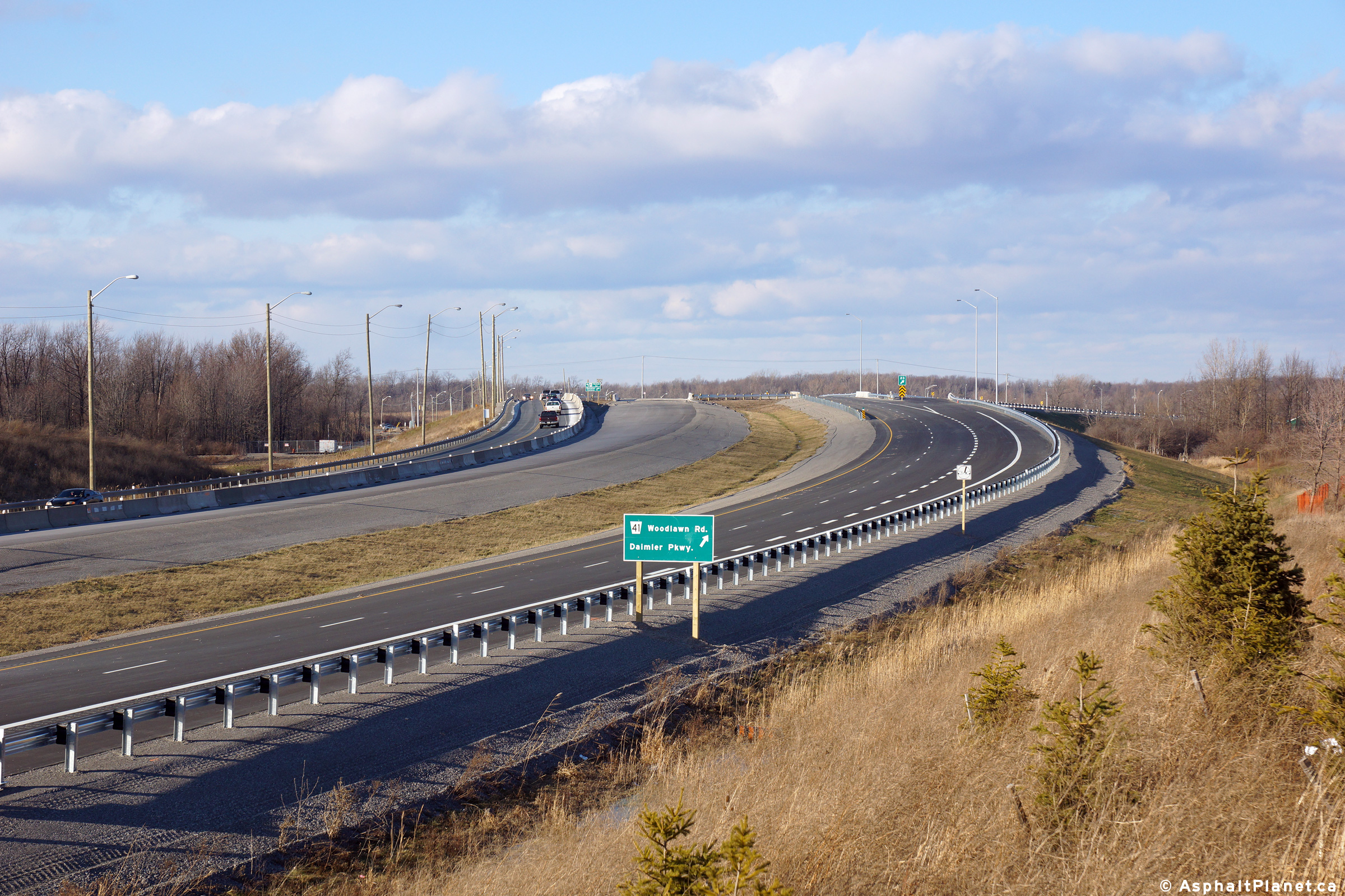
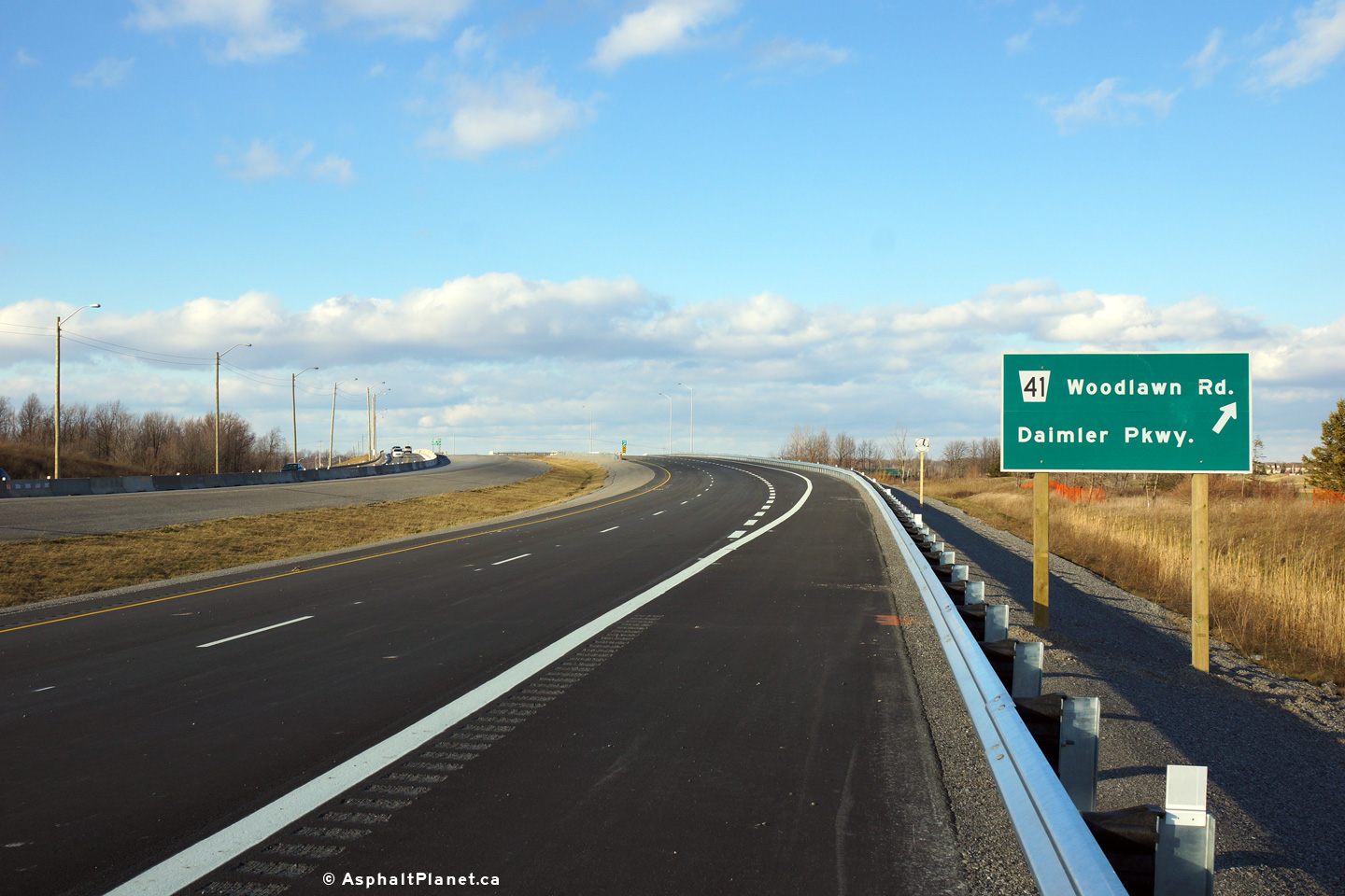
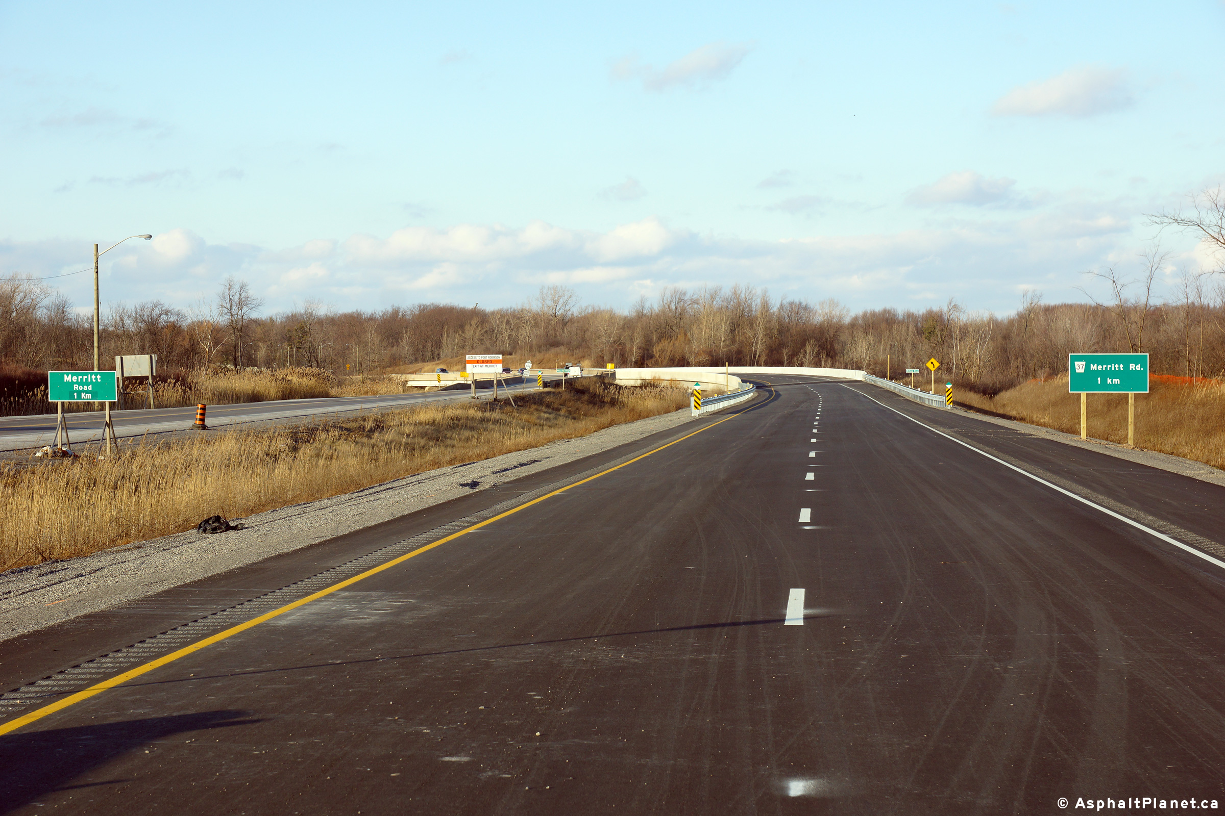
Temporary signage at the ramp from Highway 406-South to Regional Road 20 (Former Highway 20). A more centralized view of the off-ramp from Highway 406 to Highway 20. Signage at the end of the ramp from Highway 406 south erroneously still indicates Niagara Road 20 as a provincial highway. View looking easterly along Highway 20 (Niagara Road 20) at the northbound loop ramp.
 

(720x480)     (1440x960)

(720x480)     (1440x960)

 
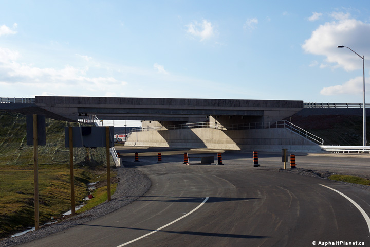
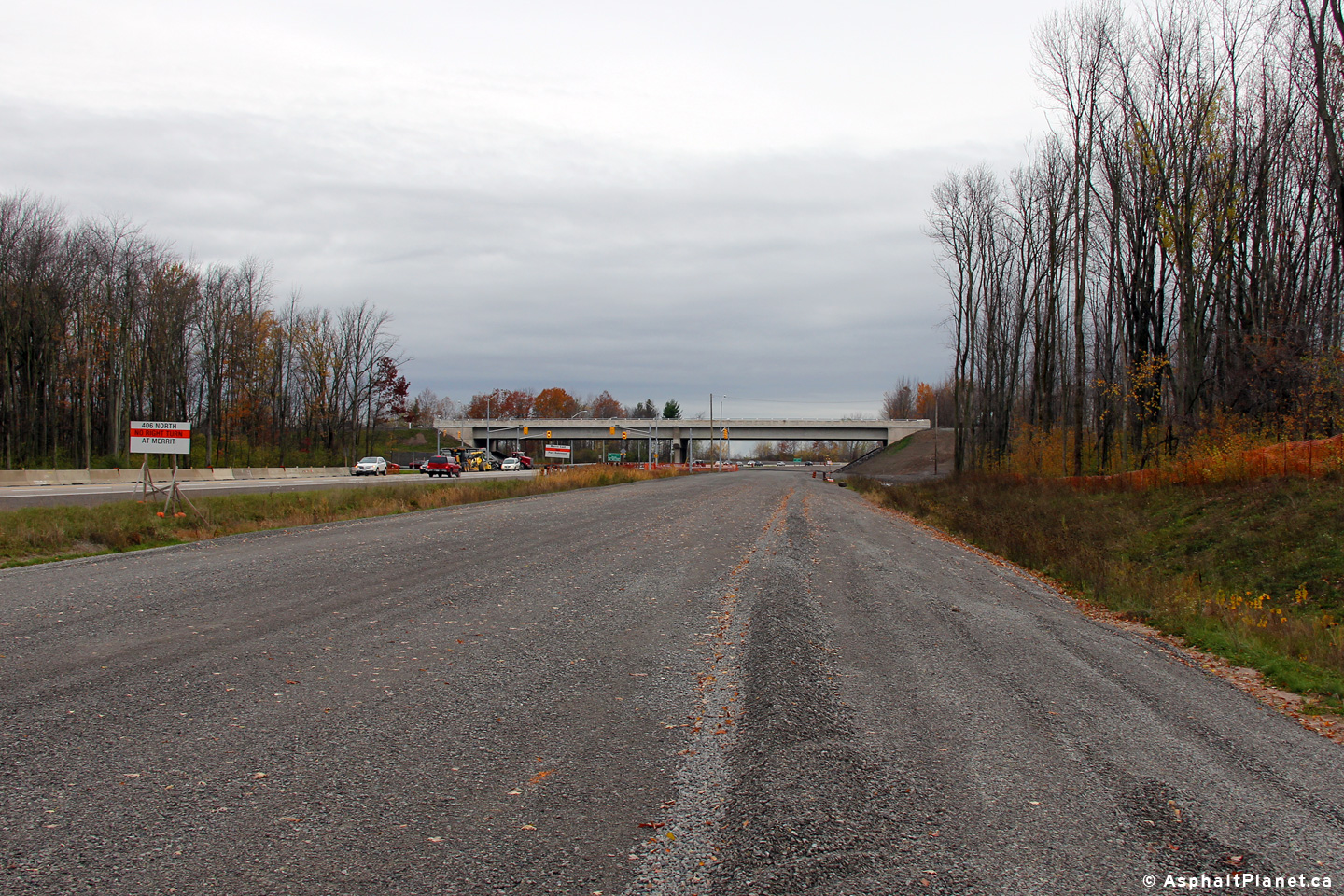
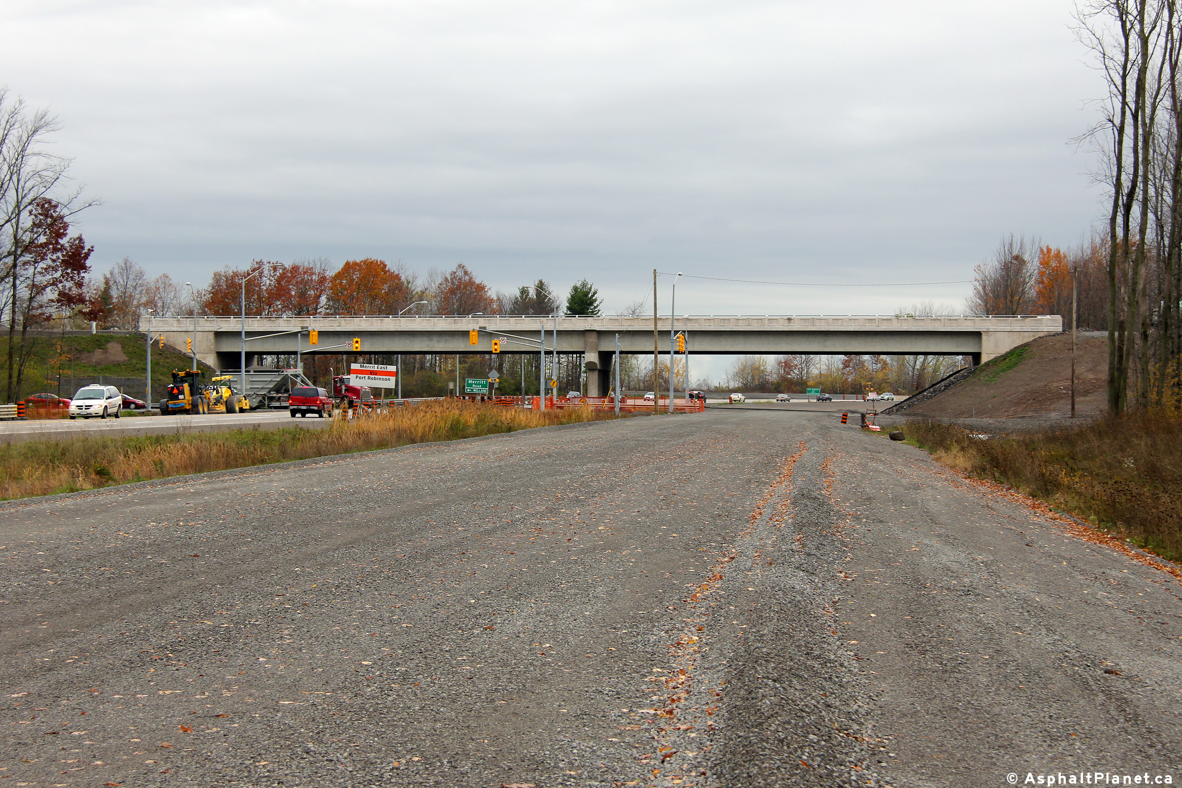
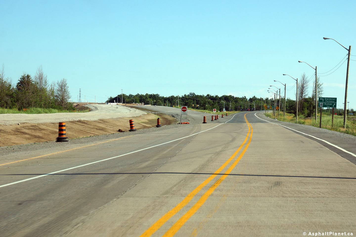
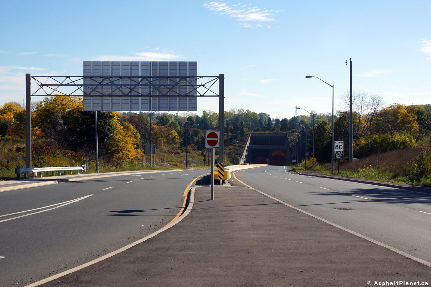
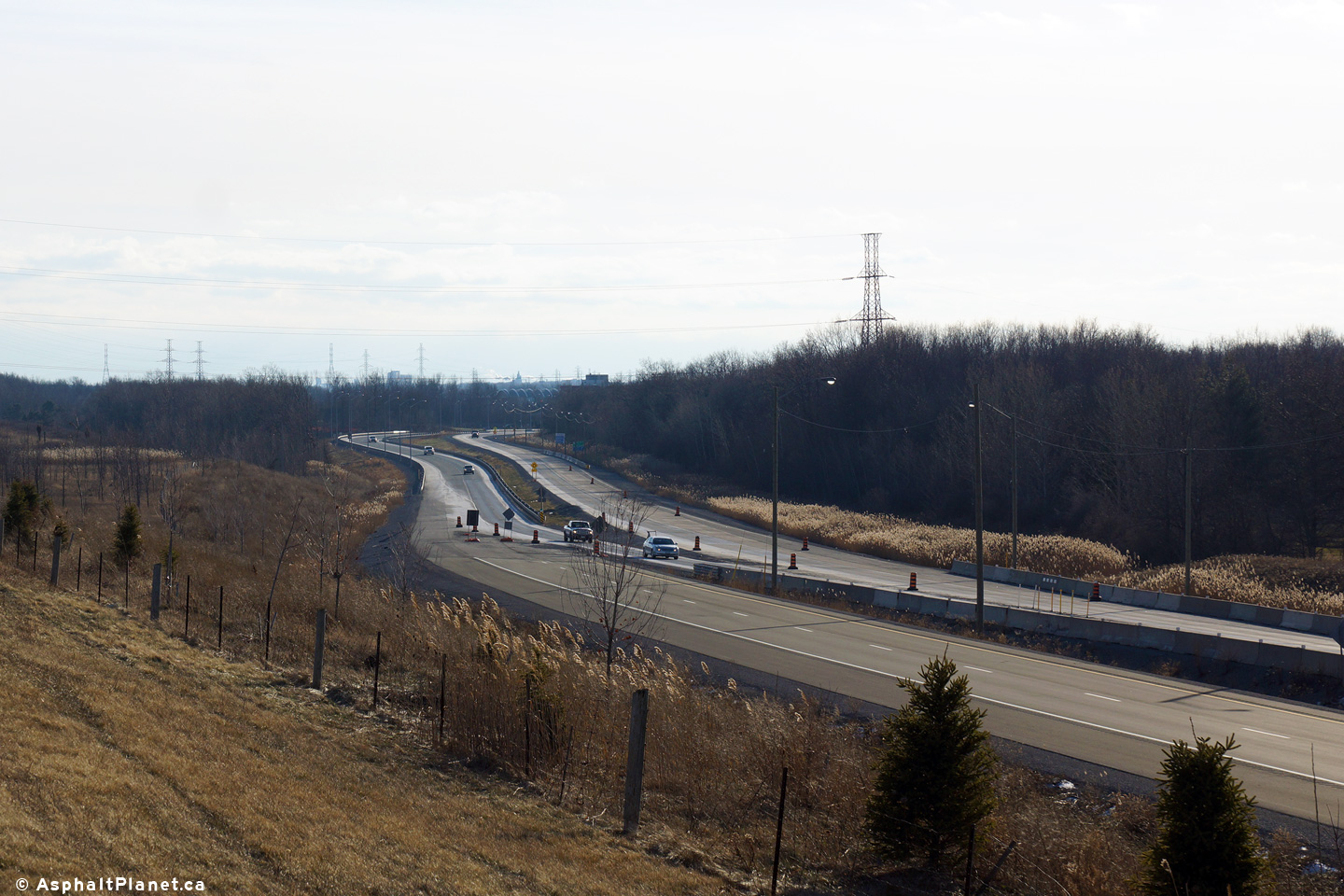
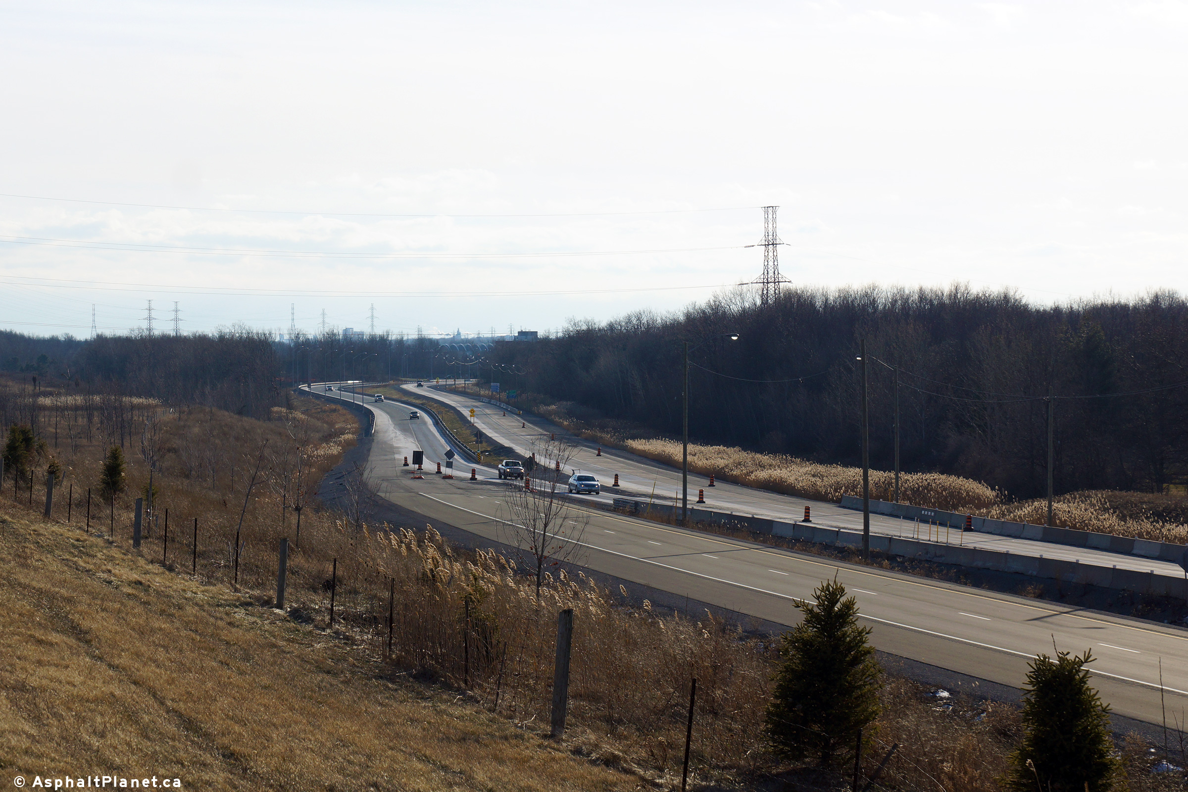
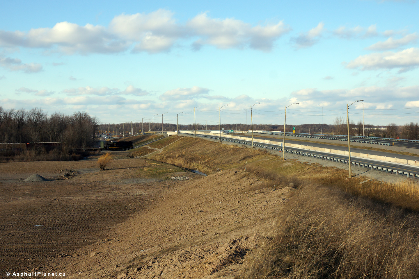
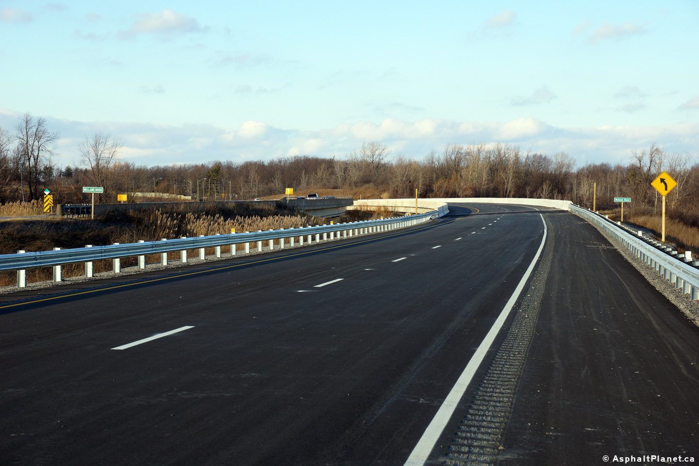
  View looking southerly at the ramp terminal from the Highway 406 off-ramp.  The off-ramp terminal is temporarily located to the west of the final location for construction staging purposes View looking northerly from Highway 20 to the graded permanent southbound ramp terminals.  


Highway 406 Twinning (2012-2015) - Welland (Port Robinson Road to East Main Street)
Photos taken: October 31st, 2012

(720x480)     (1440x960)     (2400x1600)

(720x480)     (1440x960)     (2400x1600)

(720x480)     (1440x960)     (2400x1600)

(720x480)     (1440x960)     (2400x1600)
Easterly view from the Weston Road overpass.  Work to repair the westbound collector lanes was ongoing when this photo was taken. Easterly view overtop of the eastbound lanes from Weston Road. Westerly view from the Weston Road overpass.  The left-side of the westbound collector lanes were being reconstructed when this photo was taken. Close up view of the Humber River bridge from the Weston Road overpass.  Crews had begun to remove the old steel supports.

(720x480)     (1440x960)     (2400x1600)

(720x480)     (1440x960)     (2400x1600)

(720x480)     (1440x960)     (2400x1600)

(720x480)     (1440x960)     (2400x1600)
Easterly view from the Weston Road overpass.  Work to repair the westbound collector lanes was ongoing when this photo was taken. Easterly view overtop of the eastbound lanes from Weston Road. Westerly view from the Weston Road overpass.  The left-side of the westbound collector lanes were being reconstructed when this photo was taken. Close up view of the Humber River bridge from the Weston Road overpass.  Crews had begun to remove the old steel supports.

Photos taken: July 10th, 2014


(720x480)     (1440x960)     (2400x1600)


(720x480)     (1440x960)     (2400x1600)


(720x480)     (1440x960)     (2400x1600)


(720x480)     (1440x960)     (2400x1600)

Southerly view approaching the roundabout at the southern terminus of Highway 406. Northerly view approaching the temporary Woodlawn Road intersection.  During construction, Highway 406 follows the future southbound on and off-ramp. View looking northerly approaching the temporary Woodlawn Road intersection. Northerly view approaching the future Woodlawn Road interchange.


(720x480)     (1440x960)     (2400x1600)


(720x480)     (1440x960)     (2400x1600)


(720x480)     (1440x960)     (2400x1600)


(720x480)     (1440x960)     (2400x1600)

View looking south-westerly towards the Welland River overpass. Southerly view between the Welland River structures. South-easterly view towards the Welland River structures.  The original 1990s era structure is located in the forground. Southerly view across the twin Welland River structures.


(720x480)     (1440x960)     (2400x1600)


(720x480)     (1440x960)     (2400x1600)


(720x480)     (1440x960)     (2400x1600)


(720x480)     (1440x960)     (2400x1600)

Northerly view along Highway 406 from just north of the Welland River structure. Signage at the northbound off-ramp to Merritt Road. Southerly view along Highway 406 from the Merritt Road. Southerly view from the Merritt Road overpass towards the Welland River structures.

(720x480)     (1440x960)     (2400x1600)


(720x480)     (1440x960)     (2400x1600)


(720x480)     (1440x960)     (2400x1600)

(720x480)     (1440x960)     (2400x1600)

Northerly view from the Merritt Road overpass. View along the southbound off-ramp to Merritt Road. View as the southbound off-ramp departs from Highway 406.  Until the Summer of 2014, Highway 406 was undivided through the former Port Robinson Road intersection. Southbound advanced signage for the off-ramp to Merritt Road.

Photos taken: September 30th, 2014


(720x480)     (1440x960)     (2400x1600)


(720x480)     (1440x960)     (2400x1600)


(720x480)     (1440x960)     (2400x1600)


(720x480)     (1440x960)     (2400x1600)

Northwesterly view through the East Main Street roundabout. View looking northerly through the East Main Street roundabout. Easterly view approaching the Highway 406 roundabout along East Main Street.  This is the MTO's first three lane roundabout. Easterly view approaching the Highway 406 roundabout along East Main Street.


(720x480)     (1440x960)     (2400x1600)


(720x480)     (1440x960)


(720x480)     (1440x960)     (2400x1600)


(720x480)     (1440x960)     (2400x1600)

Easterly view towards the Main Street Tunnel along East Main Street for the Highway 406 roundabout. Roundabout signage for the eastern leg of the East Main Street roundabout. Easterly view along East Main Street towards the Main Street Tunnel. Westerly view along East Main Street (Highway 7146) from the Townline Tunnel portal.


(720x480)     (1440x960)     (2400x1600)


(720x480)     (1440x960)


(720x480)     (1440x960)     (2400x1600)


(720x480)     (1440x960)     (2400x1600)

Northerly view along Highway 406 from the East Main Street roundabout. Roundabout signage for the northern leg of the East Main Street roundabout. Northerly view along the southbound lanes of Highway 406 from just north of the Highway 406 roundabout. Southerly view along Highway 406 approaching the East Main Street roundabout.  Traffic turning west of East Main Street may by-pass the roundabout using the channel to the right.


(720x480)     (1440x960)     (2400x1600)


(720x480)     (1440x960)     (2400x1600)


(720x480)     (1440x960)     (2400x1600)


(720x480)     (1440x960)     (2400x1600)

Overhead signage at the southern terminus of Highway 406 at the East Main Street intersection. Northerly view along Highway 406 from just north of the East Main Street roundabout. The Divided highway began approximately 750m north of the East Main Street intersection. Northerly view approaching the Woodlawn Road intersection.


(720x480)     (1440x960)     (2400x1600)


(720x480)     (1440x960)     (2400x1600)


(720x480)     (1440x960)     (2400x1600)


(720x480)     (1440x960)     (2400x1600)
Easterly view along Woodlawn Road in Welland, approaching the future Highway 406 interchange. View of the twin structures that will carry the new highway overtop of Woodlawn Road. Westerly view along Woodlawn Road (Daimler Parkway) approaching the future Highway 406 structures. Southerly view approaching the future Woodlawn Road interchange.


(720x480)     (1440x960)     (2400x1600)


(720x480)     (1440x960)     (2400x1600)


(720x480)     (1440x960)     (2400x1600)


(720x480)     (1440x960)     (2400x1600)

North of the Welland River bridge, Highway 406 becomes a divided highway. Northerly view at the off-ramp to Merritt Road. Northerly view approaching the Merritt Road overpass. Southerly view at the off-ramp to Merritt Road.  The southbound lanes of Highway 406 now follow their final alignment through Port Robinson Road interchange.


(720x480)     (1440x960)     (2400x1600)


(720x480)     (1440x960)     (2400x1600)

Advanced signage for the Merritt Road interchange.  The future Port Robinson Road overpass is visible beyond the signage. Overhead signage in advance of the Merritt Road interchange.  

Photos taken: January 2nd, 2015


(720x480)     (1440x960)     (2400x1600)


(720x480)     (1440x960)     (2400x1600)


(720x480)     (1440x960)     (2400x1600)


(720x480)     (1440x960)     (2400x1600)

Southerly view looking towards the East Main Street roundabout. Northerly view towards the Woodlawn Road interchange. Additional view towards the Woodlawn Road interchange. Southerly view towards the East Main Street roundabout.


(720x480)     (1440x960)     (2400x1600)


(720x480)     (1440x960)     (2400x1600)


(720x480)     (1440x960)     (2400x1600)


(720x480)     (1440x960)     (2400x1600)

Advanced signage for the Woodlawn Road interchange. View looking northerly approaching the northbound off-ramp to Woodlawn Road. Signage at the northbound off-ramp to Woodlawn Road. View as a locomotive with the Trillium Railway passes beneath Highway 406.


(720x480)     (1440x960)     (2400x1600)


(720x480)     (1440x960)     (2400x1600)


(720x480)     (1440x960)     (2400x1600)


(720x480)     (1440x960)     (2400x1600)

Southerly view along Highway 406 from just south of the Woodlawn Road interchange. Northbound signage at the off-ramp to Woodlawn Road interchange. View looking easterly beneath Highway 406 along the Trillium Railway. Northerly view at the Trillium Railway underpass.

(720x480)     (1440x960)     (2400x1600)


(720x480)     (1440x960)     (2400x1600)


(720x480)     (1440x960)     (2400x1600)


(720x480)     (1440x960)

Northerly view at the twin Woodlawn Road underpasses. Easterly view at the twin Woodlawn Road underpasses. Southerly view at the Woodlawn Road underpass.  In the event that a loop ramp was ever constructed from Daimler Parkway, the bridge abutment has been constructed extra-wide. Date Stamp for the southbound Woodlawn Road underpass.


(720x480)     (1440x960)     (2400x1600)


(720x480)     (1440x960)     (2400x1600)


(720x480)     (1440x960)     (2400x1600)


(720x480)     (1440x960)     (2400x1600)

View looking west towards the twin Woodlawn Road underpasses. Northerly view between the twin Woodlawn Road underpasses. View looking northerly along Highway 406 from Woodlawn Road. Northbound advanced signage for the Merritt Road interchange.


(720x480)     (1440x960)     (2400x1600)


(720x480)     (1440x960)     (2400x1600)


(720x480)     (1440x960)     (2400x1600)


(720x480)     (1440x960)     (2400x1600)

Northerly view along the northbound lanes of Highway 406 approaching the Welland River bridge. Northerly view between the Welland River bridges. Southerly view towards the Welland River bridges. Northerly view towards the Merritt Road interchange.


(720x480)     (1440x960)     (2400x1600)


(720x480)     (1440x960)     (2400x1600)


(720x480)     (1440x960)     (2400x1600)


(720x480)     (1440x960)     (2400x1600)

View looking southerly along Highway 406 from the Merritt Road overpass. Northerly view at the Merritt Road overpass. The Northbound lanes of Highway 406 have been surfaced with top-coat asphalt north of the Merritt Road overpass. Northerly view along Highway 406 approaching the future Port Robinson Road overpass.


Highway 406 Images
Back to Highway 406

www.OntHighways.com - Home


Copyright (c) 2004-2015, AsphaltPlanet.ca  AsphaltPlanet@asphaltplanet.ca