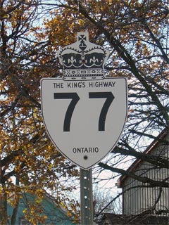
King's Highway 77 - www.OntHighways.com

Highway 77 is a short connector highway that serves as the major north-south corridor for the Leamington area.  Only a small portion of Highway 77 was decommissioned in the late, 1990s.  The section south of the newly opened Highway 3 bypass was downloaded to the local municipalities, since it no longer connected to another provincial highway.  Before 1997-98, Highway 77 connected to both Highway 3 (east of Leamington) and to Highway 18.


Old Style King's Highway 77 Shield


Southern Terminus:  Pre-1997: At the Highway 3 (now Essex Road 34) and Highway 18 junction in downtown Leamington.

                                         Current: Highway 77 now ends at Highway 3 (the Leamington Bypass) just north of Leamington.

Northern Terminus:  At the Highway 401 interchange just north of Comber

Length:  Pre-1997: 24.3 km.  Current: 22.6 km.

Multiplexes:  None

Freeway:  No

AADT (2002):  Highest:  6,100, from Leamington north to 8th Concession Road;

                             Lowest:  3,000, from the West junction of Essex Road 8 northerly to Essex Road 46.

Road info:  For a short highway, Highway 77's condition varies considerably.  From Staples northerly to Highway 401, highway 77 is in excellent condition, having been very recently reconstructed.  South of Staples, Highway 77 is in extremely poor condition, certainly among the most neglected sections of primary highway in the province.  The rural speed limit on Highway 77 is 80km/h.


Highway 77 information:


OntHighways.com  

Detailed Route information available below
Virtual Tour of Highway 77


TheKingsHighway.ca   History of Highway 77
Photographic History of Highway 77

Communities and Major Intersections along Highway 77 from South to North:

Proper Municipality Name

Community Name Distance

Major Intersection

Highway 77 was downloaded south of the Leamington Bypass.  It is now known only as Erie Street

Municplaity of Leamington Leamington 0 km / 38.9 km Talbot Street (Essex Road 34, Formerly Highway 3) & Highway 18 (Erie Street South)

Current Southern Terminus of Highway 77 is located at Highway 3, on the Leamington Bypass.

Municipality of Leamington (Former) Leamington North Limits 1.7 km / 22.6 km King's Highway 3 / Essex Road 33
Municipality of Leamington ----- 2.1 km / 22.2 km Essex Road 18
Municipality of Leamington Mount Camel --- -----
Municipality of Leamington Blytheswood 7.7 km / 16.6 km -----
Leamington - Lakeshore Boundary ----- 9.2 km / 15.1 km Essex Road 14

At Staples:  NB: Ramp to the right towards Highway 401.  SB: Turn Left towards Leamington

Township of Lakeshore Staples 13.4 km / 10.9 km Essex Road 8-West
Township of Lakeshore ----- 16.0 km / 8.3 km Essex Road 8-East
Township of Lakeshore Comber 22.7 km / 1.6 km Essex Road 46 (Middle Road, Formerly Highway 98)
Township of Lakeshore ----- 24.3 km / 0 km King's Highway 401 (Autoroute Macdonald-Cartier Freeway)

Highway 77 ENDS


<- Highway 76         www.OntHighways.com - Home         Highway 78 ->


Copyright (c) 2004-2010, AsphaltPlanet.ca  AsphaltPlanet@asphaltplanet.ca

Page last updated:  April 11th, 2007

Page created:  May 4th, 2005