|
Proper Municipality Name |
Community Name |
Distance |
Intersecting Road |
|
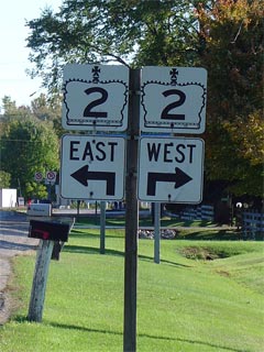
Highway 2 starts at Banwell Road in Windsor.
At this point it is known as Essex Road 22 |
| City of Windsor |
Windsor |
0km / 834.6km |
Banwell Road & E.C. Row Expressway (Formerly
Highway 7087) |
| Town of Tecumseh |
Tecumseh |
--- |
Lasperance Road |
| Tecumseh - Lakeshore Boundary |
Tecumseh East Limits |
2.6km / 831.9km |
Manning Road (Essex Road 19) |
| Town of Lakeshore |
----- |
4.6km / 830.0km |
Pike Creek Road (Essex Road 21) |
| Town of Lakeshore |
Puce |
9.7km / 824.8km |
Essex Road 2 (West Jct) |
| Town of Lakeshore |
Puce |
10.1km / 824.5km |
Puce Road (Essex Road 25) |
| Town of Lakeshore |
(Former) Belle River West
Limits |
15.6km / 818.9km |
----- |
| Town of Lakeshore |
Belle River |
15.7km / 818.8km |
Belle River Road (Essex Road 27) |
| Town of Lakeshore |
(Former) Belle River East
Limits |
17.8km / 816.8km |
----- |
| Town of Lakeshore |
----- |
18.1km / 816.5km |
Essex Road 2 (East Jct) |
|
At Essex Road 42-West: EB: Turn Left towards
Tilbury on Essex Road 42. EB: Follow the ramp onto Essex Road 22
towards Belle River |
| Town of Lakeshore |
----- |
20.1km / 814.5km |
Essex Road 42 |
| Town of Lakeshore |
St. Joachim |
24.2km / 810.4km |
St. Joachim Road (Essex Road 31-South) |
| Town of Lakeshore |
St Joachim |
24.3km / 810.2km |
Ruscom Road (Essex Road 31-North) |
| Town of Lakeshore |
----- |
31.2km / 803.4km |
Comber Road (Essex Road 35) |
| Town of Lakeshore |
----- |
34.8km / 799.8km |
Gracie Sideroad (Essex Road 37) |
| Town of Lakeshore |
----- |
38.8km / 795.8km |
King's Highway 401 |
|
Essex - Chatham-Kent Boundary:
Chatham Kent has numbered Highway 2 as C-K Road 2. In Essex, Highway 2
starts as Essex Road 42. |
| Lakeshore (Essex) - Chatham-Kent Boundary |
Tilbury West Limits |
39.5km / 795.1km |
----- |
| Municipality of Chatham-Kent |
Tilbury |
41.3km / 793.3km |
Queen Street (Chatham-Kent Road 1) |
| Municipality of Chatham-Kent |
(Former) Tilbury East
Limits |
42.0km / 792.6km |
----- |
| Municipality of Chatham-Kent |
----- |
46.0 km / 788.5km |
King's Highway 401 |
| Municipality of Chatham-Kent |
----- |
52.1km / 782.5km |
Merlin Road (Chatham-Kent Road 7) |
| Municipality of Chatham-Kent |
(Former) Chatham West
Limits |
61.1km / 773.4km |
----- |
| Municipality of Chatham-Kent |
Chatham |
63.2km / 771.3km |
Bloomfied Road |
|
At Richmond and Keil: EB: Turn Left onto Kiel
towards Downtown. WB: Follow the ramp to the right towards Tilbury |
| Municipality of Chatham-Kent |
Chatham |
--- |
Kiel Drive-South & Richmond Street-East |
|
At Keil and Grand: EB: Follow the ramp to the
right onto Grand Avenue towards Downtown Chatham. WB: Turn Left onto
Kiel Drive |
| Municipality of Chatham-Kent |
Chatham |
--- |
Grand Avenue-West & Kiel Drive-North |
| Municipality of Chatham-Kent |
Chatham |
67.5km / 767.1km |
Lacroix Street (Formerly
Highway 40-South) |
| Municipality of Chatham-Kent |
Chatham |
68.8km / 765.8km |
King's Highway 40-North
(St. Clair Street) & 3rd Street |
| Municipality of Chatham-Kent |
Chatham |
--- |
Thames Street |
| Municipality of Chatham-Kent |
(Former) Chatham East
Limits |
70.0km / 764.6km |
----- |
| Municipality of Chatham-Kent |
----- |
71.7km / 762.9km |
King's Highway 40-South
& Albert Road (Chatham-Kent Road 30) |
| Municipality of Chatham-Kent |
----- |
76.2km / 758.4km |
Centre Side Road (Chatham-Kent Road 28) |
| Municipality of Chatham-Kent |
Kent Bridge |
83.8km / 750.8km |
Kent Bridge Road (Chatham-Kent Road 15 |
| Municipality of Chatham-Kent |
(Former) Thamesville West
Limits |
91.8km / 742.7km |
----- |
| Municipality of Chatham-Kent |
Thamseville |
92.7km / 741.8km |
Highway 21
(Chatham-Kent Road 21, Victoria Street) |
| Municipality of Chatham-Kent |
(Former) Thamesville East
Limits |
93.3km / 741.3km |
----- |
| Municipality of Chatham-Kent |
----- |
102.0km / 132.6km |
Littlejohn Road (Chatham-Kent Road 18) |
| Municipality of Chatham-Kent |
----- |
103.3km / 731.3km |
Highway 79 (Chatham-Kent Road 16, West Bothwell
Road) |
| Municipality of Chatham-Kent |
----- |
106.3 km / 728.3km |
Peter Road (Chatham-Kent Road 22) |
|
Chatham-Kent - Middlesex Boundary: Middlesex
has numbered Highway 2 as Middlesex Road 2. Chatham Kent has numbered
Highway 2 as Chatham-Kent Road 2 |
| Chatham-Kent - Southwest Middlesex (Middlesex)
Boundary |
----- |
107.1km / 727.5km |
Clachan Road (Chatham-Kent Road 121 & Middlesex
Road 14) |
| Municipality of Southwest Middlesex |
(Former) Wardsville West
Limits |
115.3km / 719.2km |
----- |
| Municipality of Southwest Middlesex |
Wardsville |
115.5km / 719.1km |
Hagerty Road (Middlesex Road 1) |
| Municipality of Southwest Middlesex |
(Former) Wardsville East
Limits |
116.9km / 717.6km |
----- |
| Municipality of Southwest Middlesex |
Woodgreen |
120.4km / 714.2km |
Highway 76
(Middlesex Road 76) |
| Municipality of Southwest Middlesex |
Sthrathburn |
125.3km / 709.3km |
Highway 80 (Middlesex Road 80) |
| Municipality of Southwest Middlesex |
Lewis Corners |
132.6km / 702.0km |
Thames Road (Middlesex Road 8) |
| Southwest Middlesex - Strathroy-Caradoc Boundary |
Melbourne |
139.9km / 696.6km |
Melbourne Road (Middlesex Road 9) |
| Township of Sthrathroy-Caradoc |
Christina |
--- |
----- |
| Township of Sthrathroy-Caradoc |
----- |
151.1km / 683.5km |
Muncey Road (Middlesex Road 11) |
| Township of Sthrathroy-Caradoc |
----- |
153.6km / 681.0km |
King's Highway
402 |
| Township of Sthrathroy-Caradoc |
West Deleware |
154.2km / 680.4km |
Highway 81
(Middlesex Road 81) |
| Township of Sthrathroy-Caradoc |
Deleware |
154.9km / 169.7km |
Gideon Drive (Middlesex Road 3) |
| Township of Sthrathroy-Caradoc |
----- |
157.2 km / 677.4km |
Carriage Road (Middlesex Road 15) |
|
In the City of London, Highway 2 is known as
Longwoods Road. In Middlesex County, Highway 2 is now known as
Middlesex Road 2 |
| Strathroy-Caradoc - London Boundary |
London West Limits |
161.4km / 673.2km |
Westdel Bourne |
| City of London |
Lambeth |
165.4km / 669.2km |
King's Highway 4-South |
| City of London |
----- |
167.4km / 667.2km |
Exeter Road (Formerly Highway 135) |
| City of London |
----- |
167.7km / 666.9km |
Wonderland Road |
| City of London |
London |
170.2km / 664.4km |
Southdale Road |
| City of London |
London |
172.0km / 662.6km |
Commisioners Road |
|
At Horton Street: EB:
Follow Wharncliffe north past Horton Street under the railway and turn right
on Stanley Street heading towards Downtown. WB: Turn Left off of
Horton Street onto Wharncliffe Road |
| City of London |
London |
--- |
Horton Street & Wharncliffe Road-North |
|
At Wortley Road: EB:
Stanley Street becomes known as Dundas Street at Wortley Road. WB:
Turn Left on Wortley followed immediately by a right turn onto Horton
Street. |
| City of London |
London |
--- |
Wortley Road |
| City of London |
London |
--- |
Richmond Street |
| City of London |
London |
175.1km / 658.6km |
King's Highway 4-North
(Clarence Street) |
|
Highway 2 Information Continues
on Page 2 (Coming Soon!) |