King's Highway 22 - www.OntHighways.com

Highway 22 was an important part of the route from the north part of London to Sarnia.  West of Strathroy, the route purpose was somewhat dwarfed by the completion of Highway 402 in the 1980s.  However it is still a well traveled, and purposeful route between Strathroy and London.  Since being downloaded, the highway has been redesignated as Lambton Road 22, Middlesex Road 22 and Fanshawe Park Road.


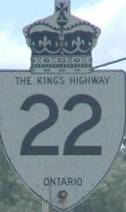
Old style King's Highway 22 shield.

Photo courtesy Mark Mirrlees

  Western Terminus:  Junction Highway 7/79 (now Lambton Road 79-North) in eastern Lambton county.

Eastern Terminus:  Junction Highway 4 at Masonville in London.

Length:  46.0 km

Multiplexes:  None

Freeway: No

AADT (1994):  Highest: 17,700, from Lobo easterly to London;

                             Lowest: 1,400, from Highway 7 easterly to Kerwood Road.

Status:  Entirely downloaded:  New names are Lambton Road 22, Middlesex Road 22, and Fanshawe Park Road (in London).

Road Condition:  Highway 22 is in good shape for virtually its entire length.  Most of Highway 22 has been recently rehabilitated by the counties now responsible for the highway.  There is a high level of variance in traffic levels along Highway 22, near London Highway 22 is quite well traveled (almost to the point of being congested), whereas west of Strathroy traffic volumes are extremely light.


Highway 21 information:


OntHighways.com  

Detailed Route information available below
Virtual Tour of Highway 22


TheKingsHighway.ca   History of Highway 22
Photographic History of Highway 22

Communities and Major Intersections along Highway 22 from West to East:

Proper Municipality Name Community Name Distance Intersecting Road
Lambton county has renamed its downloaded portion of Highway 22 to Lambton Road 22
Township of Warwick ----- --- (0km) / --- (46.0km) Highway 7/79 (Lambton Road 79)
Township of Warwick Wisbeach --- -----

Lambton - Middlesex Boundary.  In Middlesex County Highway 22 is known as Middlesex Road 22

Township of Adelaide- Metcalfe Dejong --- -----
Township of Adelaide- Metcalfe ----- --- (7.4km) / --- (38.6km) Kerwood Road (Middlesex Road 6)
Township of Adelaide- Metcalfe Adelaide --- -----
Township of Adelaide- Metcalfe ----- --- (16.5km) / --- (29.5km) Highway 81 (Middlesex Road 81, Centre Road)
Adelaide- Metcalfe - Middlesex Centre Boundary Hickory Corner --- (22.7km) / --- (23.3km) Hickory Street (Middlesex Road 39)
Township of Middlesex Centre (Poplar Hill) --- Ilderton Road
Township of Middlesex Centre (Poplar Hill) --- (26.2km) / --- (19.8km) Komoka Road (Middlesex Road 16)
Township of Middlesex Centre Lobo --- (33.8km) / --- (12.2km) Nairn Road (Middlesex Road 17)
Township of Middlesex Centre Melrose --- -----
Middlesex Centre - London Boundary London West Limits --- (39.2km) / --- (6.8km) -----

Within London City Limits Highway 22 is known only as Fanshawe Park Road

City of London London --- (41.0km) / --- (5.0km) Hyde Park Road
City of London London --- (2.4km) / --- (43.6km) Wonderland Road
City of London London (Masonville) --- (46.0km) / --- (0km) King's Highway 4 (Richmond Street)
Highway 22 ENDS

<-Highway 21          www.OntHighways.com - Home          Highway 23->


Copyright (c) 2004-2010, AsphaltPlanet.ca  AsphaltPlanet@asphaltplanet.ca

Page last updated:  April 23rd, 2007

Page created:  February 2nd, 2004