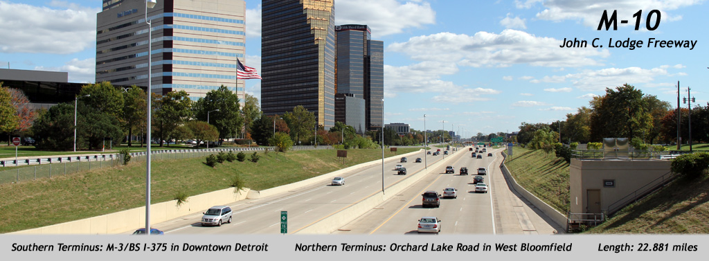
AsphaltPlanet.ca > Michigan > M-10
Pictures on
this page are arranged in order from south to north. M-10 North photos are
left-aligned in the last column, while M-10 South photos are right-aligned.
Center-line pictures are centered within the last column.
|
Location |
Description |
Photo |
||
|
North- |
South- |
|||
|
Wayne County |
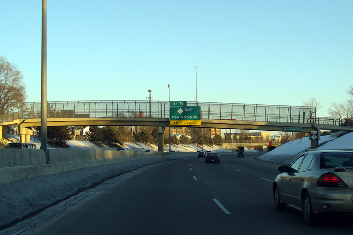
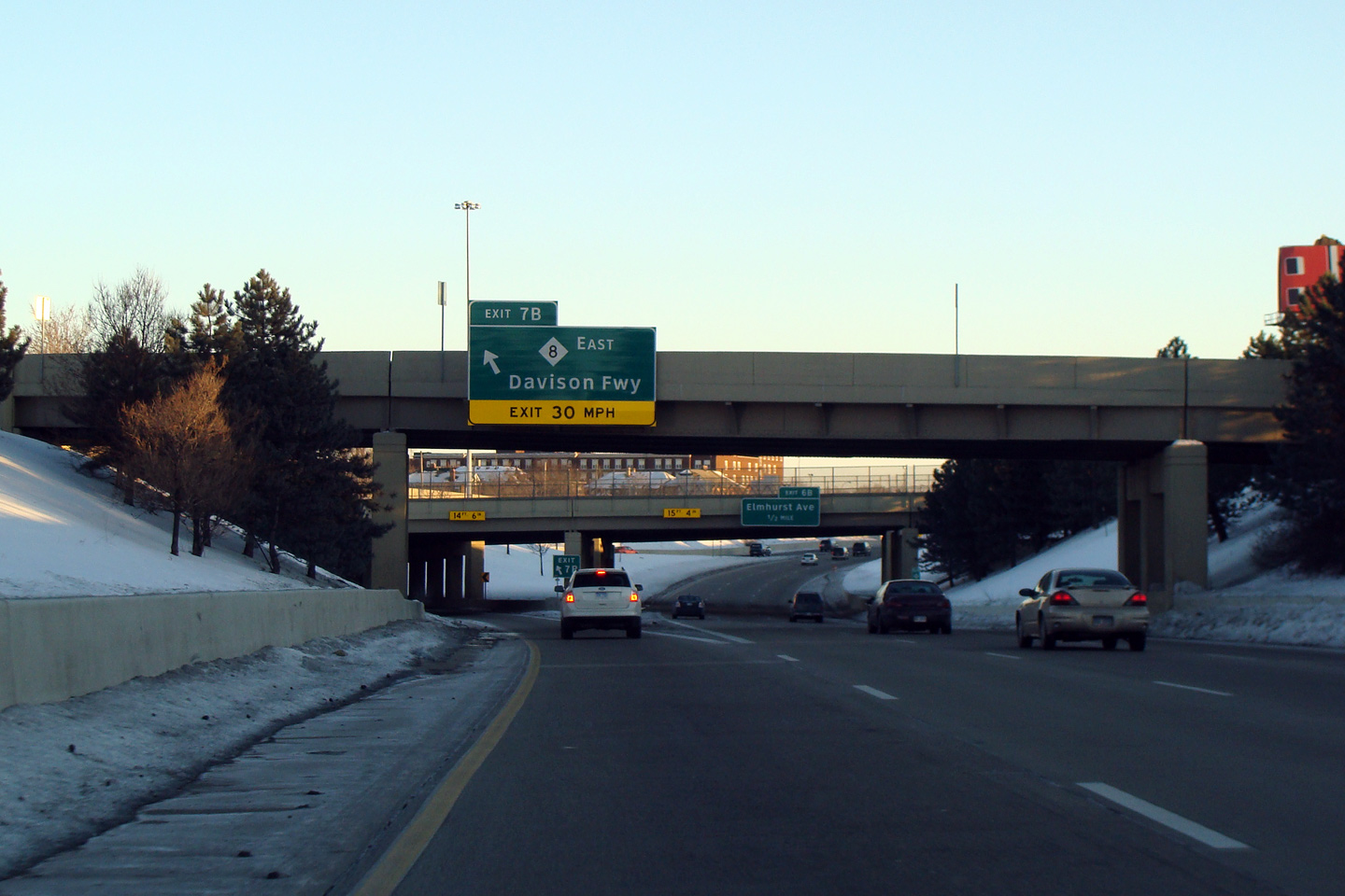
Southbound overhead signage for the ramp to the Davison Freeway East. As is written in Chris Bessert's much respected Michigan Highway's website, the Davison Freeway was one of the first freeways to be constructed in Detroit, opening to traffic in 1944. Interestingly the Davison Freeway was originally built by the Wayne County Road Commission, and not by MDOT. |
 |
||
|
Date: 1/24/2009 |
High-res | |||
|
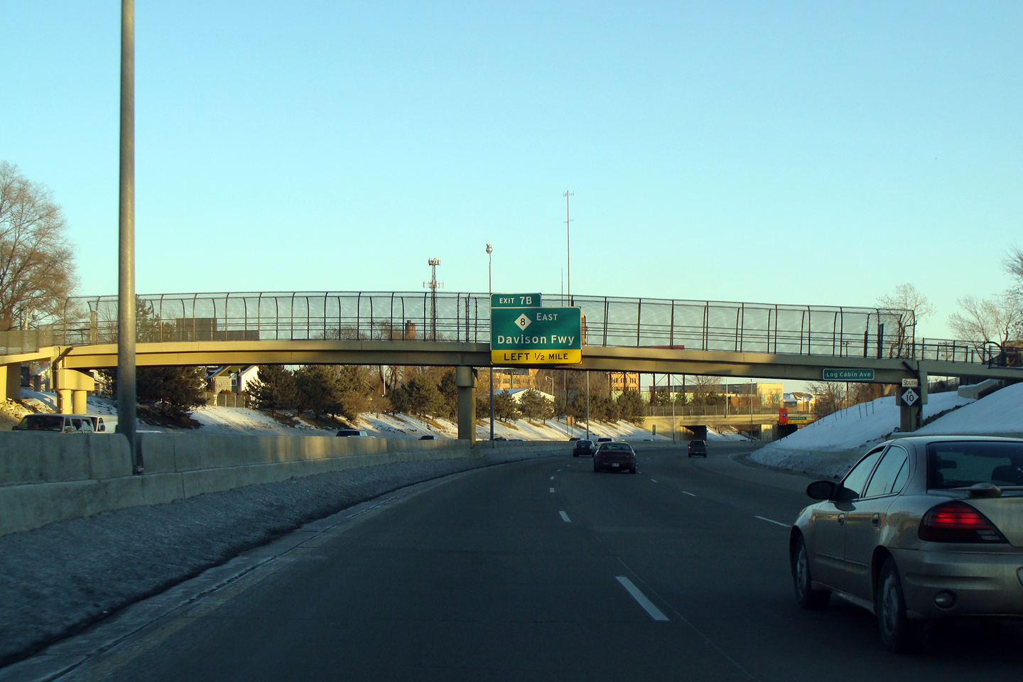
Wayne County |
Advanced overhead sign for the Davison Freeway interchange affixed to the Log Cabin Ave pedestrian overpass. Pedestrian overpasses are very common in Detroit (and urban Michigan), though they never seem to be well used by urban pedestrians. |
 |
||
|
Date: 1/24/2009 |
High-res | |||
|
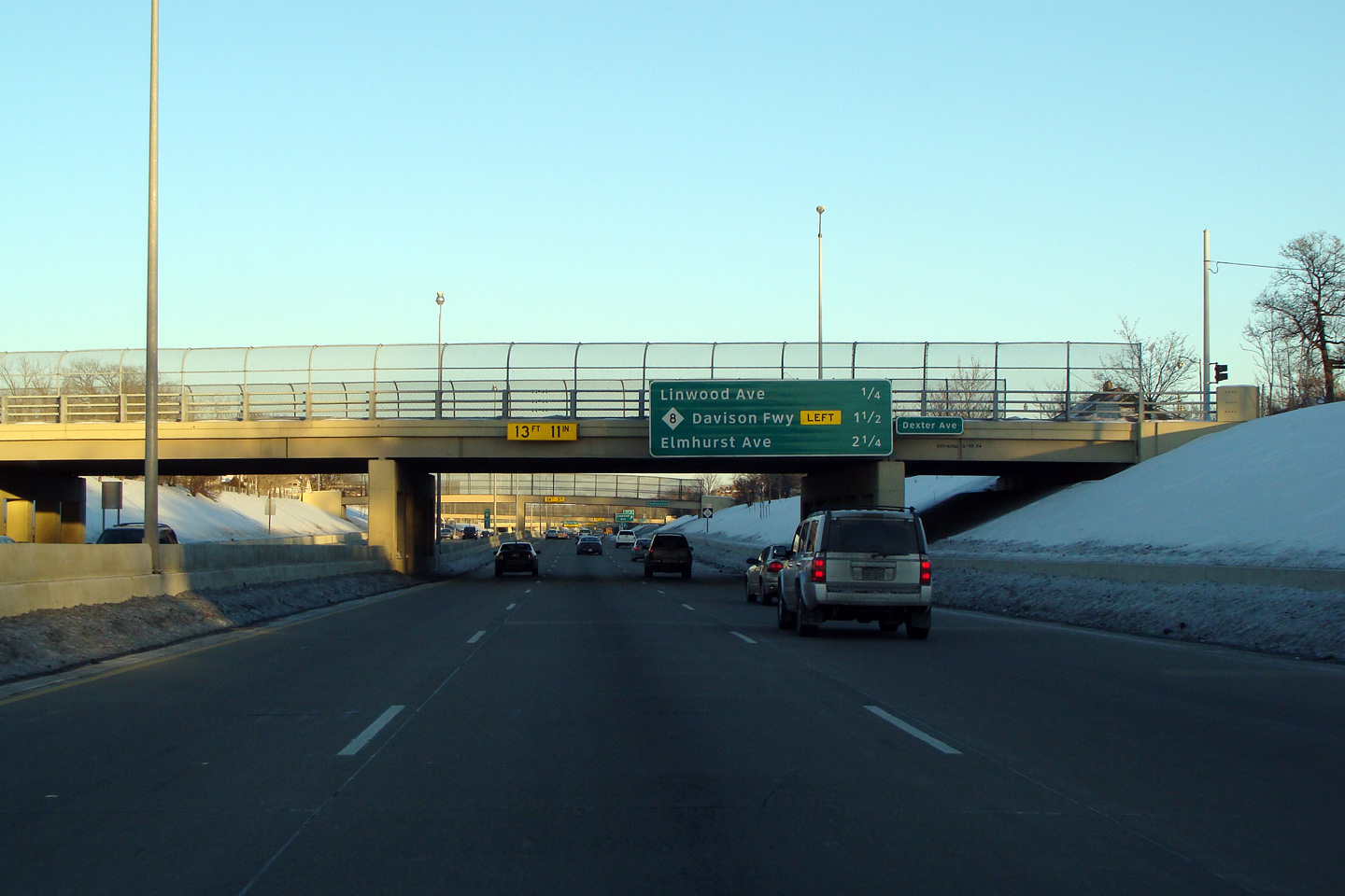
Wayne County |
Next exit signage affixed to the Dexter Avenue overpass. |
 |
||
|
Date: 1/24/2009 |
High-res | |||
|
Wayne County |
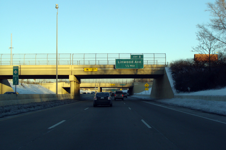
Southbound advanced sign for the Linwood Street interchange, that is affixed to the Livernois Avenue interchange cross-over structure. It is common for freeways in Detroit to be sandwiched between a pair of one-way frontage roads. Often times at a single diamond interchange three overpass structures are required to accommodate the Michigan lefts required that link the frontage roads. MDOT spared no expense when it build Detroit's superhighway network. |
 |
||
|
Date: 1/24/2009 |
High-res | |||
|
Wayne County |
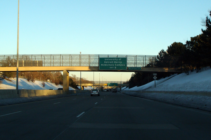
Overhead for University of Detroit Mercy sign affixed to the Northlawn Avenue overpass. |
 |
||
|
Date: 1/24/2009 |
High-res | |||
|
Oakland County |
Two view's looking south from the Evergreen Road. South from Evergreen Road, the Lodge Freeway continues south-easterly bound for Downtown Detroit. Note the maintenance building visible alongside the southbound lanes of the freeway. There are several of these buildings alongside the Lodge Freeway through Southfield. |
|
||
|
High-res: (1440x960) (2400x1600) |
||||
|
|
||||
|
Date: 10/01/2010 |
High-res: (1440x960) (2400x1600) |
|||
|
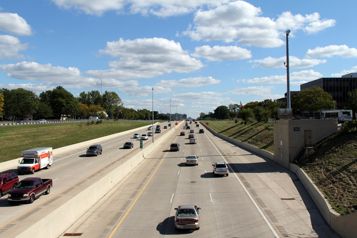
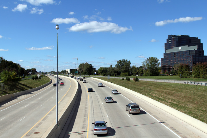
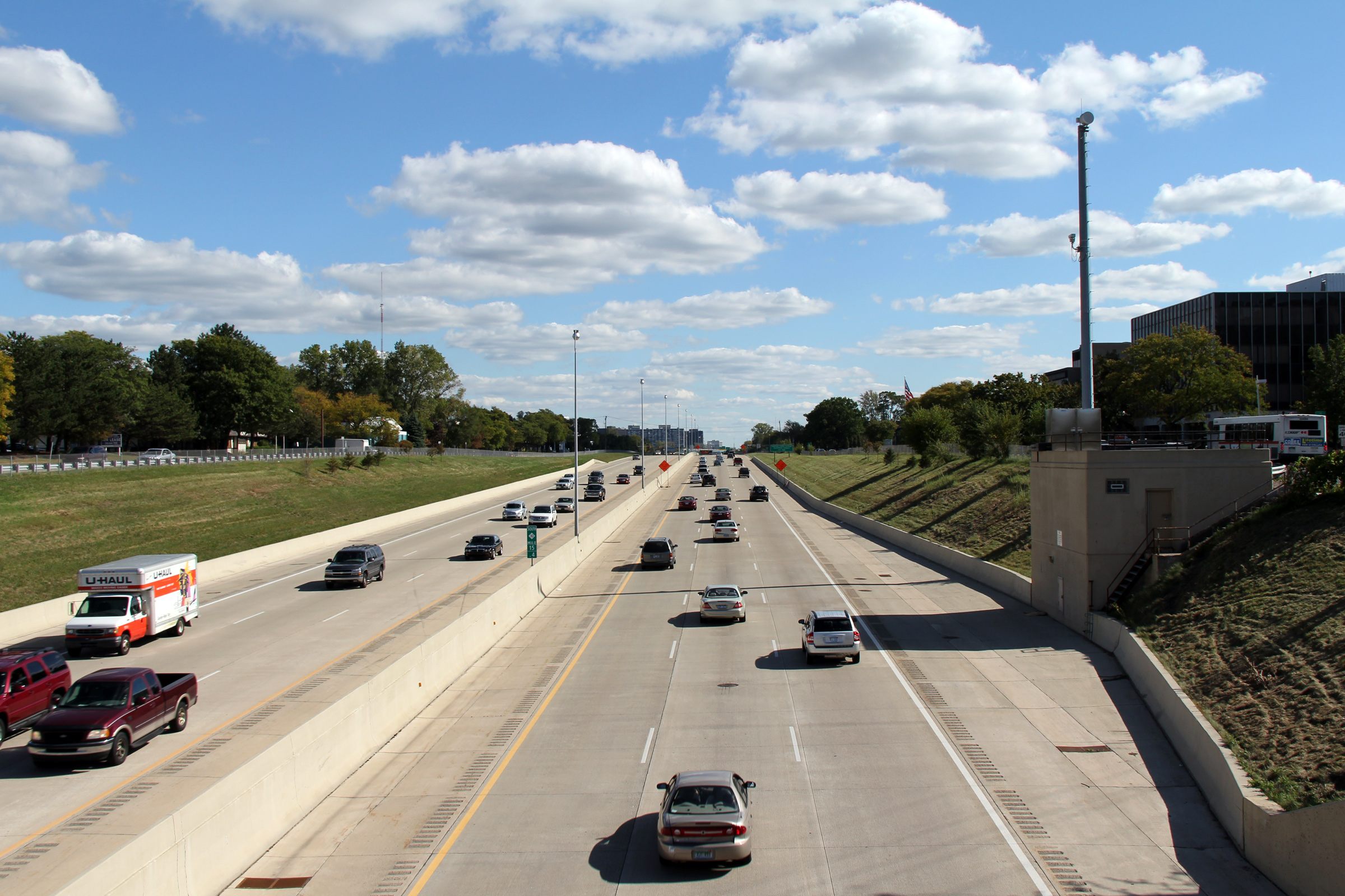
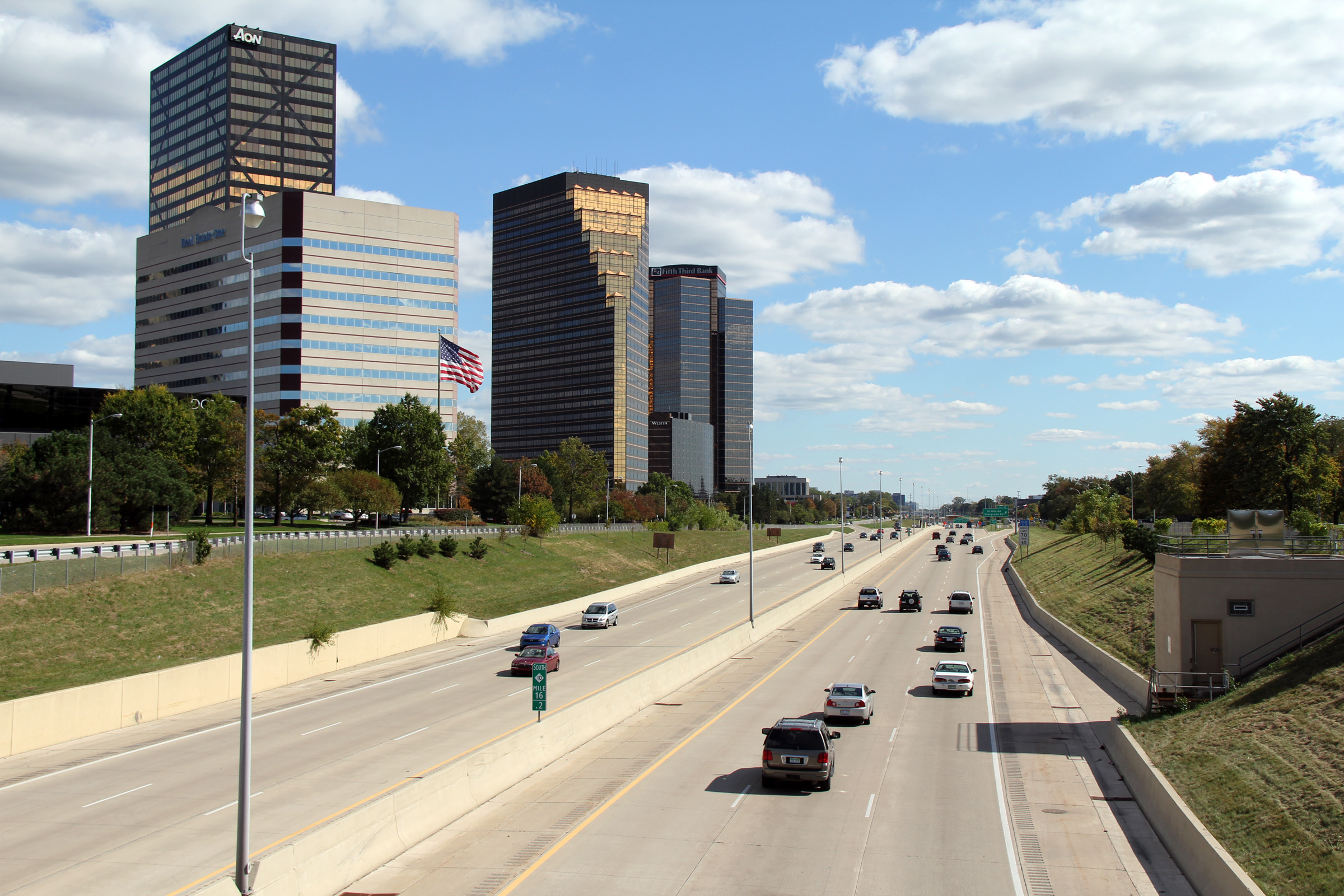
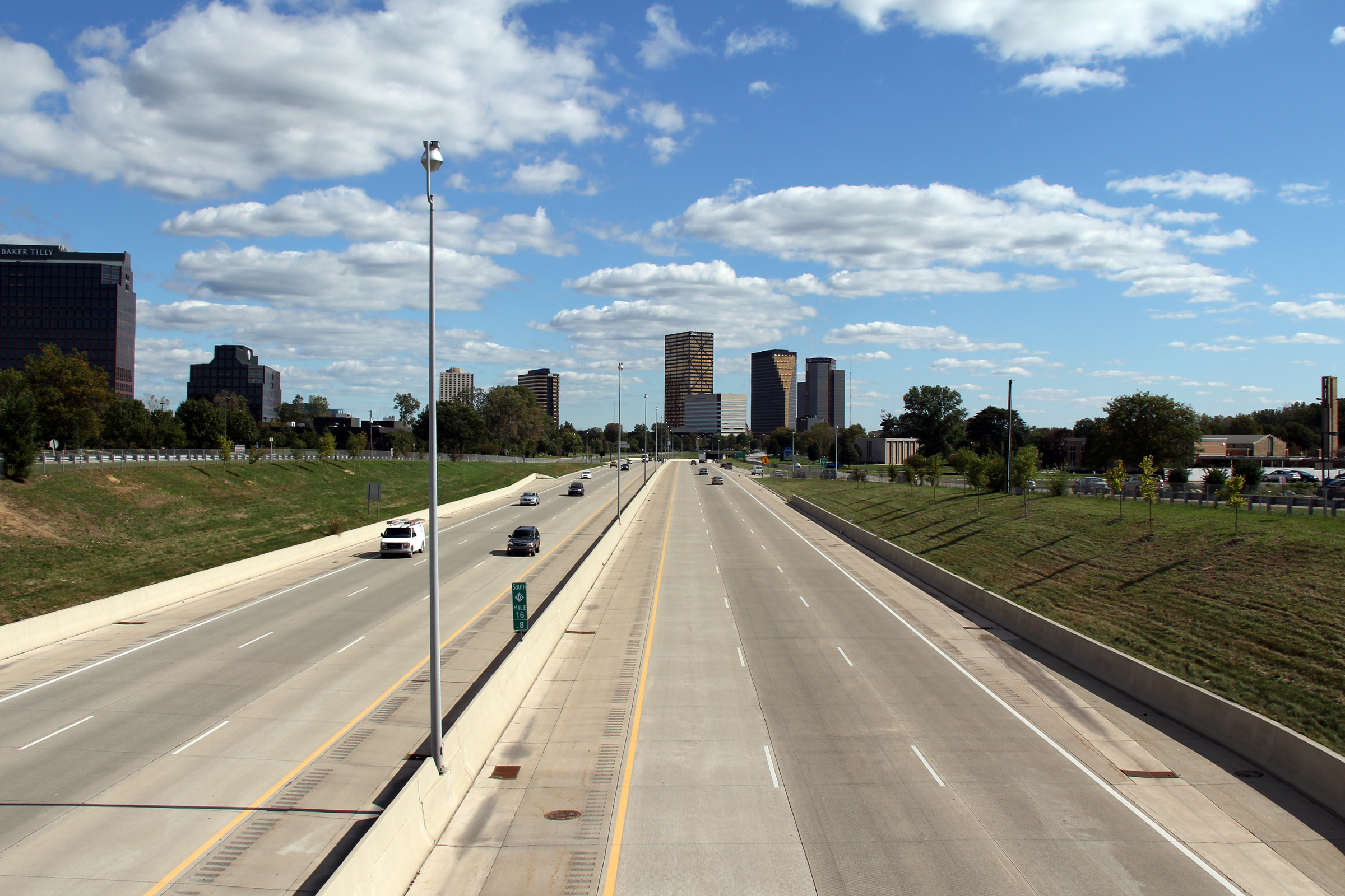
Oakland County |
Northerly view from the Evergreen Road overpass looking towards the 10 Mile Road interchange. Southfield is very much a secondary Downtown to the Metro Detroit area. The collection of skyscrapers that is pictured in the photo is known locally as the "Golden Triangle". |
|
||
|
Date: 10/01/2010 |
High-res: (1440x960) (2400x1600) |
|||
|
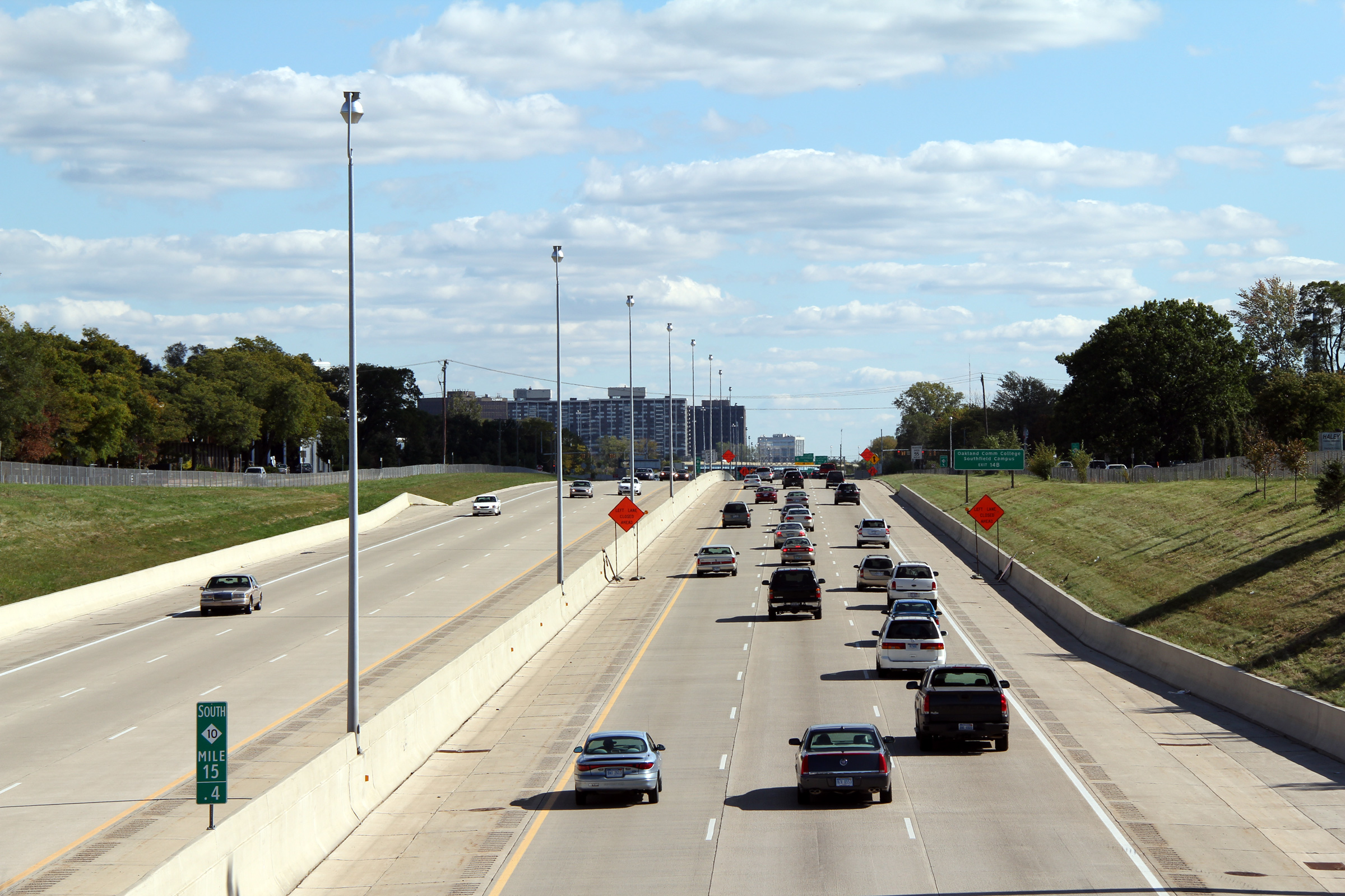
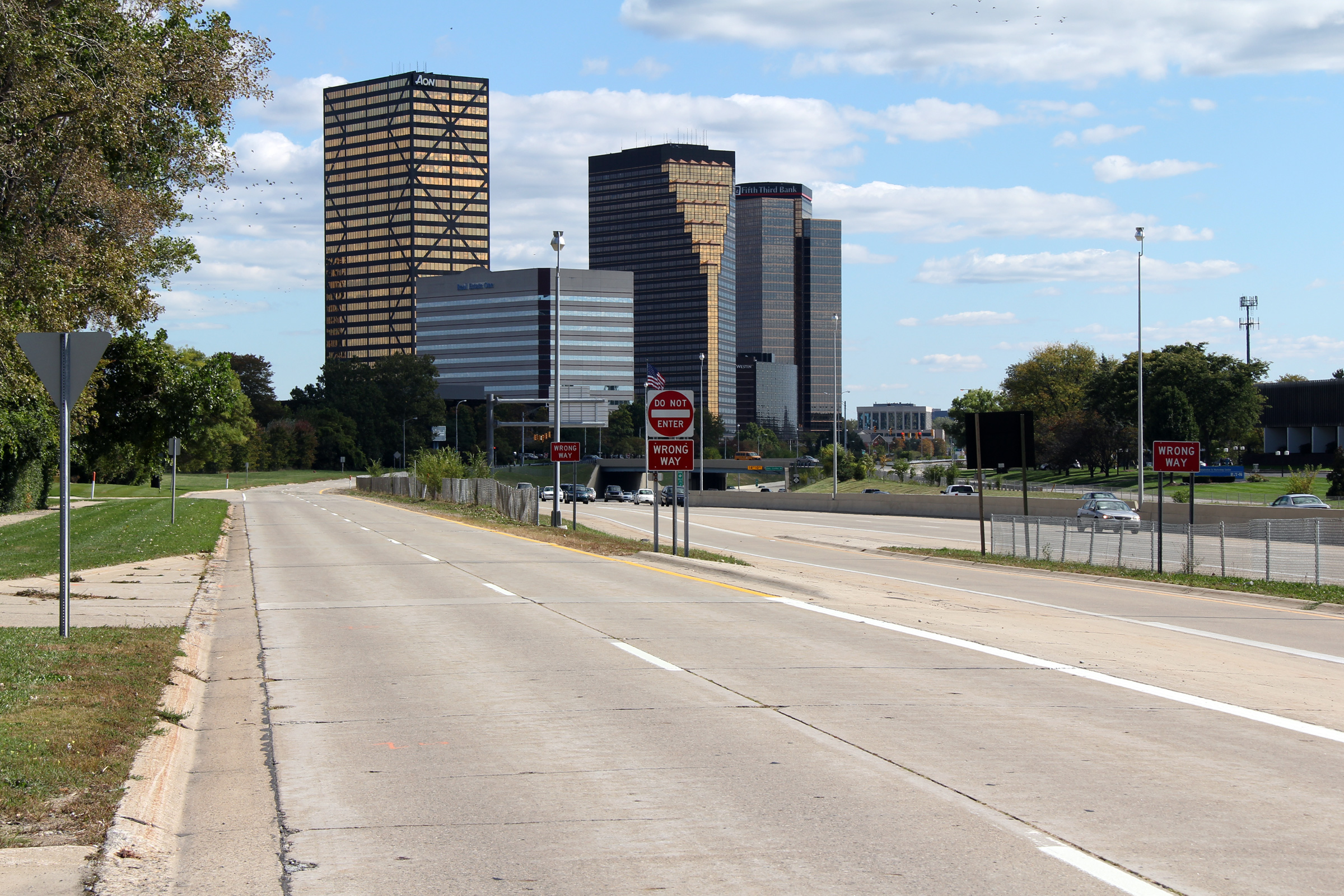
Oakland County |
Southbound view from the 10 Mile Road overpass looking southerly towards the Evergreen Road overpass. Have a look at this old historical photo of the Lodge Freeway hosted here (scroll to the bottom of the page). While this isn't the same section of the Lodge Freeway as is pictured in this gallery, notice how far highway engineering has come since the 1950s. The historical image shows a highway without shoulders, crash protections or a concrete median. We wouldn't build a road like that today. |
|
||
|
Date: 10/01/2010 |
High-res: (1440x960) (2400x1600) |
|||
|
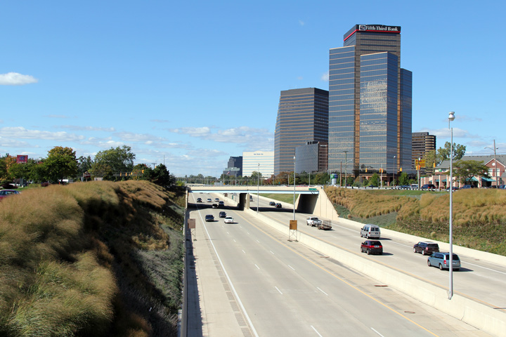
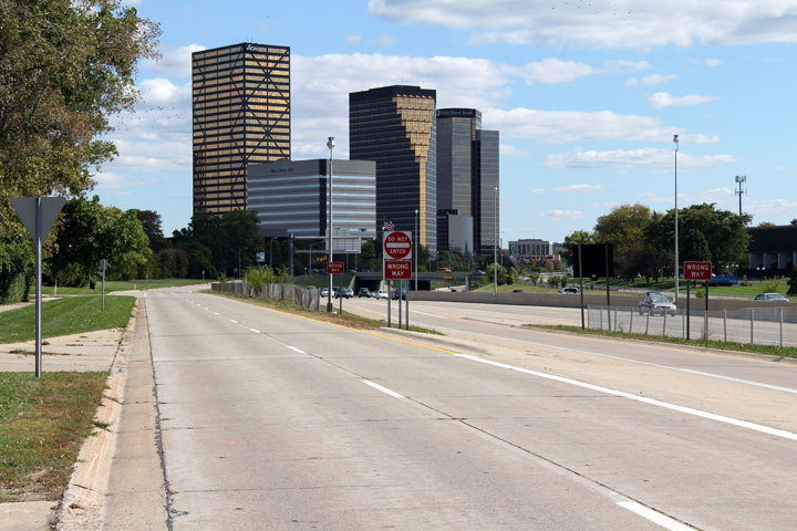
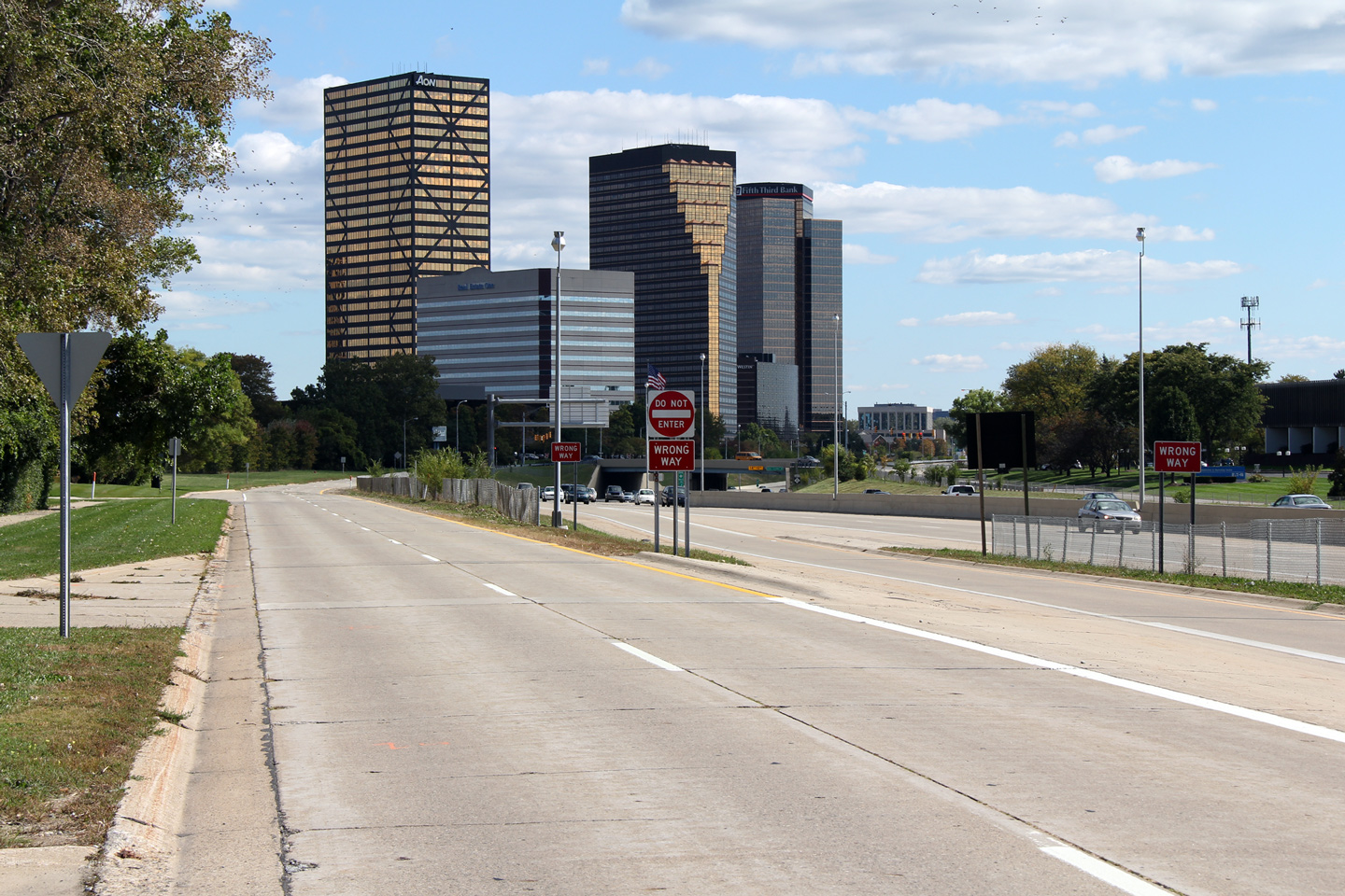
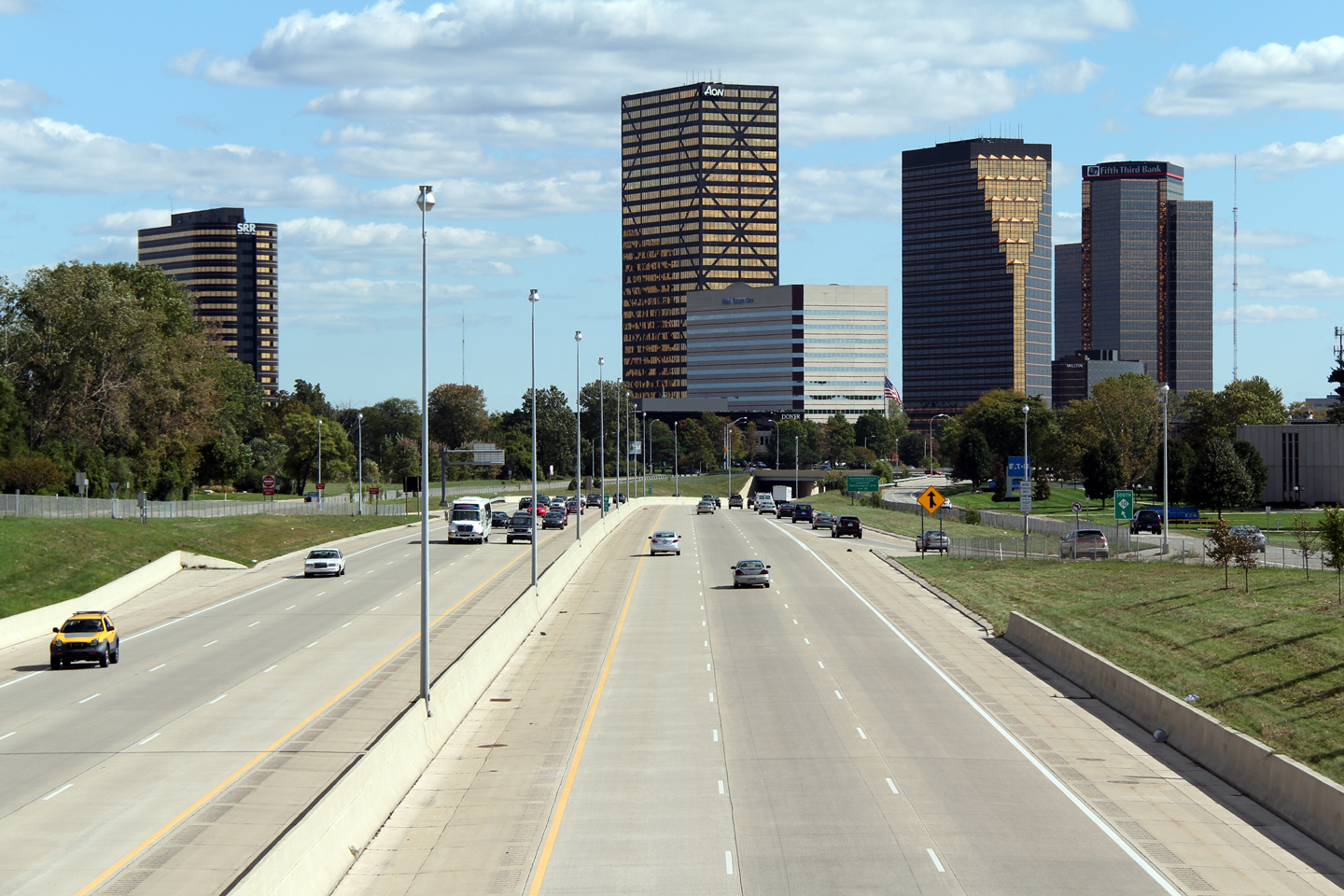
Oakland County |
This view looks northerly from the 10 Mile Road overpass. Only the east side of the Lodge Freeway is enshrouded in tall skyscrapers, the west side of the freeway is surrounded by more 'campus' type commercial establishments. |
|
||
|
Date: 10/01/2010 |
High-res: (1440x960) (2400x1600) |
|||
|
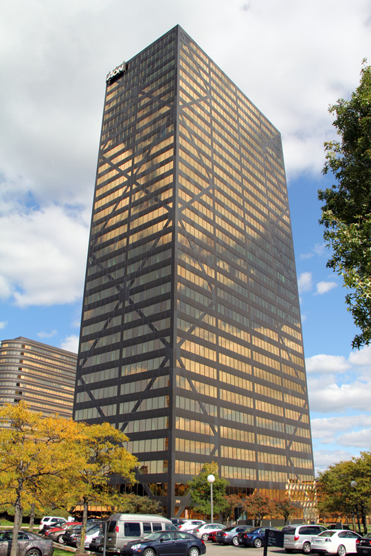
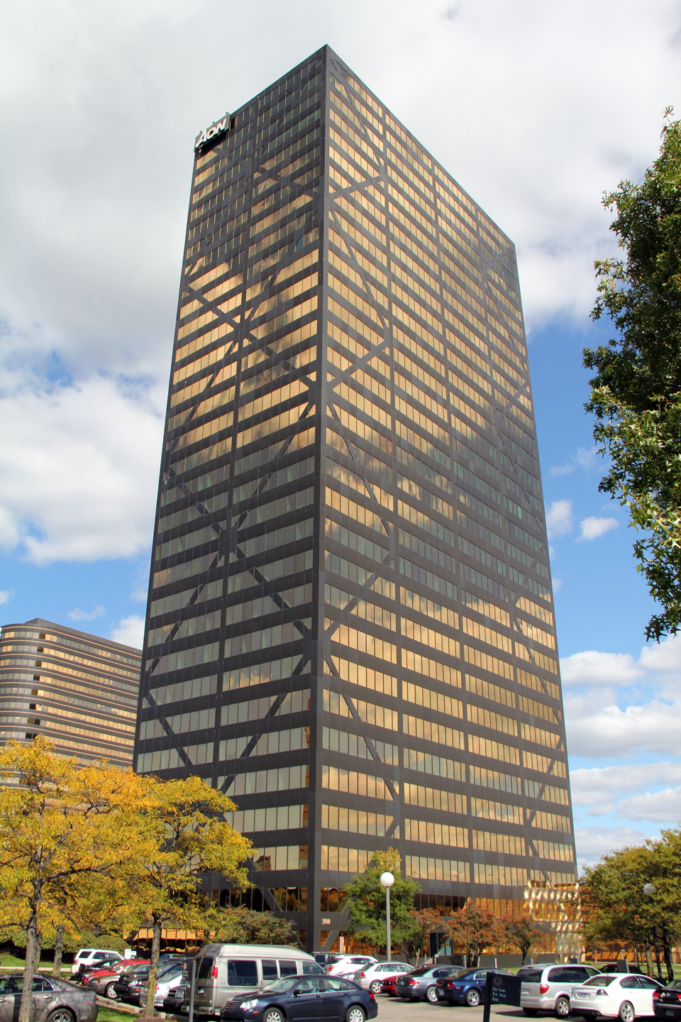
Oakland County |
Obviously this photo is not of the Lodge Freeway. The Aon building is one of the most predominant buildings of the Golden Triangle. I was surprised that on my visit in October of 2010, there were actually vacant buildings in Southfield's Golden Triangle. The area was generally very vibrant, but given the overall 'newness' of Southfield, empty buildings were a stark reminder of the tough economic times currently (as of October 2010) facing Southeast Michigan. |
|
||
|
Date: 5/24/2009 |
||||
|
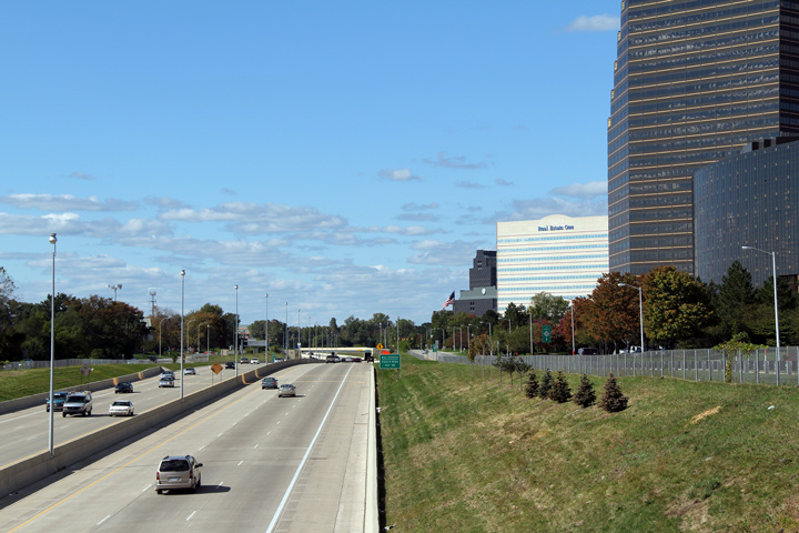
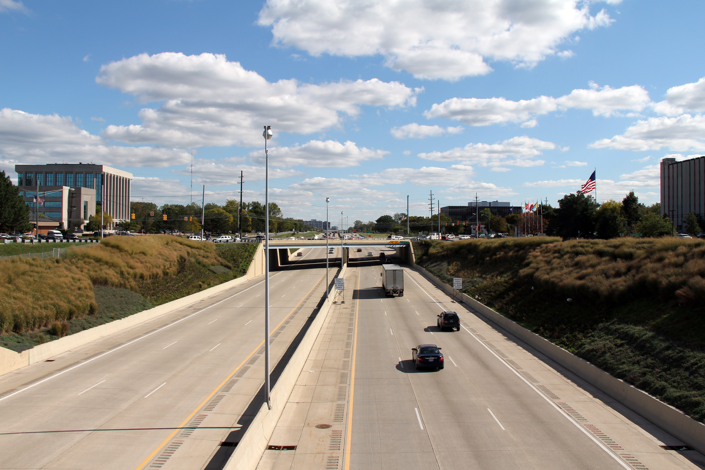
Oakland County |
Southerly view from the Civic Centre Drive overpass. The Lodge Freeway was completely reconstructed through the City of Southfield during the 2007 construction season. The concrete pavement was replaced, and numerous structures were rehabilitated. To achieve this work, the Lodge Freeway was entirely closed to traffic for long durations at a time. Complete closures are not rare in Michigan. MDOT similarly elected to fully close Interstate 75 to traffic in the vicinity of the Ambassador Bridge in order to complete Detroit's Gateway project. |
|
||
|
Date: 10/1/2010 |
High-res: (1440x960) (2400x1600) |
|||
|
Oakland County |
Northbound view of the Lodge Freeway from the City Centre Road overpass. |
|
||
|
Date: 10/1/2010 |
High-res: (1440x960) (2400x1600) |
|||
|
Oakland County |
View looking southerly from the northbound frontage road that parallels the Lodge Freeway. The Lodge Freeway, with its parallel service roads, is somewhat reminiscent of the freeways around Montreal in La Belle Province (Quebec). |
|
||
|
Date: 10/1/2010 |
High-res: (1440x960) (2400x1600) |
|||
|
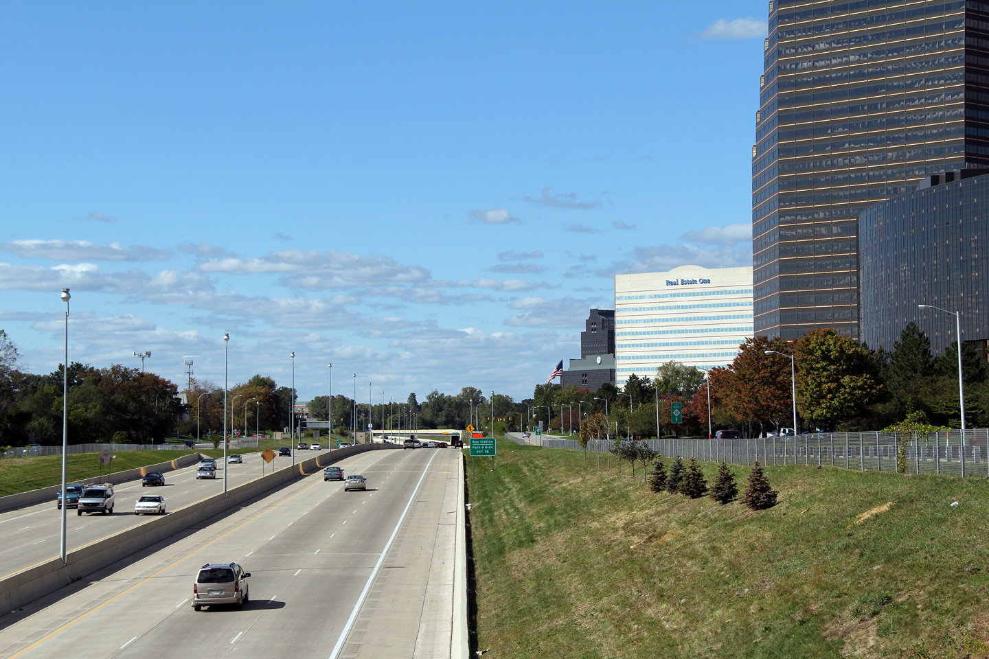
Oakland County |
Two views that look south from the Lasher Road overpass. The City of Southfield has an impressive skyline; though I noticed that as I walked through Southfield, it too had been hardly hit by the late 2000's recession. Several large office buildings appeared completely vacant, obviously these buildings are very new, modern, and in a very prosperous part of the Detroit Metro -- these buildings shouldn't be vacant. |
|
||
|
High-res: (1440x960) (2400x1600) |
||||
|
|
||||
|
Date: 10/01/2010 |
High-res: (1440x960) (2400x1600) |
|||
|
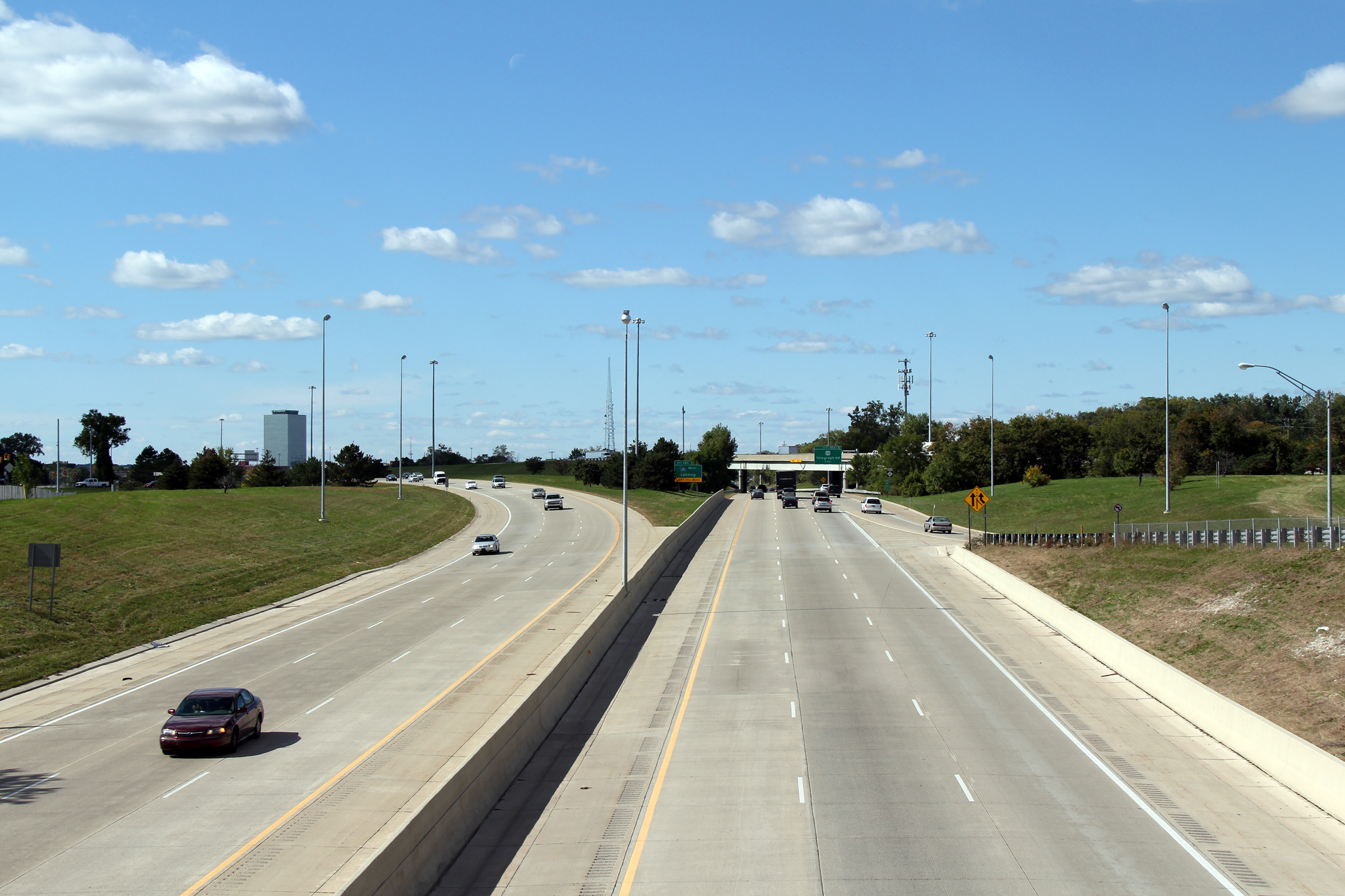
Oakland County |
View looking northerly from the Lasher Road overpass over the M-10 Freeway. The southbound lanes diverge from the northbound lanes in this photo, as M-10 straddles I-696 at the Telegraph Road interchange. M-10 forms, what appear from the air at least, to be collector lanes that surround the 696 freeway |
|
||
|
Date: 10/01/2010 |
High-res: (1440x960) (2400x1600) |
|||
|
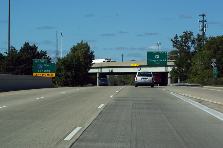
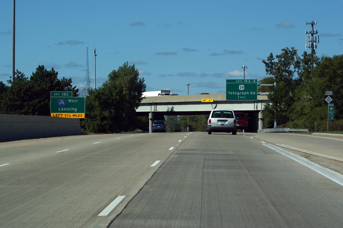
Oakland County |
Northbound signage for both Interstate 696 and US-24 as the Lodge Freeway passes under I-696. Interstate 696, and US-24 cross the Lodge Freeway at a sprawling interchange complex known locally as the "Mixing Bowl". |
|
||
|
Date: 10/01/2010 |
High-res: (1440x960) (2400x1600) | |||
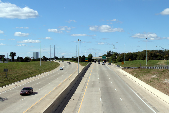
|
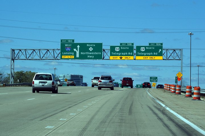
Oakland County |
Advanced signage for the US-24 North ramp. North M-10 has a six lane northbound carriageway through the Mixing Bowl interchange. |
|
||
|
Date: 10/01/2010 |
High-res: (1440x960) (2400x1600) | |||
|
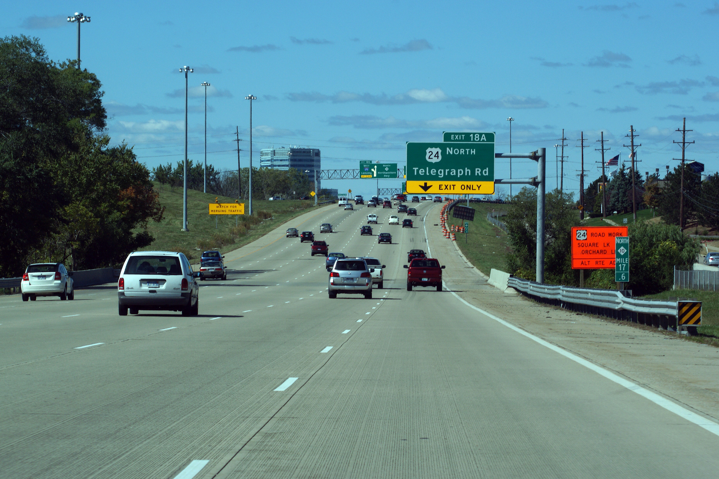
Oakland County |
Overhead signage at the northbound ramp from the Lodge Freeway to Telegraph Road. At the time this photo was taken, construction was underway to rehabilitate Telegraph Road north of the M-10 Freeway. As evident from the skid marks visible on the concrete roadway, US-24 was seriously congested during this construction. |
|
||
|
Date: 10/01/2010 |
High-res: (1440x960) (2400x1600) | |||
<- M-8
MI Highways
M-11 ->
Asphaltplanet.ca
© 2010 AsphaltPlanet.ca.
AsphaltPlanet@asphaltplanet.ca
Page Created: October 18, 2010.
Last Updated: October 18, 2010.


