|
Interstate 94
(Michigan) |
| <- Page 3 |
|
Page 5 -> |
Pictures are arranged in order from
west to east.
I-94 East photos are
left-aligned in the last column, while I-94 West photos are right-aligned.
Center-line pictures are centered within the last column.
|
Location |
Description |
Photo |
||
|
East- |
West- |
|||
|
Continue west along I-94. Click here for Paw Paw to Albion images. |
||||
|
Washtenaw County |
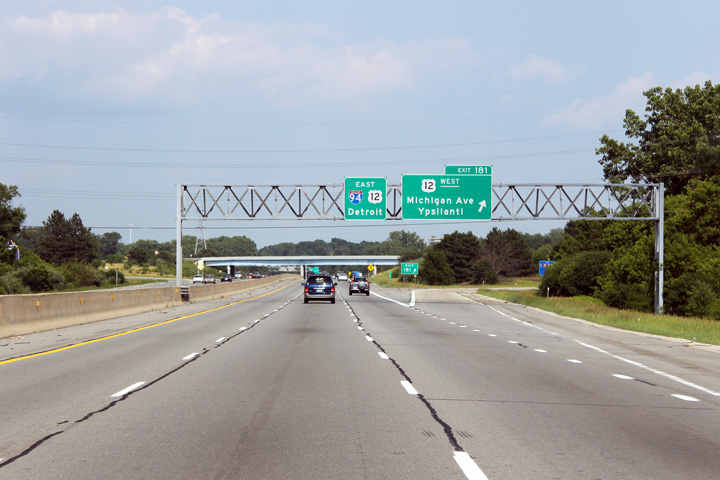
This view looks easterly at the ramp to US-12 West. US-12 piggybacks along I-94 for several miles. |
 |
||
|
Date: 6/26/2011 |
High-res: (1440x960) (2400x1600) |
|||
|
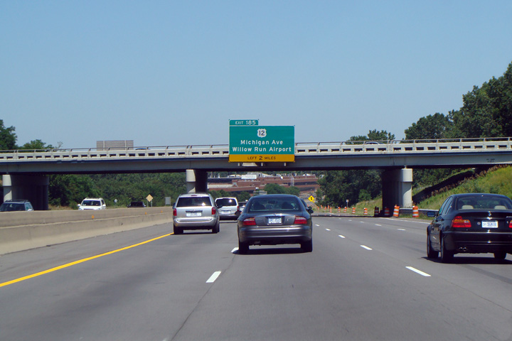
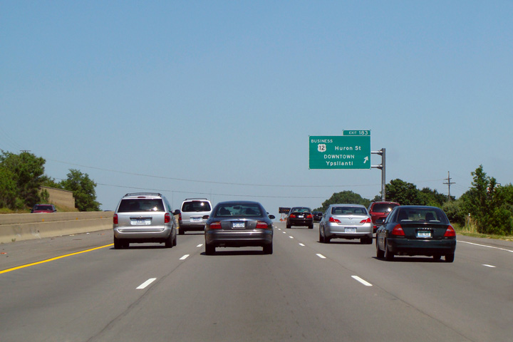
Washtenaw County |
Advanced signage for the Business US-12 loop that runs into Ypsilanti from US-12 and I-94. |
 |
||
|
Date: 3/01/2008 |
High-res: (1440x960) |
|||
|
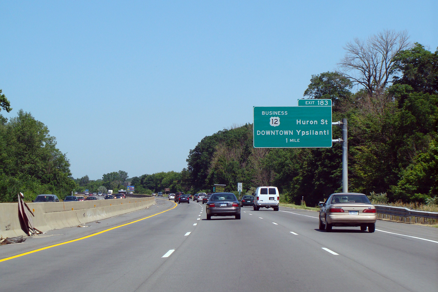
Washtenaw County |
Business US-12 follows South Huron Road back to Michigan Avenue into Downtown Ypsilanti. |
|
||
|
Date: 3/01/2008 |
High-res: (1440x960) |
|||
|
Washtenaw County |
Advanced signage for the left-ext for US-12 affixed to the South Huron Street overpass. |
 |
||
|
Date: 3/01/2008 |
High-res: (1440x960) | |||
|
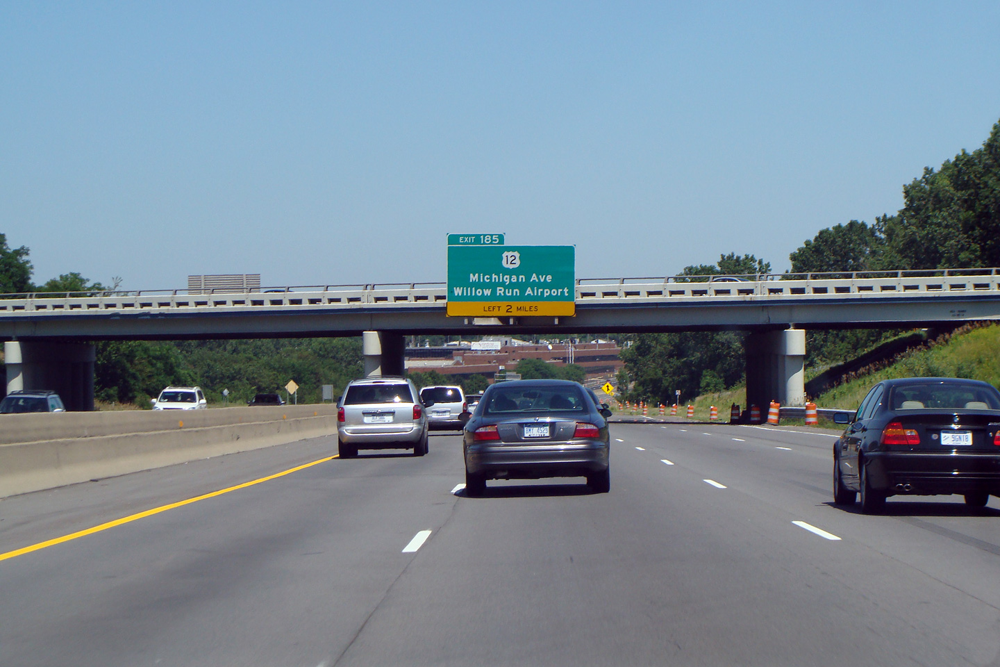
Washtenaw County |
Eastbound off-ramp as US-12 departs I-94 to follow the Willow Run Expressway around the eastern portion of Ypsilanti The Ann Arbor and Ypsilanti By-pass's are segments of I-94 that were initially constructed as a by-pass for US-12 prior to the interstate era. |
|
||
|
Date: 3/01/2008 |
High-res: (1440x960) |
|||
|
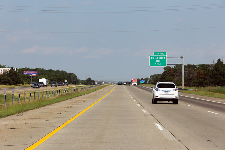
Wayne County |
Advanced signage for the Belleville Road interchange. |
 |
||
|
Date: 6/26/2011 |
High-res: (1440x960) (2400x1600) |
|||
|
Wayne County |
This advanced signage for the I-75 interchange is affixed to the Haggerty Road overpass. |
 |
||
|
Date: 6/26/2011 |
High-res: (1440x960) (2400x1600) |
|||
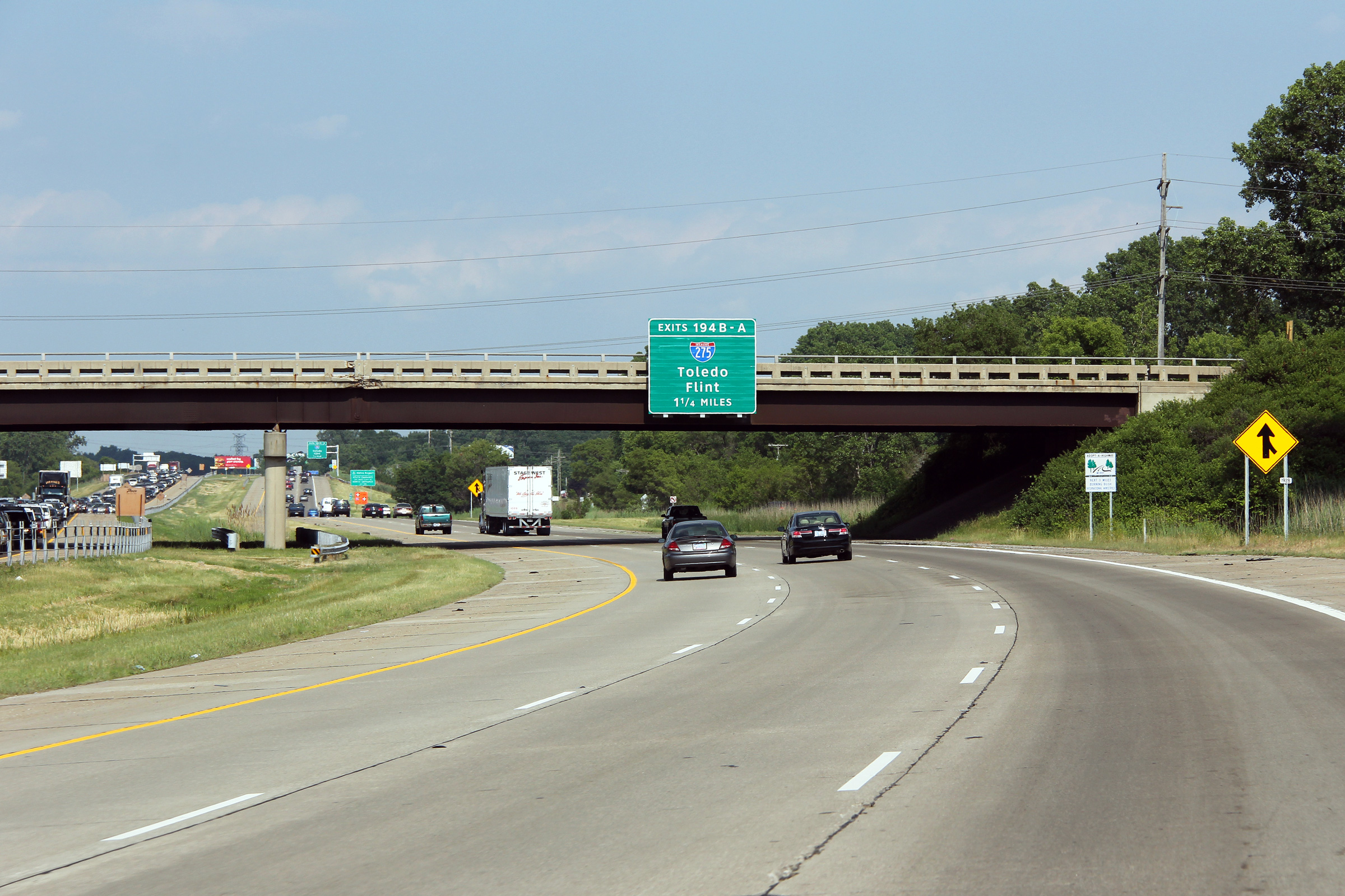
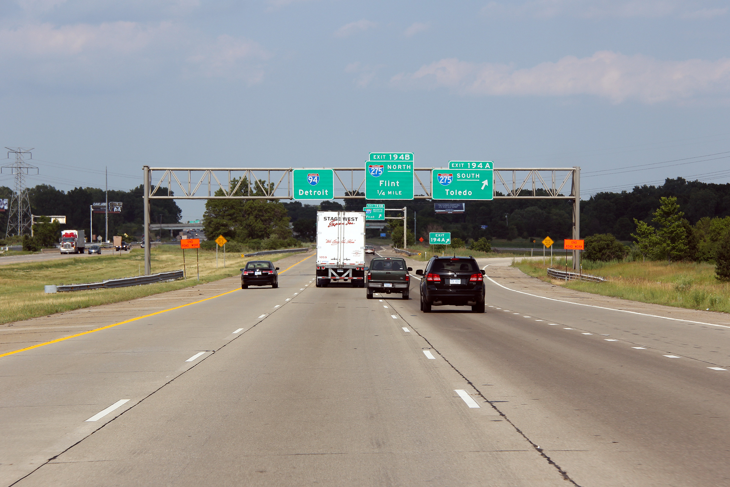
|
Wayne County |
Another advanced sign for the I-275 interchange. |
 |
||
|
Date: 6/26/2011 |
High-res: (1440x960) (2400x1600) |
|||
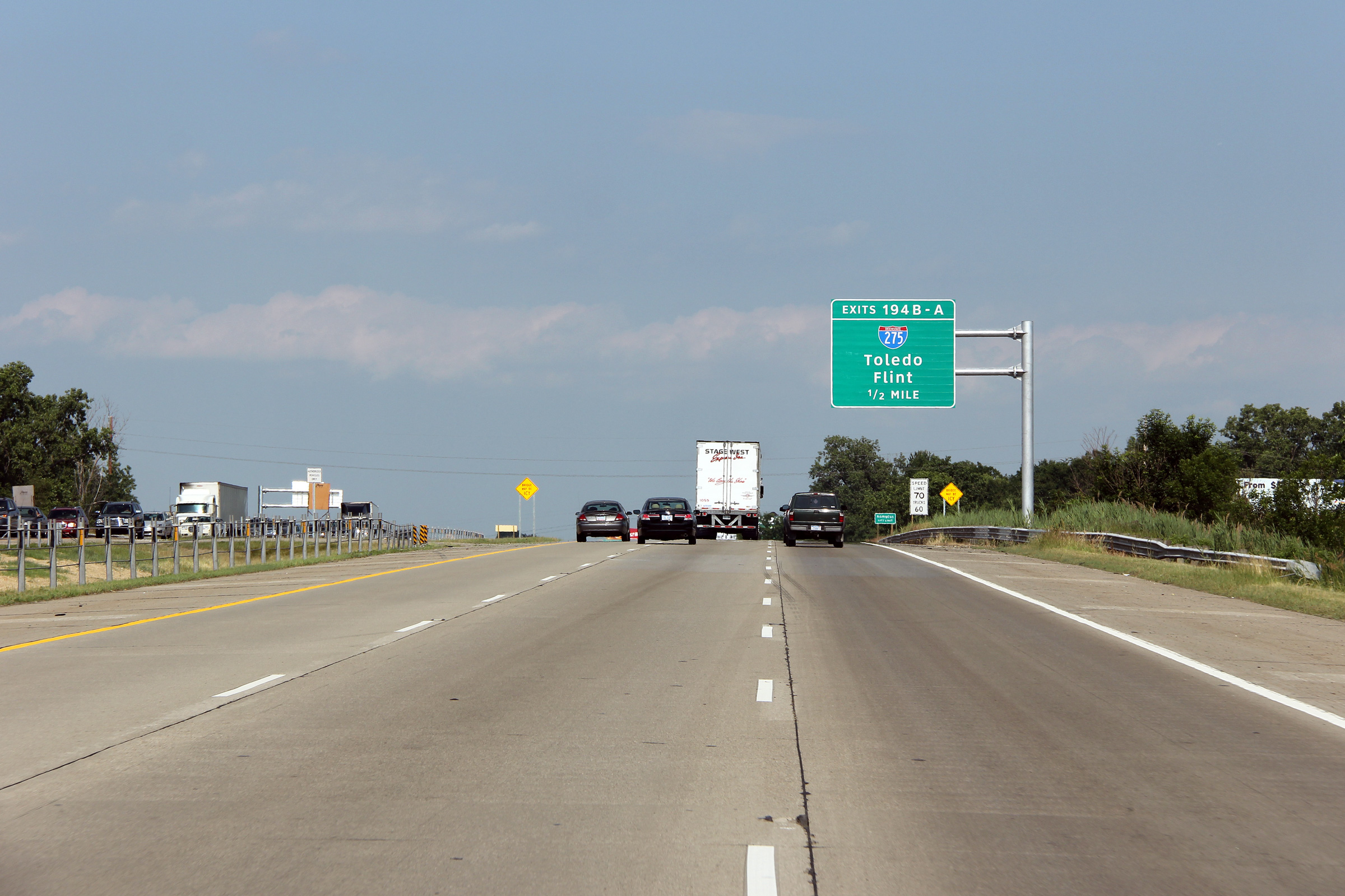
|
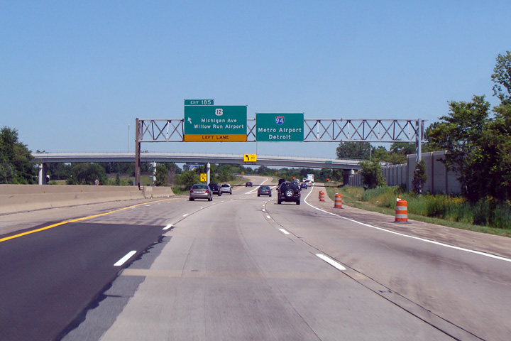
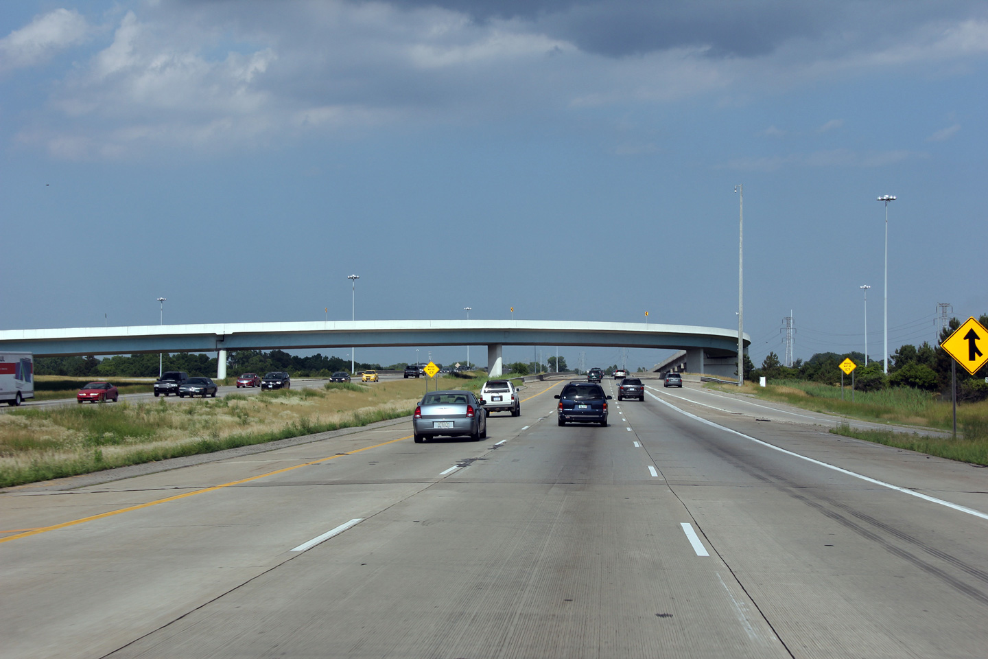
Wayne County |
Eastbound approaching the I-275 interchange. Interstate 275 serves as a western by-pass of Interstate 75 through Western Detroit. I-275 meets I-94 at a three-quarter cloverleaf interchange with a semi-directional ramp for south to east movements that replaces the loop in the southwest quadrant. |
 |
||
|
Date: 6/26/2011 |
High-res: (1440x960) (2400x1600) |
|||
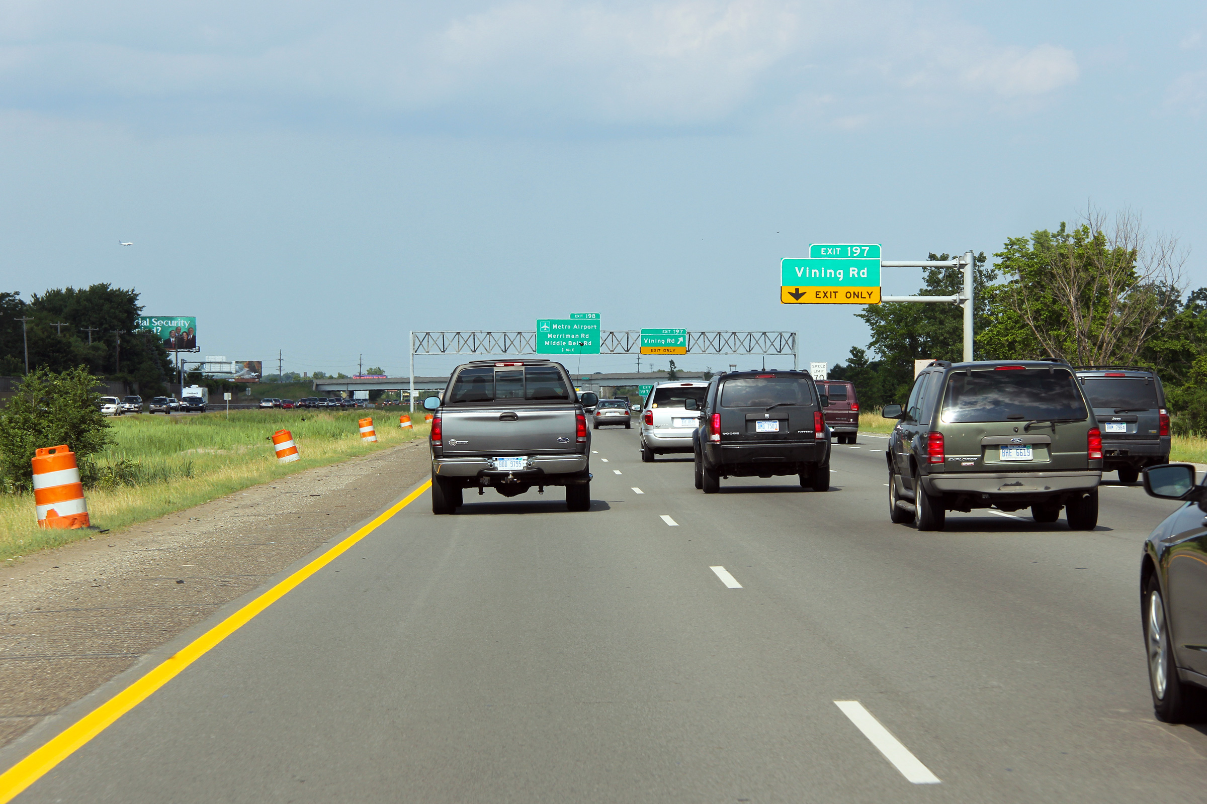
|
Wayne County |
Advanced signage for the ramp to Vining Road. |
 |
||
|
Date: 6/26/2011 |
High-res: (1440x960) (2400x1600) |
|||
|
Wayne County |
As the incoming on-ramp to Interstate 94 East joins the freeway, an overhead sign has been placed to advise incoming traffic that the right hand lane must exit to the Detroit Airport ahead. |
 |
||
|
Date: 6/26/2011 |
High-res: (1440x960) (2400x1600) |
|||
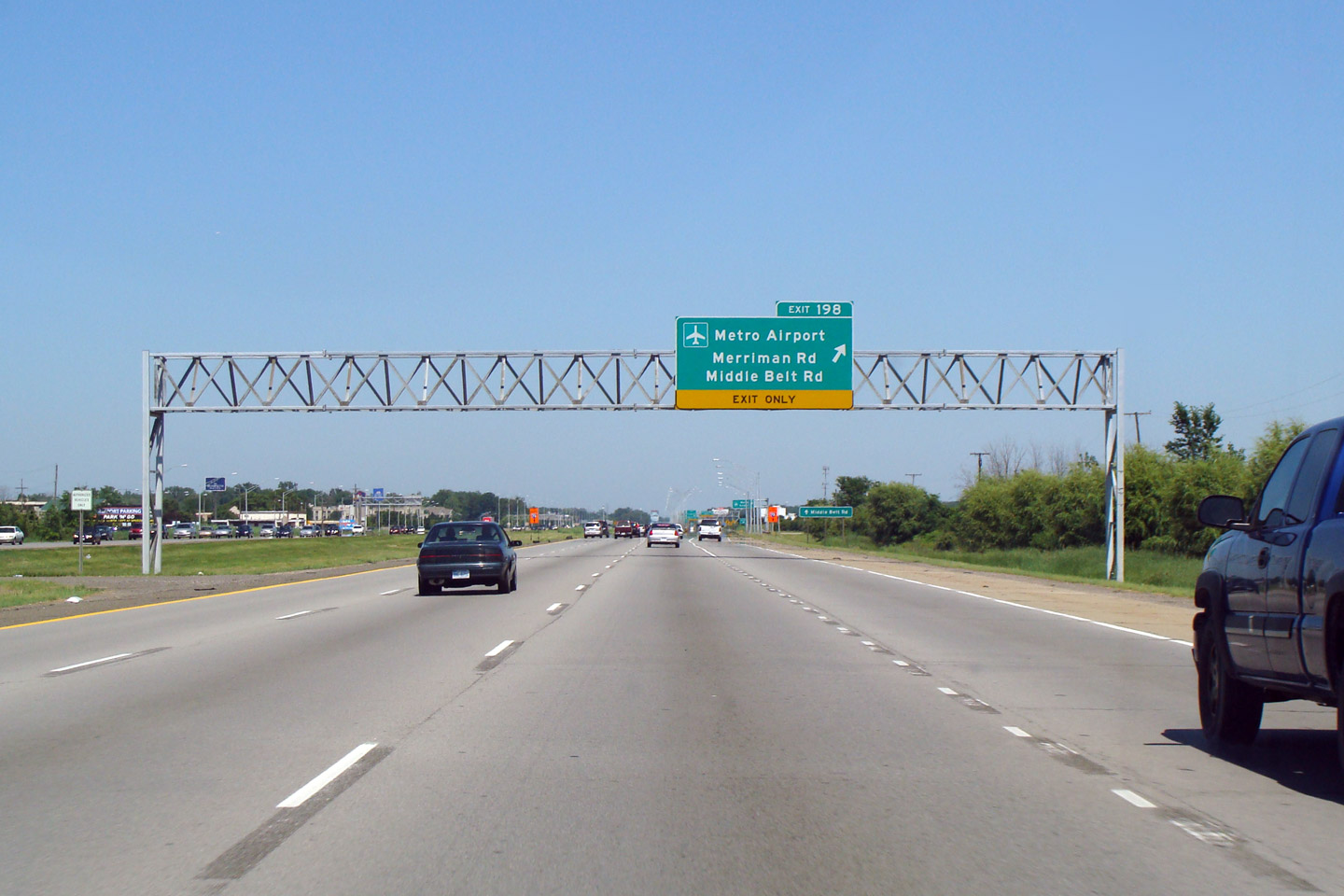
|
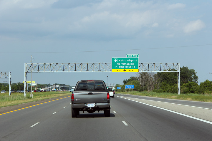
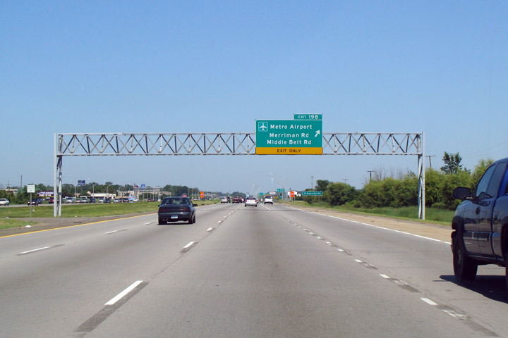
Wayne County |
Eastbound off-ramp to Metro Detroit Airport. |
 |
||
|
Date: 7/06/2008 |
High-res: (1440x960) |
|||
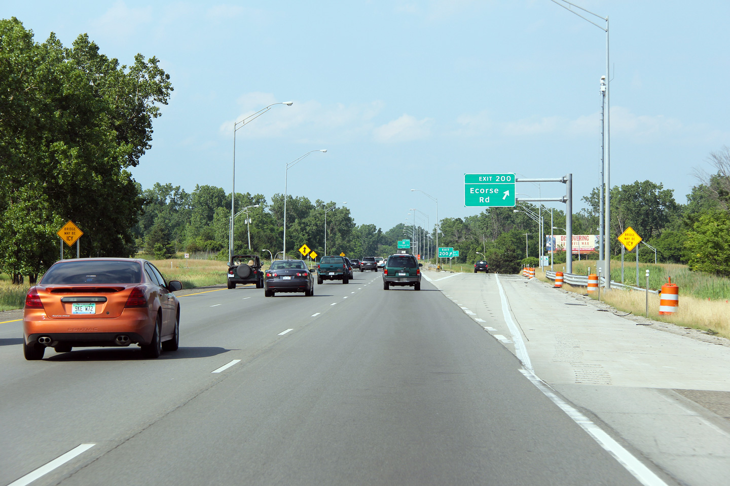
|
Wayne County |
Eastbound off-ramp to Ecorse Road. |
 |
||
|
Date: 6/26/2011 |
High-res: (1440x960) (2400x1600) |
|||
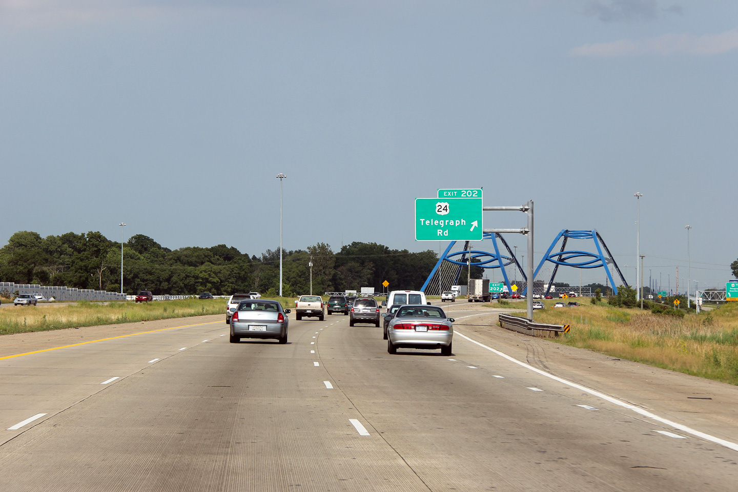
|
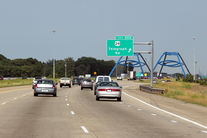
Wayne County |
Guide signage directing traffic to the off-ramp to US-24. US-24 meets the connecting ramps to and from I-94 at a SPUI (Single-Point-Urban-Interchange) that was completed in 2006. |
 |
||
|
Date: 6/26/2011 |
High-res: (1440x960) (2400x1600) |
|||
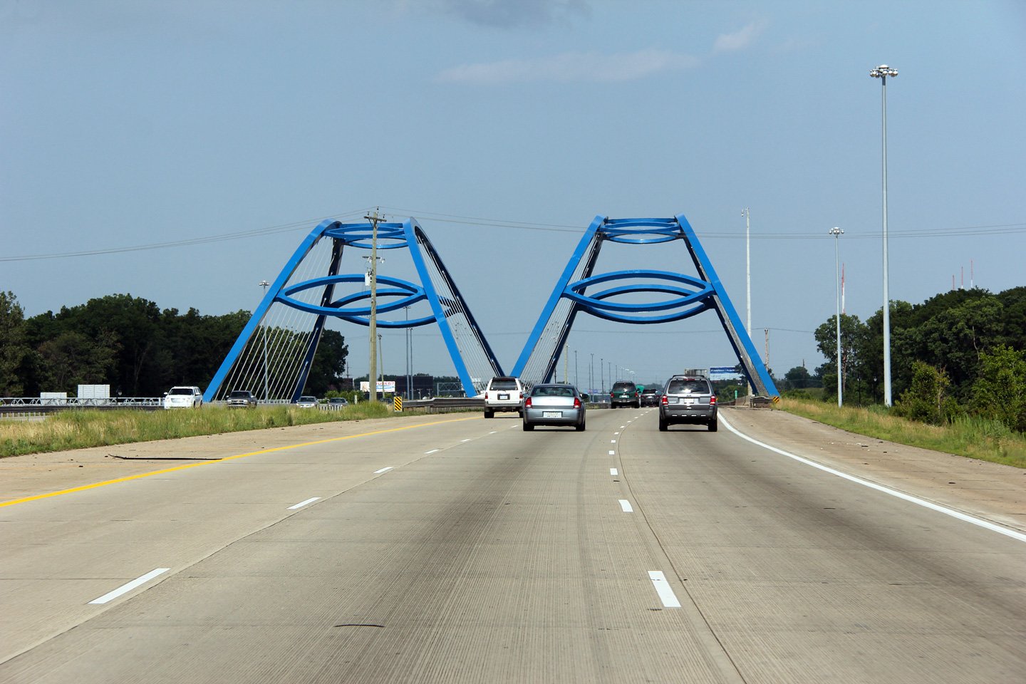
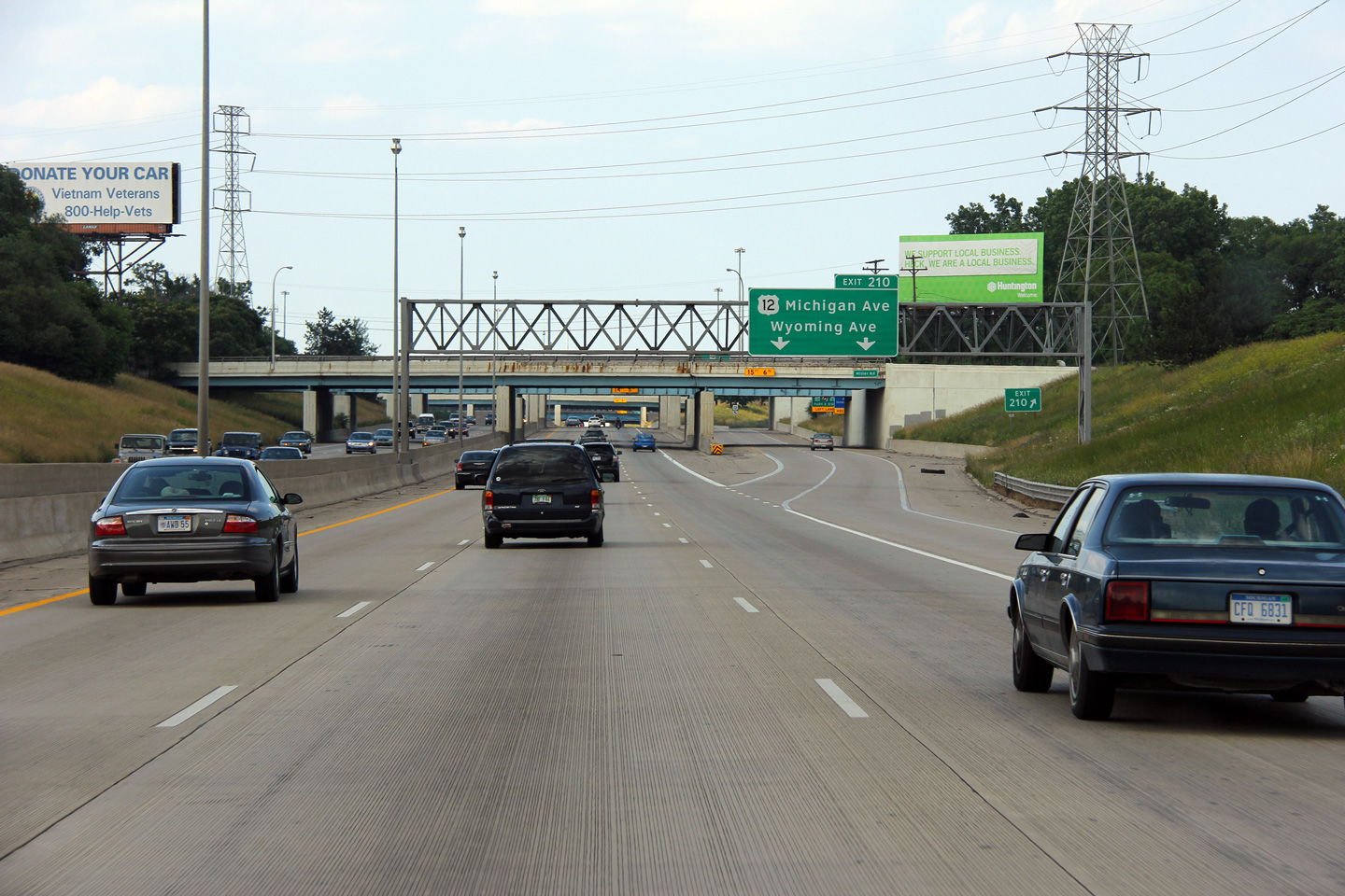
|
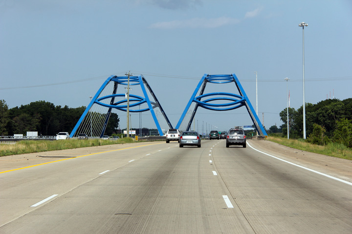
Wayne County |
Approaching the US-24 Gateway Tied Arch Bridge. MDOT writes (PDF) that "An additional challenge was making the new interchange aesthetically pleasing. The solution was to place a modified tied arch bridge instead of the traditional bridge. The modified tied arch bridge not only improves the aesthetics of the area, but it also helped to meet the under clearance requirement on US-24." |
 |
||
|
Date: 6/26/2011 |
High-res: (1440x960) (2400x1600) |
|||
|
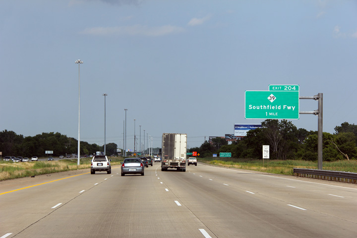
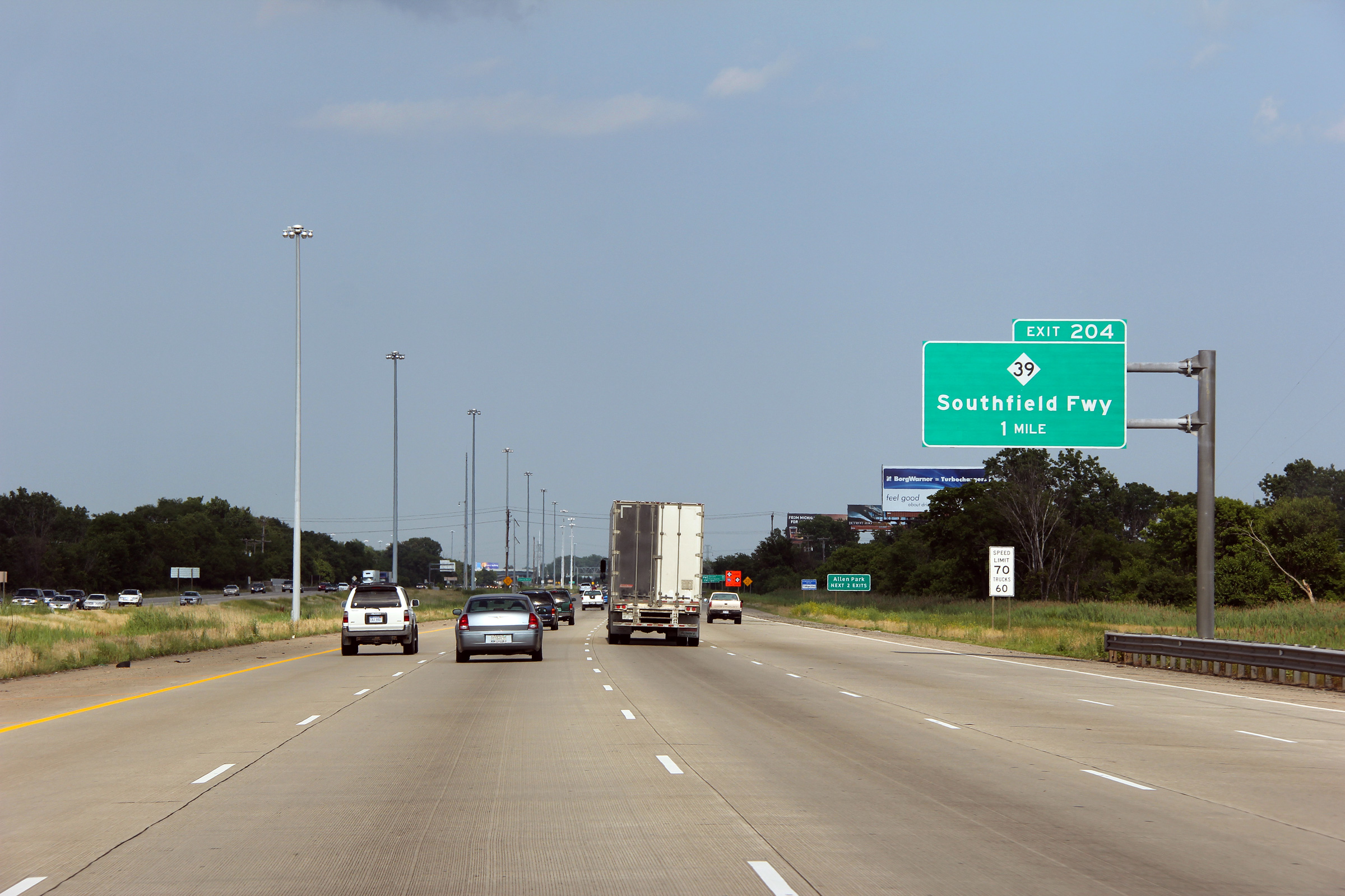
Wayne County |
Overhead 1 mile advance exit sign for M-39/Southfield Fwy. (Exit 204) on I-94 East. A two-lane on-ramp merges in with I-94 East from US 24/Telegraph Rd. These two lanes become one upon merging with the interstate becoming a fourth eastbound lane. |
 |
||
|
Date: 6/26/2011 |
High-res: (1440x960) (2400x1600) |
|||
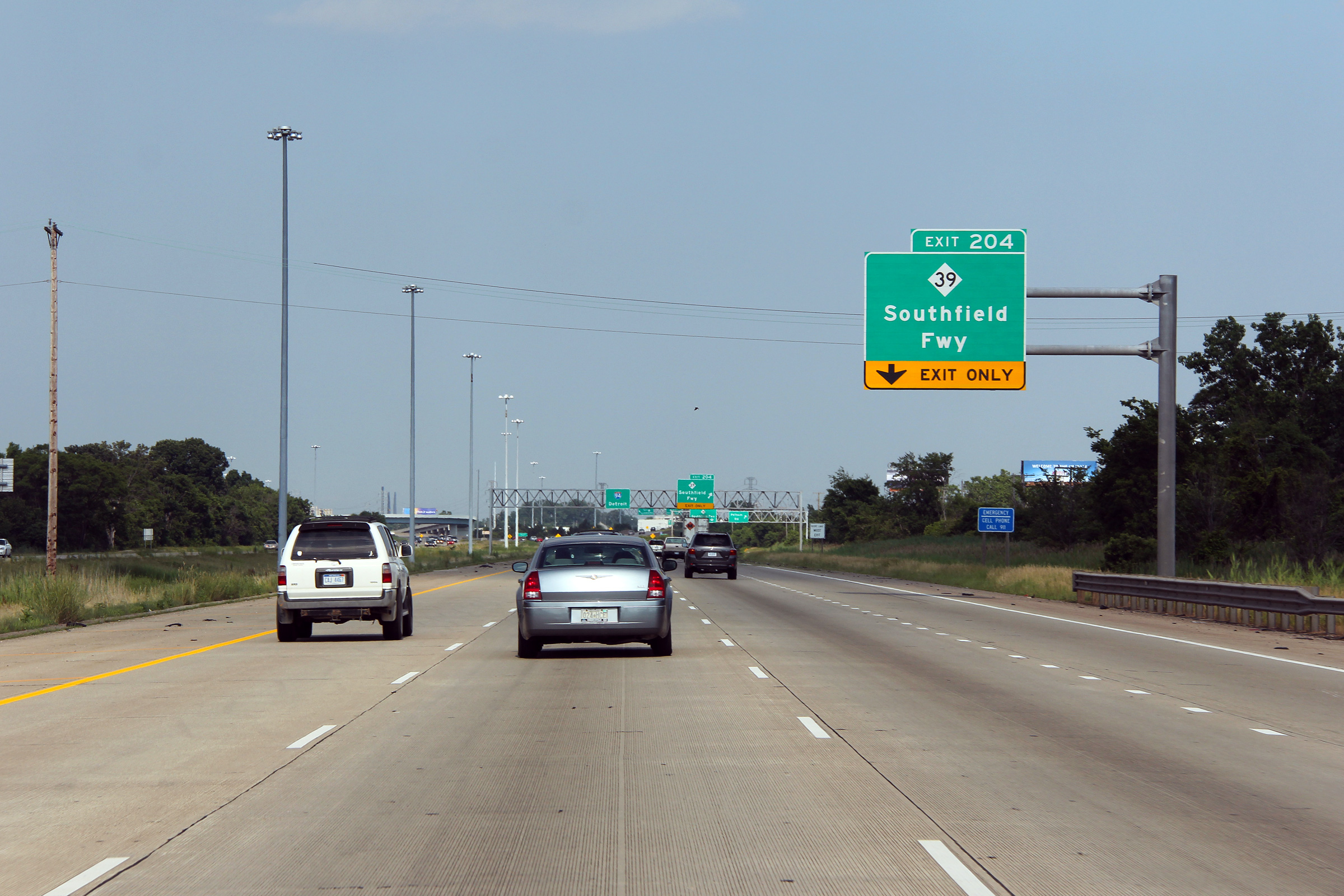
|
Wayne County |
Advanced signage for the Southfield Freeway. |
 |
||
|
Date: 6/26/2011 |
High-res: (1440x960) (2400x1600) |
|||
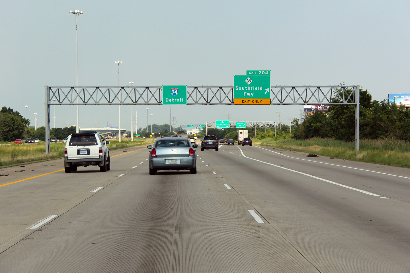
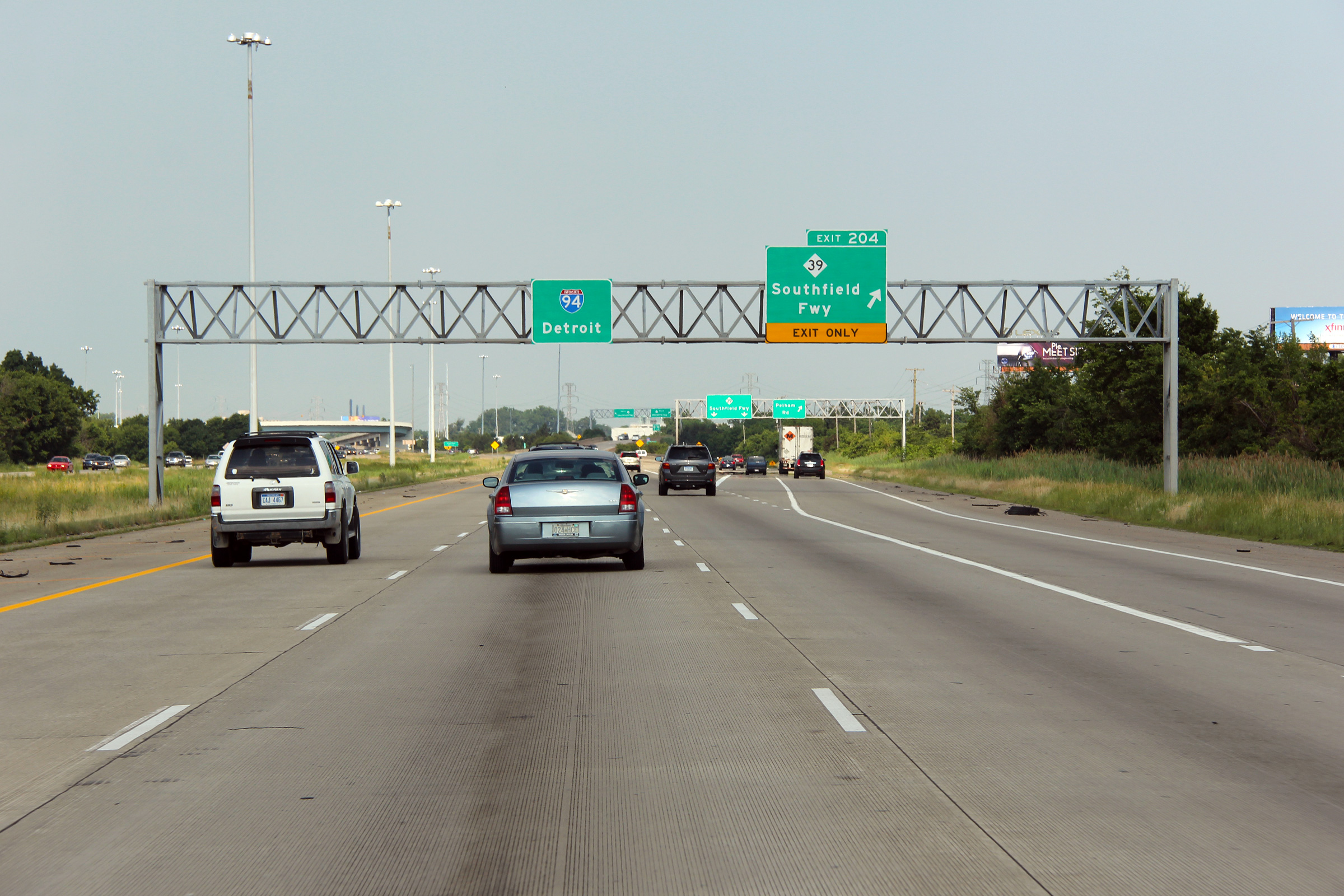
|
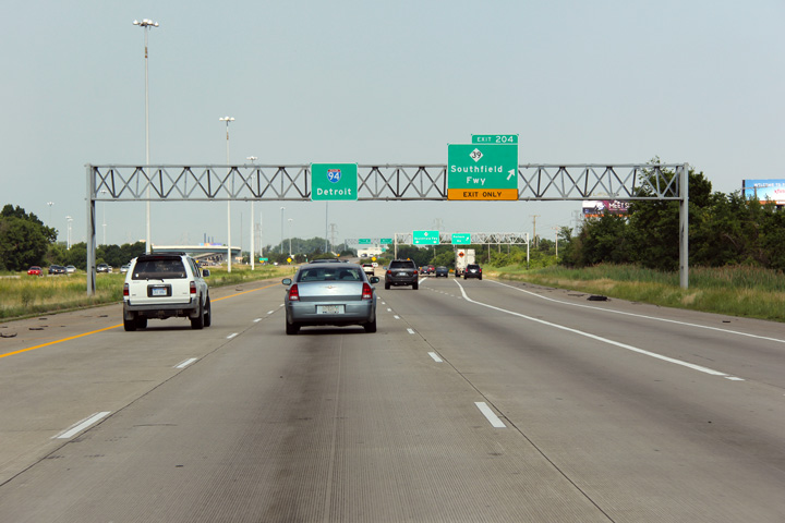
Wayne County |
I-94 guide sign and M-39/Southfield Fwy. exit sign (Exit 204). Pelham Rd. is also accessible from this interchange; however, as the previous picture shows, it is not noted on any of the I-94 East exit signs. Only an auxiliary guide sign denotes that Pelham Rd. can be reached via Exit 204. |
 |
||
|
Date: 6/26/2011 |
High-res: (1440x960) (2400x1600) | |||
|
Wayne County |
Easterly view approaching as the eastbound lanes of Interstate 94 pass beneath of the flyover from the Southbound Southfield Freeway to I-94 Eastbound. I am not sure that this photo completely captured the large scale of this flyover. The footprint of this interchange can be viewed on Google Maps. |
 |
||
|
Date: 6/26/2011 |
High-res: (1440x960) (2400x1600) |
|||
|
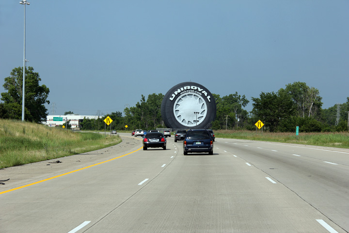
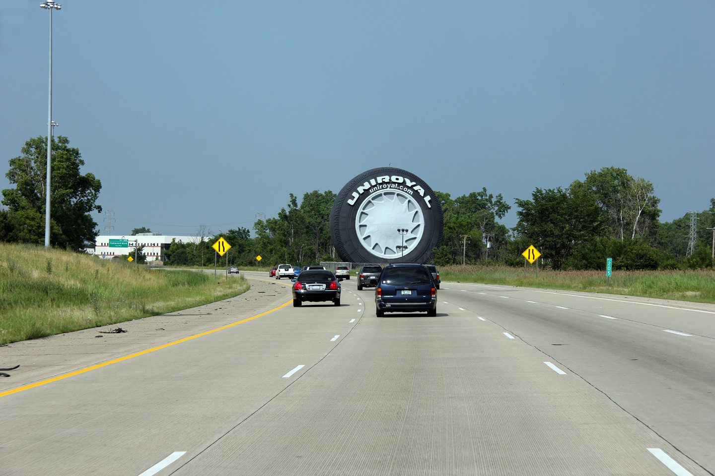
Wayne County |
The Uniroyal tire has stood for decades beside the eastbound lanes. The tire is a retired Ferris wheel that was used during the 1964-65 World's Fair in New York City. It has stood beside the eastbound lanes of I-94 in Detroit since 1965. It has been remodeled several times since it was originally placed. No city in North America is as proud of its motoring heritage as Detroit is -- Detroit is, after all, the Motor City. |
 |
||
|
Date: 6/26/2011 |
High-res: (1440x960) (2400x1600) |
|||
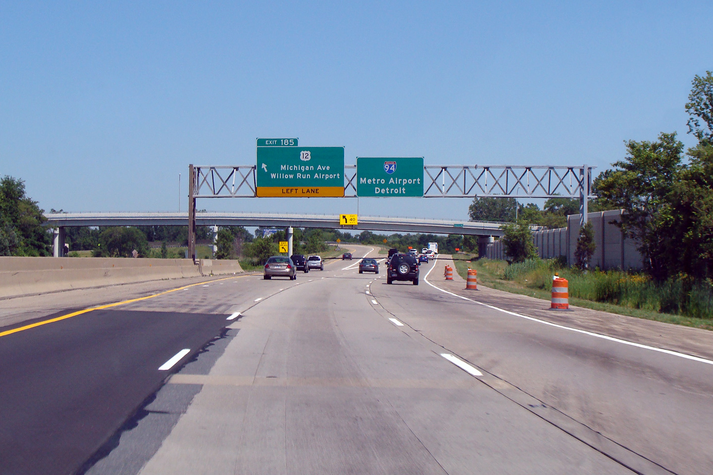
|
Wayne County |
Eastbound overhead signage for the approaching US-12 interchange. |
 |
||
|
Date: 6/26/2011 |
High-res: (1440x960) (2400x1600) |
|||
|
Continue east along I-94. Click here for Paw Paw to Albion images. |
||||
<- Page 3 Back to I-94 Index Page 5 ->
Michigan Highways Index
AsphaltPlanet.ca
© 2004-2012 Scott Steeves. AsphaltPlanet@asphaltplanet.ca
Page Created: June 7, 2007.
Last Updated: February 28, 2012.