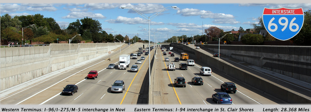
AsphaltPlanet.ca > Michigan > Interstate 696
Pictures on this page are arranged in order from west to east. I-696 East photos are left-aligned in the last column, while I-696 West photos are right-aligned. Center-line pictures are centered within the last column.
|
Location |
Description |
Photo |
||
|
East- |
West- |
|||
|
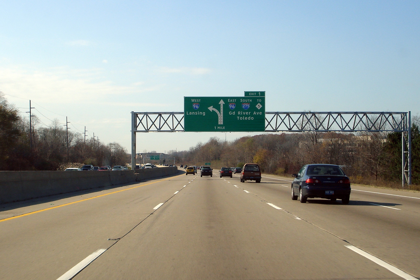
Oakland County |
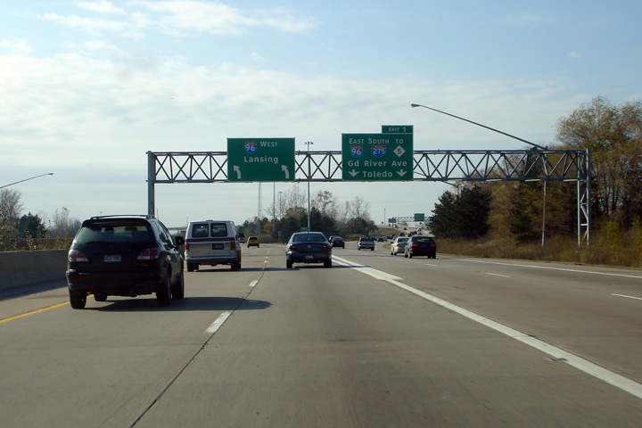
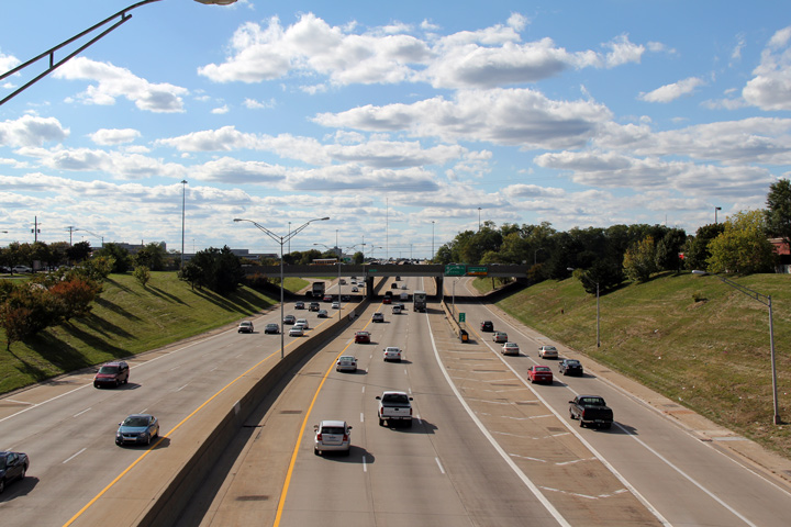
Guide signage at the western end of Interstate 696. The through lanes of I-696 default for Intestate 96 West, which is bound towards Lansing. The I-96/I-275/I-696/M-5 interchange is far and away the largest interchange complex in Michigan. Five distinct freeway routes converge at this location in Novi. |
 |
||
|
Date: 11/05/2006 |
||||
|
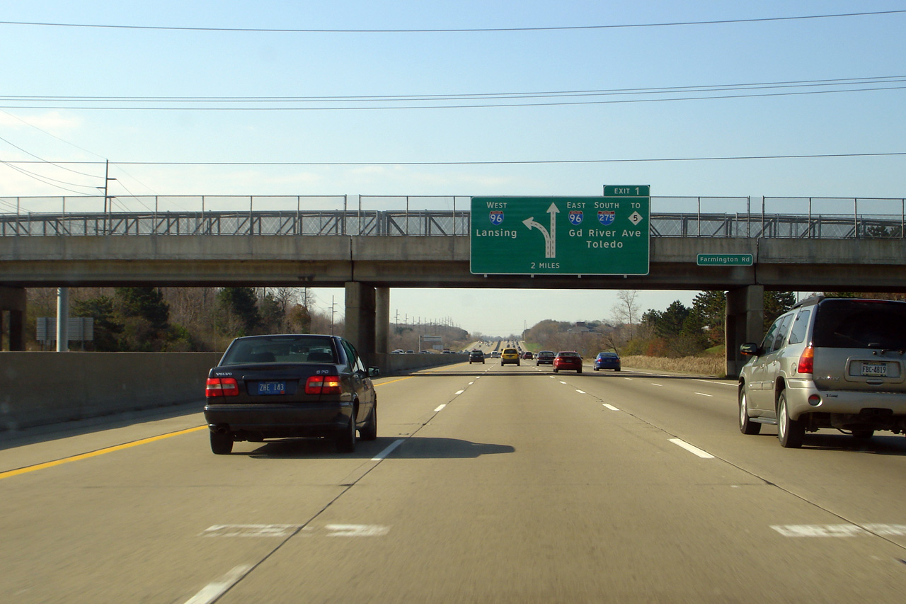
Oakland County |
I mile advanced signage outlining the western terminus of Interstate 696. |
 |
||
|
Date: 11/05/2006 |
||||
|
Oakland County |
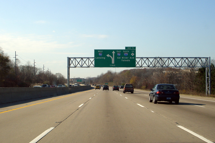
The two mile advanced signage for the western terminus of Interstate 696 looks remarkably similar to the one mile advanced sign. |
 |
||
|
Date: 11/05/2006 |
||||
|
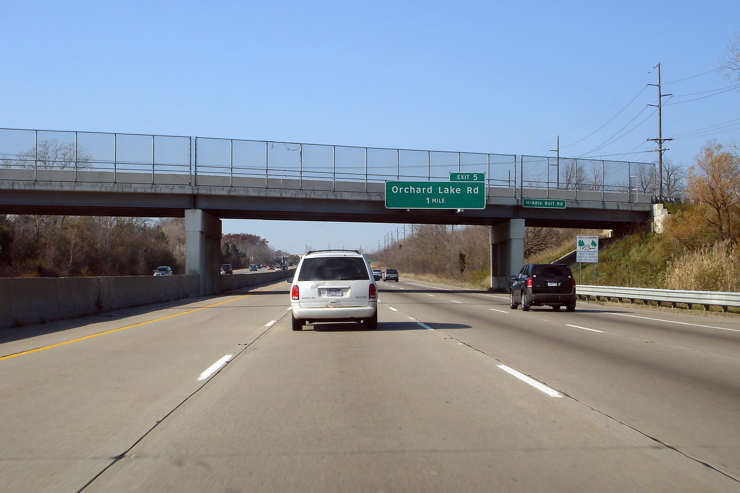
Oakland County |
Overhead advanced signage affixed to the Middle Belt Road overpass, in advance of the Orchard Lake Road overpass. Orchard Lake Road is the first interchange east of I-96 on Interstate 696. |
 |
||
|
Date: 11/05/2006 |
||||
|
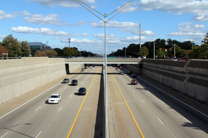
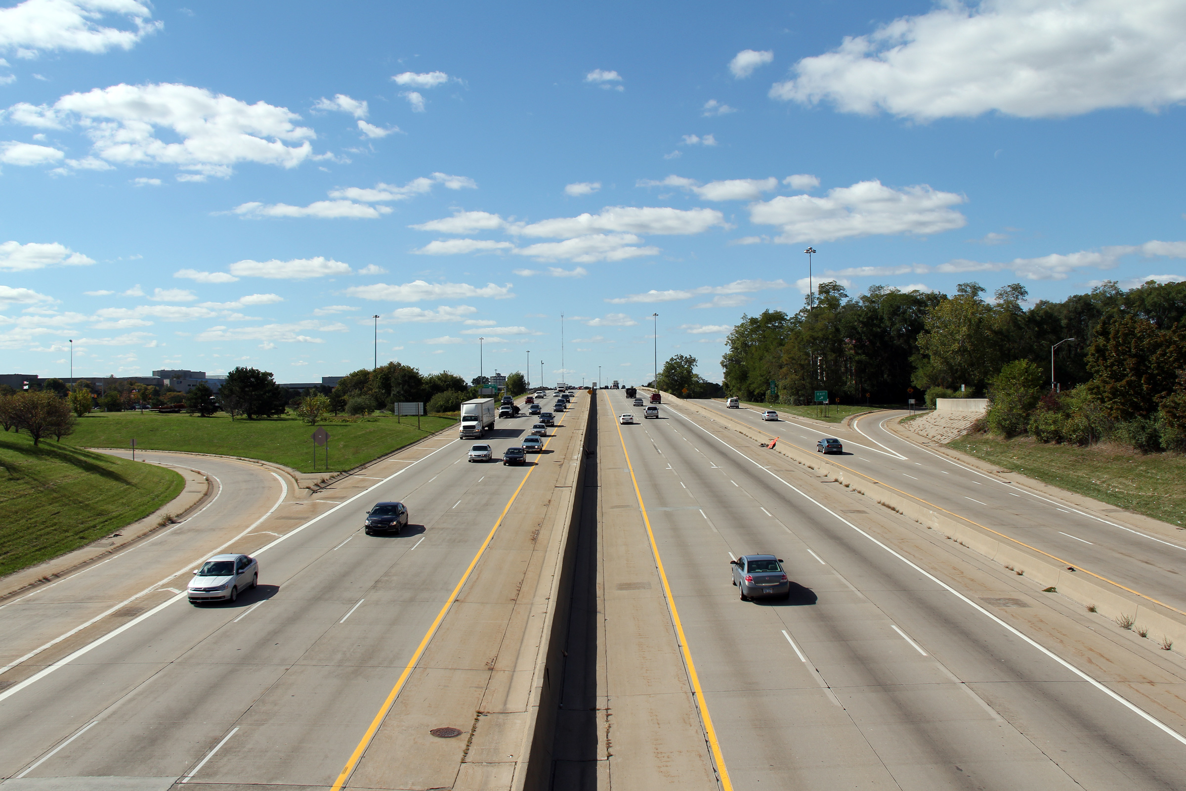
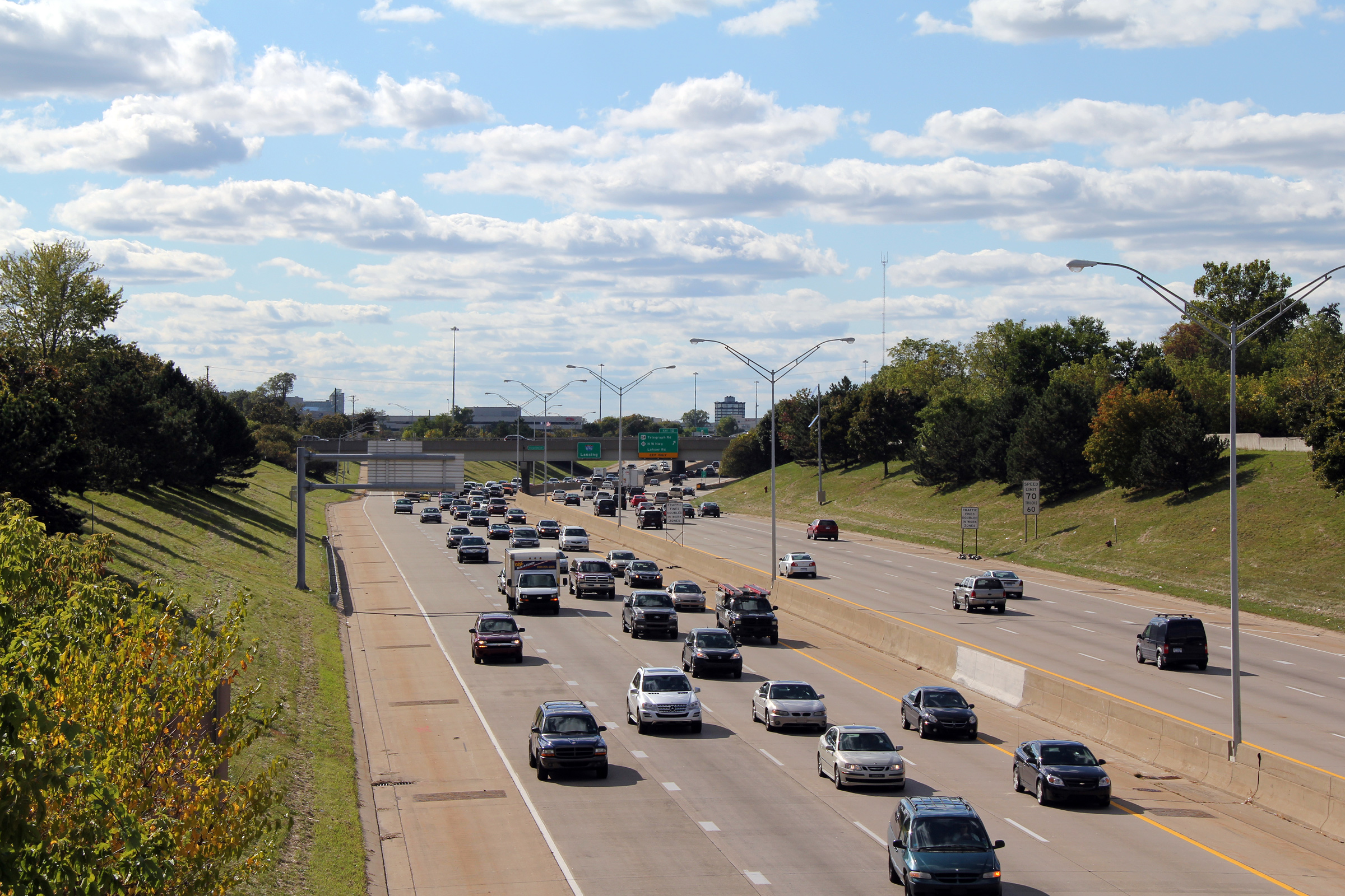
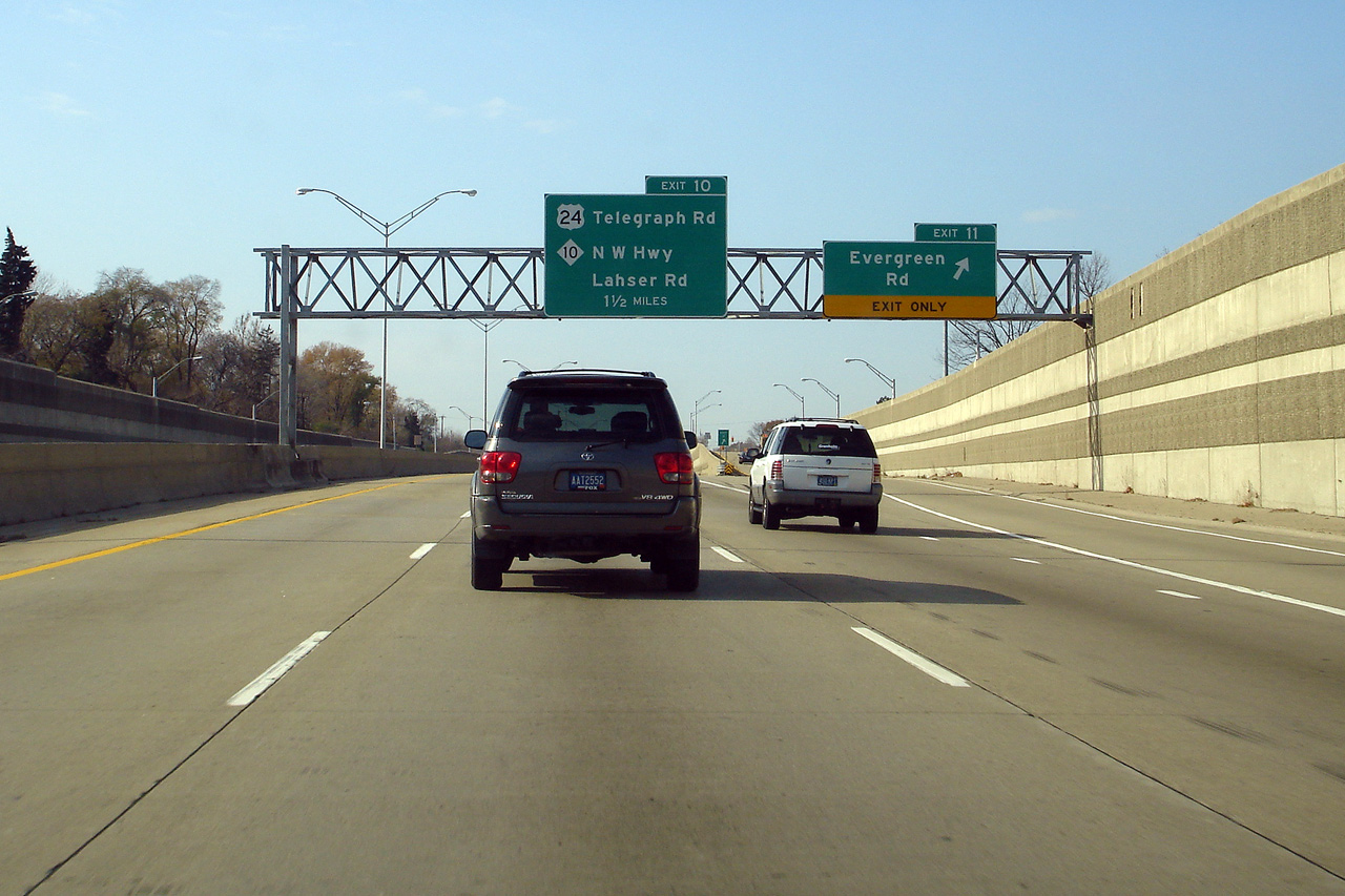
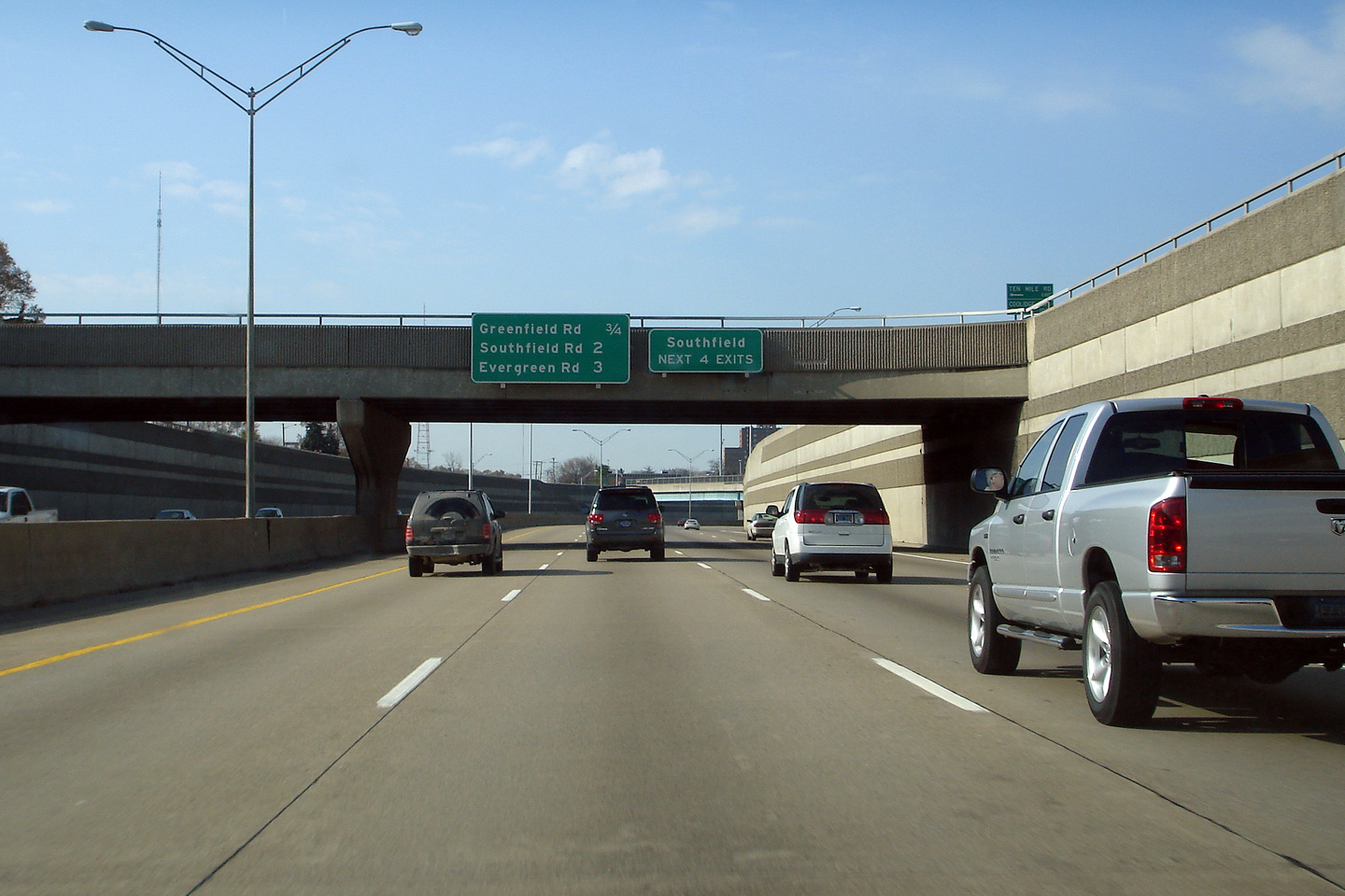
Oakland County |
Westerly view from the Lasher Road overpass in Southfield. Immediately west of Southfield Road, I-696 intersects with both the M-10 Freeway and US-24. M-10 runs generally in the same direction as I-696 and straddles I-696 almost as a set of collector lanes for almost a mile where both freeways intersect with US-24. |
 |
||
|
Date: 10/01/2010 |
High-res: (1440x960) (2400x1600) | |||
|
Oakland County |
Westerly view from Corporate Drive overpass. The westbound ramp to Lasher Road Telegraph Road and the Northwestern Highway departs from Interstate 696 under the Corporate Drive overpass. |
 |
||
|
Date: 10/01/2010 |
High-res: (1440x960) (2400x1600) | |||
|
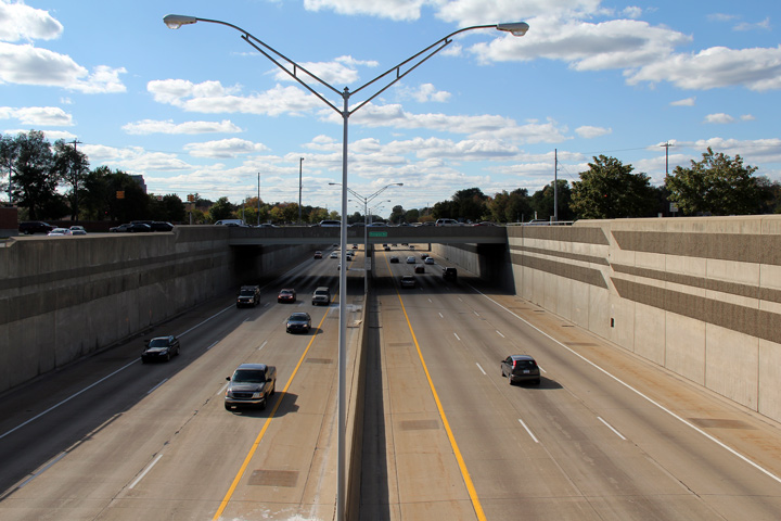
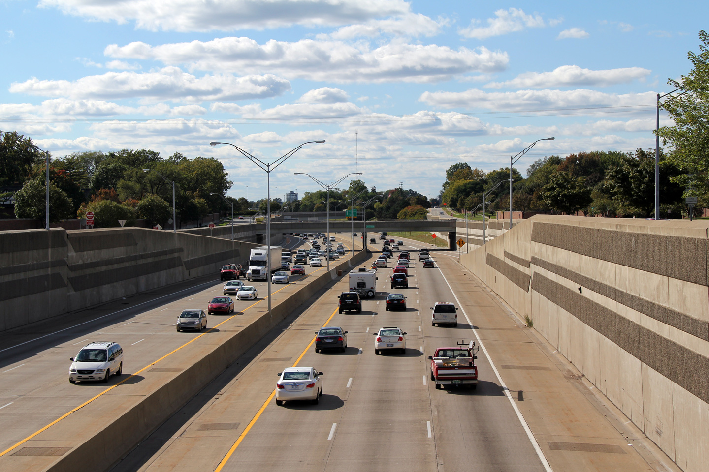
Oakland County |
Easterly view from the Corporate Drive overpass. The six lane cross-section of Interstate 696 through Southfield is atypical of the freeway. Most sections of I-696 were built to an eight lane cross-section. MDOT Engineers must have anticipated that freeway volumes would be lighter through Southfield because of the nearby Lodge Freeway. |
 |
||
|
Date: 10/01/2010 |
High-res: (1440x960) (2400x1600) | |||
|
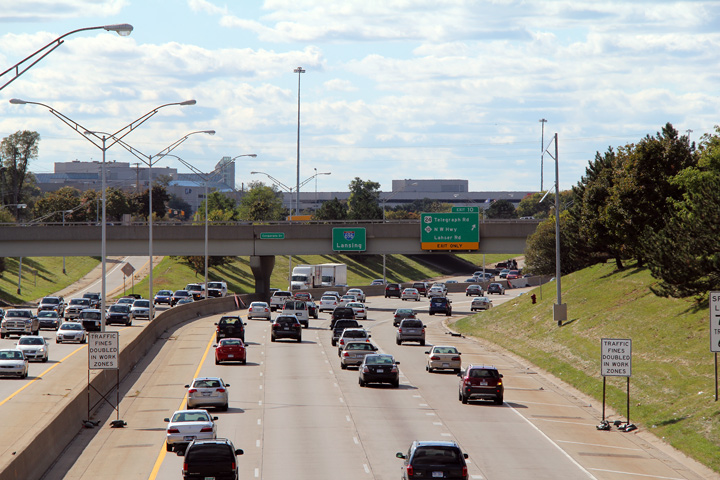
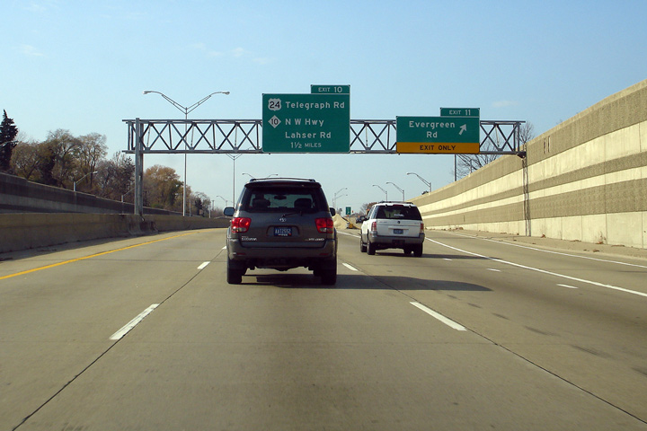
Oakland County |
Guide signage for the ramp to US-24 and M-10 shot from the top of the Eleven Mile Road overpass. |
 |
||
|
Date: 10/01/2010 |
High-res: (1440x960) (2400x1600) | |||
|
Oakland County |
Westerly view from the Eastbound 11 Mile Road overpass. |
 |
||
|
Date: 10/01/2010 |
High-res: (1440x960) (2400x1600) | |||
|
Oakland County |
Westerly view from Devonshire Street overpass. Interstate 696 emerges from its trench just west of the Devonshire Street overpass . |
 |
||
|
Date: 10/01/2010 |
High-res: (1440x960) (2400x1600) | |||
|
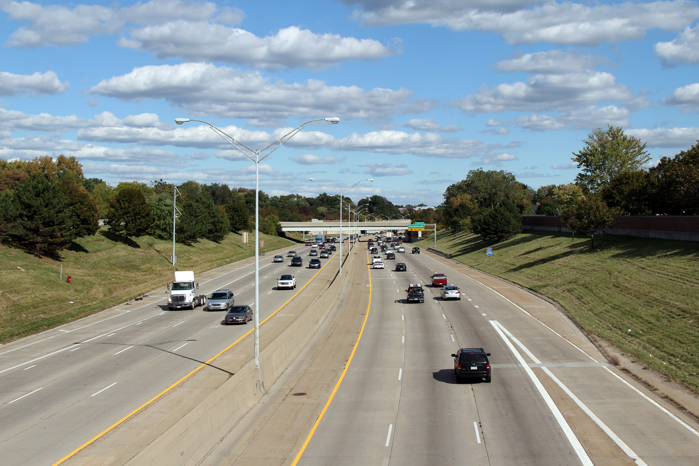
Oakland County |
Opposing view from the Devonshire Street overpass towards the Evergreen Road interchange. |
 |
||
|
Date: 10/01/2010 |
High-res: (1440x960) (2400x1600) | |||
|
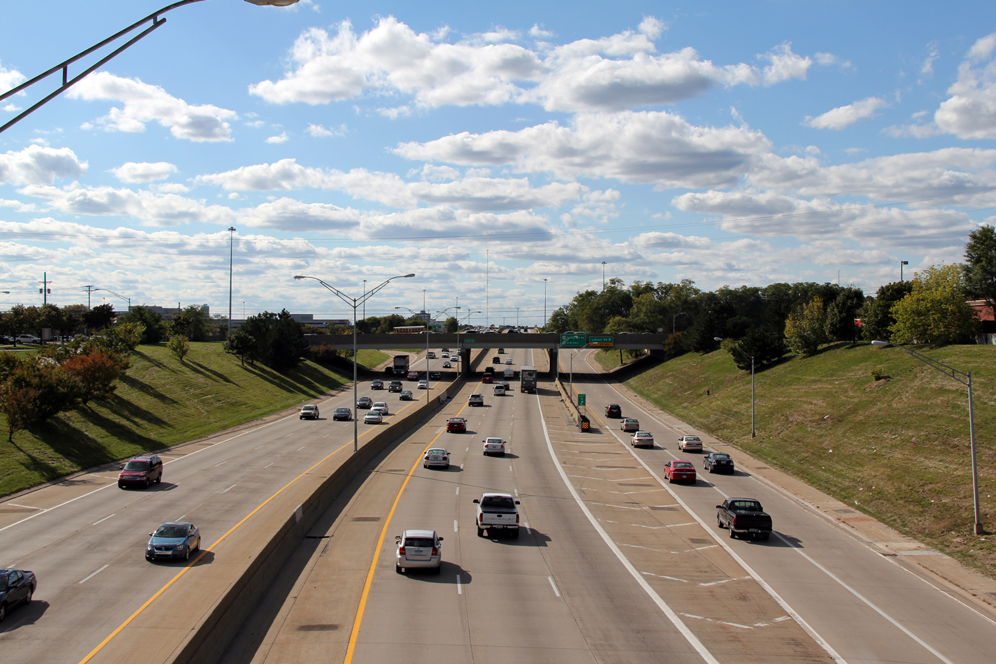
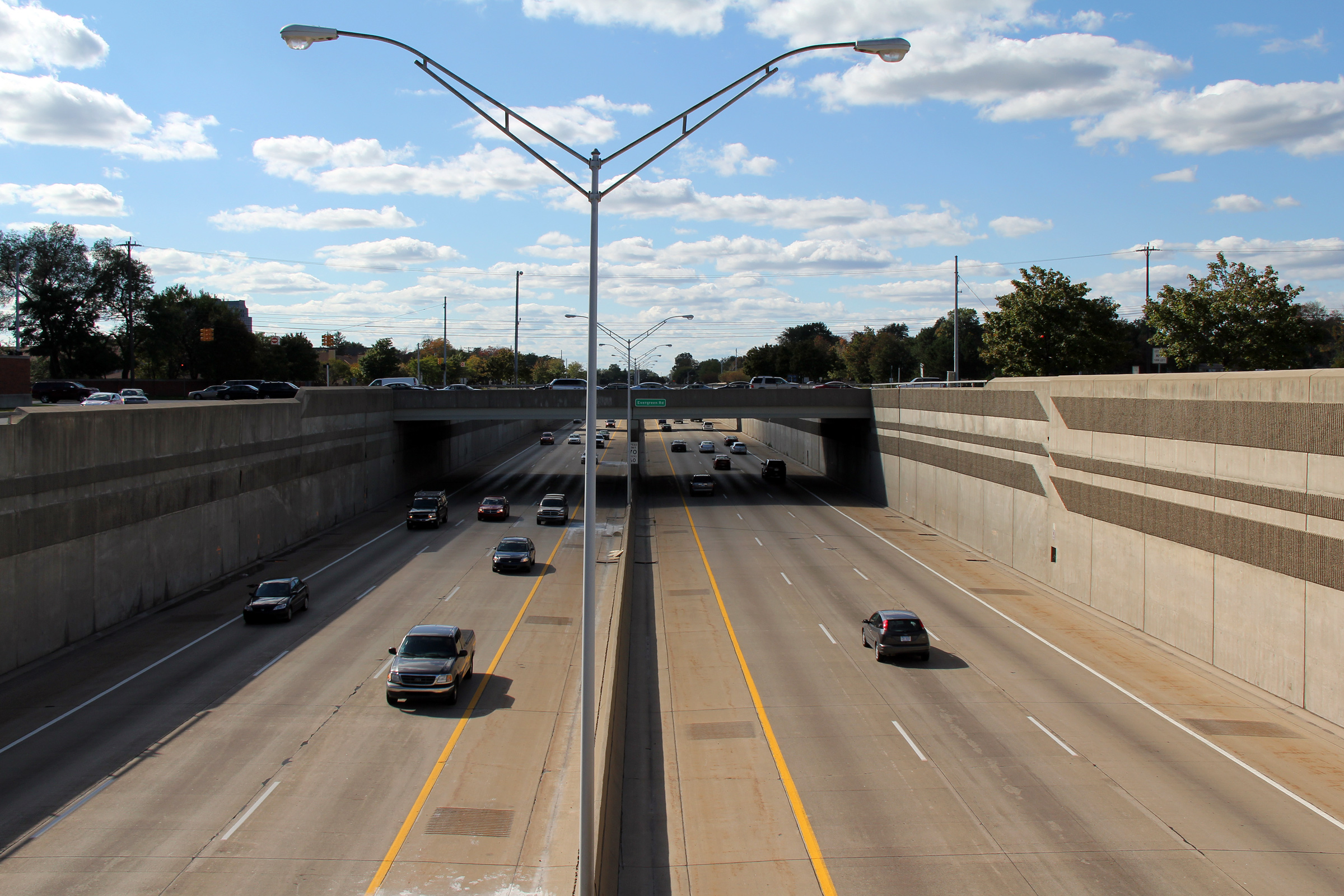
Oakland County |
Westerly view from the western Evergreen Road turnaround towards the Devonshire Street overpass. The near symmetrical on- and off-ramps that straddle the through lanes of Interstate 696 gives the depressed highway a streamlined appearance. |
 |
||
|
Date: 10/01/2010 |
High-res: (1440x960) (2400x1600) | |||
|
Oakland County |
Easterly view from the western Evergreen Road turnaround towards Evergreen Road itself. |
 |
||
|
Date: 10/01/2010 |
High-res: (1440x960) (2400x1600) | |||
|
Oakland County |
Westerly view from the Evergreen Road turnaround towards the Evergreen Road overpass. Note the decorative etching that has been installed along the retaining walls along the 696 Freeway. This type of decorative concrete work is common to several of Michigan's more recently constructed freeways, however is best executed along the 696 Freeway. |
 |
||
|
Date: 10/01/2010 |
High-res: (1440x960) (2400x1600) | |||
|
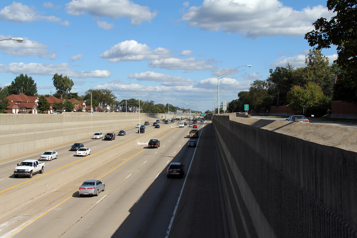
Oakland County |
Easterly view from the same eastern Evergreen Road turnaround as shown in the previous photo. Through much of the City of Southfield, Interstate 696 is straddled by 11 Mile Road as a service road. Service road's are quite common along-side freeways in South-eastern Michigan. |
 |
||
|
Date: 10/01/2010 |
High-res: (1440x960) (2400x1600) | |||
|
Oakland County |
Westbound overhead guide signage at the ramp to Evergreen Road. Southfield's Civic Centre Complex is located along Evergreen Road, just south of the Reuther Freeway, and north of the Lodge Freeway. |
 |
||
|
Date: 11/05/2006 |
||||
|
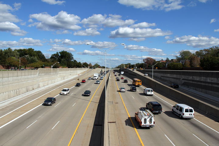
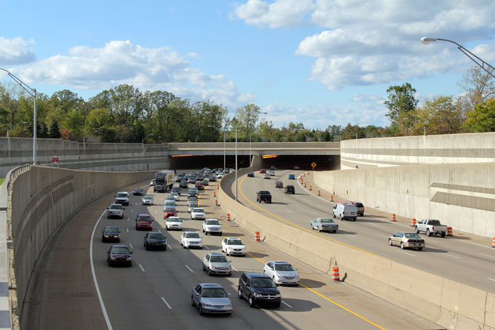
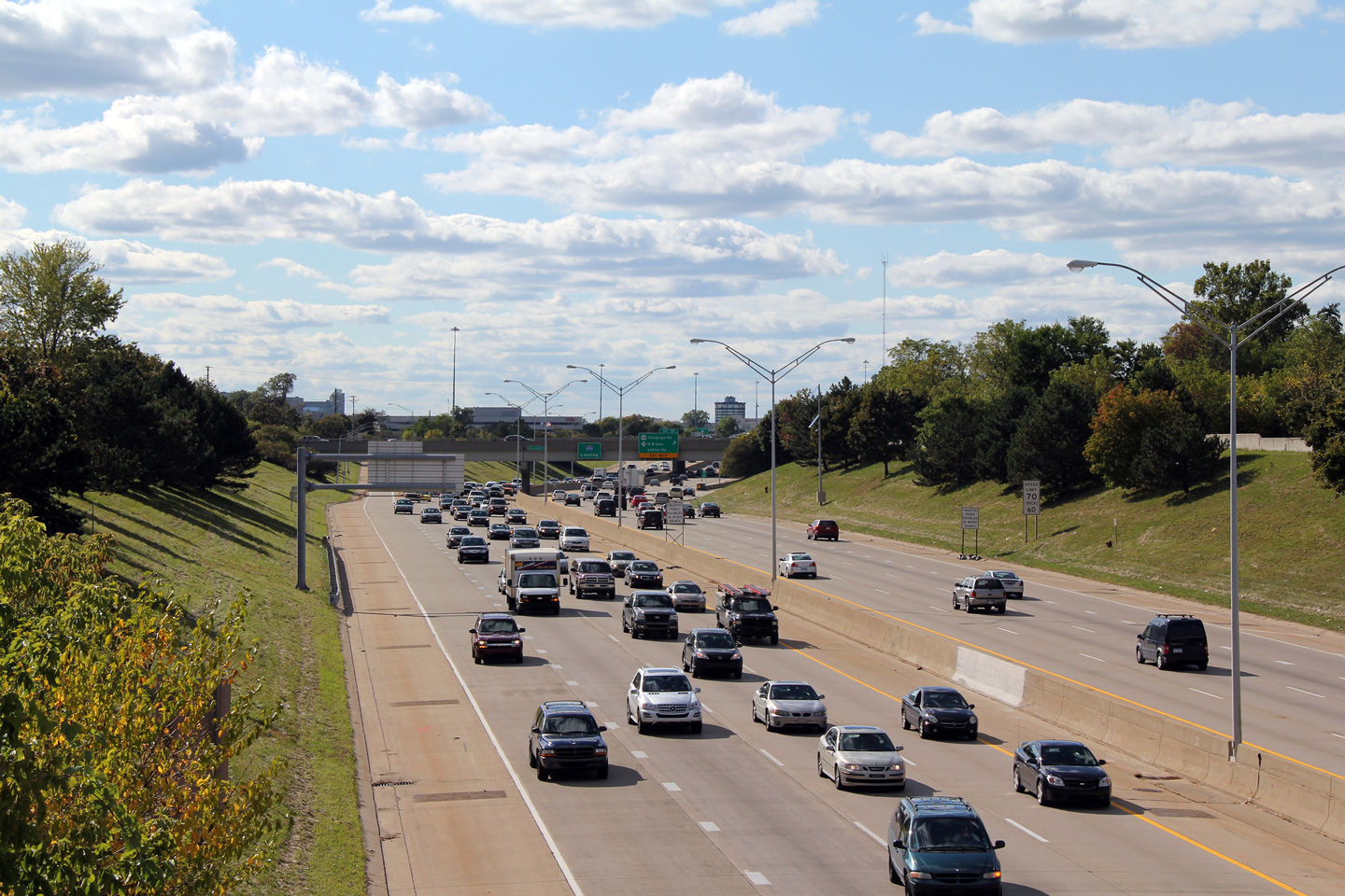
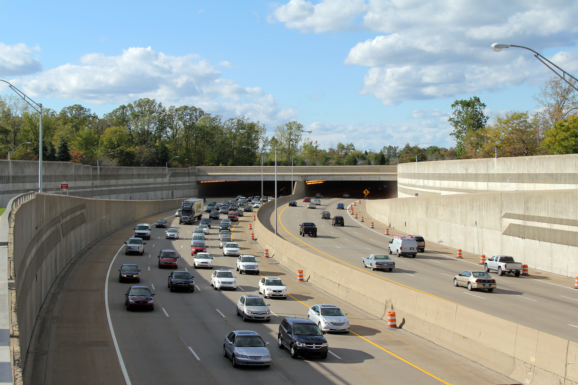
Oakland County |
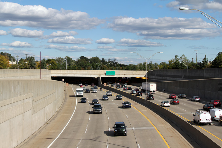
This view looks westerly from the western Greenfield Road turnaround. I-696 finds itself in a short tunnel that runs under Freeway Park west of Greenfield Road. The heavy traffic that is pictured in the eastbound lanes is atypical of I-696 (though this photo was taken near rush hour). The Reuther Freeway is often colloqually dubbed "Michigan's Autobahn". |
 |
||
|
Date: 10/01/2010 |
High-res: (1440x960) (2400x1600) | |||
|
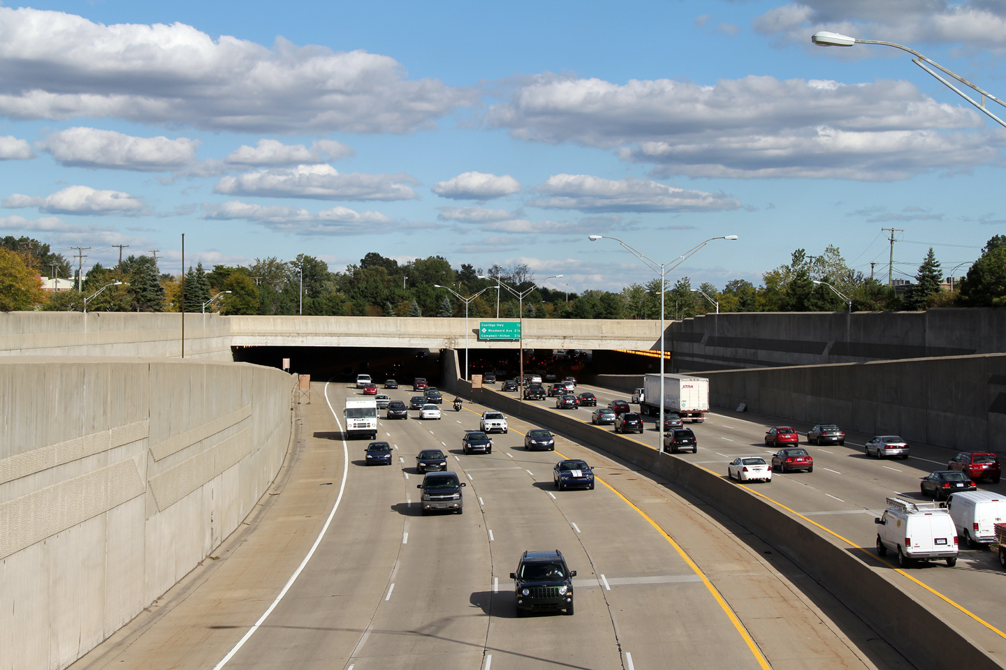
Oakland County |
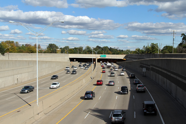
Two views looking easterly from the easterly Greenfield Road turnaround as Interstate 696 heads for a brief tunnel section. The tunnels along 696 were constructed to minimize the psychological barrier that a freeway creates as it divides a community. The tunnels were constructed via cut and cover methods, and appear from the underneath to be a fairly simple concrete slab on beam design. Interstate 696 is far and away Michigan's most elaborate freeway. |
 |
||
| High-res: (1440x960) (2400x1600) | ||||
 |
||||
|
Date: 10/01/2010 |
High-res: (1440x960) (2400x1600) | |||
|
Oakland County |
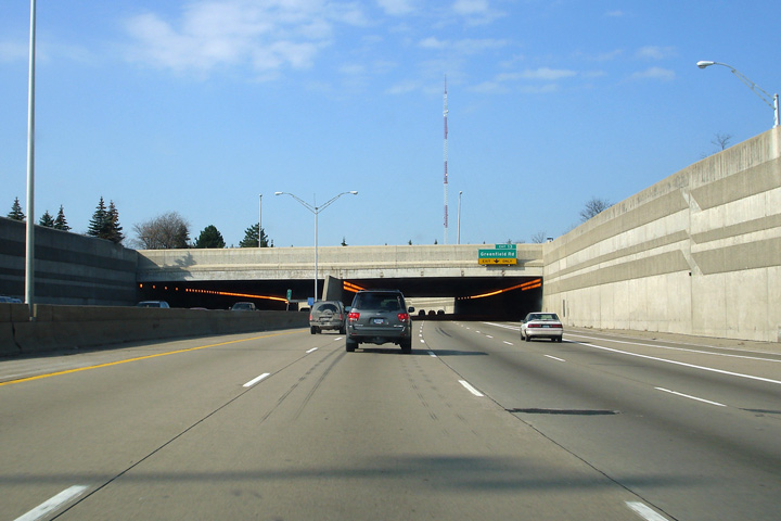
Approaching the same tunnel as is included in the previous photos from the westbound lanes of the Reuther Freeway. The ramp to Greenfield Road departs the freeway quite quickly at the western end of this short tunnel segment. |
 |
||
|
Date: 11/05/2006 |
||||
|
Oakland County |
Next exit signage as interstate 696 nears the entrance to the City of Southfield from the east. Notice the attention to detail that was placed into embossing the embankment walls and facade of the overpass. Interstate 696 is proof that concrete can indeed be beautiful. |
 |
||
|
Date: 11/05/2006 |
||||
|
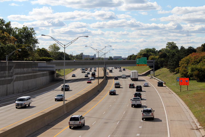
Oakland County |
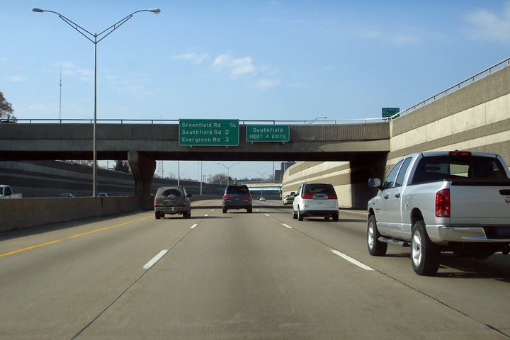
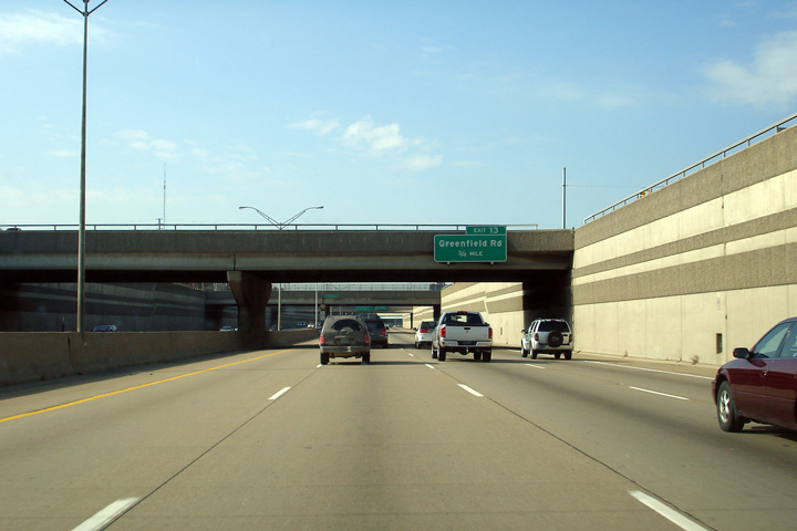
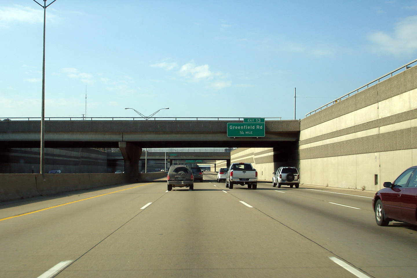
Advanced signage for the Greenfield Road interchange. |
 |
||
|
Date: 11/05/2006 |
||||
|
Oakland County |
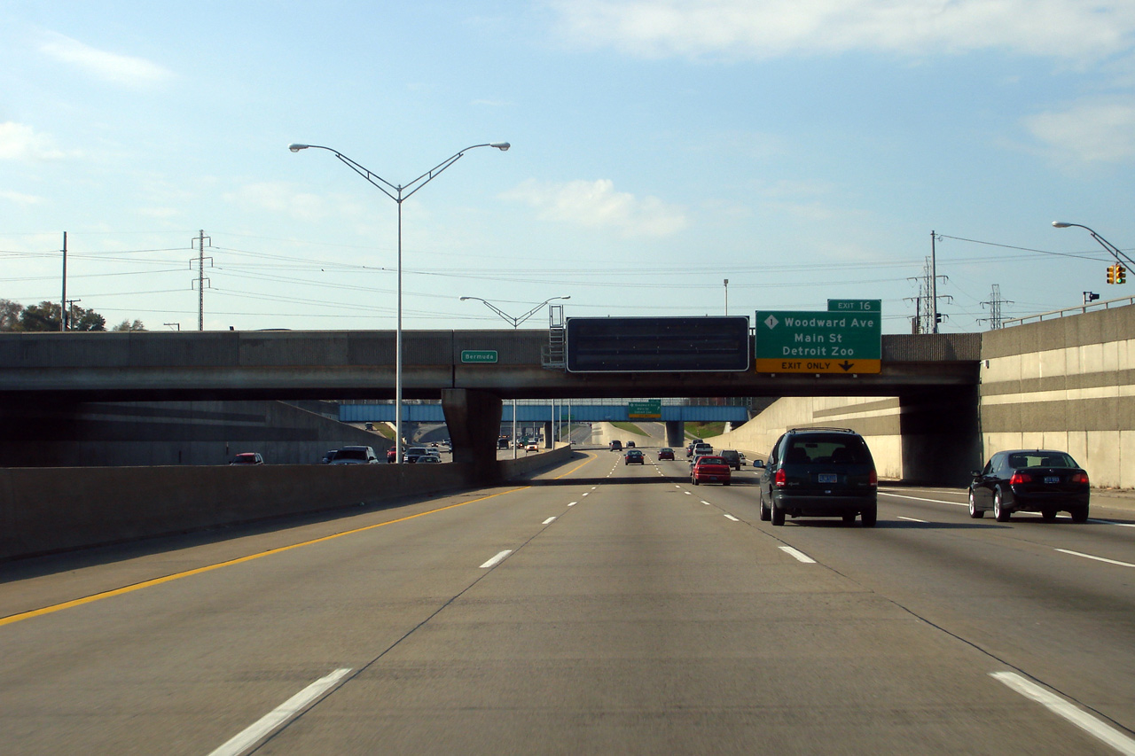
Overhead signage in advance of the Woodward Avenue interchange affixed to the Bermuda overpass along westbound I-696. Woodward Avenue is Detroit's historic main street, and stretches from Downtown Detroit, radiating northwesterly through to Pontiac. While today, Woodward Avenue carries the M-1 designation, historically US-10 was routed along Woodward Avenue. At the height of its length, US-10 was a long highway that stretched from Seattle, Washington on the Pacific Ocean, to the foot of the Detroit-Windsor Tunnel in Downtown Detroit. |
 |
||
|
Date: 11/05/2006 |
||||
|
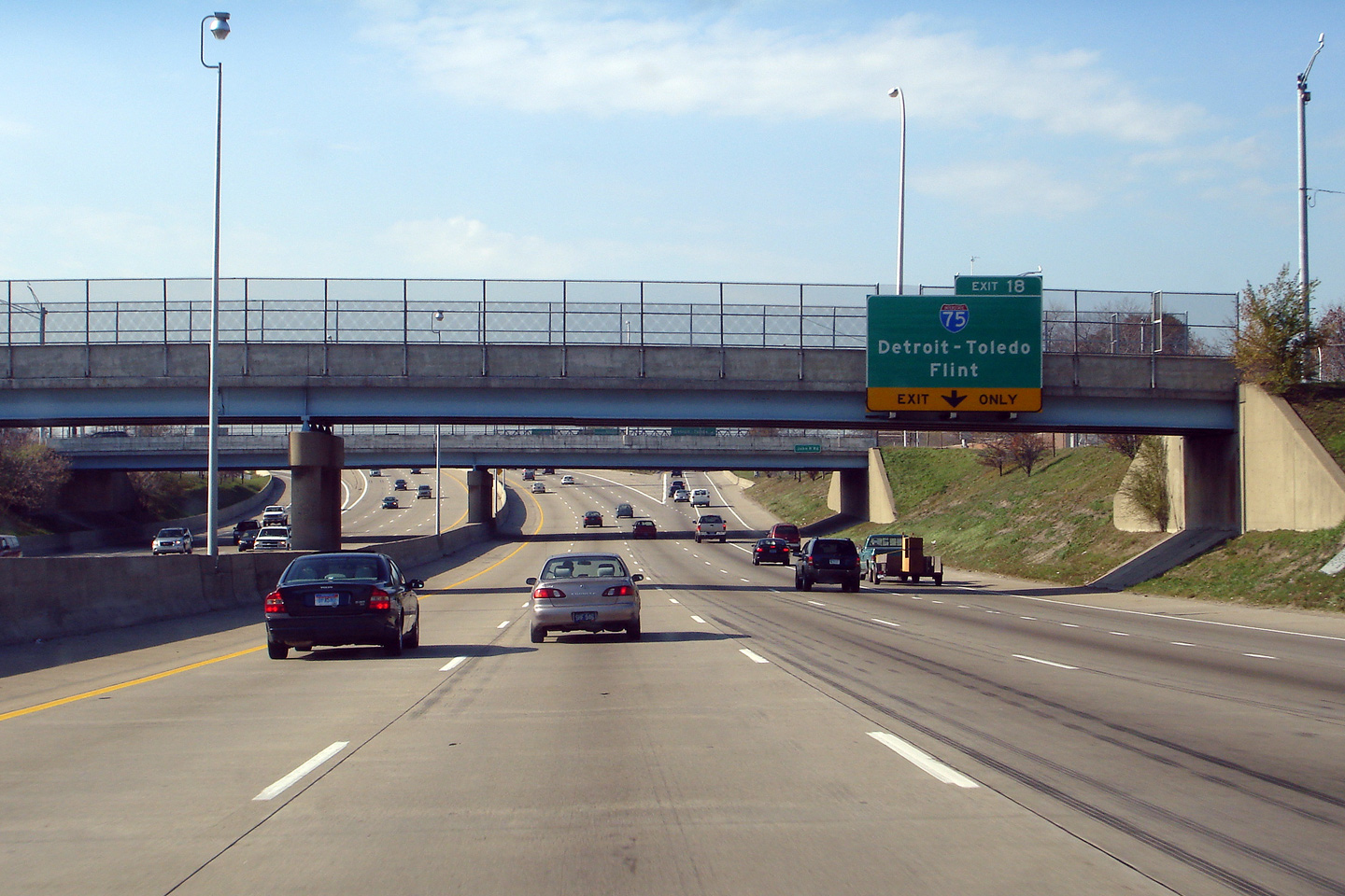
Oakland County |
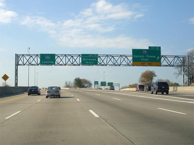
Overhead signage at the westbound off-ramp to I-75. Interstate 696 meets I-75 at one of two full directional stack interchanges along Interstate 696. (The second directional stack being at Mound Road). |
 |
||
|
Date: 11/05/2006 |
||||
|
Oakland County |
Advanced signage for the westbound off-ramp to Interstate 75. |
 |
||
|
Date: 11/05/2006 |
||||
|
Oakland County |
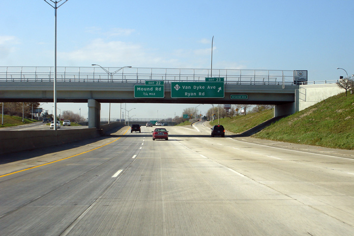
Overhead signage for the M-53 interchange affixed to the Arsenal Avenue overpass. M-53 follows the alignment of Van Dyke Avenue for virtually the highways entire length from Metro Detroit northerly through to the thumb. According to Chris Bessert's Michigan Highways website, MDOT proposed to change the alignment of M-53 from Van Dyke to Mound Road, and upgrade the Mound Road corridor to a freeway. This would explain why Mound Road meets Interstate 696 at a full diamond stack interchange. |
 |
||
|
Date: 11/05/2006 |
||||
|
Oakland County |
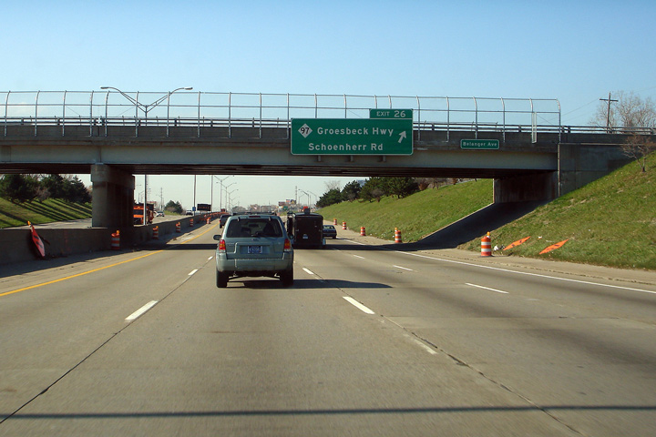
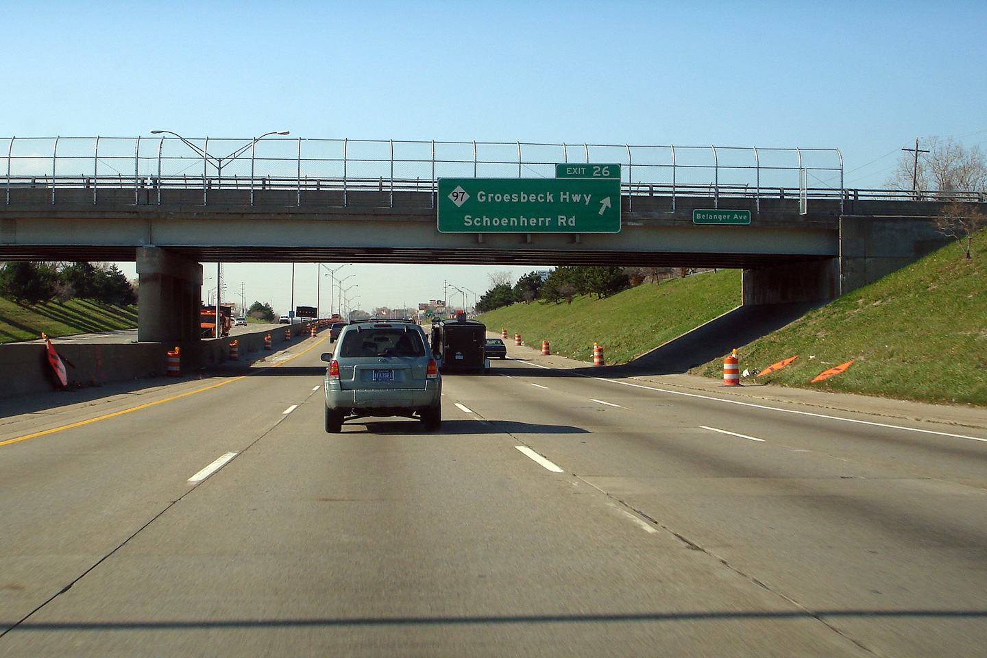
Overhead advanced signage for M-97 affixed to the Belanger Road overpass. M-97 is a short highway that runs exclusively through Suburban Detroit. M-97 roughly parallels Gratiot Street for the highways entire length; in fact the Groesbeck Highway (M-97) was constructed in the 1920s and 1930s (before the age of the super highway) to relieve congestion from Gratiot Avenue (which was at that time US-25). |
 |
||
|
Date: 11/05/2006 |
||||
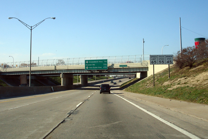
|
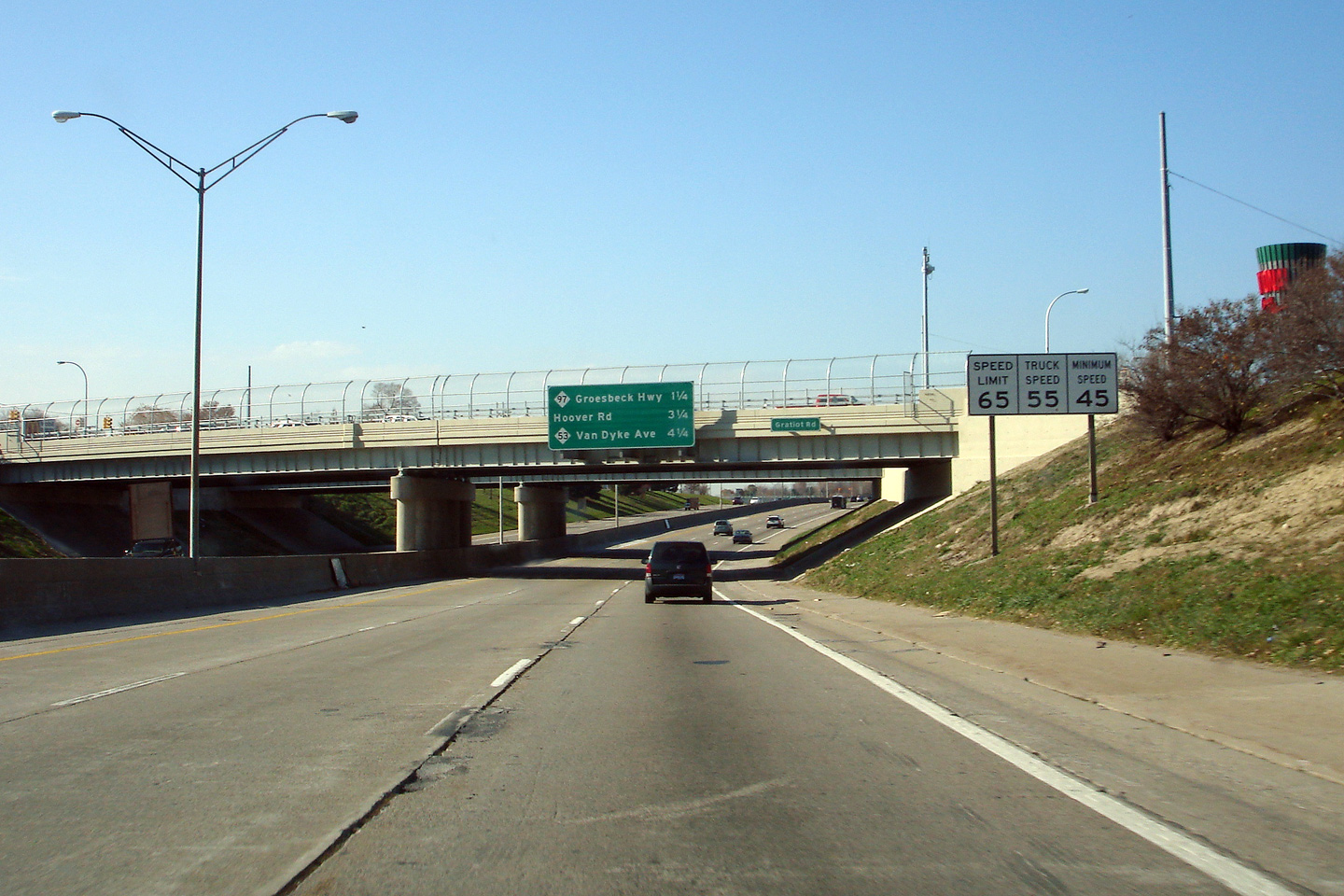
Oakland County |
Next exit signage for the Groesbeck Highway, Hoover Road, and Van Dyke Ave. Notice the speed limit sign that is pictured, this photograph was taken days before Michigan raised its maximum speed limit from 65 MPH to 70 MPH. Likewise the minimum freeway speed was raised from 45 MPH to 55 MPH. As of Fall 2010, the speed limit along Interstate 696 is 70 MPH for the entire length of the interstate. |
 |
||
|
Date: 11/05/2006 |
||||
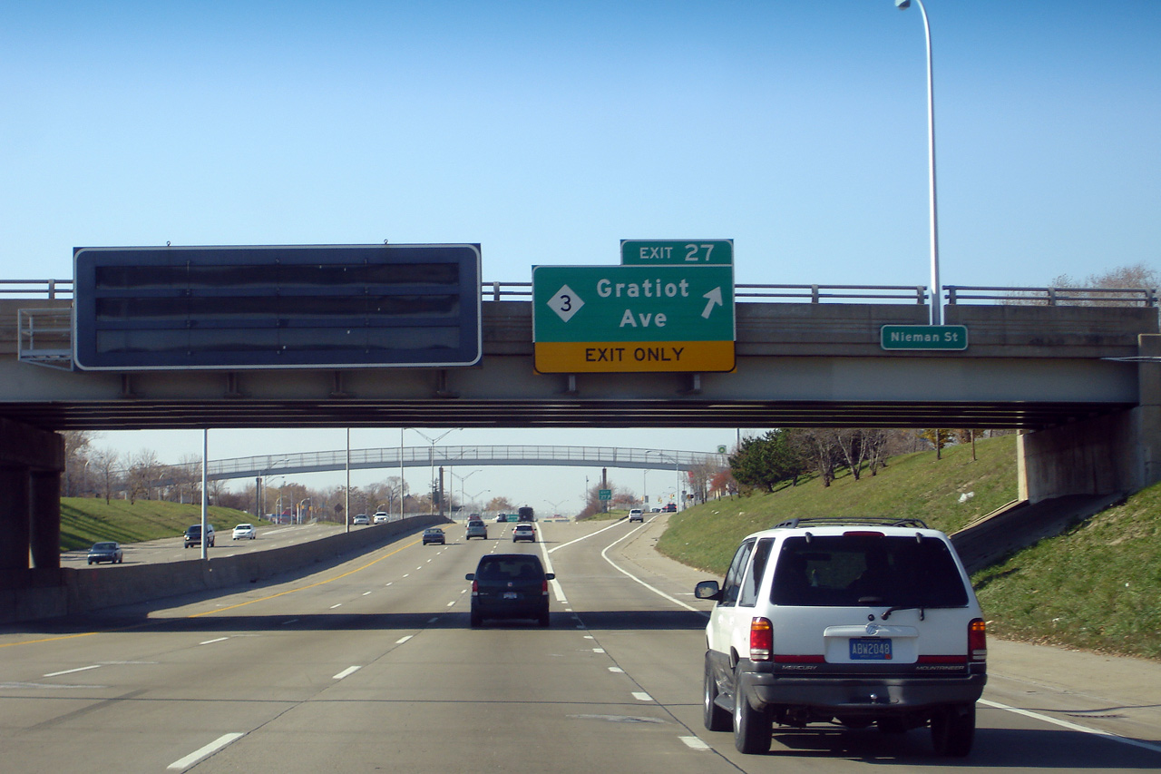
|
Oakland County |
Overhead signage in advance of the Gratiot Ave interchange. Gratiot Ave is one of Metro Detroit's most predominant arterial streets. Before the interstate age, Gratiot was the principal arterial highway between Detroit and Port Huron. Prior to 1973, Gratiot Avenue was designated as US-Highway 25. Until the 1970s, all five of grand boulevards, planned by Judge Augustus Woodward that radiated away from Detroit were designated as US highways. |
 |
||
|
Date: 11/05/2006 |
||||
<- I-675
MI Highways
AsphaltPlanet.ca
© 2010 AsphaltPlanet.ca.
AsphaltPlanet@asphaltplanet.ca
Page Created: December 3, 2010.
Last Updated: December 3, 2010.