AsphaltPlanet.ca > California > SR-54
Pictures on this page are arranged in order from west to east. CA-54 East photos are left-aligned in the last column, while CA-54 West photos are right-aligned. Center-line pictures are centered within the last column.
|
Location |
Description |
Photo |
||
|
East- |
West- |
|||
| Interstate 5 is the principle north-south interstate along the US West Coast. Click here for Interstate 5 Images. | ||||
|
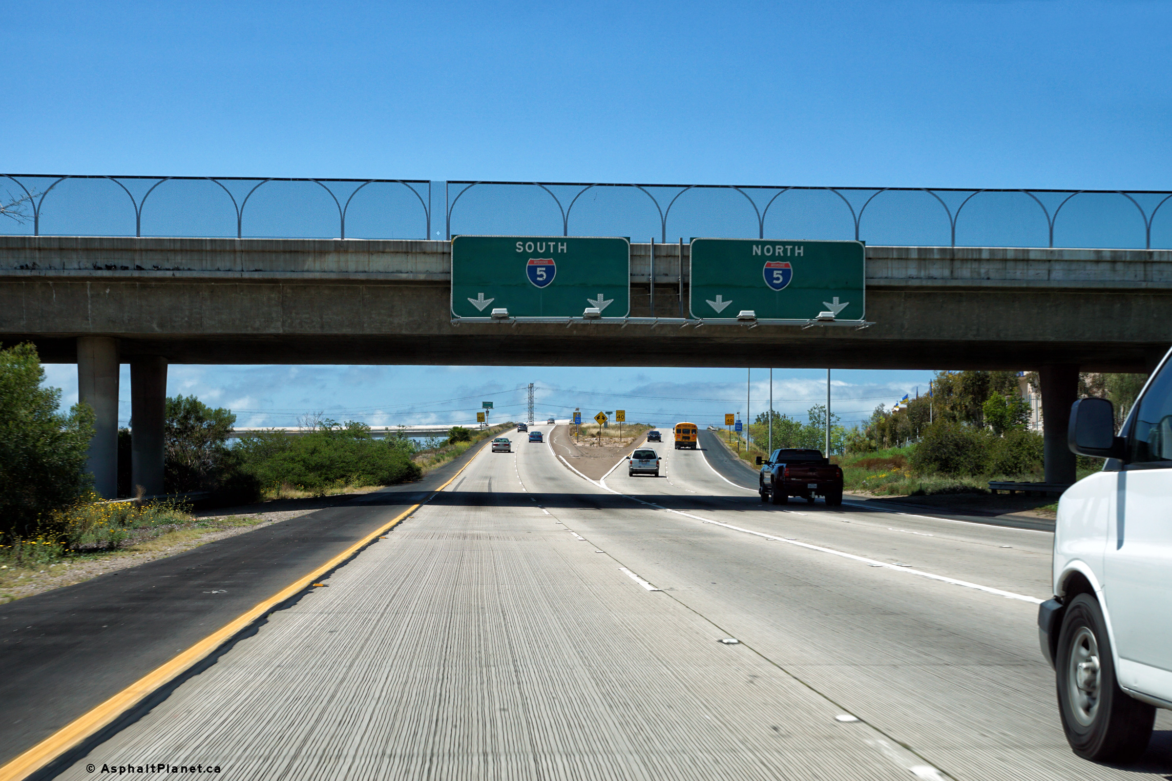
San Diego County |
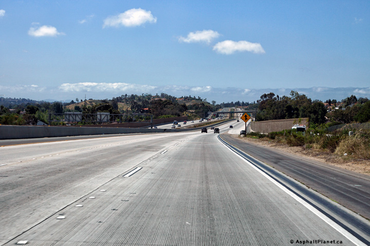
Easterly view at the beginning of SR-54 from the Interstate 5 interchange. The western portion of SR-54 straddles the Sweetwater Floodway. |
 |
||
|
High-res: (1440x960) (2400x1600) |
||||
 |
||||
|
Date: 4/10/2016 |
High-res: (1440x960) (2400x1600) |
|||
|
San Diego County |
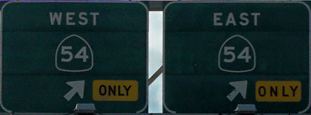
Westbound signage along CA-58/99 West at the western split between State Routes 58 and 99. |
|
||
|
Date: 4/12/2016 |
High-res: (1440x960) (2400x1600) |
|||
|
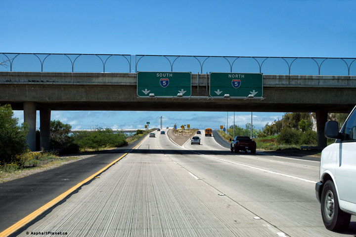
San Diego County |
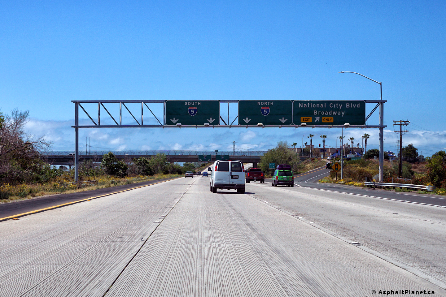
View looking westerly approaching the Interstate 5 interchange at the westbound off-ramp to National City Boulevard. |
|
||
|
Date: 4/12/2016 |
High-res: (1440x960) (2400x1600) |
|||
|
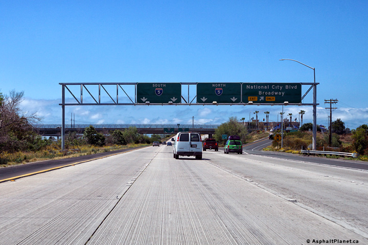
San Diego County |
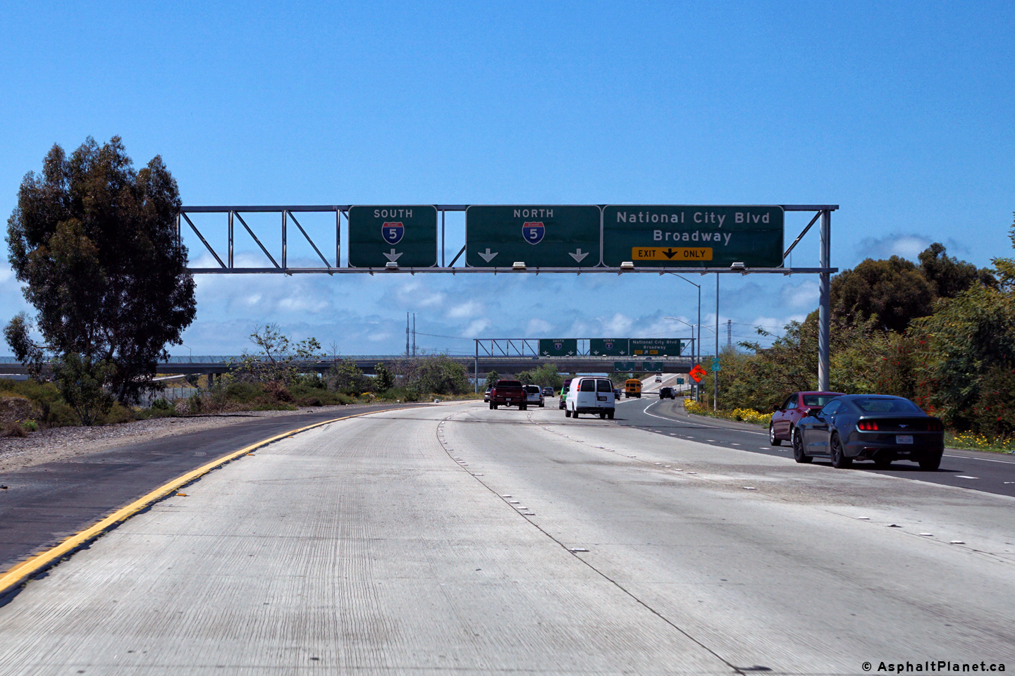
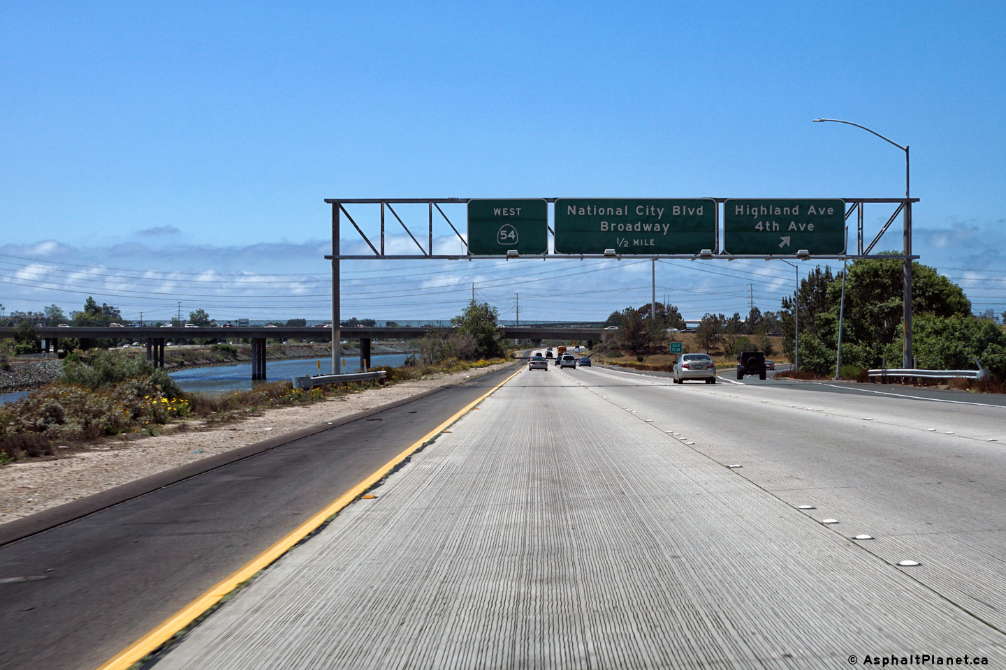
Westbound advanced signage approaching the National City Boulevard interchange. |
|
||
|
Date: 4/12/2016 |
High-res: (1440x960) (2400x1600) |
|||
|
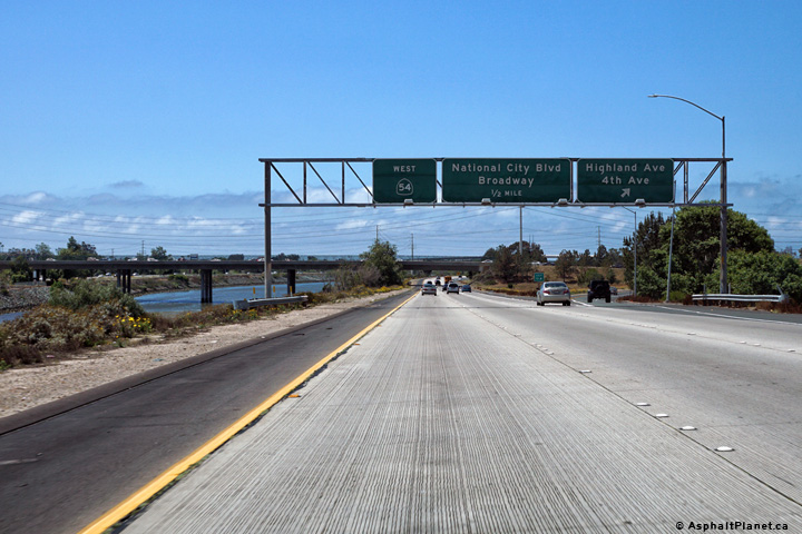
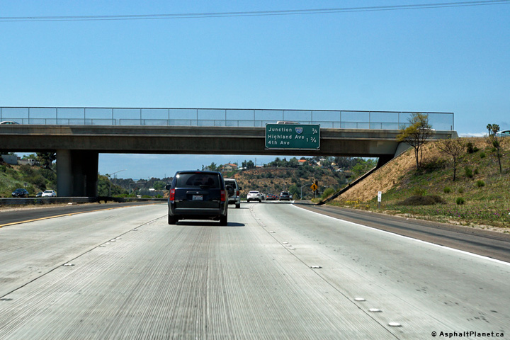
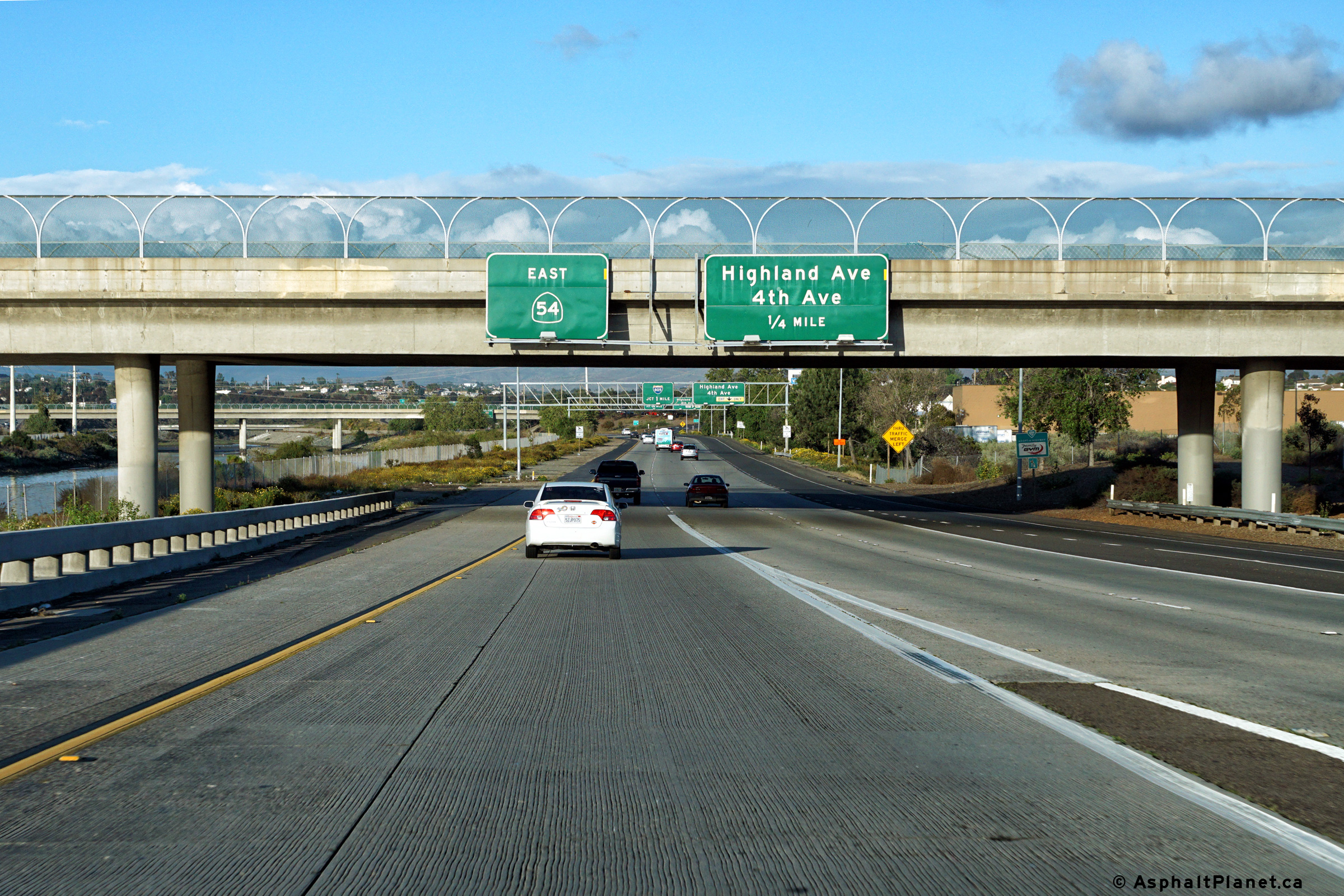
San Diego County |
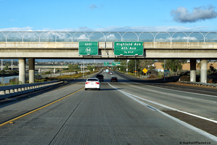
Eastbound signage approaching the off-ramp to Highland and 4th Avenues. |
 |
||
|
Date: 4/10/2016 |
High-res: (1440x960) (2400x1600) |
|||
|
San Diego County |
Eastbound off-ramp to Highland Avenue and 4th Avenue. |
 |
||
|
Date: 4/10/2016 |
High-res: (1440x960) (2400x1600) |
|||
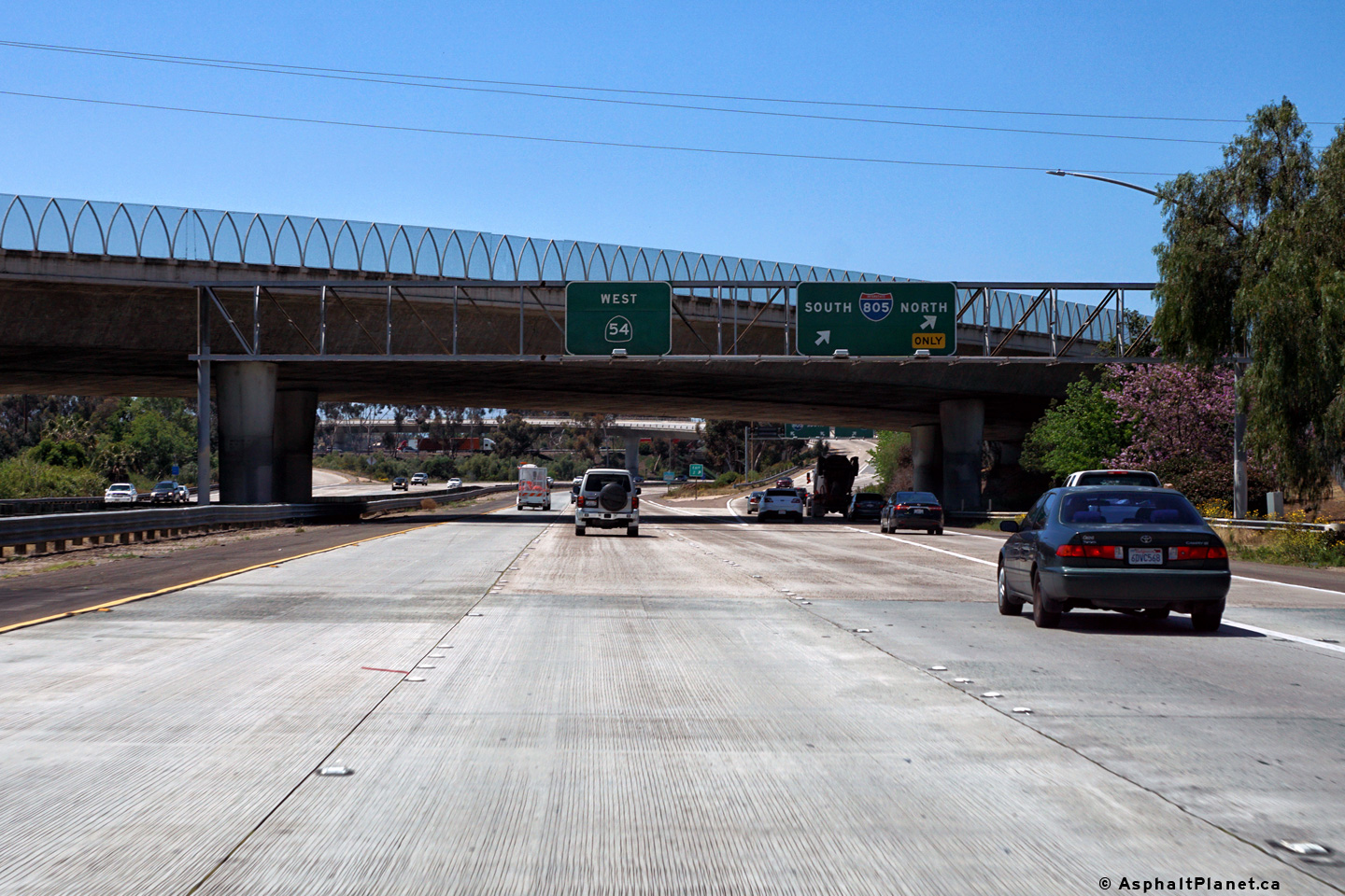
|
San Diego County |
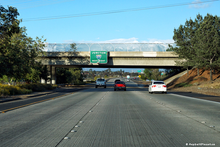
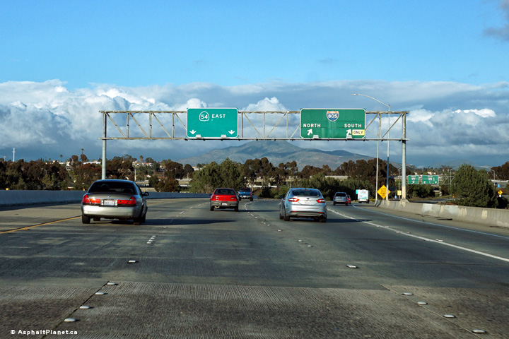
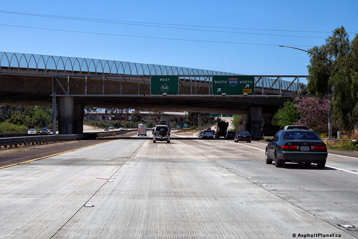
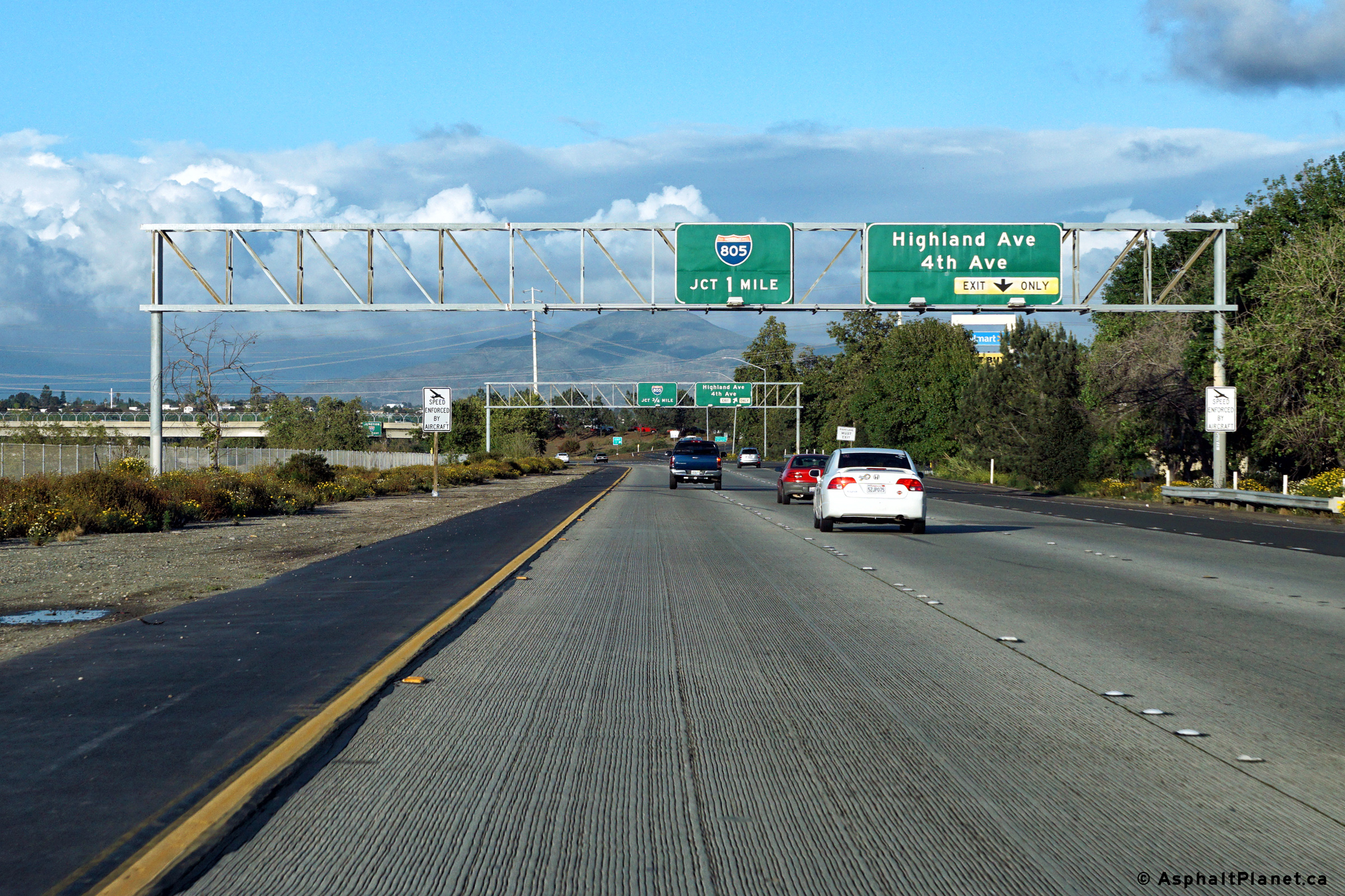
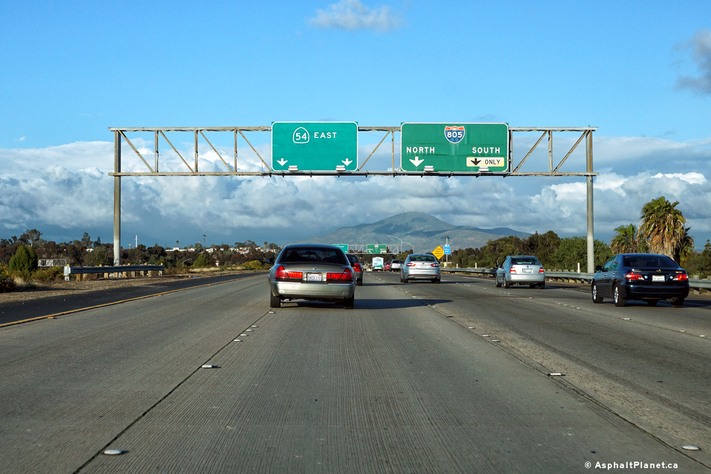
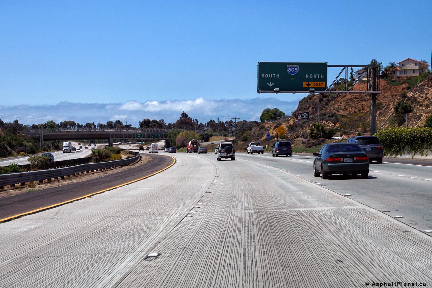
Bridge mounted advanced signage for the I-805 interchange. |
 |
||
|
Date: 4/10/2016 |
High-res: (1440x960) (2400x1600) |
|||
|
San Diego County |
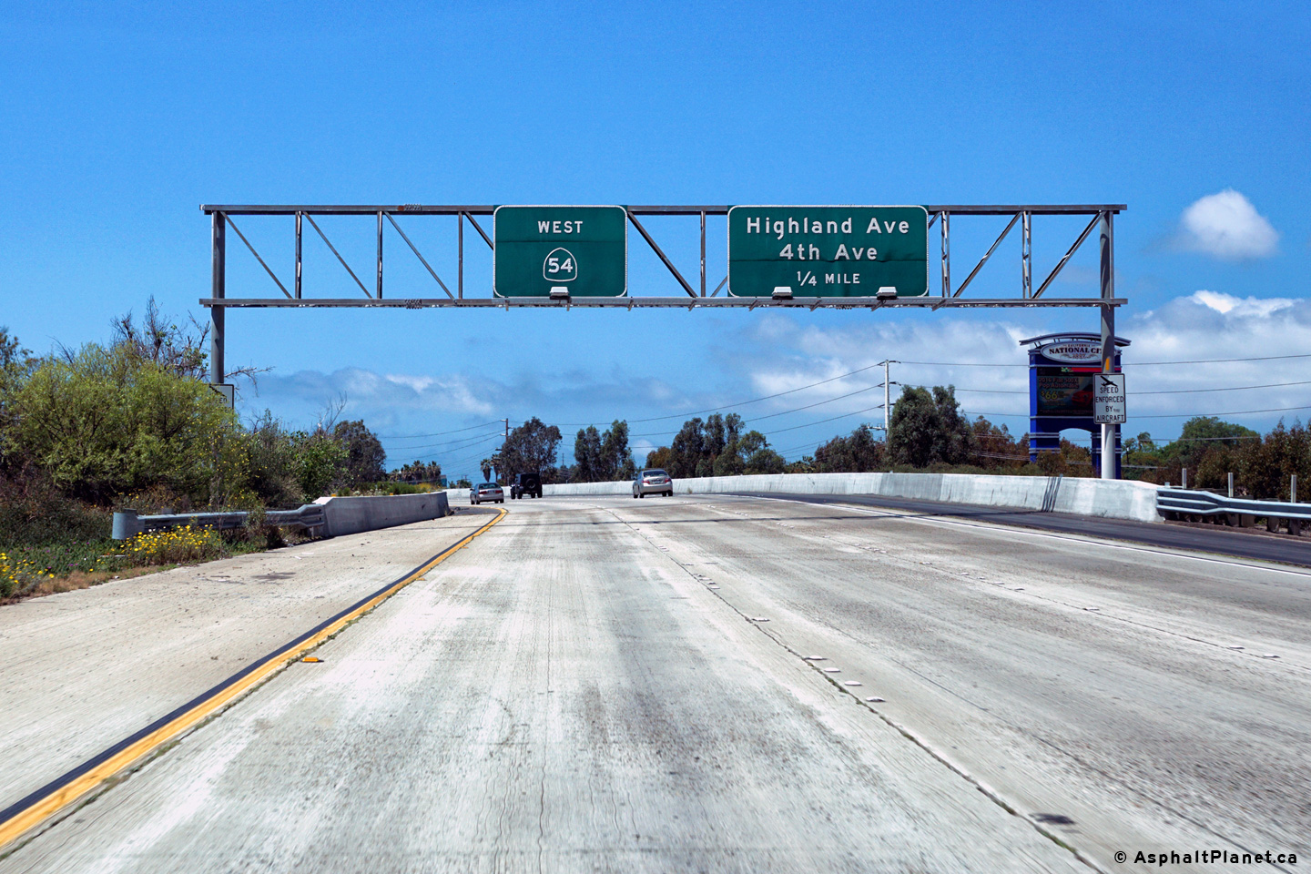
Westbound signage at the off-ramp to both Highland and 4th Avenue. |
|
||
|
Date: 4/12/2016 |
High-res: (1440x960) (2400x1600) |
|||
|
San Diego County |
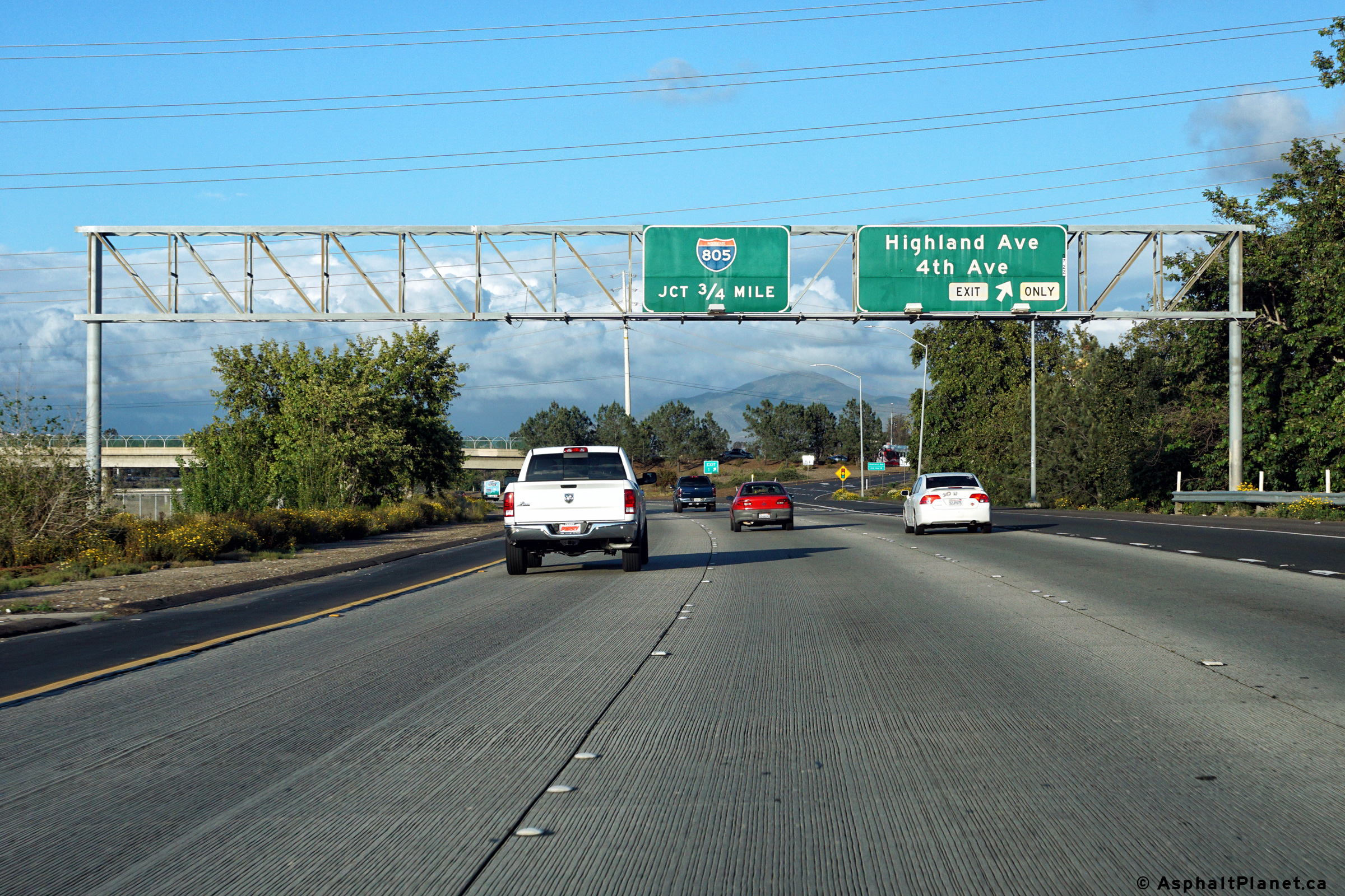
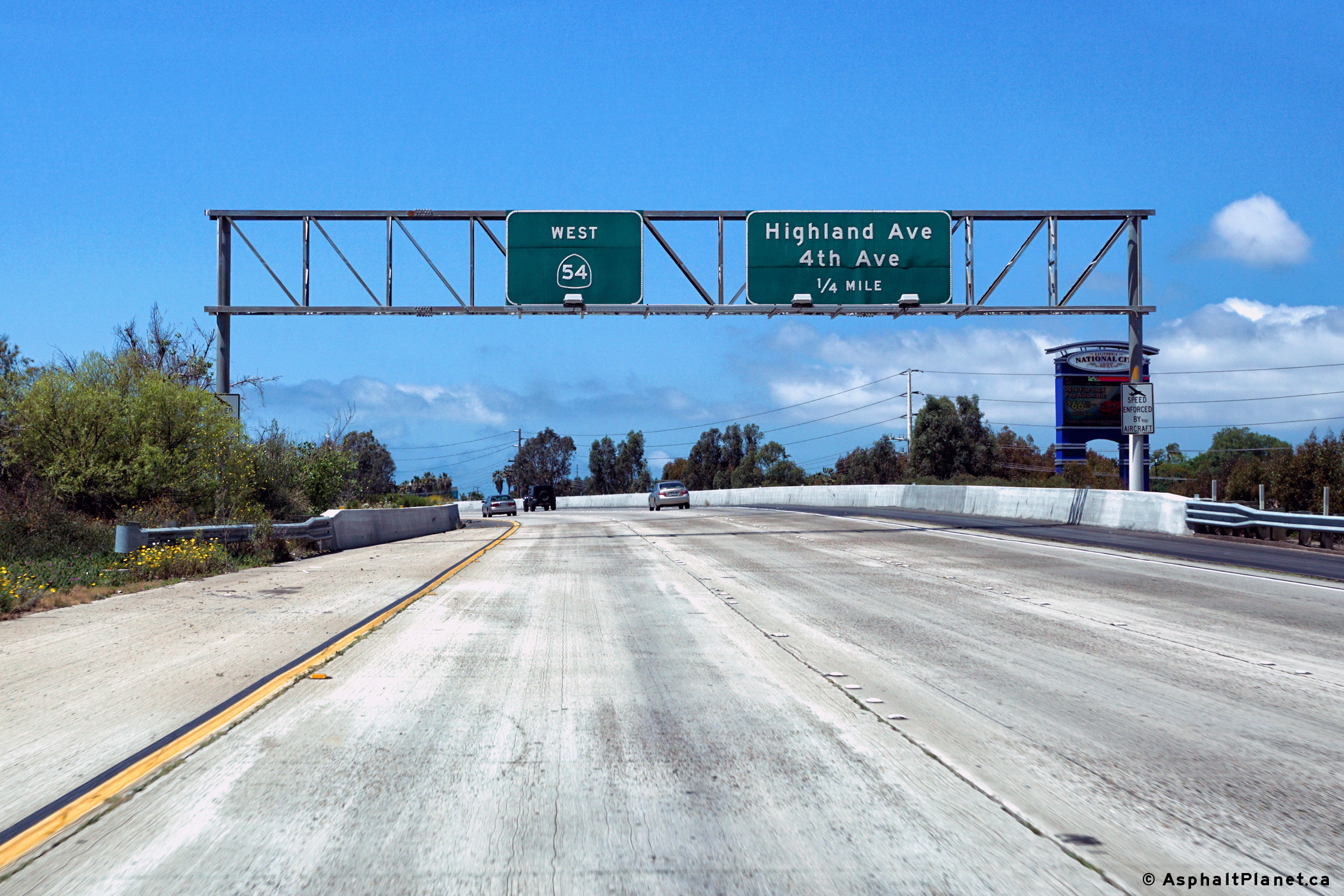
Westbound advanced signage for the Highland Avenue and 4th Avenue interchange. |
 |
||
|
Date: 4/12/2016 |
High-res: (1440x960) (2400x1600) |
|||
|
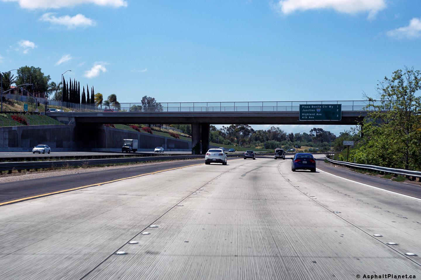
San Diego County |
Easterly view approaching the Interstate 805 interchange. |
 |
||
|
Date: 4/10/2016 |
High-res: (1440x960) (2400x1600) |
|||
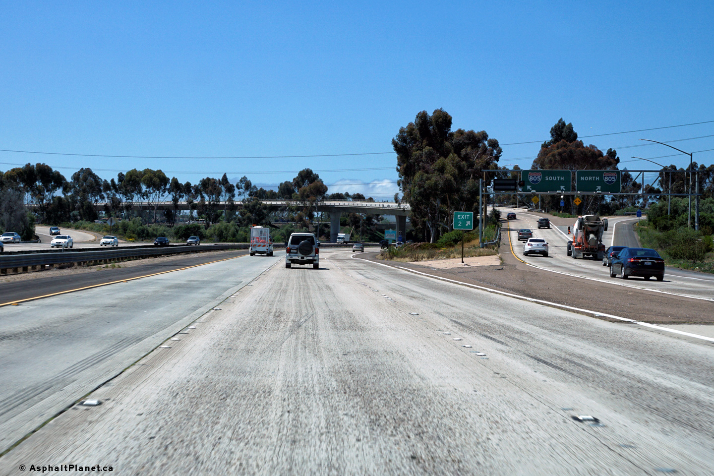
|
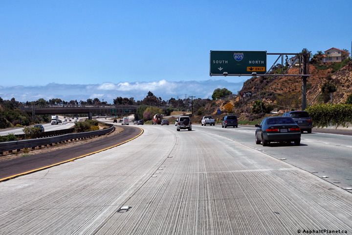
San Diego County |
Signage at the eastbound off-ramp to I-805. Despite what the signage indicates, three eastbound lanes continue through the I-805 interchange. |
 |
||
|
Date: 4/10/2016 |
High-res: (1440x960) (2400x1600) |
|||
|
San Diego County |
Interchange sequence signage with the Interstate 805 interchange in the background. |
 |
||
|
Date: 4/10/2016 |
High-res: (1440x960) (2400x1600) |
|||
| Interstate 805 leads north-south through San Diego County. Click here for Interstate 805 Images. | ||||
|
San Diego County |
Eastbound lane assignment signage in advance of the I-805 interchange. |
 |
||
|
Date: 4/12/2016 |
High-res: (1440x960) (2400x1600) |
|||
|
San Diego County |
Despite what is indicated on the signage, three lanes continue easterly along SR-54 through the Interstate 805 interchange. |
|
||
|
Date: 4/12/2016 |
High-res: (1440x960) (2400x1600) |
|||
|
San Diego County |
Interchange sequence signage at the I-805 interchange. |
|
||
|
Date: 4/12/2016 |
High-res: (1440x960) (2400x1600) |
|||
|
San Diego County |
Eastbound signage approaching the off-ramp to Highland and 4th Avenues. |
 |
||
|
Date: 4/10/2016 |
High-res: (1440x960) (2400x1600) |
|||
|
San Diego County |
Eastbound off-ramp to Highland Avenue and 4th Avenue. |
|
||
|
Date: 4/10/2016 |
High-res: (1440x960) (2400x1600) |
|||
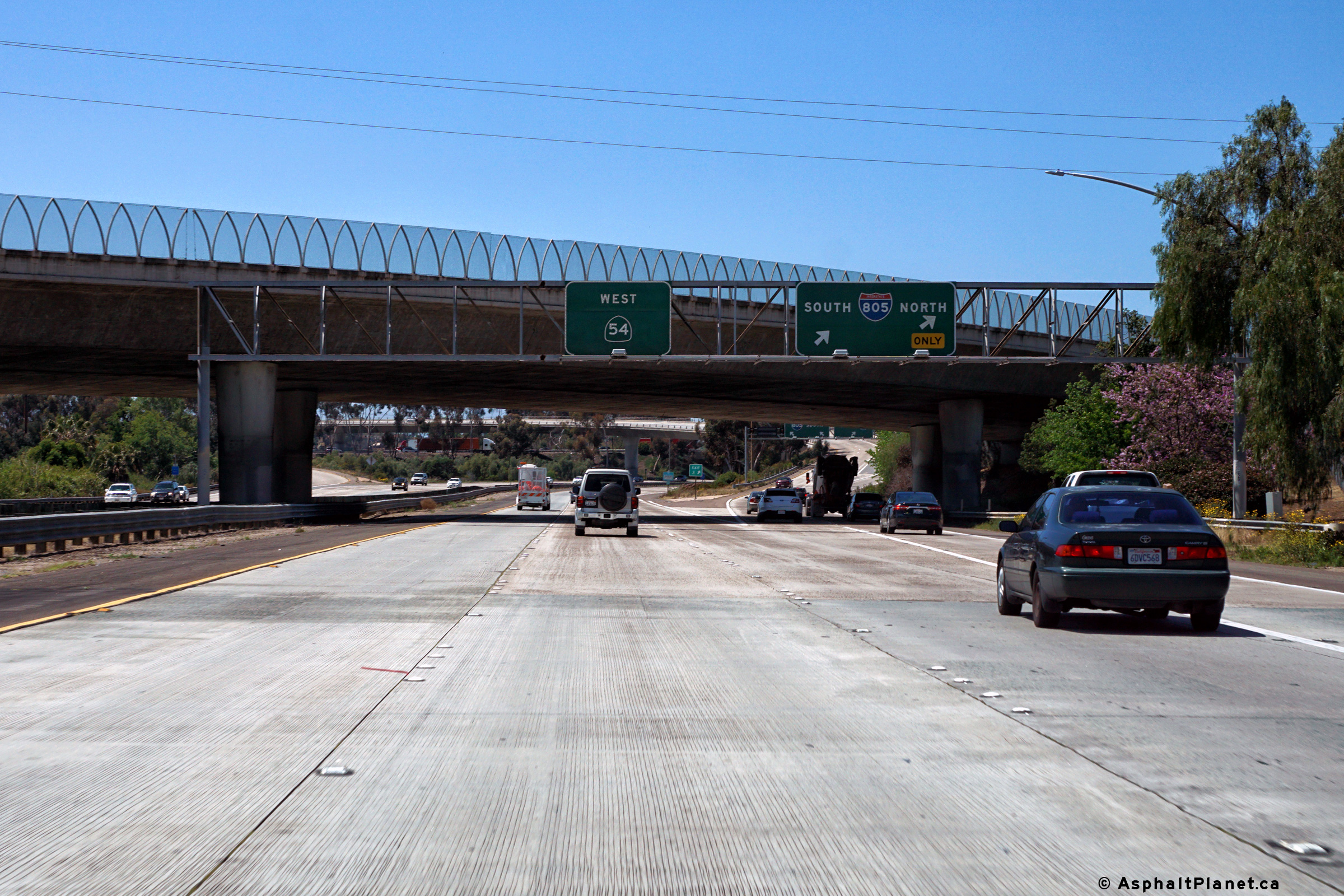
|
San Diego County |
Bridge mounted advanced signage for the I-805 interchange. |
|
||
|
Date: 4/10/2016 |
High-res: (1440x960) (2400x1600) |
|||
|
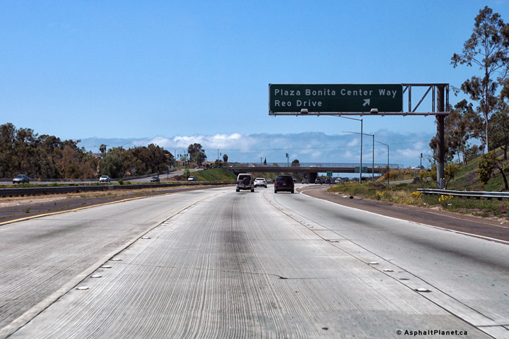
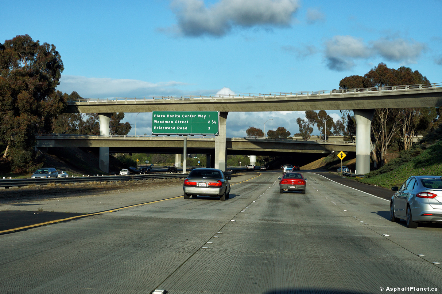
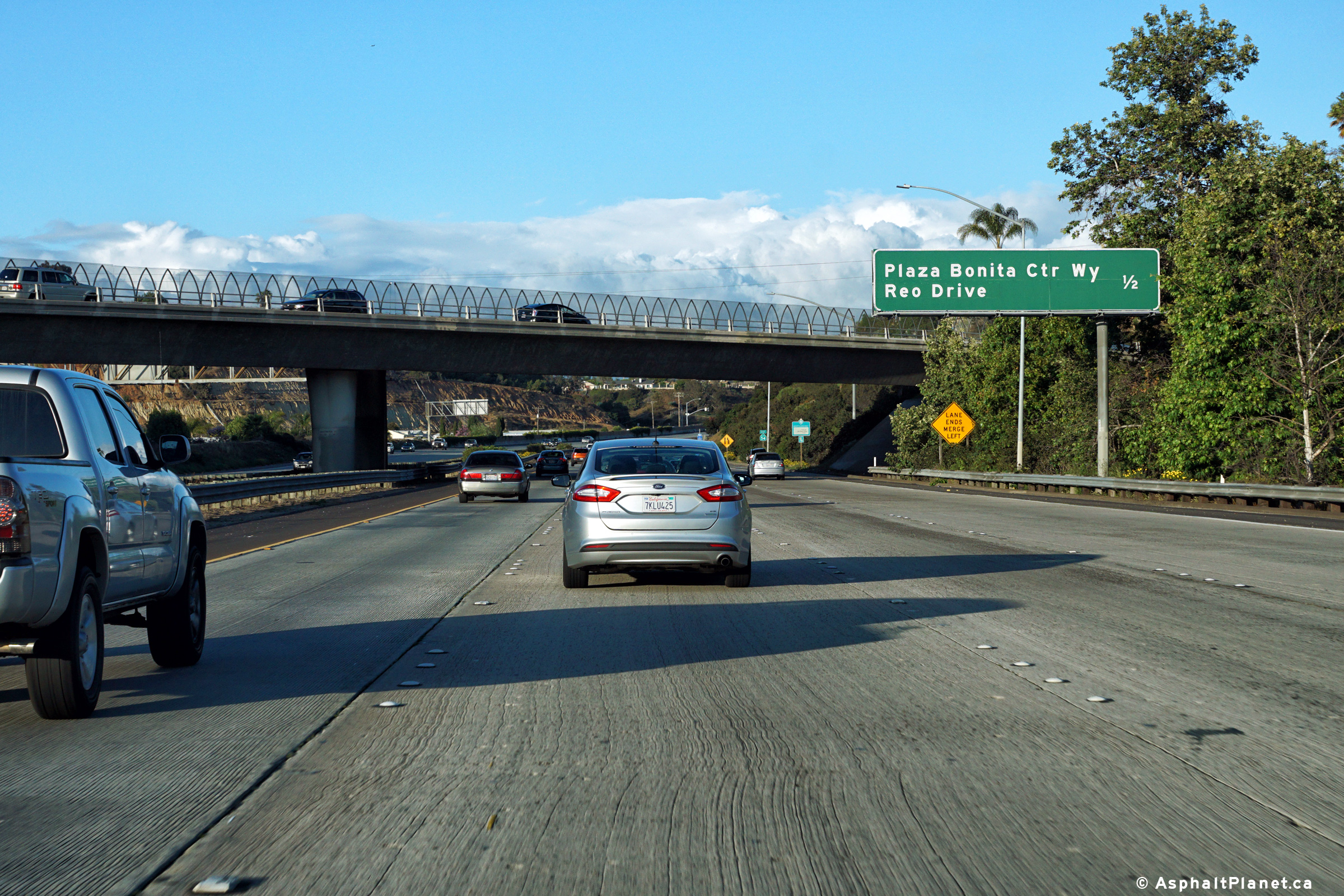
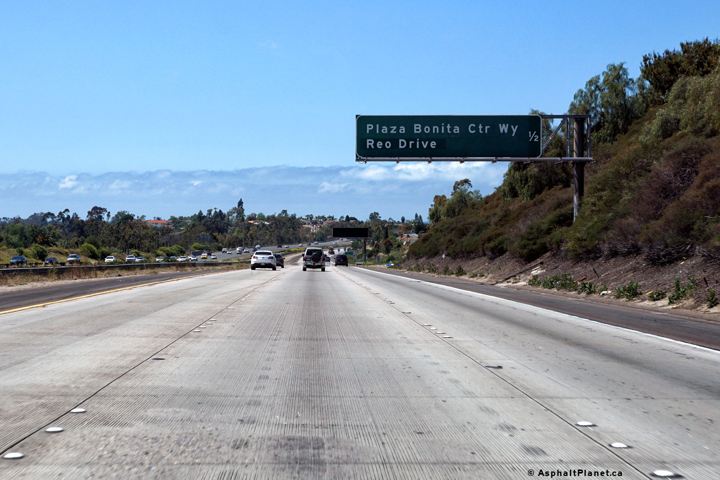
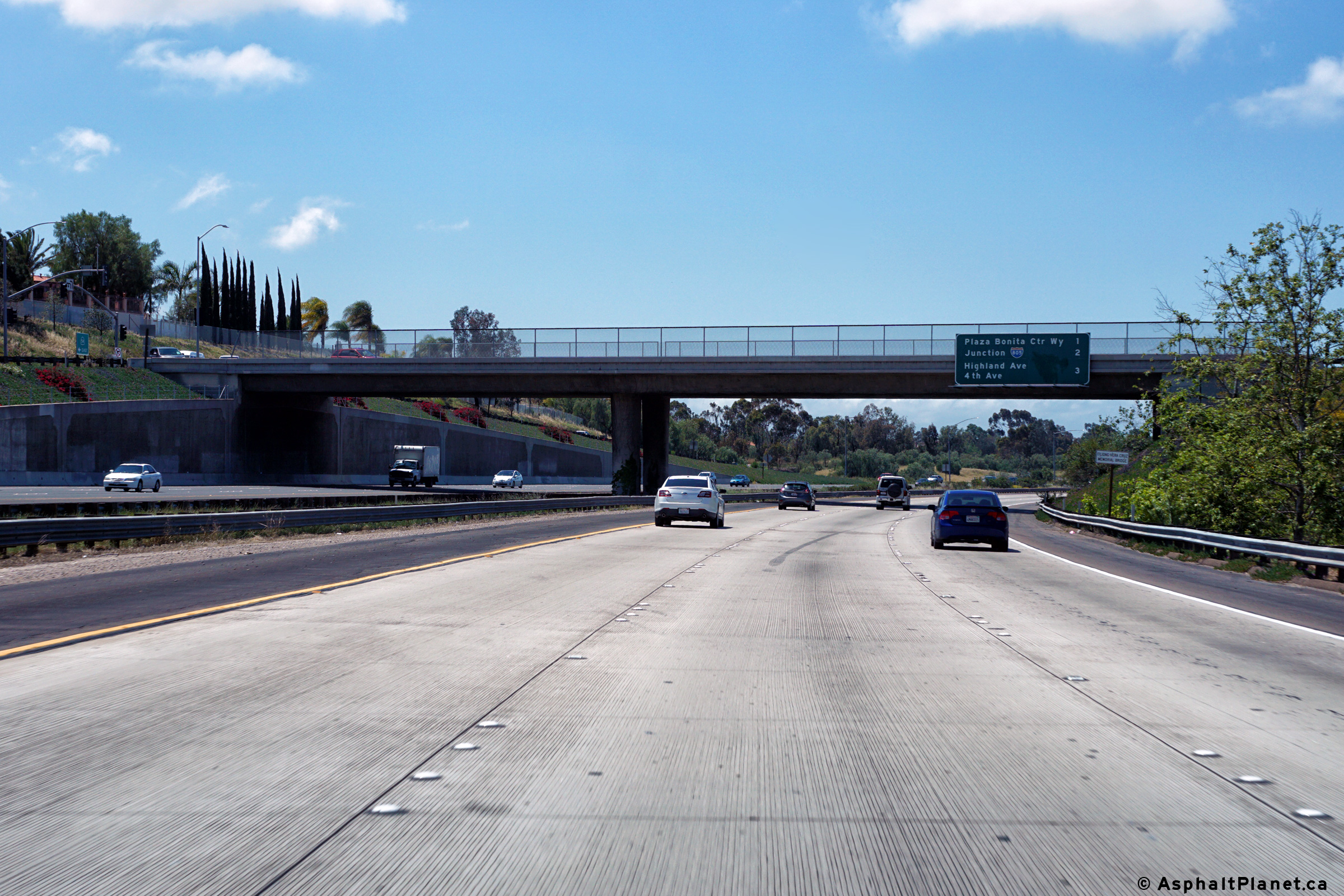
San Diego County |
Interchange sequence signage affixed to the Plaza Bonita Center Way overpass facing westbound traffic. |
|
||
|
Date: 4/12/2016 |
High-res: (1440x960) (2400x1600) |
|||
|
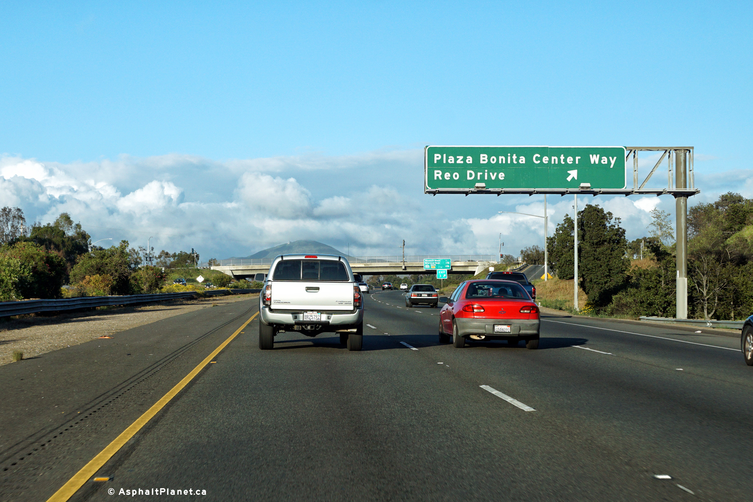
San Diego County |
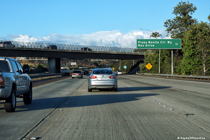
Westbound signage at the off-ramp to Plaza Bonita Center Way. |
|
||
|
Date: 4/12/2016 |
High-res: (1440x960) (2400x1600) |
|||
|
San Diego County |
Advanced signage for the westbound off-ramp to Plaza Bonita Center Way. |
 |
||
|
Date: 4/12/2016 |
High-res: (1440x960) (2400x1600) |
|||
|
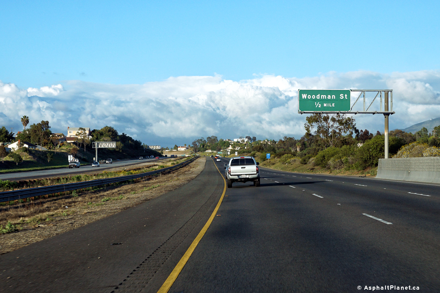
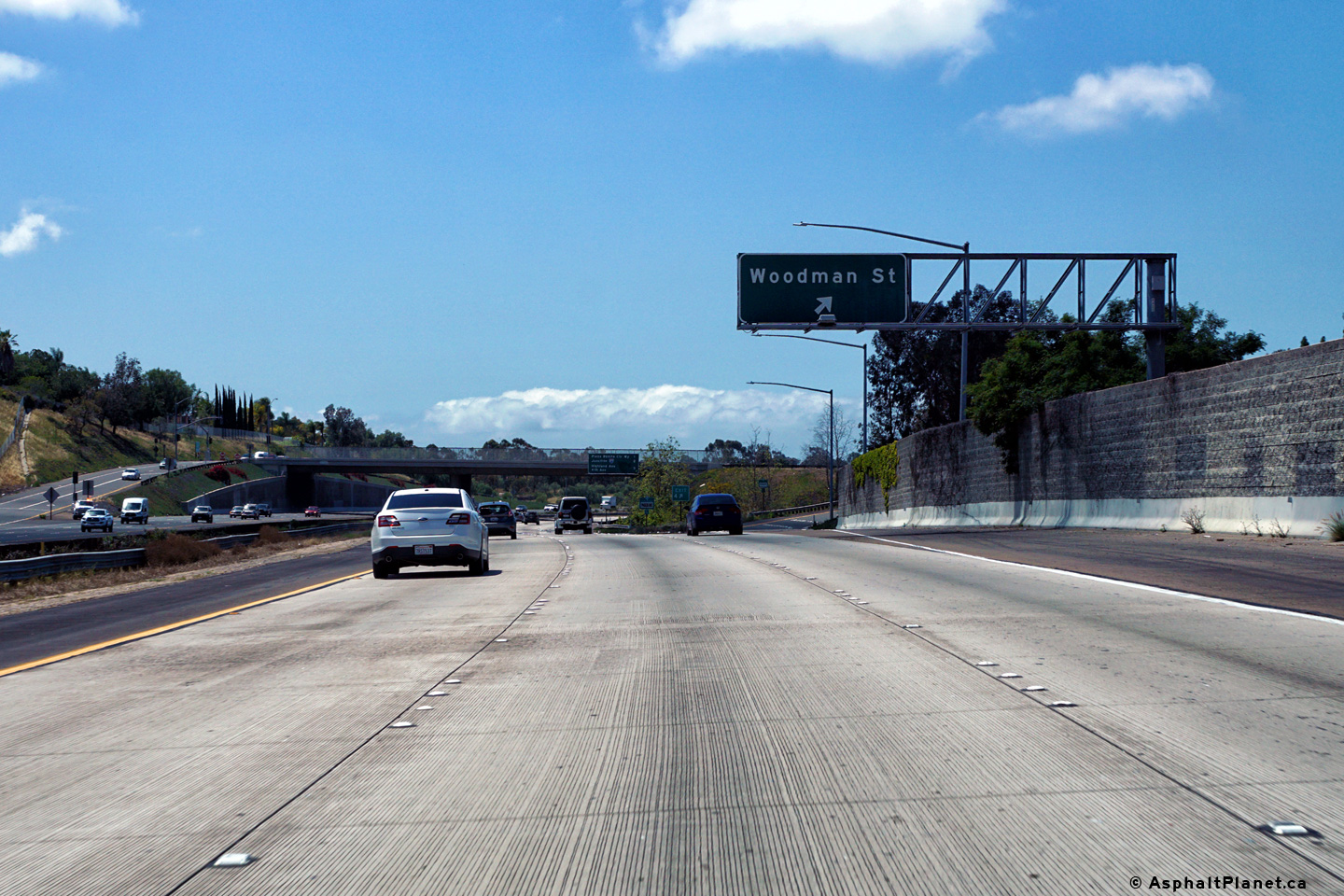
San Diego County |
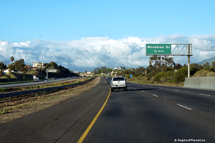
Eastbound advanced signage for the Woodman Street interchange. |
 |
||
|
Date: 4/10/2016 |
High-res: (1440x960) (2400x1600) |
|||
|
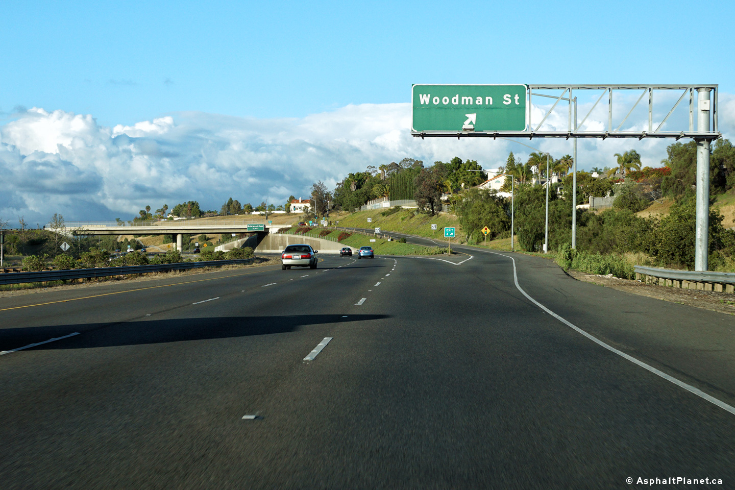
San Diego County |
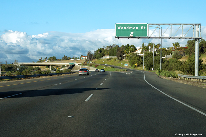
Signage at the eastbound off-ramp to Woodman Street. |
 |
||
|
Date: 4/10/2016 |
High-res: (1440x960) (2400x1600) |
|||
|
San Diego County |
Easterly view at the the ramp to I-15 South. Inexplicably, the ramp to I-15 north has three lanes. State Route 58 meets I-15 at a trumpet interchange. |
 |
||
|
Date: 4/10/2016 |
High-res: (1440x960) (2400x1600) |
|||
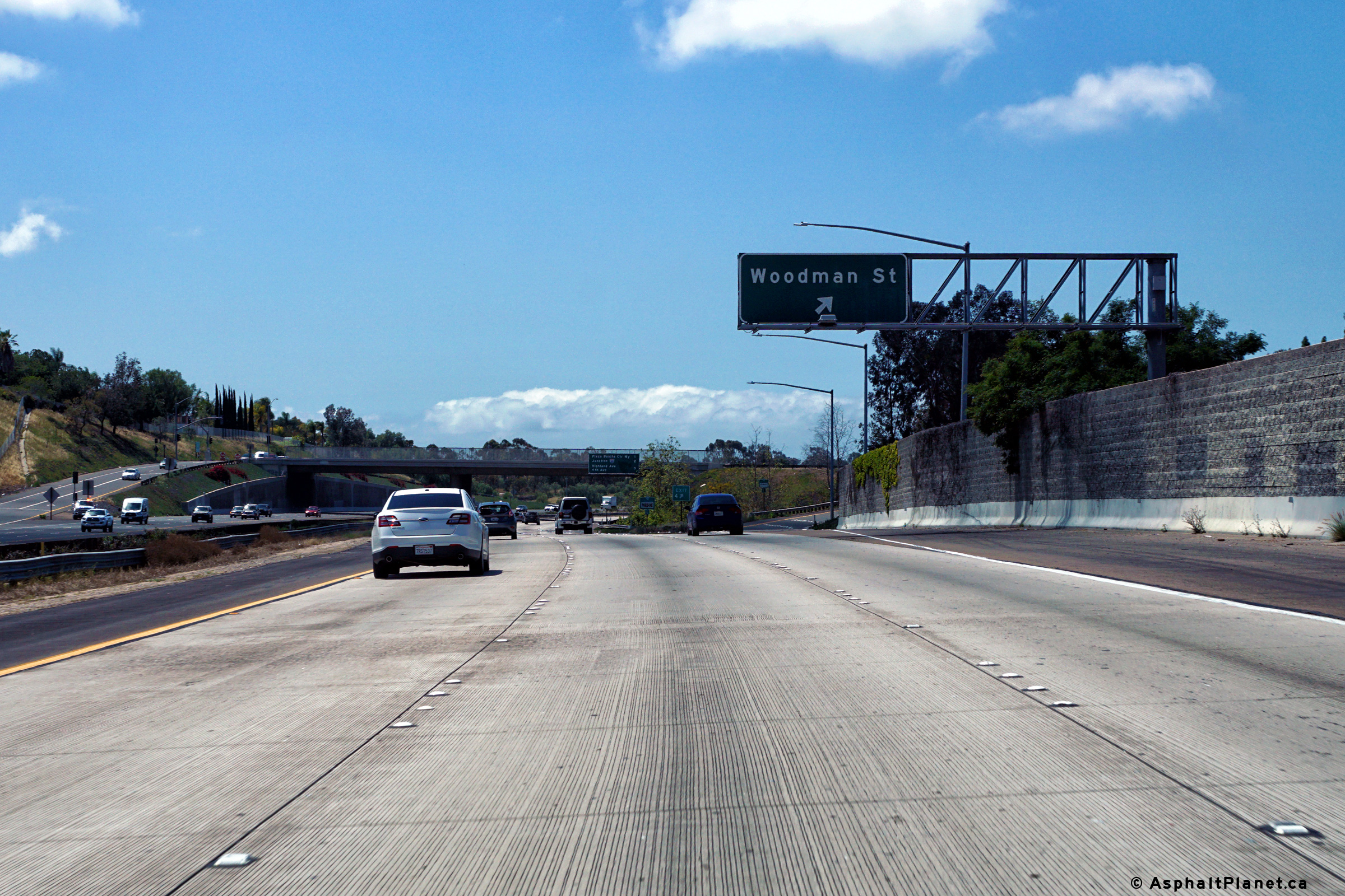
|
San Diego County |
Interchange sequence signage affixed to the Woodman Street overpass. |
 |
||
|
Date: 4/12/2016 |
High-res: (1440x960) (2400x1600) |
|||
|
San Diego County |
Signage at the westbound off-ramp to Woodman Street. |
 |
||
|
Date: 4/12/2016 |
High-res: (1440x960) (2400x1600) |
|||
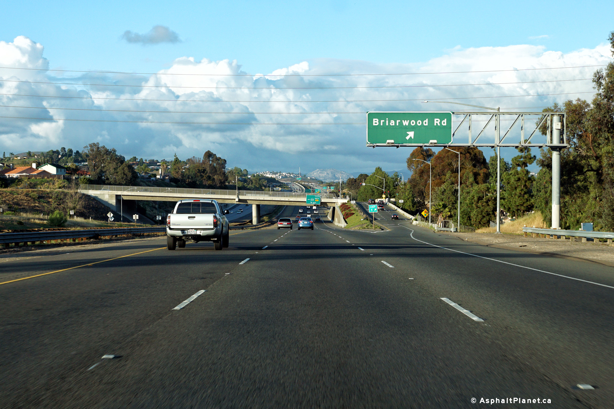
|
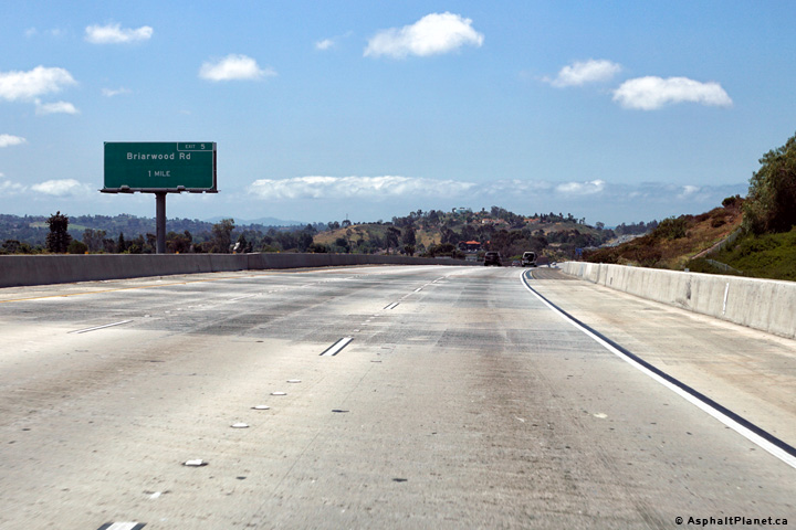
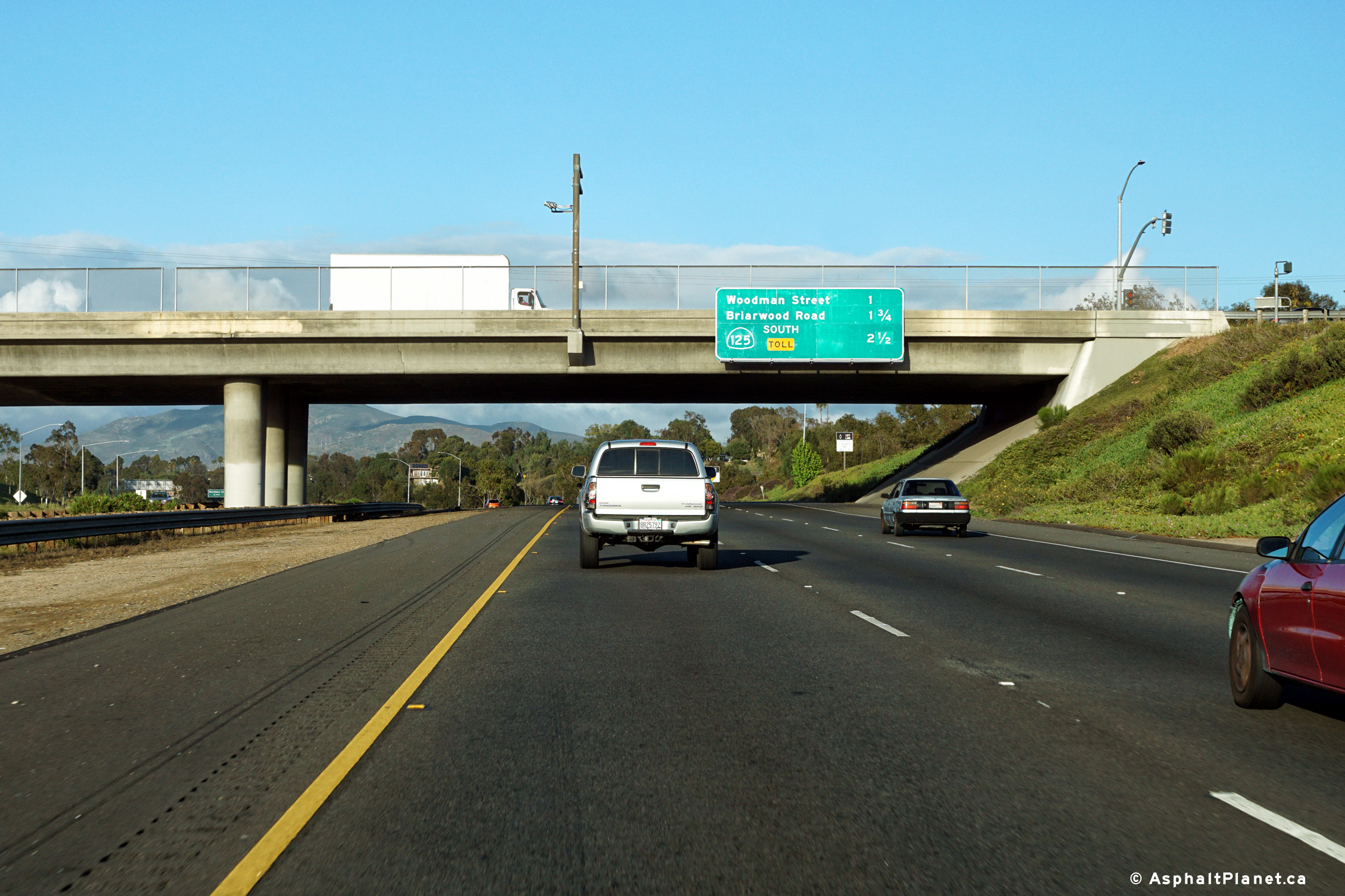
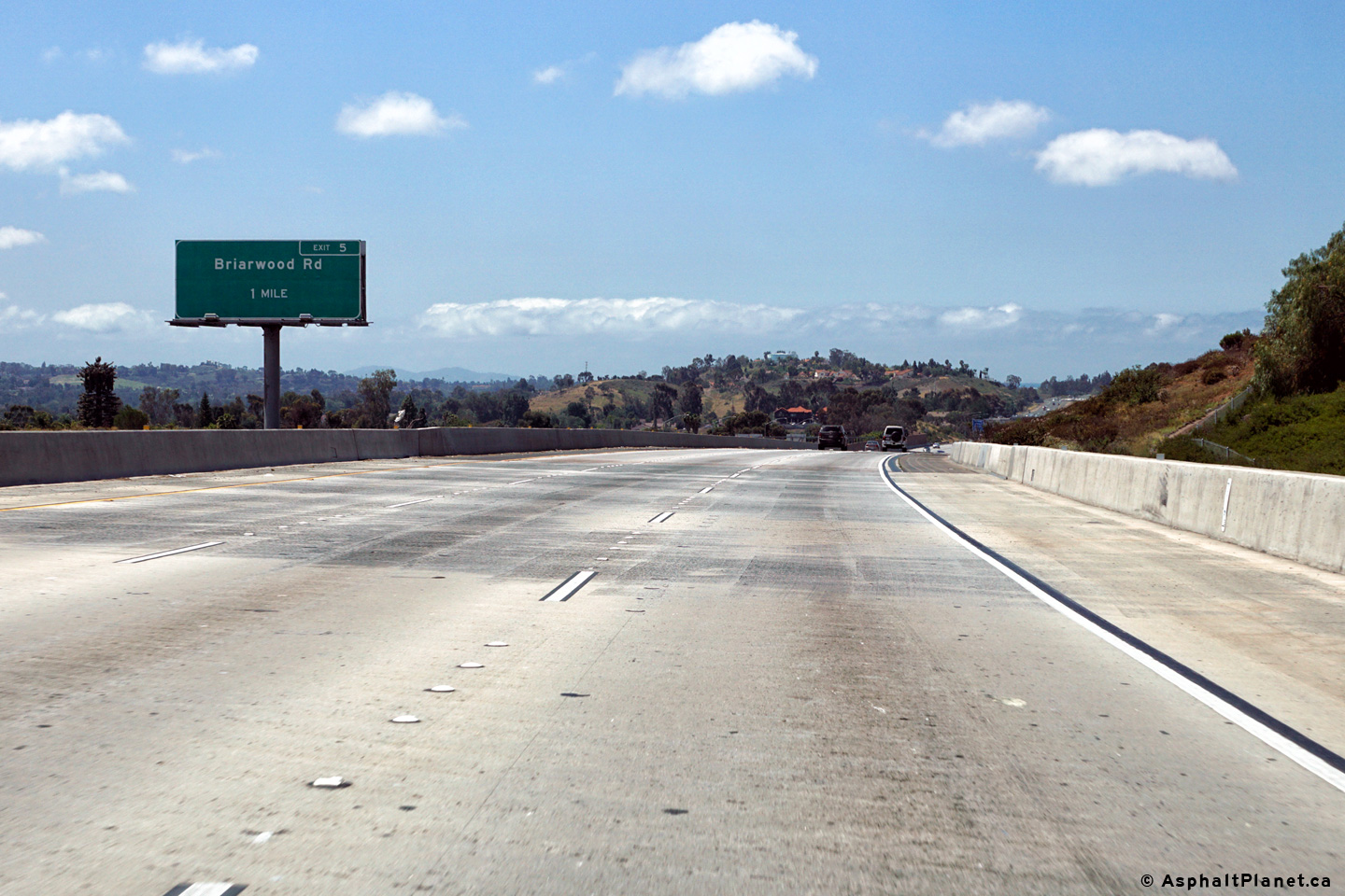
San Diego County |
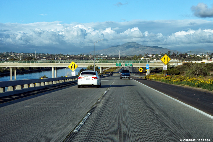
Eastbound signage at the off-ramp to Briarwood Road. |
 |
||
|
Date: 4/10/2016 |
High-res: (1440x960) (2400x1600) |
|||
|
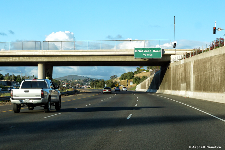
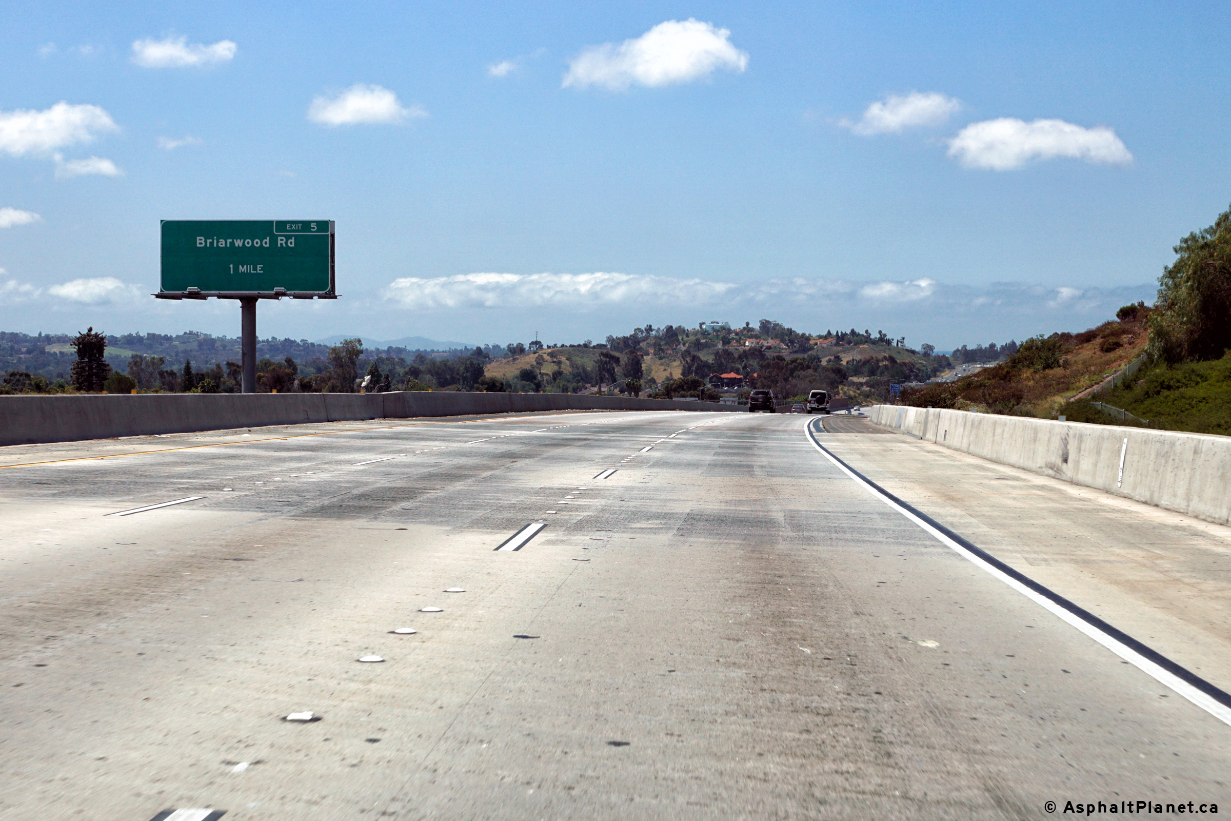
San Diego County |
Easterly view as SR-54 passes beneath the Briarwood Road overpass. |
 |
||
|
High-res: (1440x960) (2400x1600) |
||||
 |
||||
|
Date: 4/10/2016 |
High-res: (1440x960) (2400x1600) |
|||
|
San Diego County |
Westbound off-ramp to Briarwood Road. |
 |
||
|
Date: 4/12/2016 |
High-res: (1440x960) (2400x1600) |
|||
|
San Diego County |
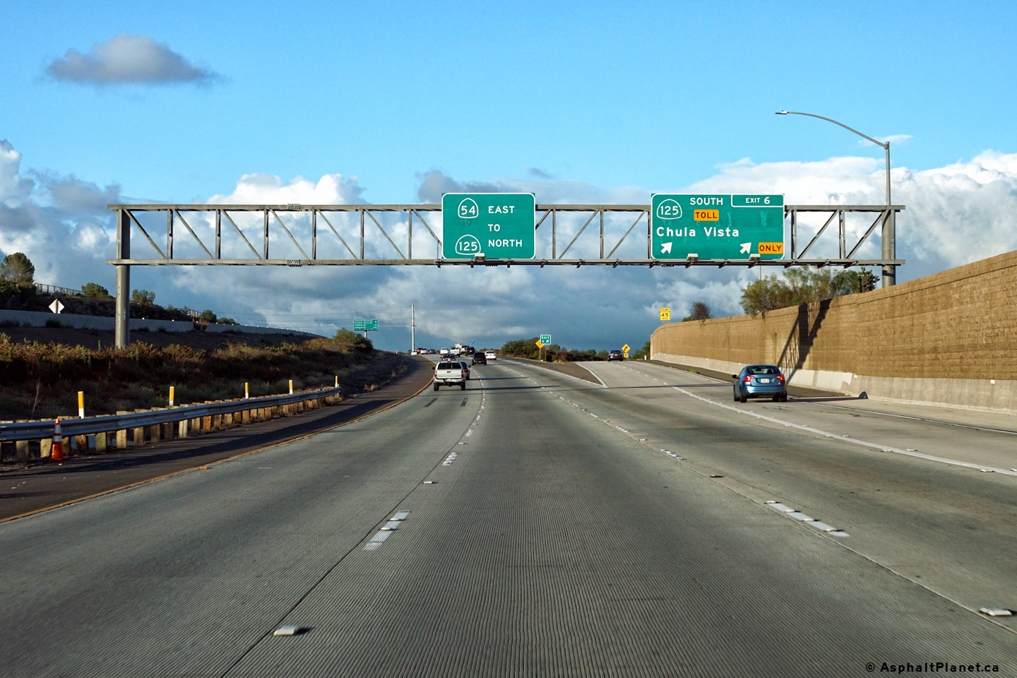
Advanced signage for the ramp to SR-125 South. |
 |
||
|
Date: 4/10/2016 |
High-res: (1440x960) (2400x1600) |
|||
|
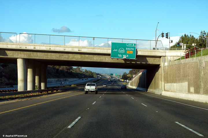
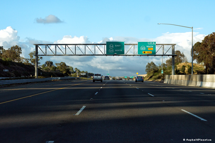
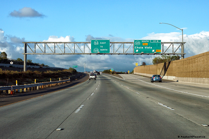
San Diego County |
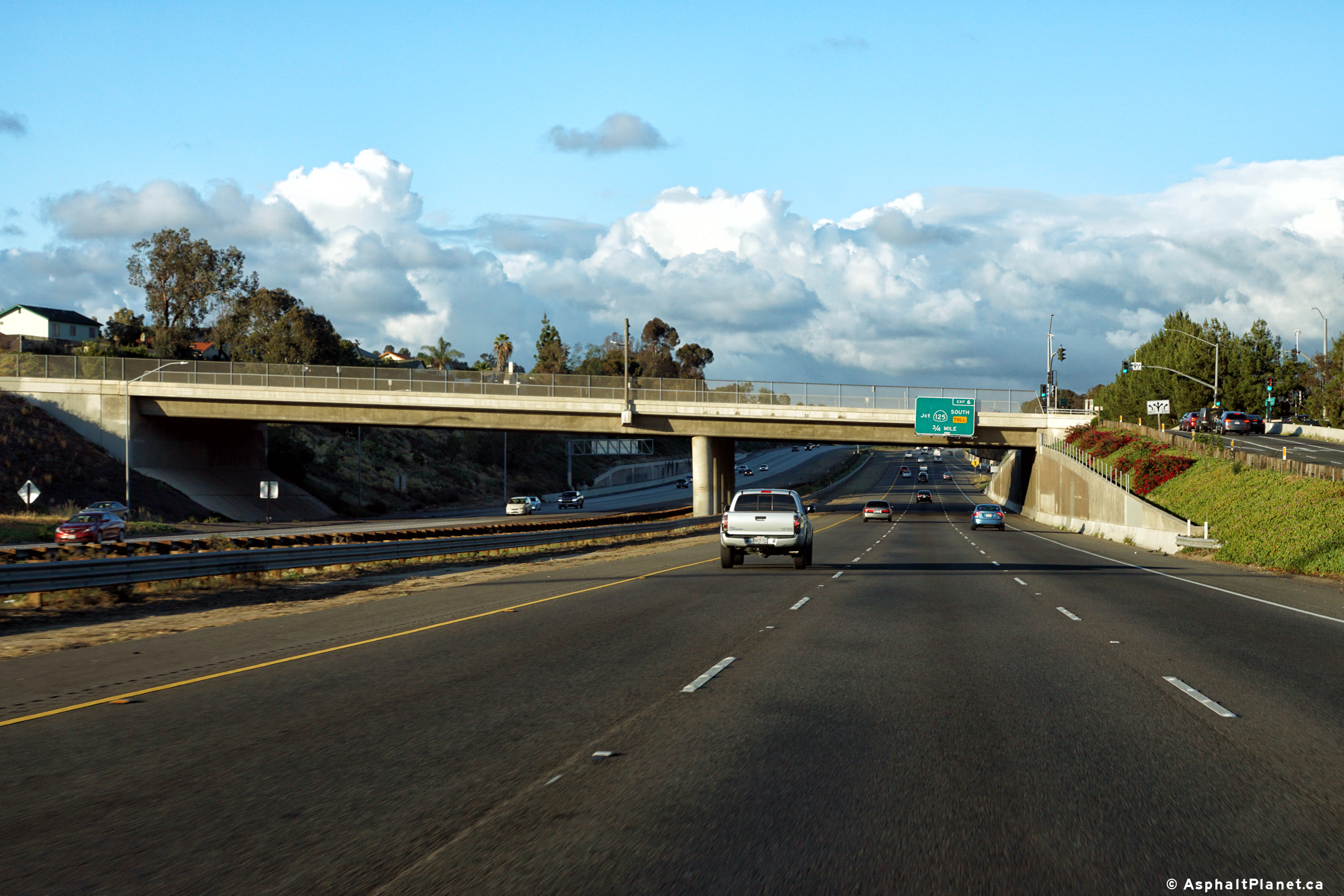
Signage at the eastbound off-ramp to SR-125 South. Through traffic continues northerly along SR-125. |
|
||
|
Date: 4/10/2016 |
High-res: (1440x960) (2400x1600) |
|||
|
San Diego County |
Westerly view along SR-54 from the top of the SR-125 interchange. |
 |
||
|
Date: 4/12/2016 |
High-res: (1440x960) (2400x1600) |
|||
|
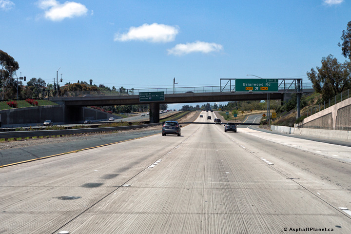
San Diego County |
Westbound advanced signage for the Briarwood Road interchange. |
|
||
|
Date: 4/12/2016 |
High-res: (1440x960) (2400x1600) |
|||
| SR-125 leads north and south from SR-54 through the eastern suburbs of San Diego. Click here for SR-125 Images. | ||||
<- CA-53
CA Highways
CA-55 ->
AsphaltPlanet.ca
© 2010-17 AsphaltPlanet.ca.
Scott@asphaltplanet.ca
Page Created: March 9, 2017.
Last Updated: March 29, 2017.


