AsphaltPlanet.ca > California > SR-52
Pictures on this
page are arranged in order from west to east. CA-52 East photos are
left-aligned in the last column, while CA-52 West photos are right-aligned.
Center-line pictures are centered within the last column.
|
Location |
Description |
Photo |
||
|
East- |
West- |
|||
| I-805 is an eastern by-pass of Downtown San Diego. Click here for Interstate 805 Images. | ||||
|
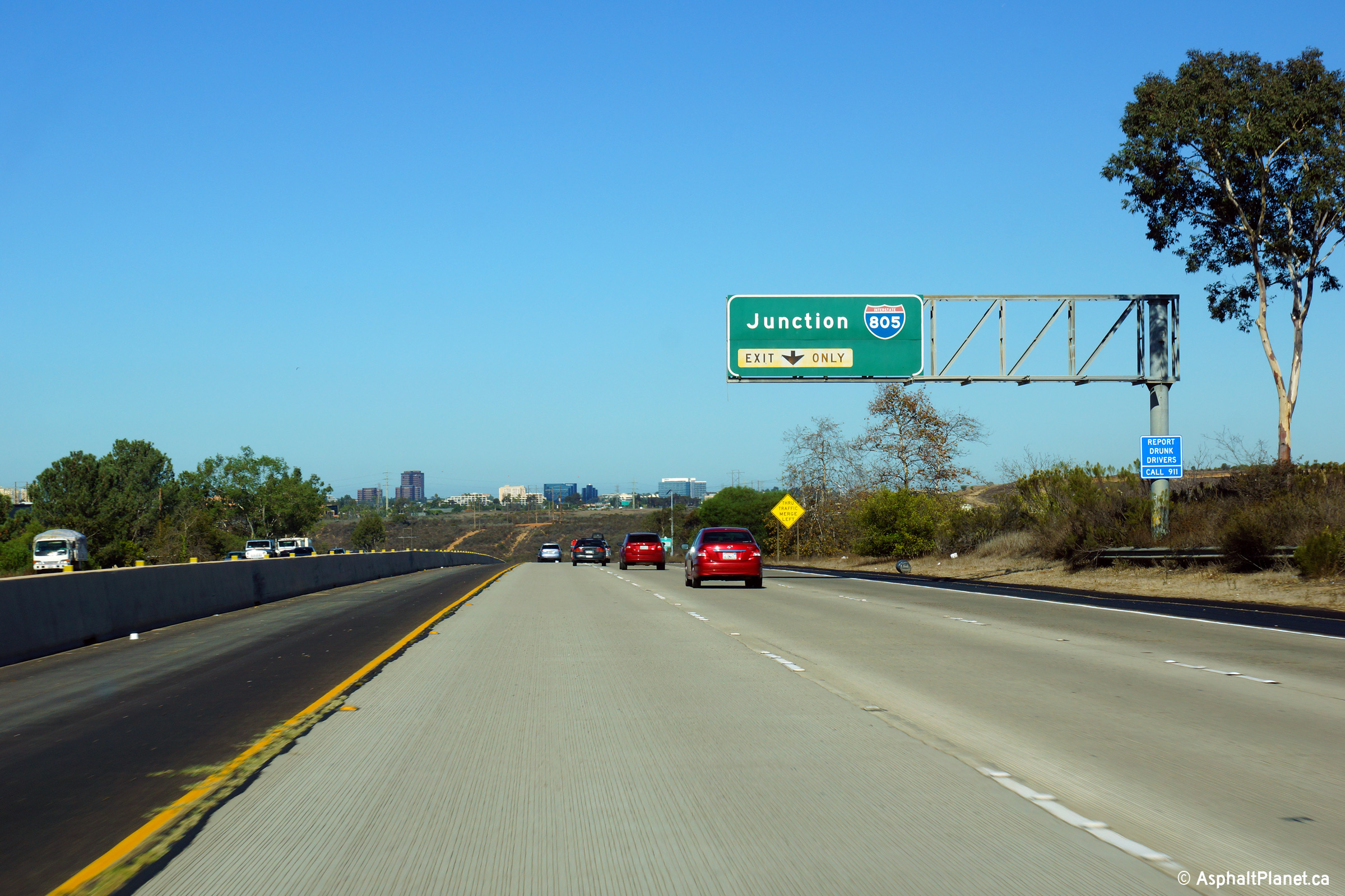
San Diego County |
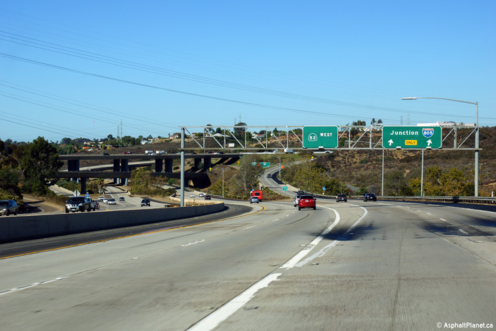
Overhead guide signage overtop of the ramp to Interstate 805 from Route 52 West. |
 |
||
|
Date: 10/31/2013 |
High-res: (1440x960) (2400x1600) | |||
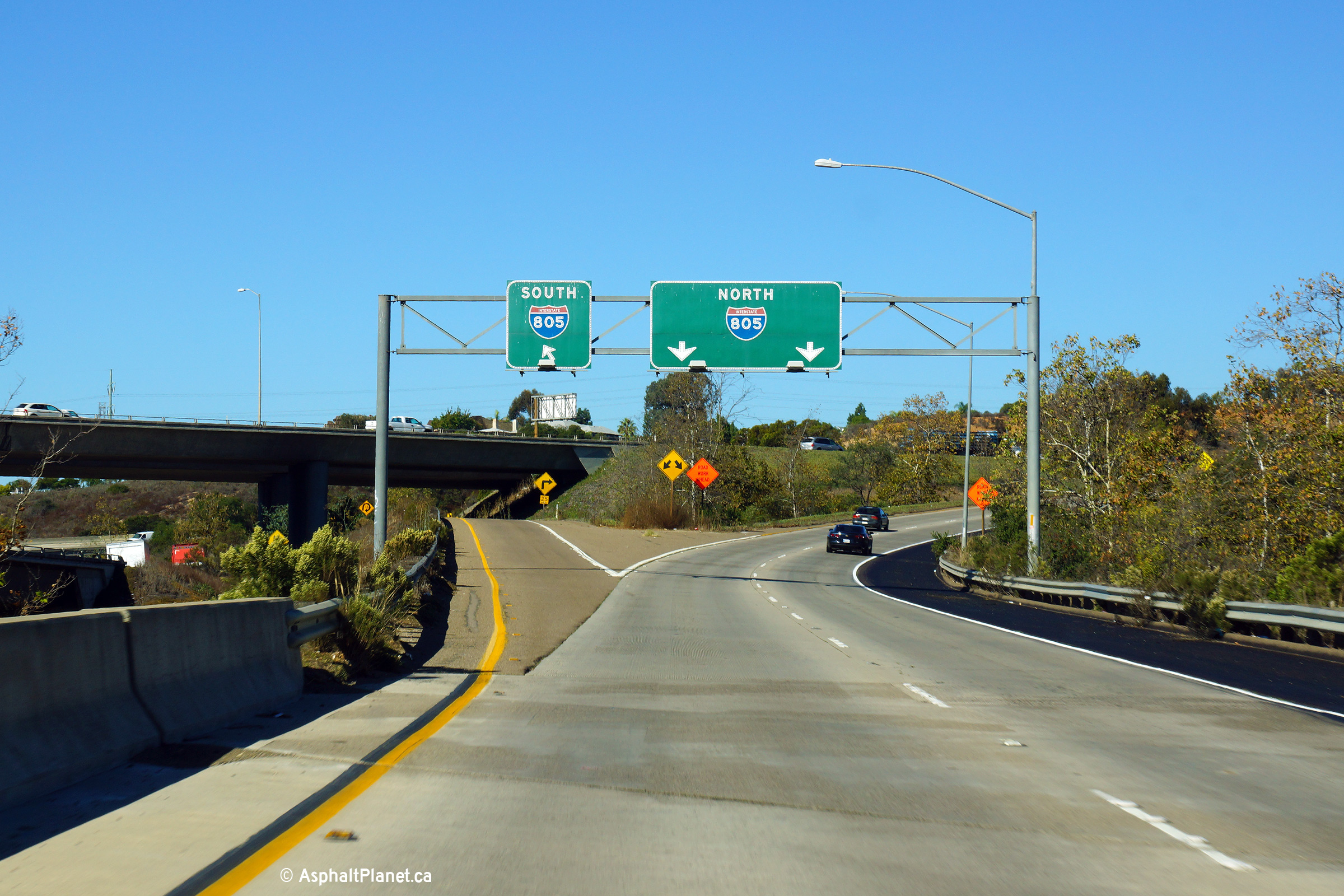
|
San Diego County |
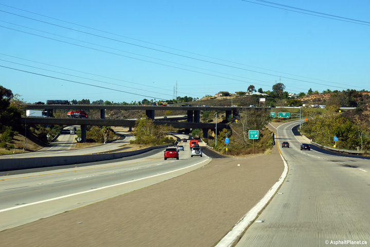
Two views looking westerly approaching the interchange with Interstate 805. |
 |
||
| High-res: (1440x960) (2400x1600) | ||||
 |
||||
|
Date: 10/30/2013 |
High-res: (1440x960) (2400x1600) | |||
|
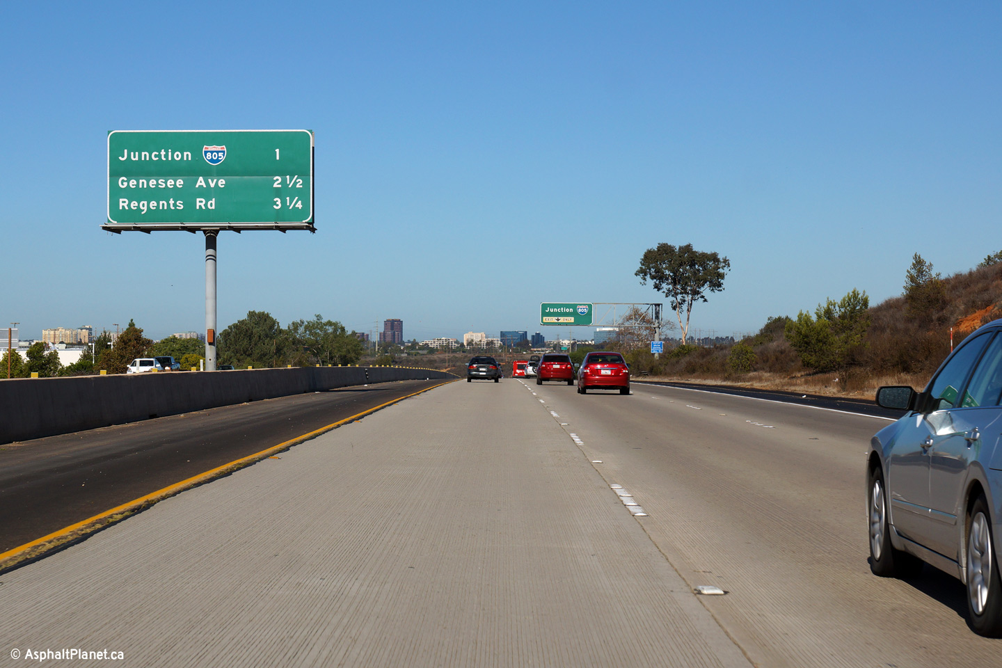
San Diego County |
Advanced signage for the upcoming I-805 interchange. The third westbound lane departs the freeway mainline at this interchange. |
 |
||
|
Date: 10/30/2013 |
High-res: (1440x960) (2400x1600) | |||
|
San Diego County |
Interchange sequence signage mounted in the median of the 52 Freeway. |
 |
||
|
Date: 10/30/2013 |
High-res: (1440x960) (2400x1600) | |||
|
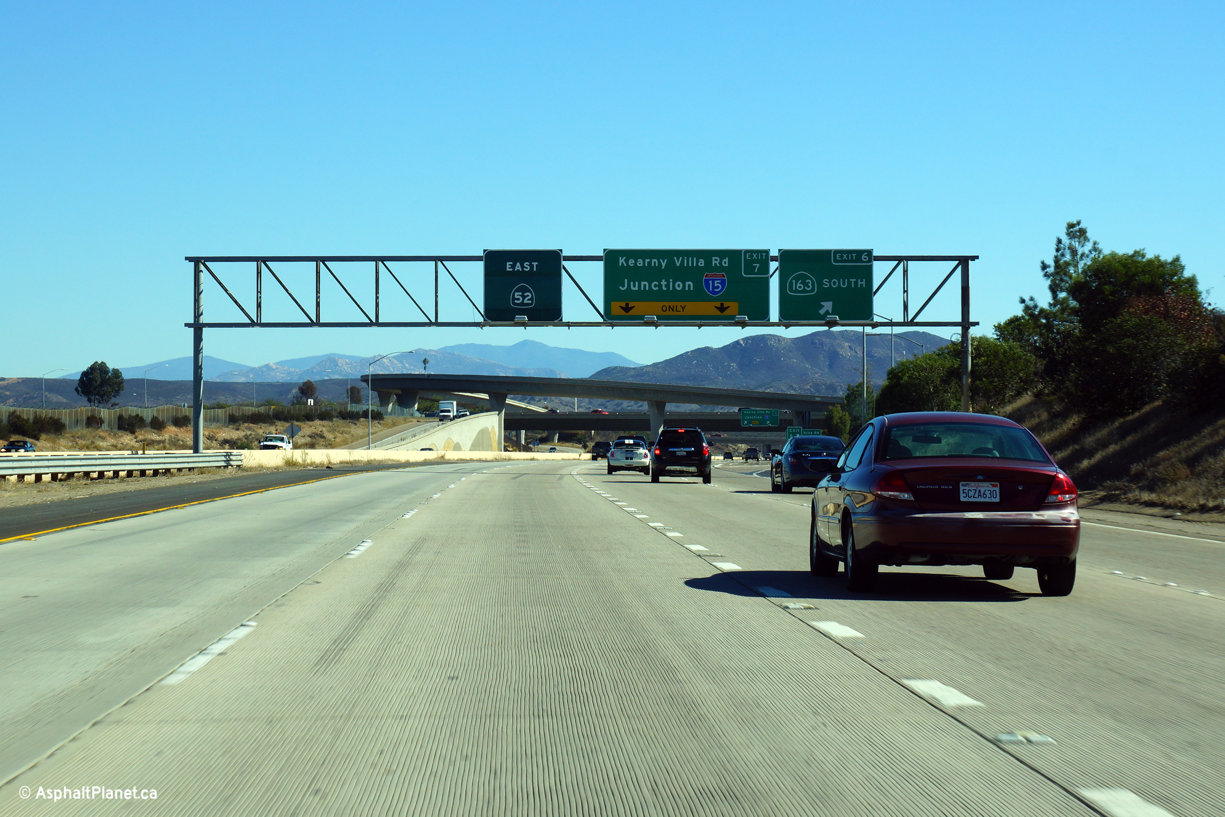
San Diego County |
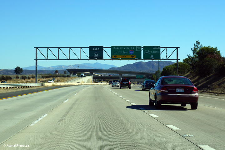
Overhead signage at the off-ramp to State Route 163 South. |
 |
||
|
Date: 10/31/2013 |
High-res: (1440x960) (2400x1600) |
|||
|
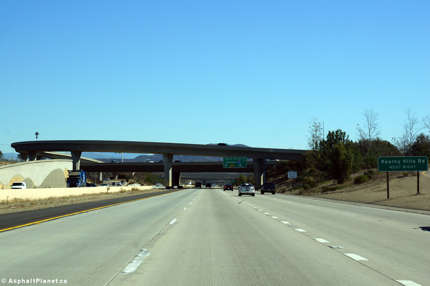
San Diego County |
This view looks easterly from just beyond the off-ramp to State Route 163 South towards the Route 163 interchange. Because of the close proximity of the State Route 163 and Interstate 15 interchanges coupled with the fact that State Route 163 ends at I-15 just a short distance to the north, SR-52 meets SR-163 at a partial interchange. |
 |
||
|
Date: 10/31/2013 |
High-res: (1440x960) (2400x1600) |
|||
| I-15 is the principal inland freeway route in Southern California. Click here for Interstate 15 Images. | ||||
|
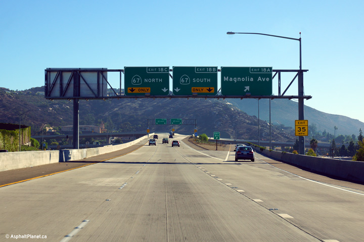
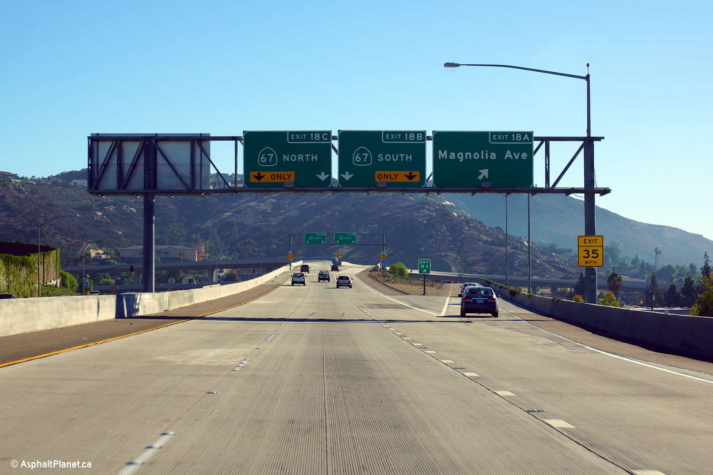
San Diego County |
Advanced signage for both the Magnolia Avenue and State Rote 67 interchanges. The 52 Freeway ends at State Route 67. |
 |
||
|
Date: 10/31/2013 |
High-res: (1440x960) (2400x1600) |
|||
|
San Diego County |
Overhead signage at the off-ramp to Magnolia Avenue. |
 |
||
|
Date: 10/31/2013 |
High-res: (1440x960) (2400x1600) |
|||
|
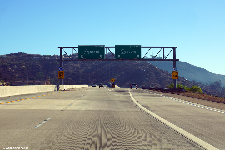
San Diego County |
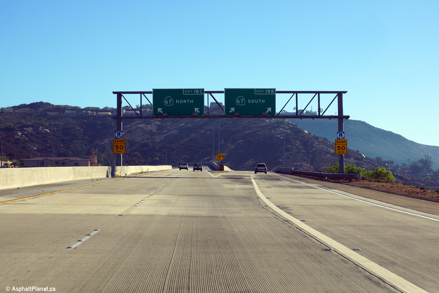
Signage as the eastbound lanes of the 52 Freeway divide to become the north and south bound lanes of the 67 Freeway. |
 |
||
|
Date: 10/31/2013 |
High-res: (1440x960) (2400x1600) | |||
| State Route 67 is a spur freeway that runs north-easterly from I-8 in Santee. Click here for State Route 67 Images. | ||||
<- CA-51
CA Highways
CA-53 ->
AsphaltPlanet.ca
© 2010-14 AsphaltPlanet.ca.
Scott@asphaltplanet.ca
Page Created: November 8, 2014.
Last Updated: November 8, 2014.