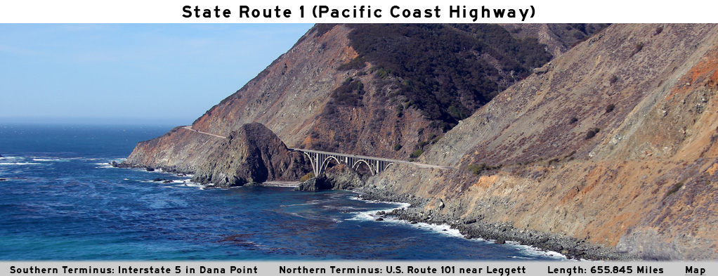
AsphaltPlanet.ca > California > SR-1
Pictures on this
page are arranged in order from south to north. CA-1 North photos are
left-aligned in the last column, while CA-1 South photos are right-aligned.
Center-line pictures are centered within the last column.
|
Location |
Description |
Photo |
||
|
North- |
South- |
|||
| The Pacific Coast Highway intersects the Century Freeway (I-105) immediately south of LAX. Click here for Interstate 105 Images. | ||||
|
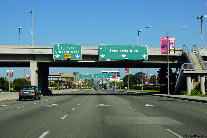
Los Angeles County |
Advanced signage approaching the off-ramp to Sepulveda Boulevard north of LAX. |
 |
||
|
Date: 10/30/2013 |
High-res: (1440x960) (2400x1600) | |||
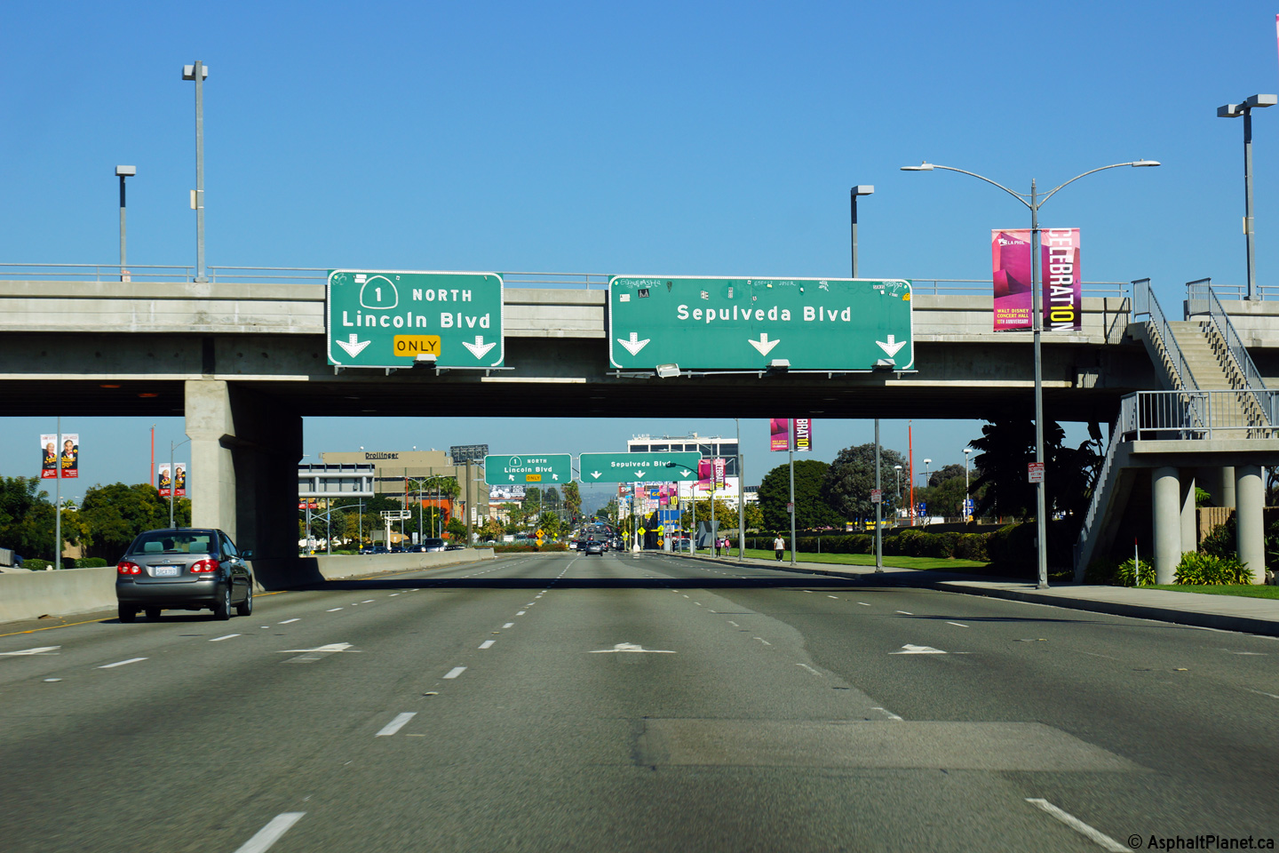
|
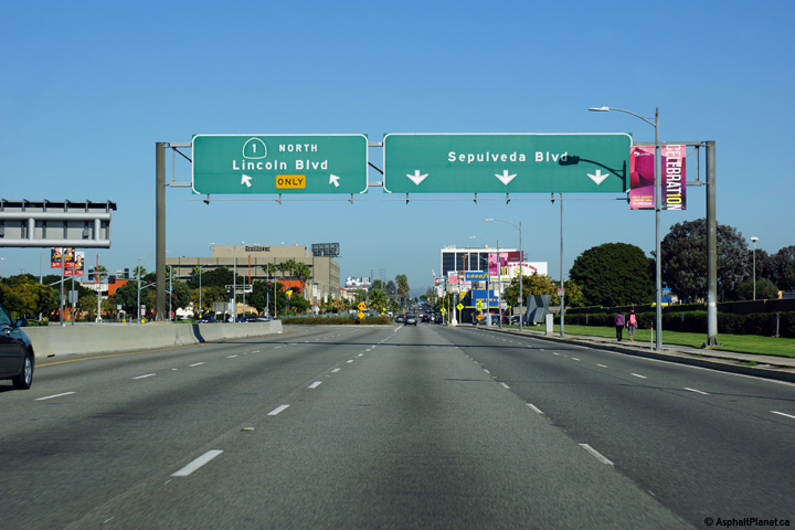
Los Angeles County |
Overhead signage as SR-1 departs Sepulveda Boulevard's alignment for that of Lincoln Boulevard. |
 |
||
|
Date: 10/30/2013 |
High-res: (1440x960) (2400x1600) | |||
| Interstate 10 is the Christopher Columbus Trans-Continental Highway and runs easterly from the PCH at Santa Monica on the Pacific Ocean to Jacksonville, Florida on the Atlantic. Click here for Interstate 10 Images. | ||||
|
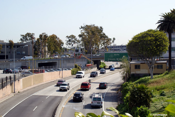
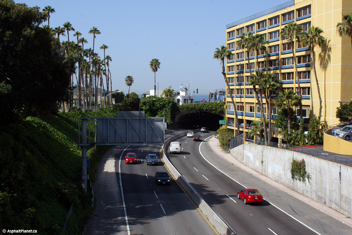
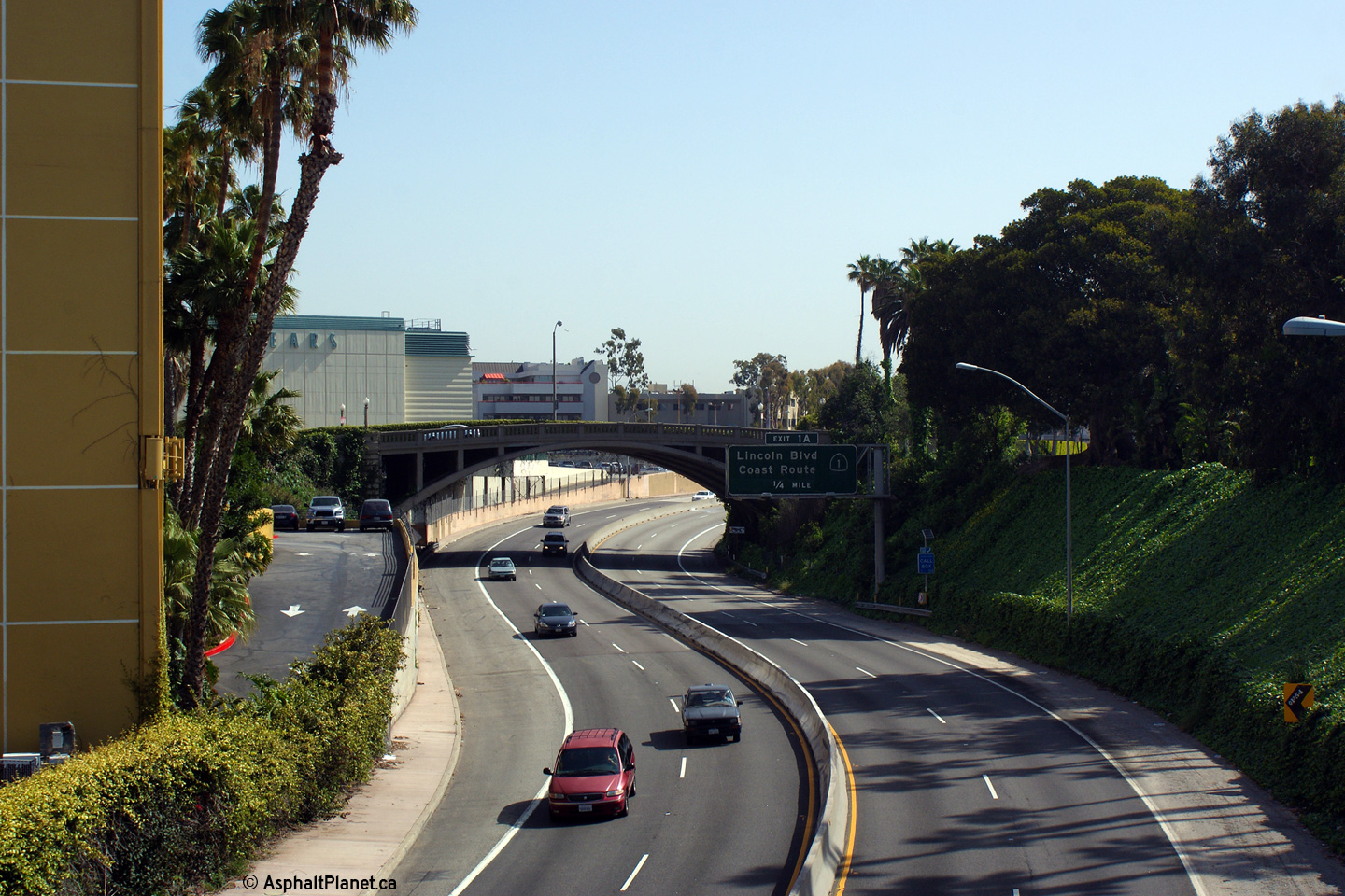
Los Angeles County |
This view looks easterly from the Main Street overpass towards the Lincoln Boulevard interchange. |
 |
||
|
Date: 3/27/2010 |
High-res: (1440x960) (2400x1600) | |||
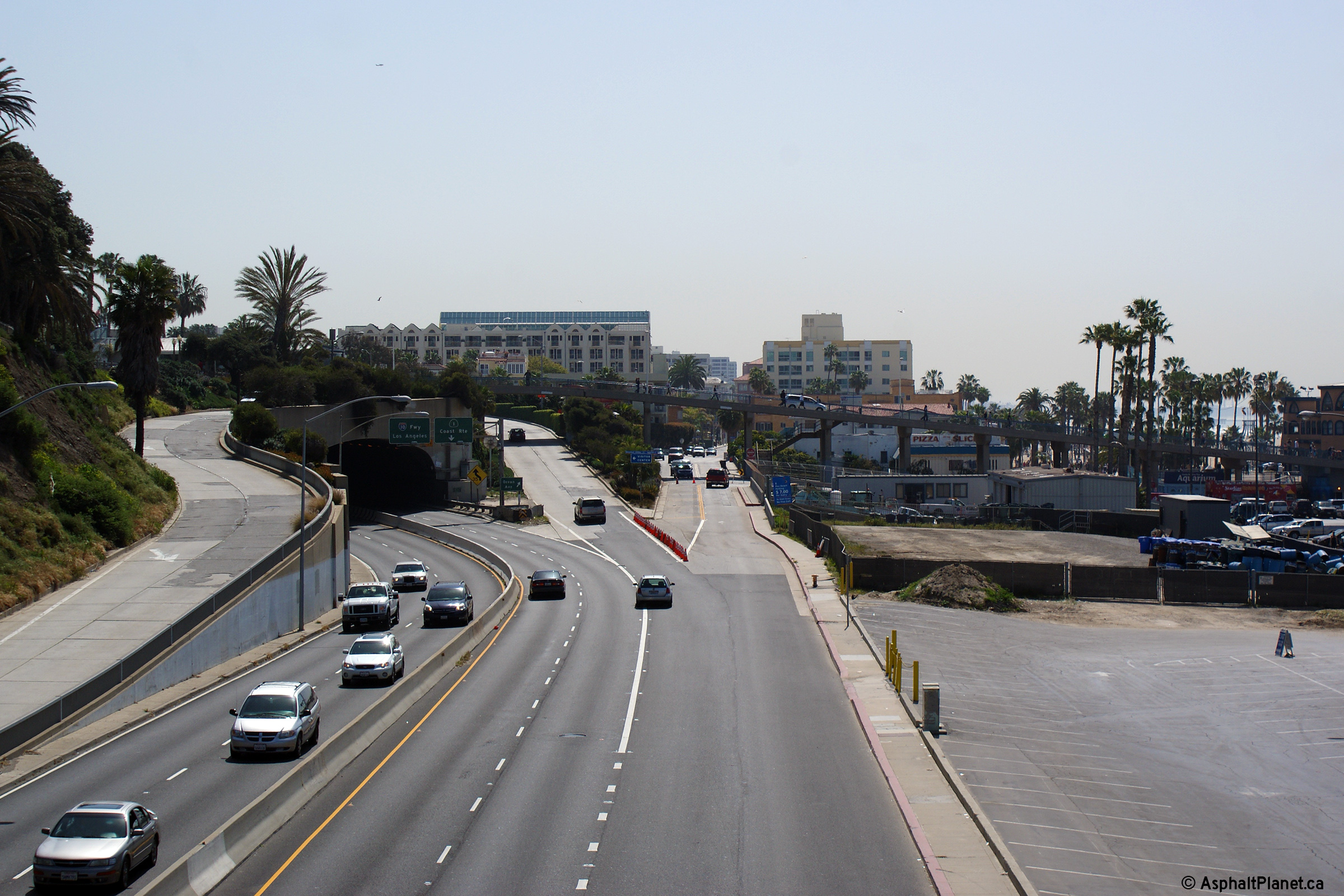
|
Los Angeles County |
Westerly view from the Main Street interchange towards the tunnel that carries I-10 and SR-1 beneath Ocean Avenue at the western terminus of the interstate. |
 |
||
|
Date: 3/27/2010 |
High-res: (1440x960) (2400x1600) | |||
|
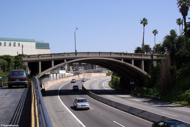
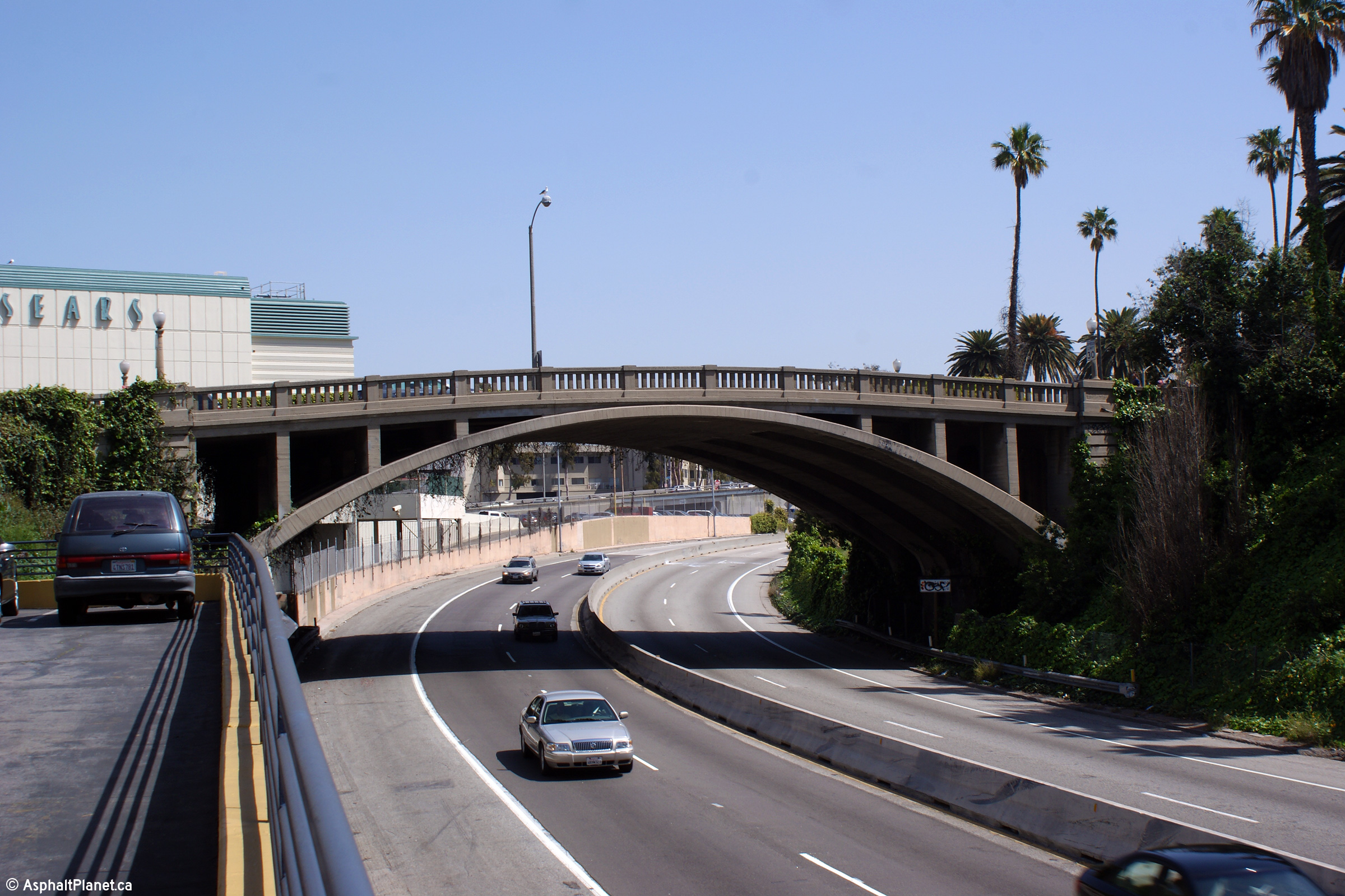
Los Angeles County |
Close-up view of the open spandrel concrete arch bridge that carries Main Street overtop I-10 and SR-1. |
 |
||
|
Date: 3/27/2010 |
High-res: (1440x960) (2400x1600) | |||
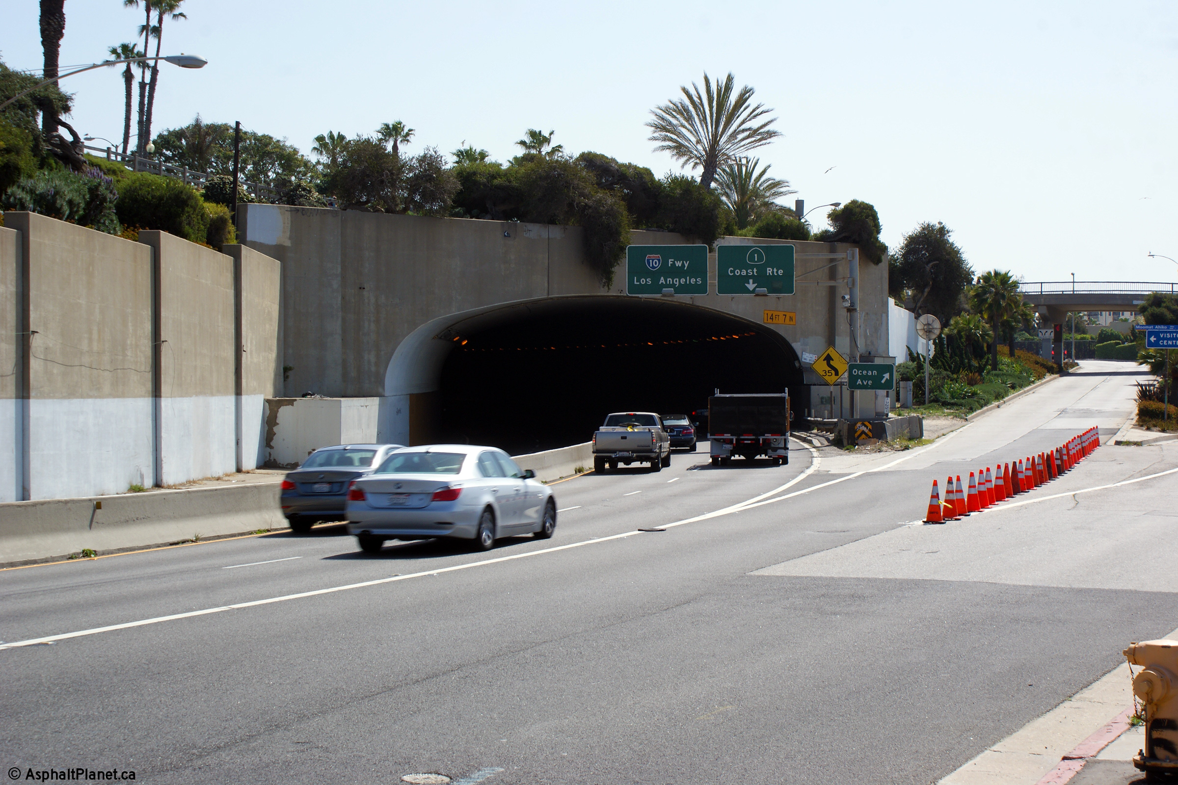
|
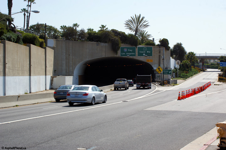
Los Angeles County |
Easterly view along I-10/SR-1 from Ocean Avenue. |
 |
||
|
Date: 3/27/2010 |
High-res: (1440x960) (2400x1600) | |||
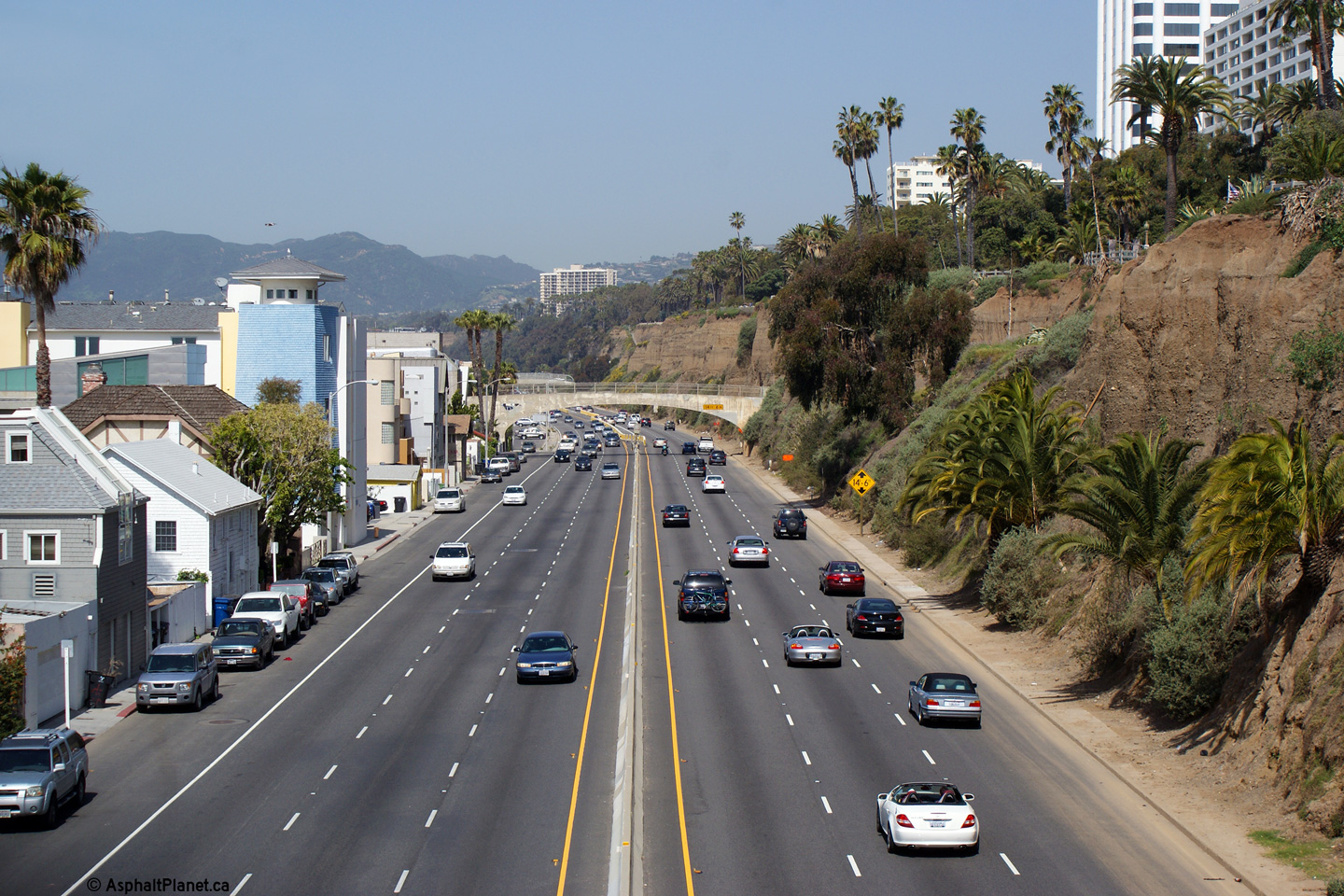
|
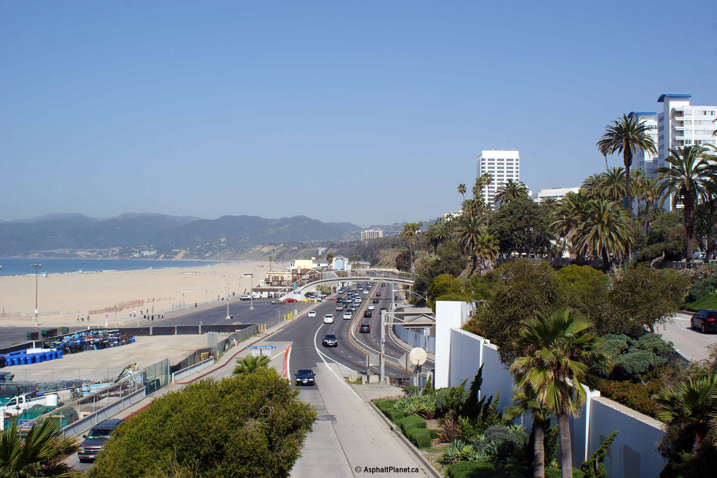
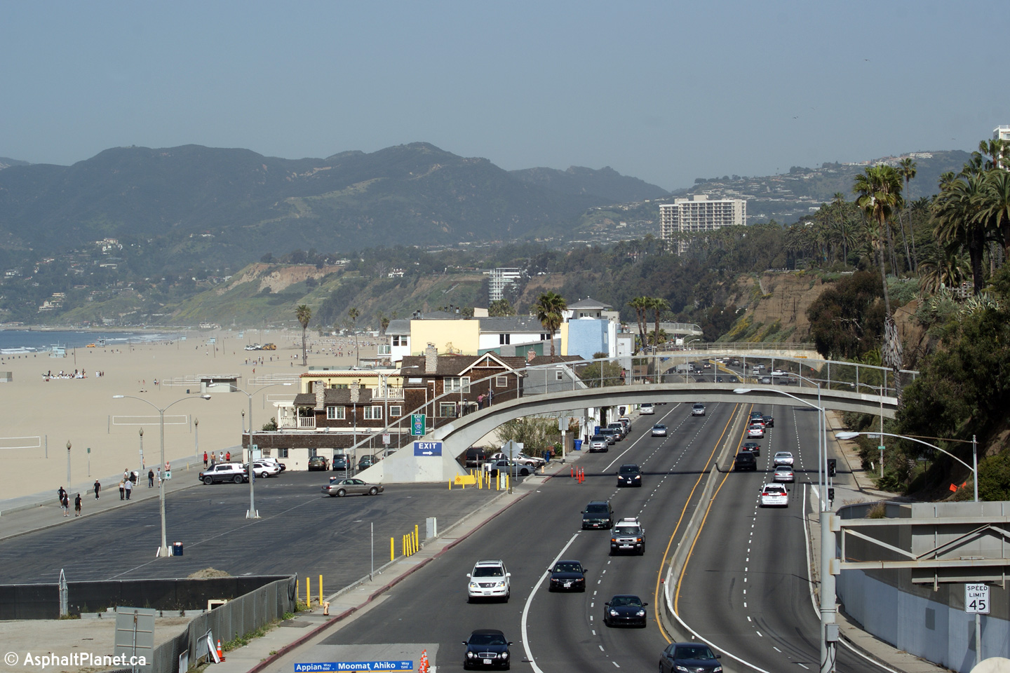
Los Angeles County |
Two views looking northerly along SR-1 from Santa Monica Pier. Santa Monica State Beach and the Pacific Ocean are visible to the left (west) of the Pacific Coast Highway. |
 |
||
| High-res: (1440x960) (2400x1600) | ||||
 |
||||
|
Date: 3/27/2010 |
High-res: (1440x960) (2400x1600) | |||
|
Los Angeles County |
This view looks easterly at the beginning of Transcontinental Interstate Route 10 at Ocean Avenue in Santa Monica |
 |
||
|
Date: 3/27/2010 |
High-res: (1440x960) (2400x1600) | |||
|
Los Angeles County |
Southerly view towards the start of I-10 from the Broadway Street pedestrian bridge. |
 |
||
|
Date: 3/27/2010 |
High-res: (1440x960) (2400x1600) | |||
|
Los Angeles County |
Northerly view from the Broadway Street pedestrian bridge. |
 |
||
|
Date: 3/27/2010 |
High-res: (1440x960) (2400x1600) | |||
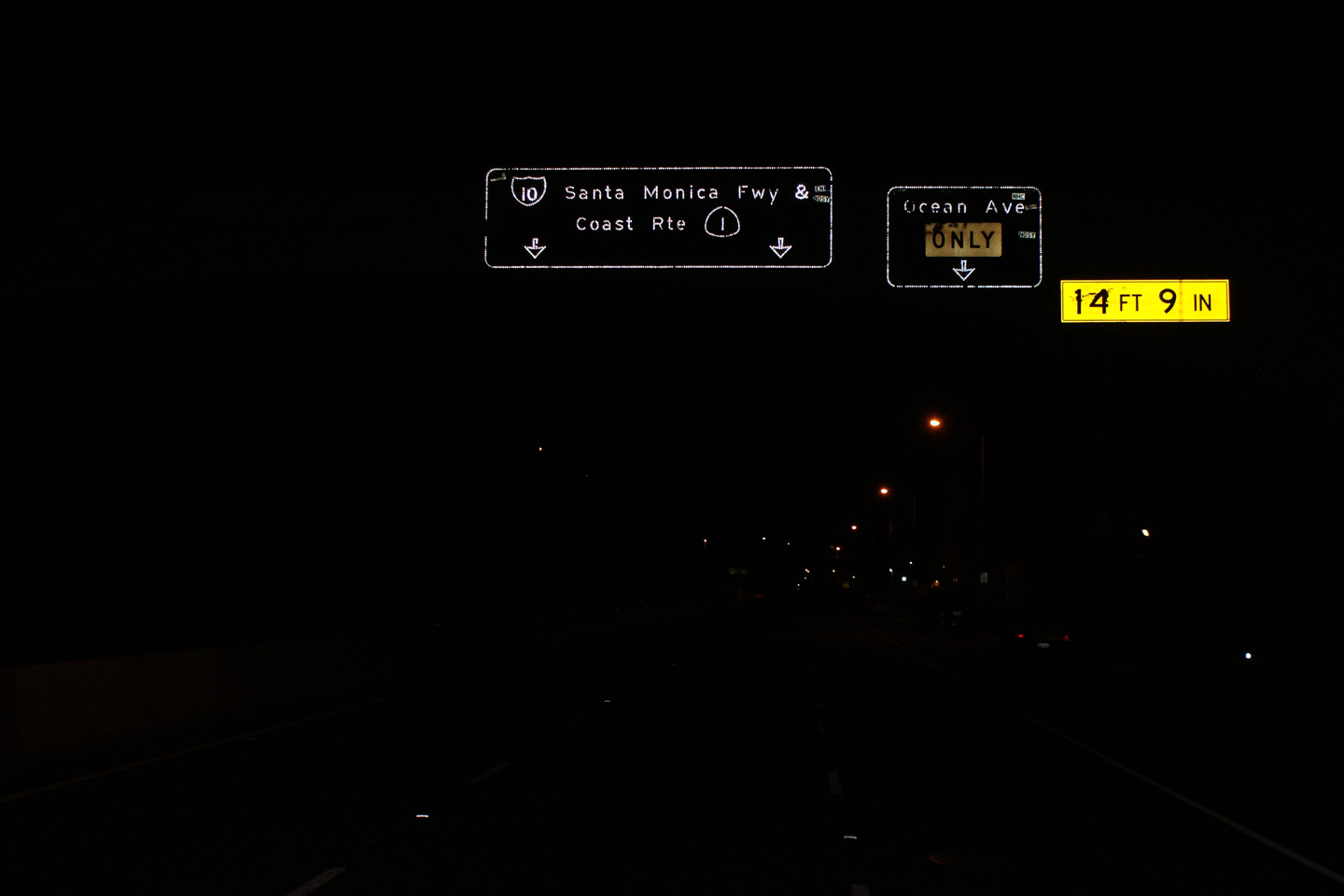
|
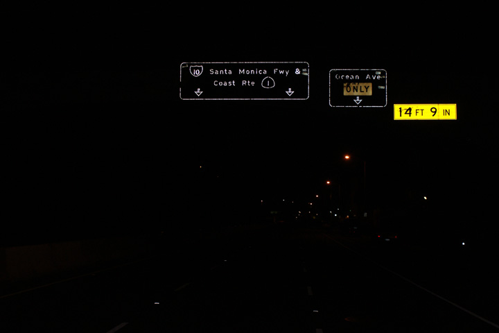
Los Angeles County |
Night view approaching the Ocean Avenue interchange along the Pacific Coast Highway. |
 |
||
|
Date: 3/27/2010 |
High-res: (1440x960) |
|||
|
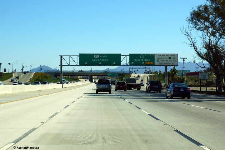
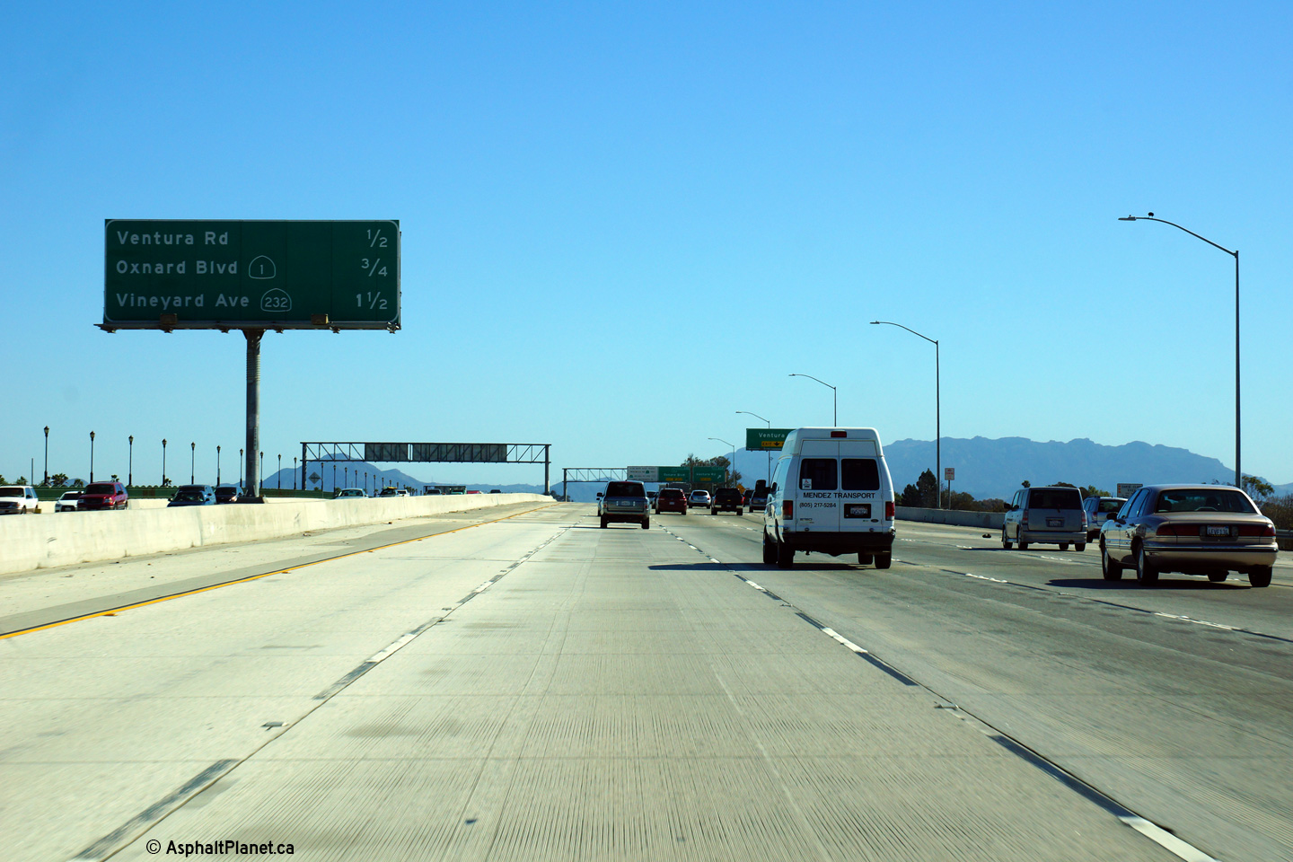
Ventura County |
Southbound signage along US-101 at the off-ramp to SR-1 in Oxnard. |
 |
||
|
Date: 10/31/2013 |
High-res: (1440x960) (2400x1600) |
|||
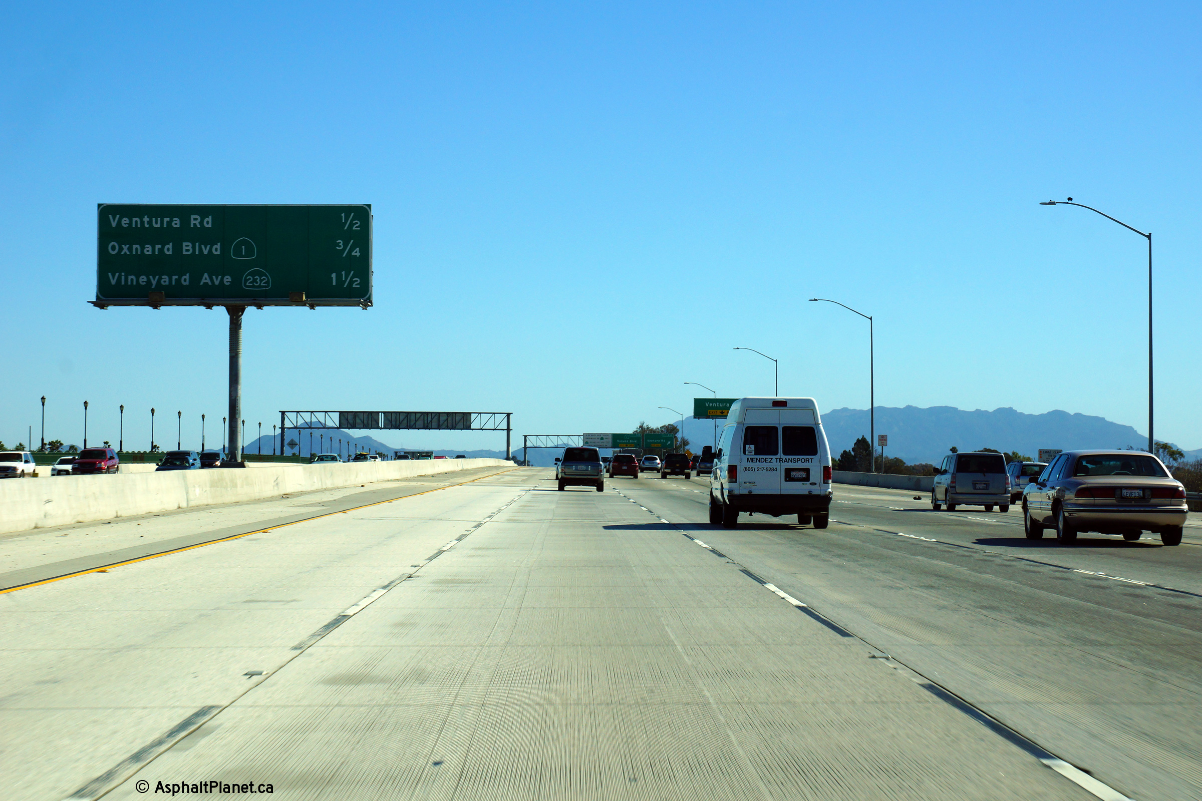
|
Ventura County |
Southbound advanced signage for the ramp to SR-1. |
 |
||
|
Date: 10/30/2013 |
High-res: (1440x960) (2400x1600) | |||
|
Ventura County |
This view looks southerly as the 57 Freeway rounds a curve north of the Yorba Linda Drive interchange. The Carpool lanes are open access along this stretch of freeway. |
 |
||
|
Date: 10/30/2013 |
High-res: (1440x960) (2400x1600) | |||
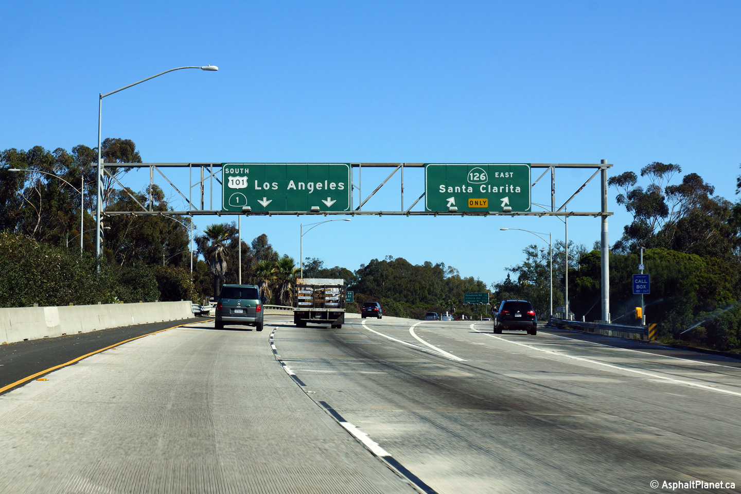
|
Ventura County |
Southbound view at the off-ramp to SR-126 in Ventura |
 |
||
|
Date: 10/30/2013 |
High-res: (1440x960) (2400x1600) | |||
|
Ventura County |
Advanced signage approaching the ramp to SR-126. The right-most freeway lane along US-101 departs the freeway mainline at this interchange. |
 |
||
|
Date: 10/30/2013 |
High-res: (1440x960) (2400x1600) |
|||
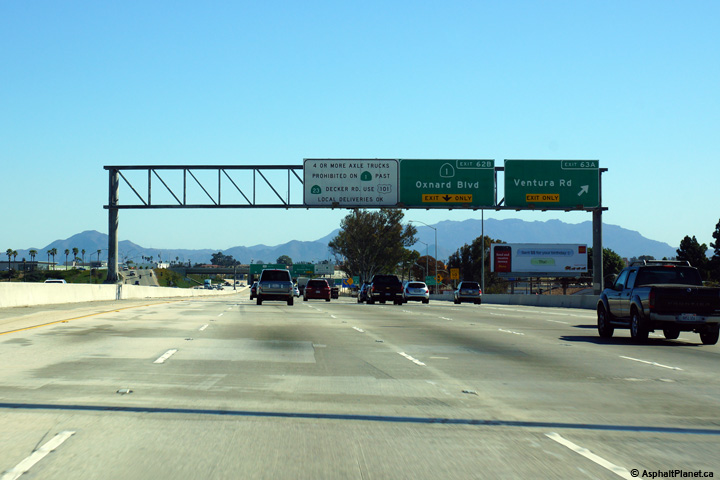
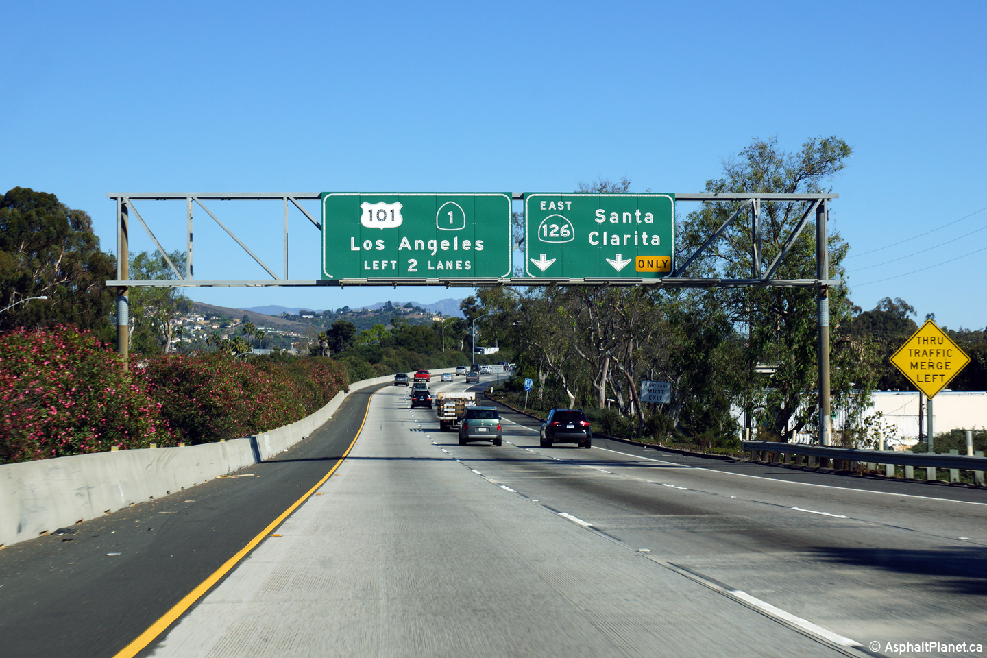
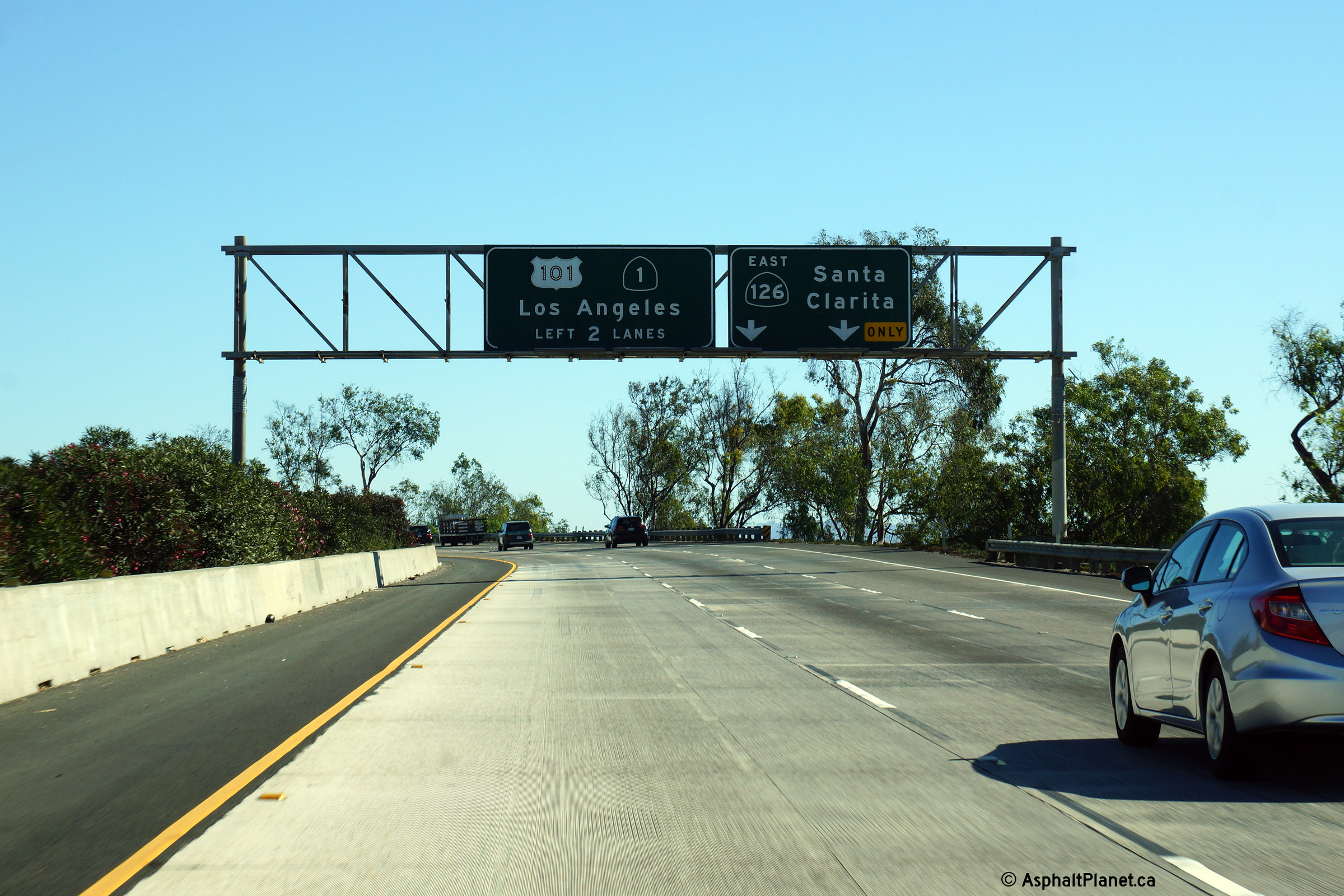
|
Ventura County |
First of two southbound advanced lane assignment signs approaching the SR-126 interchange. It is atypical for SR-1 to be signed concurrently where it runs along US-101. Typically the SR-1 designation is hidden when the two highways share the same alignment. |
 |
||
|
Date: 10/30/2013 |
High-res: (1440x960) (2400x1600) | |||
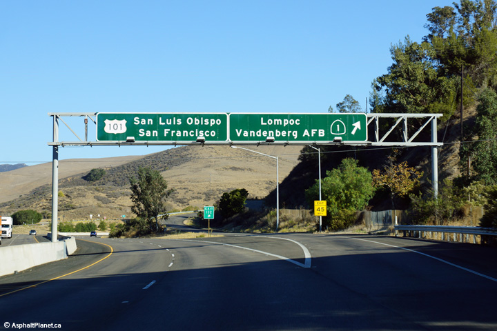
|
Santa Barbara County |
Northbound signage where US-101 and SR-1 diverge from one another's alignment south of Lompoc. |
 |
||
|
Date: 11/05/2013 |
High-res: (1440x960) (2400x1600) | |||
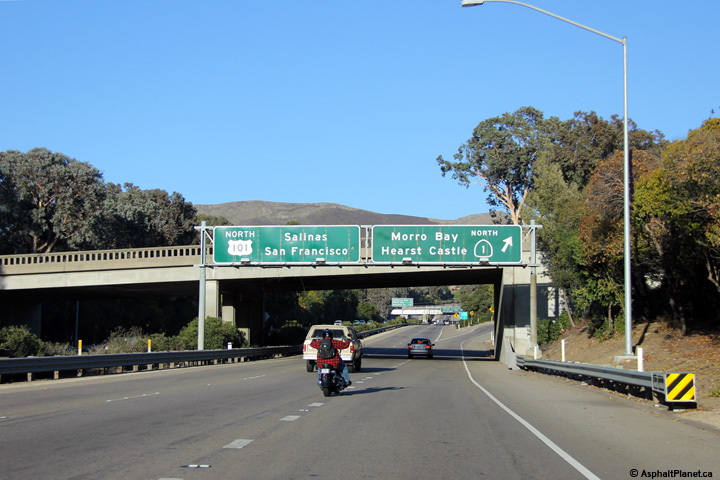
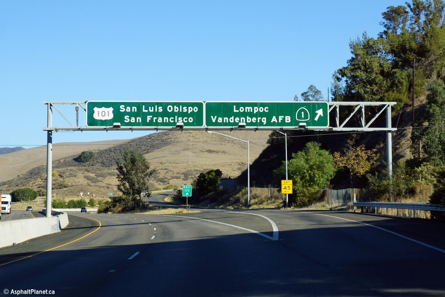
|
San Luis Obispo County |
Northbound view at the divergence of US-101 and SR-1 in San Luis Obispo. |
 |
||
|
Date: 11/04/2013 |
High-res: (1440x960) (2400x1600) | |||
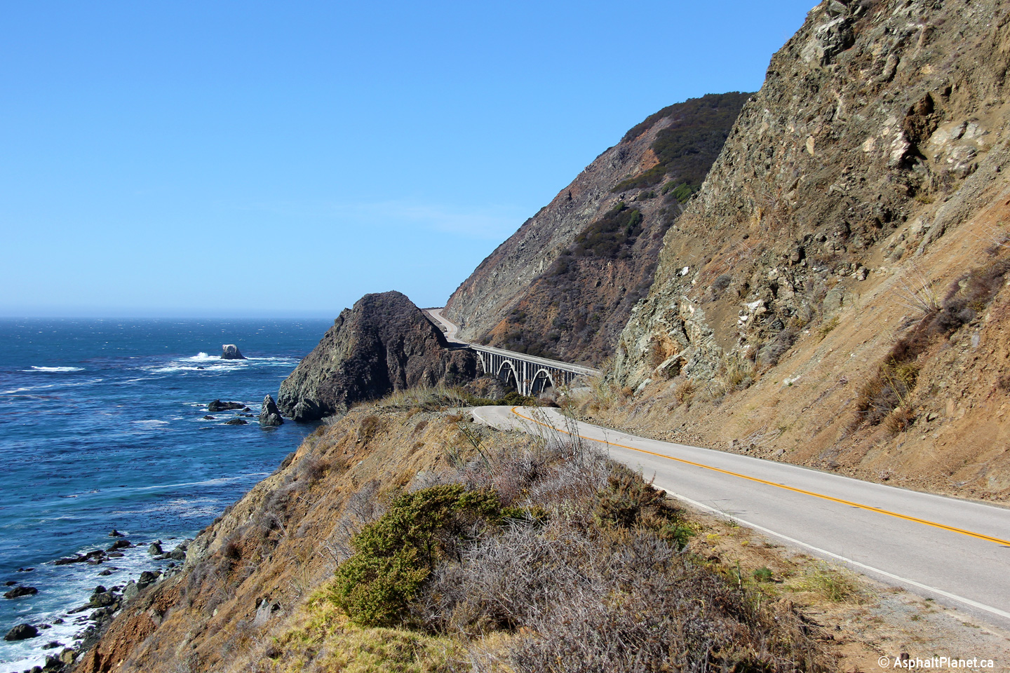
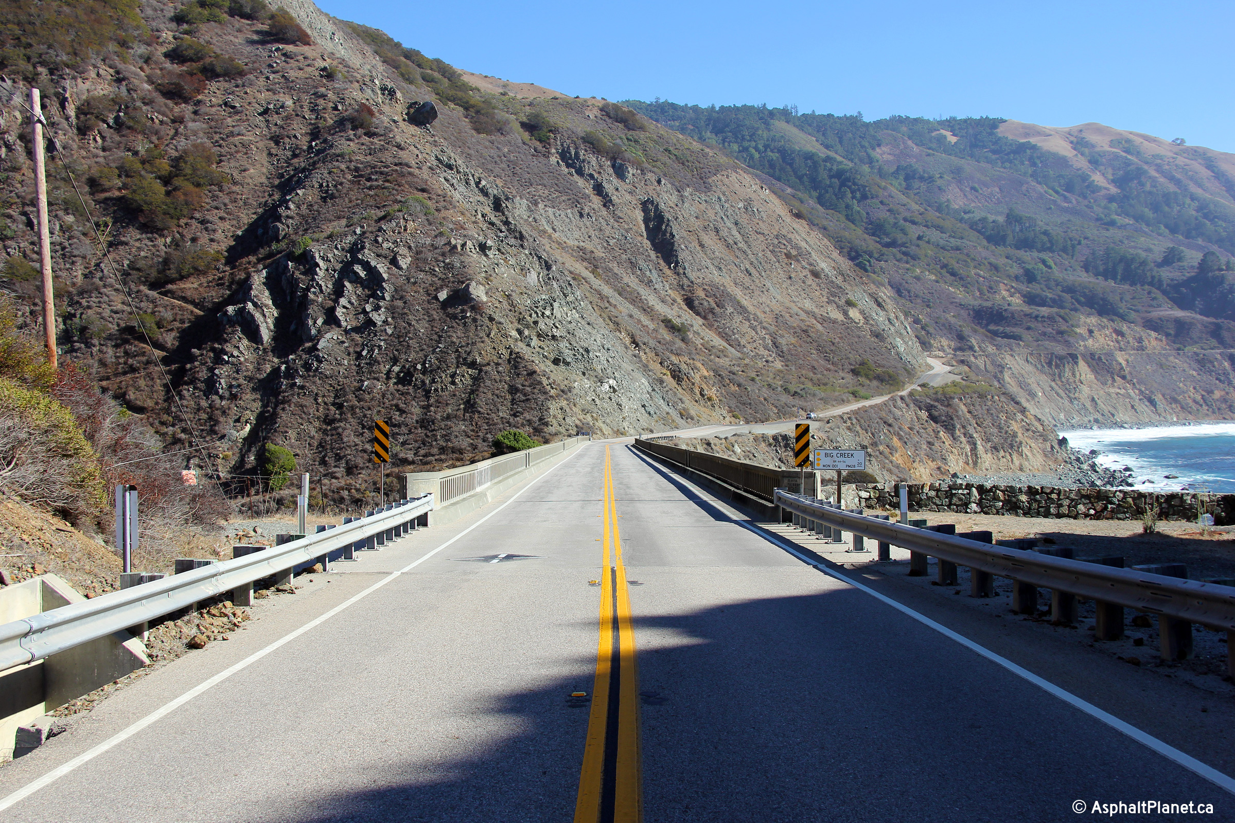
|
Monterey County |
This view looks northerly as SR-1 approaches to Big Creek bridge. |
 |
||
|
Date: 11/04/2013 |
High-res: (1440x960) (2400x1600) | |||
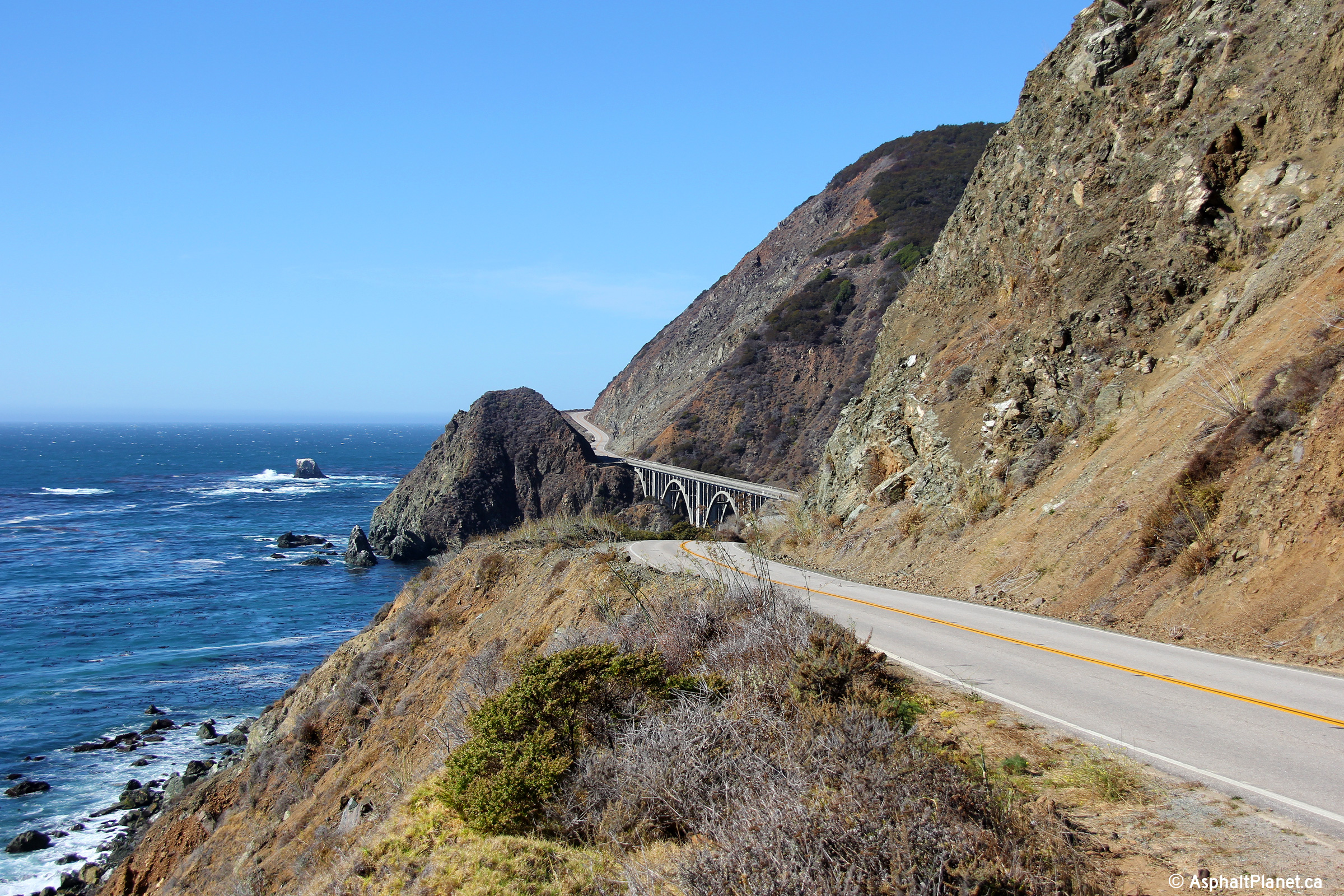
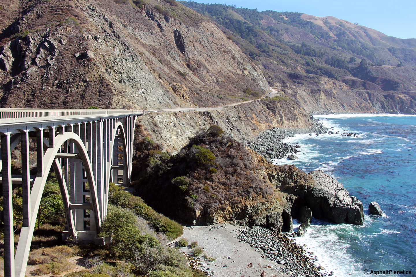
|
Monterey County |
Southerly view at the Big Creek Bridge. There are few structure designs that match the majestic aesthetics of open spandrel concrete arch bridges. |
 |
||
|
Date: 11/04/2013 |
High-res: (1440x960) (2400x1600) | |||
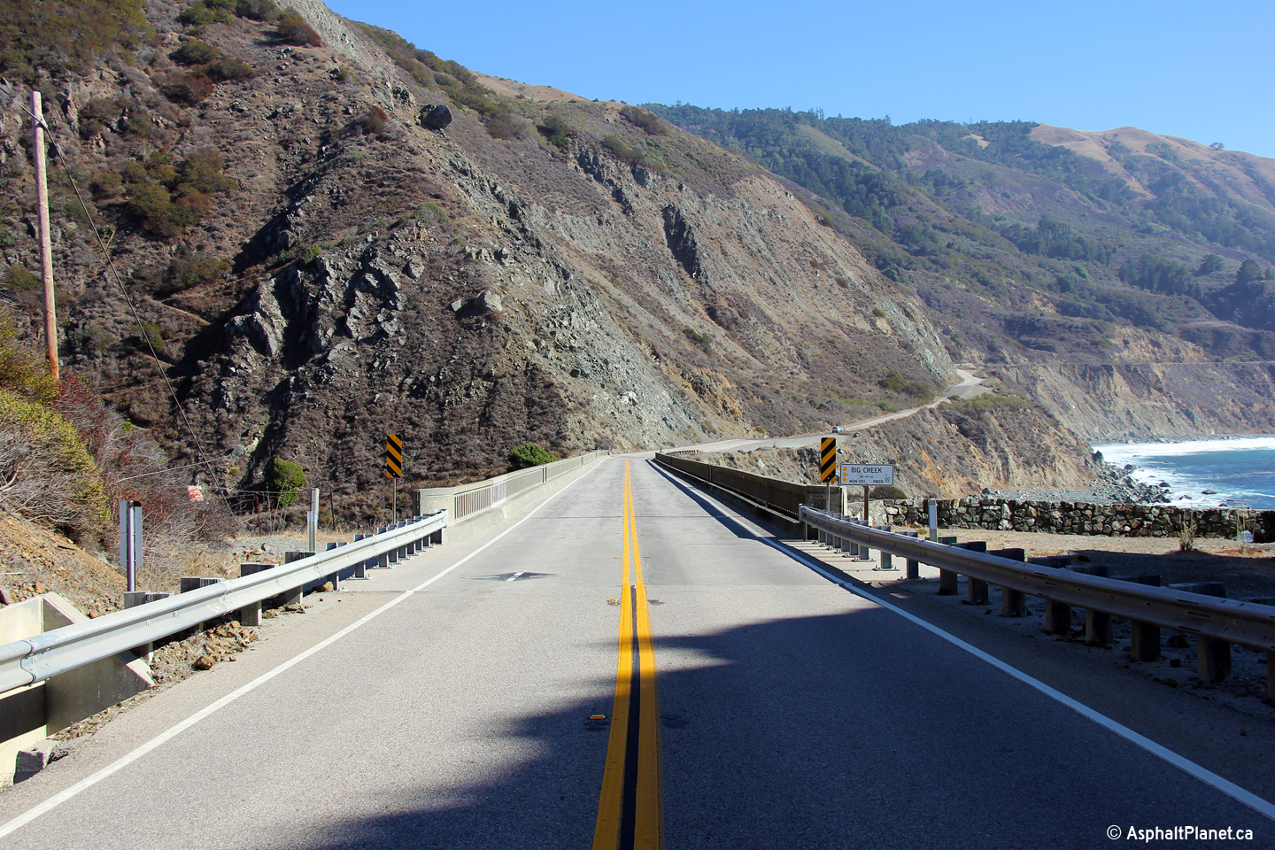
|
Monterey County |
Deck view looking southerly across the Big Creek Bridge. |
 |
||
|
Date: 11/04/2013 |
High-res: (1440x960) (2400x1600) | |||
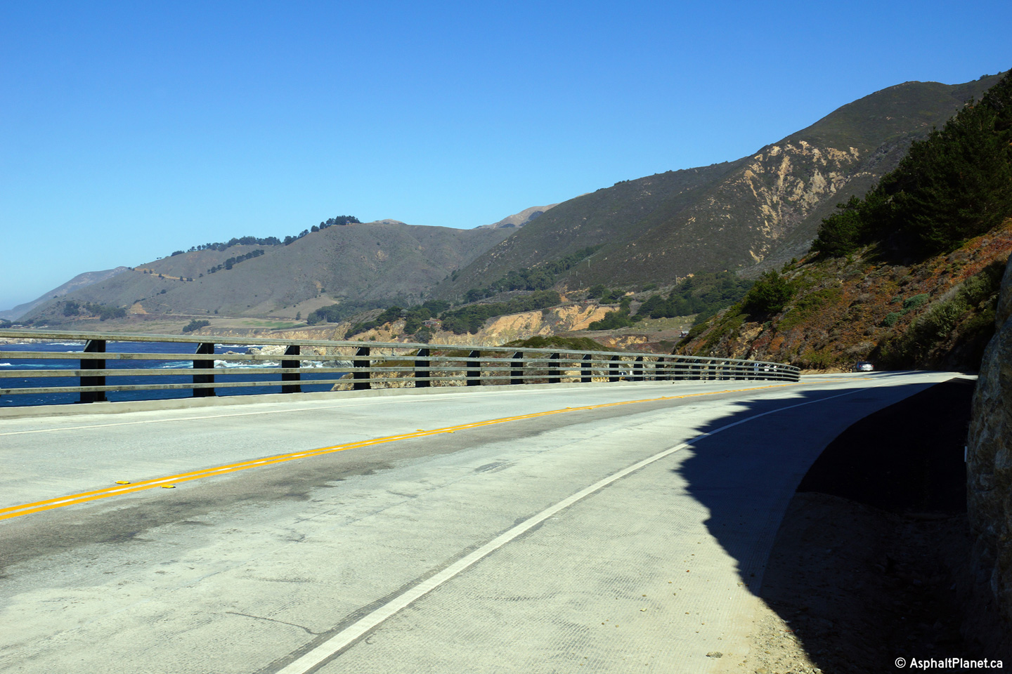
|
Monterey County |
This section of SR-1 located a short distance north of the Bixby Creek bridge has been cantilevered out on the steep hillside that are typical of the coastal ranges. |
 |
||
|
Date: 11/04/2013 |
High-res: (1440x960) (2400x1600) | |||
|
San Mateo County |
Southbound signage as the off-ramp to Skyline Boulevard South departs the freeway mainline of SR-1. |
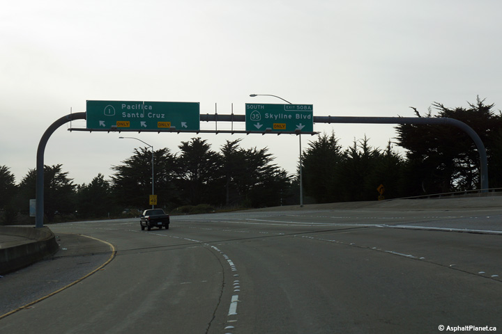 |
||
|
Date: 11/03/2013 |
High-res: (1440x960) (2400x1600) | |||
|
San Mateo County |
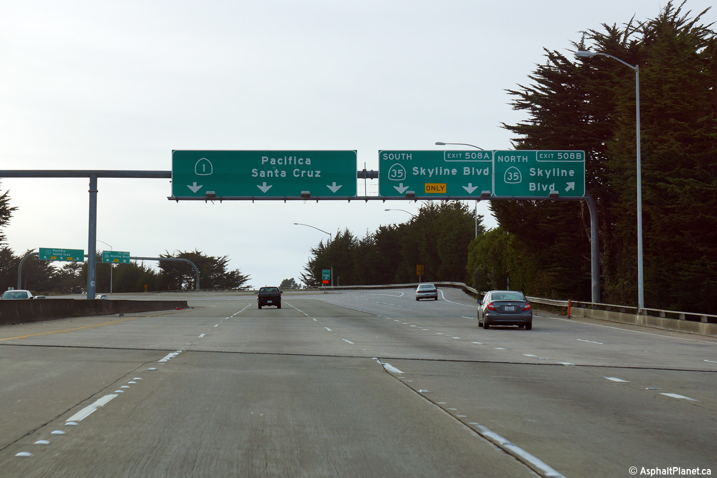
Southbound signage at the off-ramp to Skyline Boulevard North. |
 |
||
|
Date: 11/03/2013 |
High-res: (1440x960) (2400x1600) | |||
|
San Mateo County |
Advanced signage for the Skyline Boulevard interchange. |
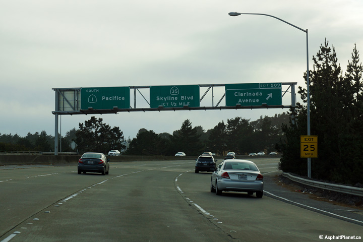 |
||
|
Date: 11/03/2013 |
High-res: (1440x960) (2400x1600) | |||
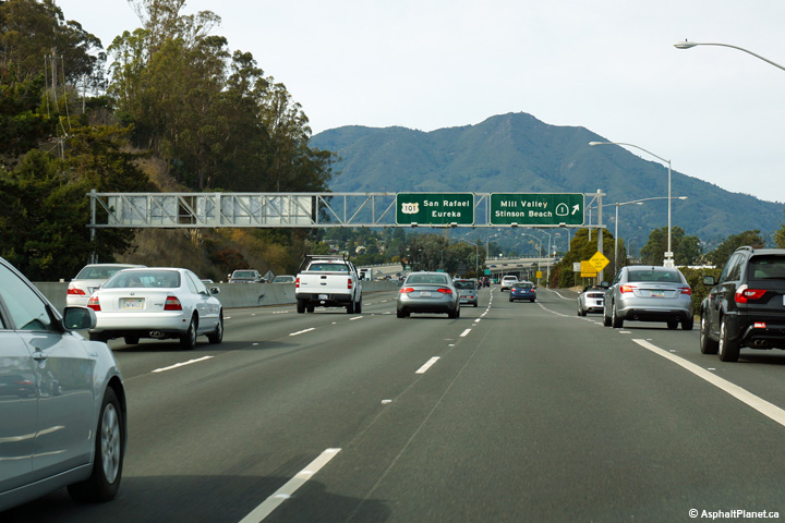
|
Marin County |
Advanced signage for the SR-1/US-101 split north of the Golden Gate Bridge. |
 |
||
|
Date: 11/03/2013 |
High-res: (1440x960) (2400x1600) | |||
|
Marin County |
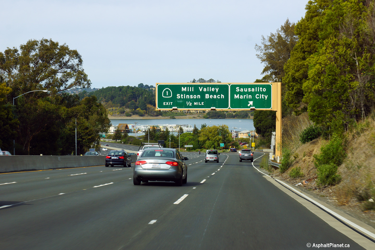
Signage at the northbound off-ramp to SR-1. |
 |
||
|
Date: 11/03/2013 |
High-res: (1440x960) (2400x1600) | |||
| US-101 continues northerly from SR-1 in Marin City running roughly parallel to SR-1, on a more inland alignment than the coast road. Click here for US-101 Images. | ||||
<- I-980
CA Highways
CA-2 ->
AsphaltPlanet.ca
© 2010-15 AsphaltPlanet.ca.
AsphaltPlanet@asphaltplanet.ca
Page Created: November 26, 2014.
Last Updated: November 26, 2014.