AsphaltPlanet.ca > Arizona > Interstate 17
|
Southern Terminus: Interstate 10, southeast of Downtown
Phoenix.
Northern Terminus: Interstate 40 interchange in Flagstaff. I-17 continues north into Flagstaff as a surface road. Length: 145.76 Miles (234.58km). |
Pictures on this page are arranged in order from south to north. I-17 North photos are left-aligned in the last column, while I-17 South photos are right-aligned. Center-line pictures are centered within the last column.
|
Location |
Description |
Photo |
||
|
North- |
South- |
|||
|
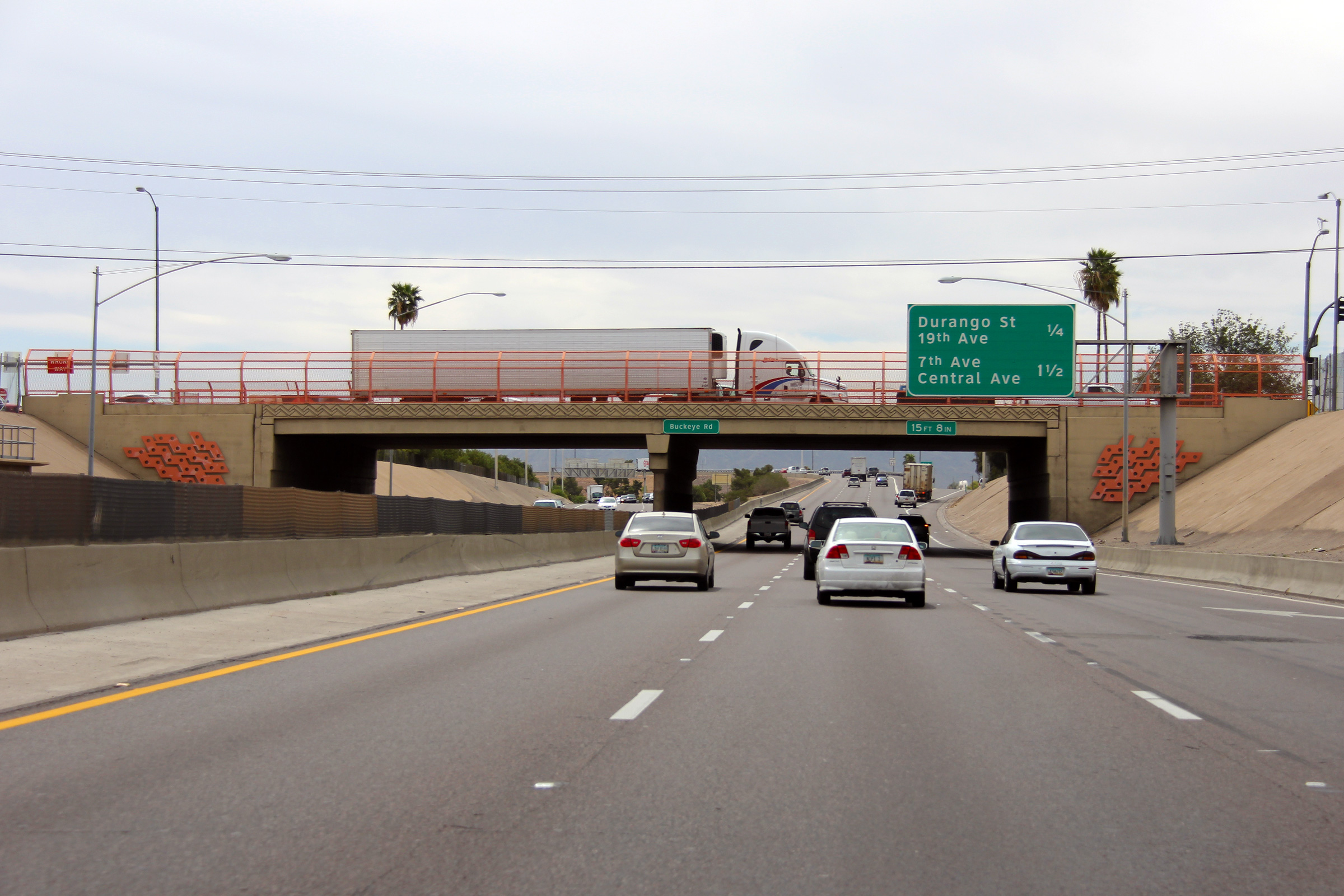
Maricopa County Phoenix |
Southerly view as I-17 passes beneath the Buckeye Road overpass. South of Buckeye Road, I-17 curves 90 degrees to the east. According to ArizonaRoads.com, one of the proposed alignments of I-10 would have met I-17 at the pictured 90 degree curve. The Black Canyon Freeway designation ends at this curve, beyond the curve, I-17 is known as the Maricopa Freeway. The Maricopa Freeway continues east beyond the end of I-17 along I-10's alignment. |
 |
||
|
Date: 26/3/2013 |
High-res: (1440x960) (2400x1600) | |||
|
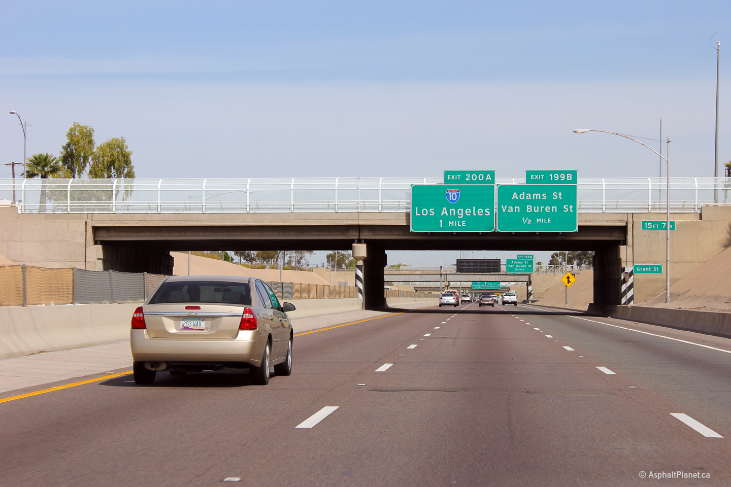
Maricopa County Phoenix |
Northbound view through the Grant Street overpass. One would think that that what appears to be white paint on the hazard makers of the bridge abutment and pier were originally painted yellow and have since faded.. |
 |
||
|
Date: 26/3/2013 |
High-res: (1440x960) (2400x1600) | |||
|
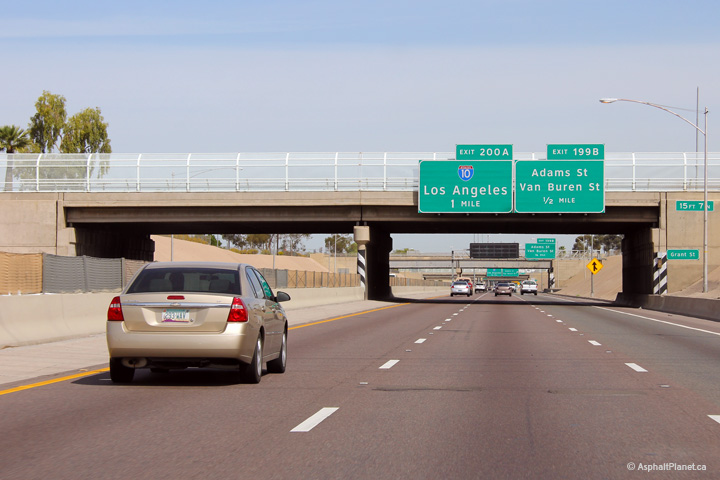
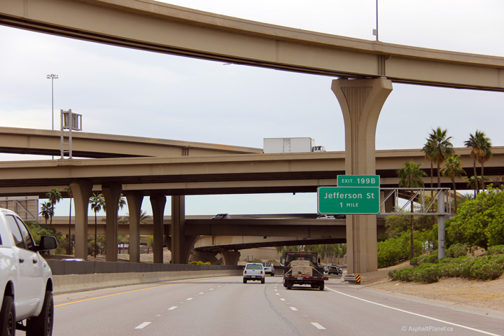
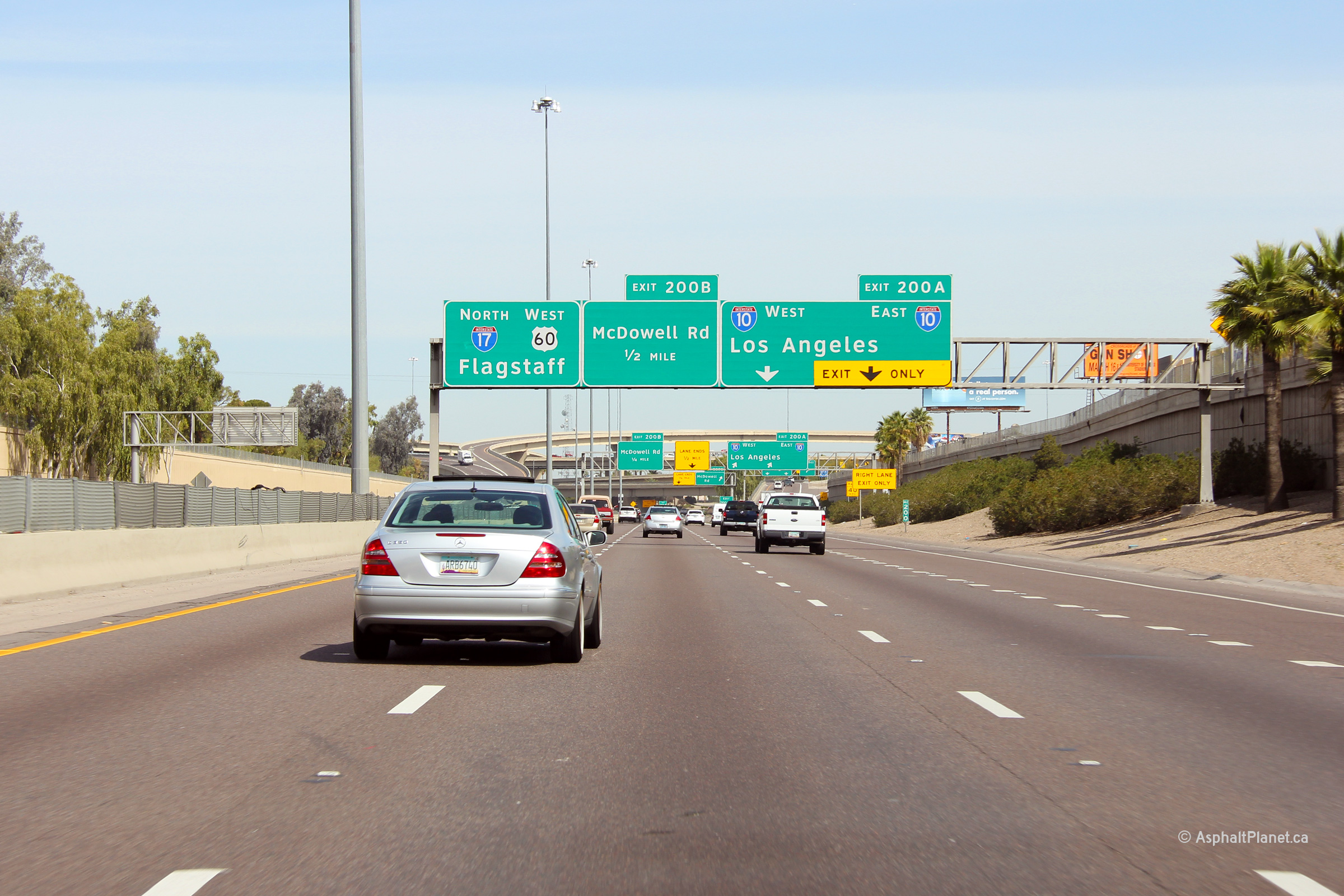
Maricopa County Phoenix |
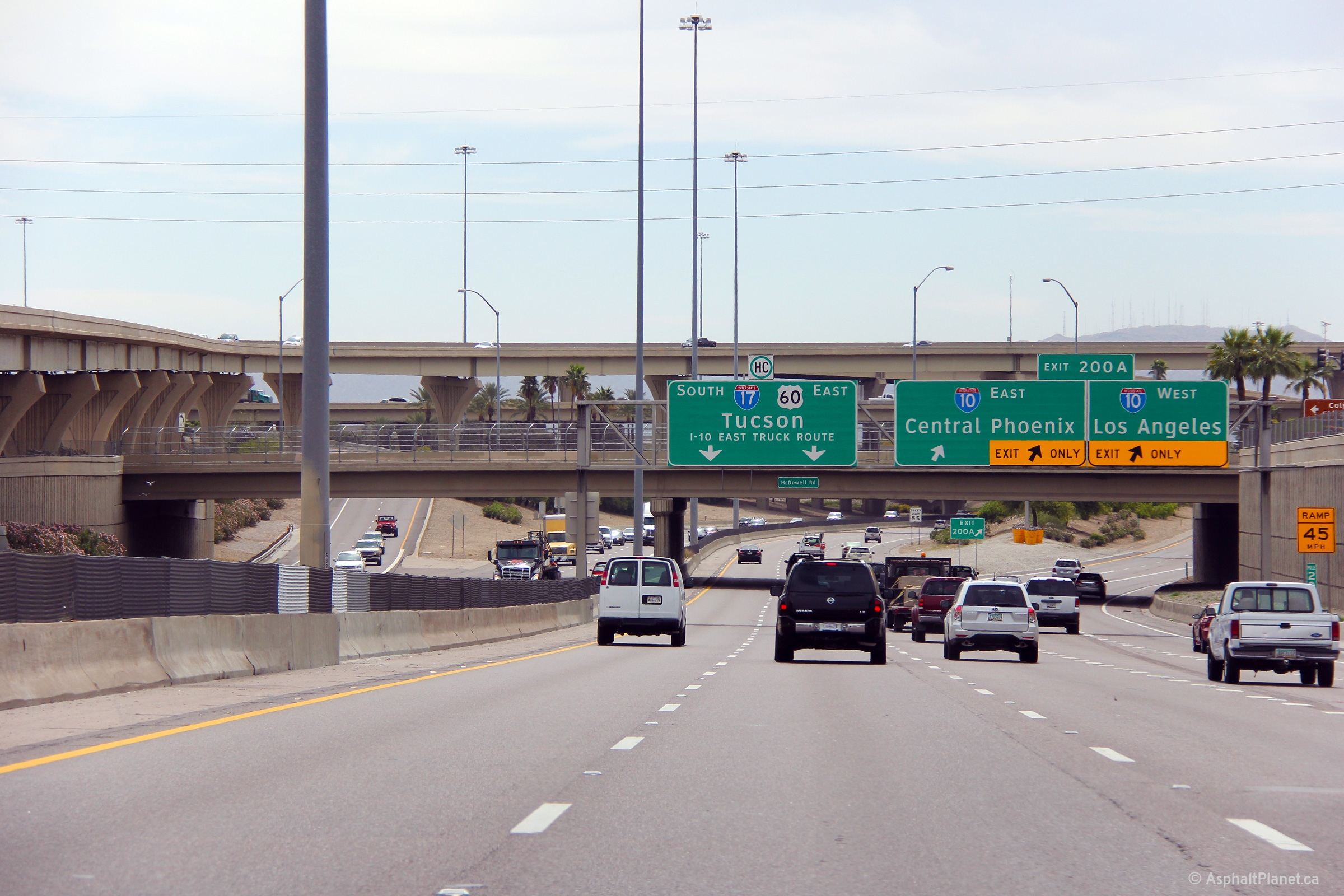
Advanced signage for the I-10 interchange. |
 |
||
|
Date: 26/3/2013 |
High-res: (1440x960) (2400x1600) | |||
|
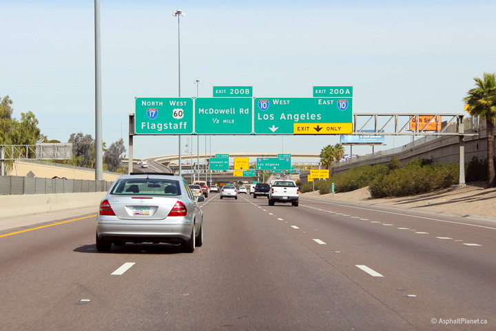
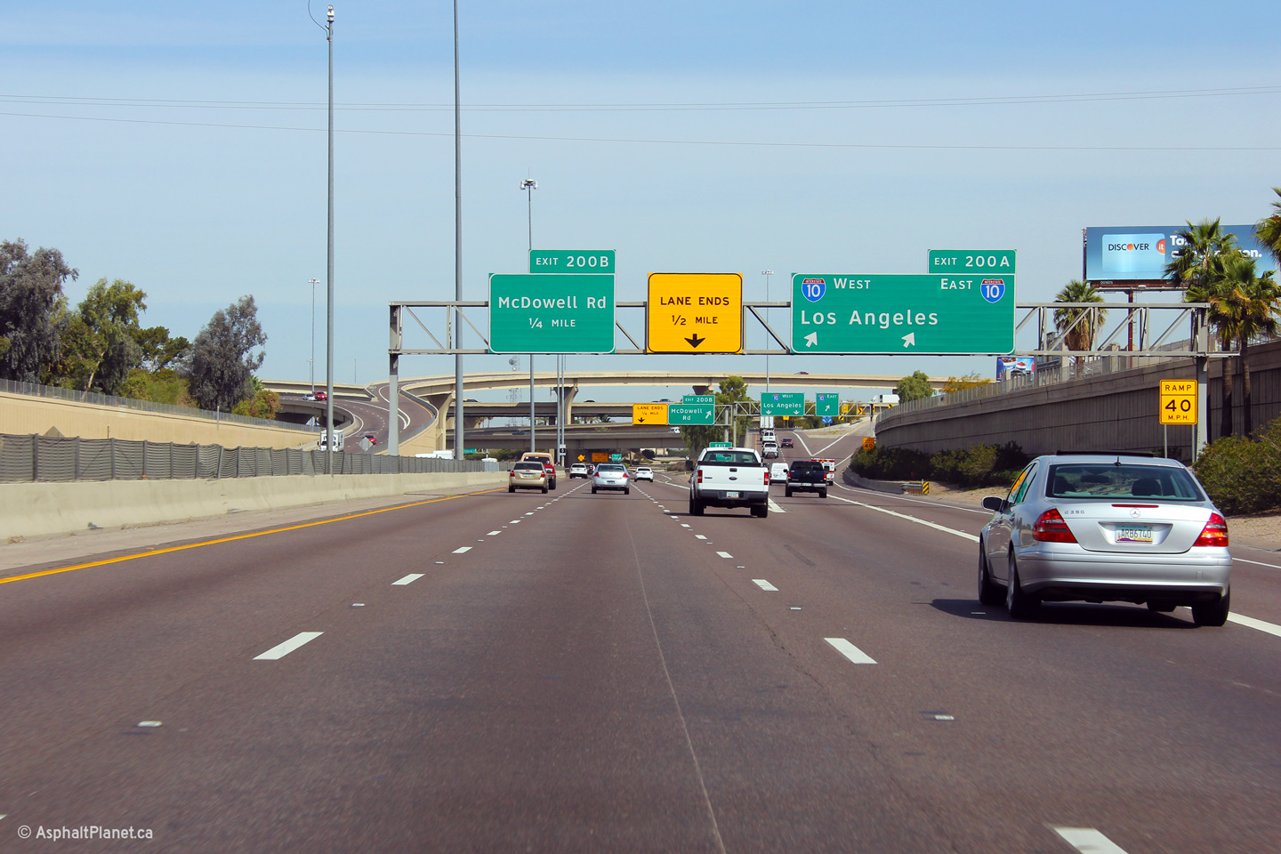
Maricopa County Phoenix |
Northbound view at the off-ramp to I-10. |
 |
||
|
Date: 26/3/2013 |
High-res: (1440x960) (2400x1600) | |||
|
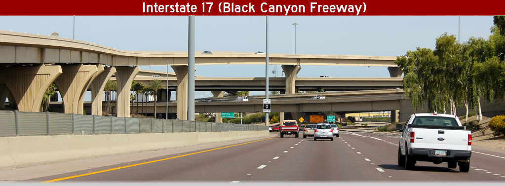
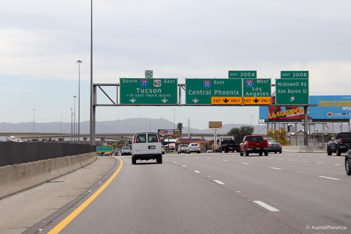
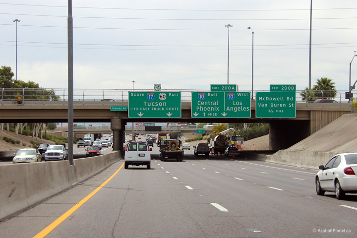
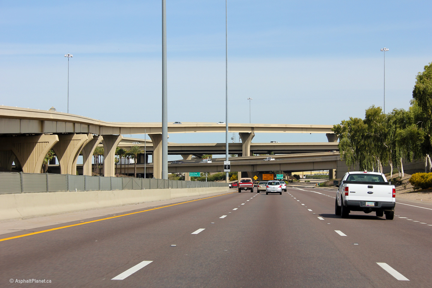
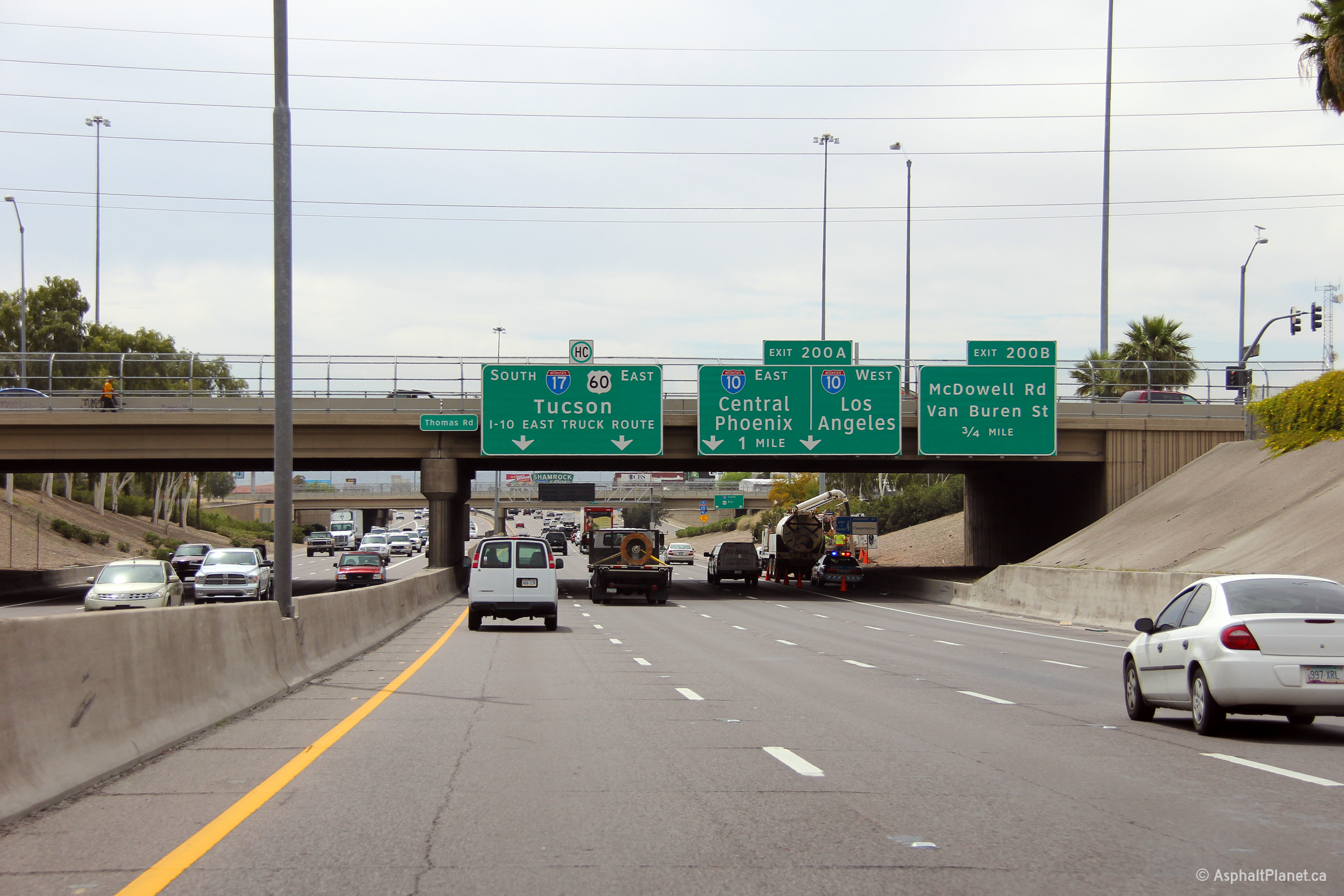
Maricopa County Phoenix |
Northerly view approaching the I-10 interchange. I-17 is the lowest level of the four level interchange with I-10. |
 |
||
|
Date: 26/3/2013 |
High-res: (1440x960) (2400x1600) | |||
|
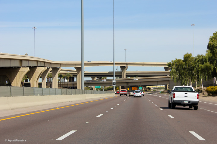
Maricopa County Phoenix |
Northerly view from underneath of the large I-10 interchange. The fly-over ramp from I-10 East to I-17 North dominates this photo. |
 |
||
|
Date: 26/3/2013 |
High-res: (1440x960) (2400x1600) | |||
|
Maricopa County Phoenix |
This view looks southerly through the I-10 interchange along I-17. |
 |
||
|
Date: 26/3/2013 |
High-res: (1440x960) (2400x1600) | |||
|
Maricopa County Phoenix |
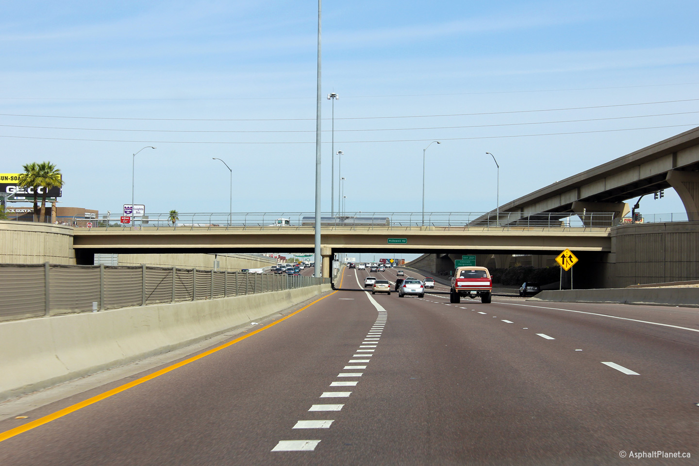
Northerly view at the McDowell Road overpass. The fly-over ramp from I-10 East to I-17 North soars overtop of McDowell Road in a way reminiscent of some of the fly-overs that link the 105 and 110 Freeways in Los Angeles. |
 |
||
|
Date: 26/3/2013 |
High-res: (1440x960) (2400x1600) | |||
|
Maricopa County Phoenix |
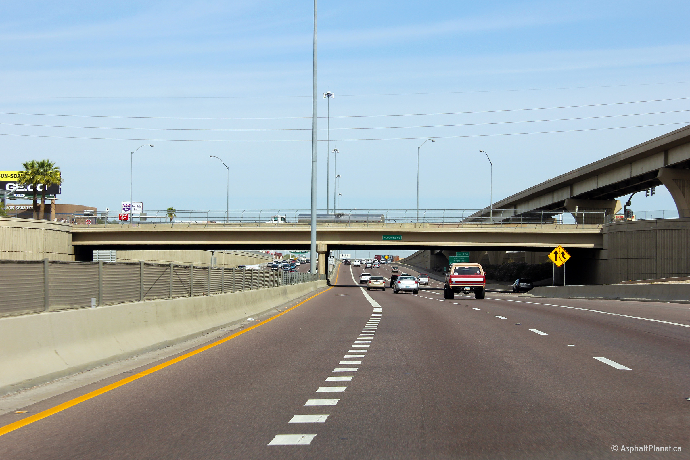
The final southbound overhead lane assignment signage is situated just before I-17 passes beneath the McDowell Road overpass. |
 |
||
|
Date: 26/3/2013 |
High-res: (1440x960) (2400x1600) | |||
|
Maricopa County Phoenix |
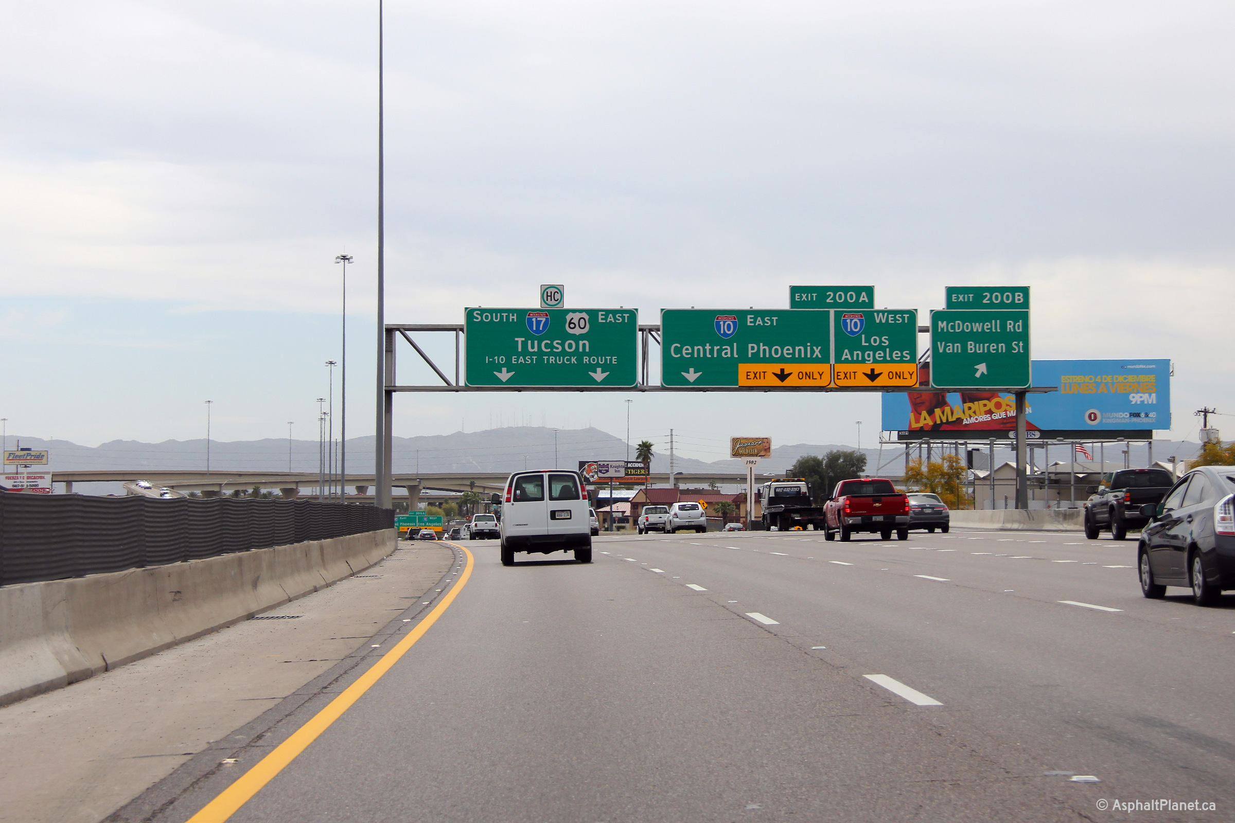
Southerly view at the off-ramp to McDowell Road and Van Buren Street. |
 |
||
|
Date: 26/3/2013 |
High-res: (1440x960) (2400x1600) | |||
|
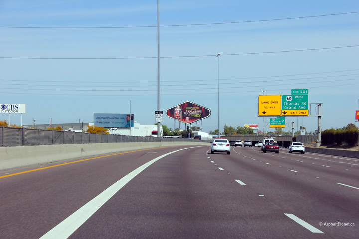
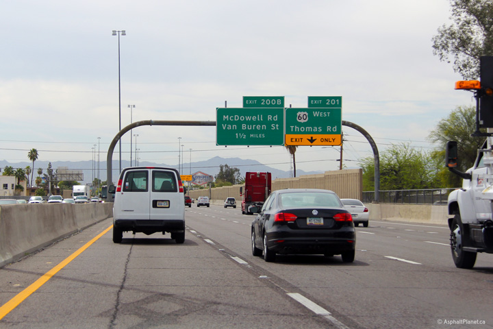
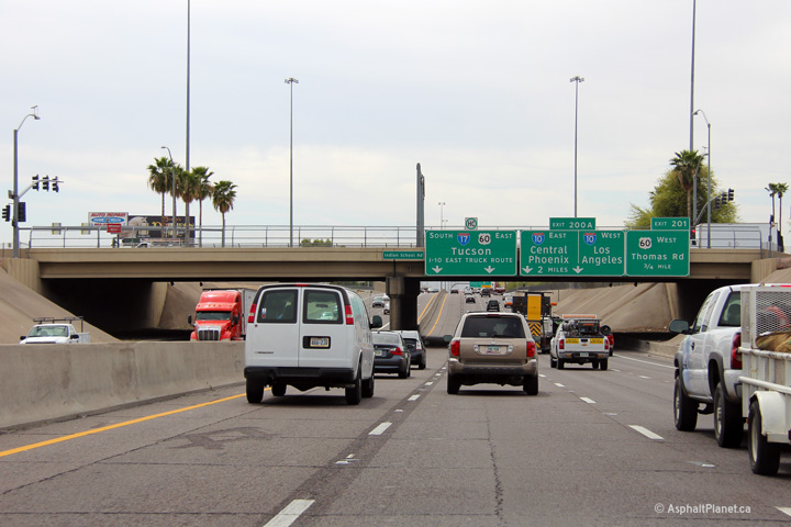
Maricopa County Phoenix |
Northerly view north of the I-10 interchange. I-17 quickly loses its auxiliary lanes from the I-10 interchange narrowing to a 6+2 cross-section at the freeway's interchange with US-60. |
 |
||
|
Date: 26/3/2013 |
High-res: (1440x960) (2400x1600) | |||
|
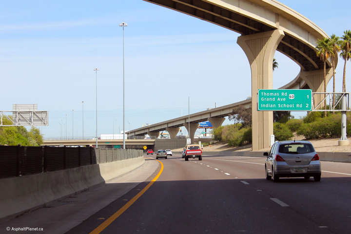
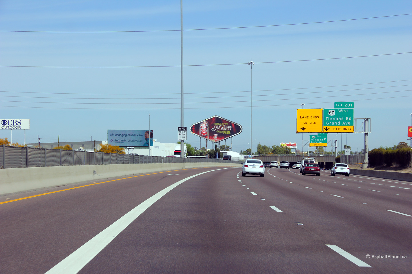
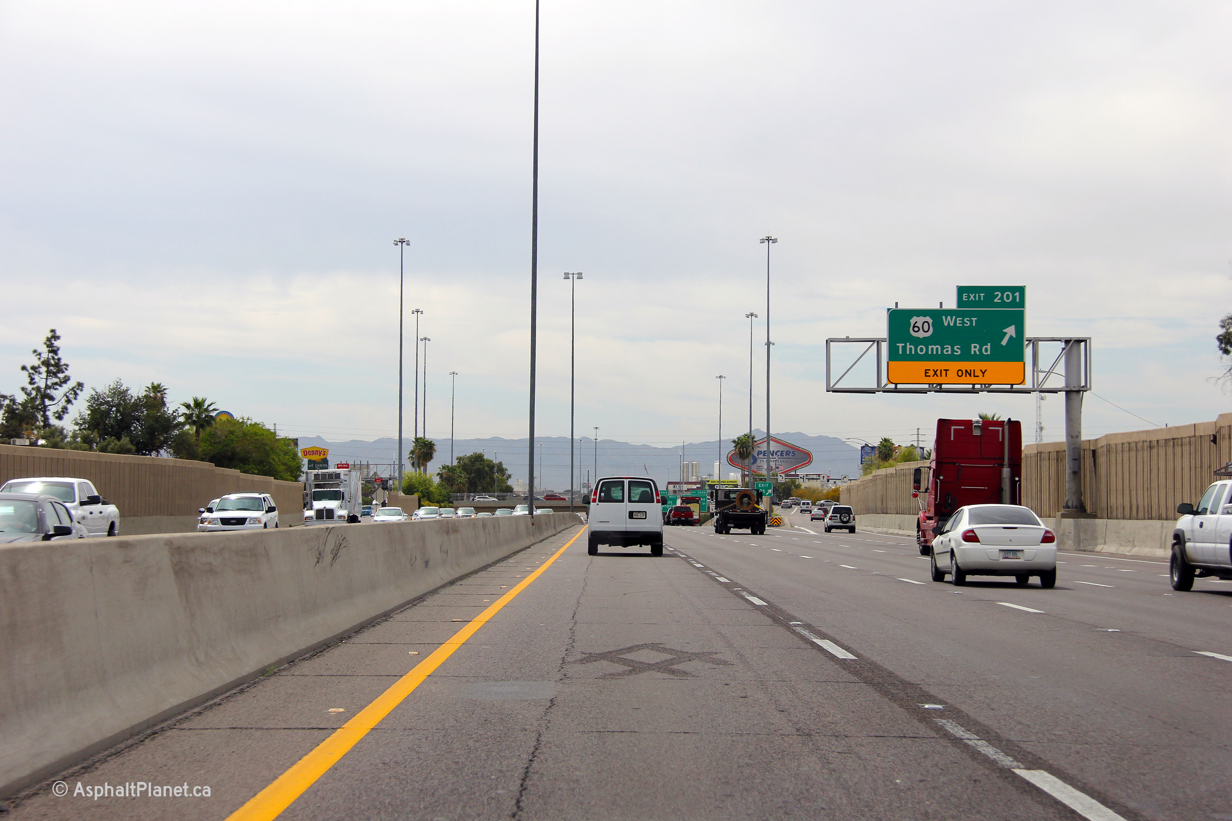
Maricopa County Phoenix |
Southerly view through the Thomas Road overpass. |
 |
||
|
Date: 26/3/2013 |
High-res: (1440x960) (2400x1600) | |||
|
Maricopa County Phoenix |
Southbound turn-off signage at the ramp to US-60 West. US-60 East follows I-17 southerly through Central Phoenix, until I-10 where it later branches off on its own freeway alignment through Phoenix's eastern suburbs. |
 |
||
|
Date: 26/3/2013 |
High-res: (1440x960) (2400x1600) | |||
|
Maricopa County Phoenix |
The westbound on-ramp from 32nd Street serves as a westbound auxiliary lane between 32nd Street and the off-ramp to 24th Street. |
 |
||
|
Date: 26/3/2013 |
High-res: (1440x960) (2400x1600) | |||
|
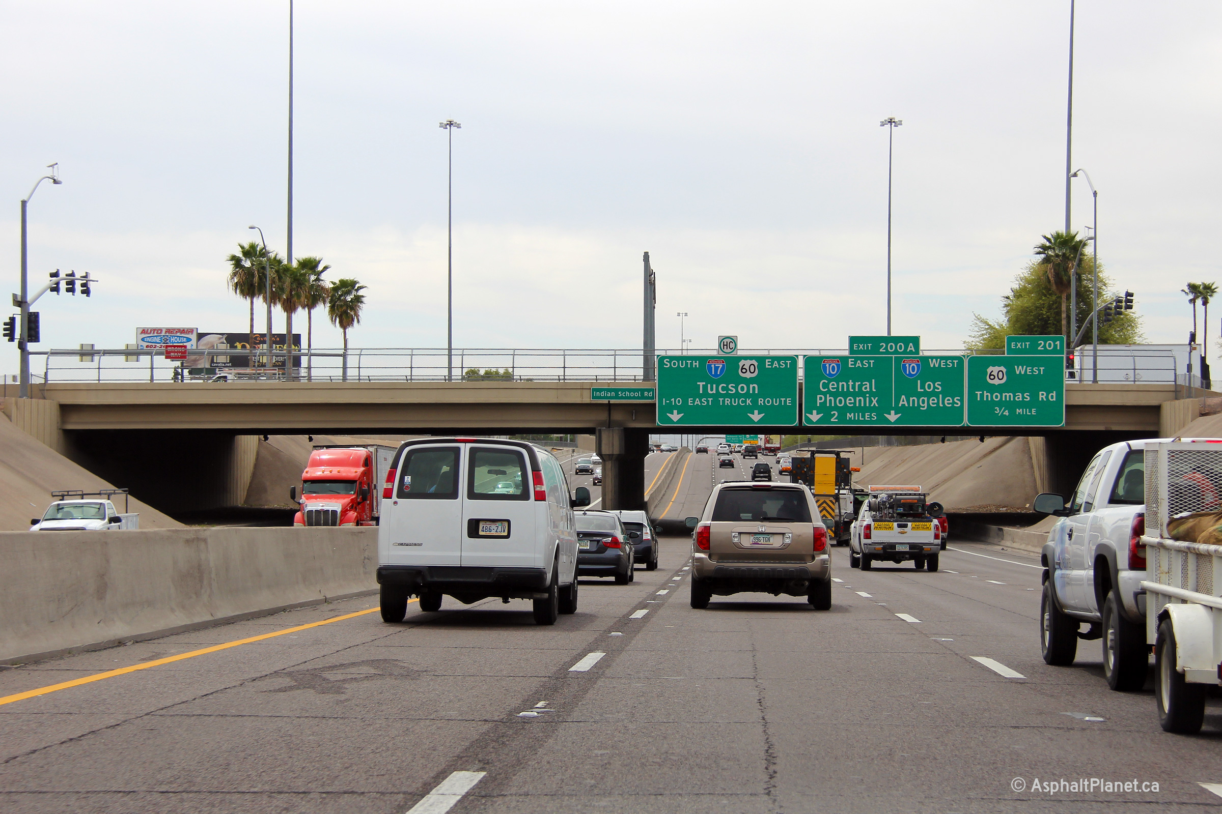
Maricopa County Phoenix |
Advanced signage for the upcoming Interstate 10 interchange affixed to the Indian School Road overpass. |
 |
||
|
Date: 26/3/2013 |
High-res: (1440x960) (2400x1600) | |||
|
Maricopa County Phoenix |
Northerly view through the Camelback Road overpass along I-17. In my opinion, the Camelback Road overpass is the least aesthetically pleasing overpass within Metro Phoenix's freeway network. |
 |
||
|
Date: 26/3/2013 |
High-res: (1440x960) (2400x1600) | |||
|
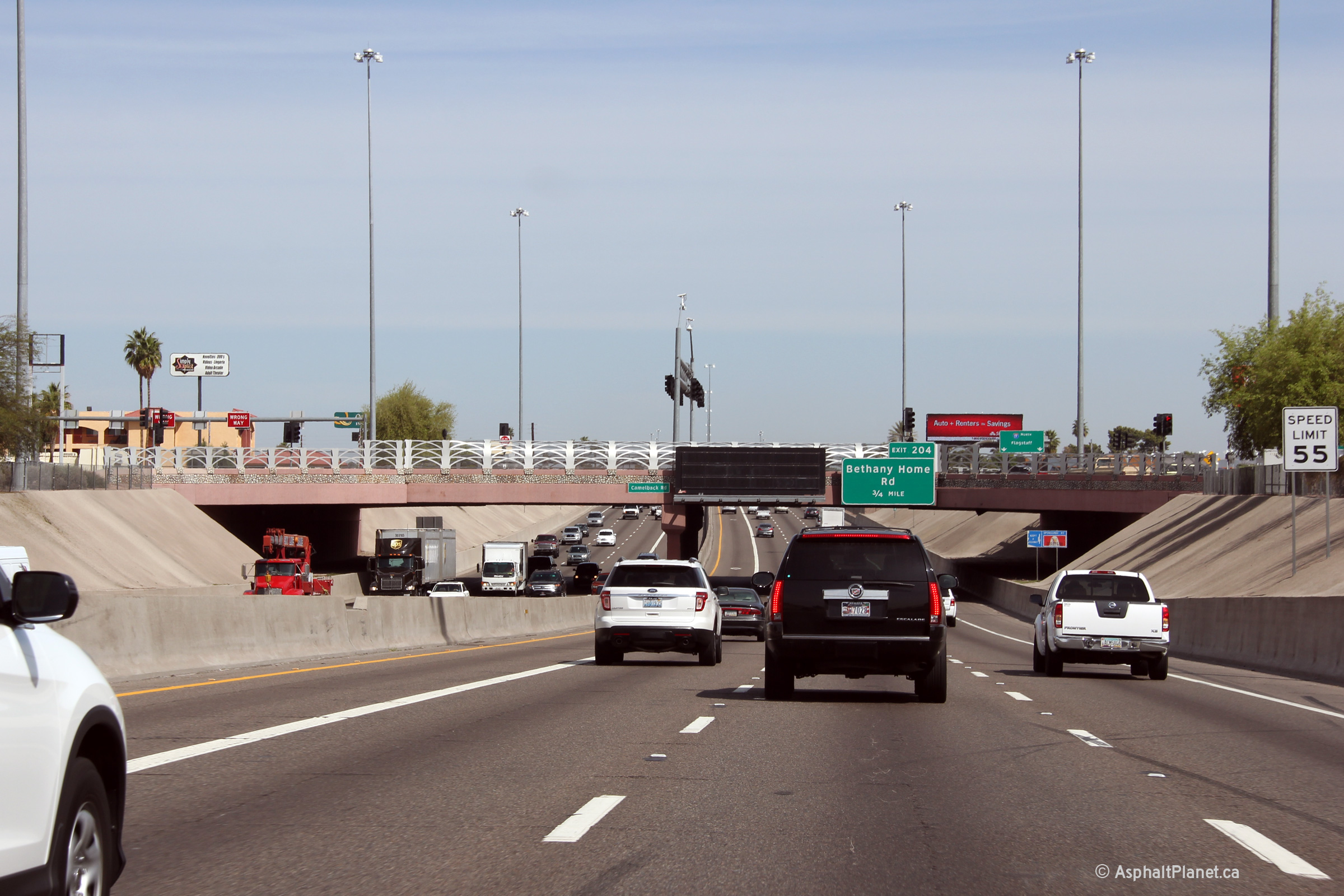
Maricopa County Phoenix |
Northerly view through Bethany Home Road overpass. This is a fairly typical looking overpass overtop of I-17 between the I-10 and Loop 101 interchanges. |
 |
||
|
Date: 26/3/2013 |
High-res: (1440x960) (2400x1600) | |||
|
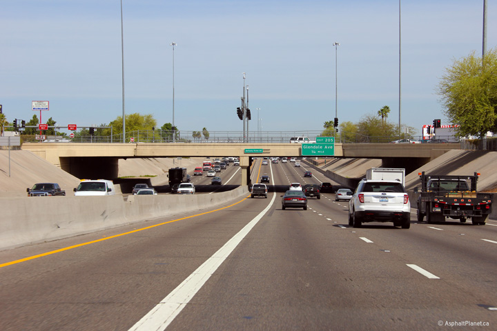
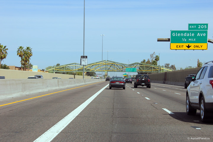
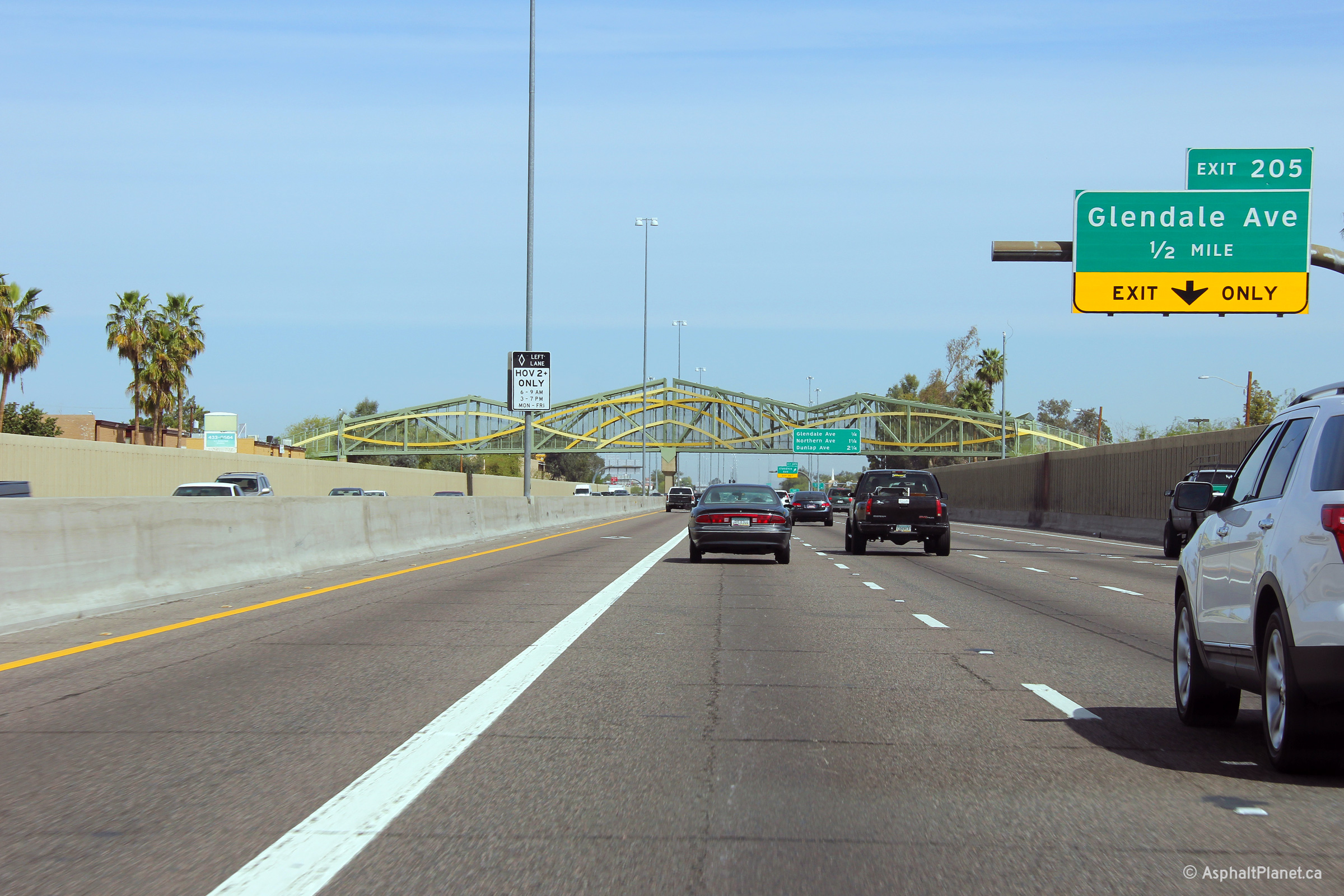
Maricopa County Phoenix |
Advanced signage for the ramp to Glendale Avenue in advance of an elaborate pedestrian overpass. The pictured pedestrian overpass reminds me somewhat of a simpler decorative design employed overtop of Highway 401 between Cambridge and Kitchener, ON. |
 |
||
|
Date: 26/3/2013 |
High-res: (1440x960) (2400x1600) | |||
|
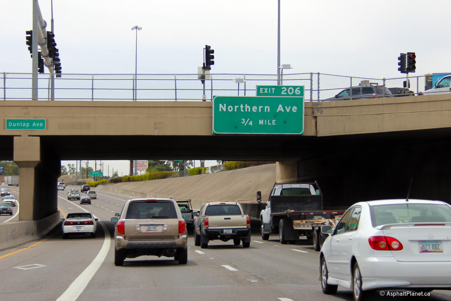
Maricopa County Phoenix |
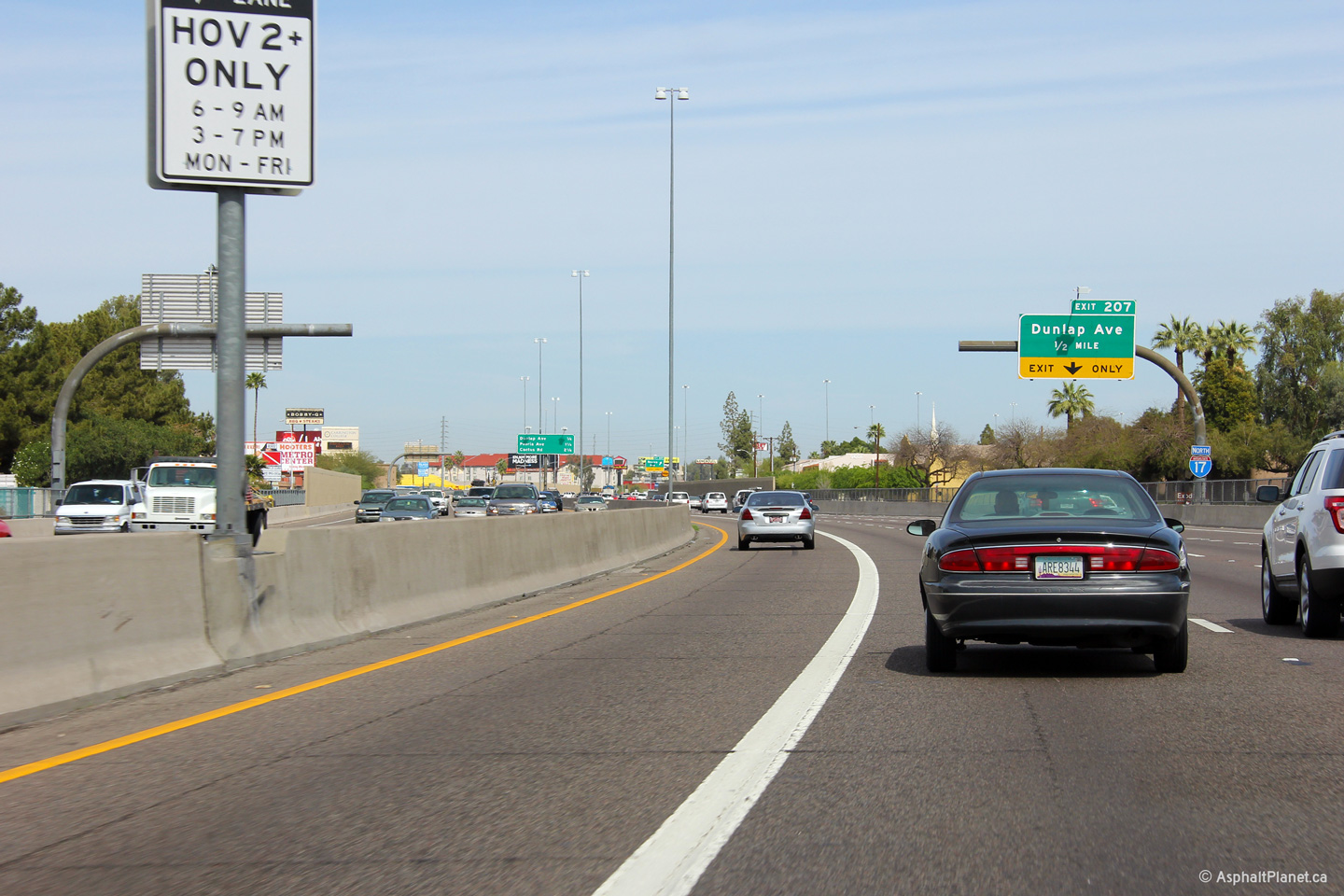
Button copy signage in advance of Dunlap Avenue. Most button-copy signage along I-17 through Phoenix has been replaced with clearview signs, but some does remain. Click here for a close-up view of the sign. |
 |
||
|
Date: 26/3/2013 |
High-res: (1440x960) (2400x1600) | |||
|
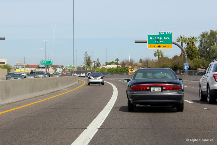
Maricopa County Phoenix |
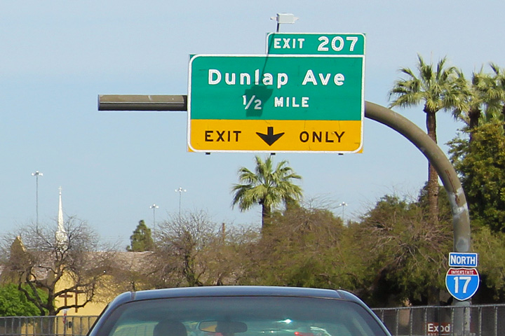
Exit signage at the off-ramp to Dunlap Avenue. The angle of the sun accentuates the button copy sign quite nicely in this photo. |
 |
||
|
Date: 26/3/2013 |
High-res: (1440x960) (2400x1600) | |||
|
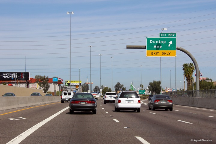
Maricopa County Phoenix |
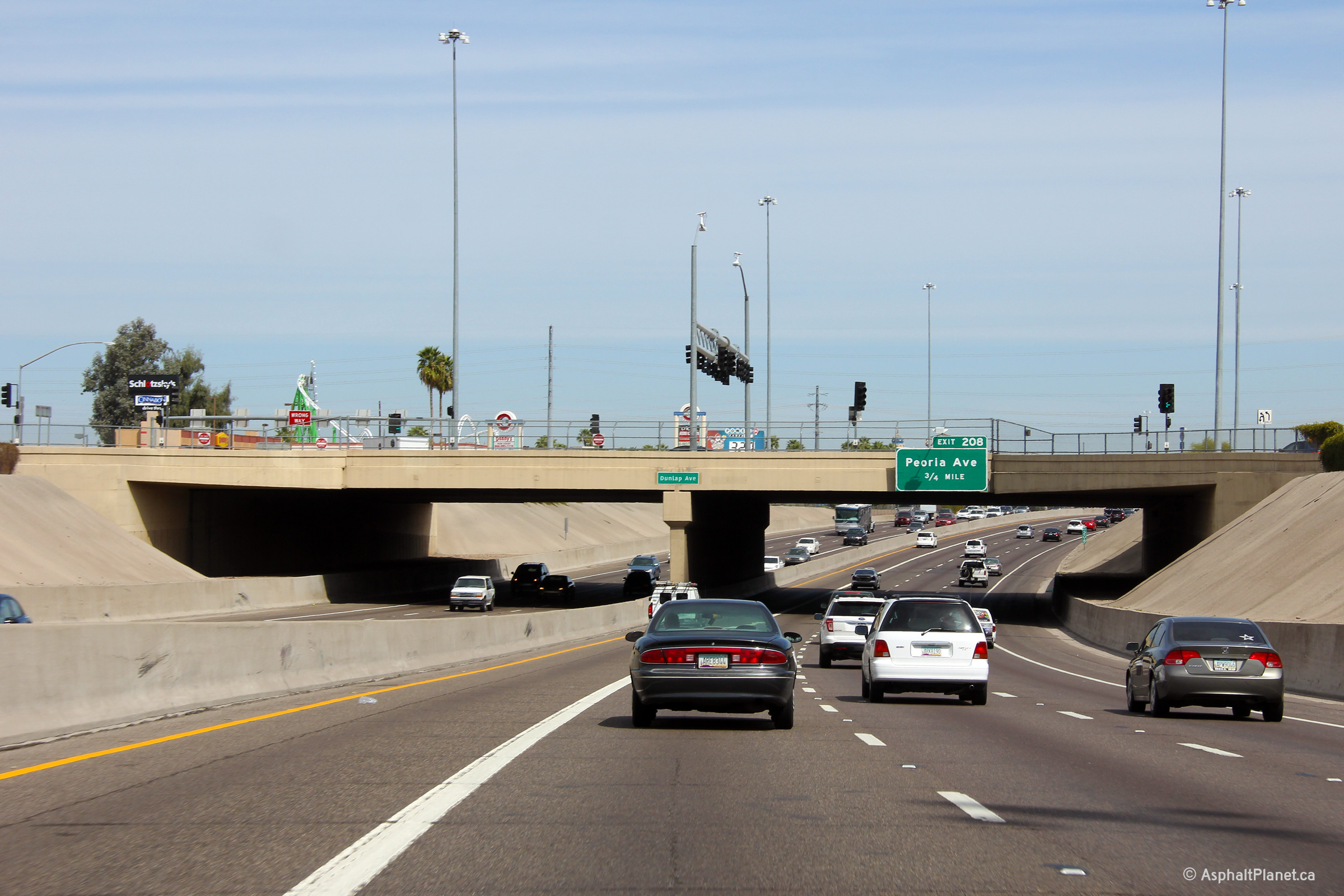
Northerly view through the Dunlap Avenue interchange. |
 |
||
|
Date: 26/3/2013 |
High-res: (1440x960) (2400x1600) | |||
|
Maricopa County Phoenix |
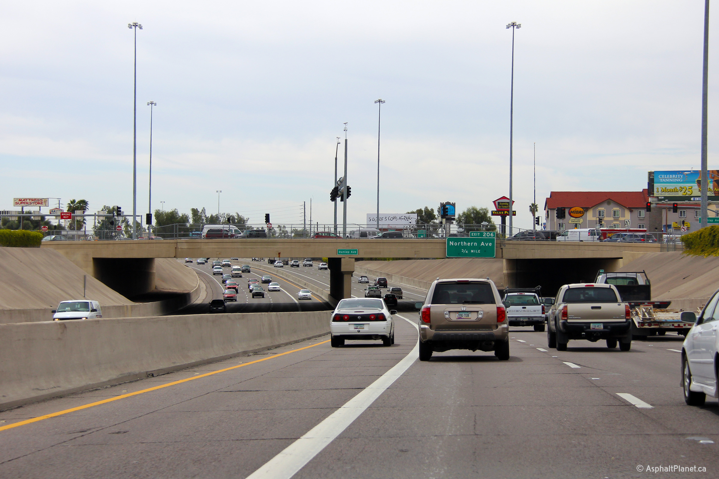
Two southerly views at the Dunlap Avenue overpass. |
 |
||
| High-res: (1440x960) (2400x1600) | ||||
 |
||||
|
Date: 26/3/2013 |
High-res: (1440x960) | |||
|
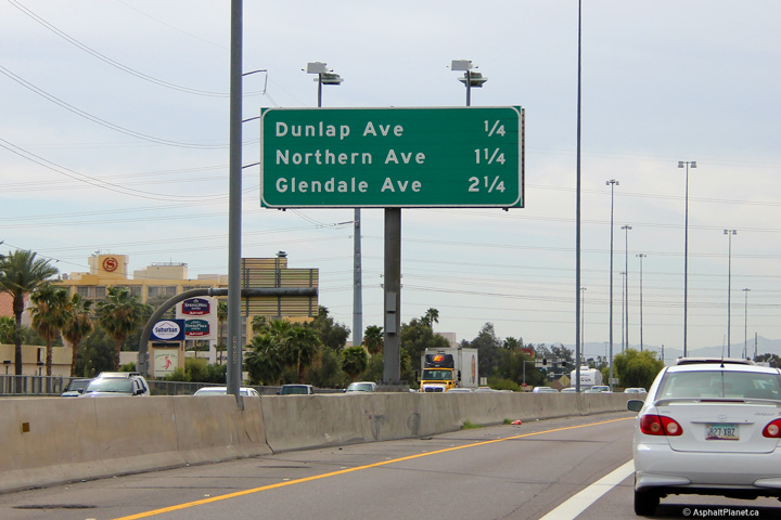
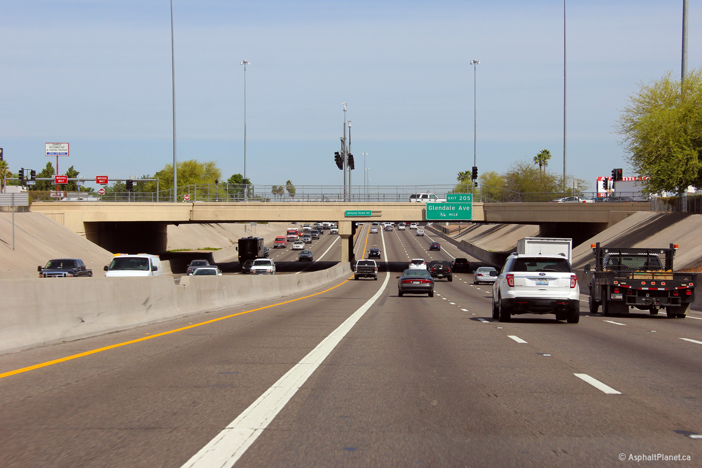
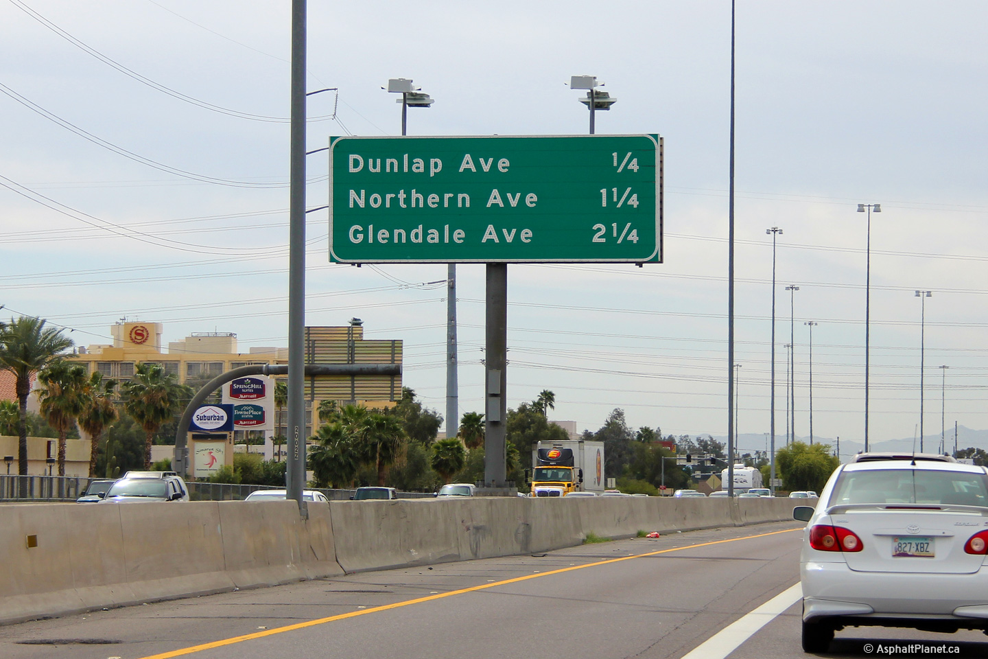
Maricopa County Phoenix |
Southbound interchange sequence sign located in the median of the Black Canyon Freeway. |
 |
||
|
Date: 26/3/2013 |
High-res: (1440x960) | |||
|
Maricopa County Phoenix |
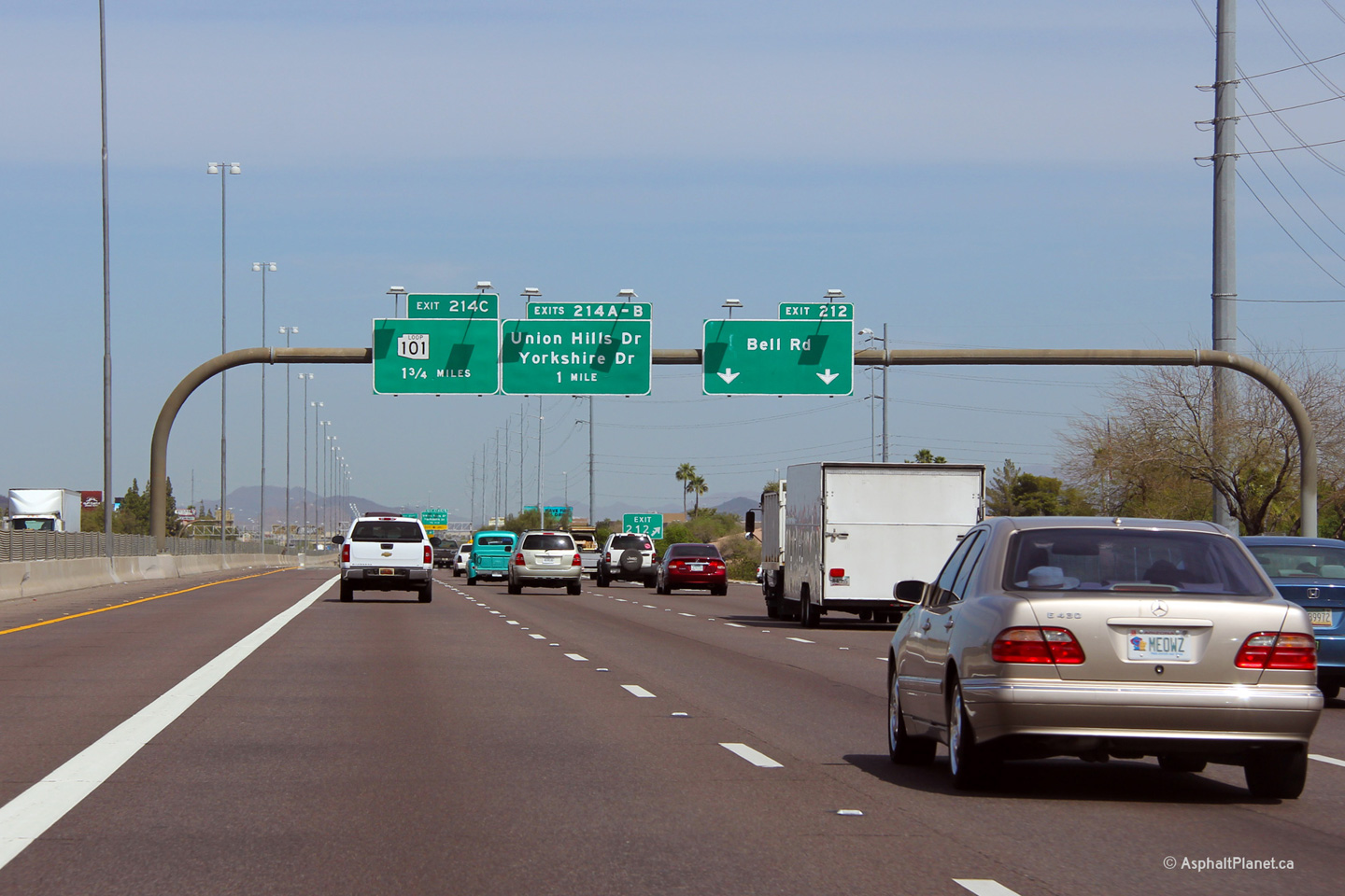
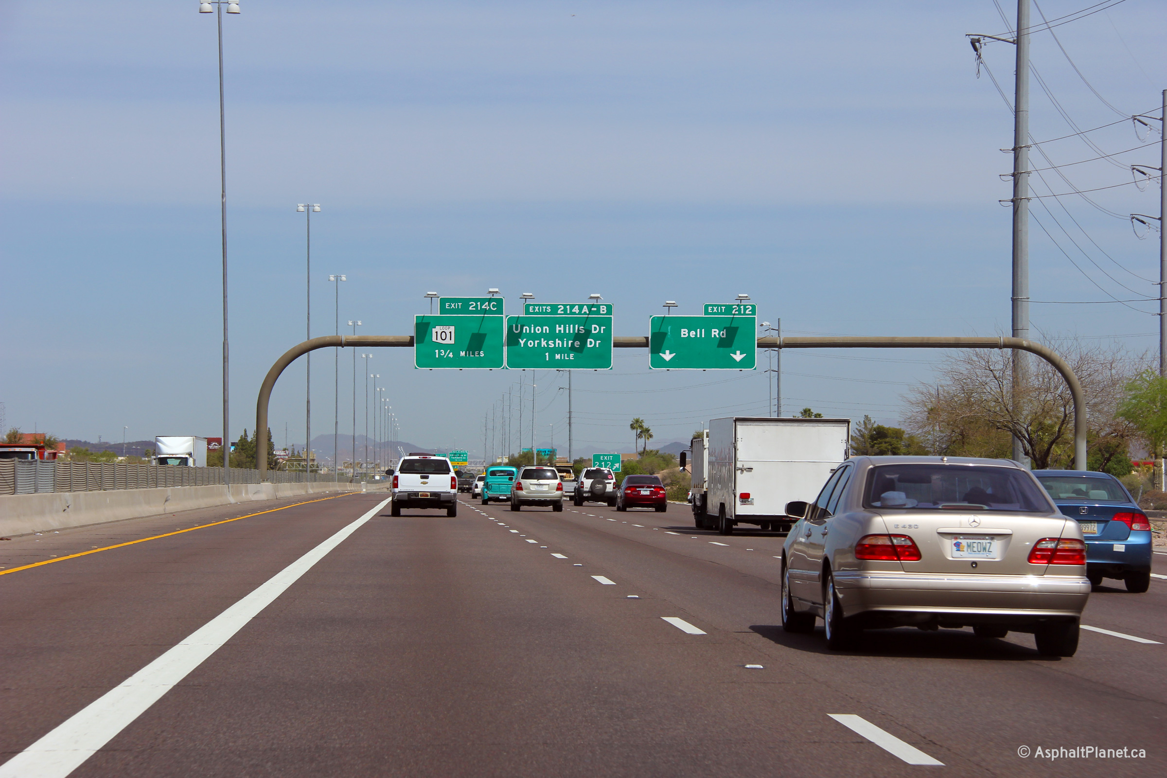
Overhead advanced signage in advance of the Bell Road exit. |
 |
||
|
Date: 26/3/2013 |
High-res: (1440x960) (2400x1600) | |||
|
Maricopa County Phoenix |
Button copy signage at the off-ramp to Bell Road. Note that the exit tab that corresponds to the Loop 101 interchange is not a button copy sign. It would seem that sometime after the button copy signage was erected, the exit number for the Loop 101 interchange was changed. |
 |
||
| High-res: (1440x960) (2400x1600) | ||||
 |
||||
|
Date: 26/3/2013 |
High-res: (1440x960) | |||
|
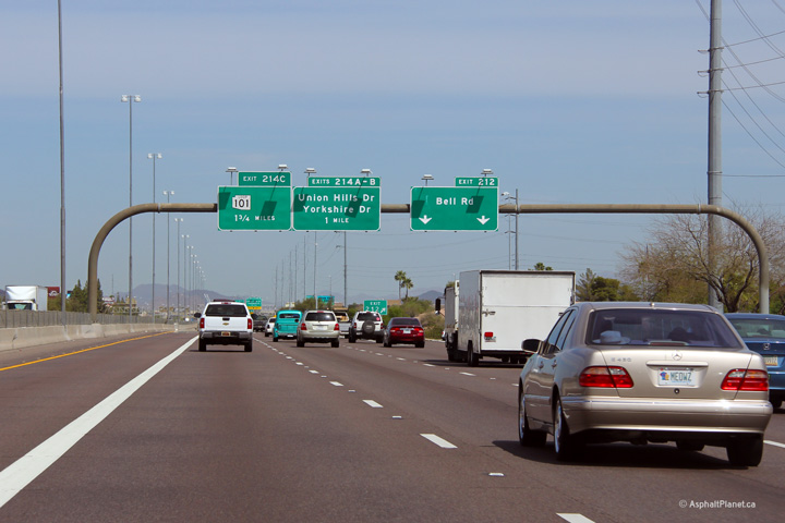
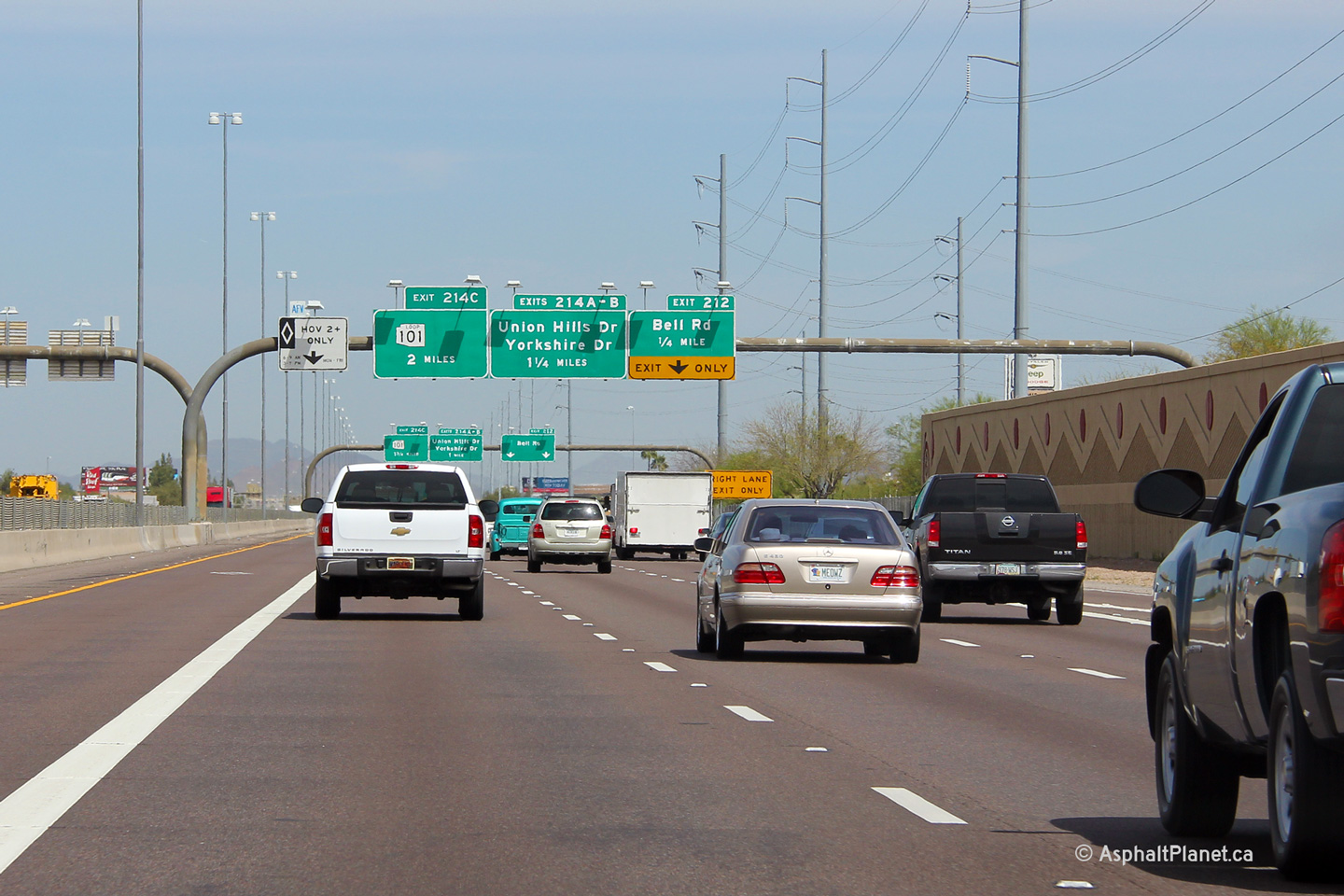
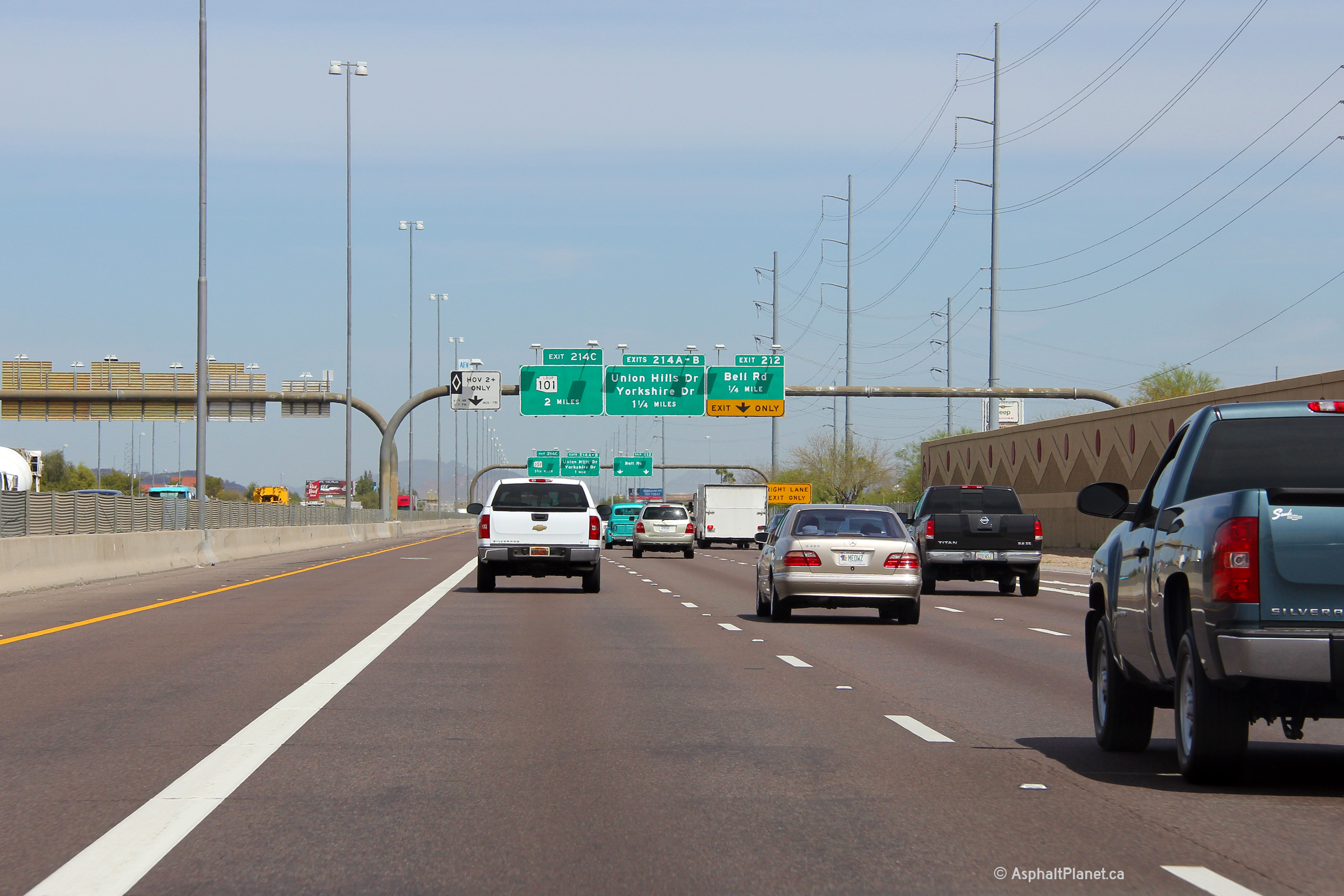
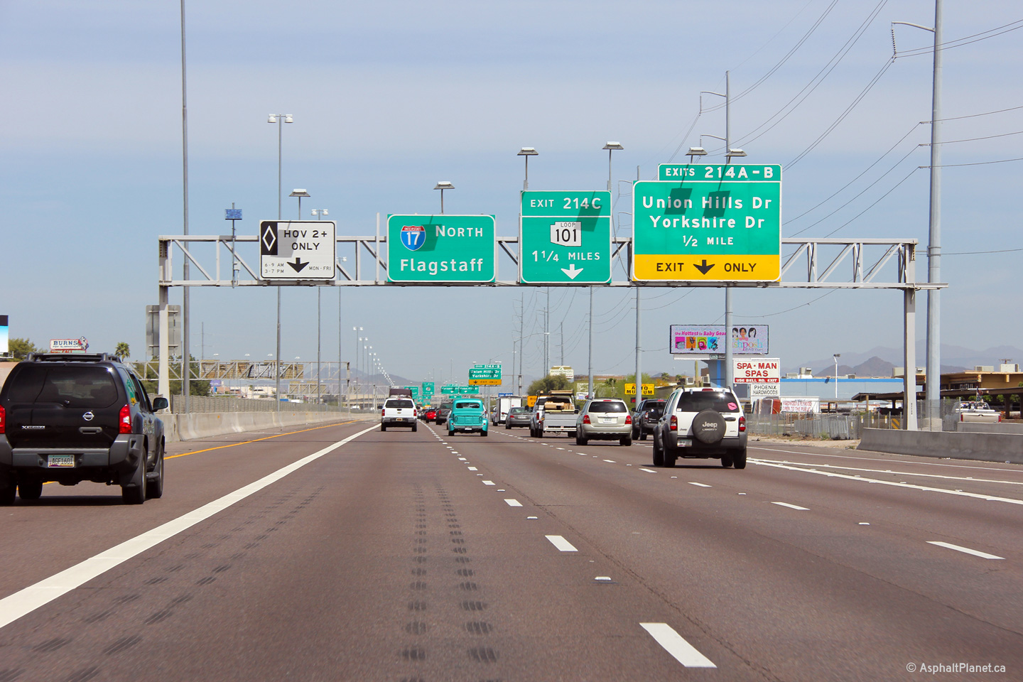
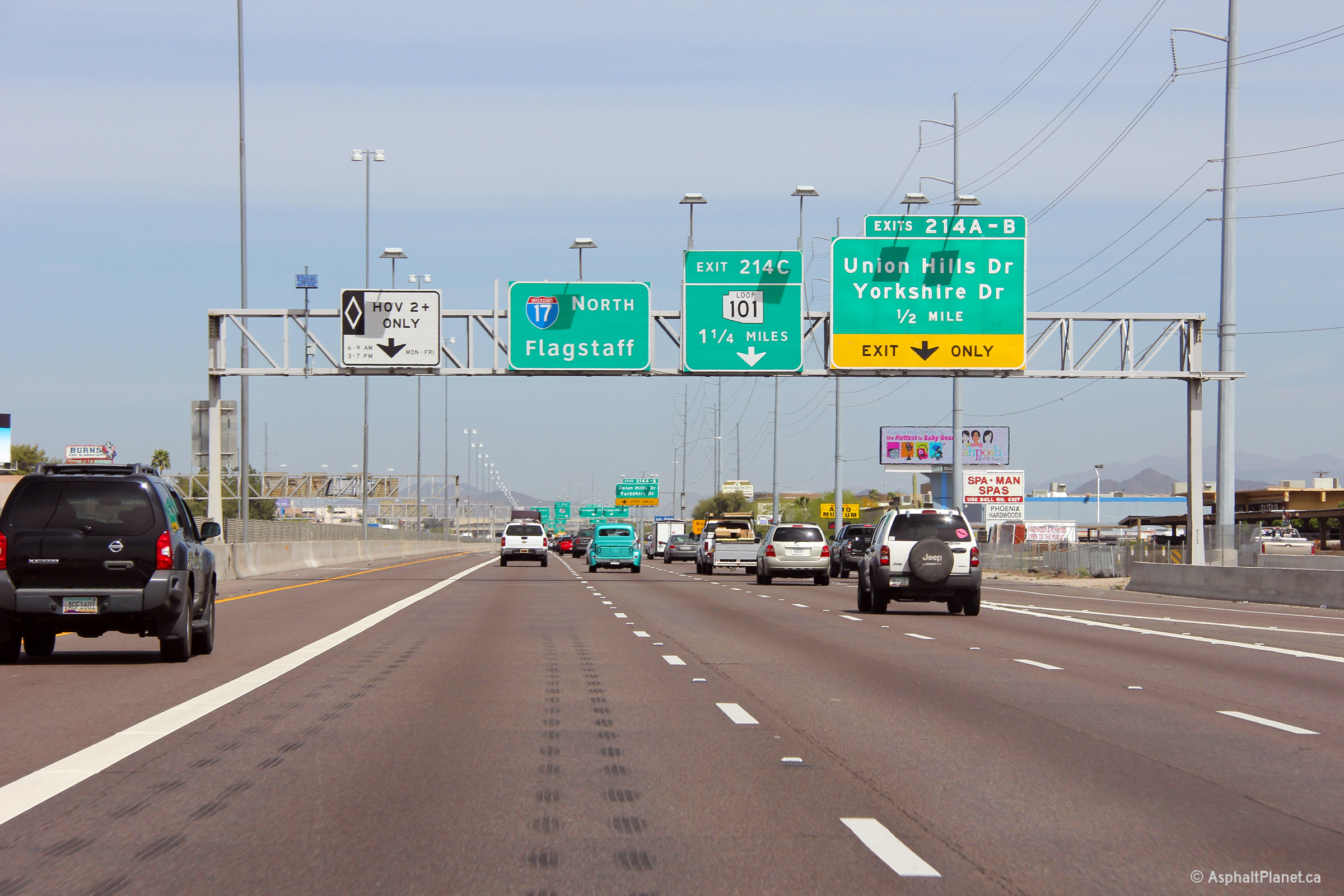
Maricopa County Phoenix |
Northerly view in advance of the exit ramp to Union Hills and Yorkshire Drives. Once away from the mainline lanes of I-17, the exit ramp splits forming a brief sub-collector lane between both Union Hills and Yorkshire Drives. |
 |
||
|
Date: 11/4/2012 |
High-res: (1440x960) (2400x1600) | |||
|
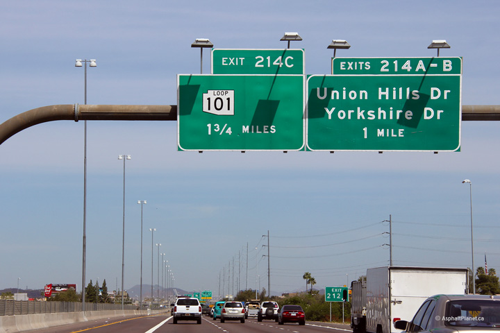
Maricopa County Phoenix |
Northerly view approaching the Yorkshire Drive interchange and the off-ramp to Loop 101 interchange. |
 |
||
|
Date: 11/4/2012 |
High-res: (1440x960) (2400x1600) | |||
|
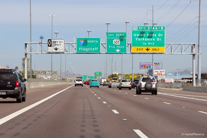
Maricopa County Phoenix |
This view looks northerly from just beyond the Yorkshire Drive overpass. I-17 is the second level of the four level Loop 101 interchange. |
 |
||
|
Date: 26/3/2013 |
High-res: (1440x960) (2400x1600) | |||
|
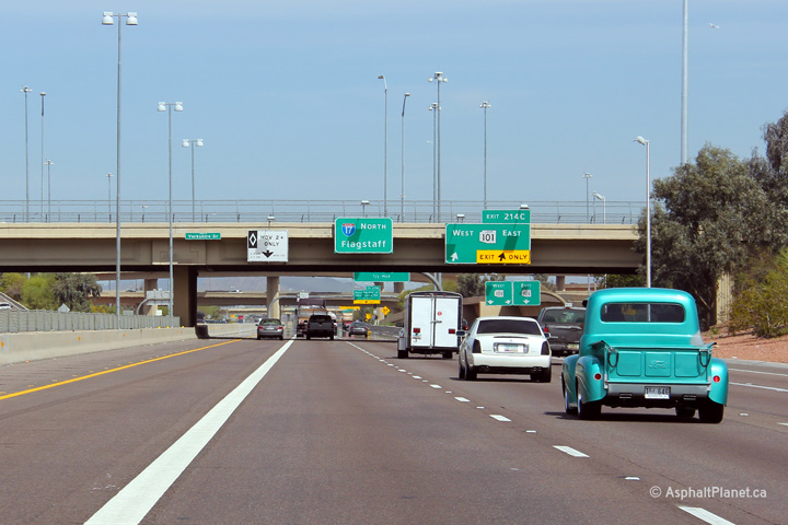
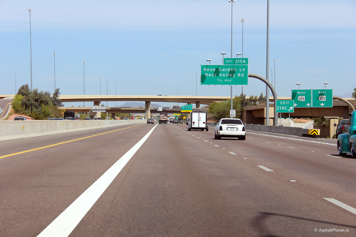
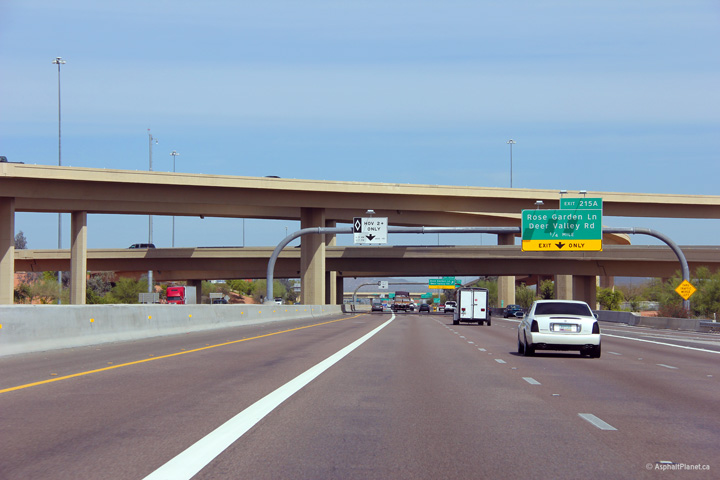
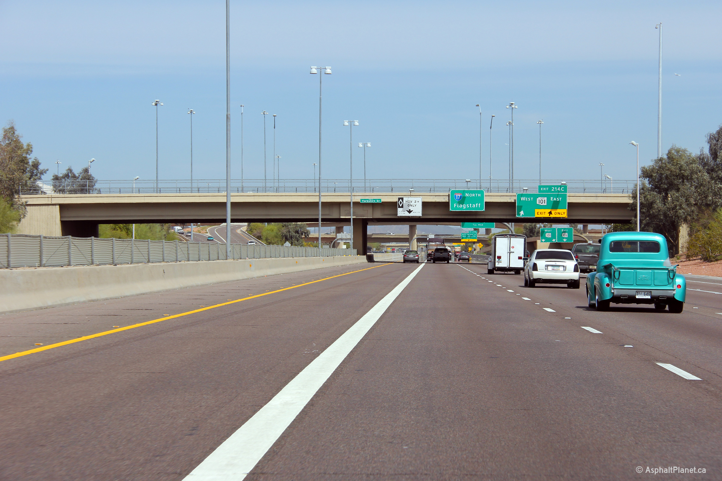
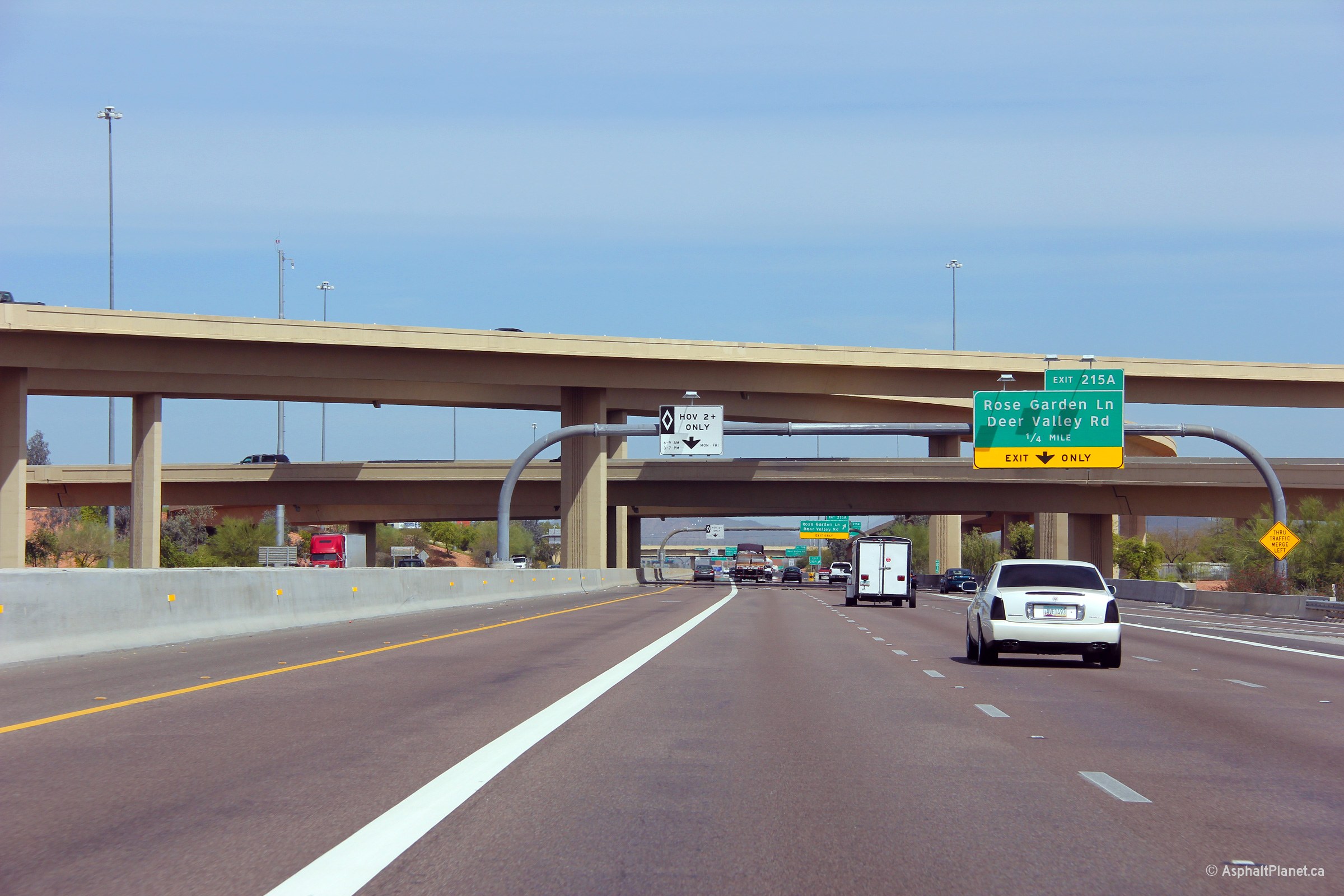
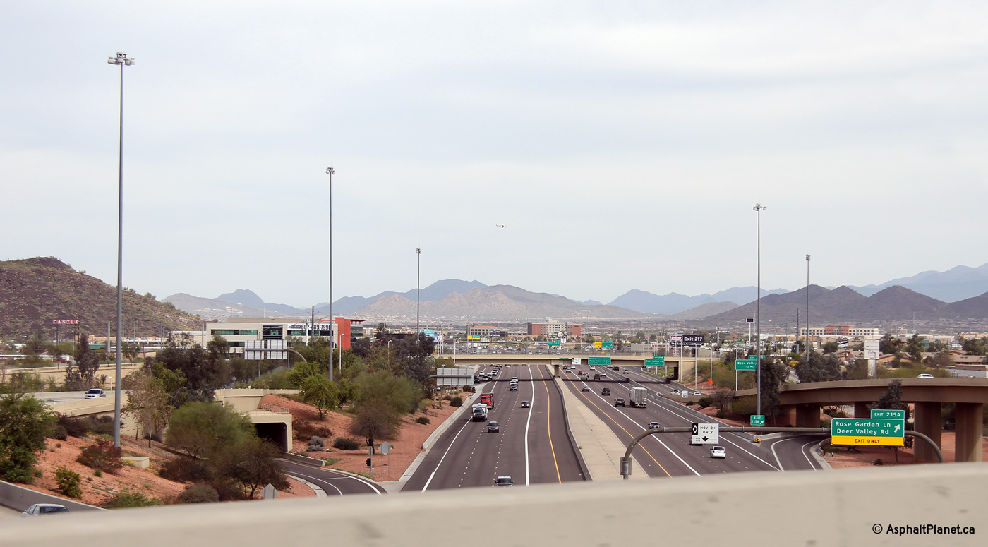
Maricopa County Phoenix |
Another northerly view at the Loop 101 interchange. The exit to Rose Garden Line and Deer Valley Road exits from northbound I-17 before the on-ramp from Loop 101 joins the northbound carriageway. |
 |
||
|
Date: 26/3/2013 |
High-res: (1440x960) (2400x1600) | |||
|
Maricopa County Phoenix |
Easterly view along Loop 202 from the flyover ramp from Loop 101. |
 |
||
|
Date: 11/4/2012 |
High-res: (1440x960) (2400x1600) | |||
|
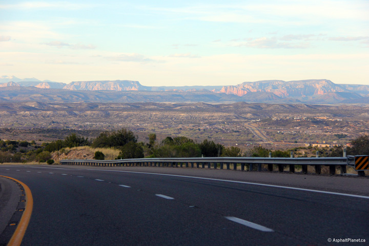
Yavapai County |
Northerly view as I-17 descends the Camp Verde grade. The red rocks of Sedona can be seen in the distance of this photo. |
 |
||
|
Date: 21/3/2013 |
High-res: (1440x960) (2400x1600) | |||
<- I-15
AZ Highways
I-19 ->
AsphaltPlanet.ca
© 2006-2013 Scott Steeves.
Scott@asphaltplanet.ca
Page Created: May 14 2013.
Last Updated: May 14 2013.